 Scarlett Isle, July 2019 – click and image for full size
Scarlett Isle is the name given to the Homestead region held by Grace Sixpence and Zigmal we recently toured. It has been landscaped for them by Engelsstaub, who is perhaps best known for her own region designs at Whimberly, a place I’ve written about on numerous occasions in this blog simply because of the elegance of the settings within it that Staubi presents.
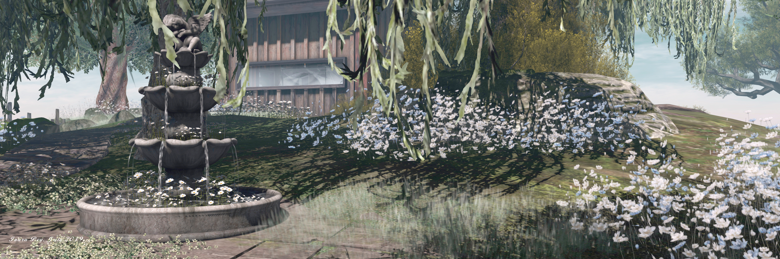
And this elegance and beauty is to be found within Scarlett Isle. The region’s About Land description states “Scarlett Isle is designed to be used by those interested in SL Photography”, and it is very definitely photogenic.
 Scarlett Isle, July 2019 – click and image for full size
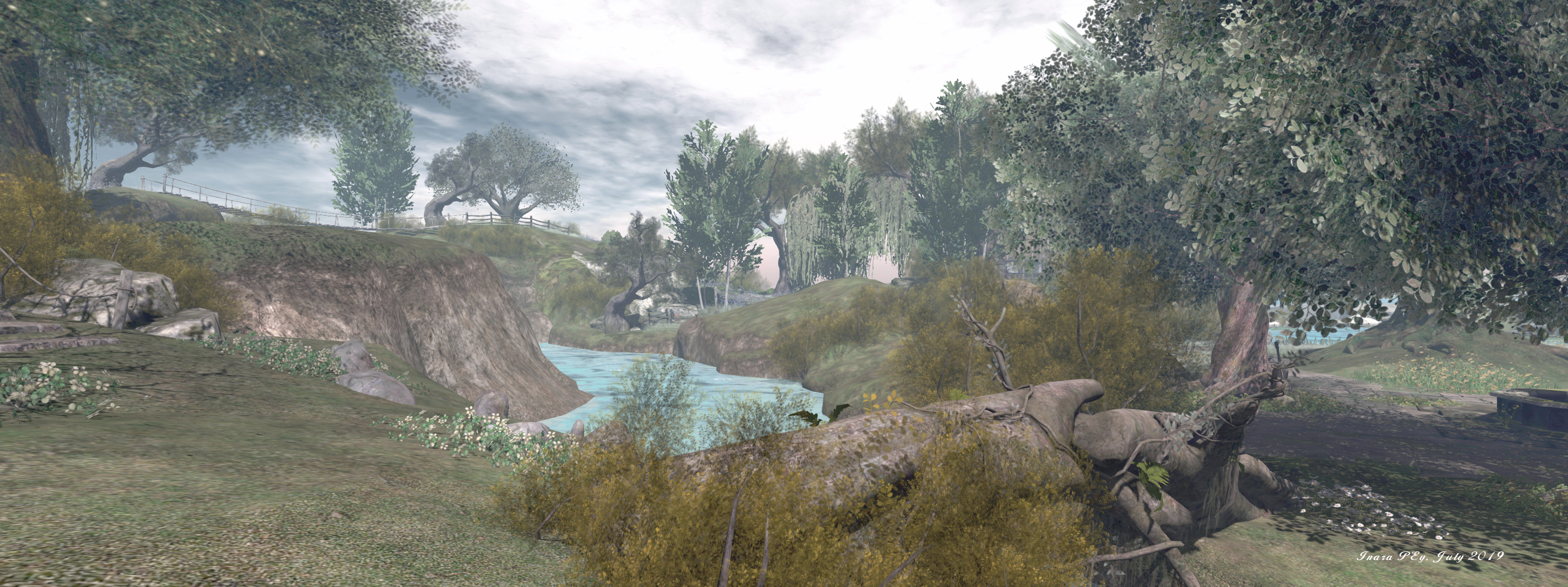
The region is presented as a pair of large islands, diagonally cut by a narrow sliver of water running south-east to north-west, where both islands form a bay in which a smaller, lighthouse-topped islet sits.
The more southerly of the two islands is the larger landmass, and home to the landing point as it sits towards the centre of the region. Rugged in nature, the southern island is nevertheless low-lying, marked by a large oval of rocky land to the east. With its stepped strata of grass-topped rock, this looks from some angles like the mossy shell of the great turtle lying in the water.
 Scarlett Isle, July 2019 – click and image for full size
The western end of this rocky hill rolls gently down to a lower shelf of rock extending further westward and bounded to the south by a beach and the north by the dividing channel. This shelf in turns falls away to a marvellous low-lying area of sand, rock and grass that encloses a large pool of water.
Paths – stone, wooden and grassy – wind gently through this rugged landscape, passing under the boughs of trees and between beds of flowers, leading the way to multiple points of interest, be they the wide swath of sandy beach to the west, a waterside walk around the inner pool of water, the stone terrace that sits in a fold of land that the water clearly once cut into, or the heights of the rocky tables south and east.
 Scarlett Isle, July 2019 – click and image for full size
A tall wooden cabin sits on the rock above the landlocked pool, looking westward over the peaceful waters and the beach beyond them. Open to the public, it resides among a copse of olive trees, weeping willows and silver birch that form a curtain of green around it, naturally shielding it and giving it a sense of privacy without actually isolating it from the surrounding landscape.
From here, a wooden board walk offers a way down to the southern curve of beach, while the meandering stone path that connects the cabin with the landing point and the rest of the island continues up the slope to the humped top of the turtle-like hill. This is marked by a great oak tree, a small swing slung beneath one of its great boughs. Surrounded by a wash of blue and white flowers, it is an ideal spot for quiet contemplation.
 Scarlett Isle, July 2019 – click and image for full size
Two bridges span the channel separating the southern island from the northern. One is a wood suspension bridge slung across the region’s highest points – the northern island being, on average, higher than the southern . The other bridge is a simple affair of logs dropped over a lower-lying point of the channel’s banks.
The bridges invite exploration for the northern island – a curbed path winds away from one, and a grass track marked by stone steps runs up the slope from the other. However, do take note that the two buildings located on the northern island – one sitting close to the suspension bridge and the other off to the north-east at the end of the winding curbed path – are protected from casual visits by security orbs. These offer 15 second warnings – but given the About Land description invites exploration in the region, a couple of signs given advanced warning of the private nature of the houses perhaps wouldn’t go amiss.
 Scarlett Isle, July 2019 – click and image for full size
A large meadow arcs around the north coast of the region between the north island’s two private houses, and a path winds down the cliffs from this to another beach, this one running around the north-east headland of the island. The beach is also open to the public, but, care is again needed when following it along the eastern coast to where a stepped set of decks can be found. These are within one of the private parcels, and it is actually very easy to miss the security orb’s warning on reaching them; so again, a warning sign might help prevent people finding themselves unexpectedly teleported home.
This grumble aside, there is no mistaking the sure beauty of Scarlett Isle. Its look is incredibly natural, and offers a feeling of a wild, but well-cared for garden environment. Throughout the islands are plenty places where this natural beauty can be appreciated, from deck chairs and blankets on the beach to swings under boughs to chairs sitting in the shade of parasols on that stone terrace, or benches sitting on rocks or grassy bank and more. All of which sits within an ideal sound scape that makes Scarlett Isle an almost perfect visual and aural experience. Those taking photos are invited to share them with the region’s Flickr group, and a fee of L$150 provides rezzing rights via the local group.
 Scarlett Isle, July 2019 – click and image for full size
With thanks to Shawn for the pointer and LM!
SLurl Details
- Scarlett Isle (Love Cats, rated Moderate)
