Avatars on Mars, Falcons in Florida and oceans in space

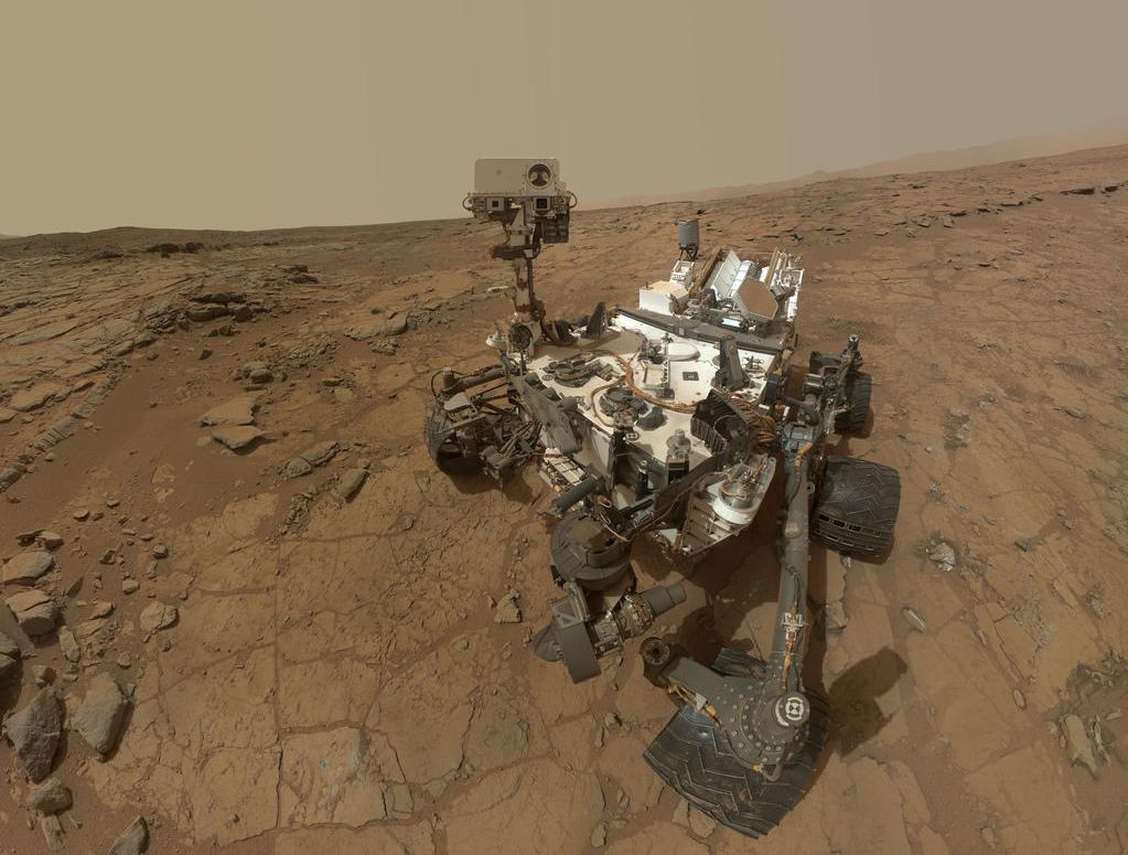
CuriosityCuriosity, NASA’s Mars Science Laboratory (MSL), has been wrapping things up in the “Pahrump Hills” region at the base of “Mount Sharp”, the mountain-sized mound of deposited material occupying the centre of Gale Crater.

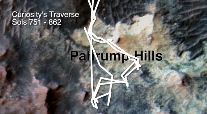
For the last several months, the rover has been engaged on what geologists on Earth call a “walkabout”, zigzagging back and forth across the area, looking for targets of interest for follow-up investigations, and allow the science team to better understand the geology and form of the region.

This method of activity is a change from how Curiosity has largely operated to date, which has seen the rover primarily move from point-to-point along its route, only re-visiting sites as a part of its onward movement towards the goal of reaching and climbing “Mount Sharp” (such as when travelling into, and then back out of the “Glenelg” and “Yellowknife Bay” regions Curiosity first explored in 2012 / 2013).

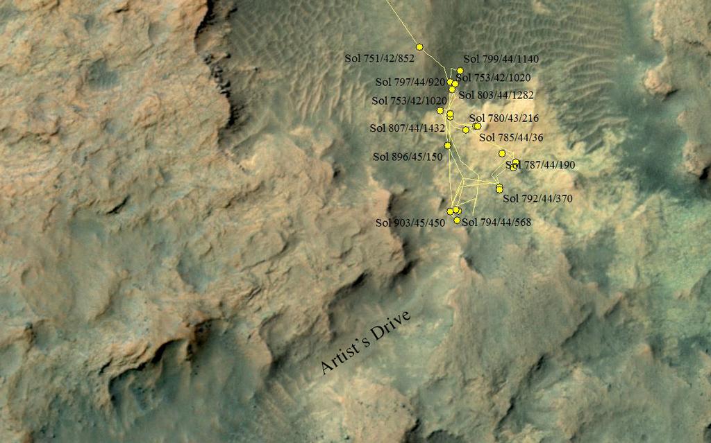
Curiosity's wandering through
Curiosity’s wandering through “Pahrump Hills”, which started with one of the tree lines into the region at the top of the image

In this respect, and as Aileen Yingst, the Deputy Principal Investigator with the Mars Hand Lens Imager (MAHLI) on the rover, describes, Curiosity has been demonstrating just how much of an avatar it is for the science team, allowing them to careful investigate, examine and catalogue “Pahrump Hills” in a rich, practical way using the very human technique of the “walkabout”, which will serve the mission well as the ascent up “Mount Sharp” continues.

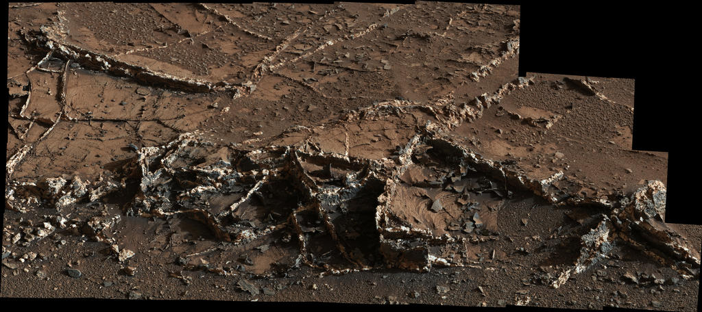
Most recently, and since collecting samples from “Mojave 2″, the area of rock displaying interesting crystalline elements within it, Curiosity has been looking at an area geologists dubbed “pink cliffs”, which shows further signs of the crystalline structures, and might be a candidate for further investigation. If so, it will be the last stopping point in “Pahrump Hills” before Curiosity continues its climb up “Mount Sharp”.

Oppy Reaches 11

January 25th, 2015 saw NASA’s Mars Exploration Rover, Opportunity, reach it’s eleventh anniversary on Mars. The rover, one of two MER vehicles, arrived on Mars at January 25th, 2004 (Universal Time), ready to start a mission initially planned to last just 90 days.

Since then, and up to its anniversary, “Oppy” has travelled a distance of some 41.7 kilometres (25.9 miles). While this doesn’t sound that much (and in truth, a human science team could have travelled that far in just a few days, including time for any science carried out along the way), remember that “Oppy’s” forward speed is measured in centimetres per hour.

As one of two solar-powered MER rovers (the second, Spirit having finally succumbed to the hostile environment on Mars around March 215th, 2011), Opportunity has carried out an incredible amount of work, and greatly contributed to our understanding of the planet, returning compelling evidence about wet environments on ancient Mars.

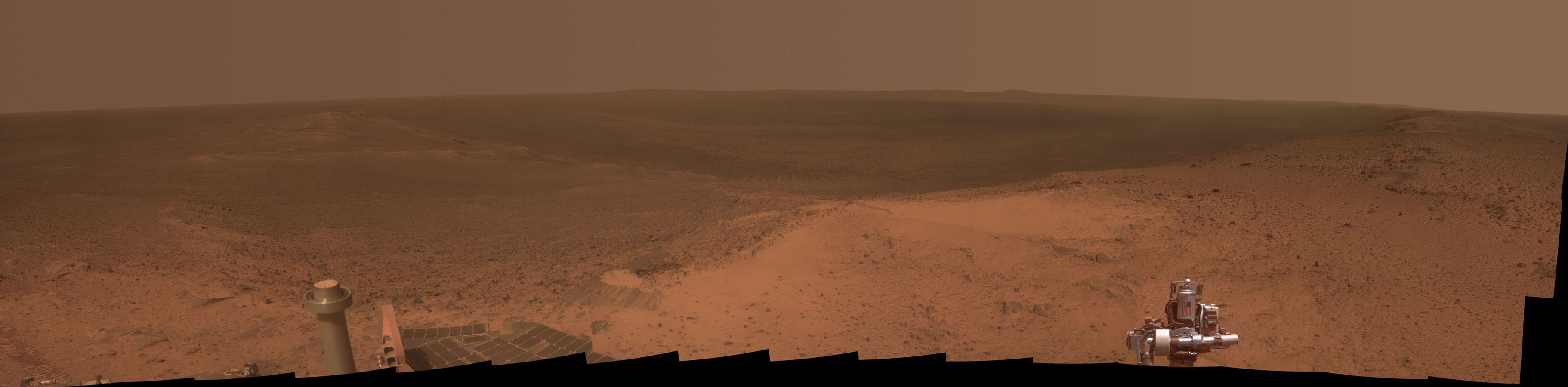
A panoramic view of Endeavour Crater as seen from “Cape Tribulation” an uprising close to the crater’s rim, the summit of which Opportunity reach in January 2015, marking its 11th anniversary on Mars (click for full size)

The rover marked its anniversary by reaching the summit of “Cape Tribulation”, an uprising close to the rim of 20 kilometre (13.7 mile) wide Endeavour Crater, which the rover has been gradually circumnavigating. This involved a change in elevation for “Oppy” of about 135 metres (440 feet), and afforded it a panoramic view of the crater and the land around it, presenting a unique opportunity for geological observations of the crater and its rim.

 A New Mars Mystery

That night, too, there was another jetting out of gas from the distant planet. I saw it … That night another invisible missile started on its way to the earth from Mars, just a second or so under twenty-four hours after the first one.

– The narrator, H.G. Wells’ The War of the Worlds

Okay, so it’s unlikely to be the sign of an impending invasion of Martians possibly ticked-of at the way we’re cluttering-up their planet with our probes and landers and rovers, but recent events high in the atmosphere of Mars have given rise to some excitement.

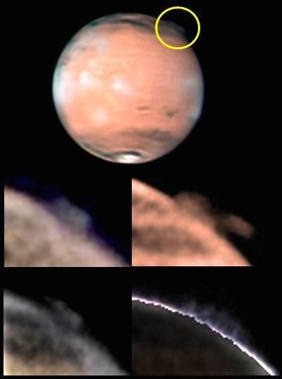
The images, originally capture in 2012, show huge plumes rising some 250 kilometres (156 miles) into the most tenuous reaches of Mars’ thin atmosphere.

Martian high-altitude plumes
Martian high-altitude plumes (image: ESA)

The plumes occurred on two separate occasions in March and April 2012, and were spotted by amateur astronomers. Each time, they developed with relative rapidity, rising upwards and outwards to cover areas of some 1000 x 500 kilometres (625 x 312.5 miles) in a period of around 10 hours before remaining visible for up to 10 days at a time, their structure and form changing on a daily basis.

Unfortunately, neither event was seen from orbit about Mars, occurring so high on the planet’s limb as to be effectively out-of-sight for the NASA and ESA orbital vehicles, and by the time word had spread sufficiently about the observations, the events were largely over.

However, investigations into images of the planet taken by the Hubble Space Telescope in orbit around the Earth have revealed similar plumes being imaged in the past. However, with the exception of an image captured in 1997, none have been anywhere near as high or dramatic as the 2012 events.

So what might have caused this plumes to occur? The answer to that question is uncertain.

Continue reading “Avatars on Mars, Falcons in Florida and oceans in space”

IXV paves the way for PRIDE and more

An artist's impression of ESA's IXV lifting body attached to its upper sage booster during its first sub-orbital flight
An artist’s impression of ESA’s IXV lifting body attached to its upper sage booster during its first sub-orbital flight

On Wednesday, February 11th, the European Space Agency (ESA) launched a Vega rocket from their Guiana Space Centre in French Guiana, South America. The rocket has been Europe’s launch system for lightweight payloads since 2012, and in this capacity it has generally been used to lift Earth observation mission payloads into polar orbits, where they can see as much of the Earth’s surface as the planet rotates beneath them.

The February 11th mission was different, however. This was launched due west, out over the Atlantic and directly towards Africa. And, rather than carrying a satellite, the rocket carried a new, experimental spaceplane, very unglamorously called IXV,  for Intermediate eXperimental Vehicle.

Dubbed a “mini-shuttle” by some in the media, IXV is more correctly a lifting body design. That is, it has no wings of any description. Instead, it uses its own aerodynamic shape to generate lift and stability during re-entry into the Earth’s atmosphere. This particular principle of flight isn’t new. Lifting body designs have been used for a number of experimental purposes over the years, including in the 1960s and 1970s as NASA investigated potential designs for a reusable space vehicle (although the evolving mission requirements for the space shuttle meant that a lifting body design was eventually rejected in favour of a delta wing configuration).

The IXV mission
The IXV mission

In popular culture, and for those old enough to remember, footage of the crash and disintegration of a lifting body piloted by Bruce Peterson, was used in the opening titles of the TV series The Six Million Dollar Man. Unlike the fictional Steve Austin, however, Peterson survived his crash without the aid of bionics, although he did lose his sight in one eye … courtesy of an infection which occurred while he was in hospital after the crash. More recently, the use of a lifting body approach has been been demonstrated by Sierra Nevada’s Dream Chaser vehicle, which had been intended to fly crews to and from the International Space Station.

Europe’s IXV is an uncrewed vehicle, weighing just under 2 tonnes. It’s primary objective is to research the re-entry and flight characteristics of such a vehicle shape and to test the re-entry shielding technologies that ESA are developing. All of this is with a view to developing a new generation of reusable space vehicles that could be employed for both crewed and uncrewed missions. The first of these is likely to be PRIDE – the Programme for Reusable In-orbit Demonstrator in Europe – a genuine spaceplane using a combination lifting body / winged design.

ESA's PRIDE aims to demonstrate the use of a reusable spaceplane in satellite launch operations
ESA’s PRIDE aims to demonstrate the use of a reusable spaceplane in satellite launch operations

PRIDE is designed to be launched atop a rocket and, once in orbit, deploy satellite payloads prior to returning to Earth for a conventional runway landing, refurbishment and reuse. In this, it would be somewhat similar to the US Air Force’s uncrewed and classified X-37B spaceplane, which is capable of long duration orbital flights, notching-up some 1,367 days in space in just 3 missions between 2010 and 2014. However, unlike the X-37 programme, which is believed to be both an advanced technologies test vehicle and potentially capable of undertaking reconnaissance activities when in orbit, PRIDE would be a purely civilian operation.

Another potential use for the technologies seen in IXV is in providing the means to operate reusable boosters as a part of Europe’s next generation of launch vehicles, which would be capable of flying themselves back to a safe landing after use. Lifting body technologies and the re-entry systems used on IXV might also be used in missions to returns samples from Mars and the asteroids to Earth, and spaceplane technologies in general might one day form a part of ESA’s strategy for ferrying crews to / from orbital space facilities in the future.

The technologies being tested by IXV may one day be used in reusable boosters forming a part of ESA's next generation of launchers
The technologies being tested by IXV may one day be used in reusable boosters forming a part of ESA’s next generation of launchers

IXV’s maiden flight was relatively short – just under 2 hours in duration – and sub-orbital in nature. Boosted to an altitude of around 450 kilometres (281 miles), the vehicle cruised over Africa prior to initiating re-entry through the Earth’s atmosphere at a speed of some 7.5 kilometres per second (just under 16,800 miles per hour), using its shape to generate lift and stability, and two tail-mounted “paddles” for steering. Once through the heat of re-entry and slowed to hypersonic speeds, a special parachute deployed to slow the vehicle to subsonic speeds. This allowed the main parachute system could be deployed, which brought the car-sized vehicle to a relatively “soft” splashdown at just 7 metres a second (12.5 mph), so it could be recovered by the vessel Nos Aries.

The entire mission, from launch to splashdown, occurred almost precisely on schedule. Only a slight delay prior to lift-off causing the schedule to be adjusted. Ironically, recovery of the vehicle following splashdown took almost as along as the mission itself, and an overcast sky in the recovery zone presented images being captured of the vehicle’s descent by parachute.

Nevertheless, the mission was a great success. Now begins a long trawl through the data gathered by some 300 instruments and sensors spread throughout and over the little spaceplane.

All images and video, courtesy of the European Space Agency

“I spy with my big eye…” and landing a rocket on Earth

CuriosityNASA’s Curiosity rover has been a busy bunny on Mars. Currently still parked in the “Pahrump Hills” terrain on the lower slopes of “Mount Sharp”, the Mars Science Laboratory (MSL) rover has now completed its latest drilling activity, collecting samples from a rock dubbed “Mojave 2”.

This isn’t actually the rock from which the science team had originally hoped to gather samples. That rock, dubbed “Mojave” broke apart as a result of the percussive action of the rover’s drill during a “mini-drill” test. As a result, the rock was ruled out as a sample gathering target. “Mojave” was of particularly interest to scientists as Curiosity had images tiny, rice-grain sized crystalline minerals that might have resulted from evaporation of a drying lake, thus presenting the science team with a further insight into environmental conditions within Gale Crater.

To counter this loss, the team relocated Curiosity to  “Mojave 2”, another rock within the same outcrop as “Mojave”, and which exhibits similar crystalline features. In doing so, the team were able to bring into play software improvements only recently uploaded to the rover as a part of an overall systems upgrade, which was deployed to one of the rover’s two computer systems at the end of January.

The software improvements for the drill are the result of investigations into the fracturing of a rock during a previous attempt to obtain samples prior to the rover arriving on “Mount Sharp”. Like an Earth-based hammer drill, the rover’s drill uses a percussive action, so that as well as drilling into a rock, the drill bit effectively hammers its way into the rock. In all, there are six settings governing the amount of percussive energy used during drilling, which range from a gentle tapping (level 1) through to hammering at the rate of 30 times a second with a 20-fold increase in energy imparted (level 6).

During early drilling operations the software monitoring these percussion settings “learned” that defaulting to the “level 4” setting best met the needs of gathering samples in the harder rock types the rover initially encountered. However, this was proving too forceful for the softer rocks closer to, and on, “Mount Sharp”, but the software was unable to switch down to a lower setting.

The drill hopes on "Mojave 2" captured by Curiosity's Mastcam. Towards the top is the small, "mini drilling" test bore, just a couple of centimetres deep, created on Sol 881 (January 28th, 2015, PDT) and some 10 centimetres below it, the sample-gathering bore hole, some 6.5 centimetres deep, cut on Sol 882 (January 29th, 2015, PDT).
The drill holes on “Mojave 2” captured by Curiosity’s Mastcam. Towards the top is the small, “mini drilling” test bore, just a couple of centimetres deep, created on Sol 881 (January 28th, 2015, PDT) and some 10 centimetres below it, the sample-gathering bore hole, some 6.5 centimetres deep, cut on Sol 882 (January 29th, 2015, PDT).

The new update causes the drill software to reset to “level 1” after each drilling operation, and then step through the levels incrementally until the ideal is found. As a result, a sample was gathered from “Mojave 2” without the drill needing to step beyond the “level 2” percussion action.

Drilling operations on “Mojave 2” took place on Sol 881 and Sol 882 (January 28th and 29th, PDT, respectively). As per standard operating procedure, the first drilling operation was a test “mini drilling” to see how the rock responded to encroachment and cutting. The second, which took the dill to a depth of around 6.5 centimetres (2.6 inches). The gathered samples were then sifted and sorted through the CHIMRA system in the rover’s turret, prior to being transferred via the surface scoop to Curiosity’s primary laboratory systems, ChemMin and SAM.

At the same time as Curiosity was carrying out its initial analysis of the “Mojave 2” rock, NASA released an image captured by the HiRise (High Resolution Imaging Science Experiment) carried aboard the orbiting Mars Reconnaissance Orbiter (MRO), which forms the mainstay of the rover’s communications with Earth. The image, which was taken on December 13th, 2014, reveals Curiosity mid-way through its “walkabouts” in “Pahrump Hills”, when it was seeking potential targets of interest for further study.

While not the first time the rover has been imaged from orbit, this is one of the clearest pictures from the rover yet capture from an altitude of around 280 kilometres (175 miles) above the surface of Mars.

"I see you!" - MRO's HiRise image of the curiosity rover, obtained on December 13th, 2014, as the rover explores the "Pahrump Hills" region on a basal slopes of "Mount Sharp"
“I see you!” – MRO’s HiRise image of the curiosity rover, obtained on December 13th, 2014, as the rover explores the “Pahrump Hills” region on a basal slopes of “Mount Sharp”

Initial results from ChemMin (the Chemical and Mineralogy) instrumental has shown that the rock was likely effected by water that was much more acidic in nature than evidenced through the analysis of other rock samples obtained by the rover. The still-partial analysis shows a significant amount of jarosite, an oxidized mineral containing iron and sulphur that forms in acidic environments. This raises the question of whether the more acidic water was part of environmental conditions when sediments were being deposited to form “Mount Sharp”, or the result of fluids soaking the rocks at a later time.

ChemMin was also unable to identify a clear candidate mineral for the crystalline deposits which first attracted the science team to the outcrop; this presents the possibility that the minerals responsible for originally forming the crystals may have been leached away over time and replaced by other minerals during later periods of wet environmental conditions.

It is hoped that SAM – the Sample Analysis at Mars – suite of instruments may be able to reveal more about the nature and composition of the samples once they have completed their round of analysis. Depending on the outcome of this work, Curiosity may be ordered to gather a further rock sample from “Pahrump Hills”, or may be ordered to continue upwards and into new territory on “Mount Sharp”.

Continue reading ““I spy with my big eye…” and landing a rocket on Earth”

All change, getting virtual on Mars and watching the asteroid go by

CuriosityThe start of the year has brought – and is bringing – some changes to the Mars Science Laboratory mission. The first change has occurred here on Earth. On January 5th, 2015, John Grotzinger from the California Institute of Technology stepped down as the mission’s principal Project Scientist in overall charge of a team of some 500 people from across the globe who are operating the rover and its suite of scientific instruments.

Recently promoted to chair Caltech’s Division of Geological and Planetary Sciences, Grotzinger will still be involved in the mission, but his new responsibilities mean he cannot reasonably continue in such a lead role within the project. Stepping into his shoes, therefore, is Ashwin Vasavada of NASA’s Jet Propulsion Laboratory. He has been serving in the role of Deputy Project Scientist since the mission’s inception 2004, and has been intimately involved in both the development of the mission’s science packages and the rover itself. As such, he is ideally placed to take over from Grotzinger.

“John Grotzinger put his heart and soul into Curiosity for seven years, leaving a legacy of success and scientific achievement,” he said on taking over the role. “Now I look forward to continuing our expedition to Mars’ ancient past, with a healthy rover and a dedicated and passionate international team. And yes, this is all just incredibly cool.”

Ashwin Vasavada of NASA’s Jet Propulsion Laboratory, Pasadena, California, took over has the MSL’s Project Scientist from John Grotzinger at the start of January, 2015

Meanwhile, on Mars, Curiosity is engaged in further studies of rocks within the “Pahrump Hills” area on the lower slopes of “Mount Sharp”. These studies will involve drilling for rock samples from at least one more target of interest,  prior to the rover continuing its climb up the flank of the mountain.

The initial target for sample gathering has been dubbed “Mojave”, which appears to be rich in crystalline minerals. Slightly smaller than grains of rice, the structures first appeared on early images of the rock captured by the rover, and have caused intense – no pun intended – curiosity among mission scientists.

“We don’t know what they represent,” Vasavada said of the mineral forms and the decision to target “Mojave” for drilling. “We’re hoping that mineral identifications we get from the rover’s laboratory will shed more light than we got from just the images and bulk chemistry.”

Prior to drilling for actual samples, Curiosity was first ordered to carry out a “mini drilling” operation. This is a routine test to ascertain a number of things prior to committing to a full-on sample gathering exercise. These include making sure the rock is stable enough for a full drilling operation, gathering data of the reaction of the drill to penetrating the rock surface, ensuring any drilling operation will not cause undue vibration within the rover’s mechanisms, and so on.

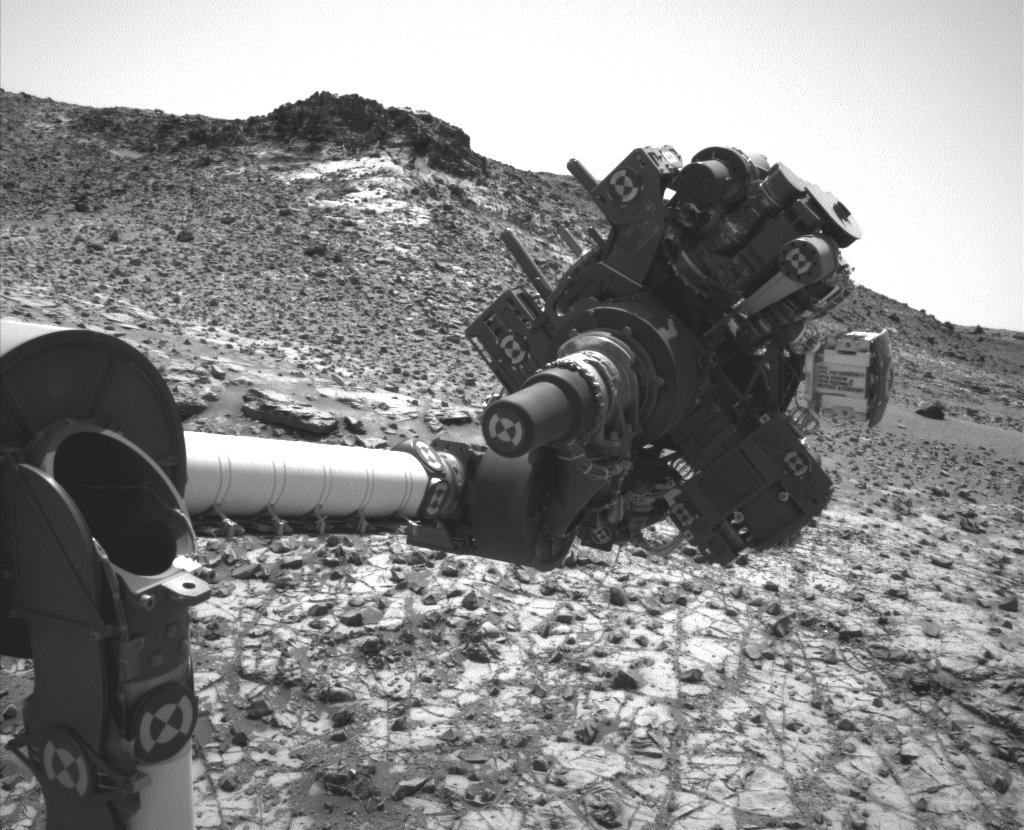
A unique view of the "mini drilling" operation on "Mojave". Captured by Curiosity's Hazcam navigation cameras, the image shows the rover's "hand" oriented such that the dril (visible with its two steadying arms) is placed against the rock
A unique view of the “mini drilling” operation on “Mojave”. Captured by Curiosity’s Hazcam navigation cameras, the image shows the rover’s “hand” oriented such that the drill (visible with its two steadying arms) is placed against the rock, with the peak of “Mount Sharp” forming a backdrop.

The initial mini-drilling operation took place on January 13th 2015, during the 867th Martian day, or Sol, of Curiosity’s work on Mars. It marks the third phase of science operations in the “Pahrump Hills” area, having been preceded by a “walkabout” of the area in which potential target sites for detail investigation were noted prior to follow-up examinations of several of them using some of the rover’s on-board systems, such as the Alpha Particle X-Ray Spectrometer and the Mars Hand Lens Imager (MAHLI), both of which are also mounted on the “hand” or turret at the end of the rover’s robot arm.

Once samples from “Mojave” have been collected, they’ll be passed through the CHIMRA system inside the turret, which will prepare them for delivery to the rover’s main on-board science suits, SAM and ChemMin. The latter (standing for Chemistry and Mineralogy instrument), will hopefully reveal a lot more about the chemical composition of the crystals. Additionally the drilling operation itself should reveal whether the crystals are only at the surface, like a salty crust, or are also deeper in the rock, which itself might lead to clues about their origins

“There could be a fairly involved story here,” Vasavada said. “Are they salt crystals left from a drying lake? Or are they more pervasive through the rock, formed by fluids moving through the rock? In either case, a later fluid may have removed or replaced the original minerals with something else.”

Two other potential targets for drilling operations are also under consideration before the rover moves out of the “Pahrump Hills” area.

The view is a mosaic of four focus-merge images created by Curiosity from 40 images acquired using MAHLI on Sol 809 (November 15th, 2014 PDT). It shows an area of the “Mojave” rock which has been cleaned by the rover’s dust removal tool in order to reveal the tiny rice-like crystalline deposits. The penny in the lower left is to scale with the mosaic

Continue reading “All change, getting virtual on Mars and watching the asteroid go by”

The Beagle had landed

An artist's impression of Beagle 2 on Mars (credit: European Space Agency)
An artist’s impression of Beagle 2 on Mars (credit: European Space Agency)

In June 2003 the European Space Agency launched a pair of vehicles to Mars. The larger of the two, an orbiter vehicle called Mars Express, is still in operation today, albeit often overlooked by the media in favour of its American cousins also in orbit around the Red Planet.  The other vehicle, piggybacking on Mars Express, was a tiny lander (quite literally, being just 39 inches across) called Beagle 2.

Designed to search for signs of life, past or present on Mars, Beagle 2 was the Mission That Almost Never Was, because at the time it was proposed, no-one outside of those wanting to build it, wanted it. And yet, even today, the science package it did eventually take to Mars is one of the most remarkable feats of science engineering put together, with capabilities that will not be repeated until NASA flies their one tonne Mars 2020 mission at the start of the next decade.

Sadly, for all its innovation and despite overcoming the odds to actually fly to Mars, Beagle 2 never achieved its goals; all contact was lost on the very day it was due to land on the Red Planet, December 25th, 2003. What happened to it remained a mystery for twelve years, but on Friday, January 16th, members of the Beagle 2 team were able to reveal that the fate of the plucky little lander was now known.

The Beagle 2 story begins in April 1997, when the European Space Agency held a meeting to discuss the possibility of flying an orbiter mission to Mars in 2003, following the failure of an earlier mission. This new mission would be called “Mars Express”, both in recognition of the exceptionally short lead-time to develop and fly it, even using instruments and systems developed for the failed mission, and for the fact that in 2003, Earth and Mars would be the closest they’ve been for some 60,000 years, allowing anything launched around the middle of that year to reach Mars in a comparatively short time.

Colin Pillinger, the man very much at the centre of Beagle 2, and who brought the mission to the public eye

Professor Colin Pillinger, a planetary scientist and a founder of the Open University’s prestigious Planetary Science Research Institute (since merged with the OU’s Department of Physics and Astronomy), attended the meeting together with his wife Judith, also a planetary scientist. At the time, Professor Pillinger was one of a number of scientists involved in investigating whether or not biogenic features had been discovered in a meteorite found in Antarctica, but which had originated on Mars.

This particular debate was focused on a piece of rock called ALH84001, regarded as one of the oldest pieces of the Solar System, being just over 4 billion years old, and which formed at a time when Mars was likely a warm wet planet. It had been raging for a year with no sign of abating, and Professor Pillinger had already come to the conclusion that one way to settled it would be to put a life sciences package actually on Mars.  He realised the proposed Mars Express mission presented the perfect opportunity for doing so, as did his wife. So much so, that by the time they got back to the UK, she had the perfect name for a mission designed to seek out evidence of life on Mars: Beagle 2, named for the vessel commanded by Captain Robert FitzRoy that carried Charles Darwin on his seminal voyage of discovery.

The microscopic structures revealed by a scanning electron microscope deep within a fragment of ALH84001 that suggested biogenic origins
One of the microscopic structures revealed by a scanning electron microscope deep within a fragment of ALH84001 that suggested biogenic origins

Given all of the controversy surrounding ALH84001 and the question of possible microbial life on Mars that dated back to the Viking Lander experiments of the 1990s, you’d think the ESA would jump at the opportunity to put a life sciences mission on Mars. Not so; for one thing, others also saw Mars Express as an opportunity to fly their projects to Mars and were busy lobbying. More to the point, it was held that the 6-year time frame for developing a lander mission from scratch was too short.

However, Colin Pillinger was not one to be deterred. In the UK he brought together a team from academia and industry, including Doctor Mark Sims, who was to prove pivotal in the  engineering design of the lander. With many of those involved in the nascent project initially working on it entirely in their own time, Beagle 2 rapidly developed from a series of rough designs “on the backs of beer mats”, to a proposal which, when presented to ESA managers, so impressed them, they provisionally agreed to the idea of flying a lander to Mars – but only if the UK was able to fund it. No money would be forthcoming from ESA.

Dr. Mark Sims of the University of Leiceter, who lead the engineering team responsible for Beagle 2, seen with another model of the lander (image: University of Leicester)
Dr. Mark Sims of the University of Leicester, who lead the engineering team responsible for Beagle 2, seen with another model of the lander (image: University of Leicester)

Thus began one of the most remarkable public relations exercises in annals of space history, with Beagle 2 becoming a household name in the UK, as Colin Pillinger sought to promote in on television, the radio, through newspaper and magazines, and giving public presentations. Space advocacy groups were rallied to the cause, celebrities were brought in to add their weight to things, Parliament and industry were lobbied and won over. In the end, the entire £44 million (US $70 million) was raised, with 50% coming from the UK government and the rest from the private sector.

Continue reading “The Beagle had landed”

Of mountains, methane and molecules

CuriosityAfter what has been a relatively quiet period in terms of news from Mars, things are once again proving interesting.

The first uptick came following the start-of-month teleconference Mars Science Laboratory personnel held to summarise the results of the last several months of activities the Curiosity rover has been performing in Gale Crater. In particular, these have allowed scientists to better determine how the 5 kilometre high mound at the centre of the crater may have been formed.

Even before Curiosity arrived on Mars, sufficient evidence had been obtained from orbit to show that features in and round Gale Crater were likely influenced by water-related activity. Curiosity itself found evidence for water once having flowed freely across parts of the crater when it encountered the beds of ancient rivers and streams as it explored the regions dubbed “Glenelg” and “Yellowknife Bay”.

With the journey down to “Mount Sharp”, and NASA call the mound, and the recent explorations of its lower slopes, the science team have been able to piece together the processes that led to its formation.

The first clues came while Curiosity was still en route to the point where examination of the “Mount Sharp’s” lower slopes could begin. As it drove southwards and towards the mound, the rover started to encounter layered sandstone deltas, all inclined towards “Mount Sharp”. On Earth, such layered, angled deposits are found where a river flows into a large lake.

A mosaic of images captured by Curiosity’s Mastcam on March 13, 2014 PDT (Sol 569). White-balanced for natural Earth light, the images show layered sandstone deposits, all pointing towards “Mount Sharp”, indicative of delta sediments dropped by a flowing river as it enters a large lake

Once in the foothills of “Mount Sharp”, in the area dubbed “Pahrump Hills”, Curiosity has repeatedly come across layers of tightly-compacted sedimentary mudstone which are entirely consistent with the sedimentary layering found in the muds and rock in lake beds on Earth. Intriguingly, while most of these layers appear to have been formed by sediments settling out of a large, still body of water, some of them appear to have been affected by wind erosion.

This latter point would indicate that rather than the crater floor once being covered by a single body of water which gradually vanished over time, it was subjected to cycles of wet and dry periods, giving rise to a number of lakes forming within the crater over the ages, each one only a few metres deep. As the water receded / vanished during the dry periods, so the uppermost layers of each lake bed were exposed to the wind, eroding them, before the next wet period started, and a new lake formed, gradually depositing more sediments on top of them.

Thus over a period of millions of years, Gale Crater was home to numerous lakes, each of them fed by assorted rivers and streams flowing into them, giving rise to the alluvial plains around the base of the crater walls, and the sedimentary deltas closer to “Mount Sharp” where these rivers and streams met the standing waters of each lake.

This diagram depicts a vertical cross section through geological layers deposited by rivers, deltas and lakes. A delta builds where a river enters a body of still water, such as a lake, and the current decelerates abruptly so sediment delivered by the river settles to the floor.

This view of Gale Crater is further supported by measurements of the deuterium-to-hydrogen ratio in the rocks sampled by Curiosity. These suggest that the sediments the rover is now examining were laid down during a period when Mars had already started losing its surface water, suggesting an extended period of climatic change on the planet, where the amount of free-standing water may well have been in flux.

Once the water had completely vanished from Gale Crater, it seems likely that “Mount Sharp” was sculpted by wind action within the crater. Thus, it is thought, would have eroded the material of the alluvial plains faster than the more densely compacted mudstone formed under the weight of the successive lakes.

As it might have been: the left image shows the repeated depositing of alluvial and wind-blown matter (light brown) around a series of central lakes which formed in Gale Crater, where material was deposited by water and more heavily compressed due the weight of successive lakes (dark brown). Right: once the water had fully receded / vanished from the crater, wind action took hold, eroding the original alluvial / windblown deposits around the “dry” perimeter of the crater more rapidly than the densely compacted mudstone layers of the successive lake beds, thus forming “Mount Sharp”

Continue reading “Of mountains, methane and molecules”