Update: This location has closed, the SLurl have therefore been removed from this article.
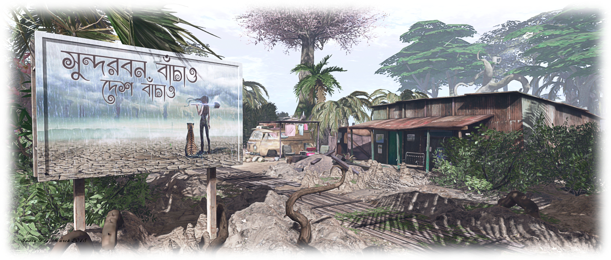
“Sundarbans is a vast mangrove forest located between India and Bangladesh, well-known for being the habitat of the Bengal tiger,” Gabrian Lascelles (gothicgaylord) writes in his introduction to his new Homestead region, Sundarban. “It’s my vision of India,” he informed me in passing an invitation to Caitlyn and I to visit. “And as I’m from Sweden, it’s been a lot of research for me, but if I’ve managed to catch just a breath of India, I’m happy!”
Gabrian is perhaps best know for designing and building Costa Blanco (see here for more), and as a landscaper at Amazon River. We both thoroughly enjoyed Costa Blanco, so with Gabrian’s invitation in hand, we hopped over to Sundarban to have a look around.
Sundarban
The physical world Sundabarans lies in the vast delta formed by the by the super confluence of the Ganges, Hooghly, Padma, Brahmaputra and Meghna rivers as they empty into the Bay of Bengal, straddling India to the west and Bangladesh to the east. It is a huge ecosystem encapsulating both freshwater swamps and the world’s largest area coastal mangroves, around 10,000 square kilometres (6,250 sq mi). As Gabrian notes, the area is the home of the endangered Bengal Tiger, but it is also home to other endangered species besides, such as the estuarine (or saltwater) crocodile, the northern river terrapin, the South Asian river dolphin (freshwater dolphin), barasingha swamp deer, as well as more widespread breeds of mammals, bird, fish and reptiles.
For his build, Gabrian presents a coastal area made up of low-lying muddy / sandy islands, some linked by bridges, others by zip lines, while little motor boats provide the means of puttering around the waters to reach all of them. The landing point sits on an island on the north side of the region, where sits a little shanty store. Elephants are bathing in the water close by – although they are of African, rather than Indian, origin (don’t blame Gabrian for this, African elephants in natural poses are a lot more popular with creators than their Indian cousins).
Sundarban
East from here, over a low wooden bridge, is a second island. This is home to an old corrugated iron shack, a small shrine, and a path leading up to the wooden jetty on the north side of the island where the motor boats can be obtained. For the adventurous, a set of zip lines have been set up behind the old shack, providing a way for people to travel to / from the island to the south without the need for a boat or getting their feet wet.
This island is probably the largest by visible landmass in the group. It arcs to the south and east, a slender ribbon of grassy dunes sitting under the shade of trees reflecting the physical world’s Sundarbans freshwater forests, before ending in a finger of rock pointing up at the sky. An ancient ruin can be found here, converted into a rest spot complete with canopied massage table looks towards the eastern islands in the group, and another pair of zip lines link it with the nearest of them. Before riding one of them, however, it’s worth walking down to that finger of rock I mentioned – you’ll pass more of the local wildlife along the way and find a most unusual perch up in the rock itself.
Sundarban
Those seeking the tigers will need a motor boat, as they are on a small island to the north-west, separated from the rest by water. Just heed the sign as you approach the island’s little bay, or you might find yourself on the menu – as seems to have been the case with the last couple of visitors, porcine and human!
Sundarban is Gabrian’s personal vision of an exotic part of India, and a place that’s easy to explore and easy on the eye. Throughout the islands are numerous places to sit and cuddle (although be aware some do have distinctly adult poses in them!), and plenty of opportunity to take pictures. Should you enjoy your visit, please consider a donation towards the region’s upkeep – just look for the beggar / trader near the path to the motor boat jetty.
Logos representative only and should not be seen as an endorsement / preference / recommendation
Updates for the week ending Sunday, March 25th
This summary is generally published on every Monday, and is a list of SL viewer / client releases (official and TPV) made during the previous week. When reading it, please note:
It is based on my Current Viewer Releases Page, a list of all Second Life viewers and clients that are in popular use (and of which I am aware), and which are recognised as adhering to the TPV Policy. This page includes comprehensive links to download pages, blog notes, release notes, etc., as well as links to any / all reviews of specific viewers / clients made within this blog.
By its nature, this summary presented here will always be in arrears, please refer to the Current Viewer Release Page for more up-to-date information.
Official LL Viewers
Current Release version 5.1.2.512803, dated February 23rd, promoted March 1st – formerly the Nalewka Maintenance RC – No Change.
Cool VL Viewer updated as follows: the Stable branch to version 1.26.20.48 and the Experimental version to 1.26.21.14, both on March 24th (release notes).
NASA’s Mars Curiosity rover celebrated its two-thousandth Martian day, or Sol, on the Red Planet on March 22nd, 2018. In celebration, NASA issued a new photo-mosaic of images captured by the rover in January 2018, which have been processed to provide a offers a preview of what comes next.
Looming over the image is Mount Sharp, the mound Curiosity has been climbing since September 2014. In the centre of the image is the rover’s next big, scientific target: an area scientists have studied from orbit and have determined contains clay minerals.
Clay minerals requires water to form. Curiosity has already revealed that the lower layers of Mount Sharp formed within lakes that once spanned Gale Crater’s floor. The area the rover is about to survey could offer additional insight into the presence of water in the region, how long it may have persisted, and whether the ancient environment may have been suitable for life.
Key to examining the area will be the rover’s drill mechanism, which the science team hope will be able to draw samples pulled from the clay-bearing rocks so their composition can be determined. As I recently reported, a new process for obtaining samples via the drill and getting them to the rover’s on-board science suite was recently tested to overcome a long-term issue with the drill feed mechanism, and the approach is being refined on Earth in preparation for the excursion into the clay region.
The 2,000 Sol celebration mosaic, published on March 22nd. It is made up of dozens of images captured by the rover’s Mastcam on Sol 1931 back in January. The mount of “Mount Sharp” (Aeolis Mons) dominates the mosaic, while the area outlined in white marks the region of clay minerals the rover is going to explore in the weeks and months ahead. The image has been white-balanced to match Earth normal lighting. Credit: NASA/JPL / MSSS
In the meantime, a new study seeking to explain how Mars’ putative oceans came and went over the last 4 billion years implies that the oceans formed several hundred million years earlier than previously thought, and were not as deep as had been assumed. In particular, it links the existence of oceans early in Mars history to the rise of the massive Tharsis volcanoes on Mars and highlights the key role they may have played in the ancient oceans of the Red Planet.
A common objection to Mars ever having oceans of liquid water is that estimates of the size of the oceans doesn’t marry-up with estimates of how much water is retained within the planet’s polar caps, how much could be hidden today as permafrost underground, and how much could have escaped into space. In the new study, from the University of California, Berkeley, it is proposed that Mars’ oceans first formed before, or at the same time as, the massive volcanoes of the Tharsis bulge, 3.7 billion years ago, rather than after them.
“The assumption was that Tharsis formed quickly and early, rather than gradually, and that the oceans came later,” Michael Manga, professor of earth and planetary science and senior author of the study, said. “We’re saying that the oceans pre-date and accompany the lava outpourings that made Tharsis.”
This would mean that the plains that cover most of the northern hemisphere, which are the presumed to be an ancient seabed, would have extended into the area later deformed as the Tharsis Ridge expanded, and lava flows cut into the plains. Thus, the initial oceans on the planet would have been more widespread – but shallower – than originally thought, providing a smaller overall volume of water.
The early ocean known as Arabia (left, blue) would have looked like this when it formed 4 billion years ago on Mars, while the Deuteronilus ocean, about 3.6 billion years old, had a smaller shoreline. Both coexisted with the massive volcanic province Tharsis, located on the unseen side of the planet, which may have helped support the existence of liquid water. The water is now gone, perhaps frozen underground and partially lost to space, while the ancient seabed is known as the northern plains. Credit: Robert Citron images, UC Berkeley
The model also counters another argument against oceans: that the proposed shorelines are very irregular, varying in height by as much as a kilometre, when they should be level, like shorelines on Earth. However, this irregularity could be explained if the first ocean, called Arabia, started forming about 4 billion years ago and existed, if intermittently, during as much as the first 20% of Tharsis’s growth. The growing volcanoes would have depressed the land and deformed the shoreline over time, leading to the irregular heights seen today. This would also apply to the subsequent ocean, called Deuteronilus, if it formed during the last 17% of Tharsis’s growth, about 3.6 billion years ago.
Tharsis, now a 5,000-km-wide eruptive complex, contains some of the biggest volcanoes in the solar system and dominates the topography of Mars. Its bulk creates a bulge on the opposite side of the planet (the Elysium volcanic complex), and the canyon system of Valles Marineris in between. This explains why estimates of the volume of water the northern plains could hold based on today’s topography are twice what the new study estimates based on the topography 4 billion years ago.
This new theory has two further points in its favour. Firstly, it can account for the valley networks (cut by flowing water) that appeared around the same time.Secondly, both Arabia and Deuteronilus would have existed at a time when the Tharsis volcanoes and those of Elysium would have been active, throwing greenhouse gases into the Martian atmosphere, warming it and increasing its density.
The authors of the study admit it is just a hypothesis at this point in time, and Manga invites others to follow-up on it. “Scientists can do more precise dating of Tharsis and the shorelines to see if it holds up.”
Too Much Water To Be Habitable?
The latest study to be published concerning TRAPPIST-1, the 7-exoplanet star system 39 light-years from our Sun, suggests the exoplanets may be too wet to have ever supported life – which might sound a little surprising. It also suggests the planets have migrated closer to their planet red dwarf star since their formation.
The study was led by Cayman T. Unterborn, a geologist with the School of Earth and Space Exploration (SESE), and used data from prior surveys that attempted to place constraints on the mass and diameter of the TRAPPIST-1 planets in order to calculate their densities, one of which I mentioned in January 2018.
Artist’s concept showing what each of the TRAPPIST-1 planets may look like. Credit: NASA
Using this data as a starting point, the team constructed mass-radius-composition models to determine the volatile contents of each of the TRAPPIST-1 planets. They found the 7 planets are light for rocky bodies, suggesting a high content of volatile elements. On similar low-density worlds, this volatile component is usually thought to be atmospheric gases. However the TRAPPIST-1 planets are too small in mass to hold onto enough gas to make up the density deficit.
Because of this, Unterborn and his teams determined that the low-density component of the seven planets was most likely water. To determine just how much water, the team used ExoPlex, software for calculating interior structure and mineralogy and mass-radius relationships for exoplanets. This allowed the researchers to combine all of the available information about the TRAPPIST-1 system.
The results revealed that all of the TRAPPIST-1 planets have high percentages of water by mass: 15% for the two inner worlds, b and c, rising to more than 50% for the outer planets, f and g. To put this into context, Earth has just 0.02% water by mass. Thus, the TRAPPIST-1 planets have the equivalent of hundreds of Earth-sized oceans trapped within their volumes. Had this water been liquid at any point in the past, or simply frozen ice enveloping the surfaces of them, it would likely to have been far too much to support life, as Natalie R. Hinkel, an astrophysicists from Vanderbilt University, Nashville, explained:
We typically think having liquid water on a planet as a way to start life, since life, as we know it on Earth, is composed mostly of water and requires it to live. However, a planet that is a water world, or one that doesn’t have any surface above the water, does not have the important geochemical or elemental cycles that are absolutely necessary for life.
In addition, the study also suggests that all seven planets in the system most likely formed father away from their star and migrated inward over time – something which has been noted with other exoplanet systems. In the case of TRAPPIST-1, the planets are distributed either close to, or within, the star’s “ice line”. This is a boundary where, within which, ice on planets tends to melt and either form oceans (if sufficient atmosphere is present) or vaporise. Beyond this line, water will take the form of ice and can be accreted to form planets.
An artist’s impression of the sky from the outermost of the three TRAPPIST exoplanets in the star’s habitable zone.
Given the relative positions of the outer planets to their star’s ice line, the research team determined all seven of TRAPPIST-1’s planets must have formed beyond the ice line, but over the aeons migrated inwards, with the inner planets losing much of their water content through their surface ice vaporising – but leaving a high volume of water still being retained within their rocky crusts.
Working out how far – and when – the planets might have formed is made more complicated by the fact that M-type red dwarf stars like TRAPPIST-1 burn brighter and hotter early in their lives before cooling and dimming – so its “ice line” would have contracted inwards as well. Based on how long it takes for rocky planets to form, the team estimated that the planets must have originally been twice as far from their star as they are now.
Overall, the study leans weight to the view that TRAPPIST-1 worlds are unlikely to be habitable. Early on, as Natalie Hinkel noted above, they may well have been ice or water covered, but lacking the geochemical and elemental cycles essential for life. Any period in which surface conditions might have been more favourable for life on the inner planets as their ice melted would likely have been comparatively short as a result of the star’s solar activity stripping most of their atmospheres away.
Kepler Observatory Nears End of Life
To date, around 3,743 exoplanets have been discovered in our galaxy – 2,649 of them by the Kepler Space Observatory, but we’re now approaching the end of life for this veritable planet hunter.
Launched in 2009, Kepler occupies an Earth-trailing heliocentric orbit, from which it has sought out exoplanets using the transit method – monitoring a star over a period of time for periodic dips in brightness caused by a planet transiting (passing in front of) the star.
In 2012 and 2013, the observatory suffered failures and issues with two of the observatory’s four reaction wheels used to hold it steady while observing distant stars. As a result, a new mission profile, K2 Second Light, was developed in order to compensate for the issues. Unfortunately this required the observatory to use small amounts of its propellant reserves to help hold it steady during operations – and those fuel reserves are almost expended.
Mission engineers are uncertain as to precisely when the observatory’s fuel will run out, other than it will likely happen in the next several months. The hope is that there is still enough time to gather as much data a possible from the current observation campaign.
For the first four years of its primary mission, the space telescope observed a set star field located in the constellation Cygnus Since 2014, Kepler has been collecting data on its second mission, observing fields on the plane of the ecliptic of our galaxy. Credit: NASA / Wendy Stenzel
“Without a gas gauge, we have been monitoring the spacecraft for warning signs of low fuel— such as a drop in the fuel tank’s pressure and changes in the performance of the thrusters,” Charlie Sobeck, a system engineer for the Kepler space telescope mission, explained. “But in the end, we only have an estimate – not precise knowledge.”
The end of Kepler’s mission does not mark the end of the search for Exoplanets from space. April 2018 will see the launch of the Transiting Exoplanet Survey Satellite (TESS), will conduct transit surveys on a large scale, and in 2019 the James Webb Space Telescope (JWST) will also have part of its mission devoted to the hunt for exoplanets. Both will help build on Kepler’s legacy.
On March 26th, 2018, the winners of the UWA Art of Artists machinima challenge, launched in July 2017, were announced. Initially sponsored by LaPiscean Liberty of SLArtist and Singh Albatros and The Writers Centre, Singapore, the challenge opened with a prize pool of L$350,00 which, thanks to additional sponsors such as Pooky Amsterdam of Pookymedia, topped-out at L$430,000 by the time the challenge closed to entries on December 31st, 2017.
Challenge entrants were asked to produce a machinima film focused on any of the art exhibits located on the UWA regions in Second Life. They were allowed to choose individual pieces of art or a collection around which to weave a story. However, the art had to be a relatively significant part of the story, and not merely something glimpsed in passing, and films to be considered for any of the prizes could not exceed 8 minutes in length (although longer films could be submitted if desired.
The award ceremony was held at the historic Winthrop Hall in the UWA virtual campus in Second Life. As well as a celebration of the competition and its winners, the event also marked an end of an era. “It’s a farewell from me,” Jayjay Zifanwe, who has been the powerhouse behind the UWA’s presence in Second Life and its patronage of digital arts, informed me ahead of the ceremony.
He continued, “Farewell in a sense that it’s the last of my major events, and the last speech in will do within SL.” During his opening address at the awards ceremony, Jayjay took time to thank all of those – especially Freewee Ling, curator of the UWA’s art exhibits, and to all those who have done so much to make the UWA’s presence in SL so rewarding for him. In doing so, he also paid tribute to artist Alizarin Goldflake, who passed away recently after a long illness.
Awarded by Singh Albatros and Kaylee West on behalf of The Writer’s Centre, Singapore to the films which best represent the The Merlion, the national personification of Singapore, and featured at the Merlion Portal in Second Life.
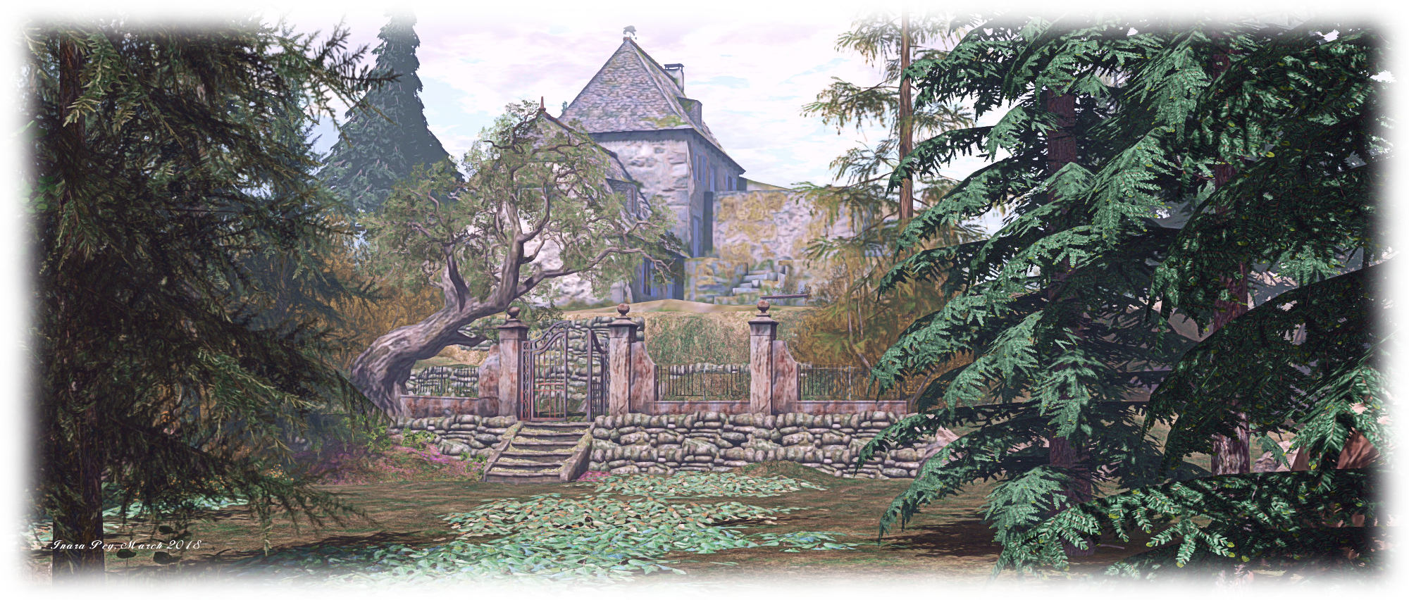
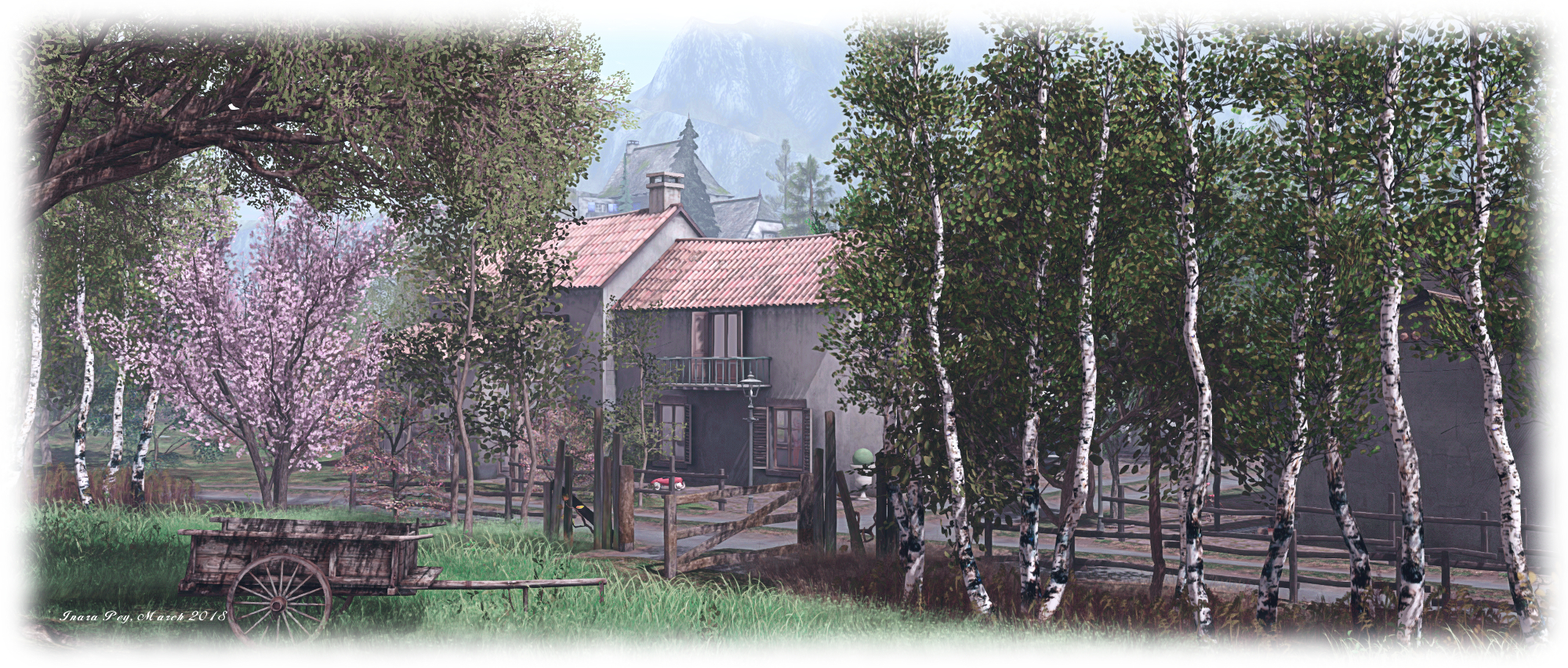
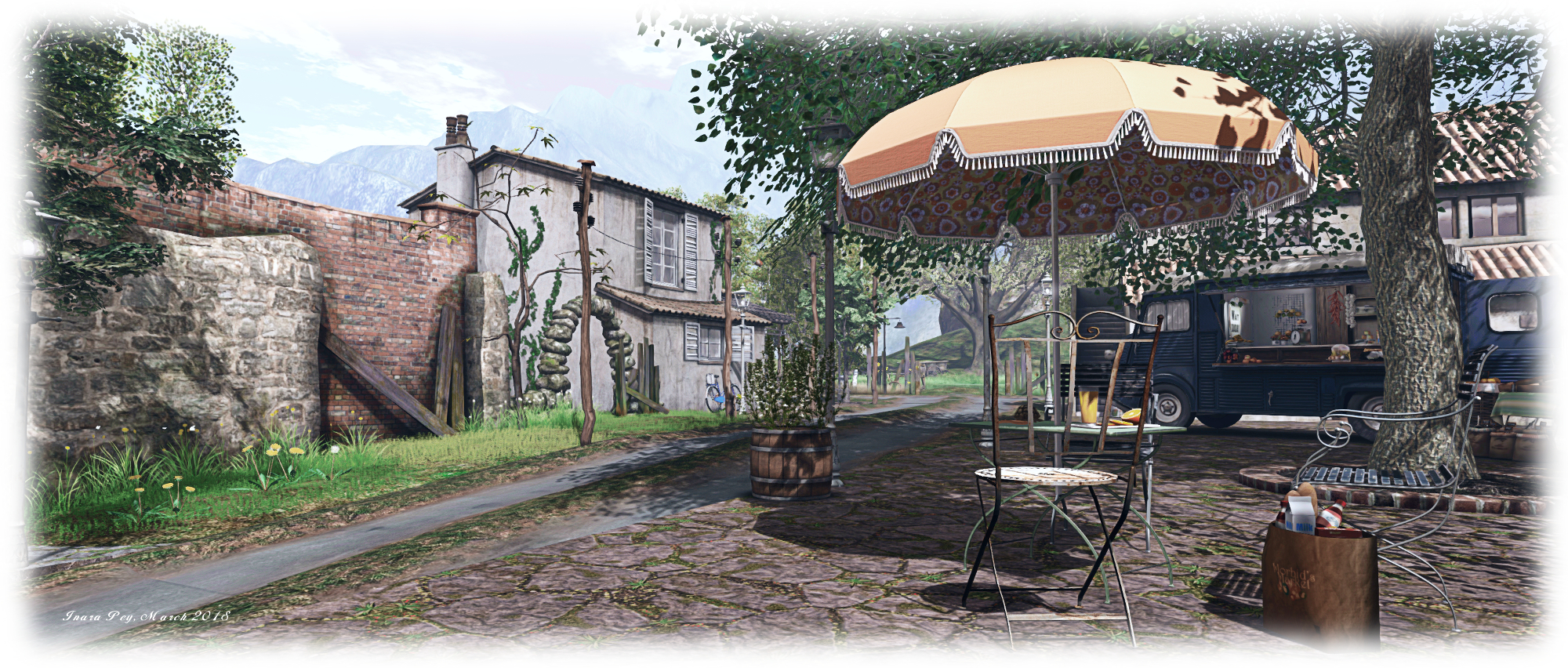
“Twirling like a butterfly, fluttering in the sky, choosing the most fragrant flowers, regardless of the end of summer.” So reads the introduction to the latest incarnation of La Virevolte (The Twirl), the highly photogenic Homestead region designed by Iska (sablina). When last we visited, the region was in the grip of winter. With this incarnation, the region has a new look caught in the Sun – as the description says – of late summer.
A visit starts on a terrace outside of a little café. It sits in the corner of a little hamlet built alongside a channel-like canal running east-to-west through the region, splitting it in two. A house also occupies the terrace, a vintage Citroen van serving as a mobile fresh produce stall, sitting between the two. Facing them sits another house, the barn alongside seemingly in the process of being converted into a home. House and barn sit on an island of grass surrounded by a loop of road.
The western end of this loop touches on a headland ending in a promontory of rock on which is perched a lighthouse keeping watch on things. North of the hamlet, beyond the road’s loop, the land offers rugged grassland rising to a rocky bluff. This open, rugged land continues around the east of the region, grassy slopes rising within the shoulders of a high v-shaped plateau. The grass between the slopes and the café are divided in part by an ancient stone wall, cupping a wild garden between it and the hamlet’s buildings.
Across the channel – which is spanned by a stone bridge – a road runs south before curling to wind its way up the stepped landscape, ending among tall pines trees, where a track points east to where an old farmhouse sits atop a rocky shelf, the land between track and building also falling in gentle steps, some of which are – like the terraces below – retained by ancient drystone walls.
These terraces are in part cultivated, presumably by whoever lives up in the farm-house. The lowest one is given over to root and vine vegetables, while grapes are ready for harvesting on the next terrace up. They and the vegetables point to the late summer setting for the region. Stone steps climb the terraces, offering a shorter route up to the track leading to the farm-house for those who don’t feel like walking the road.
This is another marvellous design by Iska, one made particularly attractive by the way things like the building have been brought together. Take the house across the road from the café, for example; part of the original wall seems to have collapsed at some point, and an effort has been made to replace it with a red brick wall. Elsewhere sit the carcasses of an old a car and van, the former turned into a little garden, the latter now serving as a snuggle spot. These and the children’s toy and tricycle in the grounds of the houses, a broken flower-pot on a doorstep, all give the feeling that this is a home to unseen locals.
Walking through the region, it is very easy to picture you’re deep in rural France. I was immediately put in mind of parts of the Massif Central (the open water and lighthouse notwithstanding), given the general style of the houses. I mentioned this to Iska as we talked about the design. “The southern foothills of Massif Central, yes!” she replied. “[With] a lot of fountains and rivers, I love the sound of water everywhere.”
To say this is once again a photogenic design would be an understatement; it is a painting in and of itself, the selected windlight and sound scape both complementing it perfectly. Throughout the region are places to sit and admire / cuddle, such as the aforementioned old van, a picnic blanket out on the banks of the channel, the tables of the café and more.
Altogether, another fabulous design, kudos to Iska in building it and offering it to people to visit. and thanks to Shakespeare for the nudge concerning the redesign.
On Friday, March 23rd, the The Art of Drew Struzan: The Studio Experience opened in Sansar. As the name suggests, it is a celebration of the art of celebrated illustrator, Drew Struzan – and it is perhaps one of the most visually superb and compelling experiences yet to surface on the platform, particularly for anyone (like me) with a love of films and all that goes with them (I love both film art and film soundtracks).
The Art of Drew Struzan: The Studio Experience is part of the The Hollywood Art Museum (HWAM) project, established by Greg Aronowitz with the aim of encouraging artists in the digital medium to find fresh inspiration in the traditional arts of Hollywood’s past, through the preservation and education of art used in entertainment.
I provided something of a “preview” of the opening, including a (very) brief look at Drew Struzan’s career here – which I hope you’ll read alongside this article. For this piece, I’m focusing purely on the presentation of Drew Struzan’s work as it appear sin Sansar. But first, some preliminary notes:
The experience is in two parts: a gallery of Drew’s work, and a reproduction of his physical world private studio. Access is via the gallery experience, which can be reached in one of two ways – via a direct URL, or via the Hollywood Art Museum experience – just walk to the entrance of Sound Stage 6, which advertises the exhibition, and you’ll be transferred to the gallery experience.
Both experiences can be enjoyed in VR mode or Desktop mode. However, if you’re visiting in Desktop mode, I suggest using first person view (toggled via F3) to get the best view of the art.
Also note that some of the pieces displayed in the “cinema” part of the gallery have associated audio recordings of Drew talking about them, indicated by a set of push buttons beside the art. These buttons work in both VR and Desktop mode. Instructions are provided on a board by the entrance to the “cinema”, but in brief:
Walk up to a button to trigger the audio track (only audible to you). Once playing, you can move away from the button so others can also trigger the audio. Slowly moving away from a button will stop the audio playback before the end, if needed. VR, users can additionally use their controller’s trigger button to start / stop the audio.
Note that if you step up to another button while audio from one is already playing, the current track will stop and be replaced by the audio for the button you are next to.
The gallery space is divided into a number of distinct areas. The “lobby” area features some of Drew’s fine art, with portraits of Abraham Lincoln and Bob Dylan together with a self-portrait, as well as a more classic piece of art (Autumn) and more. A hallway leads off this, displaying more of his fine art, including a fabulous self-portrait in pencil and a phenomenal study of Albert Einstein, before reaching the “film” element of the exhibition, which starts with some magnificent pieces celebrating George Lucas, 20th Century Fox together with the art used for the cover of Spielberg / Williams collaboration soundtrack album. There’s also a collection of truly amazing portraits of some of Hollywood’s greats, which Drew produced for US postage stamps and for Franklin Mint.
Sinatra (l, for Franklin Mint), and John Wayne, Edward G. Robinson, Jimmy Stewart, Johnny Carson, Lucille Ball and Henry Fonda (all produced for US postage stamps), and Cary Grant (r)
Beyond this is the “cinema” exhibition space, and the collection of Drew’s film-related art, and the point where the audio options are available.
This features individual film posters (including the 1977 Star Wars “Circus” poster Drew produced with Charles White III, complete with the story of the poster’s unique look related by Drew), placed along the main corridors. In the centre of the gallery is a walk-through of “comprehensives” – drawings showing the initial layout and composition of a proposed artwork for the client to approve before going to the final illustration – Drew has produced over the years. There is also a section featuring a Hellboy poster and a Star Wars poster showing the creative process in stages from initial drawing through to final poster; and a special display dedicated to the Back to the Future trilogy.
This entire environment is visually stunning. The set is that of an old-style movie theatre with Deco lighting, red carpets and ornately-panelled ceilings, completed by excellent lighting. There is a richness to it that really give the environment a sense of place; exploring it in first-person genuinely gave me the sensation of being there – no headset required (although I imagine I’ll be totally blown out of my chair when I do get to see this experience in VR). As to the art – it has to be seen to be appreciated; it is just astounding, and the images here do not do it justice.
Beyond the “cinema” gallery is the entrance to Drew’s private studio – just walk up to the door marked Enter Here to be transferred to it.This is again stunning: a complete and accurate reproduction of Drew’s physical world studio. Just how accurate? Well, it has been produced by the Sansar Studios team working in collaboration with Insight Digital, a company specialising in photogrammetry and laser scanning to recreate sites of antiquity in digital format for detailed examination. some of their work has already been imported to Sansar at the Voyage Live: Egypt experience, and you can read about that work here.
For Drew’s studio, Insight took over 4,000 photographs of his workspace and laser scanned the objects and items inside it. “They went front, back, side, top, bottom, behind. Everything!” Drew says of the work. The result is – if I might use that word again – stunning. literally everything from the original studio space is here, beautifully reproduced.
The wealth of detail is extraordinary, and I strongly recommend careful exploration and viewing, simply because there is so much to see (watch out for the drawer with the stash of paints…). While touring, a couple of people did comment that things seemed a little big, but I assume the space was slightly scaled up to reduce issues of avatars colliding with one another when looking around in groups. And when you have (eventually) done, use the door beneath the deer head to return to the gallery.
A truly marvellous and visually impression pair of experiences, and kudos to Greg Aronowitz, Insight Digital and the Sansar Studios team under Jason Gholston for bringing it all together, and very special thanks to Drew Struzan for sharing both his art and his personal space with us in this way.
 Sundarban – click any image for full size
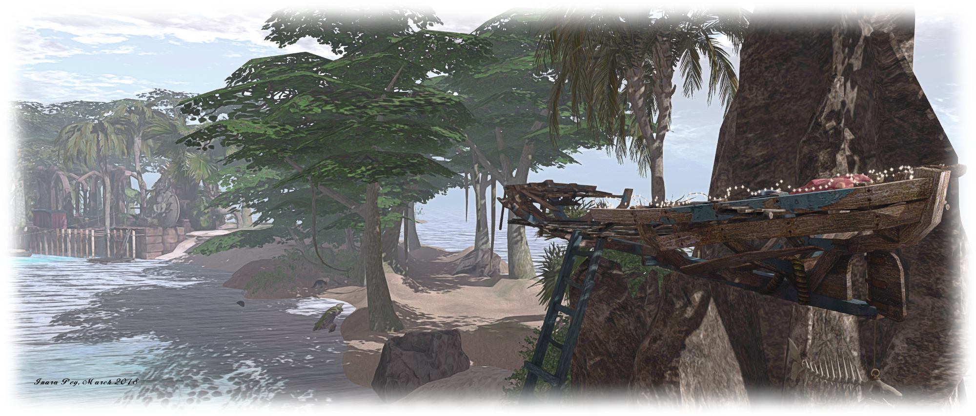 Sundarban
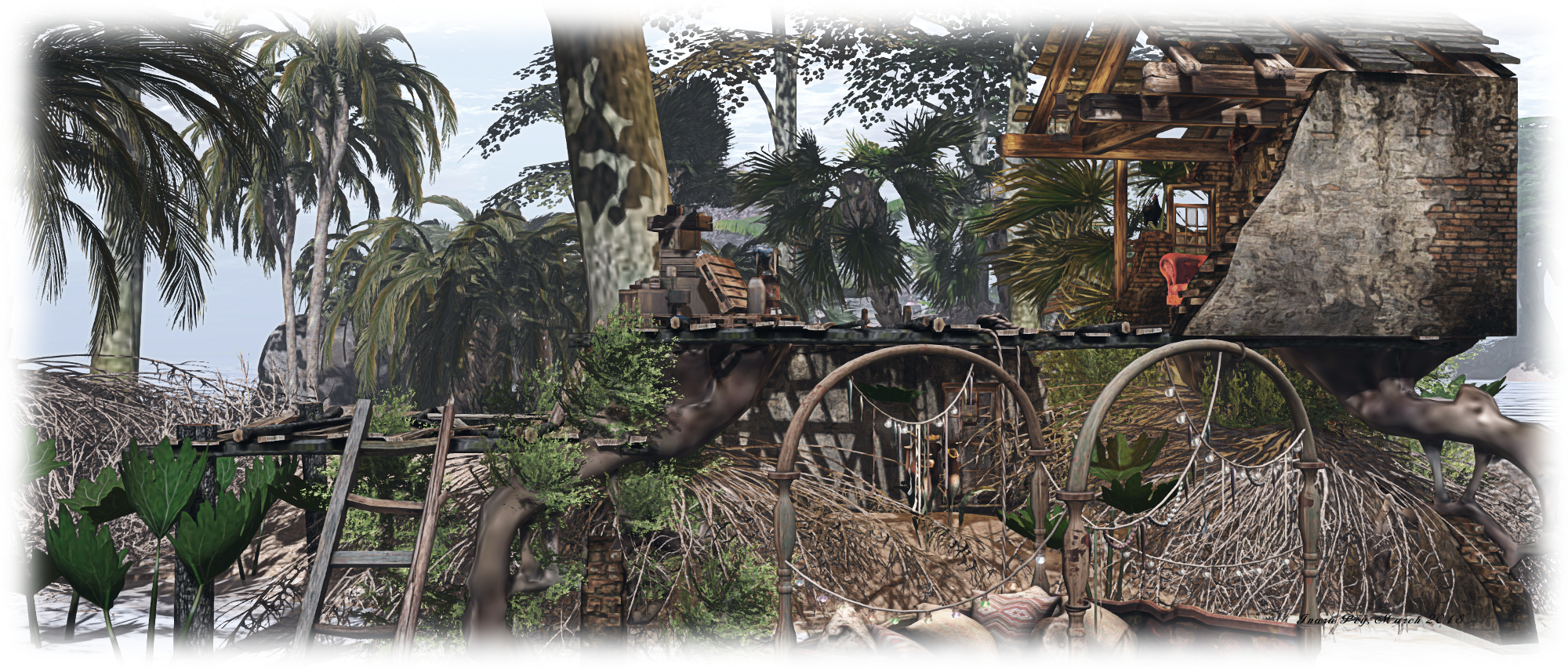 Sundarban
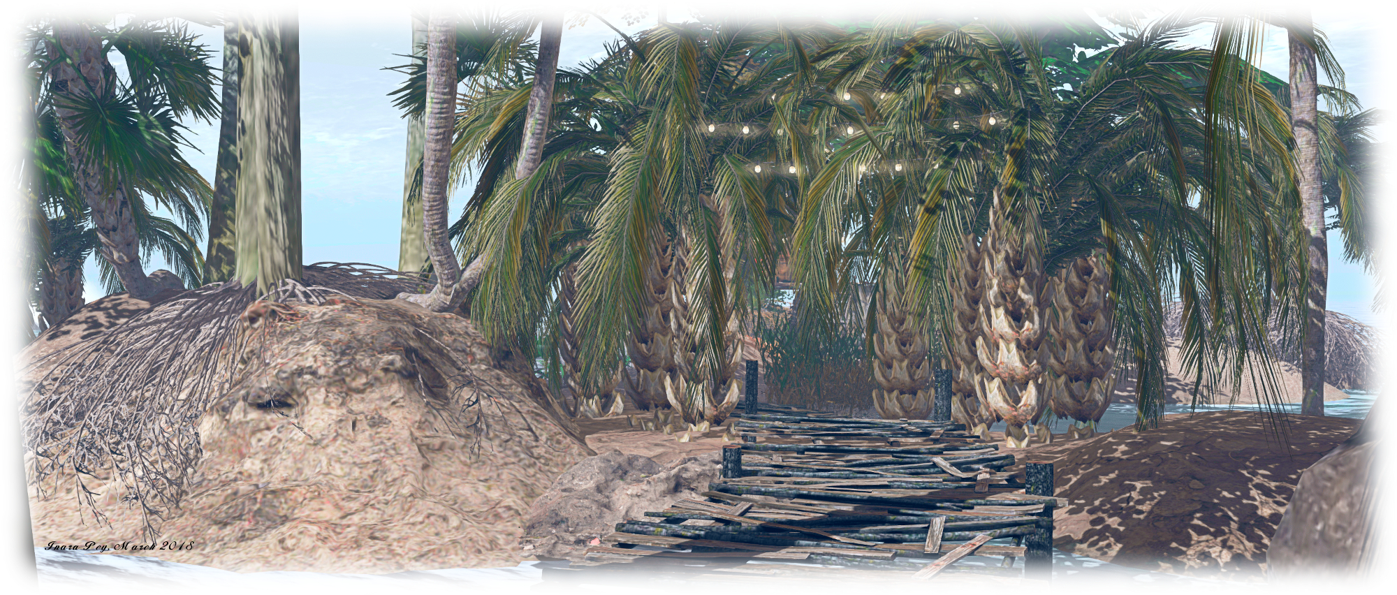 Sundarban
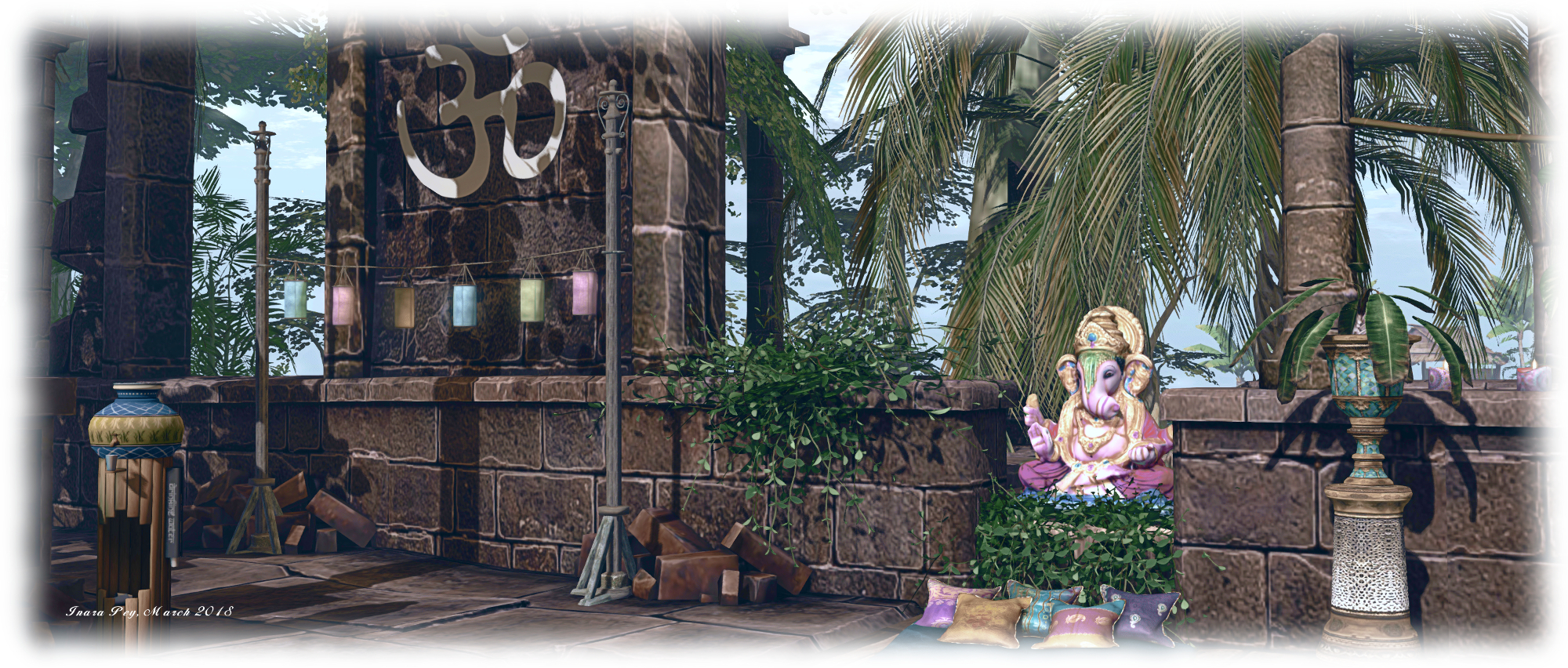 Sundarban