On June 7th, I wrote a piece about the A’stra main stage at SL10BCC. At the risk of repeating myself, this is a truly stunning build by Today Nakamura and Flea Bussy. As a part of the article, I post-processed some of the images I captured of the stage and turned them into drawings / paintings of the build to create a little illustrative narrative to go with the post.
I subsequently uploaded a couple of the images to my Flickr stream and then to the SL10BCC Flickr Group, where I think Toady may have seen them and found inspiration, as Flea IM’d me while I was off-line, and left me a message with a clue:
Shhhh! When you have a moment, maybe peek at the front of A’stra, near the angle you took the photo from…well, or we could say, painted! Toady saw your painting and well…you’ll see!
Intrigued, I pulled on my exploring boots, spent a few minutes burning incense at the Alter of the GPU asking that my Ge9800 GT hold itself together for an in-world visit (It’s been struggling badly the last 48 hours, and not only on the SL10BCC regions, which are already quite densely packed with textures), and jumped in-world.
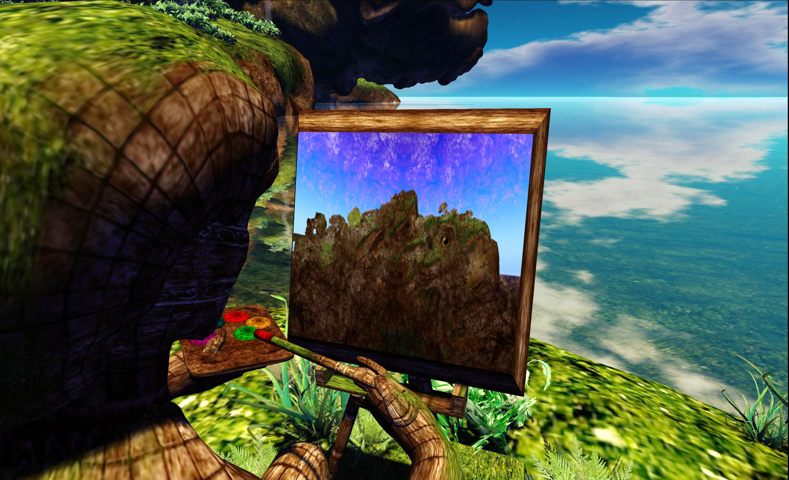
What I found was lovely, and – I have to say – deeply flattering. There’s a new little promontory leading from the “mainland” paths bordering the stage, and on it … well, see for yourselves…
“The artist”
I actually think he’s doing a much better job than I did…
“The artist”
So, thank you, Toady and Flea!
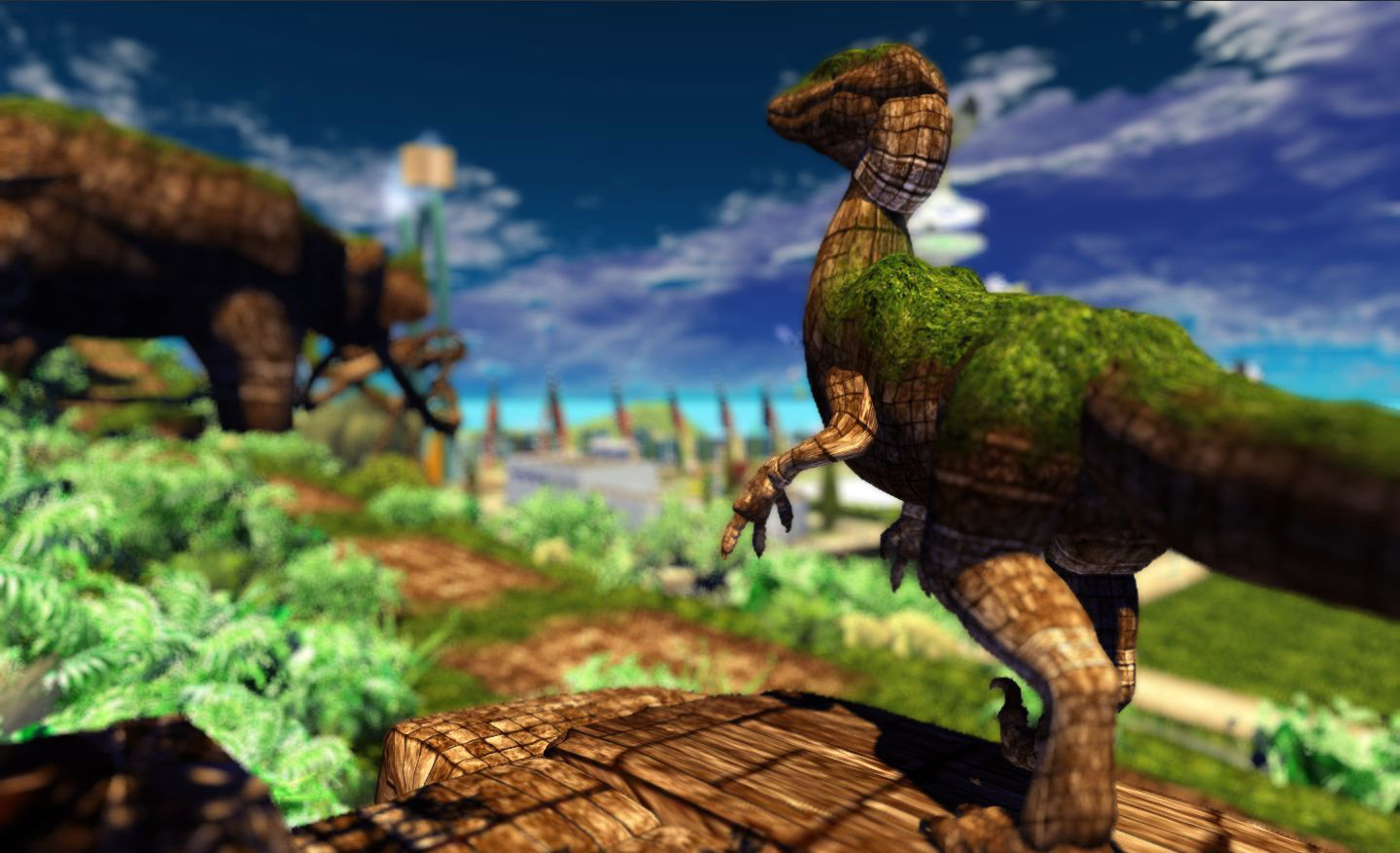
The artist adds a wonderful additional touch to the build – and I’m not saying that because the inspiration for him may have come from my pictures. There is a wealth of detail and many incredible touches from both Flea and Toady which bring this stage to life as you wander through it, and the artist adds another gem to that detail. Keep your eyes out for him once the regions open!
P.S. if you’re curious, the first image above may appear to have had a degree of post-processing. It hasn’t. It was produced purely through tweaking windlight via William Weaver’s Phototools, allow me to draw more attention to the figure of the artist.
As regulars here will know, I’m kind-of into SL sailing and flying, have written about both rather a lot since tumbling into both quite by chance, with my most recent acquisition for the former being the E-Tech Sparrow, which is leaning me dangerously close to seeing if I can rent some water-front land somewhere (I have modest needs; nothing larger than 2048 sq metre & room enough for a cottage, a bit of landscaping and a dock…).
However, it occurred to me that while I have been out on (and over) the water rather a lot over the past few months, particularly on Blake Sea, I’ve never actually blogged about places there – and there is rather a lot to see and do, beside sailing / flying.
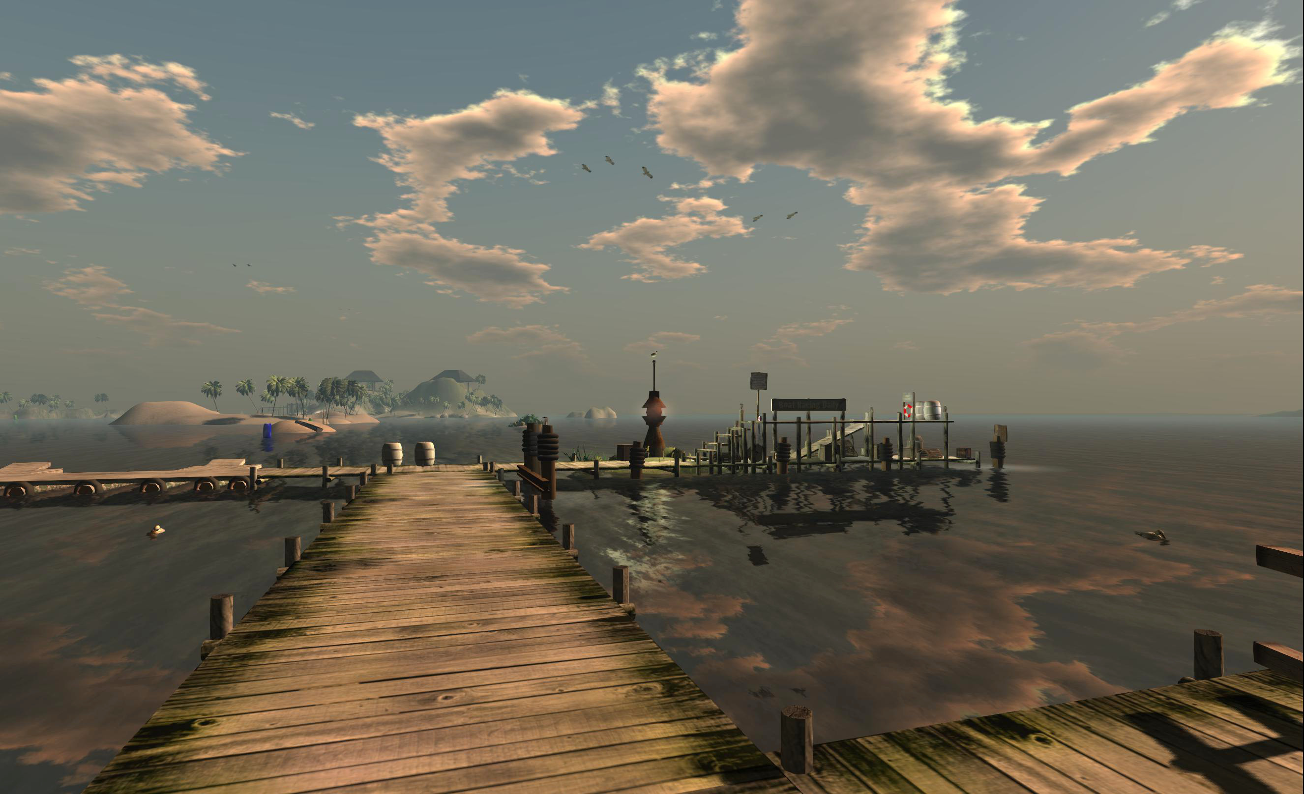
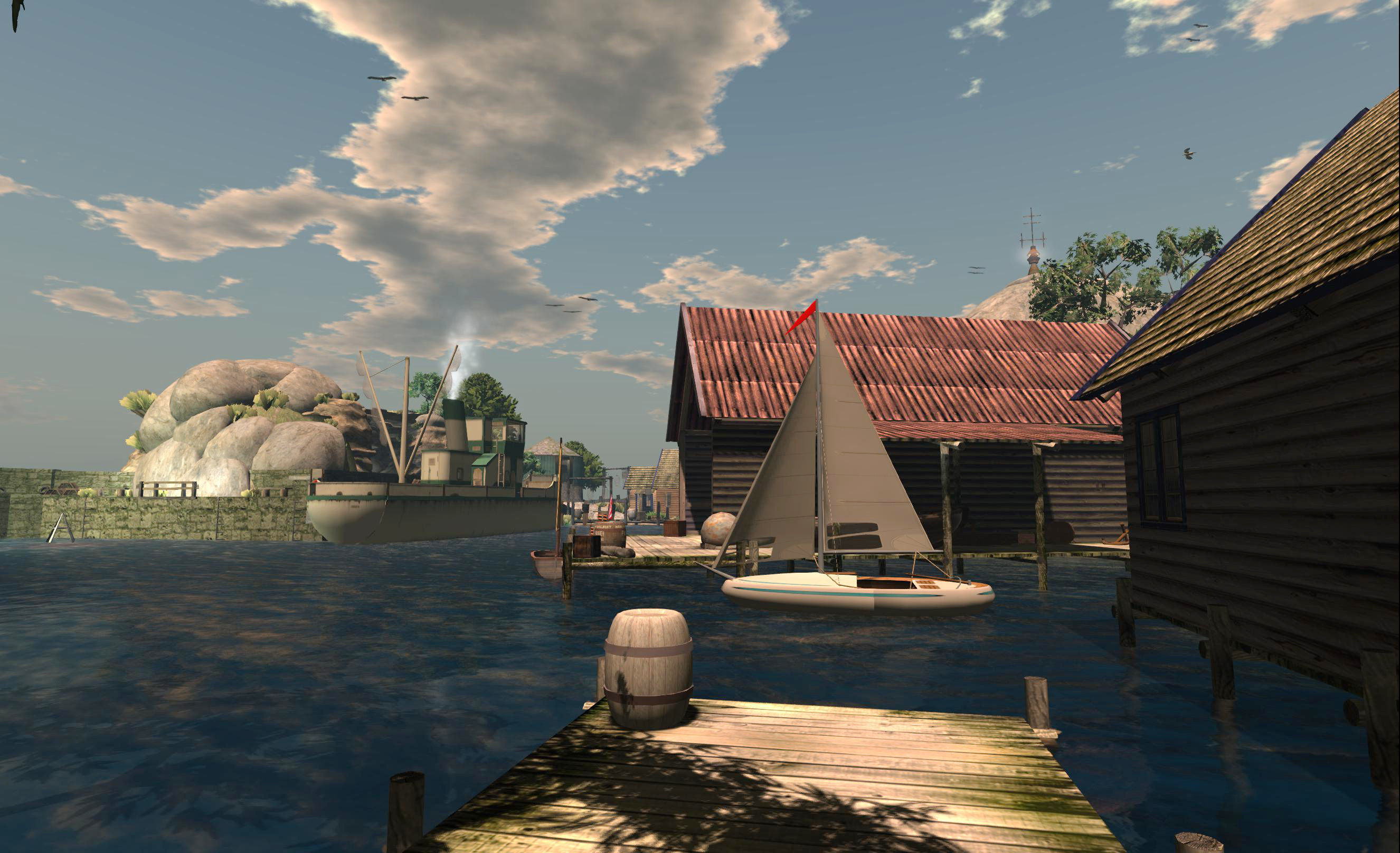
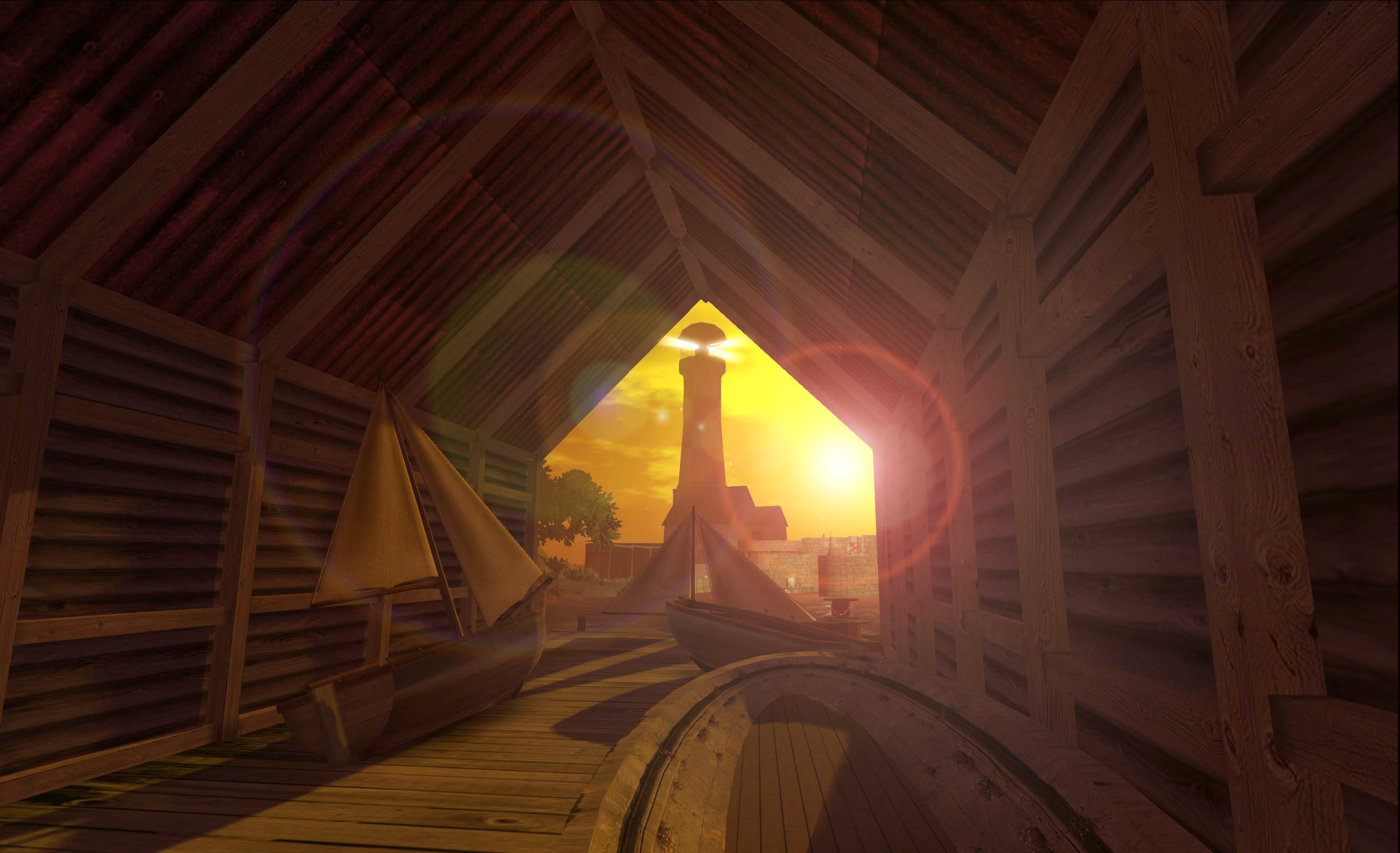
Take Half Hitch, for example. This is one of the areas in Blake Sea where you can rez your own boat (or seaplane or submarine – whatever takes you), and set out to explore the ocean blue. It’s like that many people arriving there never get beyond the quayside landing point and rez zone, which is a shame, as there is a lot to poke about at on the island – just take a wander through the cave at the landward end of the quay.
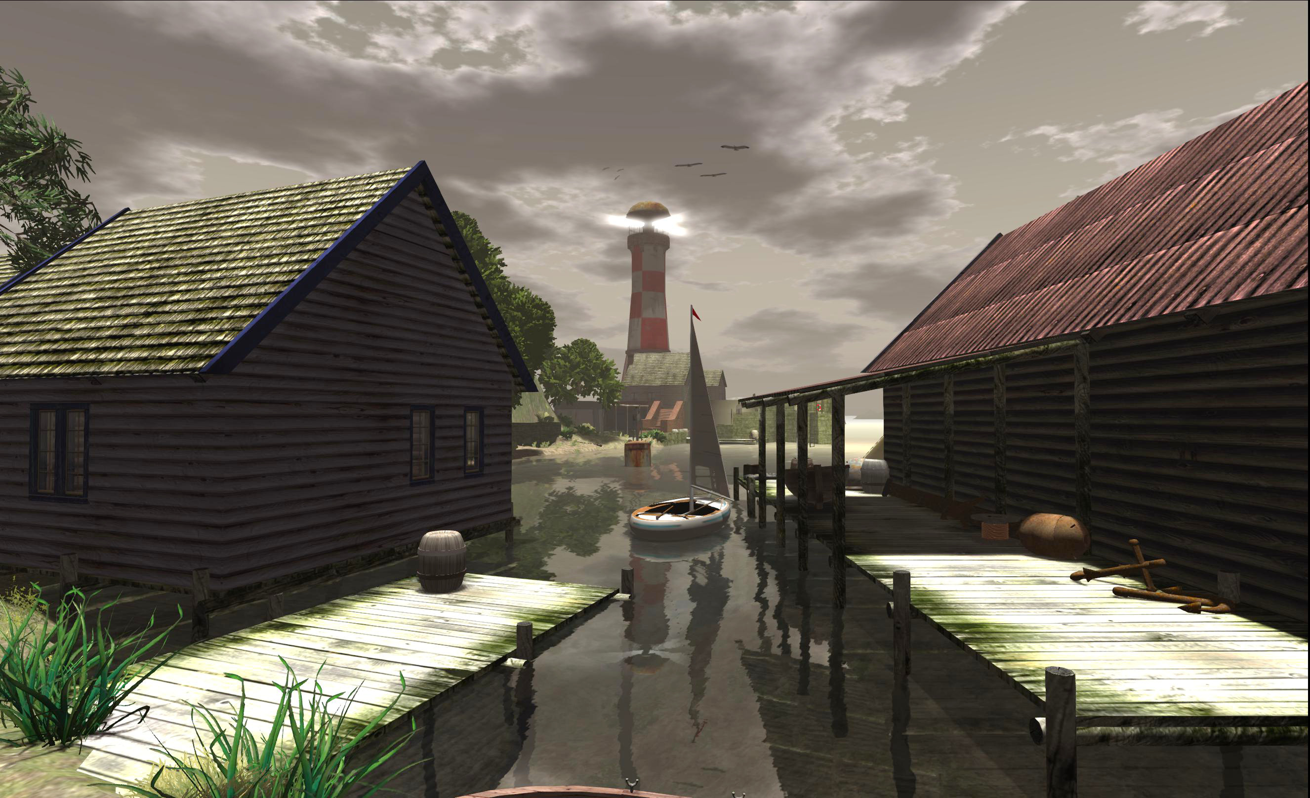
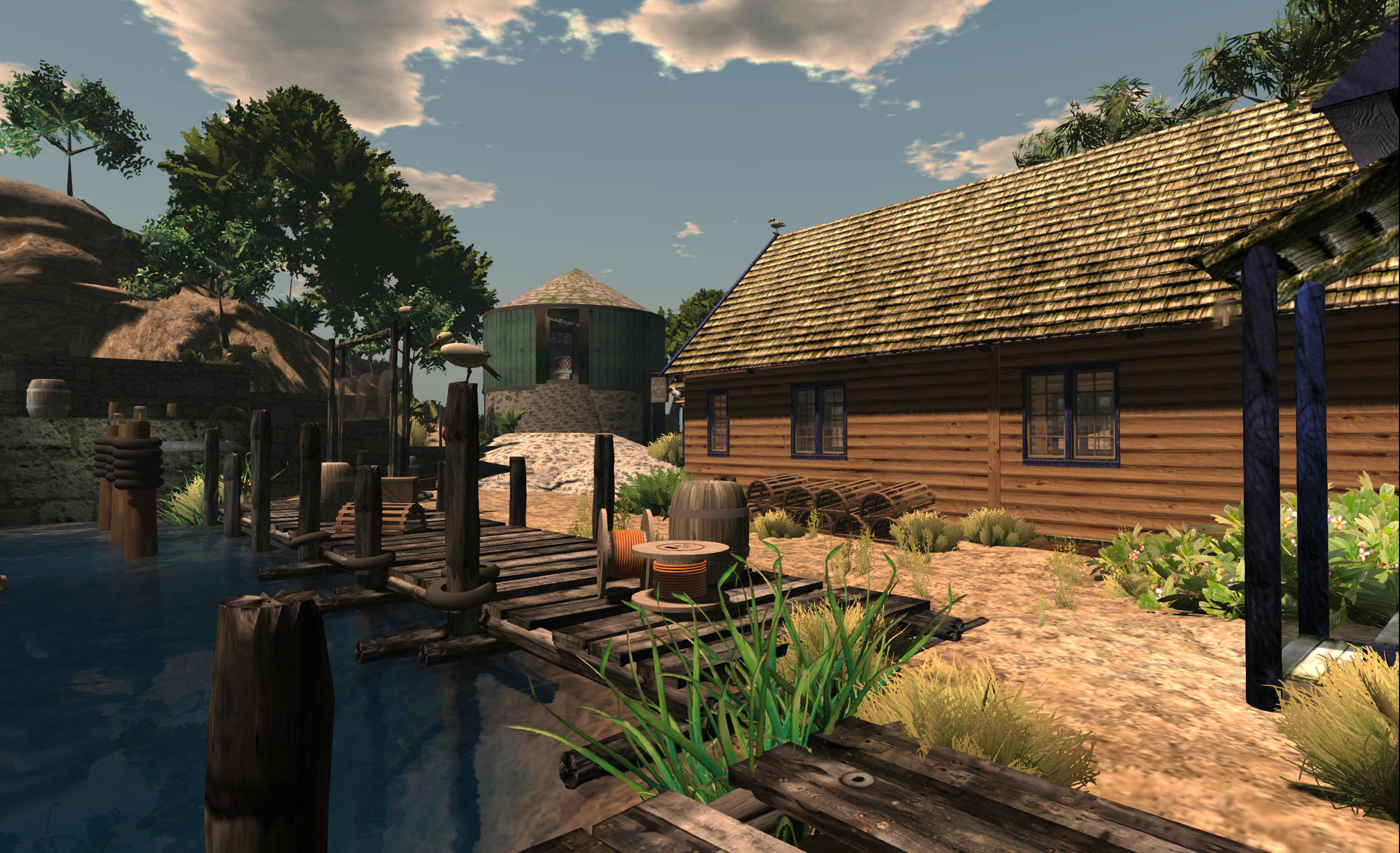
On the other side of the cave tunnel is a sheltered port, complete with breakwater, a lighthouse and warning buoys to guide boats in, and quays and buildings which form a part of a small fishing “community” – there’s even a trawler sitting dockside, either getting up steam to sail on the morning tide or which may have recently returned to port after a day’s fishing.
Now, the build is admitted not state-of-the-art. Some of the rock formations on the north side of the island are decidedly spherical, some of the textures are a tad low-res – but remember, everything around Blake Sea is designed to be low-lag to aid the flying and sailing and – in particular – to assist with any racing which may be going on. And anyway, “dated” doesn’t necessarily mean “not worth exploring”.
There are lots of little corners to poke and pry at here, and even more opportunities for the SL photographer. Those who want to try their hands with sailing can also find a demo boat rezzer which will help them take to the water and skim around a bit, and there are some nice little look-out points to watch the world go by or where you can watch any racing taking place.
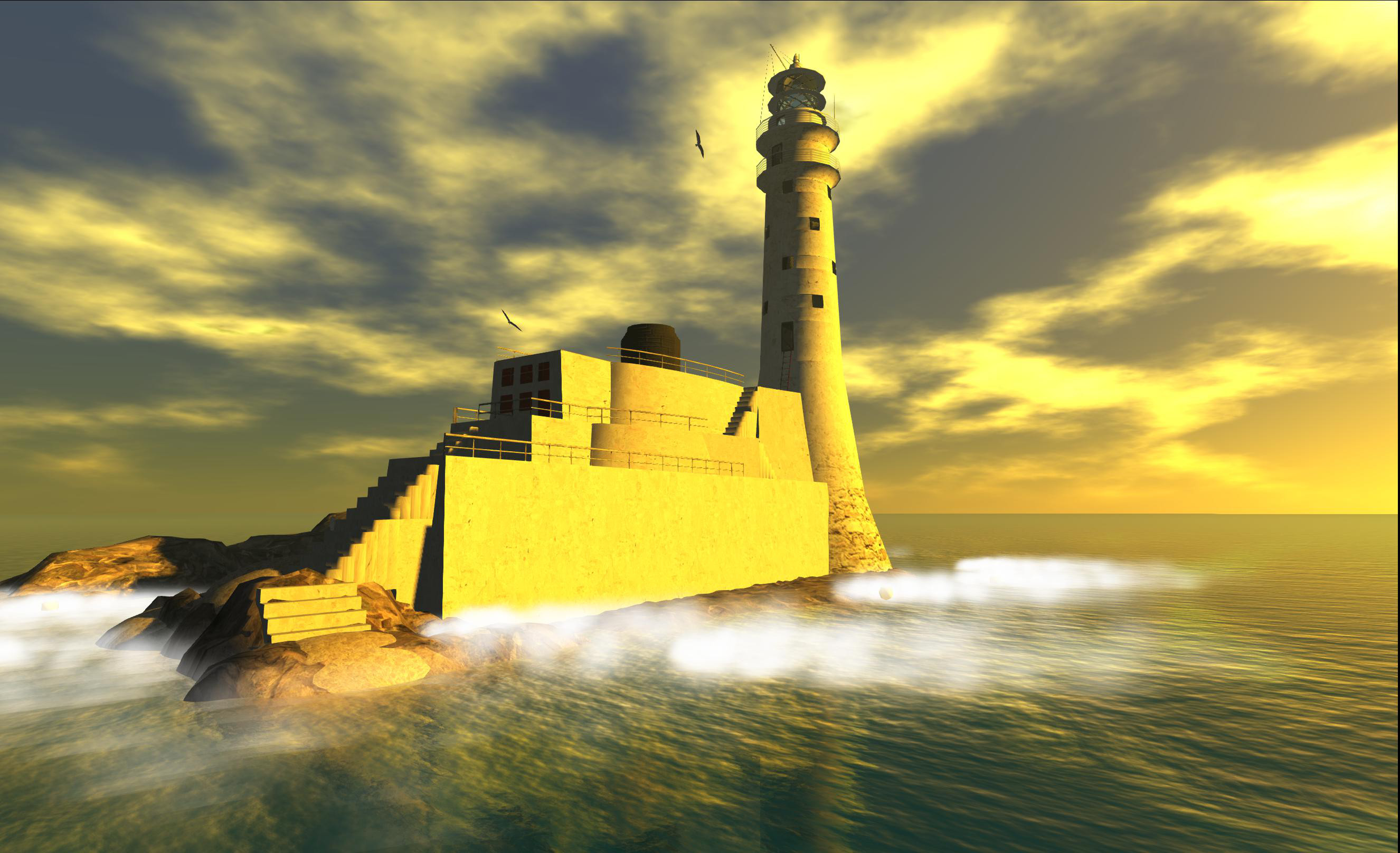
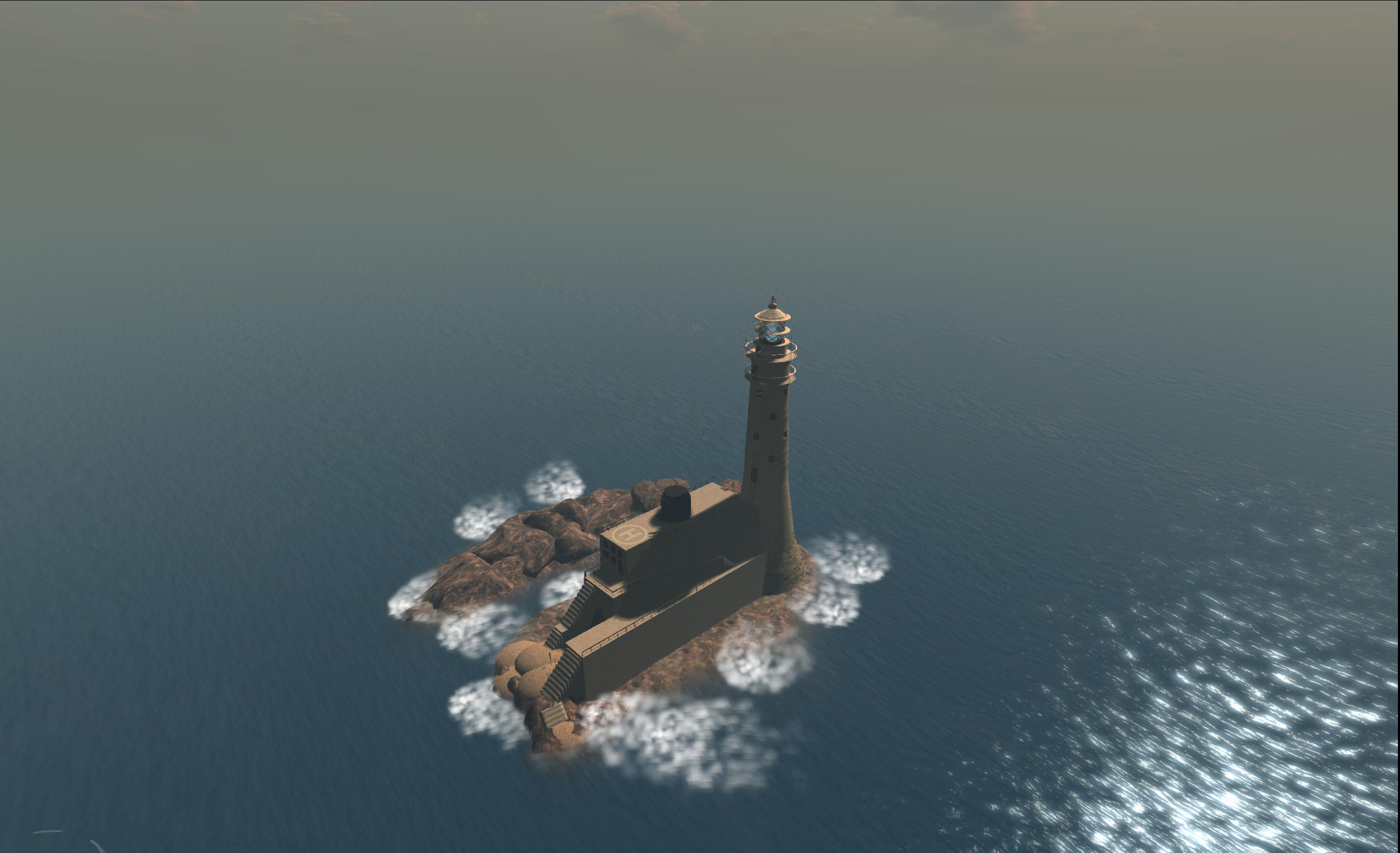
Those who do take to the water and sail west may well encounter the Crow’s Nest Lighthouse, which has again featured in some pictures in this blog. This is actually a build based on a real life lighthouse (Fastnet Rock), and, if you have your draw distance down somewhat (something of a good idea when sailing / flying), appears as a reminded of what a lonely and isolated lives lighthouse keepers once had to lead.
I managed to grab one shot in particular of the lighthouse while flying east out of Hollywood Airport a couple of months ago, which I think really demonstrates this last point, even if it’s not necessarily the most artistic of shots.
Should you opt to land at the lighthouse, there’s not a lot to actually see inside the lighthouse – although if you look hard enough, you’ll find a picture of the real life original. – but that’s not the point, it’s a great little build in its own right which does much to enhance Blake Sea, as well as providing a useful way-point for sailors. Outside of the lighthouse tower, however – and as pointed out by Lance Corrimal in the comment below – there is a memorial for all members of the SL Sailing community who have passed away.
There’s a lot else to see out on the Sea – so if you haven’t given it a try, why not have a mooch around the waters?
There’s no SL10BCC banner heading this post, as I’m writing as “me” rather than in any official or semi-official capacity.
With just 10 days to go, things are really shaping-up on the SL10BCC regions, and there are some really stunning builds coming together. For the last few days I’ve been peeking-in on the main stage sets, and have to say that if you found the stages from SL9B to be pretty special – then prepared to have your socks blown off )and possibly out the nearest window) this year.
The stages are amazing.
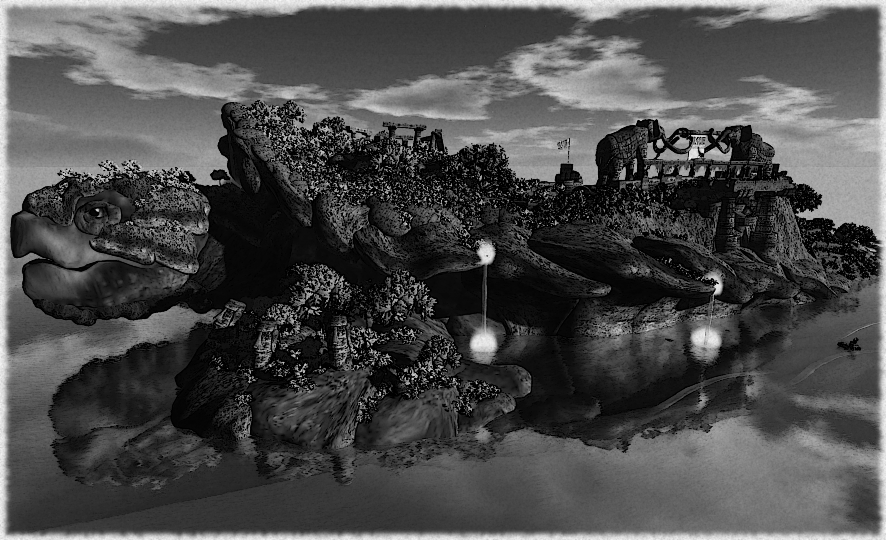
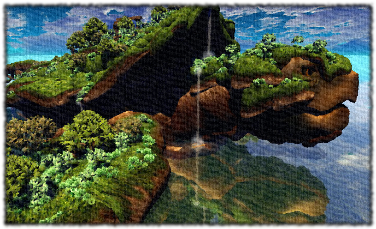
“We approached A’stra from seaward. I could scarce believe my eyes – the legends were true! An entire islands carved into the likeness of a giant turtle, beautiful waterfalls tumbling from its back which was itself a verdant green land. As the Captain dropped anchor, I took pen to paper, anxious to capture this wonderful land we were about to explore…”
I actually wanted to bring you images of the main stage yesterday, but Whiskey Monday got some incredible shots, one of which was taken from a similar angle as one of mine, so I wanted to avoid seeming like I was trying to steal her thunder.
To appreciate the main stage, you really have to see it; covering two regions, it is simply awesome and offers so much to see an explore in its own right. I’ve post-processed the images here not so much to show off that I can, but because I want you to have some element of the same wonder and awe I experienced in exploring the stage, and so didn’t want to give too much away with colour snaps :).
“We took to the long boats on the morning tide and made our way inshore. A path led towards a bridge and a route up onto the island, and the others were quick to set of in exploration. I waited a while, content to draw the great head of the ‘beast’…”
The entire build resonates strongly for me. For a start, the name of the stage is A’stra, taken from the motto Ad Astra Per Aspera, through hardship to the stars, which is very close to the motto of the Royal Air Force in which my father served, Per Ardua Ad Astra (meaning roughly the same thing). Then there are the unmistakable primary motifs for the stage: a giant turtle with four elephants upon its back…
OK, so the discworld isn’t sitting upon the backs of the elephants, who are all busy with other tasks (two providing support for the main bridge leading to the stage, for example), but if you are in any way familiar with the works of Sir Terence David John “Terry” Pratchett, then it’s hard not to feel a smile crossing your lips on seeing A’stra.
“Later in the day, my oils and canvas were brought ashore and while camp was established, I took myself away to give colour to this wonderful sight, so beautifully created by artisans of such great skill….”
Nor is it entirely inappropriate. This year does, after all, mark five years since Sir Terry visited Second Life in October 2008…
The echoes for me running still deeper, tho. The “back” part of the stage is fabulously landscaped with a wealth of detail – gardens, statues, pools of water with steps leading into them and fountains with cascades of ree-flowing water that – as I have elsewhere in SL – I was immediately put in mind of Sri Lanka, and specifically, the great palaces of Sigiriya. Not that the stage set in any way resembles Sigiriya – far from it in terms of physical appearance – but rather tha the combination of jungle paths, ancient ruins, pools and so on tended to cast my mind back to the times I spent visited the Lion Rock citadel.
Explore the stage regions careful – there is a lot to see above and – in places – below ground, and there is a story to tell in various sculptures which line one of the paths leading up to the stage.
The main stage is just one of the core elements of the forthcoming SL10BCC celebrations – the water and cake stages are both equally as amazing. Together with the builds and exhibits which are rising out of the ground right across the celebration regions, the promise to make the community-lead celebration of SL’s 10th anniversary truly magnificent.
One of the many sculptures to be found lining a path leading up to the main stage and which together tell a story of their own.
SL10BCC Key Dates
June 16 – Grand Opening
June 23 – Official Birthday day and final day of performances
June 29 – Sims close to the public
July 1 – All builds to be dismantled – sims go offline
My apologies for the relative low resolution of the above images (1440×900-ish). Sadly, and as with the Fantasy Faire regions in April, the SL10BCC regions are already more than my Ge900GT can comfortably handle when taking snapshots with bells and whistles switched on in any of my preferred viewers.
After six months in “Yellowknife Bay”, Curiosity is getting ready to move on. Investigations in the area are due to come to an end in the near future, and with the new autonomous driving software now installed in the rover, it is anticipated that the long drive to “Mount Sharp” will begin very soon. The start of this phase of the mission will be marked by the Rover retracing its steps (tracks?) through “Glenelg”, the region so-named partially because it is a palindrome, reflecting the fact the rover would be driving through it twice.
How long the rover will take to get to “Mount Sharp” is entirely open to question, however. While Curiosity is now far more capable of autonomous navigation, it won’t be a case of “pick and route which looks good and go”. If nothing else, there is no way of knowing what the rover might discover while en route.
“We don’t know when we’ll get to Mount Sharp,” Mars Science Laboratory Project Manager Jim Erickson said at the Jet Propulsion Laboratory in Pasadena, California. “This truly is a mission of exploration, so just because our end goal is Mount Sharp doesn’t mean we’re not going to investigate interesting features along the way.”
The slopes of “Mount Sharp” showing a “region of interest” captured by Curiosity’s Mastcam in August 2012 while the rover was still at the “Bradbury Landing” site. Scientists are keen to explore the mesa-like outcrops on the side of the mound, although how long it will take the rover to get to them in subject to finding a suitable route and also upon what other discoveries lay along the rover’s path. The black dot in the inset image (actually a large rock) demonstrates how the rover might look from “Bradbury Landing” were it exploring “Mount Sharp” at the time the images was captured
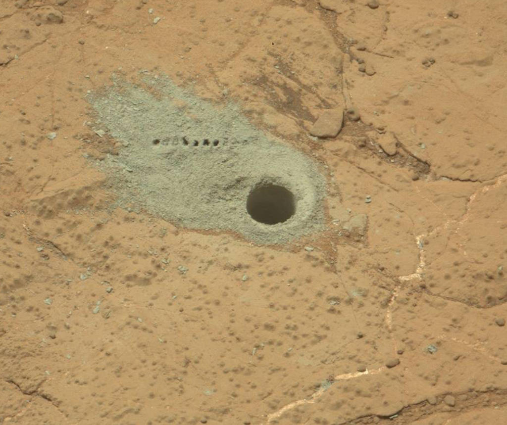
In May, Curiosity completed a second drilling operation to obtain samples from inside an area of bedrock called “Cumberland” within “Yellowknife Bay”, delivering them to the Chemistry and Minerology (CheMin) and Sample Analysis at Mars SAM) suites of instruments aboard the rover for detailed analysis. This work is still ongoing, and it is hoped that the result will further confirm findings obtained as a result of the first drilling operation, carried out a few metres away on a rock formation dubbed “John Klein”, and which suggested that the area once had environmental conditions favourable for microbial life.
No further drilling operations are now planned for the area, although NASA has yet to give word on the results from the initial analysis of the “Cumberland” cuttings. Additionally, once the order is given to start the drive towards “Mount Sharp”, the rover will retain cuttings from the “Cumberland” drilling ins its sample scoop which can be delivered to CheMin and SAM for additional analysis, if required.
Both drilling operations have been important steps for the MSL mission. Not only have they been a successful test / use of the last remain major science capability on the rover (the ability to drill into rocks and obtain samples), they’ve also been an important learning situation for mission engineers. Steps which each took a day each to complete when drilling at “John Klein” could be strung together into a single sequence of commands at “Cumberland”, allowing the rover to complete a number of drilling-related tasks autonomously and in a single day.
“We used the experience and lessons from our first drilling campaign, as well as new cached sample capabilities, to do the second drill campaign far more efficiently,” said sampling activity lead Joe Melko of JPL. “In addition, we increased use of the rover’s autonomous self-protection. This allowed more activities to be strung together before the ground team had to check in on the rover.”
Site of the second drilling operation at “Cumberland”. The sample hole, 1.6 cm across (0.6 in) was cut on May 19th, 2013 (Sol 279). The row of small holes in the grey tailings surrounding the drill-hole mark where the Chemistry and Camera (ChemCam) laser was used to check the composition of the tailings
It’s hoped that these capabilities will allow the mission team to plan future routines for the rover more efficiently and in the knowledge that Curiosity has the ability to carry out multiple tasks without the need to “‘phone home” at each stage of an operation, something which introduces considerable delays in activities as a result of the two-way communications lag.
Prior to leaving “Yellowknife Bay”, two further “targets of opportunity” will be subject to brief observations by Curiosity. The first of these is a layered outcrop dubbed “Shaler”, which was briefly looked at as the rover initially entered the “Glenelg” / “Yellowknife Bay” region, and a pitted outcrop called “Point Lake”
The science team has chosen three targets for brief observations before Curiosity leaves the Glenelg area: the boundary between bedrock areas of mudstone and sandstone, a layered outcrop called “Shaler”, a possible river deposit, and a pitted outcrop called “Point Lake”, a depressional area thought to be either volcanic or sedimentary in nature, and which the rover observed when entering “Yellowknife Bay” from “Glenelg”.
As usual, the latest updates, feedback and comments can be found on the deployment discussion thread. Anyone encountering a specific bug is asked to file a JIRA.
There was no SLS Main channel roll out this week
On Wednesday June 5th, the Release Candidate channel received the following packages:
BlueSteel and LeTigre were updated with a new server maintenance project. This project addresses a disconnection issue and also fixes a crash mode – see my notes from week 22, and a fix for a crash mode
Magnum remained on the same interest list improvement project as originally deployed to LeTigre in week 21, and to Magnum and BlueSteel in week 22, with some updates. Two of these fix what Andrew Linden describes as “two rare crash modes”. The package should also include the same disconnection issue fix.
Interestingly, the “large” scripts issue I reported on in part 1 of this update was given as the reason why there was not Main channel deployment this week. As previously reported, the fix for this issue, which prevents the text of previously saved scripts from being displayed in the script editor for users on slow connections, failed to make the cut for the week 23 deployments.
There are continuing reports of “invisible avatars” on Magnum regions. This issues was first reported following the week 22 deployments, and described as “on an in-region teleport when landing all surrounding avatars de-rezz and cannot be seen until the person re-logs. Everything else appears normally.” The problem appears to be random in nature, and was also noticed at one club which enjoys a high level of attendance. and which still appears to be encountering the same issue. During the Beta Server meeting on Thursday June 6th, this issue was discussed, and appeared to be most strongly linked to v1-based viewers.
SL Viewer News
The next release of the materials beta viewer arrived on Wednesday June 5th (3.6.0.276961 with the release notes here), and as I indicated in part one of this report, sees the beta once more installed into the “correct” folder (SecondLifeBetaViewer). This means the initial beta release needs to be uninstalled separately, as the updated version obviously won’t over-write it.
The materials project beta viewer had its first update on June 5th, with the release of 3.6.0.276961
In terms of beta releases in the future, it’s worthwhile again pointing-out that once the new viewer release process comes into effect, beta viewers will be installed into folders identified by their project name (e.g. something akin to “SecondLifeBetaMaterials”). Viewers should be fairly well self-contained (although they may still share the same default settings location, as that remains to be seen once things start rolling), so the uninstalling of individual beta versions (or RC versions) shouldn’t be a problem once they reach release status.
Work continues in preparing the new viewer release process for … release (or implementation). It’s still unclear whether it will arrive before or after materials moves to the release viewer. As reported in week 22, the current pipeline of releases we should be seeing as the new release process rolls forward includes:
A collection of open-source contributions to the viewer which is hoped will appear as a release candidate viewer pretty quickly
A “pretty substantial batch” of maintenance fixes for the viewer
Vivox updates, which Oz described as, “Finally getting attention again, and will probably be in a release candidate version ‘real soon’ now”
An Experience Tools viewer which is also expected to appear “real soon”
An interest list update viewer, which is believed to be getting closer to being stable
Server-side Baking / Appearance
Investigations have been continuing into the SUN-74 issue which affects non-SSB/A updated viewers (notably Phoenix), with Nyx Linden commenting at the Server Beta meeting that, “Thanks to the support from the phoenix/firestorm team, we’ve been able to identify the cause of that issue. We’re looking into what options are available to us. [It] took some backflips to get it in a debugging environment, but managed to hunt it down – a combination of factors from not having the last 4 years of appearance fixes :)”
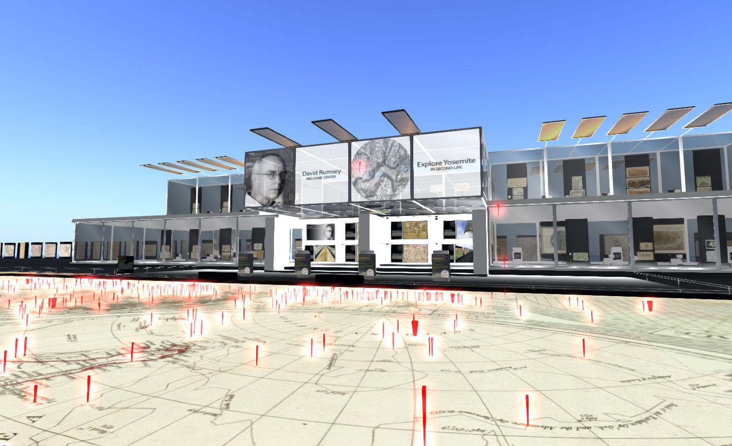
The David Rumsey Map Collection is just about everything any cartographer with an interest in the history of the subject and a particular focus on the Americas could ever want. Over 39,000 maps are on file – although these also include various maps of Africa, Asia and Europe. The maps can be accessed through a number of online viewers and services – including Second Life!
The SL exhibit covers four adjoining regions and presents a number of displays, information boards and links to the main website which, taken together, form an interactive means of study and offers the opportunity to learn about cartography.
The arrival point comprises an information centre where you can learn about David Rumsey Maps, the SL exhibit and access teleports to the various displays. Directly outside of this is a push-pin map of the world, with the invitation for visitors to move one of several push-pin “givers” over their home location, add a pin and leave a message of up to 140 characters in length.
Below this, and covering all four regions is a gigantic topographical map of Yosemite Park and its surrounding areas, circa 1883, complete with a floating observation deck. Control options allow you to view the map with full bright on or off, and as a 3D relief display (using sculpts) or a conventional 2D map.
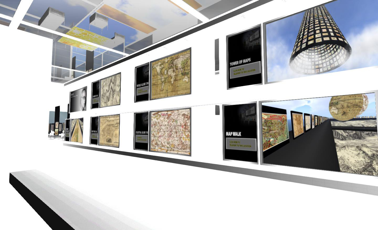
Above the 4-region map is a small orientation centre for those new to SL, and above that is a reproduction of J.H Colton’s 1836 map of New York. complete with models of some well-known landmarks (such as the Empire State Building, Brooklyn Bridge and City Hall) which help give the map context to modern eyes.
Elsewhere in the build are touch-boards on the Map walk which surrounds all four regions and the gigantic Tower of Maps, which provide direct access to various maps and pages on the website. You can also hop inside two globe maps or admire a Japanese scroll map.
All-in-all this is an extensive and excellent use of Second Life, with the information centre also providing audio / video presentations as well as a range of collectibles (40 in all), which you can pick-up as you explore. There is also a skyborne auditorium, but I’m not sure if that is still running the advertised programme (I’ve managed to miss hopping over there at noon SLT to find out the last few times it has crossed my mind to check…).
David Rumsey Maps makes for a worthwhile visit for anyone interested in cartography, and an engrossing use of Second Life. One word of advice should you visit – turn up your drawn distance to at least 512m to get the fullest benefit.