Just when you thought images of Pluto returned by the New Horizons spacecraft could get any more awe-inspiring, NASA / JHU APL release a set of raw images that are utterly stunning.
The images come from the wide-angle Ralph/Multispectral Visual Imaging Camera (MVIC) on the space craft and were captured just 15 minutes after the vehicle reached is point of closest approach to the little world, and thus from a distance of just 18,000 km (11,000 miles) from Pluto.
The stunning vistas presented in the image show the ice plains of “Sputnik Planum” bordered to the left and from below by Pluto’s huge mountain ranges, informally named Hillary and Norgay, Montes after the first partnership to successful reach the summit of Mt. Everest here on Earth. All of this is dramatically backlit by sunlight reflected through Pluto’s hazy atmosphere to create a wonderful scene said to be reminiscent of views of the Antarctic viewed from space or very high altitude.

However, the images aren’t just notable for the panoramic beauty; they actually reveal a lot about what is happening in the Plutoian atmosphere. Because of the back lighting from the Sun, the high-resolution MVIC has revealed just how complex Pluto’s atmosphere is, comprising multiple layers of nitrogen and other gases rising to around 100 km (60 mi) above Pluto’s surface (and visible as a banding in the images above).
“In addition to being visually stunning, these low-lying hazes hint at the weather changing from day-to-day on Pluto, just like it does here on Earth,” said Will Grundy, lead of the New Horizons Composition team from Lowell Observatory, Flagstaff, Arizona.
What is also exciting the science team is evidence within the images for Pluto having a complex “hydrological” cycle which seems to be comparable in some ways to that found on Earth – only on Pluto, it involves nitrogen ice, rather than water ice.
When compared with images captured as New Horizons approached Pluto, the MVIC images further suggest that the regions eastward of “Sputnik Planum” appear to have been encroached over time by ices and material possibly evaporated from the surface of “Sputnik Planum” to be deposited on the higher lands as a new ice blanket, which in turn appears to have formed glacial formations flowing back into “Sputnik Planum”.

“We did not expect to find hints of a nitrogen-based glacial cycle on Pluto operating in the frigid conditions of the outer solar system,” said Alan Howard, a member of the mission’s Geology, Geophysics and Imaging team from the University of Virginia, Charlottesville. “Driven by dim sunlight, this would be directly comparable to the hydrological cycle that feeds ice caps on Earth, where water is evaporated from the oceans, falls as snow, and returns to the seas through glacial flow.”
To Scale: The Solar System
We’re all familiar with the idea that the solar system is so vast, that it is almost impossible to show the Sun and the major planets proportional to one another and at a scale where all the later are both visible and have orbits which can be adequately encompassed in an easily viewable space.
Obviously, some models do exist; the Lowell Observatory in Arizona, USA, for example, has a walk that allows visitors to travel from the sun and by each of the planets, but it’s not always easy to clearly grasp the sheer scale of things. The same goes for digital models (and a few have been built within virtual worlds like Second Life).
With this issue of scale and proportion in mind, Wylie Overstreet and Alex Gorosh set out to produce a scale model of the solar system that might help people understand just how vast our planetary back yard is when looked at on a human scale.
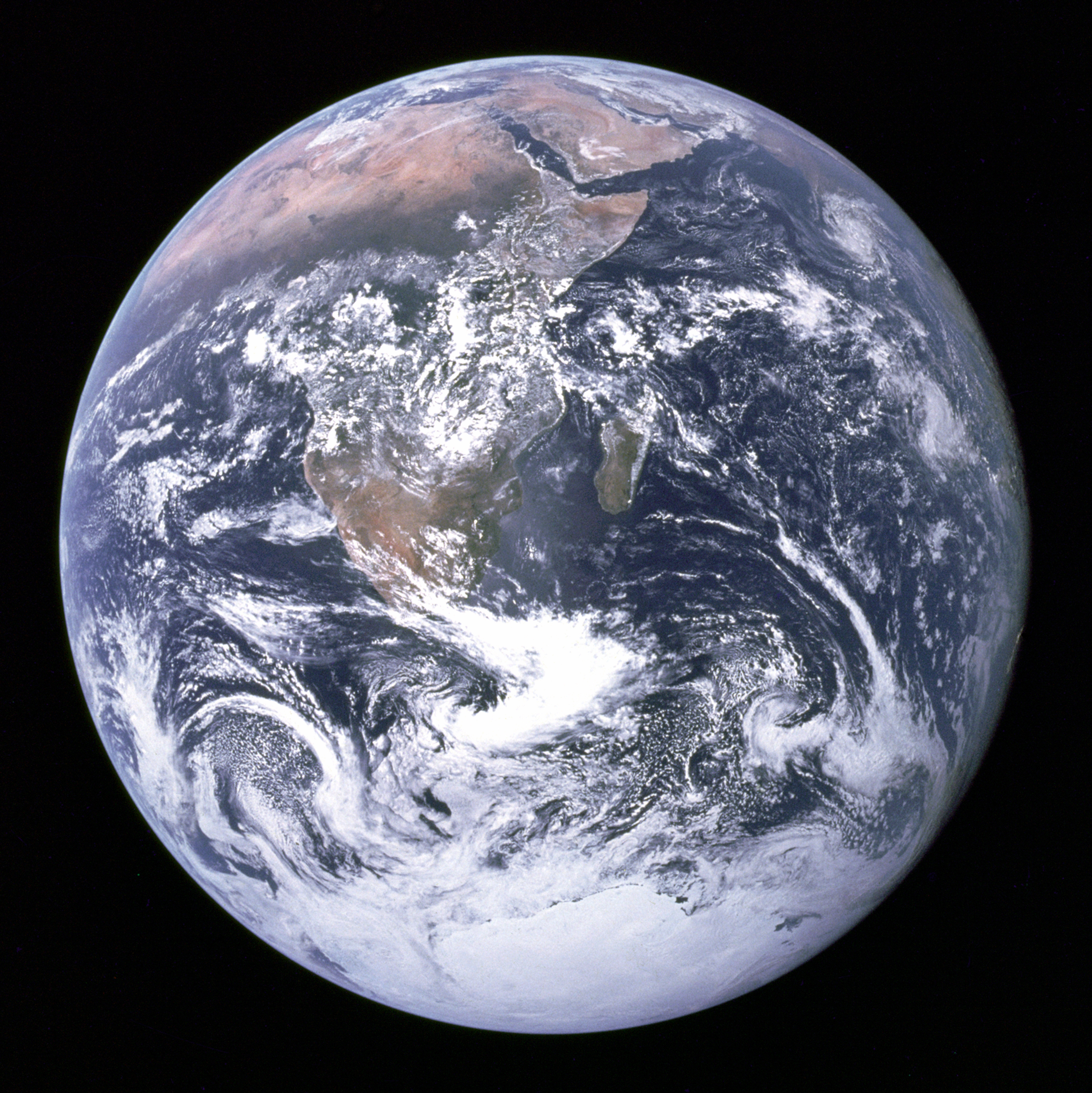
They started with a blue marble to represent the Earth, echoing the famous photograph taken on December 7, 1972, by the crew of Apollo 17 en route to the Moon and which NASA dubbed the Blue Marble.
Continue reading “Space Sunday: see Pluto’s mountains and the size of the Solar System”