Space Sunday: the last goodbye, super-Earths and spaceplanes

September 14th, 2017. One of the final images captured by Cassini as it approaches Saturn for the last time, with mysterious Enceladus visible beyond the limb of the planet. The thin blue haze seen in the picture is the atmosphere above Saturn’s cloud tops, where the spacecraft finally disintegrated. Credit: NASA/JPL / Space Science Institute

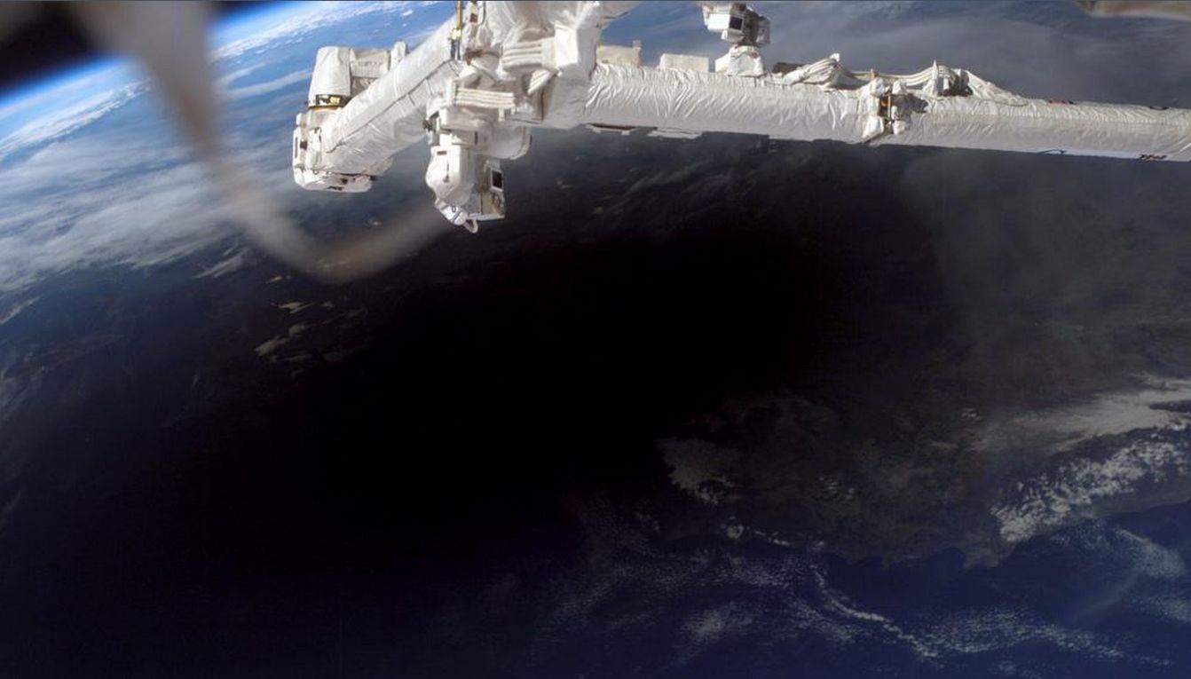
At 12:55 UT (13:55 BST, 08:55 EST, 05:55 PDT) the very last signal was received from the NASA / ESA Cassini spacecraft as it entered the upper reaches of Saturn’s atmosphere before disintegrating and burning-up. It was received 83 by NASA’s ground station near Canberra, Australia, 83 minutes after being transmitted – by which time the probe had already been destroyed.

At mission control, at the Jet Propulsion Laboratory, operated jointly by NASA and Caltech in Pasadena, California, it was an emotional moment. For many, the mission had been a part of their daily lives for nigh-on 20 years.

“The signal from the spacecraft is gone and, within the next 45 seconds, so will be the spacecraft,” Cassini programme manager Earl Maize announced, his voice catching, to the team gathered in mission control. “I’m going to call this the end of mission.” He then turned to Spacecraft Operations Team manager Julie Webster and hugged her, before giving Linda Spilker, the Cassini Project Scientist a hug as well. That loss of signal came within 30 seconds of the time predicted ahead of Cassini’s final dive.

Cassini Project Manager Earl Maize (centre left) and Spacecraft Operations Team Manager Julie Webster embrace after the Cassini spacecraft plunged into Saturn, Friday, September. 15, 2017. Credit: NASA / Joel Kowsky

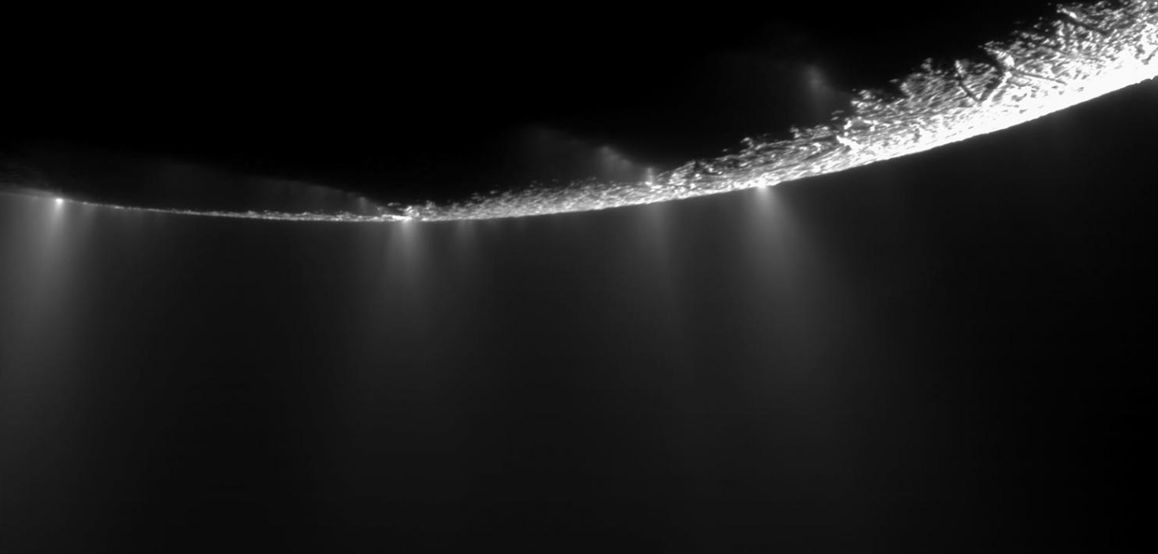
As I reported last week, The Cassini-Huygens mission has been an incredible voyage of discovery, revealing so much about Saturn, its rings and retinue of moons, including hints on the evolution of life itself and revealing how moons Titan and Eceladus may have all the right conditions to support basic life while Tethys could – like Enceladus – have a liquid water ocean under its ice.

Cassini’s final approach commenced on September 11th, as it started back towards Saturn having made a final pass between the planet and its rings and looping away from both the week before. Passing by Titan, and once more using the moon’s gravity to push it into the correct trajectory, the probe headed back for its final encounter with Saturn. The Titan fly-by presented a last opportunity to image and study the moon before Cassini’s imaging system was focused on Saturn for the first part of the final approach. Imaging Saturn ended on Thursday, September 14th as the vehicle re-oriented itself to gather as much data on its brief passage into the upper reaches of Saturn’s atmosphere.

Time line of the final plunge. Credit: NASA

As I’ve previously noted in my Cassini mission updates, the primary reason for sending the probe into Saturn’s atmosphere was because it had exhausted almost all of its on-board fuel supplies used to orient itself and to adjust its flight through the Saturnian system, and the mission team didn’t want to leave the probe tumbling around Saturn’s moons where it might one day impact one of them and contaminate it with both Earthly microbes which may be dormant inside the vehicle, and which radioactive debris from its electrical power generators.

However, an alternative would have been to use the last of the vehicle’s fuel to boost it away from Saturn and out into space, but the scientific return promised by a final plunge into the planet was too good to refuse. “Saturn was so compelling, so exciting, and the mission we finally came up with was so rich scientifically that we just couldn’t — we had to finish up at Saturn, not some place else.” Earl Maize stated during a press conference after the probe’s fiery end.

There are currently no planned missions that will follow Cassini-Huygens to Saturn, although there are proposals to send missions to Titan. However, while the active part of the mission has come to an end, it’s not an end of the mission’s science.

“We have collected this treasure trove of data, so we have decades of additional work ahead of us,” Linda Spilker, the Cassini Mission Scientist said. “With this fire hose of data coming back basically every day, we have only been able to skim the cream off the top of the best images and data. But imagine how many new discoveries we haven’t made yet! The search for a more complete understanding of the Saturn system continues, and we leave that legacy to those who come after, as we dream of future missions to continue the exploration we began.”

As a closing note – for now – it’s not often that a space mission gains an official music video; but Cassini-Huygen has been a major inspiration for many over the past two decades, it has earned not one, but three official music videos which form a suite of music by three composes: Iniziare (Italian: “to start” by Sleeping At Last, aka Ryan O’Neal), Kanna (Icelandic: “Explore” by Sarah Schachner) and Amaiera (“end” or “stop” by Joseph Trapanese). I’ve embedded the first part below.

SpaceX Launch X-37B

On Thursday, September 7th, a SpaceX Falcon 9 booster launched the US Air Force X-37B secret mini-shuttle into orbit ahead of the Florida coast being hit by hurricane Irma. It marked the 13th Falcon 9 launch of 2017, and the fifth flight overall for the X-37B.

The USAF’s X-37B Orbital Test Vehicle (OTV) on the runway at Kennedy Space Centre, May 7th, 2017, at the end of the 717-day OTV-4 mission, being “safed” by a Boeing team in protective suits to guard against harmful fumes and gases given off by the vehicle. Credit: USAF

OTv-5 (Orbital Test Vehicle flight 5) saw the automated spaceplane placed into a higher inclination orbit than previous missions – thus expanding the vehicle’s flight envelope. However, in keeping with previous missions, the USAF has remained mostly silent on the mission’s objectives or its intended duration, revealing only that one experiment flying is the Advanced Structurally Embedded Thermal Spreader II (ASETS-II), which will measure the performance of an oscillating heat pipe.

Previous OTV missions have been long-duration flights, with the maiden flight in 2010 lasting 224 days and 9 hours, which each mission lasting longer than the last, with the last mission completed, OTV-4,  totalling 717 days and 20 hours in orbit. The flights have, up until now, alternated between the two known X-37B vehicles, so although it has not been confirmed, it is believed this mission is being carried out by the first X-37B to fly in space.

The SpaceX Falcon 9 first stage descends to a safe landing at Cape Canaveral Air Force Station after sending the X-37B OTV on its way to orbit on September 7th, 2017. Credit: Ken Kremer

The launch took place from Kennedy Space Centre’s Launch pad 39A, which SpaceX has leased from the US space agency and refurbished to handle Falcon 9 and Falcon Heavy launches – and which is now liable to be the pad from which the company’s massive ITS super-heavy rocket will depart when it enters operations in the 2020s. After separating from the upper stage and its cargo, the Falcon 9 first stage performed a “burn-back” manoeuvre and flew back to SpaceX’s dedicated Landing Zone-1 (LZ-1) at Cape Canaveral Air Force Station alongside Kennedy Space Centre, offering spectators a superb view of the landing.

Continue reading “Space Sunday: the last goodbye, super-Earths and spaceplanes”

Space Sunday: Cassini – a journey’s end

An artist’s impression of the Cassini spacecraft entering the upper reaches of Saturn’s atmosphere, high above the cloud tops, and breaking / burning up against the backdrop of the planet’s rings. Credit: NASA

On Friday, September 15th, 2017, just one month short of the 20th anniversary of its launch, the NASA/ Italian Space Agency (ASI) space probe Cassini will plunge into the upper reaches of Saturn’s atmosphere, bringing to a close the momentous NASA / ASI / European Space Agency Cassini-Huygens mission.

It will be a bitter-sweet moment for many the world over – most of all the vast international team who devoted up to fourteen years of their time on the mission – even before it launched. The Cassini vehicle has not only revealed so much about Saturn, its myriad moons, the rich complexities of the gas giant’s ring system- it has also helped inform us on the potential for life to exist elsewhere in the solar system and has even helped test Einstein’s work. It has also over the years returned some of the most stunning and evocative images of other worlds we have yet witnessed. Many of these images have been gathered together by National Geographic and have been put together in a superb interactive web presentation on the mission by Nadia Drake and Brian Jacobs.

A computer model of the hundreds of orbits Cassini has made around Saturn over the years (excluding the more recent orbits of the Grand Finale). Credit: Drake / Jacobs / National Geographic

In all seventeen countries have been directly involved in the conception, design, construction and operation of the Cassini-Huygens mission, both in terms of the Cassini orbiter and the Huygens Titan lander and the science instruments they carry. NASA carries primary responsibility for the orbiter’s design and construction, with the Italian Space Agency providing the all-important, dual-purpose high-gain radio antenna and its associated communications equipment, together with the low-gain communications suite which would provide continuous communications with Earth through the mission. ASI also incorporated a compact radar system in to the high-gain antenna systems, allowing it to function as a synthetic-aperture radar, a radar altimeter, a radiometer, and provide the visible channel portion of the VMS spectrometer package carried by the probe.

ESA was responsible for the Huygens lander, with France designing the vehicle itself, with the descent parachute system provided by Martin-Baker of America, while the science and communications packages were supplied by several European countries and the United States.

Cassini-Huygens stored within the payload fairing of an Atlas 4B rocket on the pad of Launch Complex 40, Canaveral Air Force Station, October 12th, 1997, 3 days ahead of its launch. Credit: NASA

The mission was named for the Italian-French astronomer Giovanni Domenico Cassini, who first observed the divisions within Saturn’s rings system (and after whom one of the divisions is also named) as well as for of the planet’s moons, and  Christiaan Huygens, the Dutch mathematician, physicist and astronomer, who first observed Titan, Saturn’s largest moon.

Work actually commenced on the mission in the 1980s, the goal being to develop a mission which could determine the three-dimensional structure and dynamic behaviour of Saturn’s ring system, investigate Saturn’s atmosphere and magnetosphere, determine the composition and likely structure of Saturn’s moons, including the nature and origin of the dark material on Iapetus‘s leading hemisphere, and, in conjunction with the Huygens lander, characterise Titan’s atmosphere, including the variability of the cloud haze, and characterise the moon’s surface at a regional level.

Initially, the mission was funded for a 10-year period from late 1997 through mid-2008, which included a journey of seven years to reach Saturn. The voyage took so long because at the time of launch, there was no launch vehicle combination capable of sending Cassini directly to Saturn. Instead, it completed a mini-tour of the inner solar system; six months after launch, Cassini flew by Venus, using the planet’s gravity to accelerate it into a wide elliptical orbit. A second encounter in June 2000 again accelerated the spacecraft, slinging it on to a further gravity-assist flyby of Earth in August 2000, which in turn accelerated it and bent it onto an trans-Jovian flight path.

In late 2000, Cassini reached the vicinity of Jupiter, making its closest approach to the planet on December 30th of that year. As well as using Jupiter’s gravity to sling it onwards to its final destination, Cassini used the encounter to study Jupiter and its faint system of rings. In all some 26,000 images of Jupiter, its moons and its rings were taken during the 6-month period of the flyby (October 2000 – March 2001). Cassini’s science suite was powered-up for the flyby, and resulted in some significant discoveries concerning Jupiter’s turbulent atmosphere, including breaking a long-held view. Jupiter’s banded atmosphere comprises a series of alternate bands of darker and lighter zones, in part caused by Jupiter’s rapid rotation. It had also been thought that the lighter bands were the result of the atmosphere rising upwards, giving rise to lighter cloud formations, before circulating downwards once more.

The cratered moon Tethys slips behind Saturn’s largest moon, Titan, as seen by Cassini on November 26th, 2009. Credit: NASA/JPL / Space Science Institute

However, Cassini revealed the dark bands were peppered with individual storm cells of upwelling bright-white clouds too small to see from Earth, suggesting the vertical circulation of Jupiter’s atmosphere to be far more uniform than thought. The probe’s findings also showed that Jupiter’s thin and dusty rings to be made up from small, irregularly shaped particles, most likely created by ejacta from micrometeorites impacting the Jovian moons.

Cassini reached Saturn in 2004, officially entering orbit around the planet on July 1st of the year. Prior to doing so, the vehicle was part of a test of Einstein’s theory of general relativity. This states that any massive object like the Sun causes space-time to curve, causing a beam of light or any other form of electromagnetic radiation that passes close to it to travel farther (the Shapiro time delay). In 2003, with the Sun coming between Earth and Cassini, scientists on Earth measured the frequency shift in radio signals being received from the spacecraft. Similar experiments had been carried out with the Voyager and Viking missions, but Cassini provided for much more refined measurements to be taken, and firmly validated Einstein’s theory.

A geyser sprays water ice and vapour from the south polar region of Saturn’s moon Enceladus. Cassini’s first hint of this plume came during the spacecraft’s first close flyby of the icy moon on February 17, 2005. Credit: NASA/JPL / Space Science Institute

Cassini‘s primary mission at Saturn commenced as it approached the planet for orbital insertion. Although the orbiter was capable of functioning – all things being equal – through until around 2017, this primary mission was scheduled to last just 3 years and 261 days, ending in mid-2008. This was sufficient time for the primary goals of the mission to be achieved, but Cassini was always designed to achieve so much more. With this in mind, the programme was granted two funding extensions. The first, called the Equinox Mission, funded the project through until the end of 2010, and gave a particular focus on Titan (15 flybys) Saturn’s ice-covered moon Enceladus, thought two of the locations in the Saturnian system where life might have taken hold.

The second extension, granted funding in 2010 to the tune of around US $60 million a year, is referred to as the Solstice mission (as it would end a few months past Saturn’s summer solstice). It guaranteed that, avoiding any spacecraft failures, the mission would continue through to the point where Cassini’s manoeuvring propellants would be practically depleted. This phase of the mission allowed for a more extended study of Saturn, its rings and moons. It meant Cassini could witness never before seen seasonal changes in the planet’s atmosphere and study. It also meant Cassini could study Saturn’s atmosphere and magnetosphere at exactly the same time as NASA Juno mission studied Jupiter’s atmosphere and magnetosphere, allowing a direct comparison of the two. Finally, the extension would carry the mission through its 5-month “grand finale”, probing the region between Saturn and its complex ring system.

Continue reading “Space Sunday: Cassini – a journey’s end”

Space Sunday: water, spaceplanes and clockwork rovers

TRAPPIST-1 compared in size to our own Sun. Credit: NASA.

Since the February 2017 announcement on the discovery of seven rocky planets orbiting the nearby red dwarf star TRAPPIST-1, multiple studies have been conducted to ascertain whether any of the planets might harbour conditions suitable for life. The nature of their parent star would suggest this to be unlikely. However, an international team utilising the Hubble Space Telescope (HST) to study the TRAPPIST-1 system believe they’ve found evidence that some of the planets have the right conditions to allow liquid water to exist.

Vincent Bourrier, from the Observatoire de l’Université de Genève in Switzerland, and his team used the  Space Telescope Imaging Spectrograph (STIS) to study the amount of ultraviolet radiation each of the TRAPPIST-1 planets receives. If there were too much UV light, no water could survive on the surface because the water molecules would break up and escape through the top of the atmosphere as hydrogen and oxygen gas.

The team found that the inner planets in the system – TRAPPIST-1b and 1c – receive so much UV radiation from their sun, they may have lost more than 20 Earth-oceans worth of water in the course of their history, estimated to be between 5.4 and 9.8 billion years old. Thus, they are almost certainly devoid of water, and their surfaces are likely sterile. However, the findings also suggest the outer planets in the system – including the three within TRAPPIST-1’s habitable zone, may have lost less than three Earth-oceans’ worth of water throughout their history, and could possibly still possess liquid water, making them more amenable for life to rise.

As well as suggesting some of the TRAPPIST-1 planets may have liquid water present, the study has broader implications for the potential of other exoplanets harbouring life. Up to 70% of the stars in the Milky Way are believed to by M-class red dwarfs – and the majority of rocky exoplanets thus far found are orbiting such stars. So this study might indicate that many more of the exoplanets orbiting such stars could support liquid water and, perhaps, conditions suitable for life. However Bourrier and his colleagues emphasise that the study is not conclusive, and further research is needed to determine if any of the TRAPPIST-1 planets are actually watery.

SNC Prepares Dream Chaser for Glide Flight Testing and UN Mission

Sierra Nevada Corporation (SNC) carried out a “captive / carry” test of a Dreamer Chaser Cargo vehicle test article on August 31st, 2017. The flight, with the vehicle slung beneath a helicopter forms the first step towards the Dream Chaser Cargo carrying out glide flights and landings.

During the test, SNC collected data on the vehicle’s performance in flight, including operation of radar altimeters, air data probes and other systems that cannot be fully tested on the ground. The captive /  carry test followed a series of ground tests where the vehicle was towed behind a truck down a runway at speeds of up to 100 kph to ascertain its ground handling on landing.

The Dream Chaser Cargo test article is lifted aloft by helicopter in a captive/carry test. Credit: Sierra Nevada Corporation

SNC developed Dream Chaser to transport astronauts to and from the ISS. However, NASA selected capsule designs by SpaceX and Boeing. After a protest over the decision, filed with the U.S. Government Accountability Office, failed, SNC turned their attention to other potential uses for Dream Chaser.

One of these has been the development of a cargo variant to service the International Space Station (ISS) alongside existing resupply contractors,  Orbital ATK and SpaceX, and in 2016, NASA confirmed Dream Chaser Cargo has been selected to fly resupply missions to the ISS between 2019 and 2024.

On July 19th, 2017, it was announced that SNC had signed a contract with United Launch Alliance for the first two launches of these resupply missions, using the Atlas 5 552 launch vehicle. The first launch is scheduled for 2020 and the second in 2021, although NASA has yet to formally order any Dream Chaser flights.

A Dream Chaser Cargo vehicle will also be used in 2021 to launch the first United Nations mission into space. The United Nations Office of Outer Space Affairs (UNOOSA) said an agreement between them and SNC to fly the dedicated Dream Chaser mission is part of a broader effort by the office to increase access to space to emerging nations.

The mission will be open to all nations, but with a particular emphasis on those that don’t have the capabilities to fly their own experiments in space. UNOOSA are in the process of soliciting payload proposals with a goal of selecting payloads by early 2018 so that the winning countries have time to build them for a 2021 launch.

Unlike the majority of Dream Chaser Cargo missions, which will focused on ISS resupply work, the UNOOSA flight will see the vehicle placed in orbit around the Earth, and SNC have indicated the vehicle will be capable of operating freely in orbit for extended periods of time, should the UN desire a longer mission.

While billed as the UN’s first space mission, the Dream Chaser flight is part of UNOOSA’s Human Space Technology Initiative, launched in 2010 with the goal of providing developing countries the possibility to access space in microgravity conditions. Currently, the initiative includes two other major projects. The first is a cooperative project with the Japan Aerospace Exploration Agency (JAXA), designed to give developing nations the opportunity to launch cubesats from the ISS. Another programme, to be operated in cooperation with China’s space programme, will allow UN-backed missions to be flown aboard China’s space station, when it becomes operational in 2020.

Continue reading “Space Sunday: water, spaceplanes and clockwork rovers”

Space Sunday: total eclipse and exoplanet update

2016 total eclipse Credit: NASA Exploratorium webcast

On Monday, August 21st, the continental United States will experience its first total eclipse of the sun for 38 years (the last total eclipse visible from the USA having occurred in 1979). Providing the weather holds good along the path of the eclipse, an estimated 220 million people will be able to see the event – providing they take the proper precautions.

An eclipse is a periodic event, occurring when the Moon passes between the Sun and Earth and either fully or partially occults (blocks) the Sun’s light. This can happen only at new moon, when the Sun and the Moon are in conjunction as seen from Earth, in an alignment referred to as syzygy. There are actually four types of eclipse:

  • Partial – this occurs when the Sun and Moon are not exactly in line with the Earth, and so the Moon only partially obscures the Sun. Partial eclipses are virtually unnoticeable in terms of the sun’s brightness, as it takes well over 90% coverage to notice any darkening at all.
  • Annular – occurs when the Sun and Moon are exactly in line with the Earth, but because of the variations in the Earth’s distance from the Sun, and the variations in the Moon’s distance from the Earth, the apparent size of the Moon is smaller than that of the Sun. Hence the Sun appears as a very bright ring, or annulus, surrounding the dark disk of the Moon.
  • Total – occurs when the dark silhouette of the Moon completely obscures the intensely bright light of the Sun, allowing the much fainter solar corona to be visible. The complete coverage of the Sun’s disk by that of the moon – referred to as totality – occurs at its best only in a narrow track on the surface of Earth.
  • Hybrid (also called annular/total eclipse) – this shifts between a total and annular eclipse. At certain points on the surface of Earth, it appears as a total eclipse, whereas at other points it appears as annular. Hybrid eclipses are comparatively rare.

The last total eclipse took place in March 2016, and was visible from South/East Asia, North/West Australia, the Pacific and Indian oceans. The 2017 event will be visible in partial forms across every continent except Antarctica and Australia. However, the path of totality will only be visible across the continental United States.

Although totality slices through the U.S., partial phases of the eclipse touch on every continent except Antarctica and Australia. Credit: Michael Zeiler / The Great American Eclipse – click for full size

The path of totality will run from Oregon to South Carolina, as will be around 113 kilometres (70 miles) wide, offering people along it an unrivalled opportunity to view the eclipse  – weather permitting -, providing the right precautions are taken.

The most important aspect of viewing an eclipse “live” is never look directly at the Sun, even during the period of totality; you should at least use a solar filter or viewer. However, if you don’t have one or the other or any specialised kit, the best way to see the eclipse in the flesh is via pinhole projection. For those who are unable to see the eclipse first-hand, there are a wide variety of ways to watch the event on television or the Internet, including:

  • NASA Total Eclipse live stream is providing options to watch through NASA Edge, NASA TV, Ustream, YouTube and more. NASA’s Facebook page. These will show images of the eclipse, from 11 spacecraft, three aircraft and from more than 50 high-altitude balloons, and the astronauts on the International Space Station.
  • Slooh, the on-line community observatory, will run a webcast starting at 12:oo noon EDT (1600 GMT), as a part of a 3-day celebration of the eclipse.
  • The Virtual Telescope Project is hosting a free online observing session with views of the total solar eclipse beginning at 13:00 EDT (17:00 GMT).
  • The Eclipse Ballooning Project will be broadcasting live views of the eclipse from the edge of space via more than 57 cameras sent up on weather balloons.
  • CNN and Volvo will be providing a 360-degree view of the eclipse with 4K resolution from different locations along the eclipse path. The stream will also be viewable in virtual reality, which people can navigate by moving a phone or virtual reality headset. The live stream begins at 12:03 p.m. EDT (16:03 GMT).
  • ABC will air a two-hour special on the eclipse starting at 13:00 EDT (17:00 GMT). The broadcast will also be available on Facebook Live and YouTube

There are a number of terms common to eclipses which are worth mentioning for those who wish to follow the event, but are unfamiliar with the terminology. These include:

Eclipse Types (Moon and Sun not to scale). Credit: Cmglee
  • The umbra, within which the object in this case, the Moon) completely covers the light source (in this case, the Sun’s photosphere).
  • The antumbra, extending beyond the tip of the umbra, within which the object is completely in front of the light source but too small to completely cover it.
  • The penumbra, within which the object is only partially in front of the light source.
  • Photosphere, the shiny layer of gas you see when you look at the sun.
  • Chromosphere, a reddish gaseous layer immediately above the photosphere of the sun that will peak out during the eclipse.
  • Corona, the light streams that surround the sun.
  • First contact, the time when an eclipse starts.
  • Second contact, the time when the total eclipse starts.
  • Third contact, the time when the total eclipse ends.
  • Fourth contact, the time at which the eclipse ends.
  • Bailey’s beads, the shimmering of bright specks seen immediately before the moon is about to block the sun.
  • Diamond ring, the last bit of sunlight you see right before totality. It looks like one bright spot (the diamond) and the corona (the ring).

A total eclipse occurs when the observer is within the umbra (they are standing in the shadow cast by the Moon); an annular eclipse when the observer is within the antumbra, and a partial eclipse when the observer is within the penumbra.

As well as the passage of the Moon between the Earth and Sun, there are a number of Earthly effects to look for if you are in the path of totality, such as a the 360-degree sunset. This may also be accompanied by an “eclipse wind” as temperatures suddenly drop. And, of course, there is the rousing of nocturnal animals, fooled by the darkness, followed by a false dawn as the Moon moves away from between the Earth and the Sun, and an accompanying dawn chorus.

The period of totality lasts only a few minutes but offers a superb opportunity for observing the Sun and its corona – hence why NASA is using a chain of three aircraft to “chase” the eclipse as the Moon’s shadows travels at an average speed of 3,683 km/h (2,288 mph) west-to-east, enabling them to carry out an extended study of the corona.

The Moon’s shadow on Earth, as seen from the International Space Station on March 29th, 2006 as it passes over southern Turkey, Northern Cyprus and the Mediterranean Sea. Credit: NASA

As a point of historical interest, August 21st marks the 103rd anniversary of the 1914 total eclipse, which was seen from Scandinavia through to Turkey, the middle east and India. It was the subject of a number of expeditions being sent eastwards to the Baltic and Ukraine by Britain and other European nations with the intention of studying it – only for the conflagration of the First World War to erupt.

The war foiled attempts by a British expedition which intended to use the eclipse as a means to measure relativity; however, it did give rise to another mystery: whether or not a film of the eclipse apparently made in Sweden in 1914 is the real deal or not. If it is, it might be the oldest surviving footage of an eclipse.

If you are on the path of totality, and plan to view the eclipse, do please take the proper precautions and I hope the weather cooperates with you. I’ll be following things on-line.

Continue reading “Space Sunday: total eclipse and exoplanet update”

Space Sunday: Voyager at 40

Voyager: 40 years on. Credit: NASA

August 20th 2017 marks the 40th anniversary of the launch of Voyager 2, which with its sister craft Voyager 1 (launched on September 5th, 1977) are humanity’s furthest-flown operational space vehicles, with Voyager 1 being the most distant human made object from Earth, at some 140 AU (AU= astronomical unit, the average distance between the Earth and the Sun; 140 AU equates to about 20.9 billion kilometres / 13 billion miles).

Despite being so far away from Earth, both craft are still sending data back to Earth as they fly through the interstellar medium in the far reaches of the solar system (the Pioneer 10 and Pioneer 11 craft which pre-date the Voyager programme by some 5 years, ceased transmissions to Earth in January 2003 and September 1995 respectively, although Pioneer 10 is the second most distant human made object from Earth after Voyager 1).

The Voyager programme stands as one of the most remarkable missions of early space exploration. Originally, the two vehicles were to be part of NASA’s Mariner programme, and were at first designated Mariner 11 and Mariner 12 respectively. The initial Mariner missions – 1 through 10 – were focused on studying the interplanetary medium and  Mars, Venus and Mercury (Mariner 10 being the first space vehicle to fly by two planets beyond Earth – Venus and Mercury – in 1974). Mariner 11 and Mariner 12 would have been an expansion of the programme, intended to perform flybys of Jupiter and Saturn.

A drawing of the Voyager vehicles. Credit: NASA/JPL (click for full size)

However, in the late 1960s Gary Flandro, an aerospace engineer at the Jet Propulsion Laboratory (JPL) in California noted that in the late 1970s, the outer planets would be entering a period of orbital alignment which occurs once every 175 years and which could be used to throw a series of probes out from Earth, which could then use the gravities of the worlds they encountered to “slingshot” them on to other targets. This led to the idea of a “Grand Tour” mission: sending pairs of probes which could use these gravity assists to fly by Jupiter, Saturn, Uranus, Neptune and Pluto in various combinations.

Funding limitations eventually brought an end to the “Grand Tour” idea, but the planetary alignment was too good an opportunity to miss, and so elements of the idea were folded into the Voyager Programme, which would utilise Mariner 11 and Mariner 12. However, as the mission scope required some significant changes to the vehicles from the basic Mariner design, they were re-designated as Voyager class craft.

(As an aside, the Mariner class is the longest-lived of NASA’s space probe designs; as well as the ten missions of the 1960s and 1970s which carried the design’s name,  the Mariner baseline vehicle – somewhat enlarged – was used for the Viking 1 and Viking 2 orbiter missions to Mars, and formed the basis of the Magellan probe (1989-1994)  to Venus and the Galileo vehicle (1989-2003) which explored Jupiter. And uprated and updated baseline Mariner vehicle, designated “Mariner Mark II”, formed the basis of the Cassini vehicle, now in the terminal phase of its 13-year study of Saturn and its moons.)

Each of the Voyager mission vehicles is powered by  three plutonium-238 MHW-RTG radioisotope thermoelectric generators (RTGs), which provided approximately 470 W at 30 volts DC when the spacecraft was launched. By 2011, both the decay of the plutonium and associated degradation of the thermocouples that convert heat into electricity has reduced this power output by some 57%, and is continuing at a rate of about 4 watts per year.

To compensate for the loss, various instruments on each of the vehicles have had to be turned off over the years. Voyager 2’s scan platform and the six instruments it supports, including the vehicle’s two camera systems, was powered-down in 1998. While the platform on Voyager 1 remains operational, all but one of the instruments it supports – the ultraviolet spectrometer (UVS) – have also been powered down. In addition, gyro operations ended in 2016 for Voyager 2 and will end in 2017 for Voyager 1. These allow(ed) the craft to rotate through 360 degrees six times per year to measure their own magnetic field, which could then be subtracted from the magnetometer science data to gain  accurate data on the magnetic fields of the space each vehicle is passing through.

However, despite the loss of capabilities, both Voyager 1 and Voyager 2 retain enough power to operate the instruments required for the current phase of their mission – measuring the interstellar medium and reporting findings back to Earth. This phase of the mission, officially called the Voyager Interstellar Mission, essentially commenced in 1989 as Voyager 2 completed its flyby of Neptune, when the missions as a whole was already into their 12th year.

A plume rises 160 km (100 mi) above Loki Patera, the largest volcanic depression on Io, captured in March 1979 by Voyager 1. Credit: NASA/JPL

Voyager 2 was launched on August 20th, 1977. Of the two vehicles, it was tasked with the longer of the planned interplanetary missions, with the aim of flying by Jupiter, Saturn, Uranus and Neptune. However, the latter two were seen as “optional”, and dependent upon the success of Voyager 1.

This was because scientists wanted the opportunity to look at Saturn’s moon Titan. But doing so would mean the Voyager craft doing so would have to fly a trajectory which would leave it unable to use Saturn’s gravity to swing it on towards an encounter with Uranus. Instead, it would head directly towards interstellar space.

So it was decided that Voyager 1, which although launched after Voyager 2 would be able to travel faster, would attempt the Titan flyby. If it failed for any reason, Voyager 2 could be re-tasked to perform the fly-past, although that would also mean no encounters with Uranus or Neptune. In the end, Voyager 1 was successful, and Voyager 2 was free to complete its surveys of all four gas giants.

Along the way, both missions revolutionised our understanding of the gas giant planets and revealed much that hadn’t been expected, such as discovering the first active volcanoes beyond Earth, with nine eruptions imaged on Io as the vehicles swept past Jupiter. The Voyager missions were also the first to find evidence that Jupiter’s moon Europa might harbour a subsurface liquid water ocean and to return the first images of Jupiter’s tenuous and almost invisible ring system. Voyager 1 was responsible for the first detailed examination of Titan’s dense, nitrogen-rich atmosphere, and Voyager 2 for the discovery of giant ice geysers erupting on Neptune’s largest moon, Triton. In addition, both of the Voyager vehicles added to our catalogues of moons in orbit around Jupiter and Saturn, and probed the mysteries of both planet’s atmospheres, whilst Voyager 2 presented us with our first images of mysterious Uranus and Neptune – and thus far remains the only vehicle from Earth to have visited these two worlds.

This is the last full planet image captured of Neptune. Taken by Voyager 2 on August 21st, 1989, from a distance of 7 million km (4.4. million mi). A true colour image white balanced to reveal the planet under typical Earth lighting conditions, it shows Neptune’s “Great Dark Spot” and surrounding streaks of lighter coloured clouds, all of which persisted through the period of Voyager 2’s flyby. More recent Hubble Space Telescope images suggest the “Great Dark Spot”, initially thought to be a possible cloud / storm formation, similar to Jupiter’s Great Red Spot, has vanished, leading to speculation that it may have actually been a “hole” in a  layer of Neptune’s layered clouds. Credit: NASA/JPL

The flyby of Neptune also sealed Voyager 2’s future. Scientists were keen to use the flyby of the planet to take a look at Triton, Neptune’s largest moon. However, because Triton’s orbit around Neptune is tilted significantly with respect to the plane of the ecliptic, Voyager 2’s course to Neptune  had to be adjusted by way of a gravitational assist from Uranus and a number of mid-course corrections both before and after that encounter, so that on Reaching Neptune, it would pass over the north pole, allowing it to bent “bent” down onto an intercept with Triton while the Moon was at  apoapsis – the point furthest from Neptune in its orbit – and well below the plane of the ecliptic. As a result, Voyager 2 passed over Triton’s north pole 24 hours after its closest approach to Neptune, its course now pointing it towards “southern” edge of the solar system.

Continue reading “Space Sunday: Voyager at 40”

Space Sunday: Curiosity’s 5th, Proxima b and WASP-121b

On August 6th 2016, NASA delivered the Mars Science Laboratory (MSL) to the surface of Mars in what was called the “seven minutes of terror” – the period when the mission slammed into the tenuous Martian atmosphere to begin deceleration and a descent to the surface of the planet which culminated in the Curiosity rover being winched down gently from a hovering “sky crane” and then lowered until its wheels made firm contact with the ground.

The “seven minutes of terror” actually had a double meaning. Not only did it represent the time MSL would smash into Mars’ atmosphere and attempt its seemingly crazy landing, at the time of the event, the distance between Earth and Mars meant it took seven minutes to be returned to mission control from the red planet. Thus, even as the initial telemetry indicating the craft was entering the upper reaches of Mars’ tenuous atmosphere was being received, mission controls knew that in reality, the landing had either succeeded or failed.

Obviously, the attempt succeeded. Everything worked flawlessly, and Curiosity was delivered to the surface of Mars at 05:17 GMT on August 6th, 2012 (01:17, August 6th EDT, 22:17 PDT, August 5th). In the five years since that time, it is helped revolutionise our understanding of that enigmatic world – as well as adding somewhat to its mystery.

To call the mission a success is not an exaggeration; within weeks of its arrival inside the 154 kilometre (96 mile) wide Gale Crater, Curiosity was examining an ancient riverbed en route to a region of the crater dubbed “Yellowknife Bay”. It was there the rover made its first bombshell discovery: analysis of the area showed that billions of years ago it was home for the ideal conditions to potentially kick-start microbial life. It was, in essence, the achievement of mission’s primary goal: to identify if Mars may have once harboured the kind of conditions which might have given rise to life.

This 360-degree view was acquired on August 6th, 2016, by Curiosity’s Mastcam as the rover neared the “Murray Buttes” on lower “Mount Sharp”. The dark, flat-topped mesa seen to the left of the rover’s arm is about 15 metres (50 ft) high and about 61.5 metres (200 ft) long. Credit: NASA/JPL / MSSS

For the first year following its arrival on Mars, Curiosity continued to survey the regions relatively close to its landing zone, finding more evidence of a benign ancient environment. Then it started out on the next phase of its mission: the long traverse towards the massive bulk of “Mount Sharp” – officially called Aeolis Mons. A huge mound of rock deposited against the crater’s central impact peak, “Mount Sharp” rises from the crater floor to an altitude of some 5.5 km (3 mi), and imagining from orbit strongly suggested its formation was due, at least in part, to the presence of water in the crater at some point in Mars’ past.

The 8 km (5 mi) trip took the rover a year to complete, in part due to its relatively slow speed, in part due to the fact is had to travel a good way along the base of “Mount Sharp” to reach a point where it could commence an ascent up the slope; but mostly because there were a number of points of interest along the way where the mission scientists  wanted to have a look around, investigate and sample.

Mount Sharp as seen from Curiosity, on January 24th, 2017. The light grey banding befpre the sandy coloured slopes is the clay unit the rover will reach in about 2 years. In front of it is the “Vera Rubin Ridge”, the next location for study by the rover. Credit: NASA/JPL / MSSS

For the last three years, the rover has been slowly making its way up “Mount Sharp”, climbing around 180 metres (600ft) vertically above the surrounding crater floor and visiting numerous points of interest – such as “Pahrump Hills”, the mixed terrain where “Mount Sharp” merges with the crater floor. Along the way, Curiosity has both confirmed that “Mount Sharp” was most likely the result of sedimentary deposits laid down during several periods of flooding in the crater before the water finally receded and wind action took over, sculpting the mound into its present shape down through the millennia.

The lakes within Gale crater may have actually been relatively short-lived, perhaps lasting just 1,000 years at a time, but Curiosity has shown that even during the dry inter-lake periods, water was very much a feature of Gale Crater, finding evidence of compressed water channels within the layers of rock which sit naturally exposed on “Mount Sharp’s” flanks.

In December 2014, NASA issued a report on how “Mount Sharp” was likely formed. On the left, the repeated depositing of alluvial and wind-blown matter (light brown) around a series of central lakes which formed in Gale Crater, where material was deposited by water and more heavily compressed due the weight of successive lakes (dark brown). On the right, once the water had fully receded / vanished from the crater, wind action took hold, eroding the original alluvial / windblown deposits around the “dry” perimeter of the crater more rapidly than the densely compacted mudstone layers of the successive lake beds, thus forming “Mount Sharp”

Alongside the sedimentary layering of the mudstone comprising “Mount Sharp” and the compressed and long-dry water channels, a further sign that the region was once water rich comes in the form of the mineral hematite, which Curiosity has found on numerous occasions. Right now, the rover is making its way towards a feature dubbed “Vera Rubin Ridge” which orbital analysis shows to be rich in this iron-bearing mineral which requires liquid water to form. Beyond that is a clay-rich unit separating the hematite rich ridge from an area which show strong evidence for sulphates. These are also indicative of water having once been present, albeit less abundantly than along “Vera Rubin Ridge”, and thus hinting at a change in the local environment. Currently, Curiosity is expected to reach this area in about two years’ time, after studying “Vera Rubin Ridge” and the clay unit along the way.

Selfies from Mars: how Curiosity has weathered the dust on Mars over five years – the dates are given as Sols – Martian days, top left and the locations where the pictures were taken. Credit: NASA/JPL

Throughout the last five years, Curiosity has remained relatively healthy. There has been the odd unexpected glitch with the on-board computers, all of which have been successfully overcome. There has been some damage to the rover’s aluminium wheels. This did give rise to concern at the time it was noted, resulting in a traverse across rough terrain being abandoned in favour of a more circuitous and less demanding route up onto “Mount Sharp”. But overall, the wheels remain in reasonably sound condition.

The one major cause for concern at present lies with Curiosity’s drill mechanism. Trouble with this first began when vibrations from the drill percussive mechanism was noted to be having a negative impact on the rover’s robot arm.

More recently – since December 2016, in fact – all use of the drill has ceased, limiting Curiosity’s sample gathering capabilities. This has been due to an issue with the drill feed motor, which extends the drill head away from the robot arm during normal drilling operations, preventing the arm physically coming into contact with targets. Attempt to rectify the problem have so far been unsuccessful, so engineers are loot at ways to manoeuvre the rover’s arm and place the drill bit in contact with sample targets, avoiding the need to use the feed motor.

So with five years on Mars under its belt, and barring no major unforeseen incidents, Curiosity will continue its mission through the next five years, further enhancing our knowledge of Mars.

Continue reading “Space Sunday: Curiosity’s 5th, Proxima b and WASP-121b”