
Friday, September 18, 2026, saw the official opening of a new road link bringing together Bay City in the north-west of Sansara to the rest of the continent in the form of the trans-Sansara Causeway and tunnel.
It’s a project I’d first been made aware of back in August be the ever-vigilant Miro Collas (who also pointed me to the ongoing improvements to Linden Memorial Park), as elements of the project have already been made visible to the public. However, ahead of the opening of the final part of the new extension, Wendi Linden was kind enough to contact me with an offer to explain more of the project to me and also show me the final part of the work; an offer I was only too happy to accept.

This project came to us a couple years back, as Residents requested a road link up on the Mainland, connecting the roads around Bay City to the rest of the Sansara continent. It took a while to develop and greenlight a suitable road that would both provide the connection desired, and not overly disrupt either legacy mainland content of ours, for example the Ahern Welcome Area, or Oak Grove, nor that owned by existing Residents.
– Wendi Linden, describing the origins of the Trans-Sansara Causeway and tunnel to me
So, to save the disruption and possible upset, the Lab opted to go both over and under the water to offer a circuitous but potentially fun-to-drive route to link Bay City and the Sansara road network.

The parts of the project already visible to the public have been at either end: the elevated causeway road looping out from the end of end of Frog Road over the “wee islands” in the coastal waterway regions of Cleone, Falk and Tunitas and ending at Swanton, together with the tunnel starting opposite the Luna Oaks Galleria in Luna and snaking its way underwater to an island in Thetis where it resurfaces.
However, causeway and tunnel have been awaiting their own link-up, and that has now been made via the Aptos Recreational Area, which Wendi invited me to preview and which has now opened.

Occupying an island spanning the regions of Aptos and Tomales, the recreational area allows the road link to return to ground level and pass through a nicely-landscaped area with a view overlooking the historic (if relocated and much-changed) Abbots Aerodrome to the north.
As its name suggests, the area also offers the opportunity to take a break in travels, with a large rest area being provided to one side of the road.
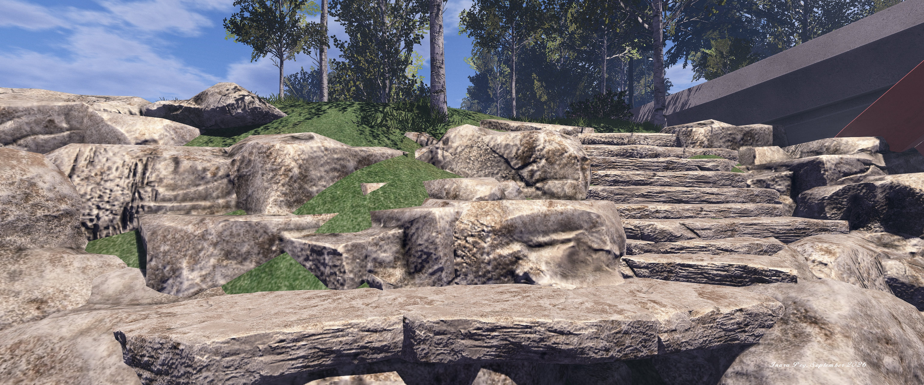
This more-or-less follows the lines of a typical US highway rest-stop: minimal formal facilities and plenty of parking – which is not to say it should be completely ignored; there is much on the island to be appreciated (do make sure you take a peek inside the ranger hut and can the construction sketch for the island, for example) .
For one thing the entire island on which it sits has been carefully landscaped in a manner akin to that seen with the updates to the Linden Memorial Park mentioned above. As well as original elements, good use has been made of landscaping and flora and trees found within various Bellisseria Linden Home regions.

One of the unique features to this area is the parking. Along the road there is a 30 minute Auto Return on untended vehicles. Within this parking lot, it is 120 minutes. That way, people can come in, park, and explore without having to immediately re-rez their vehicle. The slipway and the area in front of it is a rez zone.
– Wendi Linden, describing the Aptos Recreational Area of the Trans-Sansara Causeway to me
Not only is the extended Auto Return period intended to encourage people to explore the location, the fact that it straddles the water as well offers the opportunity for mixed-transport trips, combining driving and boating for those in the mood – and for those with a floatplane, flying into or out of Aptos.

If there is one small niggle to be had, it is not with the new route itself, but rather what it highlights: the need for water exclusion volumes once more in SL. Whilst we have water exclusion surfaces, these are only good for hiding Linden Water when looking at it from above; they cannot hide it when we’re actually underwater.
Hence, whilst the entrances to the tunnel linking Luna and Thetis look nice and free from water when approached from above ground, the illusion is immediately shattered on driving into the tunnel: we’re clearly submerged, and exclusion volumes are needed to keep the water “out” of the tunnel spaces. But this is a factor common to SL as a whole, and time will tell if it will be addressed.

In the meantime, the new road extension around Sansara from Mavericks to Bay City (and vice versa) is complete and fully driveable for all those who enjoy road trips in SL. As such, I’ll say no more here other than to suggest that if you enjoy driving – go pay a visit 🙂 – and again extend my thanks to Wendi Linden for both the invitation and for taking the time to chat with me about the project.
SLurl Details
- Trans-Sansara Causeway toll gates (Mavericks, rated Moderate)
- Trans-Sansara tunnel entrance vehicle rez zone (Luna, rated General)
- Aptos Recreational Area (Aptos, rated Moderate)

