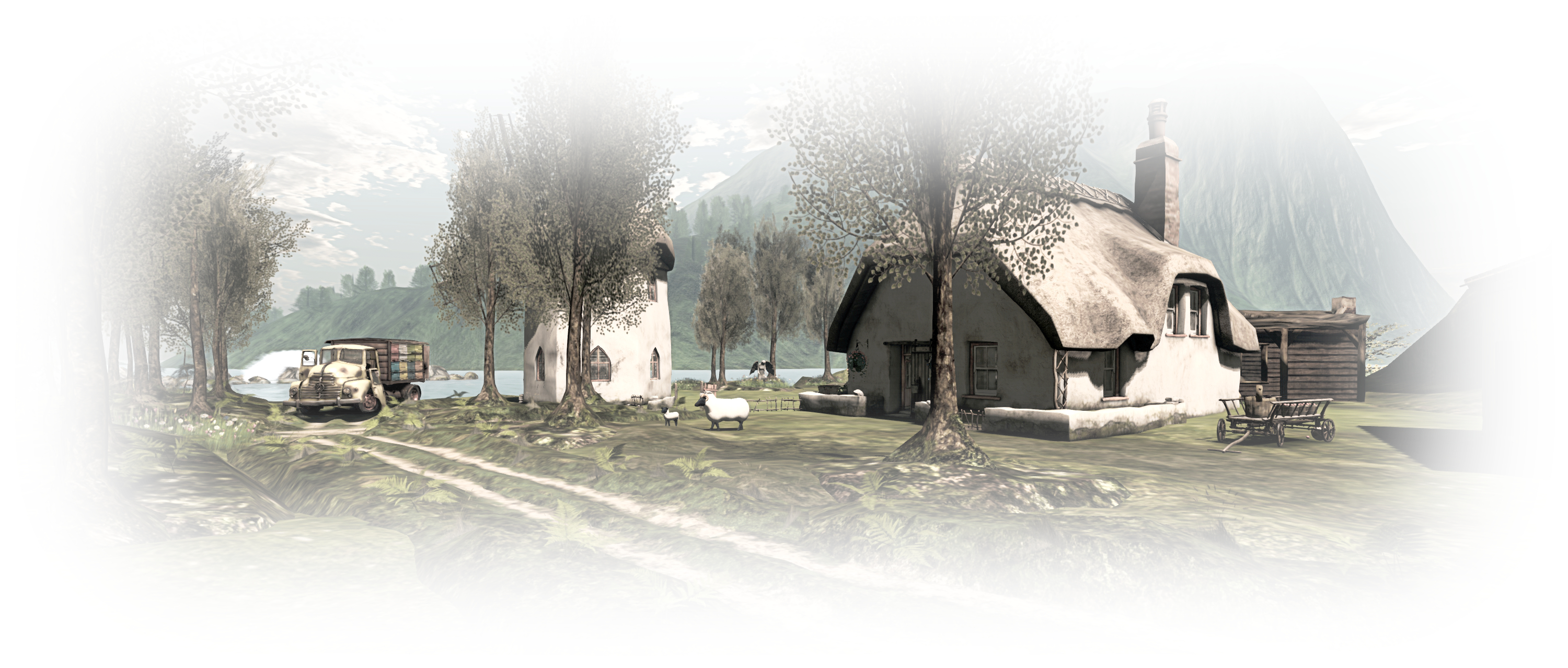
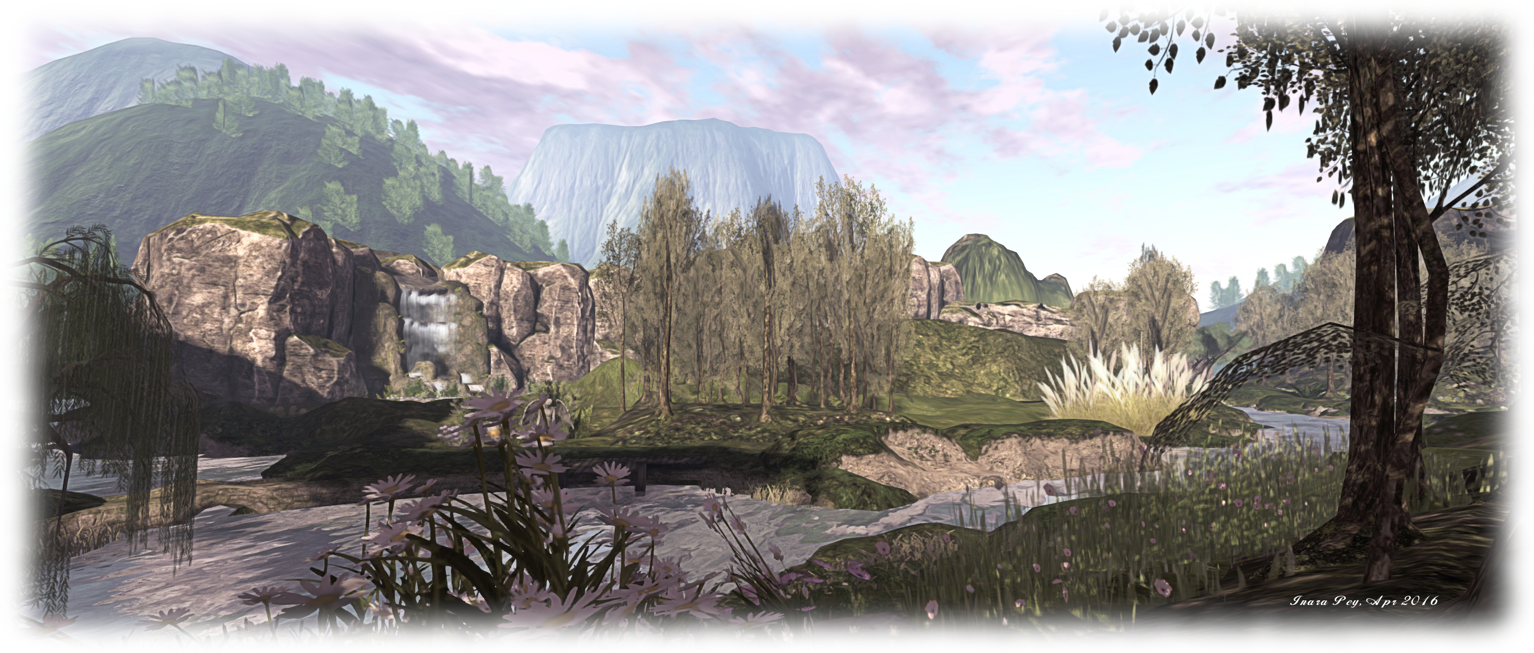
 Peacehaven – click any image for full size
Update, September 9th: Purr has moved Peacehaven to a new quarter region location.
Update, June 23rd: as Purr indicates in her comment, Peacehaven remains open, so the region is there still for you to enjoy, and again, if you have not paid a visit, I encourage you to do so!
I was drawn to Peacehaven after seeing it highlighted in the Destination Guide – only to find that its future is far from certain: a noticeboard close to the landing point carries the news that the region will be closing on May 2nd. This is something of a shame, as the region is another slice of rugged beauty in second Life, which lends itself to photography whilst offering a place to enjoy with a friend.
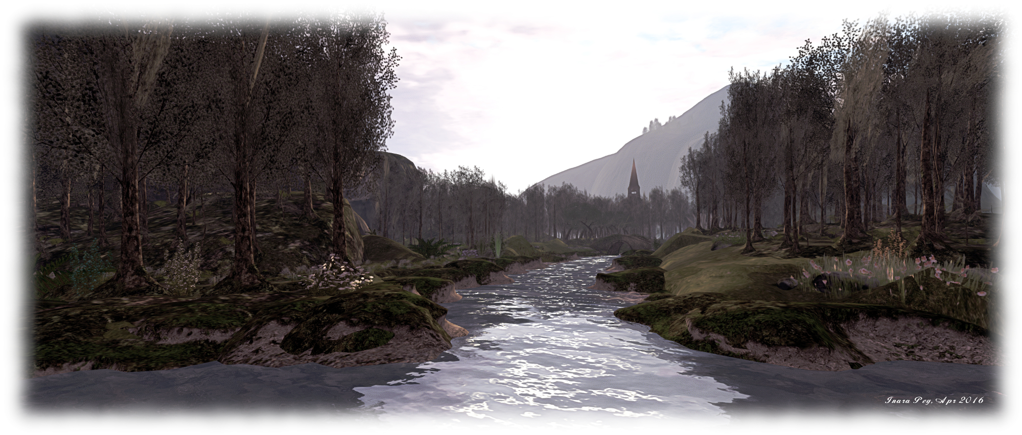
The landing point, located on the west side of the region presents two tracks for visitors to follow, one to the north, the other to the south. Both paths lead directly to little stone bridges – Alex Bader’s popular design – which arch over gently flowing streams – before offering the visitor a choice of ways forward.
The northward track branches left and right once over its bridge, a tall mesa – one of two here – blocking the way forward. Whichever branch of the path is chosen, both eventually lead the way around the mesa to a little farm huddled behind it on the north side of the region. However, the left branch of the path offers perhaps the shorter route, whilst the right branch offers the way through copses and past a glade set for dancing.
The southward path offers a slightly different choice once over its bridge, as it turns eastwards along the bank of one of the meandering streams, while also providing access to a wooden stairway which climbs the flank of another mesa by way of a smaller butte, taking visitors to a high vantage point overlooking the rest of the landscape and again offering a place to dance.
Follow the path, meanwhile, and it will take you to a wooded area and what seems like the end of the road. Wander between the trees, however, and you’ll likely come across a little glade with seats and a camp fire. beyond this, a woodland path offer a way through the trees and around the north side of a small lake, or you can continue southwards and across a greensward between the lake and a small quay, and make your way eastwards.
To the east of the region, and separated from the rest by water spanned by bridges both natural and built by human hands, lay a little country church and, just off the coast, an ancient ruin sitting atop a craggy island. Should you visit the church (and no doubt you will!), the path taking you to it will also lead you onwards to the farm, reached by passing under a heavy arch of rock linking the two mesas.

Whichever route you opt to take in exploring Peacehaven, you will find plenty of opportunities for photographs, or to sit and relax or enjoy a dance if you’re so minded. While I’ve no idea how absolute the closure of the region is, considerations at the donation points across the region might give encouragement for it to remain a little longer.
SLurl Details
- Peacehaven (Rated: Moderate)