A return to Tokyo Street and a visit to Umi

Puddlechurch; Inara Pey, March 2019, on FlickrUmi – click any image for full size

Update: Dox, the region on which these builds were hosted appears to have been closed or renamed / relocated. SLurls in this article have therefore been removed.

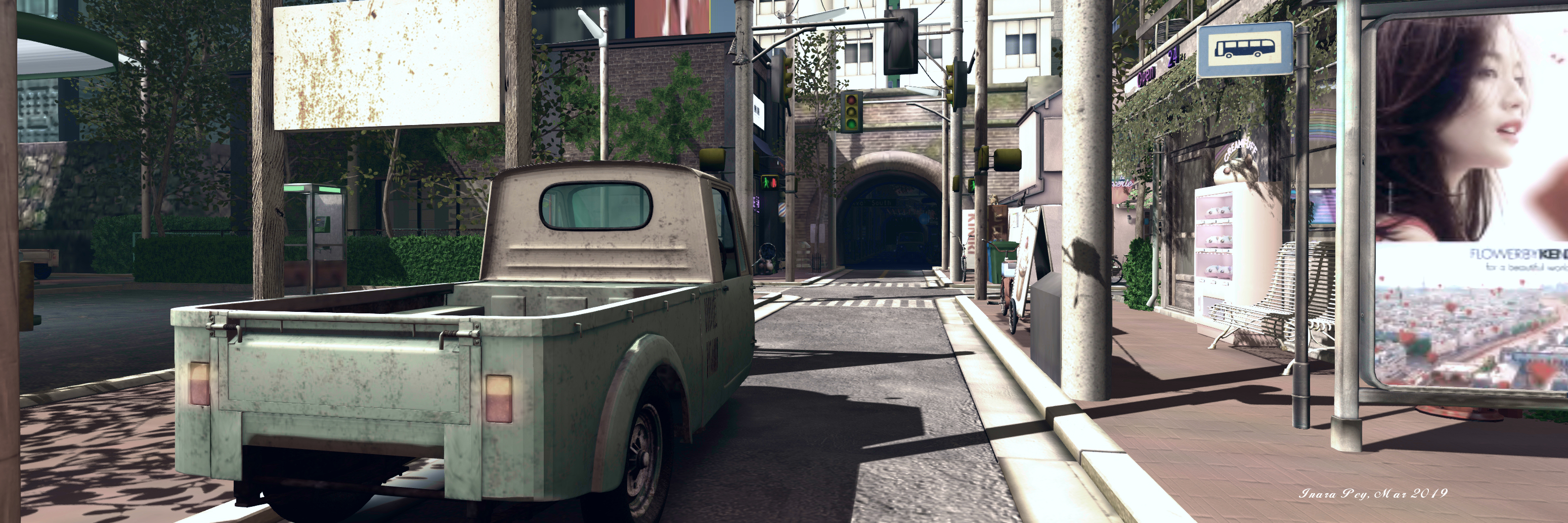
In October 2018, I wrote about our trip to Tokyo Street Subway Entrance, created by Paradox Ivory under her Dox brand and about which you can read more here: Emerging from a Tokyo Street Subway Entrance. Since then, Paradox has been busy extending this full region, both up in the air and down on the ground.

The main landing point remains unchanged, delivering visitors to the subway entrance from which the sky build takes its name. This leads up to the same street level, with its tall buildings and side alleys and roads, but whereas the tunnel at the far end of the road once ended in a blank wall, it now provides access to the extension to the sky build.

Puddlechurch; Inara Pey, March 2019, on FlickrTokyo Street South

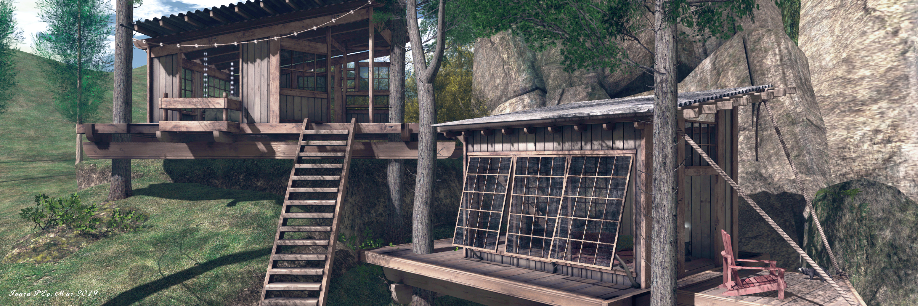
Here, laid out around a grid of narrow roads are further buildings, including the Tokyo South Gallery, a small carnival area (with a tunnel linking to a temple on its far side, an apartment building and surface railway station. As with the original build, the attention to detail is excellent, complete with an atmospheric sound scape, with the outlying building shells giving a further sense of depth.

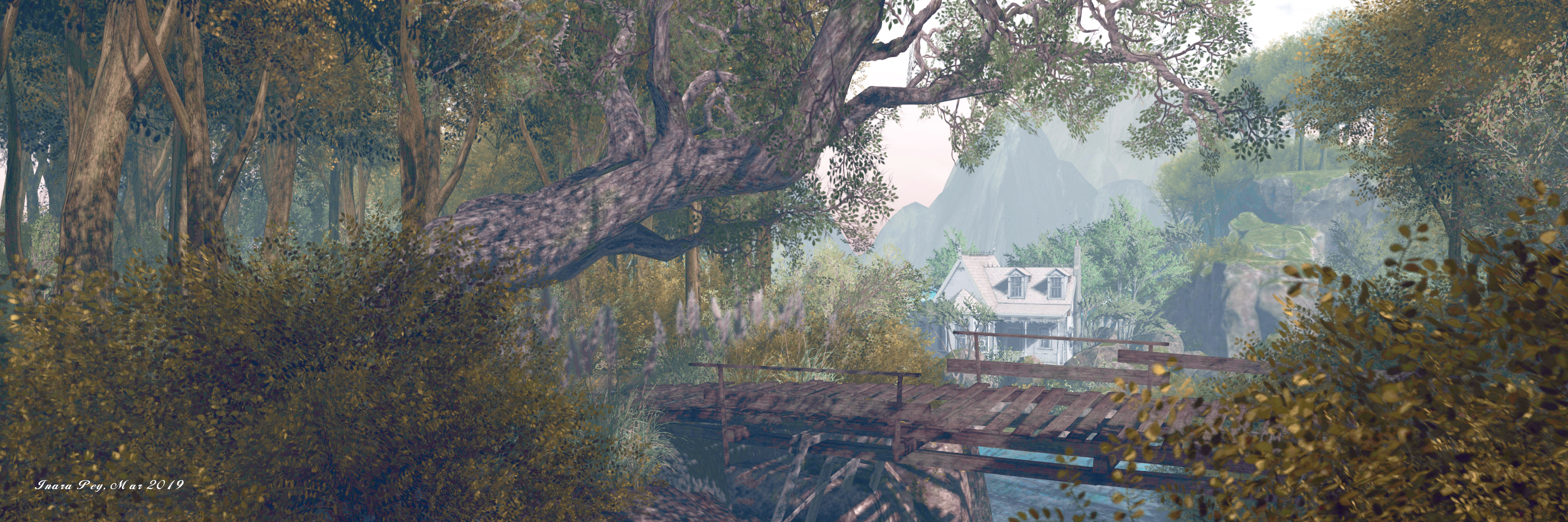
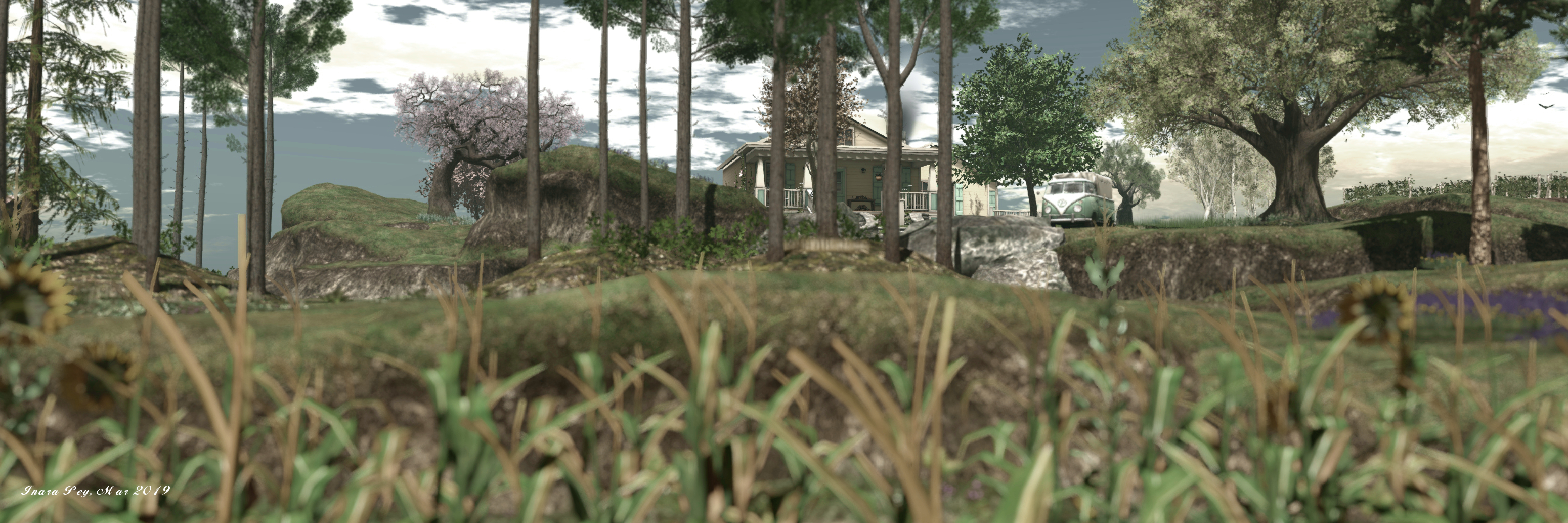
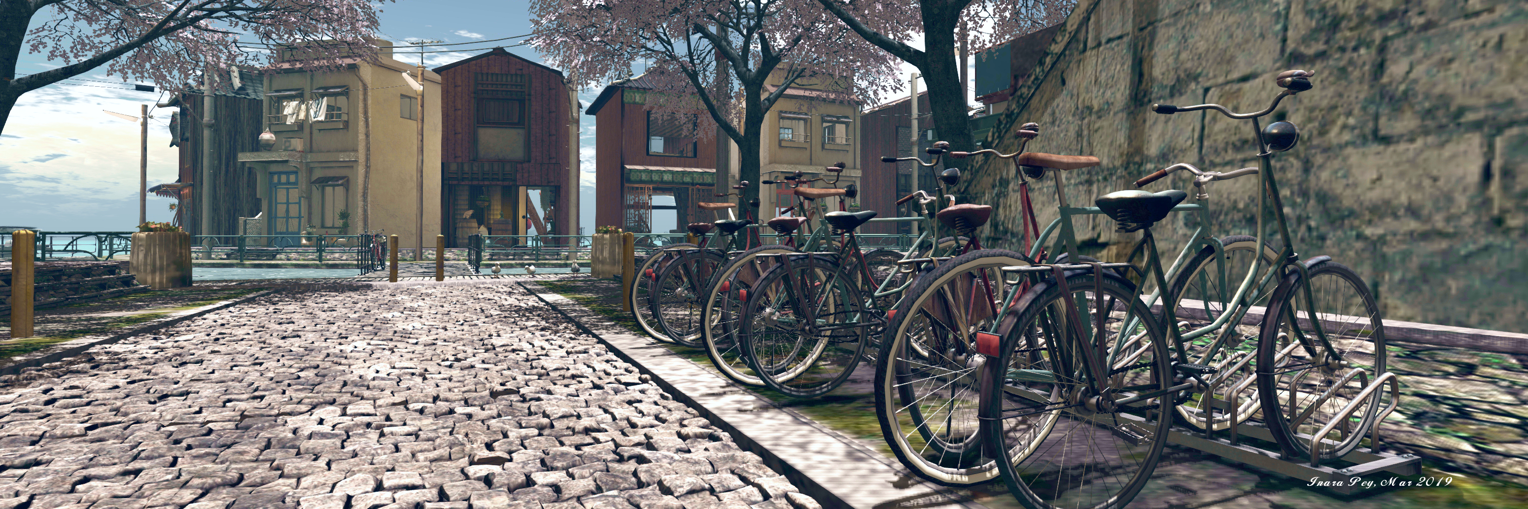
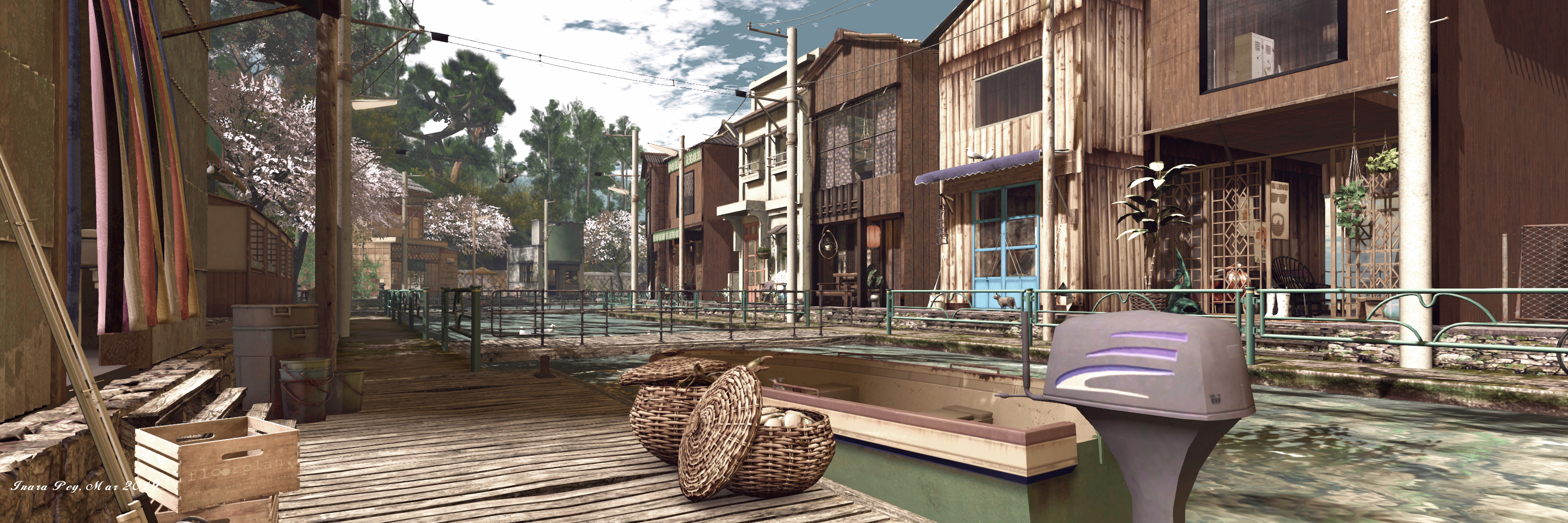
However, it is on the ground level and reached via a separate LM, that the village of Umi is to be found, hugging the coast of a small island (so far as I could tell, there was not TP connections between ground and sky). This is where the city can be left behind and visitors can explore the beauty of a coastal setting.
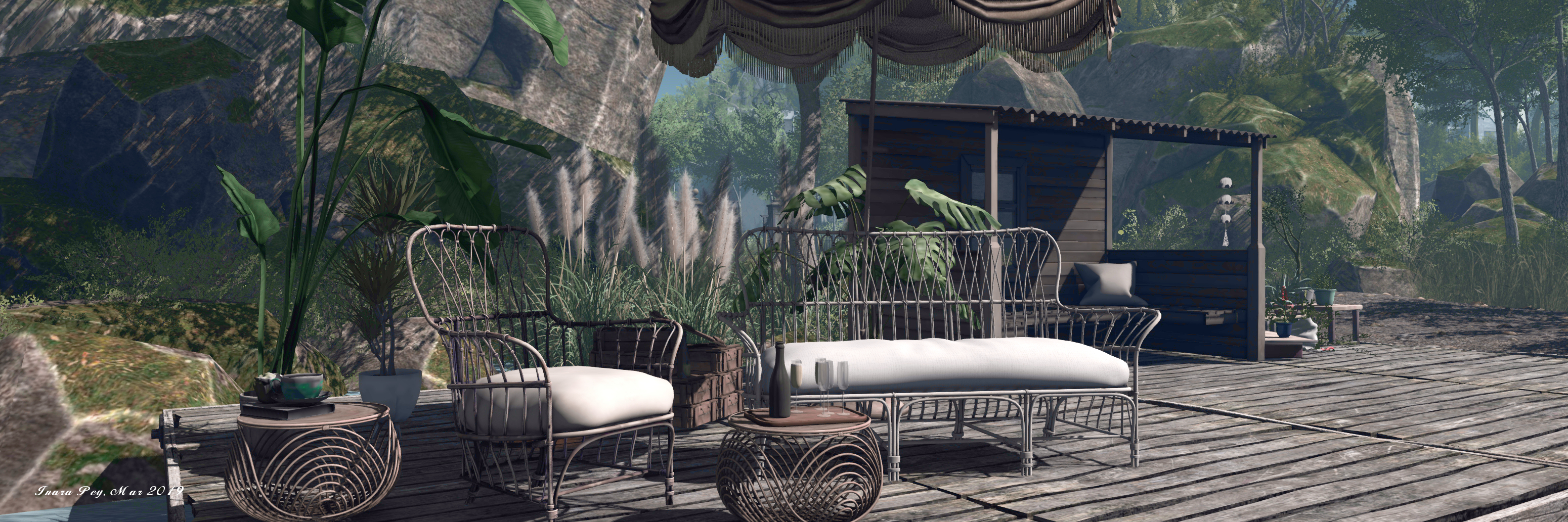
Puddlechurch; Inara Pey, March 2019, on FlickrUmi

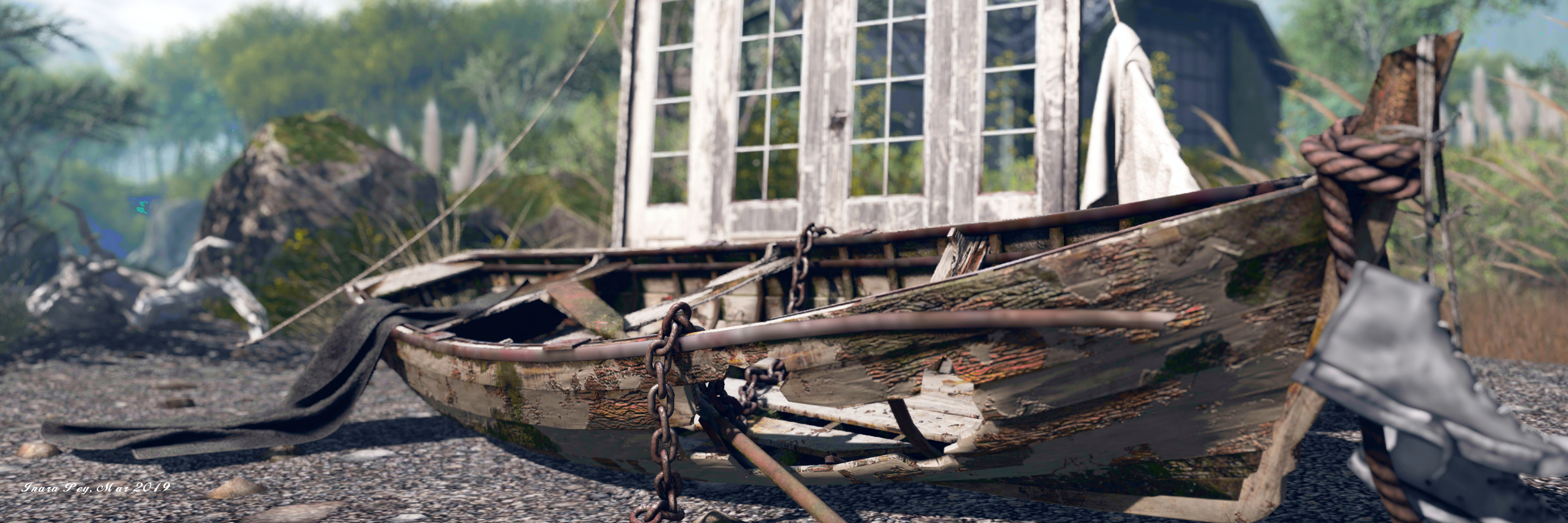
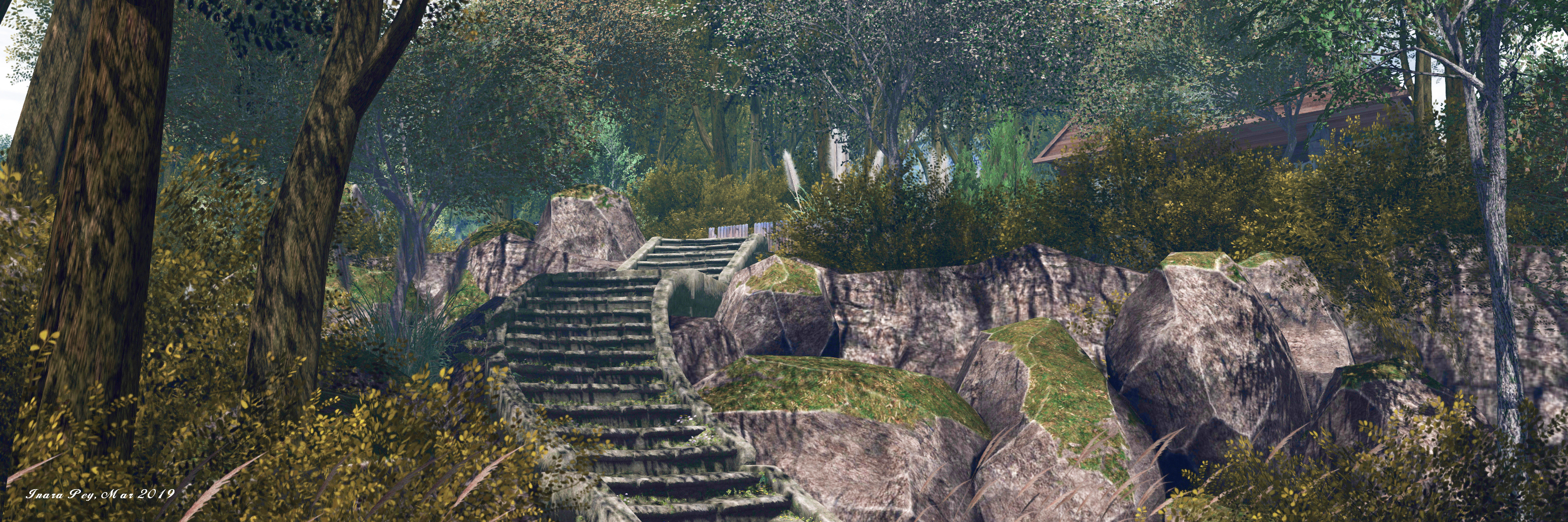
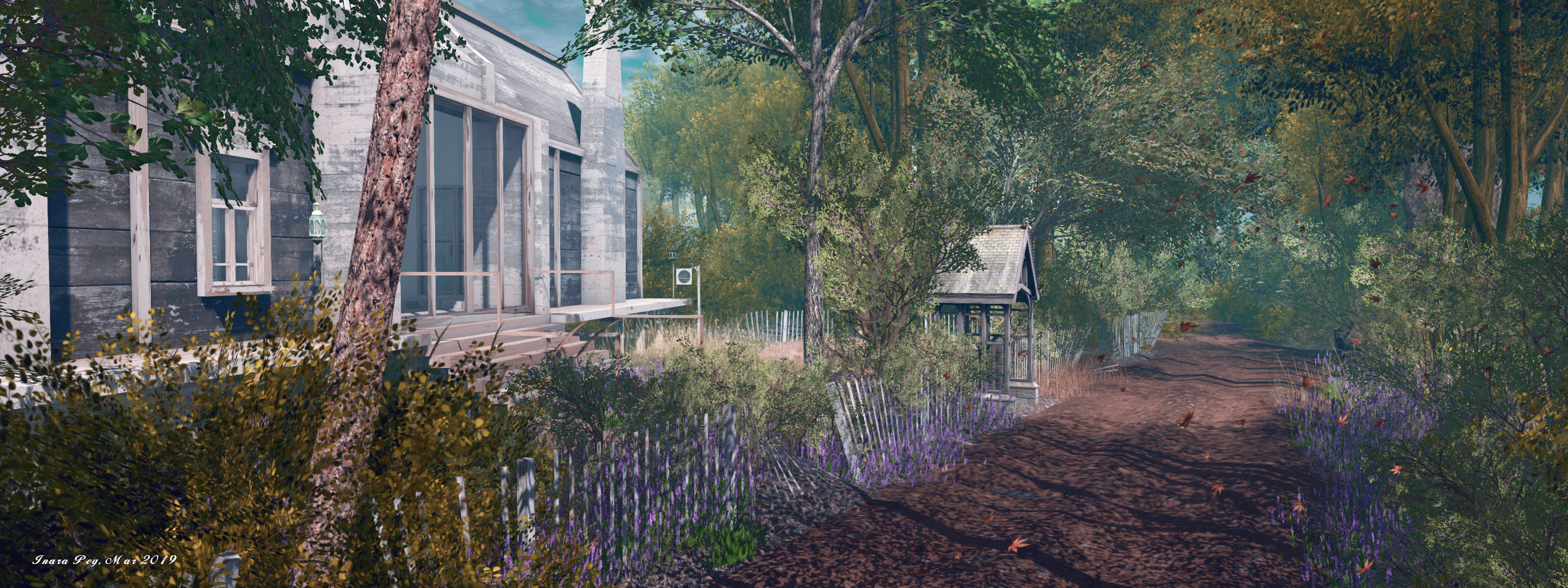
The village is a curious and oddly attractive design. A sweep of buildings are nestled under the steep slopes of the island, partially sheltered by trees and rich foliage. These face another arc of wooden and cement buildings standing on what might have once been a sand bar or a sweep of rocks, but which is now clearly a man-made breakwater.

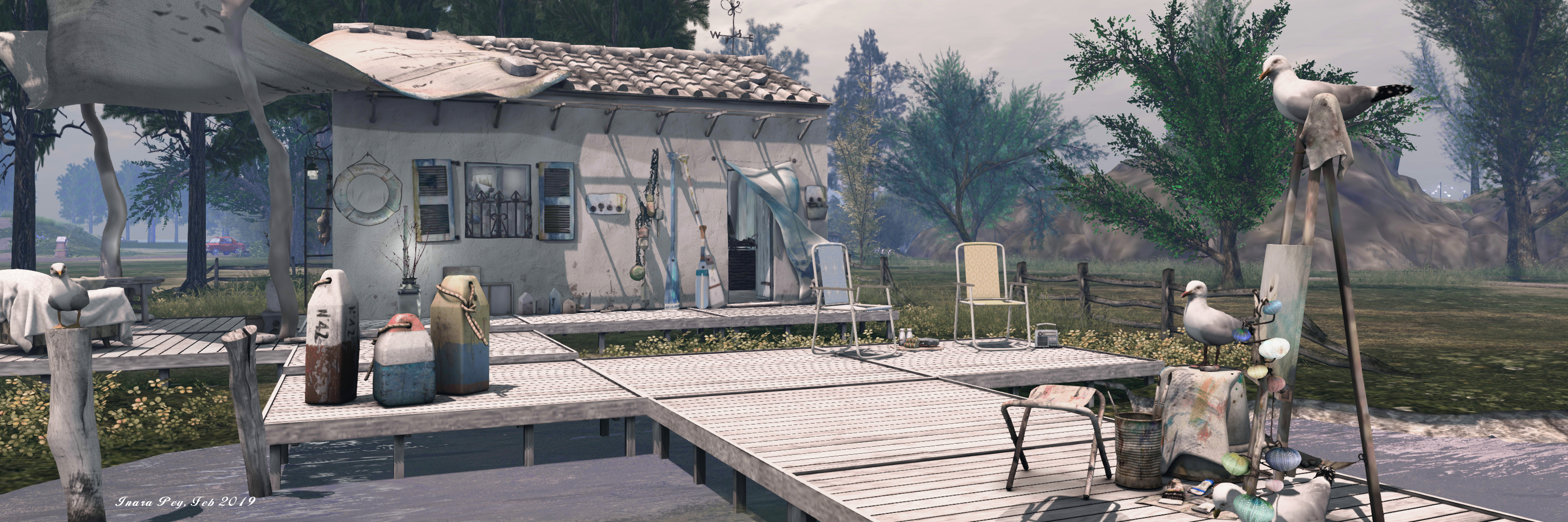
Examination of the houses on the breakwater will quickly reveal they are perhaps a little unusual. Their lower floors are open to the sea on one side, offering moorings and work spaces for small boats, although some have been decked out to provide extra accommodation space, perhaps to offset the somewhat compact – some might say cramped – living spaces of their upper floors. Be aware that four of them – the cement-faced units – are available as private residences.
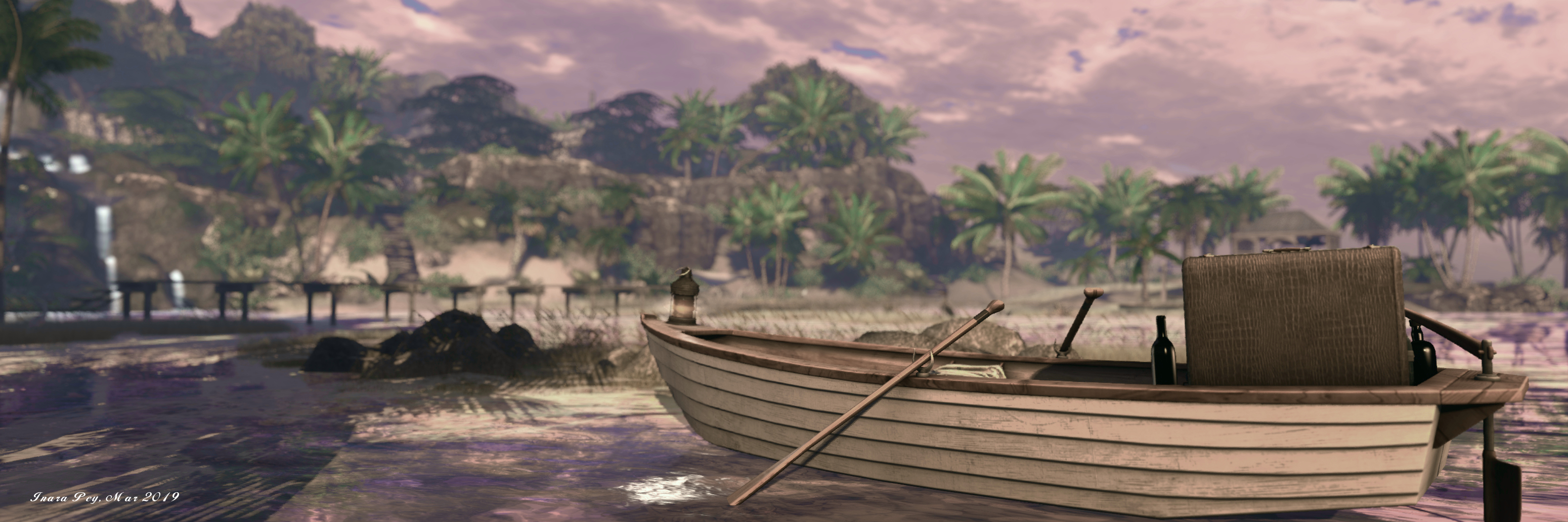
Puddlechurch; Inara Pey, March 2019, on FlickrUmi

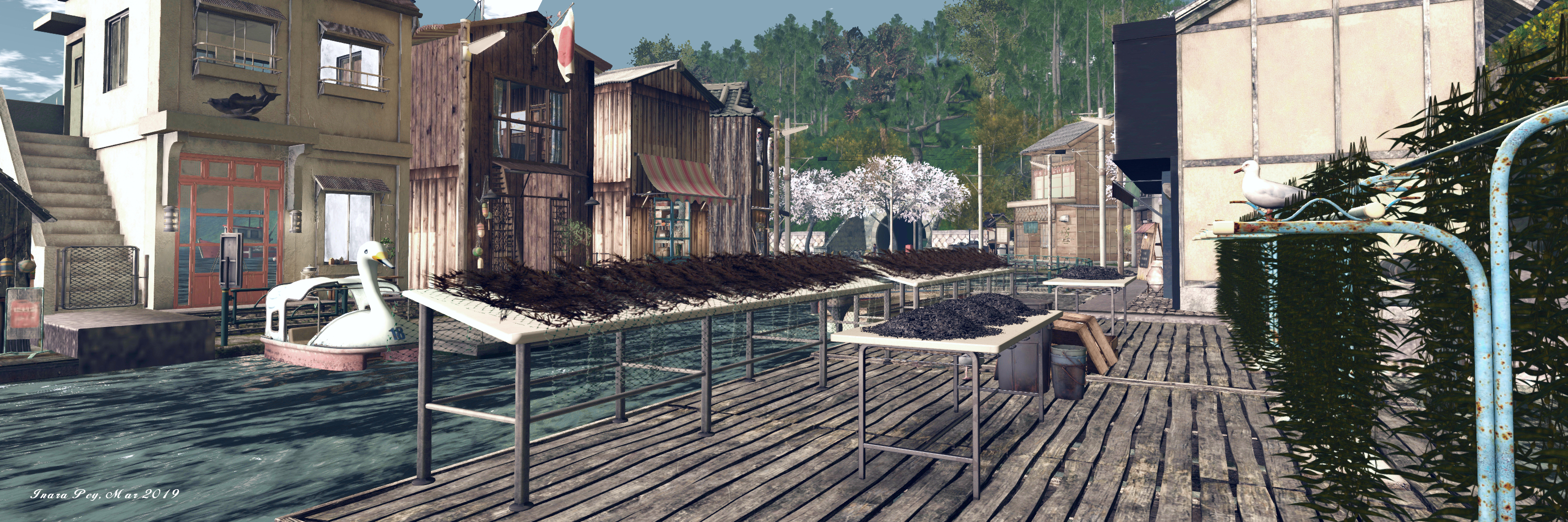
To the west of the village are working wharves and a warehouse. Fishing boats are tied-up alongside, possibly waiting for the next tide and nets are set out to dry. To the east of the island is a fuelling station, it and the wharves neatly bracketing the village. Alongside the fuelling station is a pedal boat, if you’re careful you can ride own around the island – but take care getting off the boat, any attempt to double-click TP to land will bounce you back up the the main landing point in the sky.

When we first visited Tokyo Street Subway Entrance, we found it to be engaging, detailed, beautifully modelled and presented. That is still the case now – although I admit to finding the Tokyo Street South extension a little too hemmed in and claustrophobic in places. It does, however, provide an interesting contrast with the ground level village setting, which is eye-catching, taken together. they both sit as a visual reminder of the different faces of Japan.
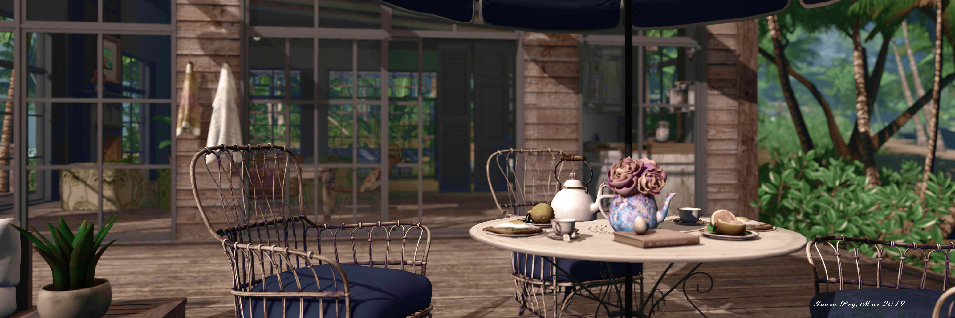
Puddlechurch; Inara Pey, March 2019, on FlickrUmi

The one major complaint that might be levelled at the region is that of performance; there is a lot packed into it, and depending on local settings ant the use of things like shadows, a viewer and computer can take a hit and end up struggling. So, be prepared to make some adjustments to your viewer, should this prove to be the case. This said, for those with the patience, the region is worth a visit, and offers very different opportunities for photography within the ground and sky builds.

With thanks to AJ and Shakespeare.

Exploring Puddlechurch in Second Life

Puddlechurch; Inara Pey, March 2019, on FlickrPuddlechurch – click any image for full size

Marty Triellis e-mailed me in late February with an invitation for us to visit Puddlechurch, the latest region design he and Cherish Demonge have developed. The invitation came almost exactly a year after we had visited one of their previous designs (see A NonStop visit in Second Life) and Shug Maitland also pinged me about the region via IM, we set off to have a look.

Described as a residential / photography region, Puddlechurch is beautifully conceived and executed. Some 14 rental properties of varying sizes are scattered through the landscape, but you’d hardly know this from a casual visit; such is the design and spread of the rentals – up on hill, down in dale, on the coast, over the water – that without a count at the rental office, you’re be pushed to tell the number was this high.

Puddlechurch; Inara Pey, March 2019, on FlickrPuddlechurch

The landing point sits close to the rental office, in a little village-like setting towards the north-east of the region. Largely deserted, the village is little more than bricked and boarded-up buildings, tumbled walls and a slightly forlorn little square, the rental office seemingly the last place of business still operating.

Three routes lead away from the square: east to a waterfront area (which I understand from Marty is still under construction). A similar path points west to the coast on that side of the region, while up a set of steps, a worn track points the way south, a tree-lined lane that passes the local chapel and graveyard.

Puddlechurch; Inara Pey, March 2019, on FlickrPuddlechurch

Which of these you take is up to you, but I confess, I found the westward path and the way it opens out to present the bay and buildings that reside there to be utterly captivating and beautifully natural. It is here that several of the rental properties are to be found, sitting close to the shingle beach or raised up on platforms build over the water and facing the mainland from the low-lying shingle bar that lies across most of the entrance to the bay, giving the impression this might once have been low-lying land that the sea has opted to lay claim to over time.

The houses out on the shingle bar are reached via wooden board walks. With a view out over the westward sea and the high peaks d the surrounding islands on one side, coupled with the view back inland on the other, these make for desirable properties for those looking for a home, their careworn looks adding a further layer of shabby chic to their attractiveness. Each sits within its own parcel, allowing parcel privacy to be used (each parcel additionally includes a security system) – a smart move given the close proximity of the public path running along the shingles betwixt houses and water.

Puddlechurch; Inara Pey, March 2019, on FlickrPuddlechurch

This approach has also been taken with the offshore units sitting on their wooden decks. Reached via their own board walks, these might be small, single room structures, but they also offer a little space for mooring boats (LI allowing!).

It is the breadth of housing style, as well as the landscaping that also makes Puddlechurch so appealing. If the small wooden cabins and houses on the west coast don’t appeal, follow the paths inland from beach or landing point (they all interconnect perfectly), and you’ll find a good mix of housing styles: a converted warehouse here, a town house there, a stone cottage in a corner; for those looking for an expansive property, there is even something of a manor house, and several of the properties have decks and / or planted gardens.

Puddlechurch; Inara Pey, March 2019, on FlickrPuddlechurch

Of course, what might be available for rent is liable to vary over time, so be sure to check the boards at the rental office, which will also furnish you with the rent and LI allowance for each property. These will also provide the estate’s rental guidelines, and I strongly recommend these are given a careful read through prior to renting.  When exploring, available properties are signified by a real estate (or if you are in America, a realtor) board outside, while memories of prices can be refreshed with the visit to the estate’s web page.

Cherish and Marty describe the setting as inspired by “British” countryside. By this I assume they mean a variety of influences from across the British Isles have informed the finished design. Certainly, there is no singular point of influence that appears to have gone into the design; rather, what is presented is singular and unique, carrying with it odd (and pleasing) little aspects of familiarity to anyone who has visited some of the more remote spots around the Irish and Scottish coastlines, or has visited some of England’s woodlands.

Puddlechurch; Inara Pey, March 2019, on FlickrPuddlechurch

Whether or not you are looking for a place to live, Puddlechurch offers a pleasing visit and includes multiple opportunities for photography. Our thanks to Marty for the invitation and to Shug for the tip.

SLurl Details

Lab launches Second Life video travelogue

The Pen – subject of Linden Lab’s new video travelogue series

On Wednesday, March 6th, 2019, Linden Lab launched another new video series: Second Life Destinations, highlighting locations across the grid that residents might like to visit. The series is intended to be issued on a weekly basis and the Lab notes:

In this series, we’ll highlight different places focusing in on the beauty and imaginative possibilities in no more than 60-90 seconds so that you can get a quick peek at the creations and communities inside each virtual space. At times we may even speak to creators of theses spaces so they can shed some light on what inspired them. Look for each new episode on our blog and social media channels, including Facebook, YouTube and Twitter.

For the first in the series, the Lab visit The Pen, Bay City’s beatnik hang-out operated by Marianne McCann, home to a range of activities include Marianne’s regular “Expresso Yourself” events, where the microphone is opened to visitors to express themselves in words (prose or poetry) or song on the first Tuesday of the month between 18:00 and 20:00 SLT.

The Pen was recently the venue for Marianne’s 13th rezday celebrations, and these are the focus of the video, which includes the voice of singer Grace MacDonnogh, a long-time friend who has a wonderfully mellow way with music and lyrics.

As a seasoned SL travel writer (and videographer when my PC decides to behave itself), I admit to finding myself caught between two conflicting feelings regarding this new series. On the one hand, there are a lot of people like me in the blogging community: we may not all focus on blogging destinations (although equally, some do), but  considerable effort goes into writing-up places and taking photos  / producing videos. Give all that, a series like this might be felt as coming a little close to treading on toes. On the other hand, the series is intended to be limited to 60-90 seconds, and as such it shouldn’t really impact on the work done by videographers and bloggers.

Nevertheless, it’ll be interesting to see how the series develops. In the meantime, I’ll leave you with the first, which demonstrates the potential innocuousness of the series.

A dip into Salt Water in Second Life

Salt Water; Inara Pey, March 2019, on FlickrSalt Water – click and image for full size

I recently received an invitation from region holder Kye (Kyevaiy) to visit her Homestead region of Salt Water. The initial part of the region’s description certainly piqued my interest – “The cure for anything is Salt Water — in one form or another, sweat, tears or the Salt Sea”; but it was Kye’s invitation that captured my desire to pay a visit sooner rather than later:

I asked Tippy Wingtips to help me recreate a places I had recently visited in Mexico, Belize and the Island of Roatán. I sent her several photographs of my trip and she tried to duplicate many of them in order to capture the places I love.

– Kye (Kyevaiy) describing the development of Salt Water

Salt Water; Inara Pey, March 2019, on FlickrSalt Water

Belize is one of those places in the world that has long fascinated me, and I was keen to see how elements of it had been interpreted in the region design, hence pushing a visit to the top of my list. Sadly, I can’t really speak for Mexico or Roatán – the latter was completely out of my ken until I looked it up, and my one visit to Mexico was limited to Sonora. However, what I can say is that, even without any in-depth knowledge of all the countries and locations used as inspiration for the design, Salt Water is marvellously conceived and designed.

The region presents itself as a rugged, tropical island that climbs slowly from a western bay up to high plateaus. It has also, at some point in the past, been split into two: to the north-east a narrow gorge breaks the land, spanned by a single rough bridge, looking for all the world like it has been cut over time by water action. Throughout the entire region, the attention to detail is stunning.

Salt Water; Inara Pey, March 2019, on FlickrSalt Water

“I loved doing this sim! It took me almost 3 months to get it the way I wanted it!” Tippy informed me. In spending several hours over the last couple of days exploring, I can see why.

The low-lying areas of the region to the west offer beach houses, sand, board walks over the shallow waters of the bay, open decks over both sand and water, all of which are woven together to present the most idyllic setting: the perfect vacation paradise. As the beach houses are presented for public access, there is no danger of trespass, and they offer additional places to sit and relax and become immersed in the setting as the westering Sun casts long shadows over sand and grass.

Salt Water; Inara Pey, March 2019, on FlickrSalt Water

As well as the waters of the bay, the west side of the island offers a small rock-encircled pool for bathing while the board walks continue over the sands, helping to form  – along with the bay itself – a natural boundary between the low-lying beaches and the island’s uplands.

The latter are reached via stone steps cut into the rocks  or an age-worn path, and rise in tiers, the trees slowly changing with altitude, with the palm trees gradually giving way to a small rain forest that hugs the upper reaches of the island. These tiers are cut by a the passage of water that cascades down falls and flows along rocky channels to feed the bay below.

Salt Water; Inara Pey, March 2019, on FlickrSalt Water

It is up on the highest level of the plateau, where the air is rent by lightning, the ancient Aztec ruins can be found, presided over by a large stone tablet raised onto its edge. These ruins, backed by the dense foliage of the rain forest, actually form the region’s landing point, and offer a marvellous lookout down and to the west to the beaches and the setting Sun.

Two paths – one at the foot of the steps cut into the rock of the plateau and which lead down to is first lower tier, the other running through the trees of the rain forest and then down through a rocky gorge, lead the way north to where that heavy bridge of felled (or fallen) tree trunks crosses the chasm separating the two parts of the region. Across it, more ruins await discovery while paths and steps wind down the land to the west, passing snuggle spots and look-out points until they reach the little beach of a headland.

Salt Water; Inara Pey, March 2019, on FlickrSalt Water

All of this only really scratches the surface of Salt Water. There is a wealth of detail to be discovered, from the way in which all of the snuggle spots, seating and look-out points offer views over and between trees to the ocean and the lowering Sun, to the inclusion of suitable wildfowl across the waters and in the air, to the selected sound scape.

A marvellous design, perfectly put together and well worth visiting and exploring. Photographs are welcome at the region’s Flickr group, and gratuities towards the upkeep of the region will be accepted by the monkey at the landing point.

Salt Water; Inara Pey, March 2019, on FlickrSalt Water

SLurl Details

A trip to Green Acres in Second Life

Green Acres; Inara Pey, March 2019, on FlickrGreen Acres – click and image for full size

Green Acres is the name given to a Homestead region designed by Alsatian Kidd with assistance from Iniquity Constantine that presents a slice of rural Americana in a very photogenic setting.

The region is roughly divided into two parts: rugged uplands running roughly diagonally across the land from the north-west to the south-east, that presents an arc of cliffs to the low-lying lands forming the rest of the setting.

Green Acres; Inara Pey, March 2019, on FlickrGreen Acres

The landing point sits on a low-lying table of grass eastwards of the hill, close to Cory Edo’s Yara Treehouse design, which is imaginatively built back into the stepped face of the rocky hills, water dropping in a sheet to one side, feeding  a pool at its feet where ducks swim, the water tumbling over a further small drop to meander away around the foot of the hills and through a narrow grassy gap between them.

This gap is shared by a path that winds along the stream’s bank, inviting visitors to follow. Beyond the cleft, the two part company, the stream continuing to hug the foot of the hills before it joins with a small river. By contrast, path branches before this confluence is reached, one arm linked to a snuggle spot nestled in the arms of the hills, reached via a little wooden bridge, the other running northwards over grassland. This path will eventually lead visitors to a lighthouse standing on a low promontory of rock and bracketed between a small beach nestled into a cove on one side and the estuary of the river on the other.

Green Acres; Inara Pey, March 2019, on FlickrGreen Acres

The estuary is home to a small fishing wharf, while the river is spanned by a broad girder bridge, providing the way to reach the ranch that occupies rest of the region. The lands here are open to exploration, but visitors are asked to respect the privacy of the owners and not stray into the ranch house itself.

This house sits above the rest of the ranchlands on a low table of grass and rock that offers an excellent vantage point for keeping an eye on things, the house sharing the hill with grapes growing on the vine. Below them, the land presents fields and livestock grazing, with cattle, sheep and horses occupying the fields adjacent to a large barn. Close by, an orchard offers apple trees ripe for harvesting, while more rutted tracks offer a route around the ranch outbuildings.

Green Acres; Inara Pey, March 2019, on FlickrGreen Acres

Beyond the ranch, the land closes back towards the hills, a large pool of water both fed by another waterfall and feeding the little river offering room for geese to swim and visitors to relax in a waiting kayak.

One of the things I like about Green Acres is the lie of the land potentially – and subject to respect and care – is one of those places ideal for exploring on horseback if you have a wearable / rideable horse. The trails around the region are ideal to follow, and the open grasslands offer plenty of room for grazing while appreciating the landscape from the saddle. But even if you don’t have a horse, the region offer a pleasant walk with plenty of opportunities for photography and for sitting and relaxing scattered around. There’s the kayak mentioned above, for example, a cosy little place on the beach, a picnic blanket spread on the grass, and the tree house near the landing point, to name but a few.

Green Acres; Inara Pey, March 2019, on FlickrGreen Acres

With deer, bear, raccoons and foxes also to be found, birds overhead and a gentle sound scape to surround you while exploring, Green Acres is another  delight of a region to visit.

SLurl Details

Maderia Springs in Second Life

Maderia Springs; Inara Pey, February 2019, on FlickrMaderia Springs

Update and warning: Maderia Springs is now an adult-rated nude beach / BDSM location.

Maderia Springs, a Homestead region designed by Thaihiti Baroque, is a curious place; so much so that while we visited it over the weekend at the suggestion of Shakespeare and Max, it’s taken me a few days to settle my thoughts and write about it. Truth be told, I probably wouldn’t be writing about it now had it not been for the fact the region I had been in the middle of blogging was summarily closed to public access by its owner literally just as I was finalising my write-up!

The reason for my having to settle my thoughts is that while Maderia Springs has plenty of photogenic elements to it, it doesn’t, at the the first glance, exactly have a feel of a cohesive whole. Oh, certainly, elements are nicely linked in places: the landing point, the waterside shack and the large central house for example, while the house across the water feeds into this setting rather nicely, as do the cattle and horses. But the region also has a feeling of being more a set of discrete vignettes, rather than an individual whole, the roads and tracks more a convenient means of connecting them rather than being part of a landscape.

Maderia Springs; Inara Pey, February 2019, on FlickrMaderia Springs

Thus, I’ve found the region a little hard to quantify in trying to describe it. In the end I decided to treat it as it appears: a grouping of vignettes, each ideally suited to photography; sets, if you will, just awaiting their subjects. Which is not to say a wander through the region along its meandering roads is without reward. Rather the reverse, there is a lot of detail here to be enjoyed, whether it is around the aforementioned central house with its little gardens on either side and to the rear, or among the horses to the north or the wedding chapel up on one of the region’s two high points, or within the numerous little settings awaiting discovery.

Whether or not the chapel see any weddings is immaterial; its open sides and the tables and benches set with food and drink make for an ideal celebratory setting; the blossoms and doves  perfect accompaniments to the bunting and lanterns. All that is missing, perhaps, is a dance system.

Maderia Springs; Inara Pey, February 2019, on FlickrMaderia Springs

Down from the chapel on the south side of the region are a couple of waterside settings. Both reflect a love of dogs that can be found throughout the region. One offers a simple picnic style setting with blankets and chairs and sun shades, the other is built around a small summer-house which, going by the easel and paints out on the deck stretching a finger over the water, would appear it be the getaway for an artist. This is in turn watched over from a little cottage sitting on a low hill to the west, a place where tea and refreshments can be partaken on the low-walled terrace, obtained via the van parked there.

The refreshments van reflects the fact that vehicles are very much another theme within the region. They are parked near houses, occupy some of the rutted tracks, and even provide a little lover’s nook among the bushes.

Maderia Springs; Inara Pey, February 2019, on FlickrMaderia Springs

One of the aspects that adds to the attraction of Maderia Springs is the choice of windlight. It takes only some minor tweaks to frame images of the landscape pretty much perfectly. In this, the windlight environment is perhaps the thing that does brig the various elements within the region together as a cohesive whole; with those minor adjustments made, it is possible to see the region as a pastoral setting, a place of open countryside where cattle, sheep and horses roam, and farmers tend to them and the land; a place that is perhaps the location of holiday visits, with the large main house offering the perfect escape.

With a suitably rural sound scape, filled with the sound of birds, the occasional bleat of lamb or moo of cow, Maderia Springs does very much come to life as you explore it, while the scattered places where visitors can sit and relaxed offer a further incentive to tarry a while and enjoy the location.

Maderia Springs; Inara Pey, February 2019, on FlickrMaderia Springs

For those who do take pictures, a Flickr group is available should you want to share your views of the region, and should you enjoy your visit, keep an eye out for the little windmill donation points, and consider offering assistance towards the region’s upkeep so that other might enjoy it as well.

SLurl Details

Maderia Springs (Maderia Springs, rated: Adult)