Thermae generally refers to Roman imperial bathing complexes featuring heated baths and that also formed a centre for socialising among the better-off. Within Second Life, Sage Allegiere – famed for Gardens of Absentia (see: The Garden of Absentia on Second Life) – uses the name for another of her public region creations.
The name is not in any way inappropriate; this is a place where visitors can literally bathe in a creation that reflects nature at her best – although the major structure to be found on the main island might admittedly at first be taken for a spa or similar offering. The setting is that of group of temperate islands – quite where is entirely up to the imagination – with the outlying isles protecting this, the innermost of the group, as it sits lower and perhaps otherwise more vulnerable to the winds and storms that might otherwise pass.

The landing point sits just off of the centre of the region, on the slopes of one of its highest reaches. An inlet cuts into the island on the far side of this hill, a balloon supported bridge crossing the landward end of the the gorge it forms. Down the slope from the landing point sit a cosy cottage with a wild flower garden guarded by a wrought iron fence. find the opening in this fence and a gentle grassy path will take you down to a shingle beach, one of four scattered around the island’s coast.
Most of the island is crowned by young trees – although there are some that have reached maturity awaiting discovery along the ruggedness of the island’s back. In fact, so rugged is the island, that there are few laid paths – exploration is a matter of finding the lesser slopes in the grass that lead down and around the rockier parts of the island.

This means that finding your way around the island is a matter of careful exploration – and given there are multiple possible paths, this adds to the richness of discovery through exploration. One of these paths leads to a rock arch that also passes over the inland end of the southern inlet to join with the bridge mentioned above.
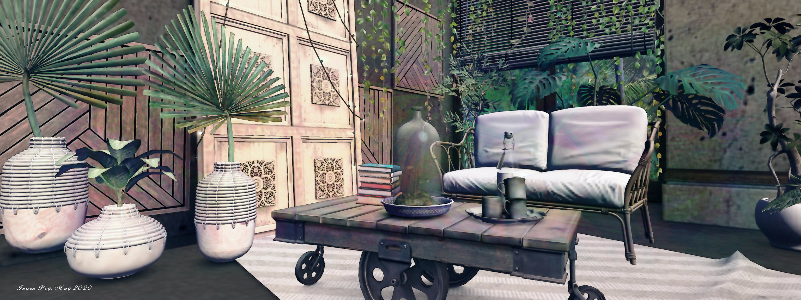
The path from here leads fairly directly to the large house mentioned above. Sitting on a high, flat table of rock, it has a open garden and an inner terrace. The garden is set as if for a party, the terrace as well, although at other times it might make for shaded conversations. Inside, the long rooms of the villa are comfortably furnished, one wing forming a lounge, the other a bedroom, the corner between them a rustic-style kitchen.

A second garden sits below this villa, nestled into the south-west of the island. Further around to the north, a second inlet has been formed as a result of water breaking out from a table under the the rocks to splash down over the rocks. A further shingle beach runs around the far side of this inlet, lanterns floating gently over it and the the bay formed by inlet and falls, although reaching it is a case of finding more of the paths running between the trees and the islands cliffs.
The north side of the island is home to another beach, a broad swathe of grass rolling down to it from the uplands of the island, suggesting water may have also once flowed down it to the sea.

Off the coast from this side of the island are three smaller isles that form a line running to the north-west. The outermost of these three looks to be a private home, so straying by air in that direction is perhaps bed avoided so as not to risk invading privacy. A further knob of rock to the north-east is home to a light house.
Sitting beneath a setting Sun, Thermae makes for a high photogenic setting with much to enjoy and plenty of places to sit, in gardens, on benches, on the water and under the trees. In all, a highly pleasing visit.

SLurl Details
- Thermae (Thermae, rated Moderate)