Of water and “raining” minerals

Curiosity 
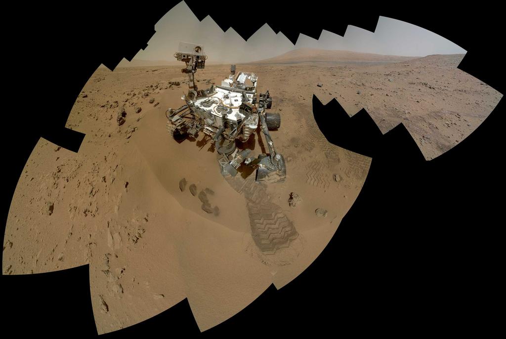
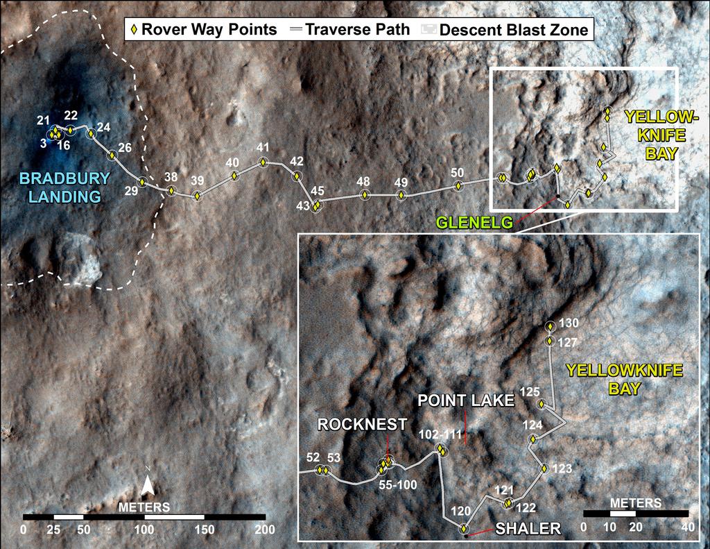
Tuesday January 15th 2012 marked Sol 158 on Mars for Curiosity, and the first NASA / JPL telecon for 2013. As per my last report, the Mars Science Laboratory rover remains in “Yellowknife Bay”, which has revealed itself as a geological treasure trove. The net result of this is that Curiosity will be remaining in the area for a while to come, and that the first drilling operation which had been anticipated for this week has now been pushed back for perhaps two weeks while scientists use the time to carry out more extensive observations and examination of the wide variety of rock types in the region.

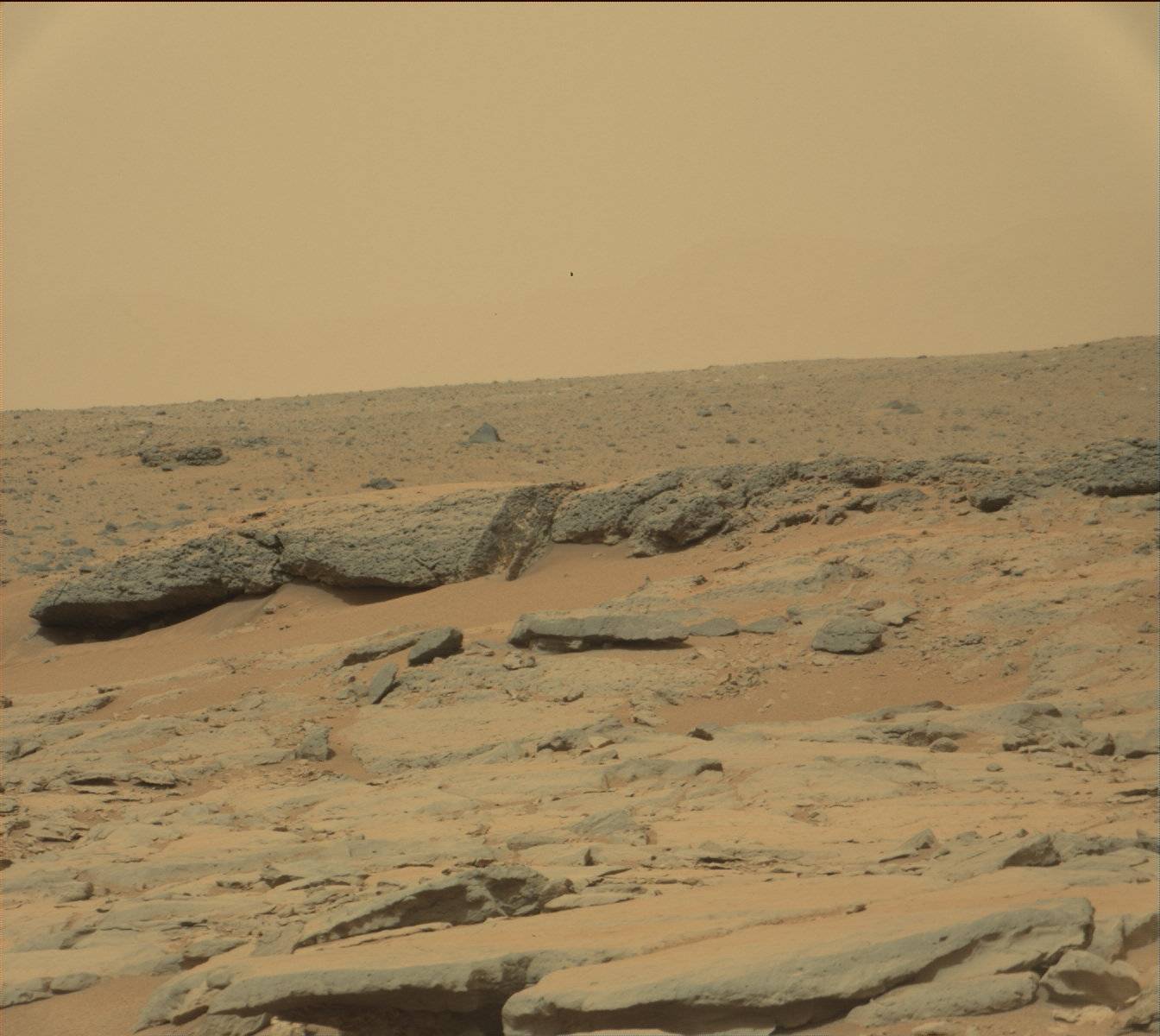
Referring the region, mission Principal Investigator John Grotzinger describes it as a “jackpot environment” for scientific exploration. A depressional area, “Yellowknife Bay” had already been identified as a possible location where free-flowing water many have been present. However, examination over the course of the last couple of weeks reveals that the entire area has been subject to very heavy aqueous activity, including the formation of rich mineral deposits.

Evidence of  water having flowed freely in “Yellowknife Bay”.An image from Curiosity’s Mastcam shows inclined layering known as cross-bedding in an outcrop dubbed “Shaler”. This cross-bedding is indicative of sediment transport in stream flows: currents mold the sediments into small underwater dunes that migrate downstream. When exposed in cross-section, evidence of this migration is preserved as strata that are steeply inclined relative to the horizontal — thus the term “cross-bedding.” The grain sizes here are coarse enough to exclude wind transport (click to enlarge)

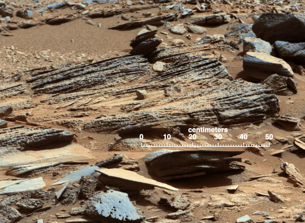
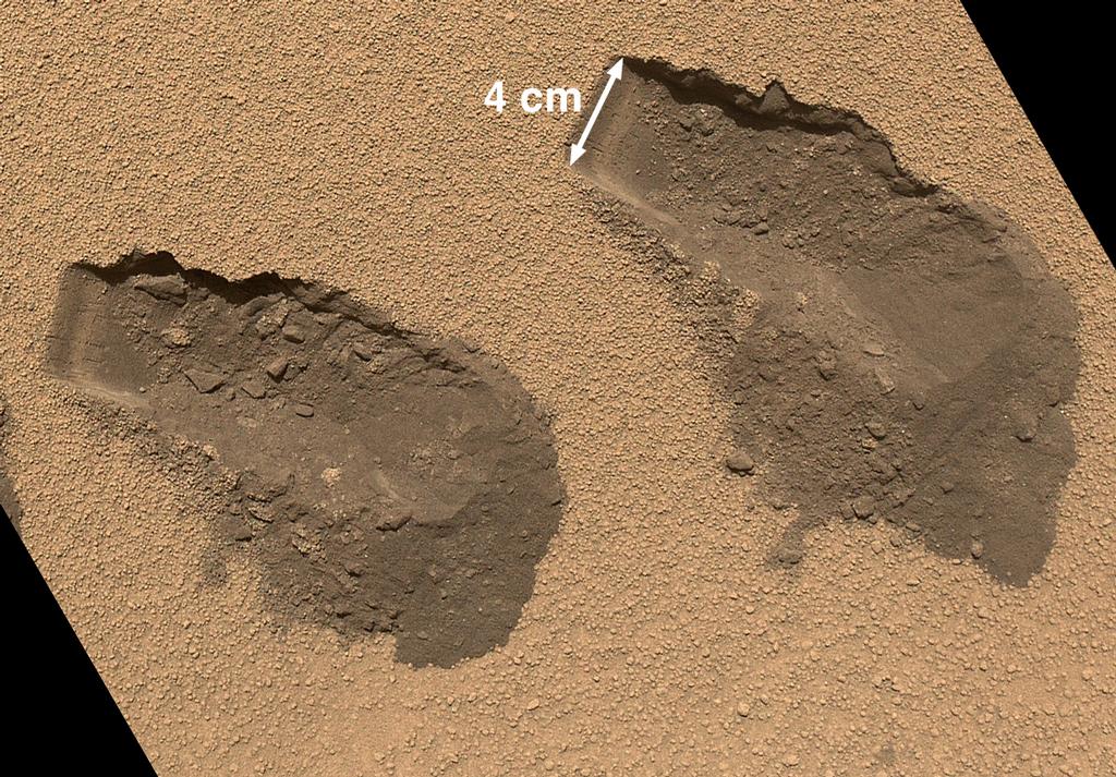
While orbital surveys ahead of the mission showed the area to be a likely location for finding evidence of water action – it is very much an alluvial plain, after all – the MSL team have  nevertheless been surprised at the diversity of rock formations found, and the very strong evidence of what is called “mineral precipitation” – a process whereby minerals which formed elsewhere being carried to the region by strong water currents (estimated to be perhaps as high as a metre per second), before the current slows to a point where the minerals can no longer be held in suspension and so “precipitate out” as deposits on and in the rocks.

The ChemCam laser has been employed in the study of some of the mineral deposits within the rocks, revealing they contain Hydrated Calcium Sulfates. On Earth, calcium sulfates like gypsum form frequently in veins when relatively dilute fluid circulates at low to moderate temperatures – in other words, water must have once been circulating through the veins in the rocks in order for these minerals, thought to be gypsum or bassanite, to form.

Please use the page numbers below to continue reading this article

Getting set for a drill down into history

CuriosityCuriosity spent the Christmas and New Year period parked in at “Grandma’s House”, a point of geological interest within the “Yellowknife Bay” area of Gale Crater.  With most of the mission team on Earth taking a break over the holiday period, the rover was left largely to its own devices for an 11-day period. This was not only to accommodate the holidays – which saw some NASA / JPL personnel available to step-in should problems be reported – but also to test the rover’s capabilities for upcoming times when it will be completely out-of-communication with Earth.

The times occur during what is known as periods of solar conjunction, which place Earth and Mars on opposite sides of the Sun. During these periods, which can last some two weeks, communications between Earth and vehicles operating on and around Mars are severely disrupted / curtailed due to interference from the Sun.

Solar conjunction: when Earth (r) is on the opposite side of the Sun or another solar system body - in this case, Mars (l)
Solar conjunction: when Earth (r) is on the opposite side of the Sun or another solar system body – in this case, Mars (l)

As a result, vehicles like Curiosity need to have sufficient instructions stored onboard so that they can continue to operate when it is impossible to upload commands on a daily basis, and to ensure their safety systems / processes are properly primed should anything untoward happen and the vehicle is forced to “safe” itself. The Christmas / New Year break was an ideal time for NASA / JPL to test Curiosity’s ability to operate in an effectively autonomous mode in preparation for the first such conjunction, which will occur in April 2013.

In all, two days were spent uploading 11 days’ worth of instructions and mission activities to the rover. These included instructions for Curiosity to record panoramic images of its surroundings and also images of potential targets of interest for the next phase of the mission. With “full” mission operations resuming on the 3rd January, 2013, mission project manager Richard Cook of JPL said of Curiosity’s first extended period of autonomous operation, “We had no surprises over the holidays,” before turning attention to the next immediate step in the mission: to commission the rover’s onboard drill.

A raw image captured by Curiosity’s Mastcam on Sol 136 (December 23rd, 2012) looking out over “Yellowknife Bay”. The image has not been white balanced and thus shows the scene as it would ben seen by the human eye in local lighting / conditions (click to enlarge)

Continue reading “Getting set for a drill down into history”

Christmas at grandma’s & preparing for when you can’t phone home

CuriosityIt has continued to be a little quiet, news-wise where the Mars Science Laboratory (MSL) mission is concerned. As mentioned last time, this is hardly surprising, given the way the news cycle works.

Since my last report, Curiosity has started exploring the depression slight to east of Glenelg which has been given the name “Yellowknife Bay”. This is an area of one of three terrain types which come together within Glenelg itself (one of the other two being the terrain the rover has been traversing since its arrival on Mars at the start of August). It is very different in nature to the terrain found around the landing site at Bradbury Landing, and an initial approach to the area was halted on December 10th (Sol 123) when sensors on the rover reported conflicting angles of tilt to the main computer. While Curiosity was in no danger of toppling over, an on-board safety protocol was initiated which halted the rover’s planned drive while it ‘phoned home for advice.

Curiosity’s progress (click to enlarge)

Confident the rover was in no danger, mission managers instructed Curiosity to resume its drive on Sol 124, which saw it complete the planned traverse from the 10th December and pass over a 1/2-metre lip into the depression proper. On Sol 125 (December 12th) Curiosity covered a further 26.1 metres (86 ft), moving well into the depression, surveying a number of rocks along the way with both the Mastcam system and ChemCam in a series of remote sensing exercises.

A prime mission goal for Curiosity’s explorations of Yellowknife Bay is the identification of a suitable candidate for the first use of the percussive drill – the last major item of equipment on the rover’s robot arm turret to be commissioned. As such, the rock surveys were part of this work.

Close-up of Curiosity's drill in action (simulation) - the drill should be deployed for the first time early in the New Year, 2013
Close-up of Curiosity’s drill in action (simulation) – the drill should be deployed for the first time early in the New Year, 2013

The drill will be used to collect samples from inside Martian rocks, something never before attempted on Mars. The powdered sample, once obtained, will be passed through the CHIMRA system which is also used to sieve and sort samples obtained by the soil scoop, before being passed to CheMin and SAM aboard the rover for detailed analysis.

On December 14th, Curiosity completed a drive of 32.8 metres (108 ft) to reach two “targets of interest” which mission planners dubbed “Costello” and “Flaherty”. Each of these rocks was subjected to study using the Alpha Particle X-Ray Spectrometer (APXS) and MAHLI, the Mars Hand Lens Imager, both mounted on the rover’s robot arm turret. These studies lasted a couple of days, during which Curiosity carried out various REMS monitoring activities as well; then on Sol 130 a further drive of just 5.6 metres (18 ft).

Continue reading “Christmas at grandma’s & preparing for when you can’t phone home”

On the edge of a (yellow)knife

Curiosity
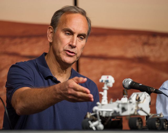
As generally happens in long-duration space missions, media attention around Curiosity is waning somewhat as the initial gee-whiz factor wears off and the reality of this potentially being a multi-year mission kicks-in and journos start seeking the next gee-whiz headline. As such, the next time Curiosity really hits the headlines, it’ll likely be for one of three reasons: Something Big has happened science-wise; someone has sensationalised upcoming news a-la Joe Palca; or something on the rover has broken. Indeed, a combination of the second two points is already occurring.

But that’s the nature of news cycles. Once the glamour and the wow has worn off, the interest fades and it is only the sensational (or titillating, in some circumstances) which does get reported. It’s why news and feature editors aren’t really interested in hearing about Second Life (“Second Life? You show me a million people a day are signing-up to it, and I’ll run it. Otherwise all you have is yesterday’s news…”).

In the meantime, Curiosity rolls onward towards “Mount Sharp” is what is still only the prelude to its mission on Mars; a prelude which has already yielded remarkable results in just four short months.

Choreographing a Self-portrait

Ever tried to take a picture of yourself? It’s not easy unless you have some frame of reference to guide you – such as an LED screen on your camera / device on which you can actually see how the shot will look prior to taking it. “Great photo, other than the fluffy bunny apparently trying to climb out of your right ear….”

Imagine how much harder it is to do the same remotely over a distance of more than 90 million kilometres (56 million miles). Yet on Sols 84 and 85 (October 31st / November 1st), that’s precisely what Curiosity did, producing a beautiful high-resolution composite image of itself quickly seen the world over.

The big picture: the full extent of Curiosity’s self-portrait captured between October 31st and November 1st. Note the absence of the robot arm in the image, a result of the picture having been put together from images captured by the Mars Hand Lens Imager (MAHLI) mounted on the arm itself, and the arm being positioned out-of-shot in the images / image portions used to create the mosaic (click to enlarge)

The portrait was put together using dozens of high-resolution images captured using the rover’s Mars Hand Lens Imager (MAHLI), located on the turret at the end of Curiosity’s robot arm in a complex series of manoeuvres. But this wasn’t just a case of point-and-click and hope for the best, then go back and try again. Everything had to be planned well in advance earth-side prior to the rover being told to “get on with it”.

But how do you choreograph something over a distance of 90 million kilometres? Phoning home in brief bursts isn’t going to cut it.

Enter Curiosity’s earth-based “twin”, another of the unsung heroes of the MSL mission. Located at the Jet Propulsion Laboratory in Pasadena, California, the VSTB – Vehicle System Test Bed – is the closest thing NASA have to a “second Curiosity“. It comprises all of Curiosity’s major elements – wheels, chassis, bodywork, drive system, electrical system, mast, camera systems, robot arm, turret systems and so on (all minus the nuclear “battery” powering the real MSL rover) – and it forms a critical element of the overall mission. Using the VSTB engineers can troubleshoot any issues which may occur with the rover’s major systems and mission planners can map complex manoeuvres using things like the robot arm, allowing them to build up a precise set of commands required to perform a given task prior to uploading them to Curiosity on Mars and allowing the rover to carry them out.

The Vehicle System Test Bed, Curiosity’s Earth-bound “stunt double”, used for a range of mission planning activities, shown here in a self-portrait put together to allow mission planners obtain the precise commands needed to allow Curiosity to do exactly the same thing over 90 million kilometres away (click to enlarge)

Please use the page numbers below to continue reading this article

The end of speculation, the beginning of something new

CuriosityOn Monday 3rd December, NASA provided an update on the Mars Science Laboratory’s (MSL) most recent findings in analysing soil samples gathered from the “Rocknest” region of Gale Crater on Mars.

As reported last time, the findings had been the subject of intense media speculation for almost two weeks after radio reporter Joe Palca over-egged relatively innocent comments made by MSL’s Principal Investigator John Grotzinger concerning the initial soil analysis results received from the SAm Analysis at Mars suite of instruments while the reporter was setting-up and testing his recording equipment for an interview on November 20th. In his subsequent broadcast, Palca was unable to resist couching Grotzinger’s comments in terms of something “earth-shaking” having been found.

Had Curiosity found evidence of organics in just its first soil sample? Had Curiosity found evidence of past life on Mars? Had Curiosity found life on Mars? The questions and speculation seemed to grow with each passing day. Not even a firm, but low-key statement put out by NASA on the 26th November stopped the speculation growing, forcing them to issue a very strongly worded press release on the matter on November 29th and use Curiosity’s “Twitter personality” team to underline the fact that no organics had been found in a series of tweets the same day.

MSL Principal Investigator John Grotzinger

The rumour-mill had been fuelled in part by the fact that NASA planned to give an update on the first four months of the MSL mission at the fall meeting of the American Geophysical Union (AGU), with some believing the space agency would only do so if they had something “major” to announce about the mission. The fact that NASA has regularly attended AGU meetings in the past to provide updates on missions  – including Curiosity’s predecessors, the Mars Exploration Rovers, seemed to escape people’s notice…

And the Findings Are….

An update was given at the AGU on Monday December 3rd, with NASA summarising them in a press briefing for those unable to attend the live meeting. While the results are not “earth-shaking”, they are nevertheless interesting.

Edgett-2-pia16469-br2
A Mars Hand Lens Imager (MAHLI) image of the third (left) and fourth (right) trenches made by Curiosity’s 4 cm-wide scoop. Acquired on Sol 84 (Oct. 31, 2012) the image shows details of the properties of the “Rocknest” sand dune. The upper surface is covered by crust of coarse sand grains approx. 0.5 to 1.5 mm, mantled with fine dust, giving it a light brown/red colour. The crust is about 0.5 cm thick and beneath it is finer, darker sand. The left end of each trough wall shows alternating light and dark bands, indicating that the sand inside the drift is not completely uniform. This might be due to different amounts of infiltrated dust, chemical alteration or deposition of sands of slightly different colour.

Please use the page numbers below to continue reading this article

Of thanksgiving drives and the rumour mill

It’s been a curious week or so where Curiosity is concerned, primarily because of speculation over exactly what SAM may – or may not – have found. In my last update, I covered recent activities with MSL, including the fact that a soil sample had, after weeks of preparation, been delivered to the SAM (Sample Analysis at Mars) suite of instruments. Since then, the media has been agog with rumours that something “earth-shaking” may have been discovered.

But before I get to that, a quick catch-up on activities since my last report.

On the 16th November, the rover’s 100th Sol on Mars, Curiosity finally made a move from the small sand dune it had been studying in an area dubbed Rocknest. It didn’t actually initially go very far – just 1.9 metres (6.2 feet), but it was enough for the rover to be able to deploy its robot arm in what was called a “touch and go” examination of an interesting rock, initially dubbed “Rocknest 3”, using the Alpha Particle X-Ray Spectrometer (APXS) in two 10-minute examinations of the rock in order to gain readings of data about its chemical elements. The rock had previously been the subject of examination by Curiosity when on Sol 57 (October 3rd) the ChemCam laser system and telescope were used to gather initial data.

An image of “Rocknest 3” captures by the micro-imager camera of ChemCam and showing the laser hit points created during initial analysis of the rock. In all some 15,000 laser pulses were directed at the rock, which was some 3.7 metres (12 feet) from the laser system. This image and the associated data wer subsequently downlinked to Earth using Europe’s Mars Express orbiter in order to demonstrate the ability to use that vehicle as a back-up communications relay should Mars Odyssey or the Mars Reconnaissance Orbiter be unavailable.

Afterwards, the arm was stowed and Curiosity travelled a further 25 metres (83 feet) eastward to a further target called “Point Lake”, which overlooks a lower-lying area leading into the area dubbed Glenelg.

“We have done touches before, and we’ve done goes before, but this is our first ‘touch-and-go’ on the same day,” said Curiosity Mission Manager Michael Watkins of NASA’s Jet Propulsion Laboratory, Pasadena, Calif. “It is a good sign that the rover team is getting comfortable with more complex operational planning, which will serve us well in the weeks ahead.”

Prior to departing Rocknest, Curiosity took a set of panoramic images of the area ahead of it, including “Point Lake”, where work will commence in finding a suitable target for the rover’s drill mechanism on the robot arm’s turret for the very first time.

This panorama is a mosaic of images taken by the Mast Camera (Mastcam) on the NASA Mars rover Curiosity while the rover was working at a site called “Rocknest” in October and November 2012. The centre of the scene, looking eastward, includes the “Point Lake” area, where the rover spent the Thanksgiving period capturing further images for analysis in preparation for the final leg of the journey to Glenelg.

Please use the page number below to continue reading this article