Of methane and waypoints

ICuriosityn what has been something of a surprise to scientists around the world, findings from the Mars Science Laboratory (MSL) suggest the amounts of methane present in the Martian atmosphere, at least at near-ground levels, are at best negligible.

While it can be produced by non-organic, as well as organic means, methane has long been regarded as one of the tell-tale signs that life may have once existed on Mars – or even may still exist somewhere beneath the planet’s arid surface.

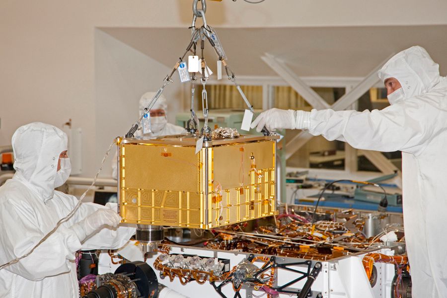
Using the highly sensitive Tunable Laser Spectrometer, a part of the Sample Analysis at Mars (SAM) science package aboard Curiosity, MSL has subjected six samples of the atmosphere gathered between October 2012 and June 2013 to analysis  – and failed to detect any signs of methane, trace or otherwise.

The Tunable Laser Spectrometer (TLS) shoots laser beams into a measurement chamber filled with Martian atmosphere. By measuring the light absorption at specific wavelengths, the TLS can measure concentrations of gases, including methane, as well as different isotopes of the gases. In this images of a TLS demonstrator, visible lasers are being used to show how the lasers bounce between the mirrors in the measurement chamber. The actual TLS uses infrared lasers.

This has come as a surprise because previous data gathered by US and international scientists via a range of means have suggested that while not present in abundant amounts, methane is very detectable within the Martian atmosphere. So much so that some of those involved in MSL were extremely confident ahead of the mission that the rover would find clear evidence of the gas as a part of its analysis of atmospheric samples.

Europe’s Mars Express, for example, which started on-orbit operations in 2004, and is still functioning today, found strong evidence for methane within the atmosphere of Mars. Not long after this, NASA’s own Mars Global Surveyor (the precursor to the Mars Reconnaissance Orbiter which relays communications between Curiosity and Earth today), which operated in Mars orbit from September 1997 through to November 2006, also detected methane to a point where scientists where able to map its annual ebb and flow.

Map showing the relative concentrations of methane on Mars, 2004. Yellow indicates the highest concentrations of the gas, which coincide with the upland regions of the northern hemisphere, including the once volcanic regions of the Tharsis Bulge and Elysium

On Earth, methane (CH4) is largely the by-product of two distinct activities: geological, such as through volcanic eruptions  – and Mars certainly has a fair few volcanoes, some of the largest in the solar system in fact; and via organic means. Either way, it tends to break down relatively quickly, so even trace amounts of it within Mars’ atmosphere suggest that it is being renewed somehow. Given that an erupting volcano on Mars is a tad hard to miss (see “some of the largest in the solar system”, above), a renewable source of methane has seen as evidence that either there is some as yet unknown chemical reaction going-on to create methane – or it may just be the result of outgassing from Martian microbes.

Possible sources of methane on Mars

The amount of methane in the Martian atmosphere has never been particularly high; even the best analyses over the years have placed it at a peak of around 70 parts per billion, However, the TLS on Curiosity is a very sensitive piece of equipment. So sensitive that any trace amounts of methane in the Martian atmosphere must be below 1.3 parts per billion (around 10,000 tonnes in total throughout the atmosphere) in order for the TLS to miss it.

Responding to the findings, published on Thursday September 19th in Science Express, NASA has pointed out that the chances of future missions finding evidence of microbial life on Mars, past or present, aren’t entirely dashed. “This important result will help direct our efforts to examine the possibility of life on Mars,” Michael Meyer, NASA’s lead scientist for Mars exploration, said in a press release accompanying the report’s publication. “It reduces the probability of current methane-producing Martian microbes, but this addresses only one type of microbial metabolism. As we know, there are many types of terrestrial microbes that don’t generate methane.”

TLS forms a part of the Sample Analysis at Mars package of instruments, one of the most comprehensive and compact science experiments sent into space, shown here being installed into Curiosity

Continue reading “Of methane and waypoints”

Crossing the unknown

CuriosityOn Sol 376, August 27th 2013, Curiosity  achieved another mission milestone: the first use of the autonomous driving capabilities to fully drive itself through a potentially hazardous zone.

The autonomous navigation software – autonav – was uploaded to the rover following the April 2013 period of solar conjunction. It is designed to allow the rover to decide how best to handle driving safely on Mars, rather than constantly relying on command updates from Earth – something which can severely limit the rover’s daily progress if there are significant obstacles in the rover’s path or if the mission team want the rover to drive beyond the limits of what the  Navcams can see at the start of a day’s drive without routes having to be constantly re-plotted from Earth.

The drive of August 27th saw Curiosity successfully use autonomous navigation to cross ground that could not be confirmed safe before the start of the drive. While the drive team were able to establish a “bounding box” in which the rover was expected to keep during the day’s progress, a significant depression in the ground some 10 metres (33 feet) across could not be imaged in advance of the rover’s arrival, and so autonav was enabled in order for the rover to make its own way through the depression.

“We could see the area before the dip, and we told the rover where to drive on that part. We could see the ground on the other side, where we designated a point for the rover to end the drive, but Curiosity figured out for herself how to drive the uncharted part in between,” said JPL’s John Wright, a rover driver.

The road ahead: a mosaic panorama captured by Curiosity's Navcams after the Sol 376 traverse. The rise on the left of the image is part of "Mount Sharp"; the most distance highlands are the walls of Gale Crater
The road ahead: a mosaic panorama captured by Curiosity’s Navcams after the Sol 376 traverse. The rise on the left of the image is part of “Mount Sharp”; the more distance highlands to the right are the walls of Gale Crater (click to enlarge)

Crossing the depression required the rover to take several sets of stereo images of the terrain, compare them, determine potential routes to reach a the designated way-point, and then select the safest course to take.

While autonav has been used a number of times already in recent weeks, these have always been under controlled conditions and limited in scope. The Sol 376 traverse marks the first time Curiosity has been left entirely to its own devices to cross what has essentially been unknown ground for the mission team.  The drive means that the rover has now travelled about 1.39 kilometres (0.86 miles) since departing “Glenelg” and “Yellowknife Bay” early in July, and has a little over 7 kilometres (4.46 miles) to go before reaching the lower slopes of “Mount Sharp”.

Rapid Transit Route

To assist the rover’s progress, NASA have marked-out a “rapid transit route” using images from the High Resolution Imaging Science Experiment (HiRISE) camera aboard the orbiting Mars Reconnaissance Orbiter. This plots a rough course for the rover from “Glenelg” to the designated entry-point into the lower slopes of “Mount Sharp”, and which runs alongside a dune field which lays between the terrain the rover is on and the slopes of the mound itself.  Several potential waypoints have been identified along the route where the rover may stop for a few days at a time to allow further science work to be carried out.

The “Aeolis Mons expressway”: NASA’s “rapid transit” route Curiosity is following in order to reach the lower slopes of “Mount Sharp”, with potential science waypoints marked. The mound is towards the bottom of the image and the black diagonal band is a dune field which runs along the foot of the hill

Continue reading “Crossing the unknown”

One year on, one kilometre travelled, a mission goal achieved

CuriosityOn the 5th/6th August 2012, an aerodynamic capsule large enough to hold compact family car separated from its cruise stage “life support” system after an eight-month journey from Earth and blazed a trail across the high, thin atmosphere of Mars at the start of what those responsible for it had dubbed the “seven minutes of terror”.

Inside that aeroshell was the most advanced remote science system yet sent into interplanetary space by humankind, 80 kg (around 180 pounds) of science equipment packaged neatly into a rover vehicle itself just under a tonne in weight and powered by a “nuclear battery”. If all went well, those “seven minutes of terror” would end with NASA’s latest and most ambitious mission to the planet Mars safely on the surface of that world. If things went badly, a lot of people would be looking at almost a decade of their endeavours smashed to pieces along with the rover.

MSL-systems
The Mars Science laboratory spacecraft systems: (1) Cruise Stage; (2) aeroshell back shell; (3) Skycrane; (4) Curiosity rover; (5) Heat shield; (6) Parachute system

Of course, things did go well. The rover, dubbed “Curiosity” by an 11-year-old girl called Clara Ma following a nationwide competition held by NASA in 2008, landed safely and so wrote the first lines in what have been a remarkable year of operations on Mars.

Just over half-way through its primary phase of a full Martian year (about 1.8 times longer than a year here on Earth), Curiosity and the Mars Science Laboratory mission has already achieved a major part of its mission goal: to discover if Mars demonstrates any evidence for once having the kind of environment conducive to the formation of life.

And with the mission indefinitely extended beyond that primary mission phase (the rover’s RTG power system should be able to power it for around 14 years or so, so only the unforeseen accident or failure might now curtail the mission in less than that time frame), the opportunities for Curiosity to write many more new chapters in our understanding of Mars are considerable.

Over the last year, as an aside to my reporting on Second Life and virtual worlds (as well as one or two other things!), I’ve tried to provide a steady narrative on the mission in these pages (with more than a little help from NASA JPL!), I’ve done so as space exploration is of interest to me for assorted reasons, and because the reports seem to have resonated with some of you who regular read this blog (and thank you on both counts, for  reading the blog and the reports!).

Obviously, as with all things fresh and exciting, coverage of the mission in the early months was easy; such was the media interest in the story that information was flooding out of NASA’s Jet Propulsion Laboratory as the rover went through its month-long post-landing commissioning activities, and then started its first hesitant operations on the dusty, wind-swept floor of Gale Crater.

With the passing of a year, media interest has moved on. As a result, the science and engineering teams responsible for the mission have been able to focus more on their day-to-day work, and the updates coming out of NASA have slowed somewhat.

Curiosity is now well into the eight kilometre (five miles) drive to its next target: the lower slopes of Aeolis Mons (“Mount Sharp”), the mound surrounding the central peak of the crater. In the six weeks since departing “Glenelg” and “Yellowknife Bay”, where it had been engaged in science activities for almost six months, the rover has travelled almost a full kilometre.

Traversing Mars: from the arrival point of “Bradbury Landing” to Curiosity’s position on Sol 365 (August 16th, 2013) this map traces a remarkable journey (click to enlarge)

That the rover is making “rapid” progress is down to two things: there are no planned science objectives for this phase of the mission (unless Curiosity happens across something completely unexpected and interesting), and the rover’s drive team have gained considerable confidence in the upgraded autonomous driving capability I reported on last time around.

Curiosity’s primary mission is not to find direct evidence of life, past or present, on Mars, but rather to see if ancient Mars once had the right conditions present in or on it for life to have possibly arisen. Gale Crater was chosen as a landing site with this in mind; since well before the mission it has been the subject of study from orbit by the likes of NASA’s Mars Odyssey and Mars Reconnaissance Orbiter and Europe’s Mars Express. That it has surface features which appear consistent with free-flowing water once having existed on Mars have been well-known, including the fact that “Mount Sharp” itself shows signs of having been in part formed from water-borne sedimentary deposits (it is thought Gale Crater may have once been filled with a lake). As such, it was anticipated that the rover would find evidence of free-flowing water having once been present within the 194-kilometre wide crater.

What wasn’t expected was the overwhelming evidence the rover came across in terms not only of sedimentary deposits, but also in what look to be ancient river beds sitting exposed on the floor of the crater, and rock and soil samples the on-board science systems have found to contain mineral and chemical elements and traces which point to a wet history in this part of Mars. What has been more exciting is that the mix of elements and minerals suggest the environment in the crater was once very benign towards life, so much so, that John Grotzinger, the mission’s Principal Investigator, was given to comment:

Continue reading “One year on, one kilometre travelled, a mission goal achieved”

One kilometre and counting

CuriosityOn July 16th, NASA’s Mars Science Laboratory rover Curiosity passed the one kilometre mark (0.62 miles) on its travels around Gale Crater. The milestone came eleven months after the one-tonne rover arrived on the surface of Mars on August 5th 2012.

Since that time, Curiosity has achieved a lot; it has travelled across several terrain types, it has studied the Martian atmosphere and meteorology and probed the ground underneath it for evidence of water. It has taken samples from the surface of Mars and drilled into rocks. It has analysed samples and returned a huge amount of data to Earth, including thousands of colour, black and white and high-resolution images. It has viewed its surrounding in 3D and – most intriguing of all – it has discovered very convincing evidence that Mars was more than likely once an abode suitable for the evolution of basic life.

Coincidentally, July 17th 2013 marked the half-way point for the rover’s prime mission of one Martian year (687 day or 1.88 Earth years). As the rover’s power system has a potential operating life of fourteen years, it is more than certain that, barring any accidents or major systems failure in the interim, operations will be extended well beyond the prime mission time frame. In this, Curiosity will not be alone; half a world away, NASA’s rarely mentioned Opportunity rover is fast approaching the tenth anniversary of what was originally a 90 day mission.

Curiosity’s progress: from landing through to its position on Sol 344 (July 24th, 2013) The numbered dots along the line indicate the Sol number of each drive. North is up. The scale bar is 200m (656 ft). From Sol 343 to Sol 344  Curiosity drove a straight line distance of about 68.82m (225.79 ft)

More Atmospheric Analysis

As mentioned above, Curiosity has been studying the Martian atmosphere using the Sample Analysis at Mars (SAM) suite of instruments. SAM has more recently been involved in analysing rock and soil samples collected by the rover’s scoop and drilling system, so it is easy to forget that it can also “sniff” and analyse Martian air, which it did for the very first time right back at the start of the mission. Since then, SAM has continued to periodically sample the Martian atmosphere, and it has already helped in further understanding the dynamics of the atmosphere and how it may have been lost over time.

SAM is able to measure the abundances of different gases and different isotopes in the Martian atmosphere. Isotopes are variants of the same chemical element with different atomic weights due to having different numbers of neutrons. In the first set of tests carried out, SAM compared the stable isotope argon-36 with its heavier cousin, argon-38. Since then, SAM has carried out a series of comparative tests on a range of isotope drawn from the Martian atmosphere, including carbon-12 and carbon-13 and both oxygen and hydrogen isotopes.

These tests, carried out using two different instruments within SAM – the mass spectrometer and tuneable laser spectrometer – during the first 16 weeks of the mission, measured virtually identical ratios of carbon-13 to carbon-12, with the ratios again pointing to the lighter isotopes having “bled off” into space from the upper portions of Mars’ atmosphere, rather than a process of the lower atmosphere interacting with the ground.

“Getting the same result with two very different techniques increased our confidence that there’s no unknown systematic error underlying the measurements,” said Chris Webster of NASA’s Jet Propulsion Laboratory. “The accuracy in these new measurements improves the basis for understanding the atmosphere’s history.”

The rate at which Mars is currently losing its atmosphere cannot be measured by Curiosity or any of the vehicles currently operating in orbit around Mars.  This will be the work of the Mars Atmosphere and Volatile Evolution (MAVEN) mission, which is due to be launched in November 2013.

Gullies on Mars: Water or Dry Ice?

While it is accepted that Mars’ atmosphere was once dense enough to support liquid water – Curiosity itself has found unmistakable evidence for free-flowing water to have once been present in the crater – evidence has also put forward to suggest that some features imaged on Mars and associated with possible water action may have been the result of another process entirely, as explained in this interesting NASA video.

Continue reading “One kilometre and counting”

The long trek and looking to the next decade

CuriosityCuriosity has started on the long trek to Aeolis Mons, which NASA unofficially refers to as “Mount Sharp”. With some eight kilometres (5 miles) between the rover an its initial destination among the lower slopes of the mound, the drive is liable to take several months to complete. Nevertheless, the drive marks the start of the core part of the mission.

The journey started on July 4th, when Curiosity departed the sedimentary rock target NASA had dubbed “Shaler” within the “Glenelg” region of Gale Crater between “Yellowknife Bay”, where the rover had been carrying out drilling and other tasks, and the landing zone at Bradbury Landing. “Shaler” had actually been passed b the rover on its way to “Yellowknife Bay” and had, along with another location in “Glenelg” which had been dubbed “Point Lake”, been identified as a “target of interest” for the rover as it backtracked through “Glenelg” in order to start the long trip to “Mount Sharp”.

“Point Lake” became a target of interest to MSL scientists as Curiosity passed it while en route to “Yellowknife Bay”, and remained of interest even as the rover carried out various science operations in “Yellowknife Bay”. This image was captured by the Mastcam telephoto lens on  Sol193 (February 20th, 2013) when Curiosity was engaged in the “John Klein” rock drilling operations. It show the cliff-like face of the outcrop. At the time the image was captured, it was unclear if the outcrop might be sedimentary or volcanic in origin. This image has been white-balanced so the rocks appear as they would under Earth-type atmospheric and lighting conditions

Point Lake first caught the interest of Curiosity’s science team in October and November of 2012. It caught the attention of mission scientists for two reasons: it forms a small cliff, and geologists love cliffs because they offer a sense of how a rock unit differs from bottom to top; plus images captured by the rover as it passed relatively close to the outcrop while en route to “Yellowknife Bay” revealed it to be full of holes. Why holes form in rocks can be due to diverse mechanisms, and Identifying which mechanism in particular is responsible can provide a greater understanding about the rock and its history.

The rover returned to “Point Lake” on Sol 301 / 302 (June 11th and 12th, 2013) and captured a further series of images using the Mastcam systems, some of which were then put together to create a mosaic.

A 20-shot mosaic of “Point Lake” captured by the telephoto lens of Curiosity’s Mastcam system on Sol 302 (June 12th, 2013) (click to see the full size image)

The mosaic clearly shows that the upper and lower portions of the outcrop differ in composition, with the upper part having more holes while being more resistant to weathering. The holes themselves range in size from about that of a garden pea through to some larger than a golf ball’s diameter. Some additionally have raised rims, as if the material immediately around a hole is slightly more resistant than material farther from the hole. A number of smaller rock fragments towards the right-hand end of the mosaic look as if they might have fallen out of some of the holes, and some of these exhibit colour banding suggestive of material which could have coated the interior of a hole.

The science tem are still studying the images captured by the Mastcam system and by the rover’s Mars Hand Lens Imager (MAHLI), mounted on the turret at the end of Curiosity’s robot arm. Taken from a distance of just 4cm, the MAHLI images reveal pebble-like deposits within many of the holes covering “Point Lake”, and which have made the identification of the processes responsible for forming the holes somewhat harder, as both sedimentary and igneous processes could account for the “pebbles”.

The Mars Hand Lens Imager (MAHLI) mounted on Curiosity’s robot arm captured this close-up of the holes in the “Point Lake” rock outcrop, in which the “pebbles” cxan be seen to be nestling

Following the stop at “Point Lake”, Curiosity continued retracing its route back through “Glenelg”, reaching the vicinity of “Shaler” around Sol 313, where it remained for several days taking further images and manoeuvring in the area immediately adjacent to the rock formation. Then on July 4th, the rover started on the drive to “Mount Sharp” in earnest, initially travelling  back towards “Rocknest”, which it visited in September 2012, prior to skirting around it in a drive of some 36 metres (118 feet) between July 5th and July 8th (Sol 327).

Continue reading “The long trek and looking to the next decade”

One billion pixels, two remarkable images

CuriosityThe news coming out of NASA about the Mars Science Laboratory has slowed somewhat following the period of solar conjunction which formed a natural break in operations during April.

As I’ve mentioned before, there is nothing surprising in this – the news operates in cycles, and NASA is only too aware that trying to keep Curiosity as a headline item isn’t going to stick. Better than to keep the mission going at both ends of the divide – Earth and Mars – as report to the media when there is significant news to report.

And it is fair to say that mission personnel have a lot of data to analyse. Not only are there the results of the recent sample gathering from the “Cumberland” rock to comb through, there is still a wealth of data covering the rover’s first ten months on Mars which is growing daily as a part of its automatic monitoring of its environment as well as all the data gathered during the flight from Earth to Mars which has already renewed concerns about the long-term health of humans attempting a mission to Mars, as I reported last time around.

In the meantime, Curiosity’s extraordinary ability to capture images and video of the surface of Mars has come in for attention.

The primary reason for this the release of the “billion pixel image” of the “Rocknest” region of Gale Crater, where Curiosity spent some time in 2012 after departing its landing site at Bradbury Landing, and was the location where the rover’s scoop was first tested and samples of Martian soil were first analysed by the rover.

Actually comprising some 1.3 billion pixels, the image brings together over 900 images primarily captured by the rover’s Mastcam telephoto lens (some 850 in all), although some wide-angle shots from the second Mastcam lens (21) are also included, as are 25 frames captured by the mast-mounted black-and-white Navcams. Together, the images form a full-circle view of Gale Crater as seen from “Rocknest”, providing a unique insight into the environment.

Curiosity's remote sensing mast, seen fully deployed prior to launch in 2011
The top of Curiosity’s mast, highlighting the colour Mastcam lenses and the black-and-white Navcam lenses

The finished product has been made available on a NASA website in two formats, both of which allow you to study the surface of Mars, panning and zooming freely, or using a selection of pre-selected images to quick zoom in on features of interest. The two versions of the mosaic can be found as follows:

Of the two, the cylindrical view is potentially the more engrossing, offering a greater number of images for zooming-in on surface features as well as a an easier means of panning and zooming freehand.

Continue reading “One billion pixels, two remarkable images”