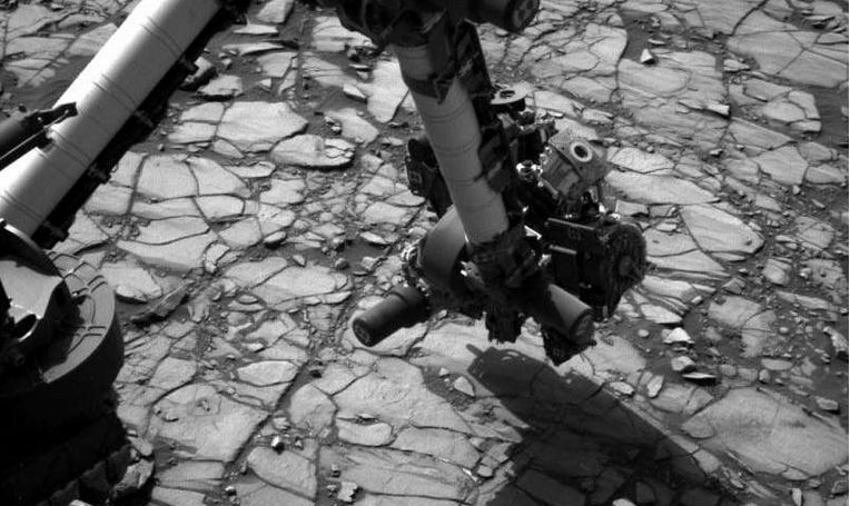
NASA’s Mars Science Laboratory rover, Curiosity, has said “farewell” to “Murray Buttes” in a stunning series of images, as it continues its climb up the slopes of “Mount Sharp”, a massive mound of deposited material located at the central impact peak of Gale Crater.
The mesas of “Murray Buttes” mark the upper extend of the transitional “Murray Formation”, where the material deposited during the earliest centuries of “Mount Sharp’s” formation merge with the rock comprising the crater floor. Curiosity has been passing by the area of the buttes for a little over a month now, carrying out examinations of the rock surface and gathering samples of mudstone for analysis.

Believed to be the eroded remnants of ancient sandstone that originated when winds deposited sand after lower “Mount Sharp” had formed, the buttes rival anything of a similar nature found on Earth in terms of dramatic looks and structure. So much so that while we’re hardly likely to see Clint Eastwood ride his horse around the base of one, they would nevertheless fit neatly into a Sergio Leone western.
Several of the pictures – mosaics of images captured by the rover which have been white-balanced to match typical Earth daylight lighting conditions and then stitched together to offer complete scenes – reveal the deeply layered nature of the sandstone, sandwiched in what is referred to as “cross-bedding”. This indicates that the formations are the result of both wind deposition of material and then wind erosion, further confirming the idea that “Mount Sharp” was initially formed as a formed as a result of Gale Crater once being home to a great lake, before the waters receded and wind action took over.

The images were taken as Curiosity traversed the base of the final butte, where it gathered a final drilling sample on September 9th. On completion of the sample-gathering, the rover will continue farther south and higher up Mount Sharp, leaving these spectacular formations behind.

The Sand Dunes of Shangri-La
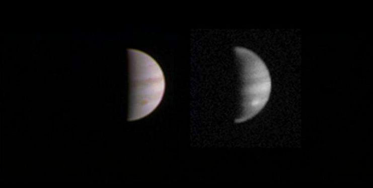
On September 7th, NASA issued a video showing the latest radar images captured by the Cassini probe of the surface of Saturn’s largest moon, mighty Titan. The data was gathered as the probe swept by the huge moon – which is blanketed by a thick atmosphere and is known to have lakes and rivers of liquid hydrocarbons on its surface – at a distance of some 976 km (607 mi) on July 25th, 2016 – one of the closest passes over the moon the vehicle has ever made.
Because of the moon’s thick atmosphere, conventional camera systems cannot be used to probe Titan’s mysteries, so Cassini uses a radar system to “map” surface features in black-and-white. Of particular interest to mission scientists during the July 25th flyby was a dark patch along Titan’s equator, previously images by the radar system at much greater distances and dubbed “Shangri-La”. And area which revealed itself to be – in part – a region of linear dunes, mostly likely comprised of grains derived from hydrocarbons that have settled out of Titan’s atmosphere, and which have been sculpted by Titan’s surface winds. Scientists can use the dunes to learn about winds, the sands they’re composed of, and highs and lows in the landscape.
Also captured by the radar is an arena dubbed “Xanadu annex”, believed to be an out-thrust of chaotic terrain from a region dubbed “Xanadu” just to the north of “Shangri-La”. First imaged by the Hubble Space Telescope in 1994, just before the Cassini / Huygens mission was launched, “Xanadu” and its annex are thought to be remnants of the moon’s icy crust before it was covered by organic sediments from the atmosphere.
OSIRIS-REx Lifts-off as an Asteroid Sweeps By Earth
On Thursday, September 8th, NASA successfully launched OSIRIS-REx on a 7-year trek to reach asteroid Bennu, where it will gather surface samples and return them to Earth for analysis. The mission, which I previewed in my last Space Sunday report, lifted-off flawlessly from Space Launch Complex 41 at Cape Canaveral Air Force Station at 19:05 EDT, atop its Atlas V booster at the start of a journey which will carry it a total of 7.2 billion kilometres (4.5 billion miles).

Witnessing the launch was principal investigator Dante Lauretta, from the University of Arizona. “I can’t tell you how thrilled I was this evening, thinking of the people who played a part in this,” he said following the launch.
“This represents the hopes and dreams and blood, sweat and tears of thousands of people who have been working on this for years.”
The mission will gather samples from the surface of the asteroid – a remnant from the formation of the solar system – and will also map Bennu’s orbit around the Sun and the influences affecting it.
This is because the asteroid is a near-Earth object (NEO): an asteroid which periodically passes across Earth’s orbit around the Sun, and can come very close to our planet whilst doing so. So close, in fact, that some estimates of Bennu’s future orbit suggest it will collide with Earth towards the end of the next century.
Continue reading “Space Sunday: mesas, dunes NEOs, comets and launches”