The stunning beauty of Ukivok in Second Life

Ukivok; Inara Pey, March 2019, on FlickrUkivok – click any image for full size

Update: in keeping with Serene and Jade’s approach to keeping their region designs open for approximately a month, Ukivok has closed, and SLurls have therefore been removed from this article, as the host region is under private holding. 

As I’ve frequently noted, Serene Footman and Jade Koltai are the creators of what are arguably the most evocative region designs made for Second Life.Each of their creations tends to last for a month, and when available, should not be missed, given they are so beautifully presented and perfectly reflect the physical world locations that form their inspiration.

Each and every design – the majority I have written about in this blog – are exquisite, but I confess there is something about their latest design – Ukivok – that is utterly breathtaking; quite the most visually impressive presentation of a rugged, isolated island, one that offers an informative look at a part of the world perhaps unknown to most.

Ukivok; Inara Pey, March 2019, on FlickrUkivok

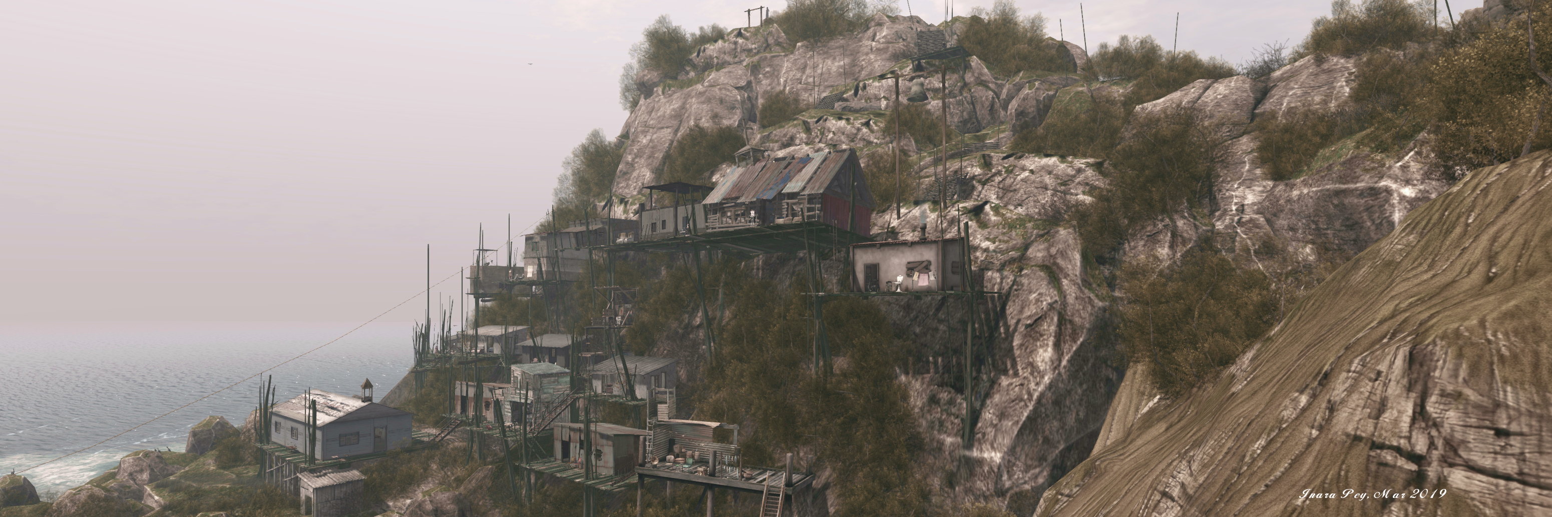
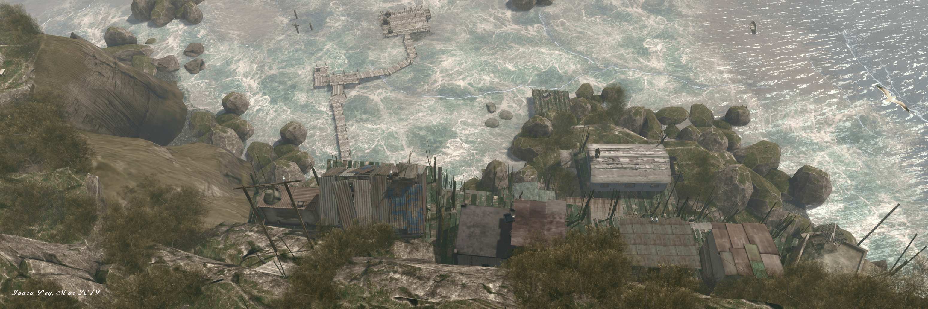
Our new sim is a recreation of the abandoned Alaskan village of Ukivok … Once home to around 200 Iñupiat, the village is located King Island, which is situated in the Bering Sea, around 64km off the Alaskan coast and 145km from Nome.

– Serene Footman, describing Ukivok

The Iñupiat (or Inupiaq) are native Alaskan people whose traditional territory extends from Norton Sound on the Bering Sea to the Canada–United States border. Those who once lived on Ling Island called themselves Aseuluk, “people of the sea” or Ukivokmiut – a name combining the name of the village and “miut”, meaning “people” (and so might translate as “people of Ukivok”).

Ukivok; Inara Pey, March 2019, on FlickrUkivok

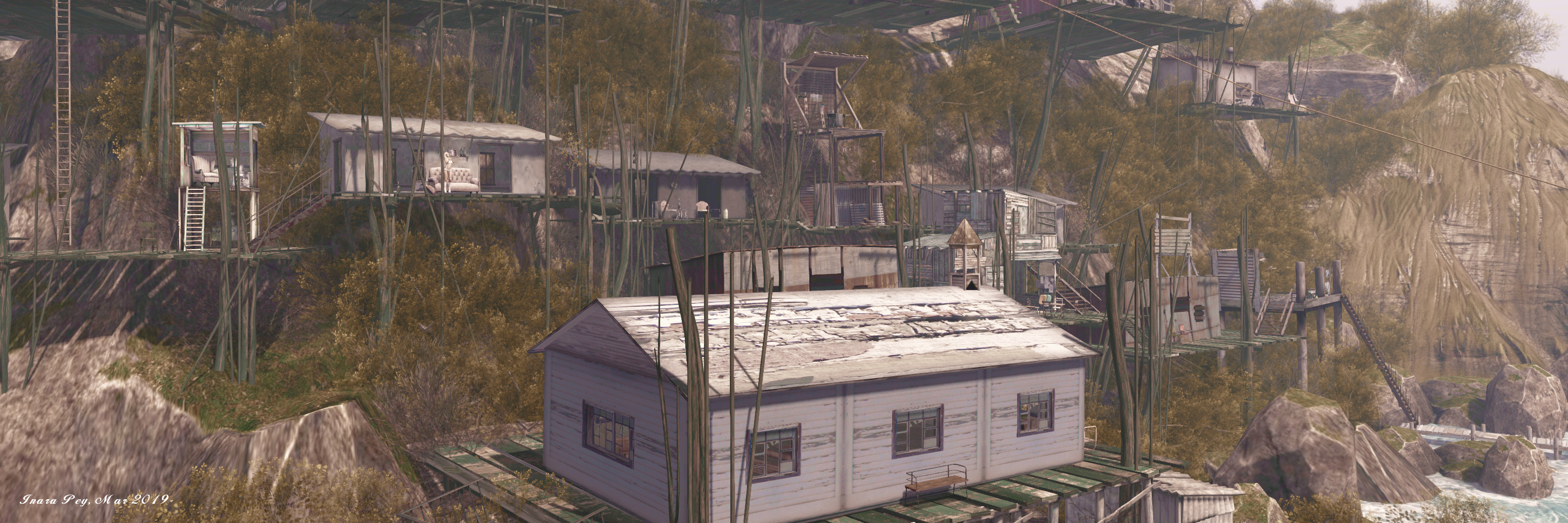
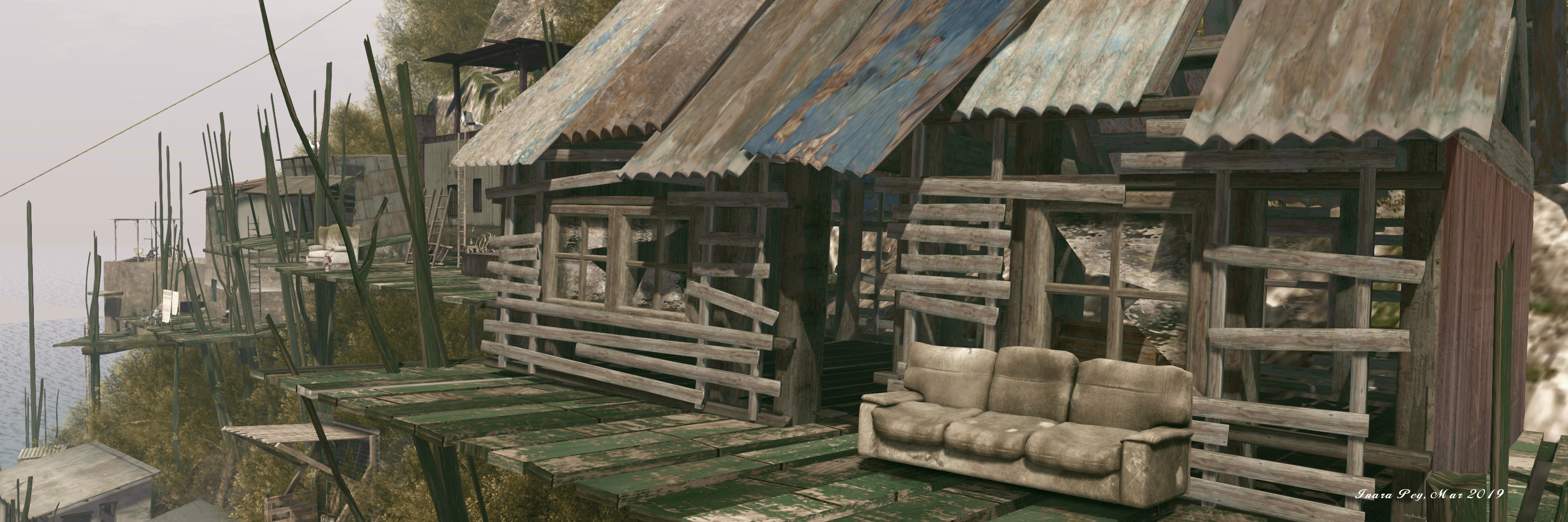
The village itself seems an impossible place; built against a rocky slope of the island’s flank as it rises at a 45-degree angle from the sea. Houses and community buildings sit upon wooden platforms, themselves standing on stilts, with the platforms rising in uneven tiers, connected by rickety looking wooden walkways and steps. Nestled between the frigid sea below and the desolate upper slopes of the island, the most recognisable building in the village is perhaps the 2-storey faded white block of the former Bureau of Indian Affairs school, the closure of which in the latter part of the 20th century marked the beginning of the end of village life on the island.

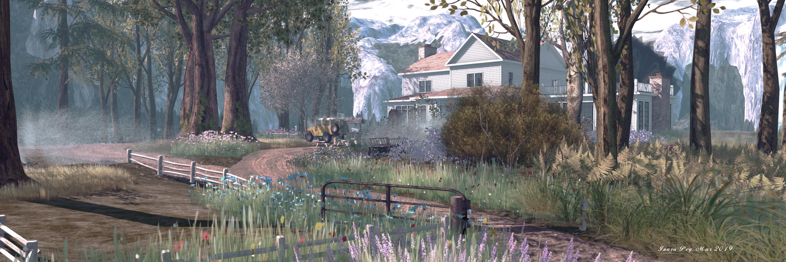
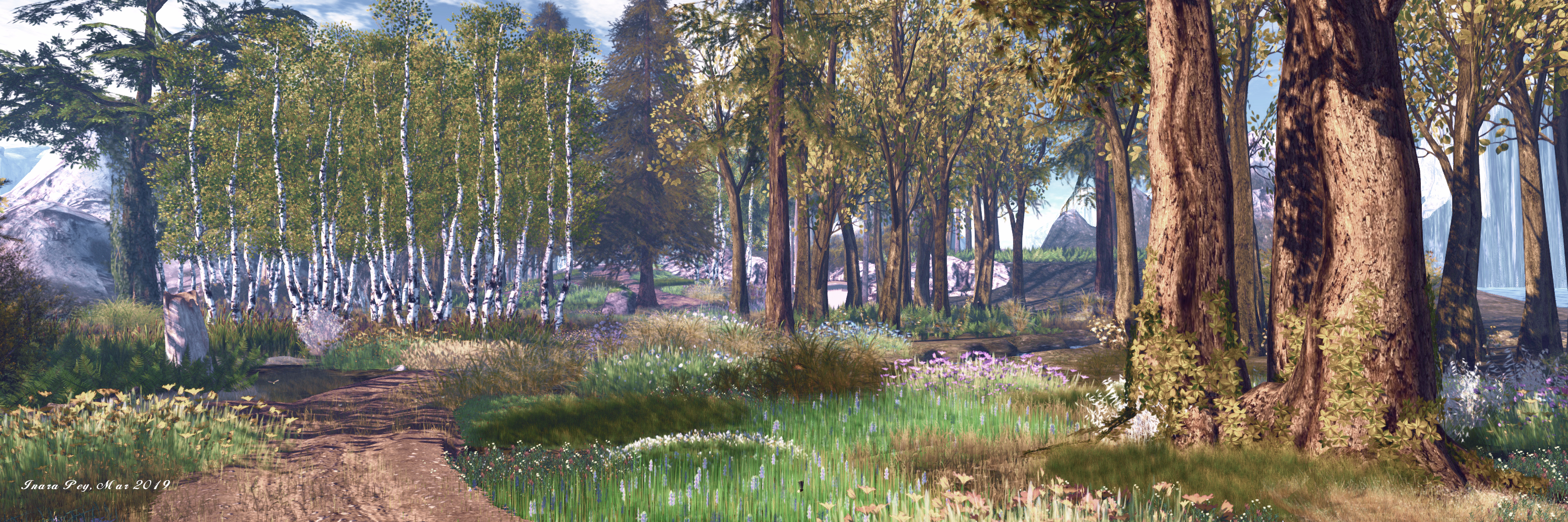
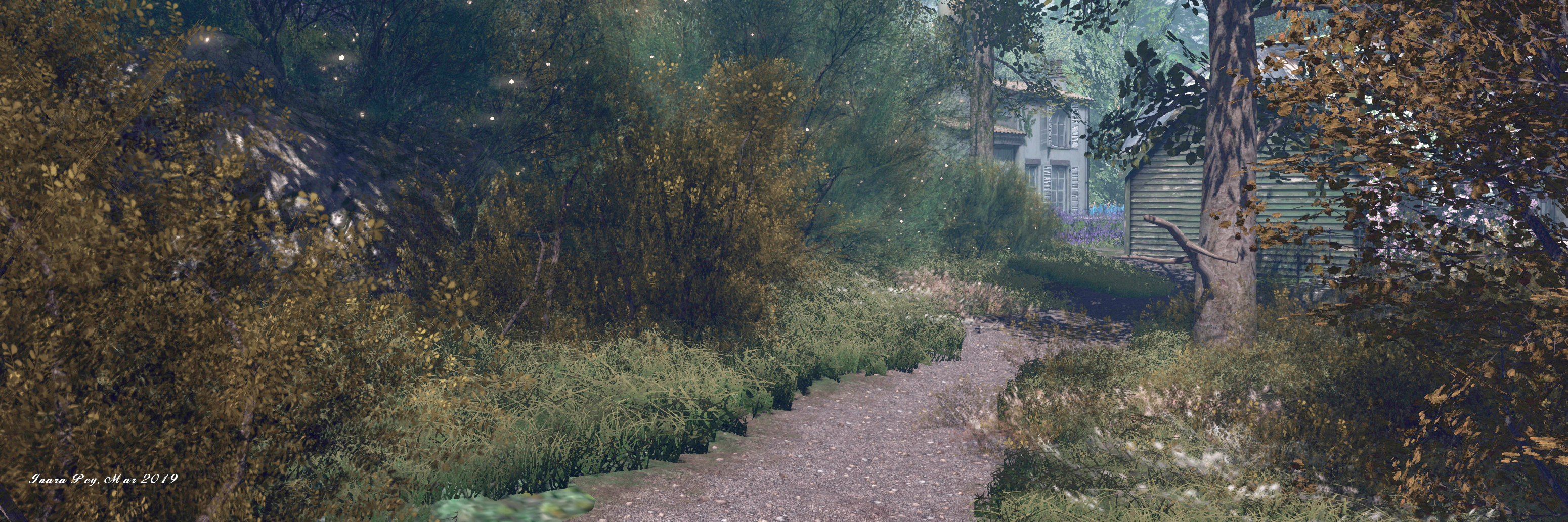
For their build, Jade and Footman could not recreate all of King Island, which is 1.6 km wide (and, as an aside, was named thus by Captain James Cook in 1778, in recognition of Lieutenant James King, a member of his crew). Instead, they have focused on the bay the village sits above, and the village itself.

Ukivok; Inara Pey, March 2019, on FlickrUkivok

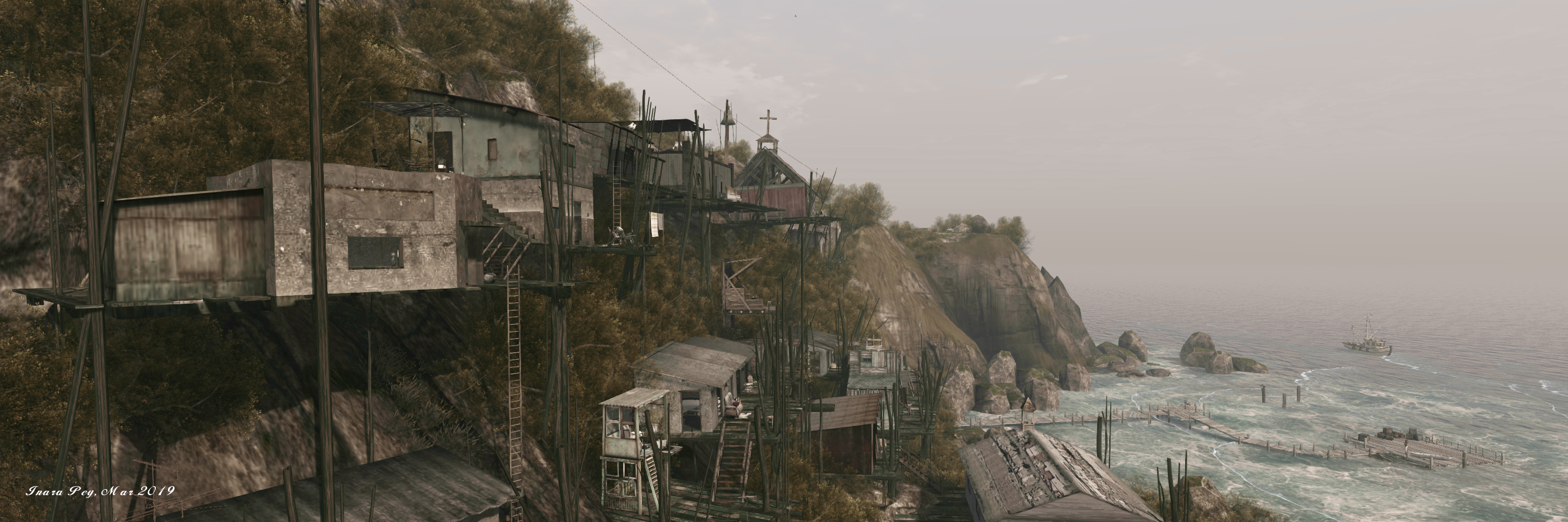
And the reproduction perfectly captures the windswept, elemental look and feel of the now-deserted Ukivok perfectly, including a homage to the school mentioned above. The landing point sits off-shore platform that provides a glorious first look at the island as it rises from the waves, reaching an impressive, and entirely natural 108 metres above the surrounding sea floor.

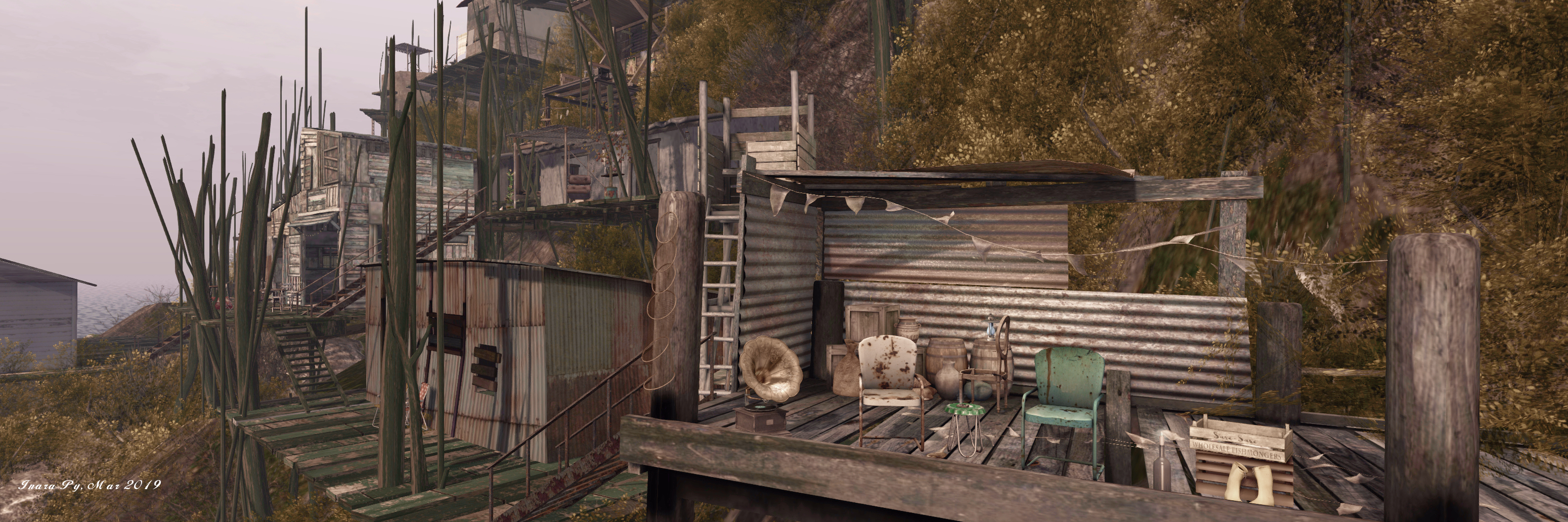
Even without the village, the island makes for an incredible sight, and it’s clear considerable thought an effort has gone into designing and building it; if you can, make sure you cam all the way around it to fully appreciate the beauty of the design. A board walk links the landing point with the shoreline, where a steep set of steps offer the way up to the first platform – and the start of an adventure up through the village, using steps and ladders (click the latter to ascend / descend them), passing through areas that offer echoes of the lives once lived here, and opportunities to sit and appreciate the island as a whole.

Ukivok; Inara Pey, March 2019, on FlickrUkivok

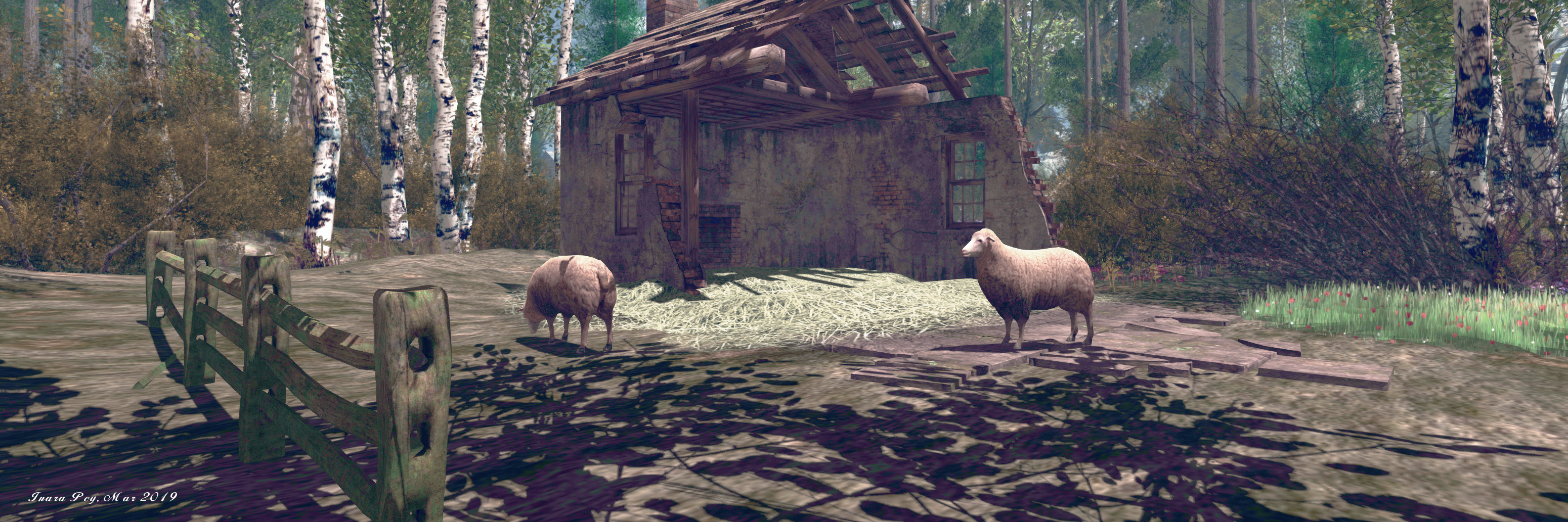
The Ukivokmiut were subsistence hunters and whalers who had lived on King Island for centuries. Their activities on and around the island included hunting for seals and walruses, crab fishing, and gathering bird eggs and other foods.

– Serene Footman, drawing on notes about the Aseuluk of King Island

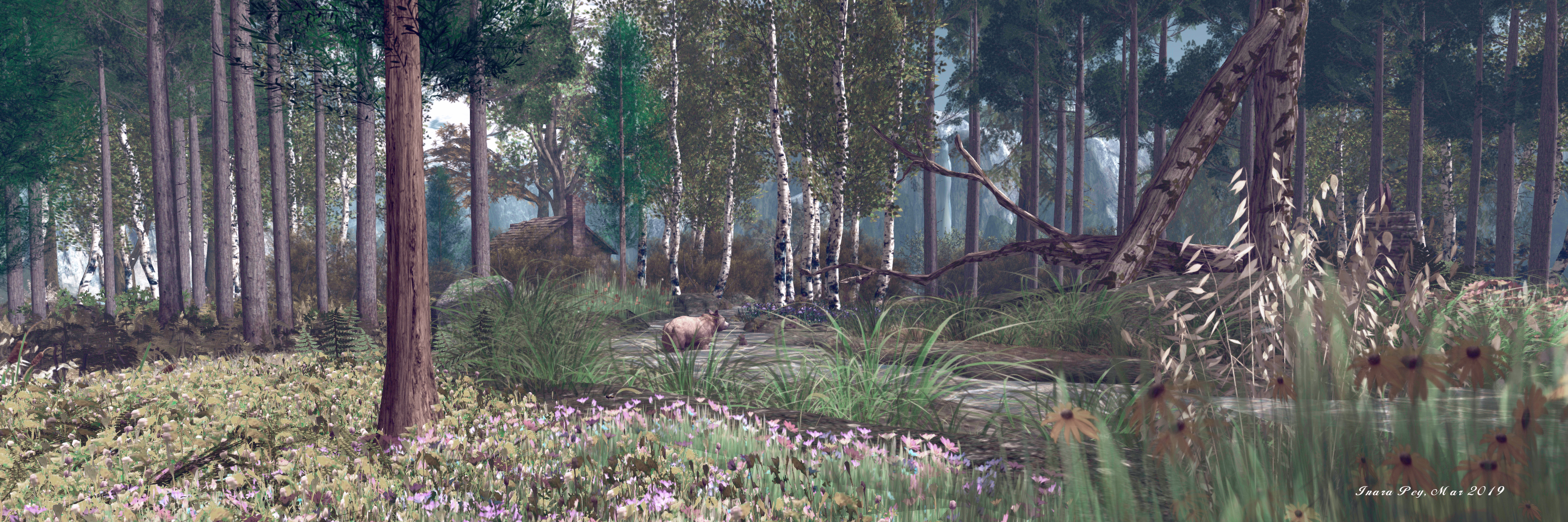
Above the upper levels of the village are more steps, linking shelves of rock one to the next. Some of these steps might be easy to find, others hidden by the scrub hedges that cling to cliff and slope. Follow one group, and you may find your way to the north-eastern headland, which again offers a stunning view back across the rest of the island to the village. This route will also take you past an homage to an entirely natural tor of rocks that crown the physical world King Island.

Ukivok; Inara Pey, March 2019, on FlickrUkivok

The crown of this Jade and Serene’s version is a little different, and lies to the south-east. It is marked by a single statue looking down over the village, and the view gives a further understanding of Ukivok’s seemingly precarious position on the island. Close to the statue is a zip line which descends steeply (and quite rapidly) down to an outcrop of rock and shingle close to the landing point. Should you take the ride, you’ll have to fly back to the landing point or to the island; or you can rest a while on the chairs set out on the rock.

Set under an ideal windlight, surrounded by ocean foam and perfectly placed submerged terrain that is naturally suggestive of rocky shallows close to the island, Ukivok is completed by another superb sound scape. And once having seen it, I think you might find it hard to deny it is one of the natural wonders of Second Life – so many sure you visit it while it is here.

Ukivok; Inara Pey, March 2019, on FlickrUkivok

Gaining a little A L T I T U D E in Second Life

A L T I T U D E; Inara Pey, March 2019, on FlickrA L T I T U D E – click any image for full size

I jumped over to have a look at A L T I T U D E after catching it in Maddy Gynoid’s Echt Vituell. Sitting on and over a Homestead region, it is one of the most unusual and imaginative settings I’ve seen in Second Life for a while.

Designed by Dan the Hammie (DannChris), A L T I T U D E presents a place to “hang out, play and listen to indie music, alternative music, live performances and voice events.”

A L T I T U D E; Inara Pey, March 2019, on FlickrA L T I T U D E

The music venue sits up in the air, “an abandoned hangar on a forgotten island”, held aloft by a combination of cement pillars rising some 60 metres above the water / ground by a mass of propeller engines slung beneath the baseplate on which it sits. Several more platforms float in the sky around it, some offering places to sit, others more functional in nature.

The hanger itself is little more than a rusting metal framework curving over the venue and facing a building that might, at one time, have been a small airport terminal or similar. Despite its industrial appearance, however, the club has a friendly, almost cosy look and feel to it. Events are regularly staged as per the schedule board over one of the stages.

A L T I T U D E; Inara Pey, March 2019, on FlickrA L T I T U D E

Down below, apparently floating on the water, is a stunning garden spot sitting behind tall stone walls with a decidedly Tuscan look and feel; a reminder of Dann’s previous builds of Natural Falls (see Navigating Natural Falls in Second Life).

Watched over by leaf-laden trees, this is home to the most exotic of plants, a place where Nature’s chaos prevails in the most marvellous of ways, be it with the free form of plant growth, the broken, lopsided train of a of greenhouse, the slightly tumbledown suggestion of age and ruin, the delightful corner snug, or the myriad other attractions to be found here.

A L T I T U D E; Inara Pey, March 2019, on FlickrA L T I T U D E

Such is the detail and design in the garden, it is easy to lose track of time camming around its enclosed space, seeking out all the little details, while several places to sit and relax offer further enticements to stay and enjoy the setting and watch the butterflies. Art is also to be found here, courtesy of Chirzaka Vlodovic and Mistero Hifeng, while opportunities for photography abound.

With great electrical pylons take a perpendicular march across the water in relation to the high music venue and the long gantry-like walkway that sits besides it, the entire regions sits beneath a forever twilight sky that frames both club and garden perfectly.

A L T I T U D E; Inara Pey, March 2019, on FlickrA L T I T U D E

A sign close to the gantry landing point warns visitors that they are about to enter someone else’s dream. Given the overall design and layout of A L T I T U D E, it is a dream worth taking the time to visit and share in; beautifully conceived and presented.

A L T I T U D E; Inara Pey, March 2019, on FlickrA L T I T U D E

SLurl Details

Touring Toshi Farms in Second Life

Toshi Farms; Inara Pey, March 2019, on FlickrToshi Farms – click any image for full size

We originally visited Toshi Farms back in , when the region was in the depths of winter. However, at the time things were such that I didn’t get to write about it, so when Shawn Shakespeare suggested we should go see the region now spring has arrived, it was added to the list of places we should see “soon”.

Designed by Syx Toshi and his SL partner Bryn Toshi (Bryn Bulloch), Toshi Farms is a homestead region designed as something of a public park, linked at it now is to its neighbour, Peace, lying to the north.  Whist “farm” might feature in the title, the design of the region is intended to be that of a nature reserve.

Toshi Farms; Inara Pey, March 2019, on FlickrToshi Farms

Bryn and I have tried to create a natural country setting that you would experience in RL. A Farm and Wildlife refuge where you might catch a glimpe of any of over 50 different animals.

– Syx Toshi, describing Toshi Farms

Caught in spring colours, both regions present an engaging and photogenic opportunity for exploration – although beware that at least a part of Peace a private home to Syx and Bryn.

Toshi Farms; Inara Pey, March 2019, on FlickrToshi Farms

Dry dirt tracks wind through both regions, offering clear routes of exploration, although there are paths to be found that depart from them, allowing  visitor to wander off the tracks. However, given that both regions are undergoing construction / update, be aware things might get shuffled about (the Toshi’s home, for example, uprooted itself and moved from Toshi Farm to Peace between two of our visits! 🙂 ).

Follow the tracks, and you’ll find some of the wildlife Syx mentions – bears, raccoons, birds; while horses, cattle and goats occupy the fields in both regions. Also to be found along the paths are places to sit and relax – benches, blankets on the grass, swings; while water tumbles through streams and hill mountains cast a protective wall around the setting.

Toshi Farms; Inara Pey, March 2019, on FlickrToshi Farms

Close to the bridge linking Toshi Farm to Peace sits a summer-house (or it did on my last visit! – As noted things are still being changed 🙂 ). Within it, a fire burns warm in the hearth and comfortable sofas await visitors, banks of flowers surrounding it on three sides. Climb the stairs to the little balcony above, and a blanket lies set with a picnic.  Walk down to the waterfront a short distance away, and a dock with kayaks gives the opportunity for those  who wish to take a trip out on the waters – say to the offshore diving platform.

One of the things that makes Toshi Farm attractive are the static characters that have been set out here and there. They bring a little life to the regions – although I’m not entirely sure all of the handymen working here and there are completely au fait with the tasks they have been given – although they do raise a smile on being seen.

Toshi Farms; Inara Pey, March 2019, on FlickrToshi Farms

A charming pair of regions (assuming Peace remains a public space – it is still under construction at the time of writing) that are pleasing to the camera’s eye, Toshi Farms makes for a worthwhile visit – and this shouldn’t be missed, even if Peace doesn’t remain a public offering for visitors. And given things are in a state of flux, more than visit might be in order!

SLurl Details

An Authors Point in Second Life

Authors Point; Inara Pey, March 2019, on FlickrAuthors Point – click any image for full size

Miro Collas suggested we pay a visit to Authors Point, a Homestead region designed by Xarl Bombastic (Xariell) and Weed Bombastic as both a region open to visitors and a residential offering. Rugged and rural, it offers a mixed landscape with some interesting quirks.

The island forms a table-like plateau, most of it raised well above the surrounding sea by cliffs, and split almost in two by a narrow gorge running from the south to the north-west to where it forms a pool. Part of the plateau top to the west sits a little higher than the rest, grass dried to gold by a summer’s sun, a flat head of hair for the rock, broken only by the occasional bent tree, knots of scrub hedge and a single, old warehouse building that listens the turning wheel of a wooden windmill and the gentle chimes of bottles strung from rope lines.

Authors Point; Inara Pey, March 2019, on FlickrAuthors Point

Two sets of stone stairs lead down from here. The first drops to the lower step of the plateau, home to more grass and an old piano , sheet music upon its stand. The second, longer stairway drops down to where a grass glade sits just above the waters of the sea and cosseted by the protective arc of rocky cliffs. Here can be found one of several places scattered around the region where quit times can be enjoyed.

Across the watery chasm cutting into the island, itself spanned by an old bridge, the larger part of the plateau stands as another flat head of grassland, this rich green and dotted with tall trees. A track loops around it,, running from and to the bridge, roughly following the line of the cliff edge.

Authors Point; Inara Pey, March 2019, on FlickrAuthors Point

On its way along the south-east cliffs, the track passes a second path, this one winding it way down the rock to coastal lowlands. Here sit five rental properties – so do be aware of people’s privacy should you follow the path downwards. A sixth rental unit faces them across the entrance of the gorge that cuts into the island. The fact the rental units are separated from the rest of the land by cliff and path means it is reasonably easy to avoid trespassing into people homes.

I say “reasonably”, because there is an exception: a tree house sits over the grassy table of rock, close to several point of public use. As such, it is easy to miss the fact is also a rental unit. However, stray too close and you will be curtly warned that it is by a security orb allowing you five seconds to move away. It’s an abrupt discovery that can be off-putting given the nearby carousel and other locations to sit scattered across the island’s top.

Authors Point; Inara Pey, March 2019, on FlickrAuthors Point

This is also a place of change – although how frequently this might be is hard to tell: on our first visit, we found a small Alice In Wonderland-esque tea party setting, complete with a hare (although not the March Hare) accompanied by a chipmunk standing-in for the dormouse. On my return 24 hours later to take photos, the tea party had been replaced by a collection of books, some of them suspended in the air under the spreading branches of a tree.

More stone steps descend down a cutting to the north, offering the way to a cinder beach and another cosy hideaways for couples or those wanting to be alone. Follow the beach westwards around a headland and you’ll come upon  another of the region’s secrets, again hidden from the land above by the curving arms of cliffs.

Authors Point; Inara Pey, March 2019, on FlickrAuthors Point

Two more houses sit on the northern side of the island. The first, mounted on stout wooden legs that presumably protect it from high tides that might otherwise sweep over the low-lying headland, does not appear to be a rental – but perhaps caution should be employed when exploring it, just in case. The second sits offshore, and appears to be a private home for Xarl and Weed.

Aside from the risk of bumping into the slightly abrupt security orb as a result of mistaking the tree house as a part of the public space, Authors Point is a pleasant, photogenic visit that may well stir the urge to write. Photographs are welcome at the region’s Flickr stream for those so minded.

Authors Point; Inara Pey, March 2019, on FlickrAuthors Point

SLurl Details

A return to Alpha Tribe in Second Life

Alpha.Tribe

Miro Collas recently pointed out to me via Twitter that it’s been over three years since I’d last visited Alpha Auer’s region, Alpha.Tribe (see Finding fool’s gold in Second Life for more), and suggested a return visit might be in order – and he was right!

From the region description, it would seem the current region design is a follow-on from the one I visited back in 2015, and carries a number of echoes of that build whilst presenting something new as well. Captain Nemo remains well represented, for example, with not one but two copies of his Nautilus present – both of them serenely circling the sky, making an interesting trio with a steampunk airship.

Alpha.Tribe

This time around I wanted to build a sim that (unlike the previous version which was around for a very long time) did not have any gold whatsoever – at least on the ground level, since the golden Blueprint City is still around on one of the sky levels. While the previous rez was called “fool’s gold” this one now is called “The Straits” because of the strait that runs through it. I am not sure that it has a theme, as did “fool’s gold” but I know that you folks will be spinning your own tales as you wander around.

– Alpha Auer describing the current Alpha.Tribe

Part of the ground area is an amusement park – the rides can be tried and Alpha recommends the visitors “thoroughly plunder the grab a duck kiosk”, but I’d caution on using the bumper cars: when I tried, the ride was … bumpier … than might be expected.

Alpha.Tribe

Also to be found on the ground level is the aqua gym, located within a floating geodesic dome, which Alpha notes goes all the way back to aqua gym that dates all the way back to her Syncretia region. Close by is a “chemistry garden” (look for the departing galleon), while towards the centre of the region is another reminder of the previous build: the crazy cat parlour.

Island float above, and in sight of, the ground level, while higher up, alpha has retained her Blueprint City, together with a new build, Midnight Wastes, which Alpha recommends viewing into the altitude windlight (Wastes Midnight). This is a stunning city-style environment built on a glass platform, its “reflection” visible below, ornate buildings and structures raised on stilts and platforms.

Alpha.Tribe

Getting around the builds is best achieved by walking / flying at ground level, and using the teleport cylinders that are scattered around to reach the sky builds (and which also connect to the ground-level areas). As with past builds this incorporates elements by Arcadia Asylum, which Alpha has re-textured and re-purposed to  suit her design and which share the region with works by other Second Life creators.

Always fascinating, rich in curios, Alpha.Tribe remains an artistic expression and pleasing visit. However, do be aware the region can impact viewers that are running with high draw distances, shadows enabled, etc.

Alpha.Tribe

SLurl Details

Touring CandleWood in Second Life

Candlewood; Inara Pey, March 2019, on FlickrCandlewood – click any image for full size

We received two suggestions to visit CandleWood, a Full region making use of the 10K additional land capacity, almost simultaneously (thank you AJ and Miro!). Designed by Adalynne Romano (AdalynneReed), who also runs the region along with her partner, Doc Romano (Doc Battitude), this is a picturesque region with an About Land description that is certain to pique the interest.

Destination and community Sim. A whimsical journey of love and care with mystery, romance, and inspiration riddled everywhere.

CandleWood’s a treat for the eyes to see, come out and make your own story.

Candlewood; Inara Pey, March 2019, on FlickrCandleWood

The About Land description goes on the note there are rentals in the region – but these are not excessive enough to make public visits a chore. In fact, and in a manner akin to Puddlechurch which we dropped into recently (see Exploring Puddlechurch in Second Life), CandleWood has been designed as a place to visit, with the eight rental units, forming a natural part of the landscape and placed in such a way as to not interfere with general exploration.

“I designed it to be a destination sim but for people who would like to live here, that option is available too,” Adalynne informed me as we visited. “There are five town houses for rent and three regular parcels.”

Candlewood; Inara Pey, March 2019, on FlickrCandleWood

The five town houses are located in CandleWood’s little corner “town” on the south-west side of the region. Setting atop low cliffs rich a foliage and with their backs to the sea, the sit across a short paved road from an old railway station – this being the landing point for the region.

The layout of the street makes it clear that while it might once have been a busy place of commerce, it now experiences quieter times. The station itself is no longer active, with one of the aches glass roofs that may have once protected a platform from the elements has been converted into a covered seating area, nestled between station and the local tea house. The remaining platform also clearly isn’t in use any longer; the train parked within it is now more a feature for plants to grow against, and the single remaining track running down from the back of the station is now little more than a path pointing the way to explore the rest of the region.

Candlewood; Inara Pey, March 2019, on FlickrCandleWood

It is in wandering along the street, passing tea house and café, peeking into the folly-as-a-photo-studio at the end of the road, that a part of the backstory Ryanna Foxclaw has written for the setting, and which can be found in Adalynne’s Profile Picks come especially to mind.

Just off the mainland lies and isle hidden in a thin mist of forgotten time. A busy town once driven by the railway and exports brought in by the ship, now gives way to a quieter, simple life. The fresh air from the sea, the wind blowing in the trees, and if one listens carefully they may hear the forgotten train whistles melody.

– Ryanna Foxclaw describing Candlewood

Candlewood; Inara Pey, March 2019, on FlickrCandleWood

Perhaps the easiest route of exploration is via the old door at the back of the railway station (a second door is hidden behind the little tea house  and reached through the covered seating area. Going via the back of the station provides access to the old railway line that, as noted, offers a route of exploration. It also reveals just how extensive the town’s use of rail transport once was. Leading the way past old warehouses, it forks several times, often disappearing into what appear to be tunnels, offering a choice of possible exploration routes. Follow it far enough, and you’ll wind your way through the heart of the island to reach an old sliding, long overgrown and marked by a forgotten shipping container and a broken remains of a car, now used as a snuggle point

Note, however, this is only one possible route through the region, turn off the track in the little cluster of old commercial buildings, and you can follow the path around an aged warehouse looking out over the deck to the sea, and then along a shingle beach that skirts much of the region. This will take you to where a quaint little cottage sits to the south-east of the land. pen to the public, this can also be reached by follow a spur of the railway track close to the inland commercial units and passing through the short tunnel where it apparently ends. Two similar tunnels sit within the region, one in the north-east the other to the north-west – but take care with these as the former leads the way to two of the rental parcels in the region, and the latter marks the start of the Romano’s own home, so privacy should be respected.

Candlewood; Inara Pey, March 2019, on FlickrCandleWood

The remaining rental property stands a grand house atop a table of rock near the centre of the region, commanding views on every side, water cascading from a pool to feeding a further pool below. This, in turn, feeds two narrow and crooked fingers of water as they flow outward to the sea, dividing the land between them.

And that is really just a beginning of all that is to be found in CandleWood; a place that deserves time and care when visiting, as there is much more to discover, including the elven-like dance area, the many places to sit and relax, the signs of semi-abandonment, the impressive footbridge, and more, all of which sit neatly within the backstory mentioned above.

Candlewood; Inara Pey, March 2019, on FlickrCandleWood

Yes, the load placed on a viewer can make a visit a little heavy going if you have a lot of bells and whistles running, but don’t let this deter you. For photographers, the region is rich in opportunity, and Adalynne notes she and Doc run a weekly contest where they will pick one photo from those submitted to the CandleWood Flickr group for display at the landing point, and the photographer awarded with L$500. I also understand from Adalynne larger photo competitions might also be in the planning – so if you are interested, be sure to join the region’s group (which will also grant you rezzing rights – just be sure to pick things up after!).

SLurl Details