Sundarban in Second Life

Sundarban; Inara Pey, March 2018, on FlickrSundarban – click any image for full size

Update: This location has closed, the SLurl have therefore been removed from this article.

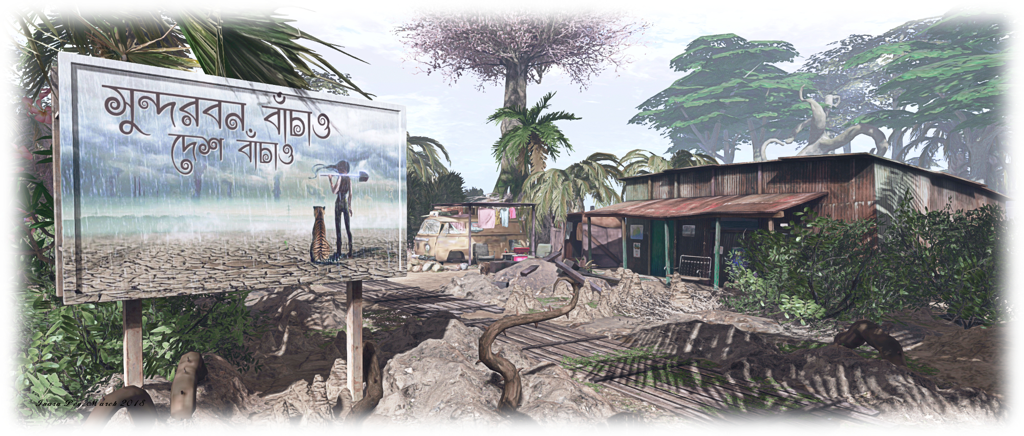
“Sundarbans is a vast mangrove forest located between India and Bangladesh, well-known for being the habitat of the Bengal tiger,” Gabrian Lascelles (gothicgaylord) writes in his introduction to his new Homestead region, Sundarban. “It’s my vision of India,” he informed me in passing an invitation to Caitlyn and I to visit. “And as I’m from Sweden, it’s been a lot of research for me, but if I’ve managed to catch just a breath of India, I’m happy!”

Gabrian is perhaps best know for designing and building Costa Blanco (see here for more), and as a landscaper at Amazon River. We both thoroughly enjoyed Costa Blanco, so with Gabrian’s invitation in hand, we hopped over to Sundarban to have a look around.

Sundarban; Inara Pey, March 2018, on FlickrSundarban

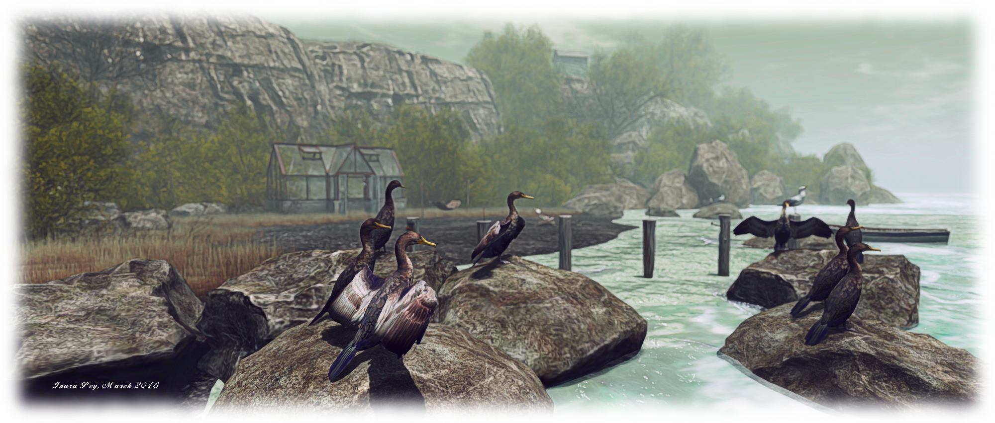
The physical world Sundabarans lies in the vast delta formed by the by the super confluence of the Ganges, Hooghly, Padma, Brahmaputra and Meghna rivers as they empty into the Bay of Bengal, straddling India to the west and Bangladesh to the east. It is a huge ecosystem encapsulating both freshwater swamps and the world’s largest area coastal mangroves, around 10,000 square kilometres (6,250 sq mi). As Gabrian notes, the area is the home of the endangered Bengal Tiger, but it is also home to other endangered species besides, such as the estuarine (or saltwater) crocodile, the northern river terrapin, the South Asian river dolphin (freshwater dolphin), barasingha swamp deer, as well as more widespread breeds of mammals, bird, fish and reptiles.

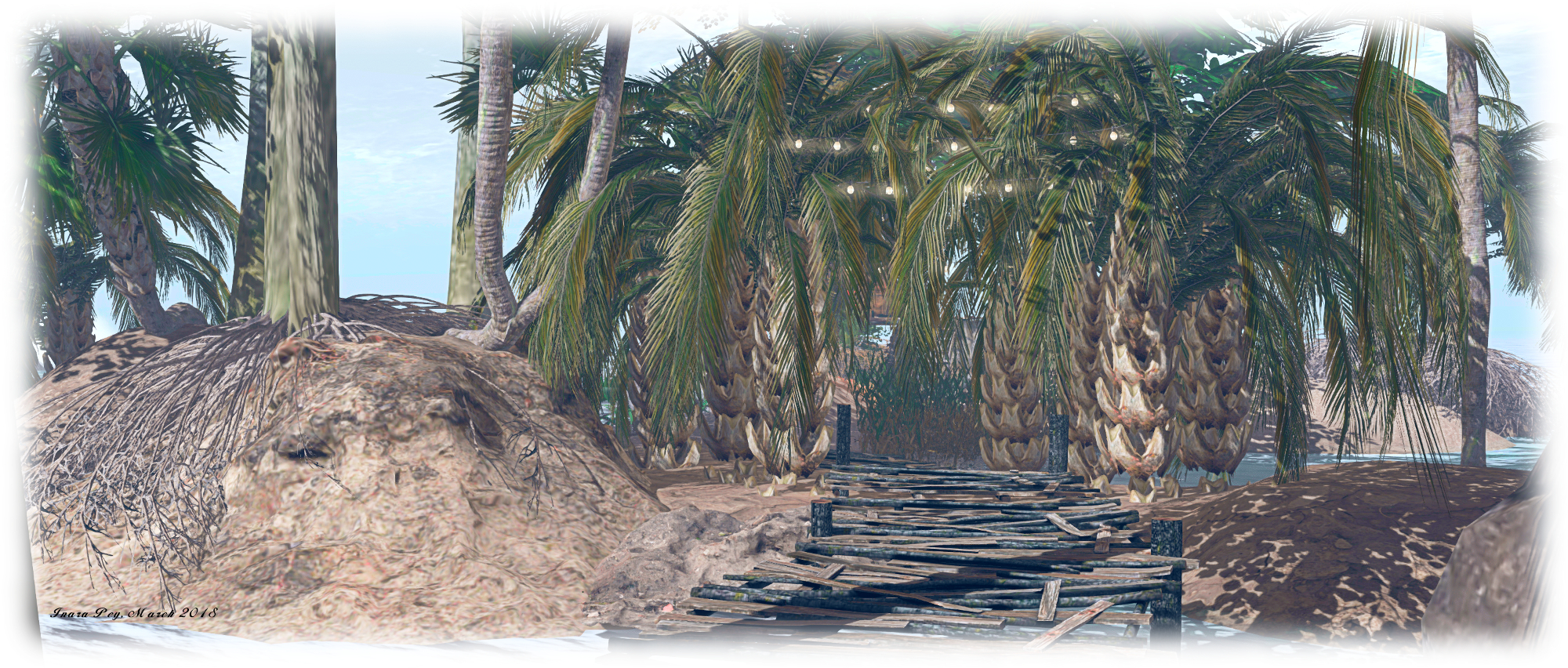
For his build, Gabrian presents a coastal area made up of low-lying muddy / sandy islands, some linked by bridges, others by zip lines, while little motor boats provide the means of puttering around the waters to reach all of them. The landing point sits on an island on the north side of the region, where sits a little shanty store. Elephants are bathing in the water close by – although they are of African, rather than Indian, origin (don’t blame Gabrian for this, African elephants in natural poses are a lot more popular with creators than their Indian cousins).

Sundarban; Inara Pey, March 2018, on FlickrSundarban

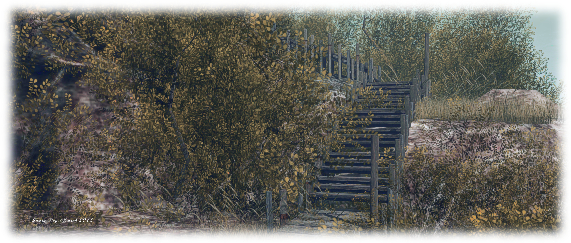
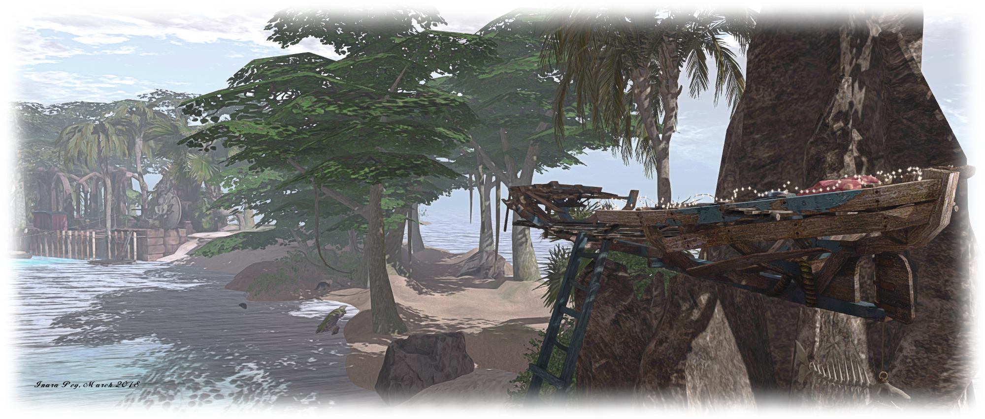
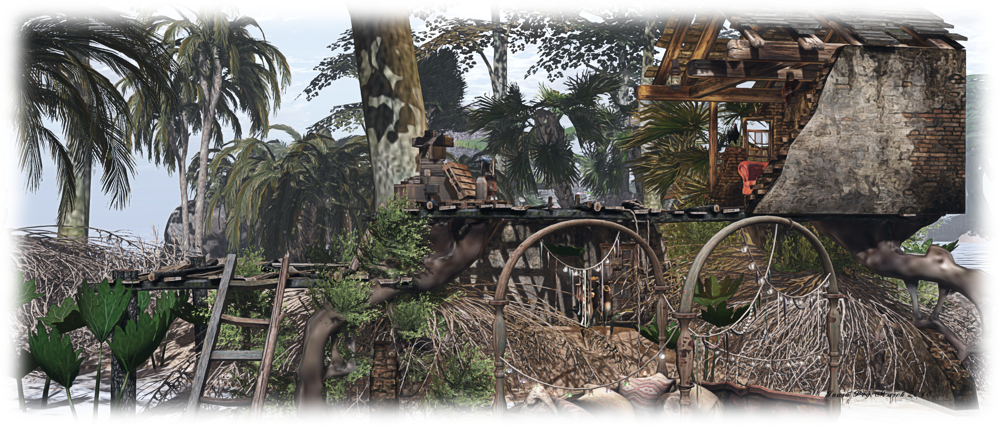
East from here, over a low wooden bridge, is a second island. This is home to an old corrugated iron shack, a small shrine, and a path leading up to the wooden jetty on the north side of the island where the motor boats can be obtained. For the adventurous, a set of zip lines have been set up behind the old shack, providing a way for people to travel to / from the island to the south without the need for a boat or getting their feet wet.

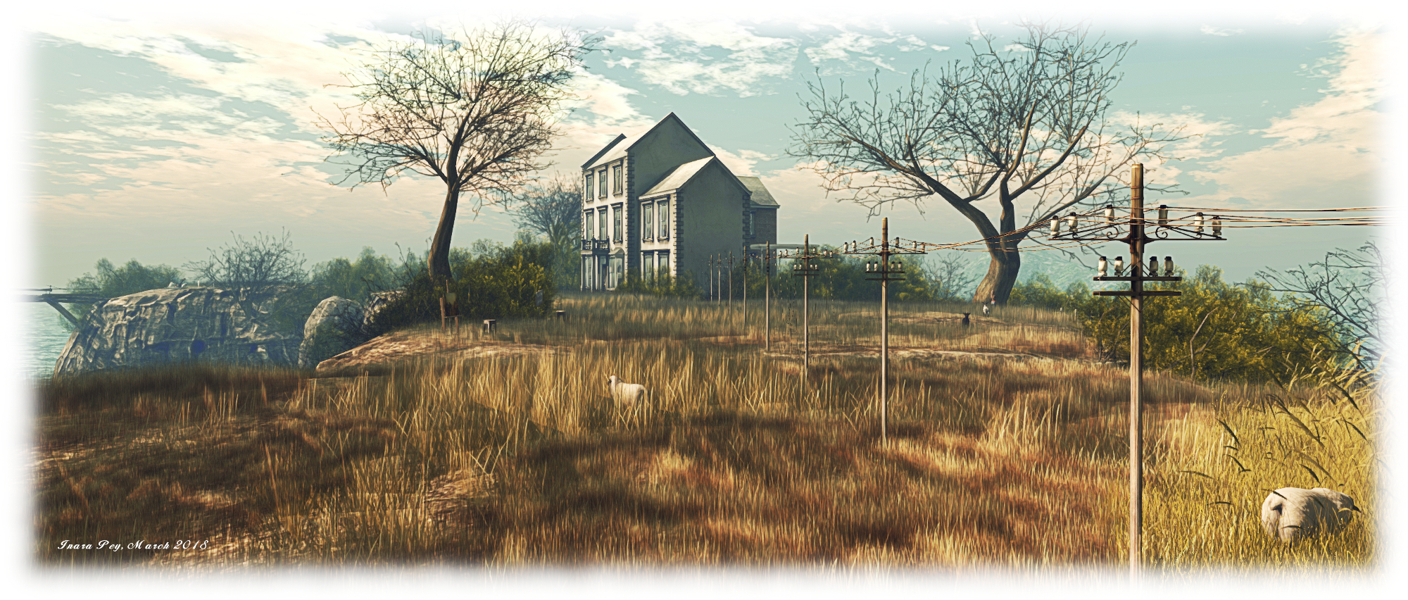
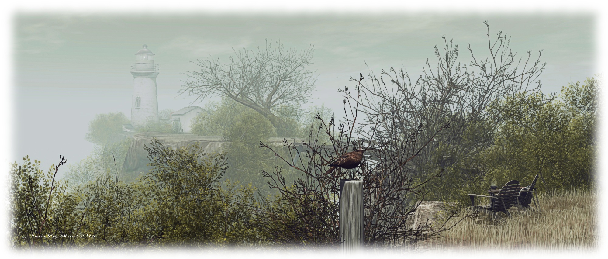
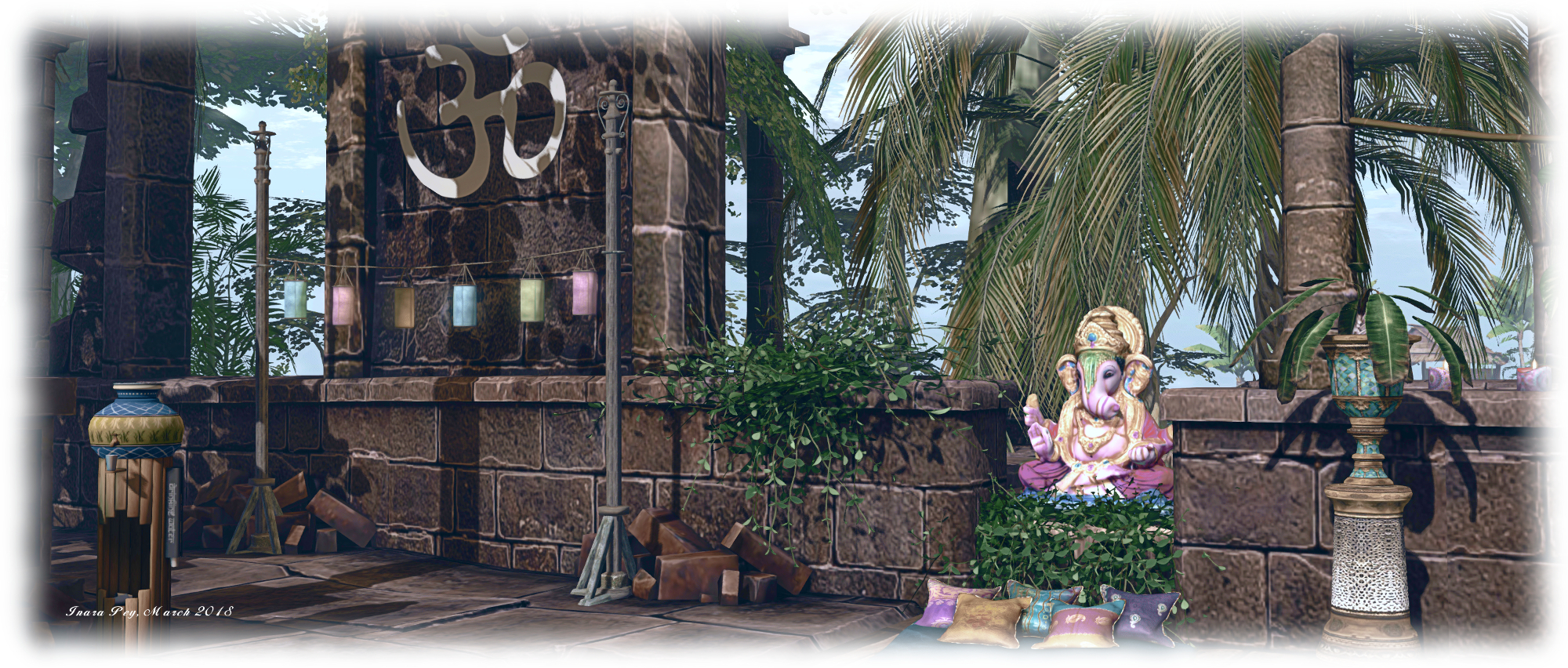
This island is probably the largest by visible landmass in the group. It arcs to the south and east, a slender ribbon of grassy dunes sitting under the shade of trees reflecting the physical world’s Sundarbans freshwater forests, before ending in a finger of rock pointing up at the sky. An ancient ruin can be found here, converted into a rest spot complete with canopied massage table looks towards the eastern islands in the group, and another pair of zip lines link it with the nearest of them. Before riding one of them, however, it’s worth walking down to that finger of rock I mentioned – you’ll pass more of the local wildlife along the way and find a most unusual perch up in the rock itself.

Sundarban; Inara Pey, March 2018, on FlickrSundarban

Those seeking the tigers will need a motor boat, as they are on a small island to the north-west, separated from the rest by water. Just heed the sign as you approach the island’s little bay, or you might find yourself on the menu – as seems to have been the case with the last couple of visitors, porcine and human!

Sundarban is Gabrian’s personal vision of an exotic part of India, and a place that’s easy to explore and easy on the eye. Throughout the islands are numerous places to sit and cuddle (although be aware some do have distinctly adult poses in them!), and plenty of opportunity to take pictures. Should you enjoy your visit, please consider a donation towards the region’s upkeep – just look for the beggar / trader near the path to the motor boat jetty.

Sundarban; Inara Pey, March 2018, on FlickrSundarban

SLurl Details

  • Sundarban (Enchanted World, rated: Adult)

A summer’s twirl in Second Life

La Virevolte; Inara Pey, March 2018, on FlickrLa Virevolte – click any image for full size

“Twirling like a butterfly, fluttering in the sky, choosing the most fragrant flowers, regardless of the end of summer.” So reads the introduction to the latest incarnation of La Virevolte (The Twirl), the highly photogenic Homestead region designed by Iska (sablina). When last we visited, the region was in the grip of winter. With this incarnation, the region has a new look caught in the Sun – as the description says – of late summer.

A visit starts on a terrace outside of a little café. It sits in the corner of a little hamlet built alongside a channel-like canal running east-to-west through the region, splitting it in two. A house also occupies the terrace, a vintage Citroen van serving as a mobile fresh produce stall, sitting between the two. Facing them sits another house, the barn alongside seemingly in the process of being converted into a home. House and barn sit on an island of grass surrounded by a loop of road.

La Virevolte; Inara Pey, March 2018, on FlickrLa Virevolte

The western end of this loop touches on a headland ending in a promontory of rock on which is perched a lighthouse keeping watch on things. North of the hamlet, beyond the road’s loop, the land offers rugged grassland rising to a rocky bluff. This open, rugged land continues around the east of the region, grassy slopes rising within the shoulders of a high v-shaped plateau. The grass between the slopes and the café are divided in part by an ancient stone wall, cupping a wild garden between it and the hamlet’s buildings.

Across the channel – which is spanned by a stone bridge – a road runs south before curling to wind its way up the stepped landscape, ending among tall pines trees, where a track points east to where an old farmhouse sits atop a rocky shelf, the land between track and building also falling in gentle steps, some of which are – like the terraces below – retained by ancient drystone walls.

La Virevolte; Inara Pey, March 2018, on FlickrLa Virevolte

These terraces are in part cultivated, presumably by whoever lives up in the farm-house. The lowest one is given over to root and vine vegetables, while grapes are ready for harvesting on the next terrace up. They and the vegetables point to the late summer setting for the region. Stone steps climb the terraces, offering a shorter route up to the track leading to the farm-house for those who don’t feel like walking the road.

This is another marvellous design by Iska, one made particularly attractive by the way things like the building have been brought together. Take the house across the road from the café, for example; part of the original wall seems to have collapsed at some point, and an effort has been made to replace it with a red brick wall. Elsewhere sit the carcasses of an old a car and van, the former turned into a little garden, the latter now serving as a snuggle spot. These and the children’s toy and tricycle in the grounds of the houses, a broken flower-pot on a doorstep, all give the feeling that this is a home to unseen locals.

La Virevolte; Inara Pey, March 2018, on FlickrLa Virevolte

Walking through the region, it is very easy to picture you’re deep in rural France. I was immediately put in mind of parts of the Massif Central (the open water and lighthouse notwithstanding), given the general style of the houses. I mentioned this to Iska as we talked about the design. “The southern foothills of Massif Central, yes!” she replied. “[With] a lot of fountains and rivers, I love the sound of water everywhere.”

To say this is once again a photogenic design would be an understatement; it is a painting in and of itself, the selected windlight and sound scape both complementing it perfectly. Throughout the region are places to sit and admire / cuddle, such as the aforementioned old van, a picnic blanket out on the banks of the channel, the tables of the café and more. 

La Virevolte; Inara Pey, March 2018, on FlickrLa Virevolte

Altogether, another fabulous design, kudos to Iska in building it and offering it to people to visit. and thanks to Shakespeare for the nudge concerning the redesign.

SLurl Details

The Isle of May in Second Life

Isle of May; Inara Pey, March 2018, on FlickrIsle of May – click any image for full size

Update, November 26: Isle of May has re-opened for winter 2018 – read here for more.

Update, July 6th: Isle of May has “closed for now”. SLurl links have therefore been removed from this article.

Isle of May, located on the north side of the outer Firth of Forth, is a tiny island – less than 2 kilometres long and under half a kilometre wide – sitting 8 km off the Scottish coast. A rugged finger-like uplift of basalt, it has no permanent human residents today but is managed by Scottish Natural Heritage as a National Nature Reserve, and home to over 285 bird species, including puffins, kittiwake, guillemots, razorbills, shags and fulmars, and from October through Easter, is a home for seal pups.

It is also now the inspiration for a new region design in Second Life. Called, appropriately enough, Isle of May. Designed by Jade Koltai and her partner, Serene Footman (of FurillenKhodovarikha and La Digue du Braek fame), the region is a beautifully conceived and executed design.

Isle of May; Inara Pey, March 2018, on FlickrIsle of May

Compressing something even as small as Isle of May into Second Life isn’t easy, but within this design, Jade and Footman have captured the essence of the island perfectly. As rugged as the original, it is similarly cut by deep gorges, and offers a hint of antiquity – the original had settlements dating back to the Bronze Age, and was the site of one of the earliest Christian churches in Scotland, was a site of pilgrimage and, in medieval times, home to a Benedictine community – through the ruins located on the north-western headland.

Some of the island’s famous landmarks are imaginatively represented. Its two lighthouses and unmistakeable fog horn, for example, have been combined into a single lighthouse and buildings on the north-eastern headland of the region (check the map of the island inside the building alongside the lighthouse). A little artistic license is also taken with the geography; this Isle of May is cut into three islands linked by wooden bridges. However, while the Rona peninsula of the original is almost separate from the rest, the physical Isle of May is but a single rocky mass.

Isle of May; Inara Pey, March 2018, on FlickrIsle of May

This setting also has a lot of foliage in the form of trees and bushes than the original boasts (it being largely grassland atop its basalt rock plateaus). But the trees and bushes help to give the couple’s vision more of a unique look and feel – although at times, the foliage can make several of the paths winding down the cliffs a little hard to find when searching at avatar eye-level.

These paths offer multiple routes down to the islands’ rough coast. Some lead to shale and rock “beaches” and coves, others form paths down to shoreline buildings – here a cottage, there an old working hut on a pier, now converted into a cosy snug …

Isle of May; Inara Pey, March 2018, on FlickrIsle of May

Jade and Serene note that while the original has no permanent human residents, they imaged their Isle of May to be home to a small community of artists and photographers – hence the large house dominating the main plateau, and the aforementioned cottage and converted pier hut. And it works perfectly.

Also well represented is the island’s avian communities are richly and diversely represented, from garden birds through to cormorants, guillemots and more, while the more usual seal pup population found on the island in winter months has been imaginatively substituted by the presence of sea otters, while dolphin and orca might be found off-shore, together with a passing trawler.

Isle of May; Inara Pey, March 2018, on FlickrIsle of May

“What we were searching for is something holistic and organic,” Serene and Jade note of the build. “For visitors, an immersive experience of being ‘in nature’ that is powerful and evocative.” With its natural look and feel, wrapped in a delightful sound scape and suited to a wide range of windlight settings, it is absolutely clear that they’ve succeeded.

With thanks to Shakespeare from dropping me the LM!


Spirit of Sun, Spring 2018 in Second Life

Spirit of Sun; Inara Pey, March 2018, on FlickrSpirit of Sun – click any image for full size

Now open to the public through until approximately Sunday, March 18th, is Spirit of Sun, a normally private group-owned region. The region has been opened to public access as a part of a photo competition, in which entrants are asked to submit images to the Flickr group associated with the Spirit of Sun. Caitlyn and I were alerted to the opening by Shakespeare and Max, so given the brief period of opening we hopped over to take a look – and found a visually stunning region, well worth taking the time to visit.

The region has been split into three large islands of roughly equal size. The landing point is on the southernmost of the three, a slender finger that runs east-west across the sim’s entire length. A rugged plateau, it is topped by a  bumper car ride (available to visitors) at its eastern end, linked to a central plaza of shops by a broad cobbled walk and wooden steps. Beyond the shops sits a garden area featuring a small stage, open-air seating and a track leading back to the shops.

Spirit of Sun; Inara Pey, March 2018, on FlickrSpirit of Sun

A small headland extends from this island, pushing out into the waters of the region’s channels. A great stone bridge once spanned the channel between this southern island and the one to the north-west, where a knuckle of rock rises from the surrounding land. However, some disaster long ago broke the back of the bridge, leaving it a ruin on either side of the channel. Instead, the western island can be reached via a switchback path winding down to the foot of the blunt headland to where a pier sits, two sailing boats moored against it, the wreck of a fishing boat close by.

The boathouse behind the pier offers a cosy place to sit – one of several across the region – while on the side of it opposite to the wreck of the fishing boat lies a small wooden bridge. A little awkward to reach, it nevertheless provides access to the western island by way of a low table of rock and grass sitting mid-channel.

Spirit of Sun; Inara Pey, March 2018, on FlickrSpirit of Sun

The knuckle of rock against which the ruined bridge is anchored is one of two plateaus on this island, the second being home to an old lighthouse. A dirt track runs south-to-north along the island, passing under a rocky arch between these two plateaus, pointing the way to a third at the northern end of the island. This home to a broad wooden deck, reached by stairs. A greenhouse converted for use as a summer-house sits close to the foot of the steps, while the deck at the top sits around an old English-style folly. Tables and chairs are placed out across the deck, while the folly itself offers a further comfortable lounge.

Between these highland areas is more to be found – a café sitting in the middle of a small lake, another greenhouse – this one of more traditional design – presenting another cosy snug. Pass under the rocky arch to the southern headland, and you’ll find a camp site complete with a pair of British Land Rovers which look like they are on an outing from Encounter Overland.

Spirit of Sun; Inara Pey, March 2018, on FlickrSpirit of Sun

Across the water to east is the remaining island. Dominated by another massive plateau – one equalling the height of the southern island, leaving a deep gorge between the two – curls around the eastern coastline of the  island to form a broad ridge descending down to the lowlands. Six houses sit atop this plateau and ridge, spaced along the track that winds its way along both.  As these appear to be private residencies, discretion when walking by them is recommended.

The lower part of the island offers a broad greensward of grass running out to a narrow ribbon of a beach. This is the home of another camp site, this one apparently of a Romany origin, watched over by a stone windmill oddly built against the rocky face of the plateau. Further around this southern headland lies another summer-house and further secluded spot couples can enjoy.

Spirit of Sun; Inara Pey, March 2018, on FlickrSpirit of Sun

Spirit of Sun is a richly engaging place to explore – albeit one with a limited time with which people can appreciate it. With this latter point in mind, I’d suggest anyone wanting to visit do so sooner rather than later, least public access is restricted once more. And don’t forget to submit photos to the region’s Flickr group. Congrats to Justine Lemton, Doutz (Rianna Joubert), and the rest of the group for their creation.

SLurl Details

Bailey’s Norge in Second Life

Bailey's Norge; Inara Pey, March 2018, on FlickrBailey’s Norge – click any image for full size

Note: Bailey’s Norge is now La Frontera – read here for more.

In late January, Caitlyn and I visited Bailey’s Norge, designed by the Bailey family and in the Homestead region of Forest Haven. At the time, it wasn’t clear how long the region would be open to public visits, but as it is still open to people to explore, I thought I’d write a few words on it.

Designed to represent a piece of rural Norway, the region sits within a ring of green mountains, surrounded by water as if snuggled at the inland end of a fjord, a single channel leading out to sea, watched over by the rotating eye of a lighthouse.

Bailey's Norge; Inara Pey, March 2018, on FlickrBailey’s Norge

A visit starts close to the centre of the region, on a set of stepping-stones running across the mouth of a channel separating two of the region’s islands – so be sure to wait until everything has rezzed and rendered before taking too many steps, or you might end up taking and unexpected bath.

These stones link the two largest islands with one another. The easternmost of these islands has a north-south orientation, and is occupied by two large houses. One of these sits alongside the stepping-stones, the second to the north, reached by a walk through the long grasses which dominate the flatlands of the island. This second house has the look of a working home – a pier sits on the shoreline close by, perhaps home to the fishing boat out in the bay, and with fish drying on the lines alongside the pier. And old pick-up truck has been converted into a makeshift flower garden, while a seating area lies in the shade of trees.

Bailey's Norge; Inara Pey, March 2018, on FlickrBailey’s Norge

A box bridge spans the water separating the northern end of this island with one of the two small islands on the north side of the region. Cut by a man-made water channel, where a little snuggle spot can be found atop a raft, it is otherwise deserted. A second small island lies to the west – but please note it appears to be a private residence, so exploration there should perhaps be avoided in the interests of privacy.

Travel south through the grasslands of the east-side island, and you’ll find your way to a small cabin snug against the southern coastline, looking west towards the second of the large islands, on which sits a large number of structures. A gable roofed bridge sits close by, spanning the narrow channel dividing the two islands from each other.

Bailey's Norge; Inara Pey, March 2018, on FlickrBailey’s Norge

The closest of the  buildings across the bridge is a large Scandinavian-style house. It is clearly a family home, given the swings, slide, roundabout and see-saw in the fenced garden. Surrounding this on two sides are outhouses and barns. These give the house the feel of being a farm, although the outhouses have been converted for particular uses: a bathhouse and a small photography studio / gallery.

Slight further afield, on the north side of the island lies a little shop, a converted boat dock nearby, a swing seat replacing the covered moorings. Further along the curve of the shoreline sits an old Norse building, its apparent age hinting that there has been a settlement here for a long time. Meanwhile, on the west side of the island sits a wood-framed church. This faces a boathouse sitting on the shore alongside a wooden deck that extends out over the waters. As well as offering cosy seating indoors and chairs on the deck, the boathouse also has a hot tub and hammock outside.

Bailey's Norge; Inara Pey, March 2018, on FlickrBailey’s Norge

With rich, open spaces with places to sit and / or cuddle scattered throughout, and one or two little surprises waiting to be found – keep an eye out for the Norwegian troll keeping a watch on things from the tree-line – Bailey’s Norge offers a lot to see and enjoy. Should you enjoy a visit, please consider offering a donation towards the upkeep of the region (the donation box is at the southern end of the east-side island). And if you take photos, please consider sharing them with the region’s Flickr group.

SLurl Details

Gaia Calling in Second Life

Gaia Calling; Inara Pey, March 2018, on FlickrGaia Calling – click any image for full size

Update: Gaia Calling no longer exists at Serena Kiraly. The sim is under new management and has been repurposed.

Gaia Calling is the name given to the Homestead region design by Gidgy (Gidgette Adagio) – who has previously presented Savor Serenity and Hobbiton (see here and here respectively). It is something of a departure from these previous builds, which were rooted in Tolkien’s mythologies, offering instead a take on more classical mythology – specifically that of the primordial deity, Gaia, the ancestral mother of all life and primal Mother Earth goddess. But while a departure from Gidgette’s past designs, it is nonetheless as enchanting as they have been.

A visit begins on a transparent octagonal platform serenely floating above a deep gorge cutting into an elevated landscape. This platform contains an echo of Gidgette’s earlier builds in that it is ringed by a circle of elven-like arches. A single arched walkway points the way to a second platform, almost at the centre of the region. From this, a tall figure of Gaia rises, arms uplifted as she becomes a tree – the perfect symbol of mother Earth – framed by a rising Sun.

Gaia Calling; Inara Pey, March 2018, on FlickrGaia Calling

The roots for this great tree / statue reach down beneath the platform, extending down to the surface of the water below. The waters of this gorge are served by a series of waterfalls that tumble-down the cliffs and slopes of the surrounding ring of land – a right richly forested, but which doesn’t quite connect to either of the platforms, presenting visitors with an interesting quandary of how to get from platforms to land.

Flying is one means of crossing the divide – but there are preferable alternatives: the arrival platform includes a bubble rezzer for those who like to travel on their own. Simply touch to rez, sit in the bubble and use the WASD / arrow keys for forward / back motion and turnings, and PAGE UP and PAGE DOWN to increase / decrease altitude. For couples, there is a flying leaf rezzer, with the same principles applying to flying it.

Gaia Calling; Inara Pey, March 2018, on FlickrGaia Calling

The surrounding lands offer various paths through the aged trees, some of which are strung with lights. Along these paths visitors can find numerous points of interest: lanterns offering dances, “magic” mushroom that rez picnic spots and / or cuddle spots, a gazebo rich with flower growing in an old bathtub, a cosy camp fire … all offering places to sit and appreciate the ethereal surroundings.

Nor is this all: bears and wolves and rabbits are scattered across the landscape, and for those willing to take the plunge – preferably via bubble or flying leaf –  there is a world under the surface of the waters to be found, where whale, porpoise, shark and more swim together, their surroundings rich in colour from corals and plants.

Gaia Calling; Inara Pey, March 2018, on FlickrGaia Calling

“Many moons ago, many sunrises ago, Gaia called.” Gidgette says of the region, “Her song singing the essence of our being, the calling of the soul, the oneness of our dream, and as our consciousness arises, Gaia smiles.” Wandering this landscape, beautifully lit, it isn’t hard to imagine being one of Gaia’s first Earth-born, and even encouraging spiritual / conscious growth through the mediation platform extending from one of the cliffs of the gorge.

Gaia Calling is a marvellously ethereal setting, rich in content and beautifully photogenic (and photos can be submitted to the region’s Flickr group). It makes for both a restful and fun visit – particularly when floating around in the bubbles. There’s also a lot more to discover than might at first appear to be the case – not only because of the underwater setting mentioned above, but also because of other little spots I’ve refrained from mentioning here so that you might enjoy discovering them for yourself – just be sure to look underground and under tree…

Gaia Calling; Inara Pey, March 2018, on FlickrGaia Calling

SLurl Details

  • This sim is under new management, and Gaia Calling as a region no longer exists.