A trip to Ojuela in Second Life

Ojuela, May 2022 – click any image for full size

Serene Footman continues his renewed region design partnership with Jade Koltai, with the two opening their latest offering to Second Life users on May 21st, this one taking us deep into Mexico and the ghostly settlement of Ojuela.

Located within the state of Durango, Ojuela initially gained some notoriety in the 17th century as a place where gold and silver could be found, both having been discovered there by Spanish prospectors in 1598. However, it was the discovery of assorted minerals – some 177 different types in all, including adamite, calcite, legardite, rosasite and fluorite – that really spurred the mining operations in the area.

Ojuela, May 2022

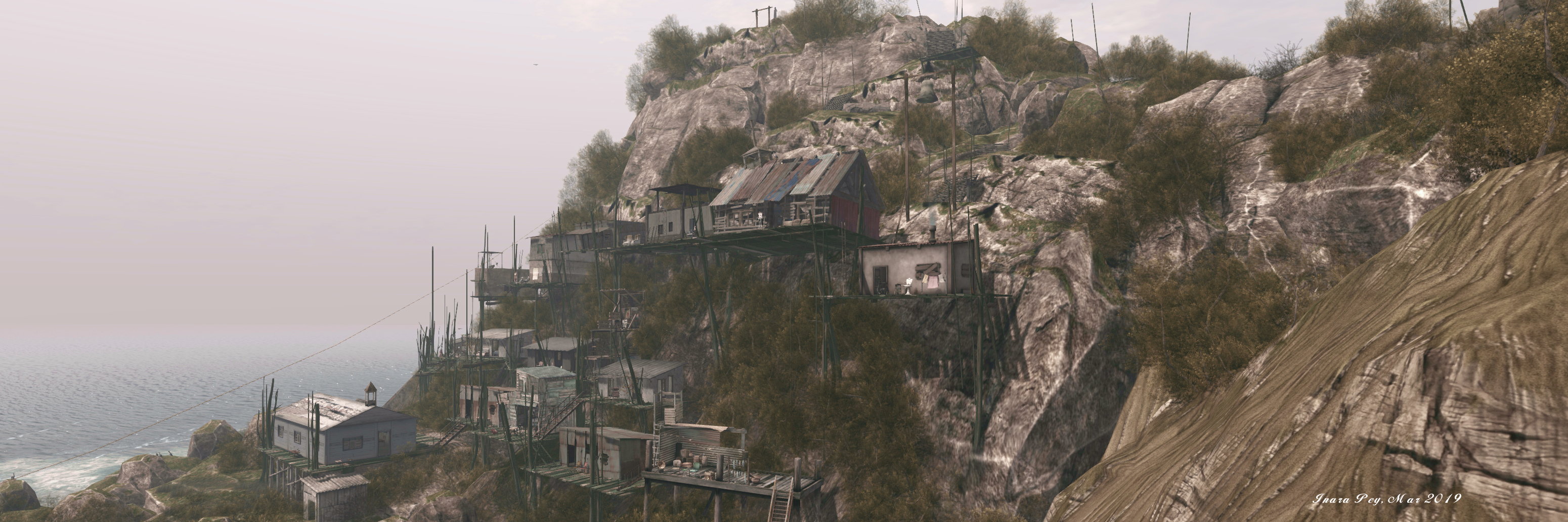
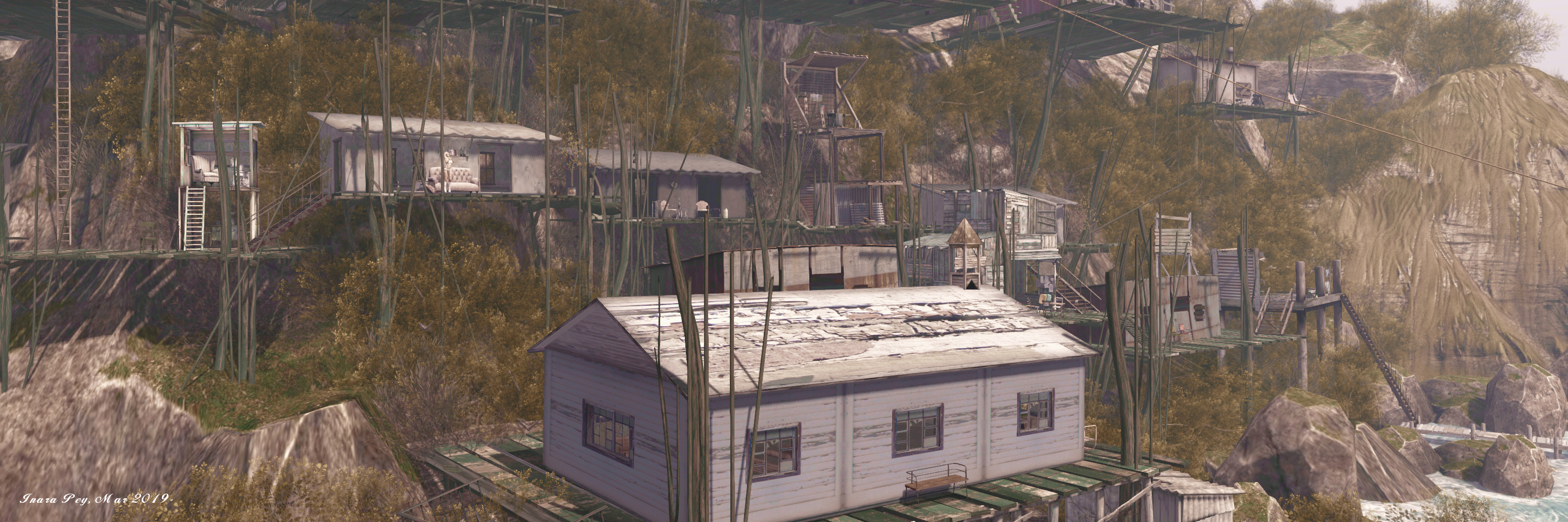
By the 19th century, mining operations had given rise to a small settlement on the mountain housing the the mine, and this underwent significant expansion as miners tbrought their families to settle with them and a railhead was established for transporting mined minerals to nearby Mapimí.

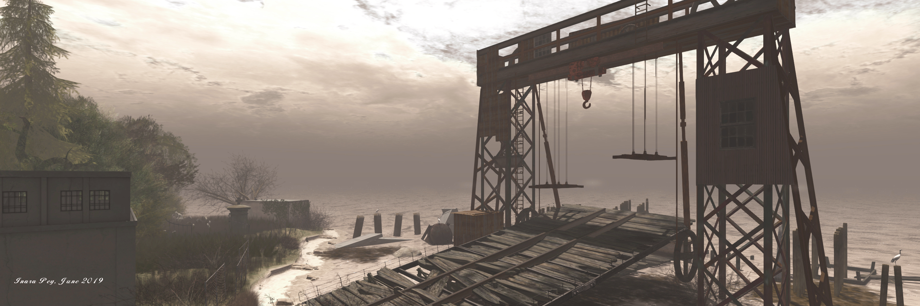
It was at the end of the 19th century that the town’s most famous landmark – and focal point for Jade and Serene’s build – was constructed.  This is the impressive  Ojuela Bridge, designed by Wilhelm Hildenbrand. With a span of 271.5 metres, on completion in 1898 it was the world’s the third longest suspension bridge. However, by the time it was completed mining at Ojuela – now under the control of the Peñoles mining company (today the second largest mining conglomerate in Mexico) – was starting to experience increasing issues with shafts flooding and waning mineral deposits.

The Mexican Revolution of 1910-1920 did not help with production at the mine, and following the end of the fighting, Peñoles opted to withdraw, leasing the mine back to local miners. However, by the early 1930s, with the mine suffering from severe flooding and the accessible mineral veins exhausted, Ojuela was abandoned, bringing to an end around 350 years of continuous mining which had yielded 6 million tons of thoroughly oxidised ore carrying 90 million ounces of silver, 0.6 million ounces of gold and 1.8 billion pounds of lead.

With the mine abandoned the town was left to nature, and today little remains. However, the Ojuela Bridge has been luckier. A major restoration project was started in the late 1980s, culminating in it being fully restored and re-opened as a pedestrian bridge (and tourist attraction) in 1991.

Ojuela, May 2022

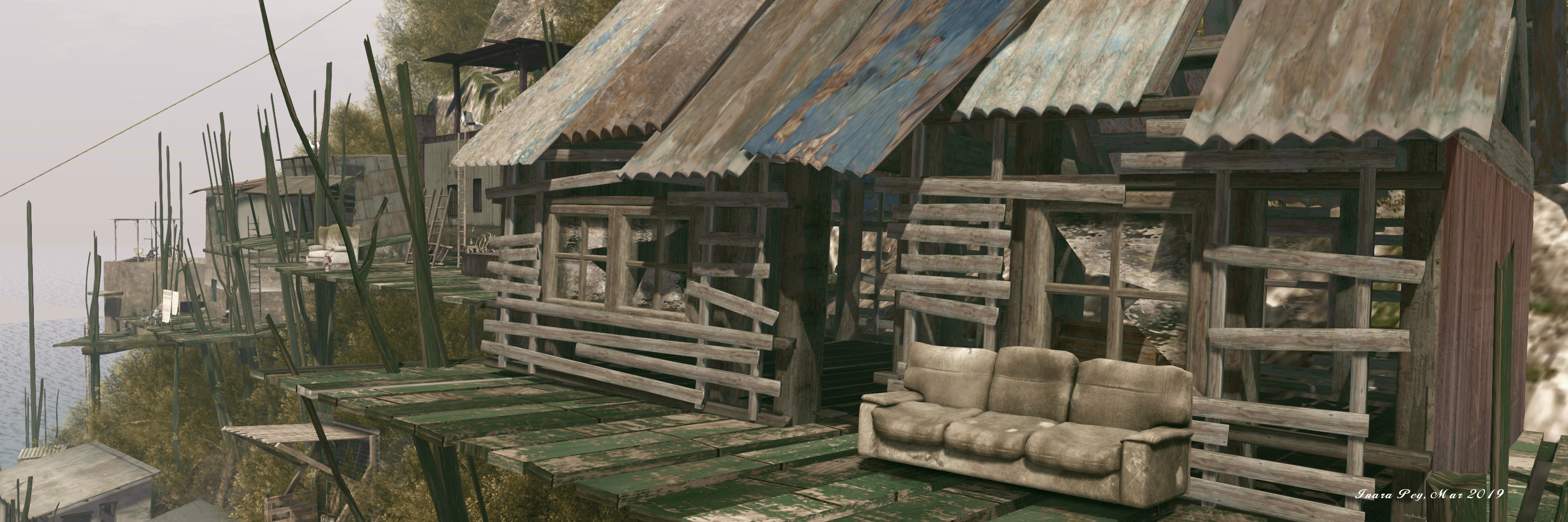
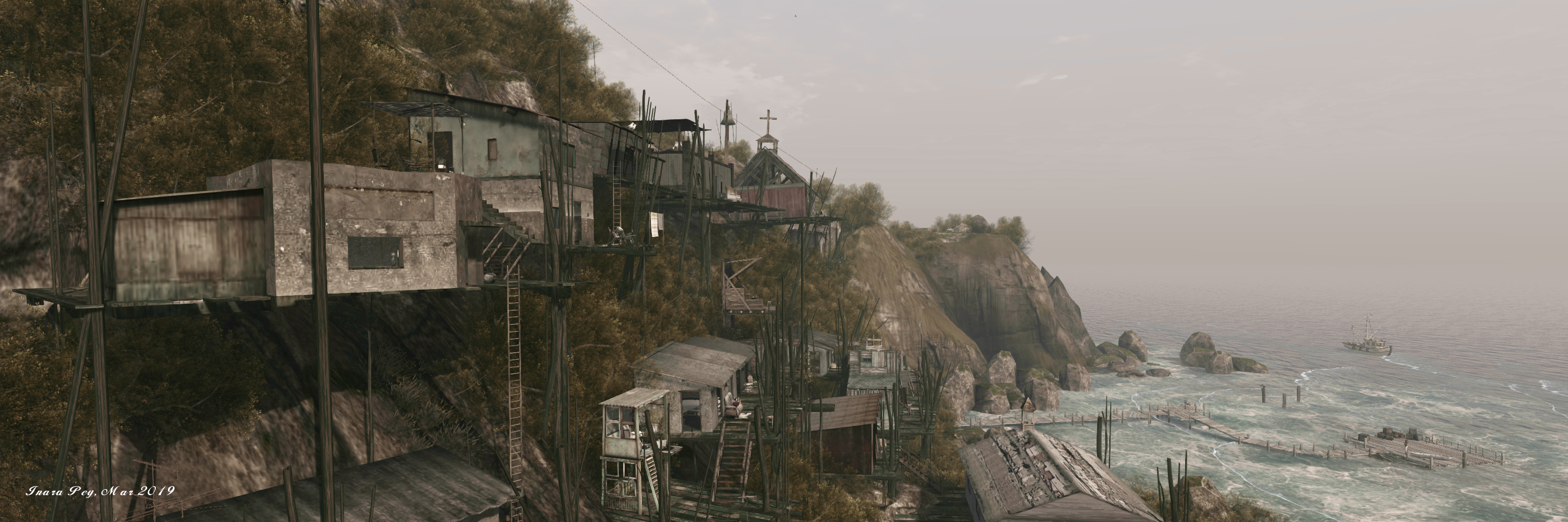
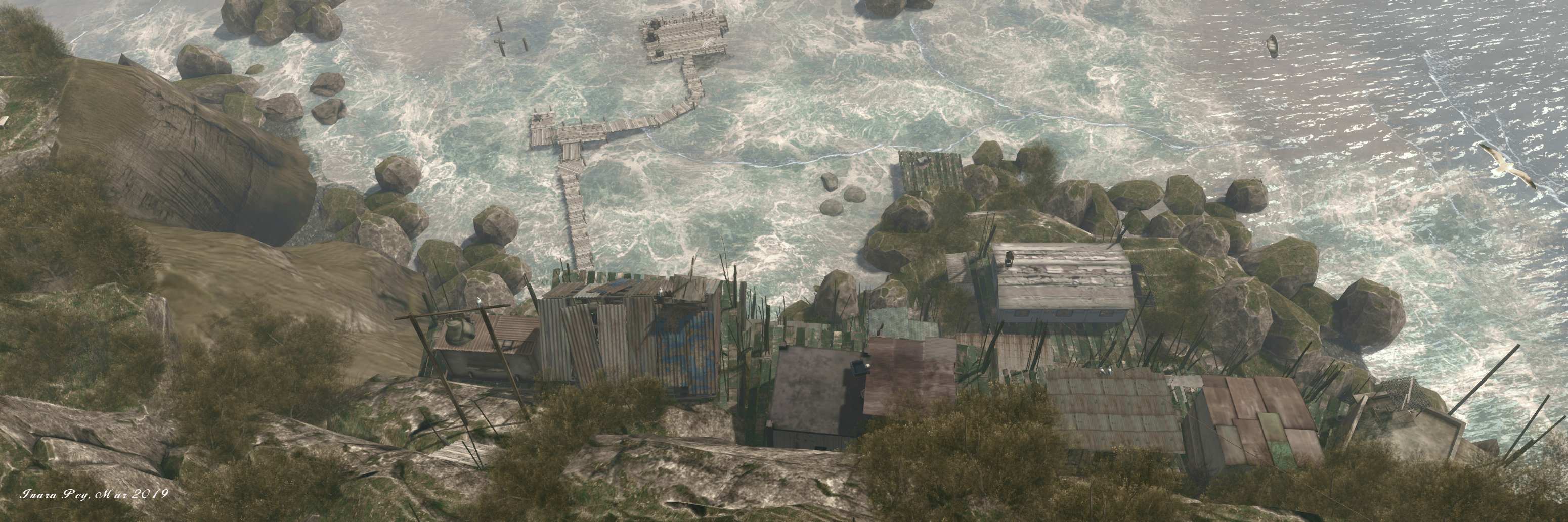
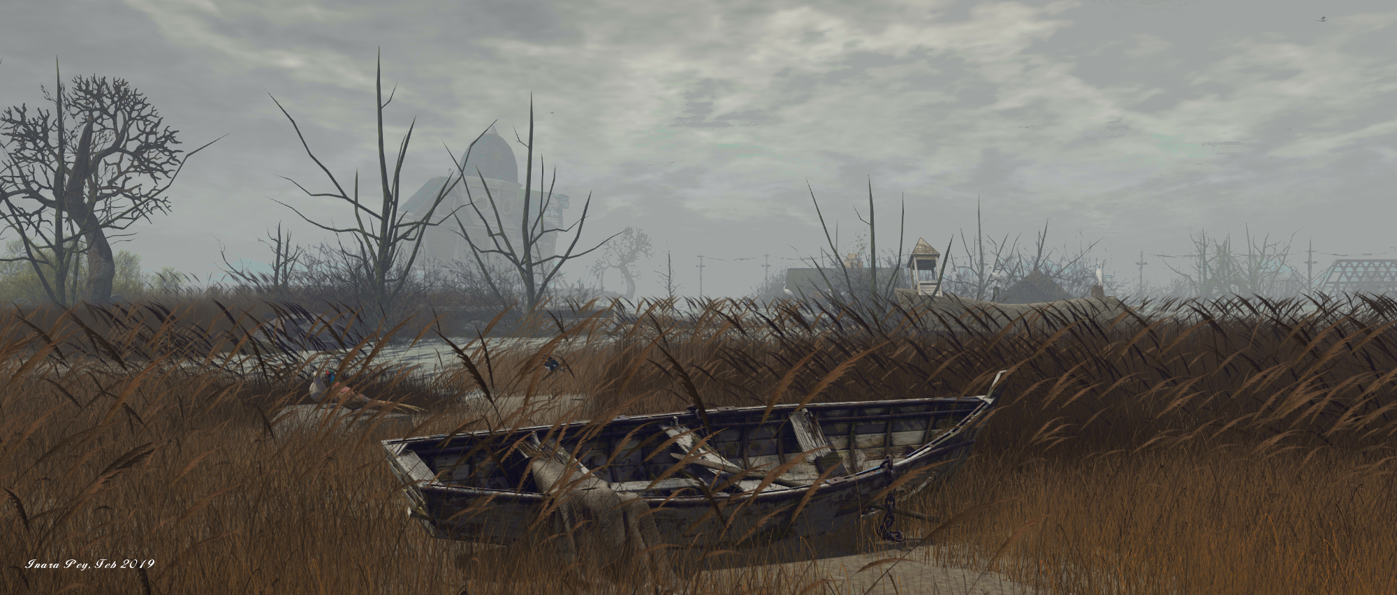
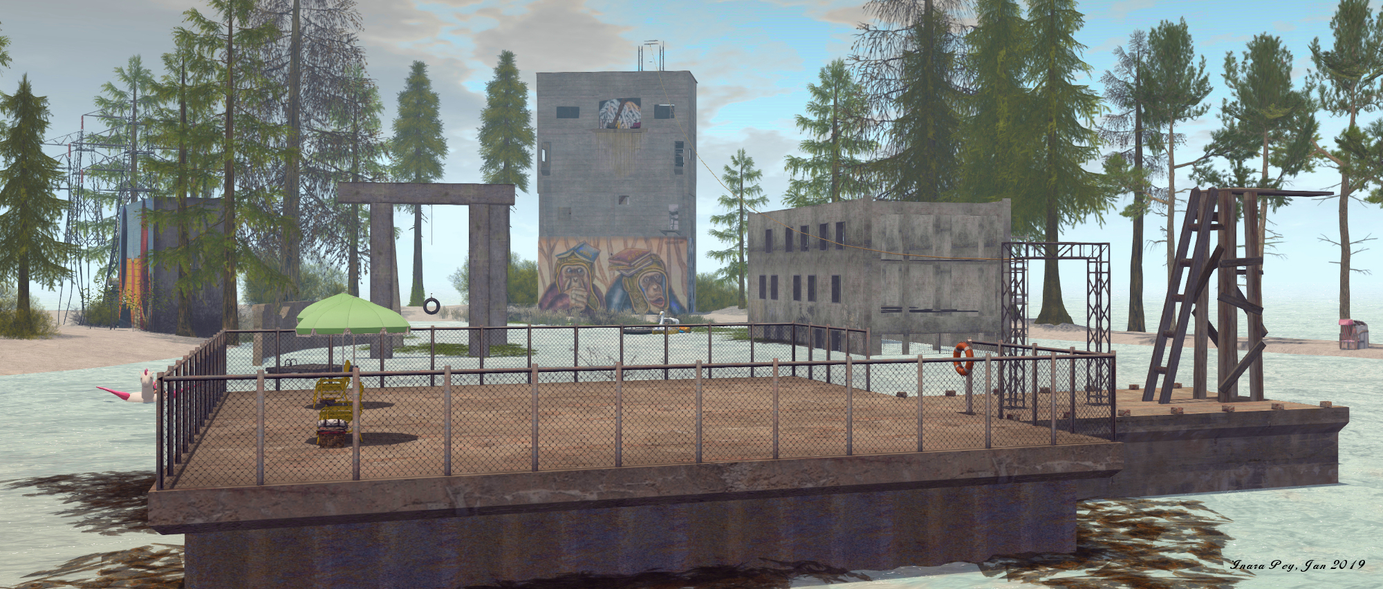
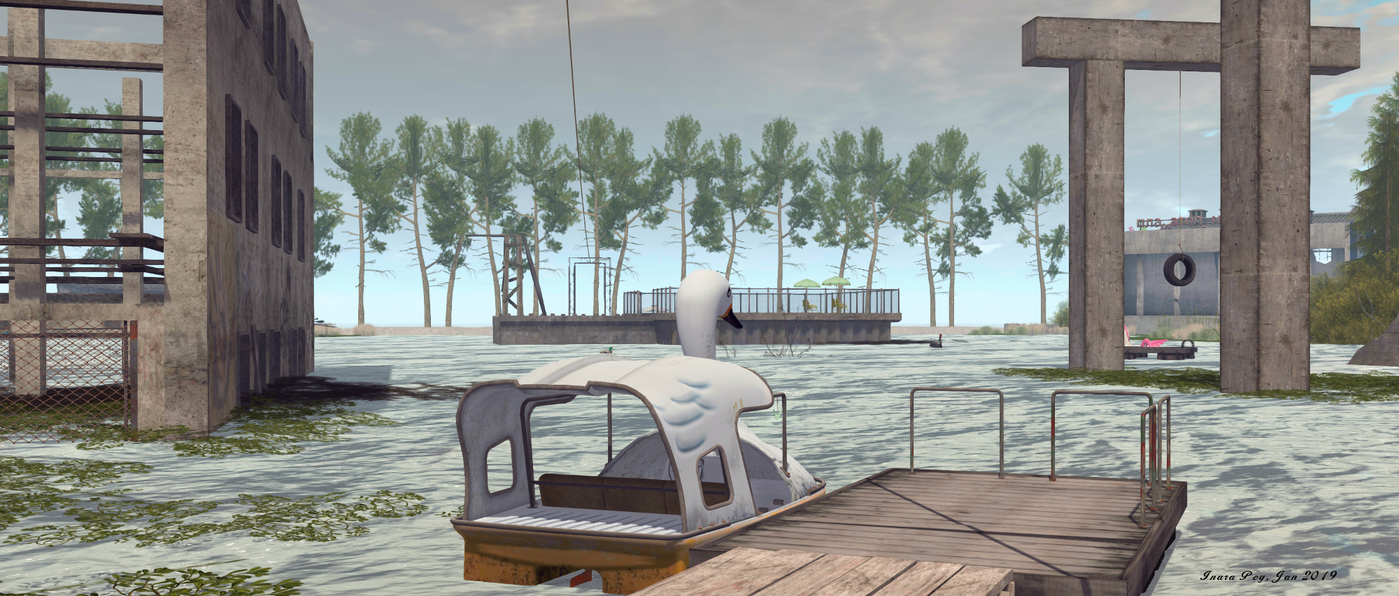
Given they only have a single region to work within, Serene and Jade have – as always – captured the core essence of their subject perfectly, blending the region with a surround to offer a real sense of being in a mountainous setting. From the massive bridge gantries – built be Serene – through to the surrounding peaks, they’ve taken a huge amount of care to offer an engaging mix of physical fidelity at scale with the original setting and a degree of artistic licence.

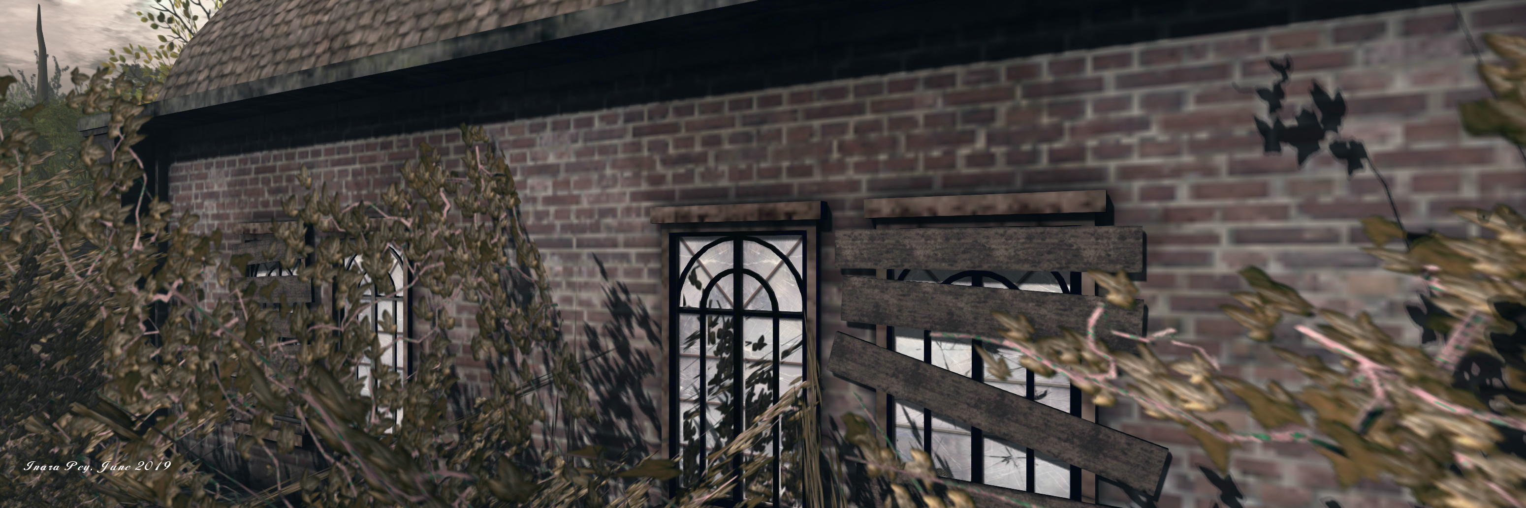
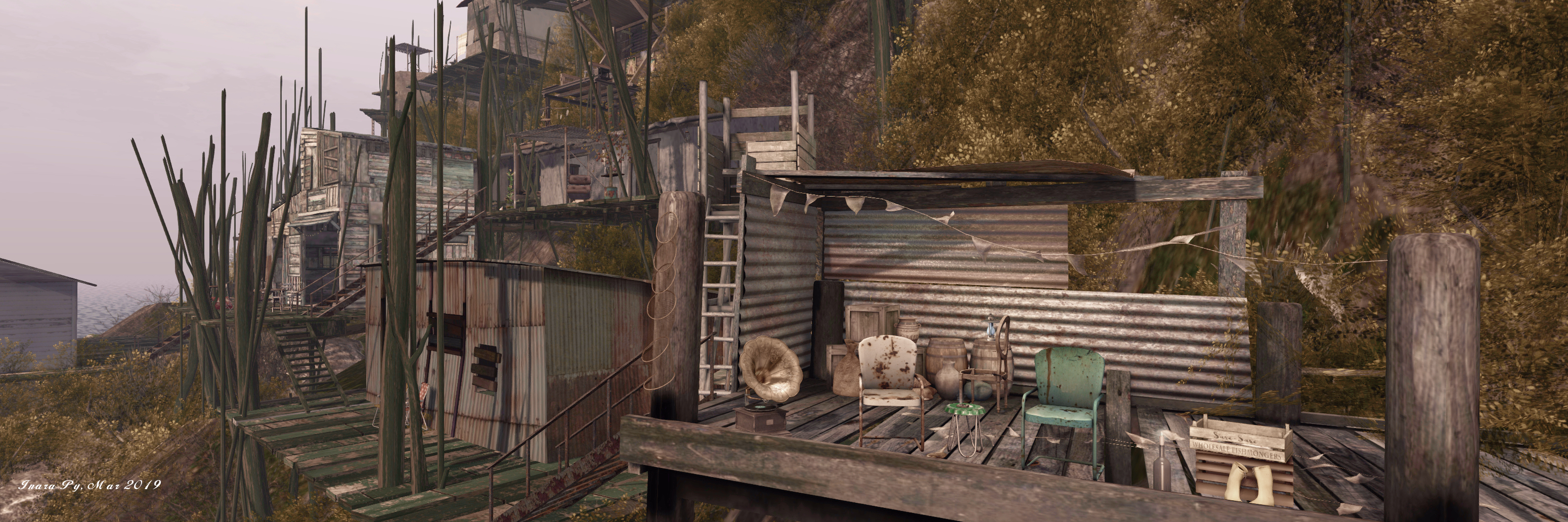
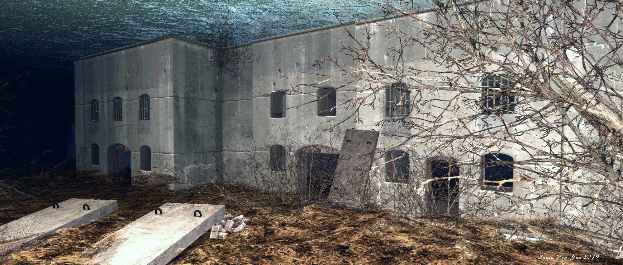
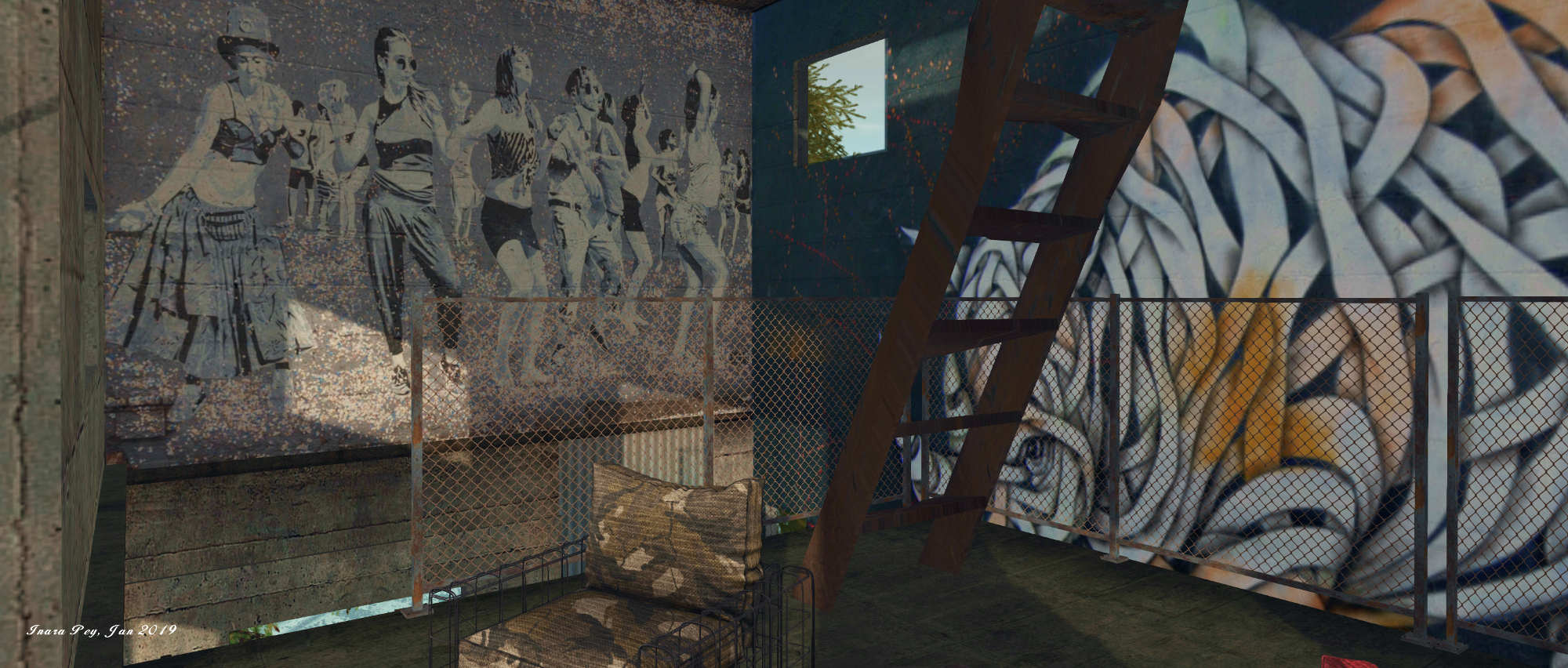
Fore example, the remnants of the Ojuela township, are perhaps more complete here than in the physical world Ojuela, where they are referred to as “ruins” and “foundations” – but this adds to the attractiveness of Jade and Serene’s Ojuela, allowing visitors to gather a sense of how it might have appears in the years following the immediate abandonment.

Ojuela, May 2022

The bridge itself cleverly uses Serene’s own work and commercially-available bridge elements and is simply a masterpiece, spanning as it does the deep gorge that comes complete with the shadowy entrance to a cave (or older mineshaft) that can also bee seen in many photographs taken around the actual bridge. The model fully captures the cabling of the original and the sensation evoked when crossing it is such that all it needs is a couple of materials surfaces to allow the natural creaking of wood in response to walking on the boards together with the susurration of a breeze through the cables, as one would definitely have the sensation of crossing the actual bridge.

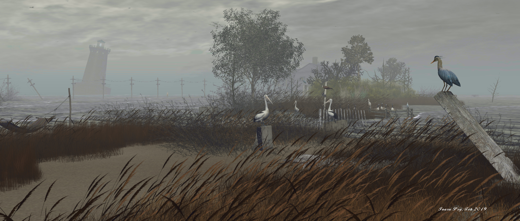
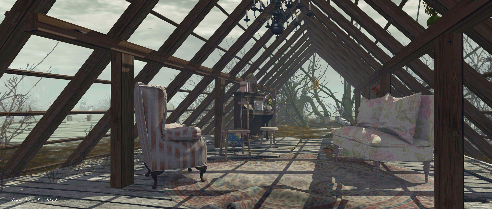
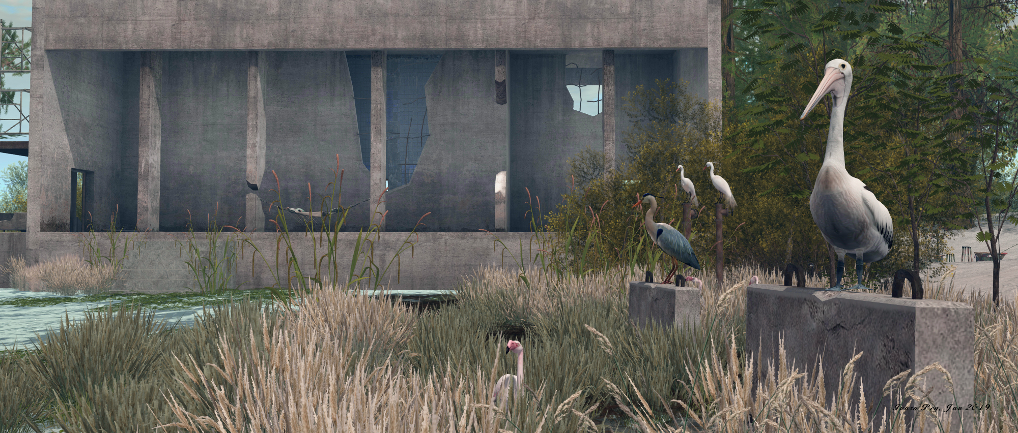
As is usual for the team’s work, Ojuela includes multiples places to sit and appreciate the setting, together with local wildlife and the use of a gentle soundscape to add definition and depth to a visit.

Ojuela, May 2022

Admittedly, I’ve opted from a brighter daylight setting with the images here than has been created for Ojuela, the region’s environment being more of a twilight nature, but this shouldn’t put you off visiting: Serene’s and Jade’s work is always richly engaging and rewarding to see whilst it remains available to appreciate.

SLurl Details

With thanks to both Shawn and Cube for the SLurls / pointers!

Serene’s Black Bayou returns to Second Life

Black Bayou Lake, April 2022 – click any image for full size

I’ve long established that I really appreciate the work of Serene Footman as he brings us places from around the globe we’d otherwise likely never get to visit outside of photos and television images. With his own eye for interpretation, Serene brings these places to life within Second Life to allow us to appreciate them directly. In all the years I’ve had the pleasure of following Serene’s work and writing about his region builds, I’ve never failed to be impressed with his skill and execution in bringing these places to life.

However, there has tended to be one of his builds that has always held a special place in my recollections of his work. In October 2018, Serene brought us his vision of Black Bayou Lake, Ouachita Parish, Louisiana. So you can imagine my delight when Shawn Shakespeare nudged me about Serene having re-opened Black Bayou on April 22nd, 2022. What’s more, and as with the original design, this is once again collaboration with Jade Koltai, with whom he worked on a fair number of regions designs.

Black Bayou Lake, April 2022

Established in 1997, Black Bayou Lake is a US national Reserve covering 2,000 acres of lake and a further 2,000+ acres of shoreline and watershed. The primary am of the park is to provide a place for people to connect with the natural world, and it forms one of four refuges managed in the North Louisiana Refuges Complex.

The lake and its surroundings is a haven for wildlife and waterfowl, and its most ionic landmark for the park is a wooden walkway that extends out over the waters of the lakes and its wetlands. This was a central feature with the original 2018 build and makes a return with this new iteration, complete with its angled raised section intended for the passage of small boats. Also to be found are some of the dry lowlands with their long grass and sprawling trees and much of the wildlife that can be found throughout the actual Black Bayou and also brought Serene’s original build.

Black Bayou Lake, April 2022

However, this iteration of the region design adds some new aspects, as Serene notes in his own bog post on the 2022 iteration of his region.

We’ve added a railway bridge – the Cross Bayou Railroad Bridge, aka the Kansas City Southern Railroad Bridge – which we believe adds to the coherence of the region, making it easier to walk around.
In reality this bridge is located around 100 miles from Black Bayou Lake. It straddles the Twelve Mile Bayou (spelled ‘Twelvemile Bayou’ by locals), which is part of the Cross Bayou, a tributary of the Red River of the South. The bridge was built in 1926 and abandoned during the 1980s. 

– Serene Footman, Return to Bayou

To accommodate the bridge, a river has been added to the region, seemingly carrying water down to the bridge on the west side of the region, from the wetlands to the east.

Black Bayou Lake, April 2022

Elsewhere, other little touches in keeping with legends of the bayou have been included – such as the rickety cabin that appears to be home to voodoo / black magic rituals.

Rich in scenery and wildlife and caught under s setting Sun (I’ve used my own EEP settings here), this iteration of Black Bayou Lake retains the spirit and sense of the original for those who remember it, whilst offering enough that is new to engage and entreat those who do to explore onwards and discover what is new. For those who never got to visit the original, the return of Black Bayou Lake presents the opportunity to enjoy a build celebrating one of the southern United States great areas of natural beauty. As such, I’ll say no more here other than – go visit and see for yourself!

Black Bayou Lake, April 2022

SLurl Details

North Brother Island, “the last unknown place”, in Second Life

North Brother Island; Inara Pey, June 2019, on FlickrNorth Brother Island, June 2019 – click and image for full size

Update: in keeping with Serene and Jade’s approach to offering their region builds for approximately a month before moving to a new location and project, North Brother Island has closed, and SLurls therefore removed from this article.

For their July 2019 region design, Serene Footman and Jade Koltai bring us their vision for what photographer Christopher Payne called The Last Unknown Place in New York City – North Brother Island; and like all of their builds, it is a true wonder to behold and explore.

North Brother Island is one of two small islands located on New York’s East River, its slightly smaller companion now being known as South Brother Island. Both were claimed in 1614 by the Dutch West India Company and originally called De Gesellen (“the companions”), which eventually became transposed to “the Brothers”. Both island have a fascinating history, with that of North Brother perhaps being the more complex – and the more tragic.

North Brother Island; Inara Pey, June 2019, on FlickrNorth Brother Island, June 2019

In 1904, it was the final resting place of the General Slocum, a massive side-wheel paddle steamer built in the 1890s, she caught fire whilst carrying 1,342 passengers and through a combination of neglect by the owners, foolhardiness by the Captain (he failed to use opportunities to either make a safe landing or run the ship aground before the fire overwhelmed the vessel), 1,021 of those souls perished either aboard the ship or as a result of drowning in the East River – many of their bodies washing up on North Brother Island in addition to as the vessel running aground there.

In addition, Serene goes on to note the island was the home to:

Riverside Hospital, which moved here from Roosevelt Island in 1885 … Following World War II North Brother Island was inhabited by war veterans during the nationwide housing shortage, before being abandoned again in the early 1950s. It was then was used as the site of a treatment centre for adolescent drug addicts, but the centre closed amidst controversy – it was said that heroin addicts were held against their will and locked in rooms until ‘clean’ – in the 1960s.

– Serene Footman, writing about North Brother Island

North Brother Island; Inara Pey, June 2019, on FlickrNorth Brother Island, June 2019

Riverside Hospital, originally founded in the 1850s, was designed to isolate and treat victims of smallpox, with its mission expanding to cover other diseases requiring quarantine. In this role – as Serene also notes – it took in those stricken with typhoid, including “Typhoid Mary”, Mary Mallon. An Irish-American cook, she was the first person in the United States identified as an asymptomatic carrier of the pathogen associated with typhoid fever. It is believed she infected between 47 and 51 people during her career as a cook, and was twice forcibly isolated by public health authorities, the second time finally passing away in Riverside Hospital in 1938, after a total of nearly three decades in isolation.

In 1943, a large tuberculosis pavilion was constructed on the island but was never used for that purpose, already being obsolete by the time it opened. Instead, it was used as a dormitory by a number of New York City’s colleges, students transported to and from the island via the East 134th Street Ferry Terminal.

North Brother Island; Inara Pey, June 2019, on FlickrNorth Brother Island, June 2019

In the late 1950s  / early 1960s, the same ferries were used to transport adolescents to the island to be “treated” for drug abuse. The idea had been to provide care for up to 100 males and 50 females away from jails where drugs could still be obtained, with stays at the pavilion being for up to six months. But the hospital gained a reputation for keeping adolescent addicts against their will – it merely required their parents to place them there, with or without the agreement of the courts. Once there, the young people were frequently locked away and left to go cold turkey as a means to break their addiction.

The hospital finally closed in the 1960s, and North Brother Island abandoned, its many building and facilities – including the ferry wharves and giant gantry crane, many of the hospital buildings and facilities, left to rot. However, many of them have now been captured in this interpretation of the island by Serene and Jade.

For our reconstruction of North Brother Island, we have relied on maps which contain details of where specific buildings – the hospital itself, staff quarters, the physician’s house, the morgue, tennis courts, and so on – were located. (For reference, we have labelled and dated the island’s buildings in-world.)

– Serene Footman, writing about North Brother Island

North Brother Island; Inara Pey, June 2019, on FlickrNorth Brother Island, June 2019

In addition they have called upon the resources of Christopher Payne’s catalogue of photos of the island: North Brother Island The Last Unknown Place in New York City. The result of five years of being allowed to visit the island  – today both North and South Brother islands are designated wildlife sanctuaries, and so protected (North Island is additionally regarded as being too dangerous for the public given the state of its buildings) – Payne carefully constructed a visual history of the island. This, together with their own extensive research, have allowed Jade and Serene have produced a region that powerfully captures North Island as it stands today, its past history, and the pathos and pain of that history.

The latter is particularly well captured in the small details to be found throughout the region. Take, for example, the bed frame converted to a seat and that sits on a little dock. A suitcase  sits behind it, while a short distance away, a little motor boat sits on the water; the entire scene brings to mind the longing of the young people held on the island to return home.

North Brother Island; Inara Pey, June 2019, on FlickrNorth Brother Island, June 2019

To say North Brother Island is visually stunning is to do it a disservice. As with all of Serene and Jade’s builds, it must be seen to be appreciated and understood – and there are plenty of places within it that allow visitors to contemplate on the history of the island – or whatever else might be on their minds.

Related Link

The stunning beauty of Ukivok in Second Life

Ukivok; Inara Pey, March 2019, on FlickrUkivok – click any image for full size

Update: in keeping with Serene and Jade’s approach to keeping their region designs open for approximately a month, Ukivok has closed, and SLurls have therefore been removed from this article, as the host region is under private holding. 

As I’ve frequently noted, Serene Footman and Jade Koltai are the creators of what are arguably the most evocative region designs made for Second Life.Each of their creations tends to last for a month, and when available, should not be missed, given they are so beautifully presented and perfectly reflect the physical world locations that form their inspiration.

Each and every design – the majority I have written about in this blog – are exquisite, but I confess there is something about their latest design – Ukivok – that is utterly breathtaking; quite the most visually impressive presentation of a rugged, isolated island, one that offers an informative look at a part of the world perhaps unknown to most.

Ukivok; Inara Pey, March 2019, on FlickrUkivok

Our new sim is a recreation of the abandoned Alaskan village of Ukivok … Once home to around 200 Iñupiat, the village is located King Island, which is situated in the Bering Sea, around 64km off the Alaskan coast and 145km from Nome.

– Serene Footman, describing Ukivok

The Iñupiat (or Inupiaq) are native Alaskan people whose traditional territory extends from Norton Sound on the Bering Sea to the Canada–United States border. Those who once lived on Ling Island called themselves Aseuluk, “people of the sea” or Ukivokmiut – a name combining the name of the village and “miut”, meaning “people” (and so might translate as “people of Ukivok”).

Ukivok; Inara Pey, March 2019, on FlickrUkivok

The village itself seems an impossible place; built against a rocky slope of the island’s flank as it rises at a 45-degree angle from the sea. Houses and community buildings sit upon wooden platforms, themselves standing on stilts, with the platforms rising in uneven tiers, connected by rickety looking wooden walkways and steps. Nestled between the frigid sea below and the desolate upper slopes of the island, the most recognisable building in the village is perhaps the 2-storey faded white block of the former Bureau of Indian Affairs school, the closure of which in the latter part of the 20th century marked the beginning of the end of village life on the island.

For their build, Jade and Footman could not recreate all of King Island, which is 1.6 km wide (and, as an aside, was named thus by Captain James Cook in 1778, in recognition of Lieutenant James King, a member of his crew). Instead, they have focused on the bay the village sits above, and the village itself.

Ukivok; Inara Pey, March 2019, on FlickrUkivok

And the reproduction perfectly captures the windswept, elemental look and feel of the now-deserted Ukivok perfectly, including a homage to the school mentioned above. The landing point sits off-shore platform that provides a glorious first look at the island as it rises from the waves, reaching an impressive, and entirely natural 108 metres above the surrounding sea floor.

Even without the village, the island makes for an incredible sight, and it’s clear considerable thought an effort has gone into designing and building it; if you can, make sure you cam all the way around it to fully appreciate the beauty of the design. A board walk links the landing point with the shoreline, where a steep set of steps offer the way up to the first platform – and the start of an adventure up through the village, using steps and ladders (click the latter to ascend / descend them), passing through areas that offer echoes of the lives once lived here, and opportunities to sit and appreciate the island as a whole.

Ukivok; Inara Pey, March 2019, on FlickrUkivok

The Ukivokmiut were subsistence hunters and whalers who had lived on King Island for centuries. Their activities on and around the island included hunting for seals and walruses, crab fishing, and gathering bird eggs and other foods.

– Serene Footman, drawing on notes about the Aseuluk of King Island

Above the upper levels of the village are more steps, linking shelves of rock one to the next. Some of these steps might be easy to find, others hidden by the scrub hedges that cling to cliff and slope. Follow one group, and you may find your way to the north-eastern headland, which again offers a stunning view back across the rest of the island to the village. This route will also take you past an homage to an entirely natural tor of rocks that crown the physical world King Island.

Ukivok; Inara Pey, March 2019, on FlickrUkivok

The crown of this Jade and Serene’s version is a little different, and lies to the south-east. It is marked by a single statue looking down over the village, and the view gives a further understanding of Ukivok’s seemingly precarious position on the island. Close to the statue is a zip line which descends steeply (and quite rapidly) down to an outcrop of rock and shingle close to the landing point. Should you take the ride, you’ll have to fly back to the landing point or to the island; or you can rest a while on the chairs set out on the rock.

Set under an ideal windlight, surrounded by ocean foam and perfectly placed submerged terrain that is naturally suggestive of rocky shallows close to the island, Ukivok is completed by another superb sound scape. And once having seen it, I think you might find it hard to deny it is one of the natural wonders of Second Life – so many sure you visit it while it is here.

Ukivok; Inara Pey, March 2019, on FlickrUkivok

The lost islands of Chesapeake Bay in Second Life

Chesapeake Bay; Inara Pey, February 2019, on FlickrChesapeake Bay – click any image for full size

Update: in keeping with Serene and Jade’s approach to having their region designs open for approximately a month, Chesapeake Bay has now closed and the host region is under private holding. SLurls have therefore been removed from this article.

Serene Footman and Jade Koltai have opened their February region design – called Chesapeake Bay – and, given it is by two people who always produce the must stunning vistas in Second Life, it is utterly captivating.

Our latest sim is located in the Chesapeake Bay, an estuary in the US states of Maryland and Virginia.  The Chesapeake Islands are famous for the simple reason that they disappeared. Built on clay and silt, over the course of a century the islands were gradually submerged as a result of erosion exacerbated by sea level rise. They were the islands that sank.

– Serene Footman, introducing Chesapeake Bay

Chesapeake Bay; Inara Pey, February 2019, on FlickrChesapeake Bay – click any image for full size

For the build, Jade and Serene have focused on two islands in particular:  Holland Island and Sharps Island, with a particular focus on the former while blending features of both into a unique setting and memorial to both with all of the attention to detail and care in design that make their work among the best to be found in Second Life. As with all of their regions, this design carries within it a story – or rather stories. The first – and primary – story is that of the attempts of a husband and wife team to save Holland Island and the last remaining house standing upon it, all that remained of a place once home to over 400 watermen and farmers, and their families.

Stephen White, a waterman and Methodist Minister, first visited Holland Island when he was a boy. Years later, he was visiting one of the island’s three cemeteries when he saw an inscription on one of them.
The discovery inspired Stephen White to embark on a campaign to stop Holland Island from disappearing into the sea. He purchased the island for $70,000, and set up the Holland Island Preservation Foundation. For fifteen years, Stephen and his wife waged their own battle against the sea. Spending $150,000, they built wooden breakwaters, laid sandbags and carried 23 tons of rocks to the island and dropped them at the shoreline.

– Serene Footman, describing Stephen White’s attempt to save Holland Island

Chesapeake Bay; Inara Pey, February 2019, on FlickrChesapeake Bay – click any image for full size

The waters of the Chesapeake were not to be held back, however, and in 2010 that last house, originally built in 1888, collapsed, forcing the Whites to admit defeat and sell the island. The remnants of  that last house was completely lost to the waters of the bay in 2012.

Hoewever, for this incarnation and in recognition of the Whites’ attempts, the house remains, much as it appeared in 2010 after the initial collapse. It sits on the west side of the island, the carcasses of the vehicles used to try to shore up the land around it slowly drowning under the rising waters, watched over by sea birds and waterfowl.

Chesapeake Bay; Inara Pey, February 2019, on FlickrChesapeake Bay – click any image for full size

North of the Last House is an automated lighthouse sitting on a platform, marking the second story commemorated by the region: that of lighthouse keeper Ulman Owens. The light sits atop a platform once home to the Holland Island Bar Lighthouse, also built in 1888, and manned through until 1960, when the automated tower replaced it on the platform. In 1931, keeper Owens was found dead in the lighthouse kitchen amidst a scene of apparent violence, including a bloodied butcher’s knife close to the body and bloody stains within the room, although the body itself showed no significant wounds.

Initially, his death was ruled the result of a fit, rather than foul play. But subsequent investigations and an autopsy suggested Owens may have been murdered by local rum runners or that, given he had at least two affairs that caused the women involved to leave their husbands, he might have been set upon by an angry husband. However, as the autopsy revealed Owens had heart disease, the ruling of accidental death was held, and the case closed.

Chesapeake Bay; Inara Pey, February 2019, on FlickrChesapeake Bay – click any image for full size

Sharps Island, although some distance from Holland Island in the physical world, is represented in the region by a reproduction of the “leaning tower” of the (deactivated) Sharps Island Light, and the ruins of a second large house. The latter represents the popular (if short-lived, due to the island’s continuing erosion) hotel built by Miller R. Creighton in the late nineteenth century. Sharps Island itself finally vanished under the waves in 1960.

Today, Holland Island is marshlands and sandbars, home to a great many varieties of birds and waterfowl, and Serene and Jade have captured this within their design, which is finished with an atmospheric windlight and superb sound scape.

As with all of Jade and Serene’s builds, Chesapeake Bay won’t be around forever, so do make a point of visiting; you won’t be disappointed. Be sure, as well, to read the excellent piece on the region and its inspiration on the Furillen blog.


The haunting beauty of Rummu in Second Life

Rummu; Inara Pey, December 2018, on Flickr
Rummu – click any image for full size

Update: in keeping with Serene and Jade’s usual approach of maintaining a region design for approximately a month after opening, Rummu has closed. SLurls have therefore be removed from this article.

The start of a new year brings with it the opening of a new region design by Serene Footman and Jade Koltai, and once again they present a vision of a place few of us may ever get to see in the physical world. Rightly renowned for their work in reproducing Furillen (read here), Khodovarikha (read here), La Digue du Braek (read here), Isle of May (read here) and Black Bayou Lake (read here), they now present a setting with deep historical and cultural meaning, harkening back to the era of the Soviet Union: the Rummu quarry, located in Estonia.

Called simply Rummu in Second Life, the region completely captures the heart and soul of Rummu quarry and some of its surroundings. beautifully encapsulating them within the confines of a 256 square metre setting.

It was the location of a quarry from the 1930s until the early 1990s. More notoriously, Rummu was the site of a Soviet prison, whose inmates formed the majority of the quarry’s workforce … Rummu quarry was essentially a labour camp in which prisoners were forced to work and to endure brutal treatment from guards who barely spoke their language.
After Rummu prison was closed, the quarry ceased operating. The site was flooded and another remarkable story began. The prison itself now lay hidden beneath a lake that slowly became a well-known Estonian beauty spot, drawing many visitors who wanted to swim and dive in its crystal clear waters. In summer, this place resembles a city beach, packed with bathers.

– Serene Footman, discussing Rummu

Rummu; Inara Pey, December 2018, on Flickr
Rummu

It is as this modern beauty spot (still used today, despite bathing and swimming in the quarry having been banned) that Jade and Serene have recreated Rummu, and they’ve done so with remarkable detail.

In the physical world, the quarry sits within a heavily wood region and is immediately identified by a massive spoil tip from the quarry excavations, which forms a man-made table mountain rising above what is now the meandering lake. Sitting close to the spoil tip are a number of building shells, some rising directly out of the flood waters filling the quarry, others sitting on the shoreline, all now battered and broken since the quarry’s closure in the 1990s, and the natural flooding of the quarry pit that followed (the prisons themselves – Rummu and Murru prison, which Serene references in his own write-up about the location, – actually continued to operate through until 2012, after being merged into one in 2001, and then with the nearby Harku women’s prison in 2004).

Rummu; Inara Pey, December 2018, on Flickr
Rummu

All of this is wonderfully recreated within the Rummu build, right down to the rills and channels created by water that flows down the flanks of the spoil tip as a result of regional rainfall, and the low, sandy-like spaces where Estonians come to enjoy the summer Sun between dips in the deep waters. Also captured within the build is the fact that rather than merely standing as derelict shells or as diving platforms for daring leaps into the waters below, the buildings also became the home of an impromptu outdoor art gallery, their walls home to large fresco-like paintings and graffiti.

Nor is the build restricted to reproducing what lies above the waters; when the quarry naturally flooded after work within it ceased (the quarry had to be continuously pumped during its operational life in order to prevent it filling up with water), many of the buildings it contained, together with equipment, ended up underwater.

Rummu; Inara Pey, December 2018, on Flickr
Rummu

These drowned remains give the physical world Rummu prison something of an eerie, ethereal feel, as they can often be seen from above the surface. And it is these submerged buildings and other reminders of the quarry’s past that have also in part been reproduced within Serene’s and Jade’s build. Somewhat hidden from any overhead view when using the default windlight, they lie within a haze that gives a great sense of the real quarry’s depth, looming into view much as they would to divers braving the waters of Estonia’s Rummu.

As Serene notes, almost all the LI for the region is used up; ergo there is no public rezzing available – but there are a lot of places to sit and enjoy the surroundings – including a dive platform that appears to have been drawn from this video of the quarry, and which again adds to the overall setting. There are also a number of interactive elements to be found as well, including two places where you can dive, a zip line slide and a pedal boat rezzer.

Rummu; Inara Pey, December 2018, on Flickr
Rummu

But why pick on a place that once harbours such human misery? I think Serene explains it perfectly:

We were drawn to the place by its contrasts: between past and present, between what lies above and below the water, between freedom and captivity, between beauty and brutality. We also liked Rummu’s bohemian vibe: there is something carefree and illicit in the way that visitors use it, painting murals on the walls of the buildings one can see, and staging impromptu parties and music events.

– Serene Footman, discussing Rummu

To give you a flavour of Rummu as it appears today, and just how carefully Serene and Jade have recreated it, I’ll leave you with a short video of the quarry. Do remember that the setting will not in in-world forever, so a visit is strongly recommended, and photos can be shared on the Rummu Flickr group.

Links