More middle-eastern promise

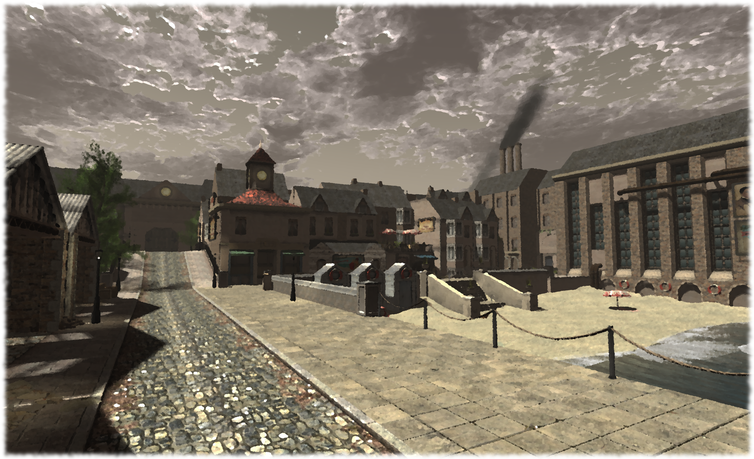
I dropped-in at Sands of Time at the weekend, a marvellous region which offers a heaven of peace and tranquility – as well as a host of beautiful vistas – for the footsore and weary seeking shelter from the rush and excitement of SL10BCC.

Jordan First
Jordan First

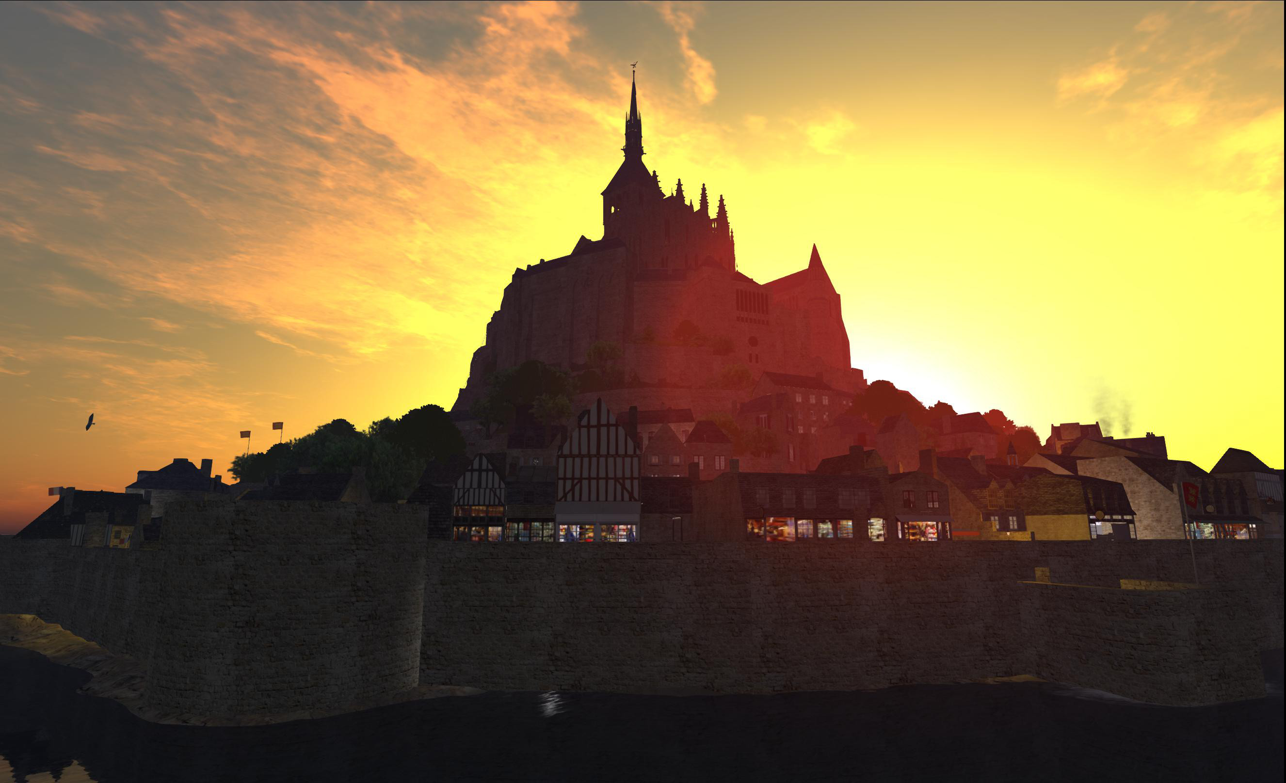
Well, I’m staying with things of an middle-eastern flavour, because in playing catch-up with my explorations, I’ve opted to cover Jordan First, the home of Kingdom of Jordan, another stunning and very photogenic build; this one with a foot planted firmly in history (and one Ziki Questi visited about the same time I did, but beat me to the post, so I opted to hang back a while before Pressing an article of my own). A homestead region owned by Farah Loordes is described as a “hangout” area – which grossly undersells it.

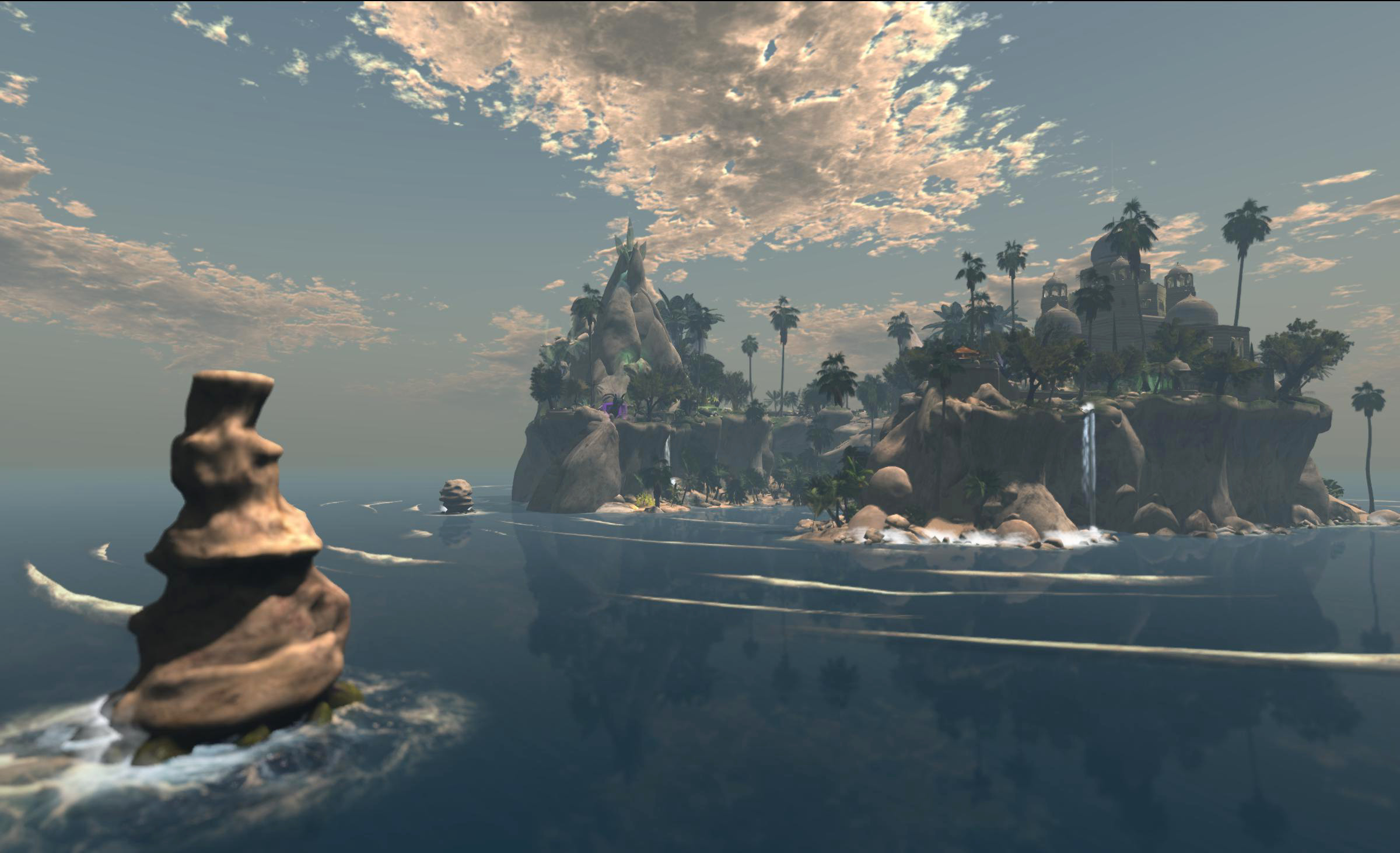
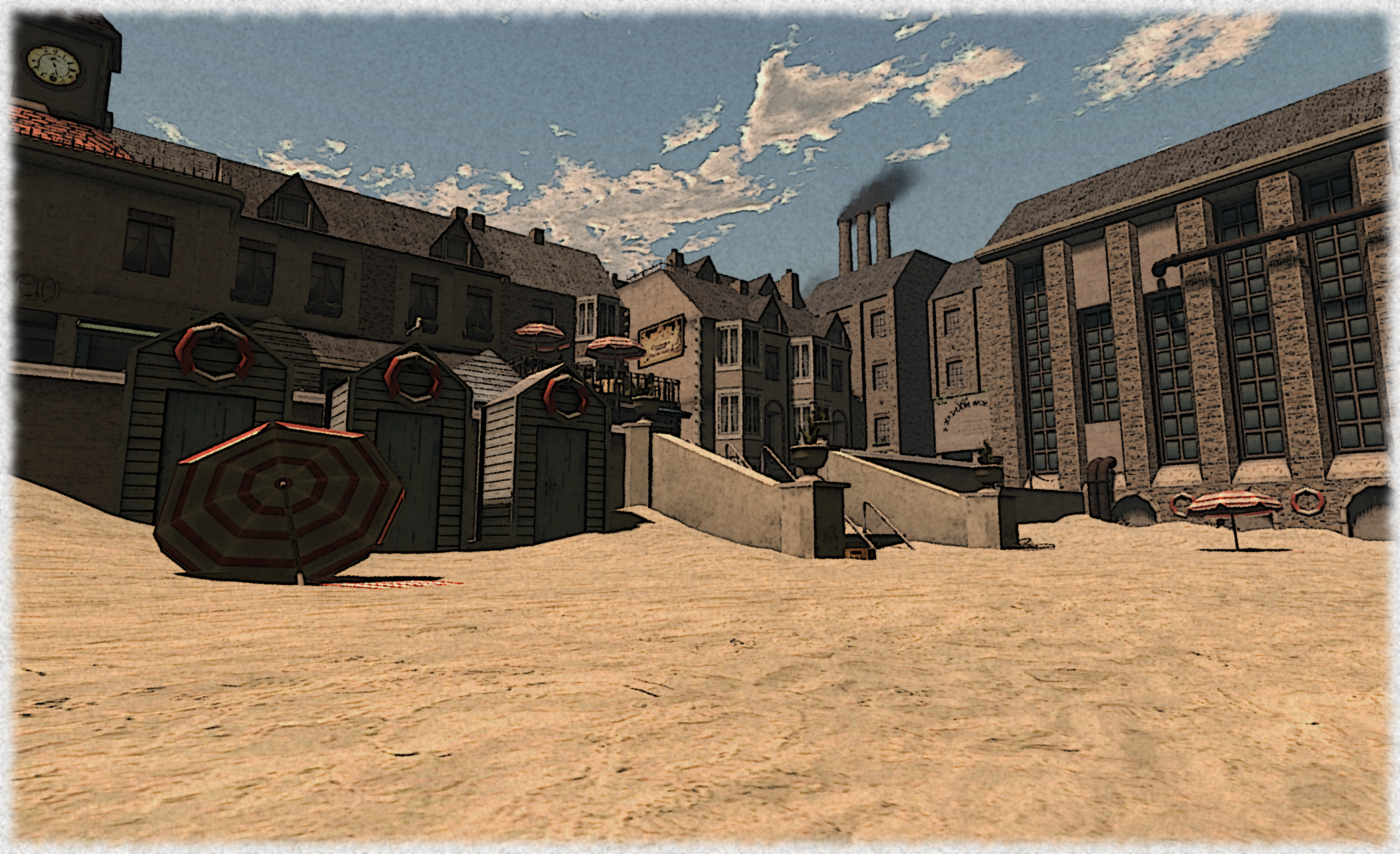
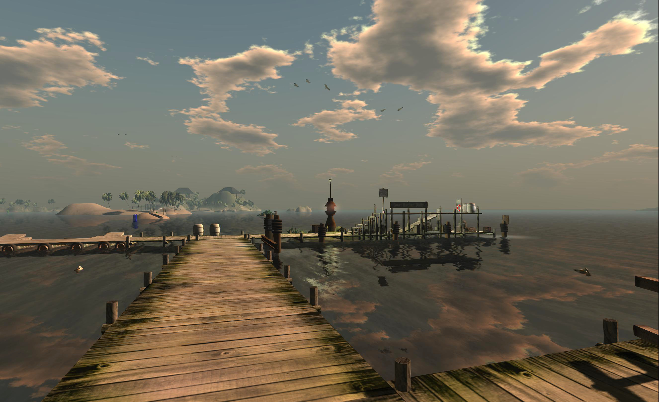
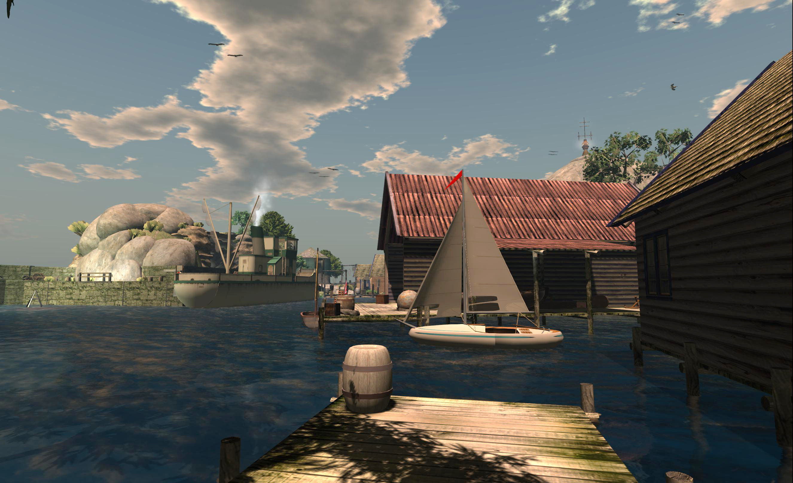
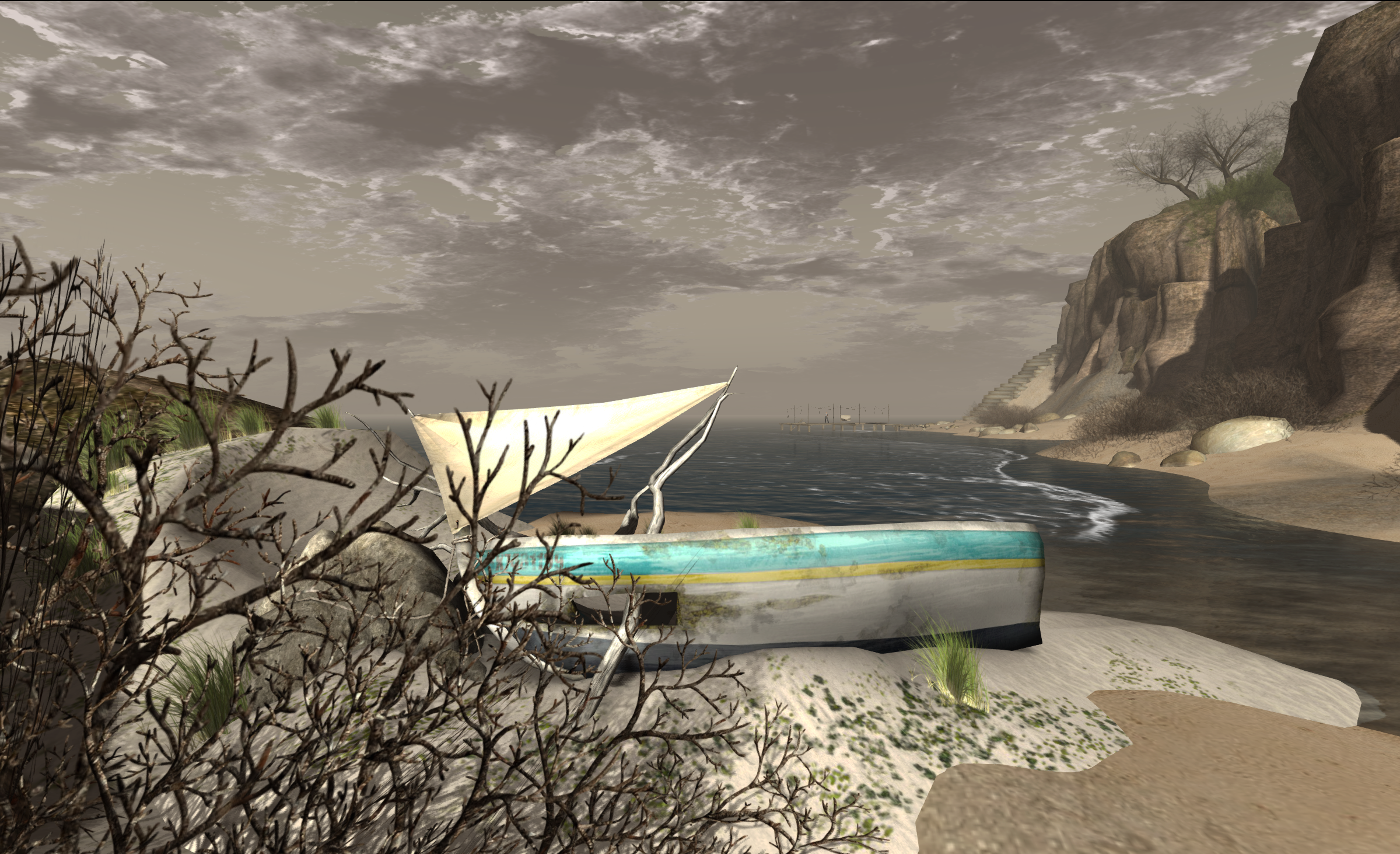
The default arrival point kind-of gives away the secret of the build from the moment you arrive, so I’ve opted to give a SLurl that will bring you to a little wooden pier over the sea next to a sand-kissed beach. A long stone stairway leads up the cliffs to the top of the island which, if you’ve visited Hazardous, will immediately appear very familiar – not that Jordan First is in any way a copy of the latter.

Jordan First
Jordan First

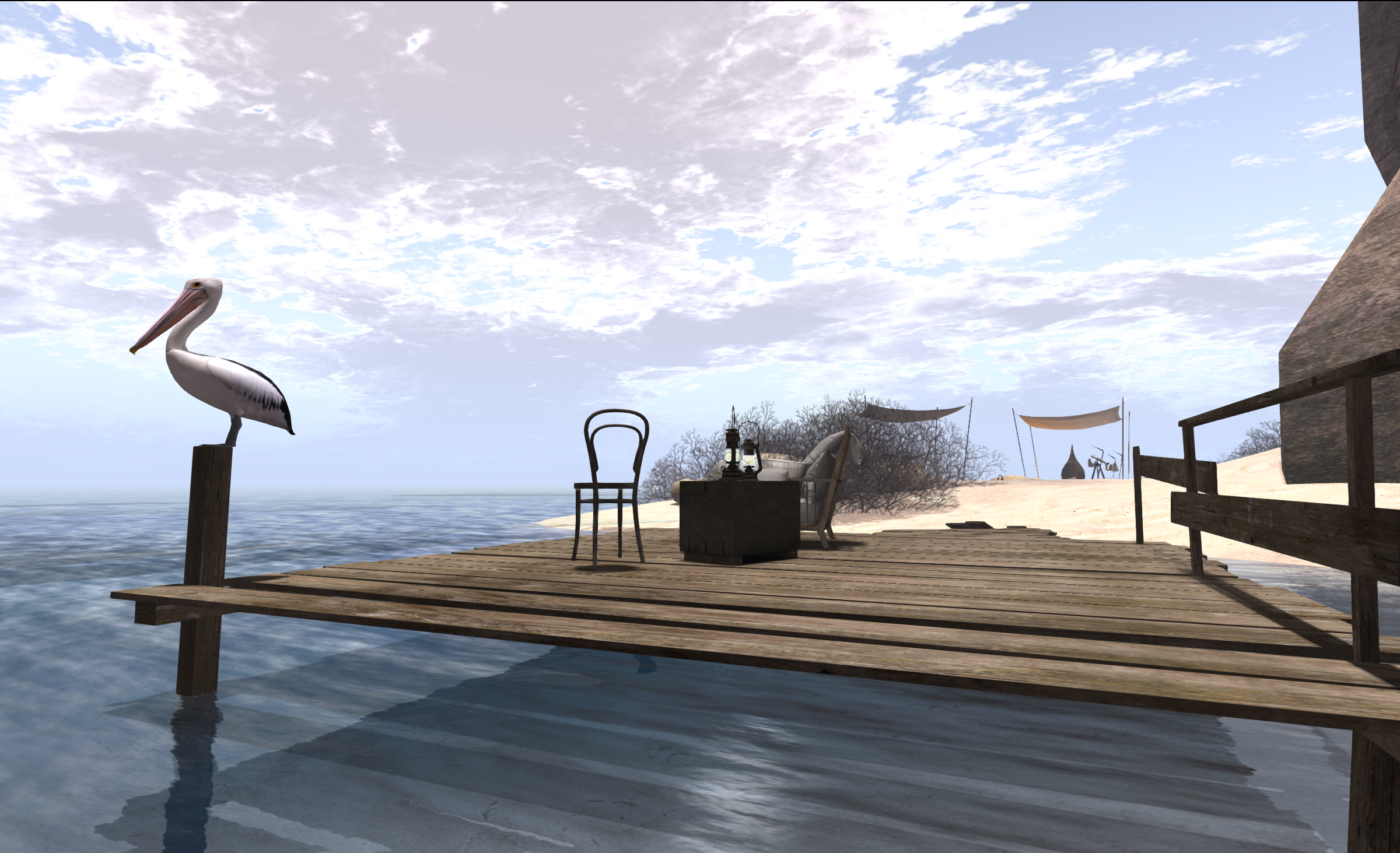
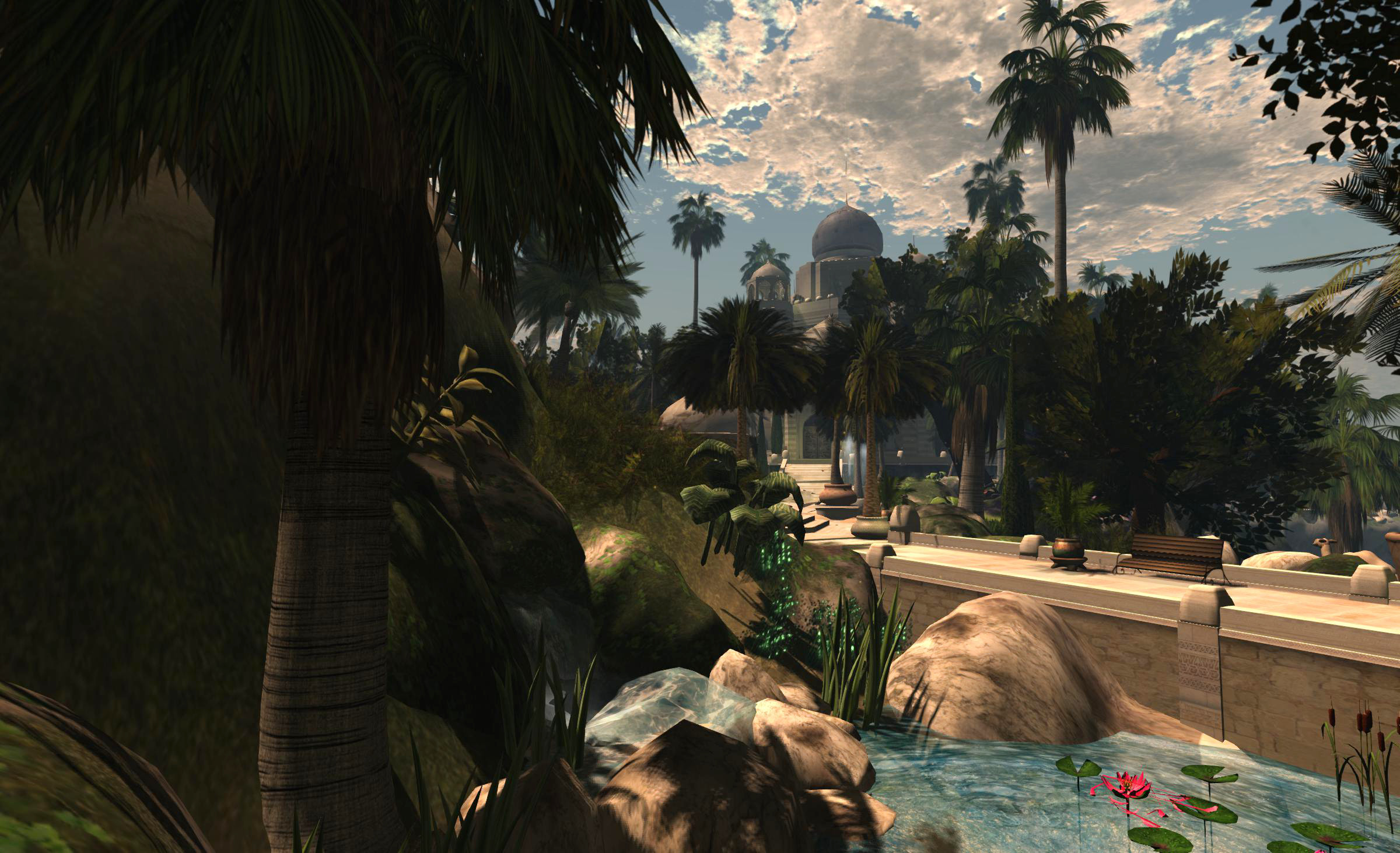
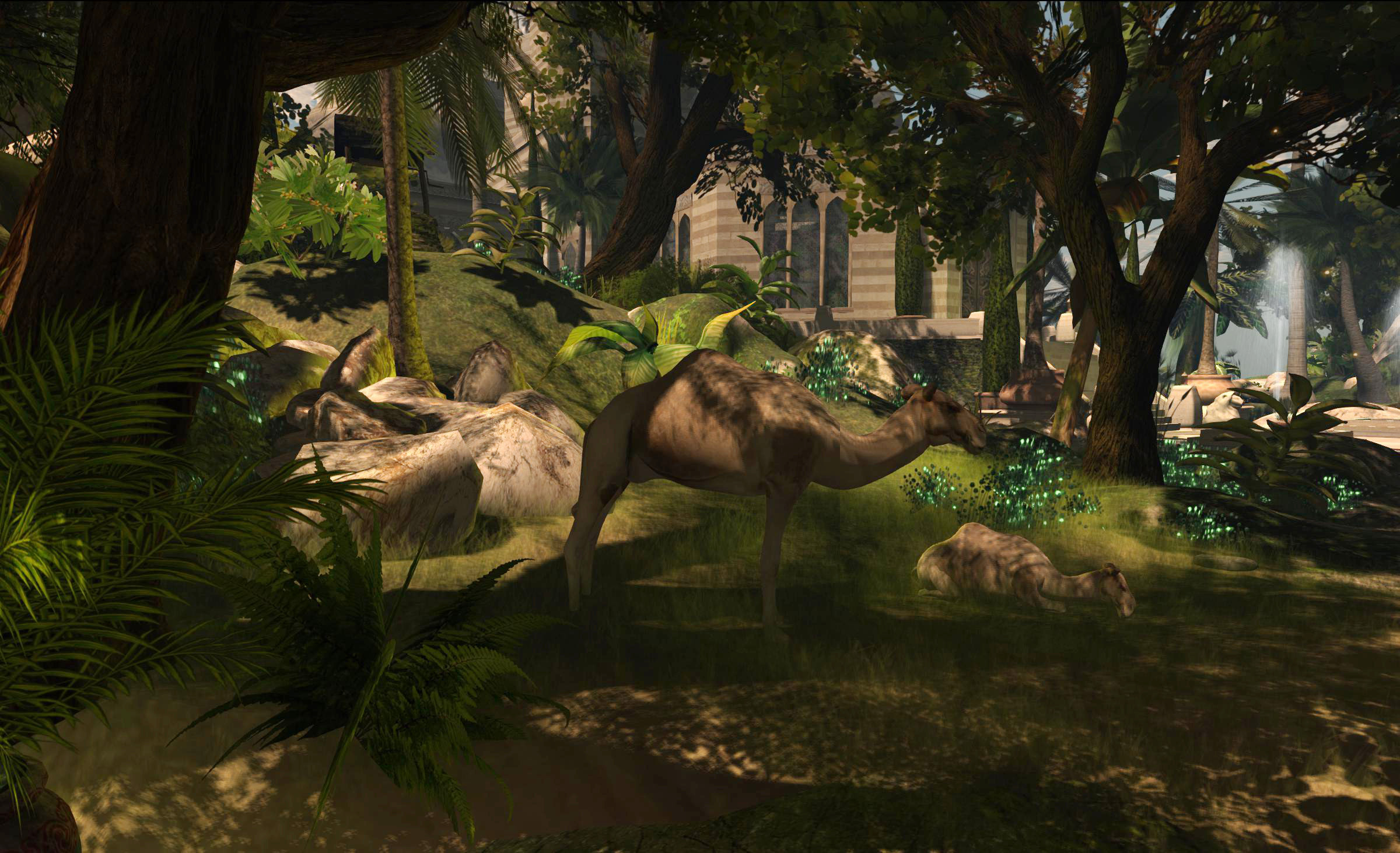
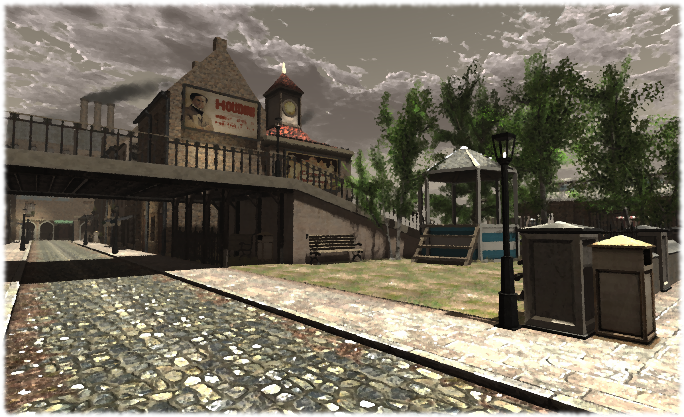
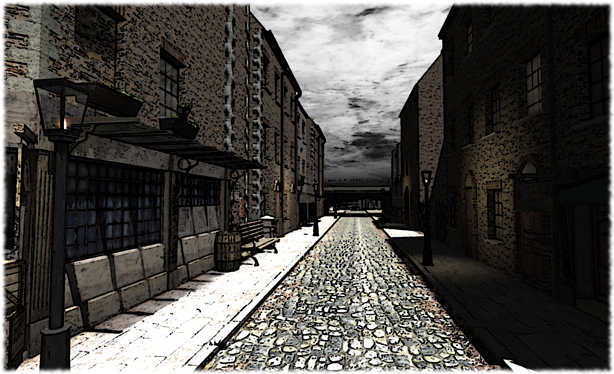
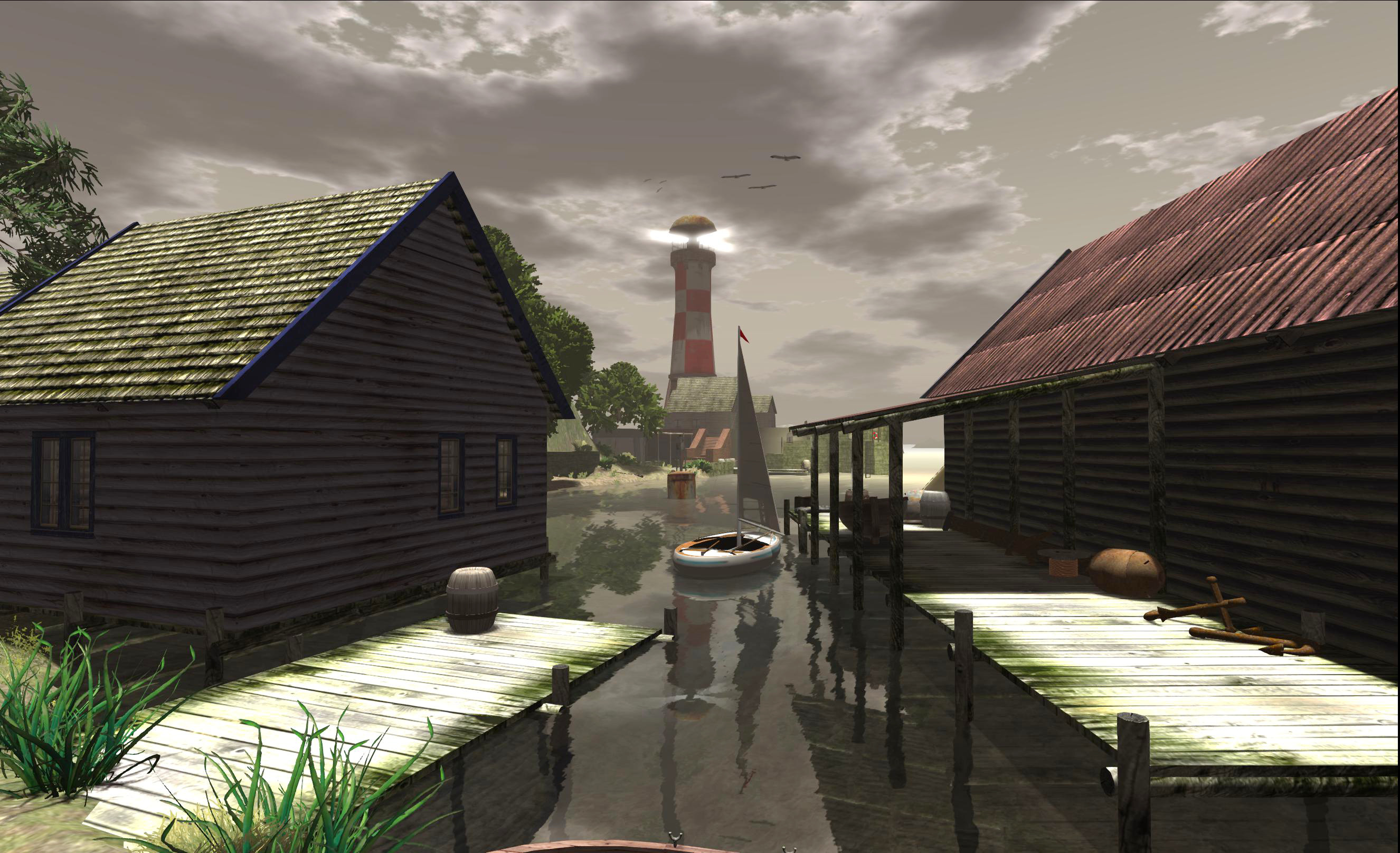
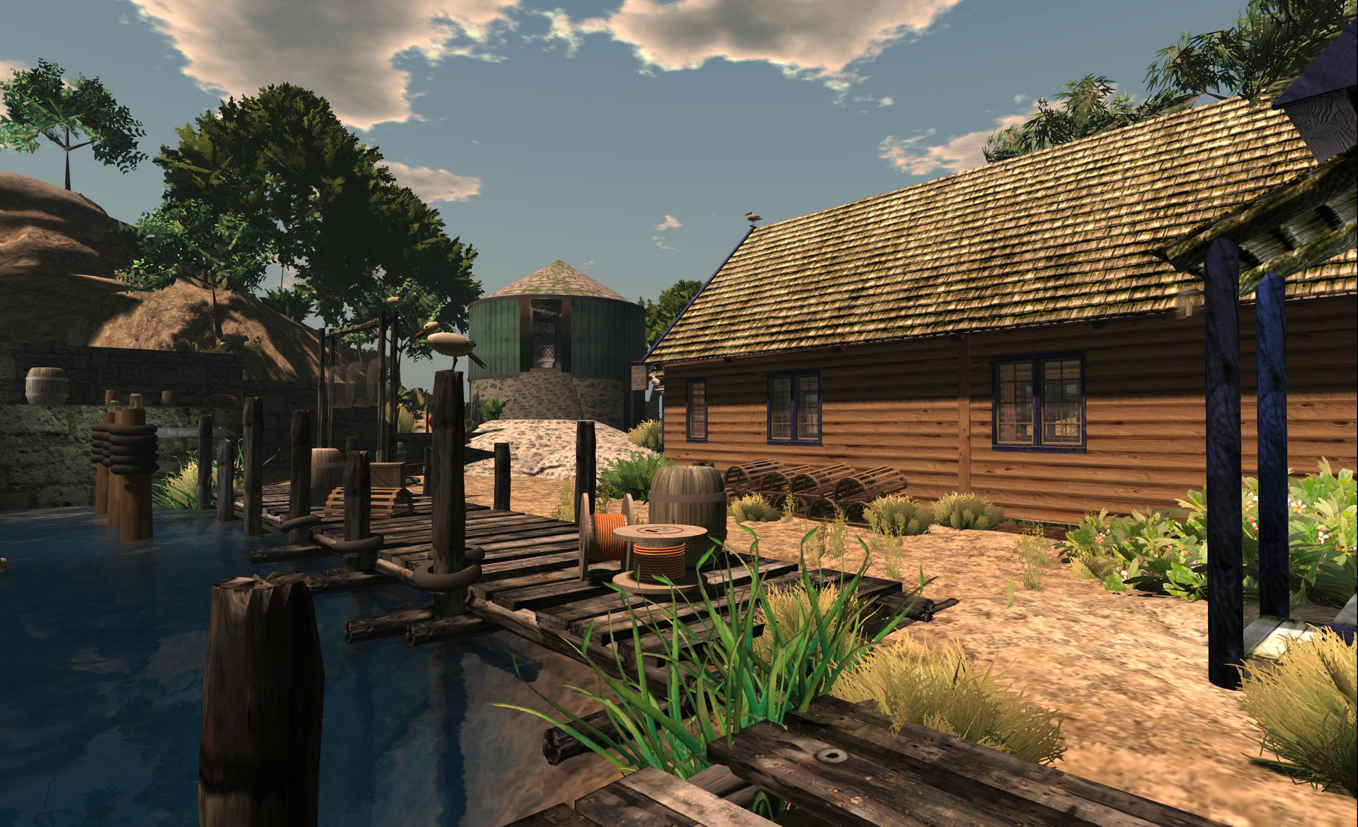
Climb the steps, and you’ll find places to sit, chat and pass the time in a landscape which is again reflective of Hazardous (and which includes elements by Wendy Xeno and Mandingo Quan). On the far side of the island is another set of stone steps leading down to a further beach and more places to sit, relax and share. There is even a mix of table-top games to sometimes be found as well.

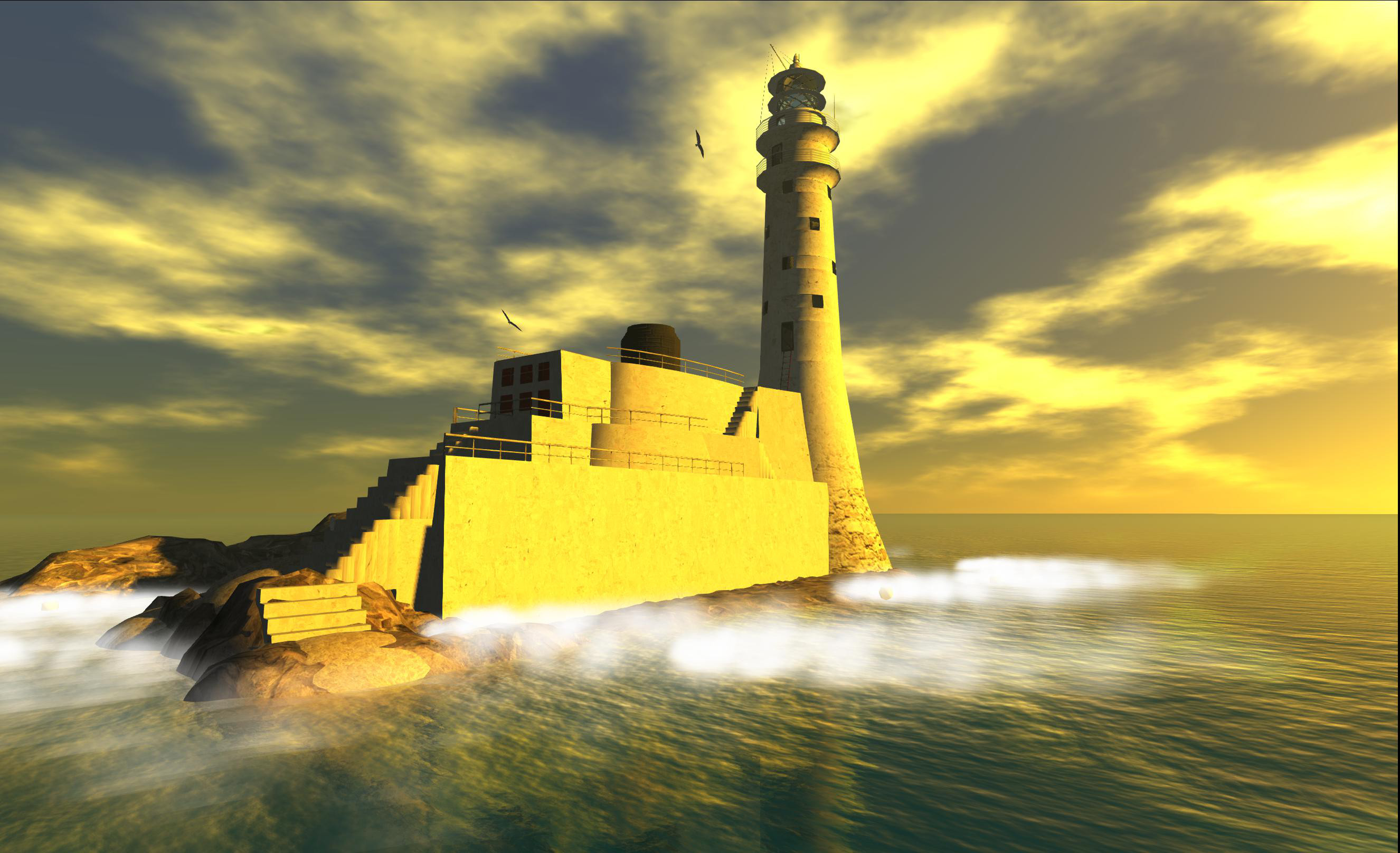
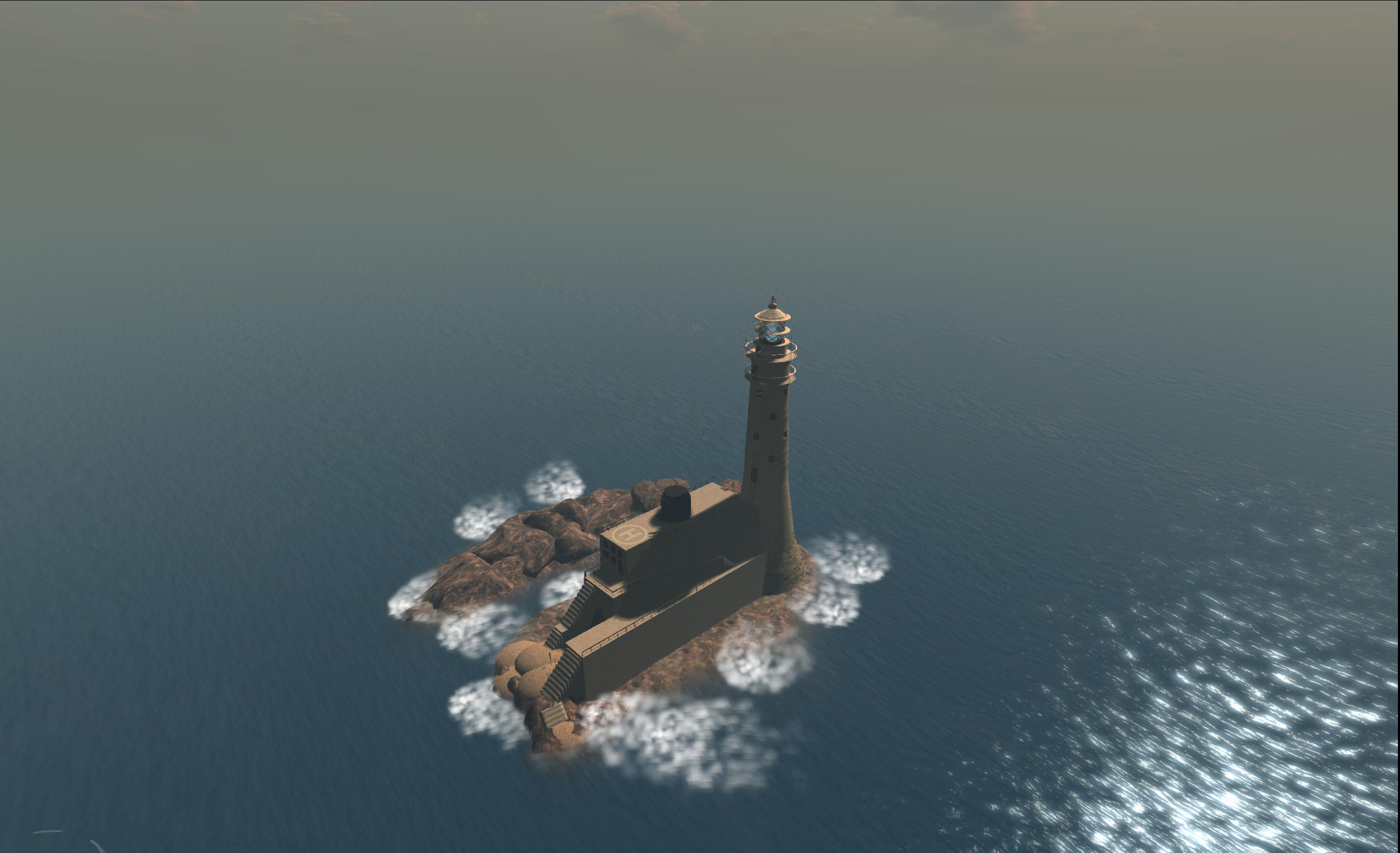
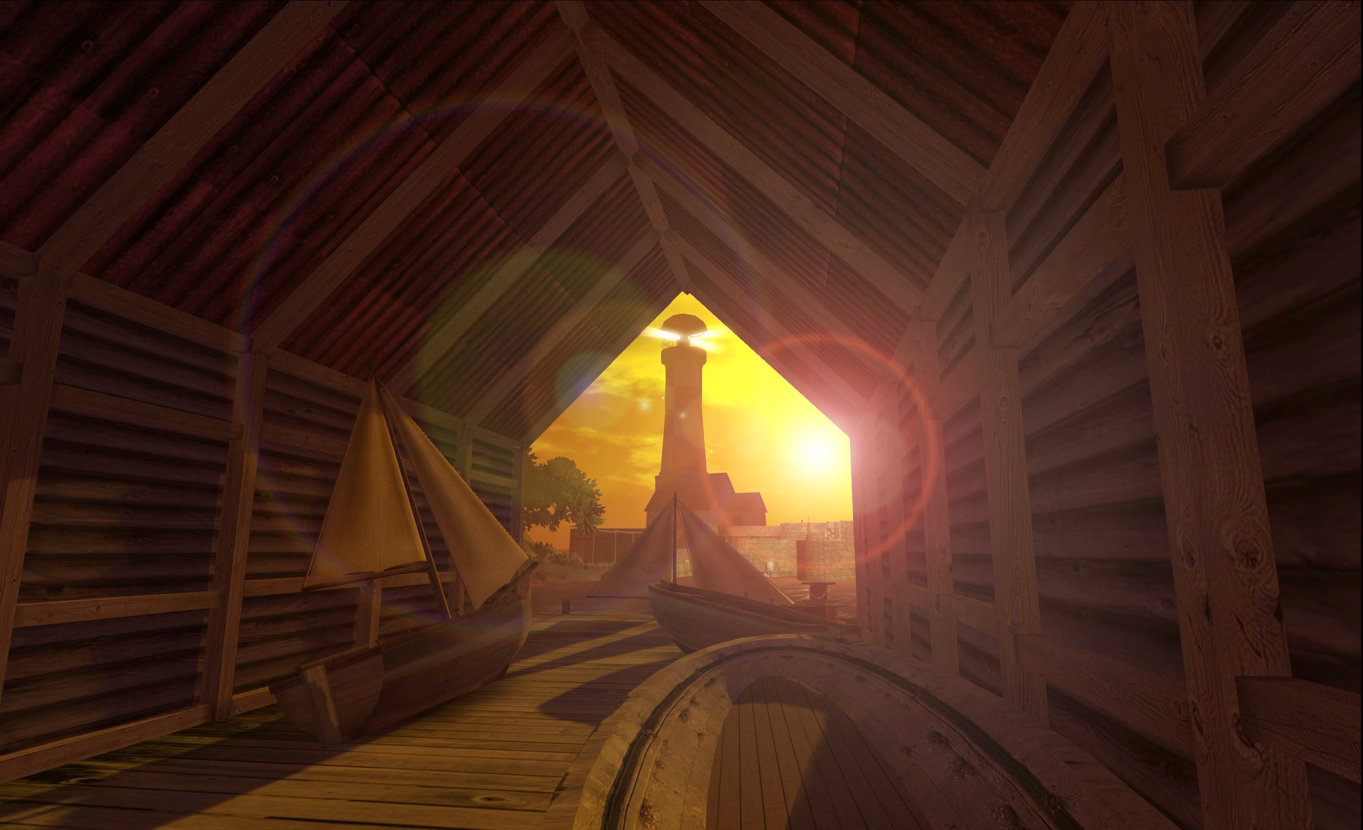
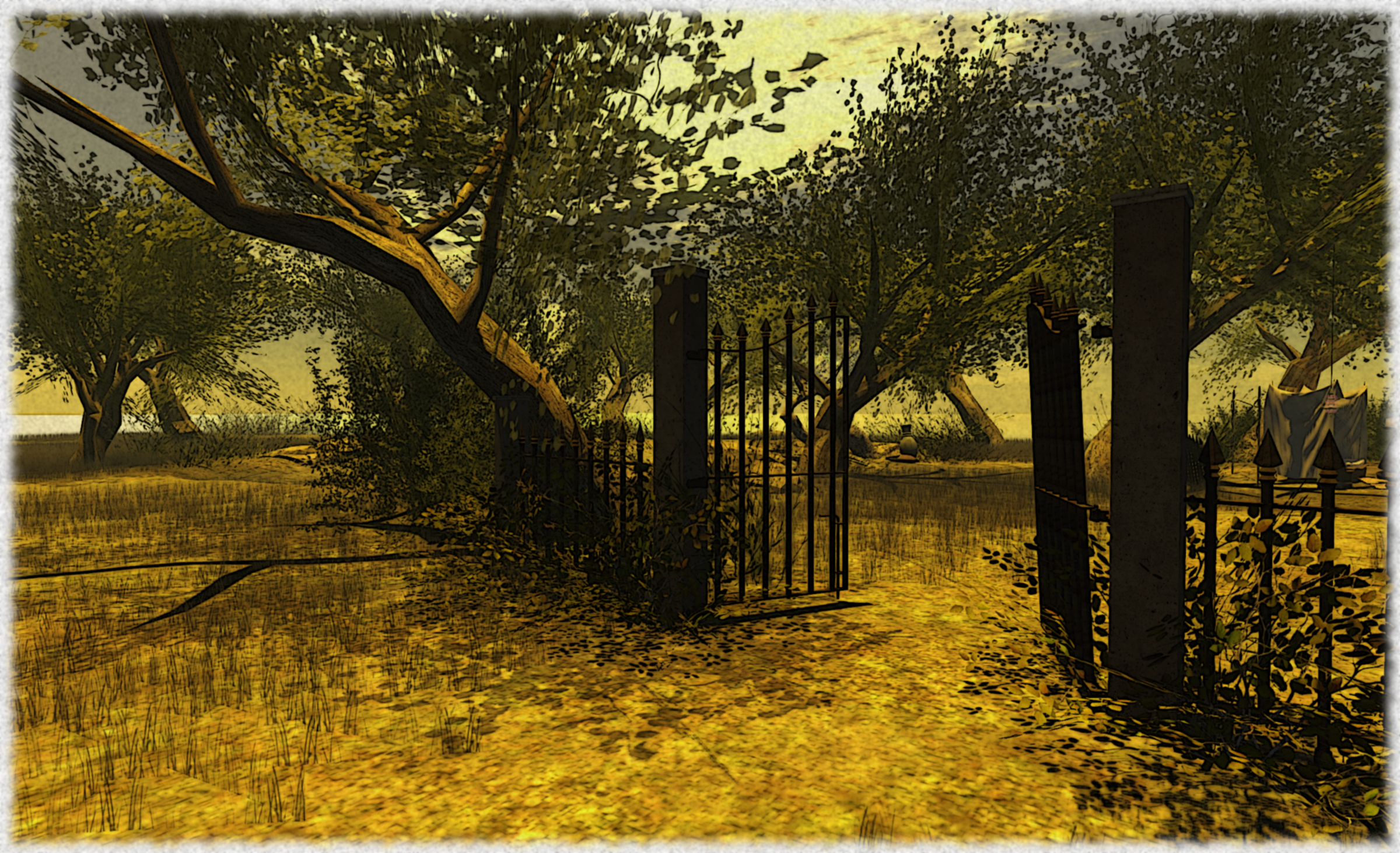
It’s another of those beautifully minimalist landscapes that speaks volumes, especially when there are just two or three of you there, and it is  – as ever – a place I think is utterly suited to the eye of the camera, and which really invites time and effort spent playing with the viewer’s windlight settings & fiddling around with things in post-process.

Jordan First
Jordan First

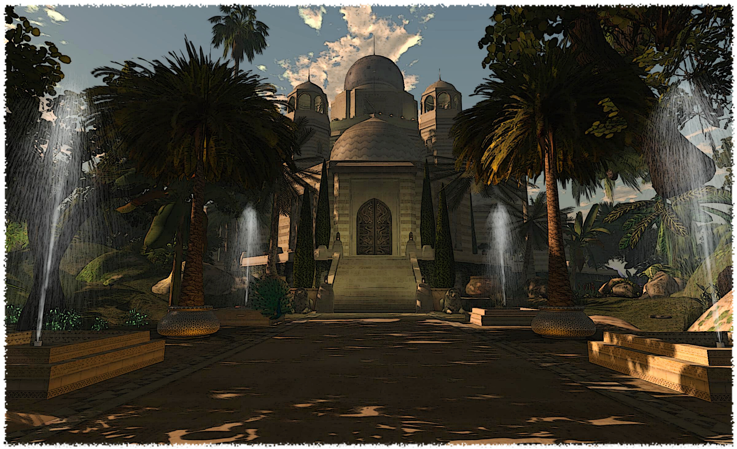
But that’s not all. Follow the beach (from either set of steps) and you will eventually come to a deep gorge cutting into the island, with stepping-stones leading you into it over the water. Follow them and you’ll find a reproduction of Al Khazneh (“The Treasury”), rightly regarded as one of the most elaborate temples in the ancient Jordanian city of Petra, and famed throughout the world thanks to numerous films and documentaries.

Catching a glimpse of The Treasury through the narrow ravine is a genuine “Oooo!” moment, and doubtless one which has / is / will be the subject of many SL snapshots…

Jordan First
Jordan First

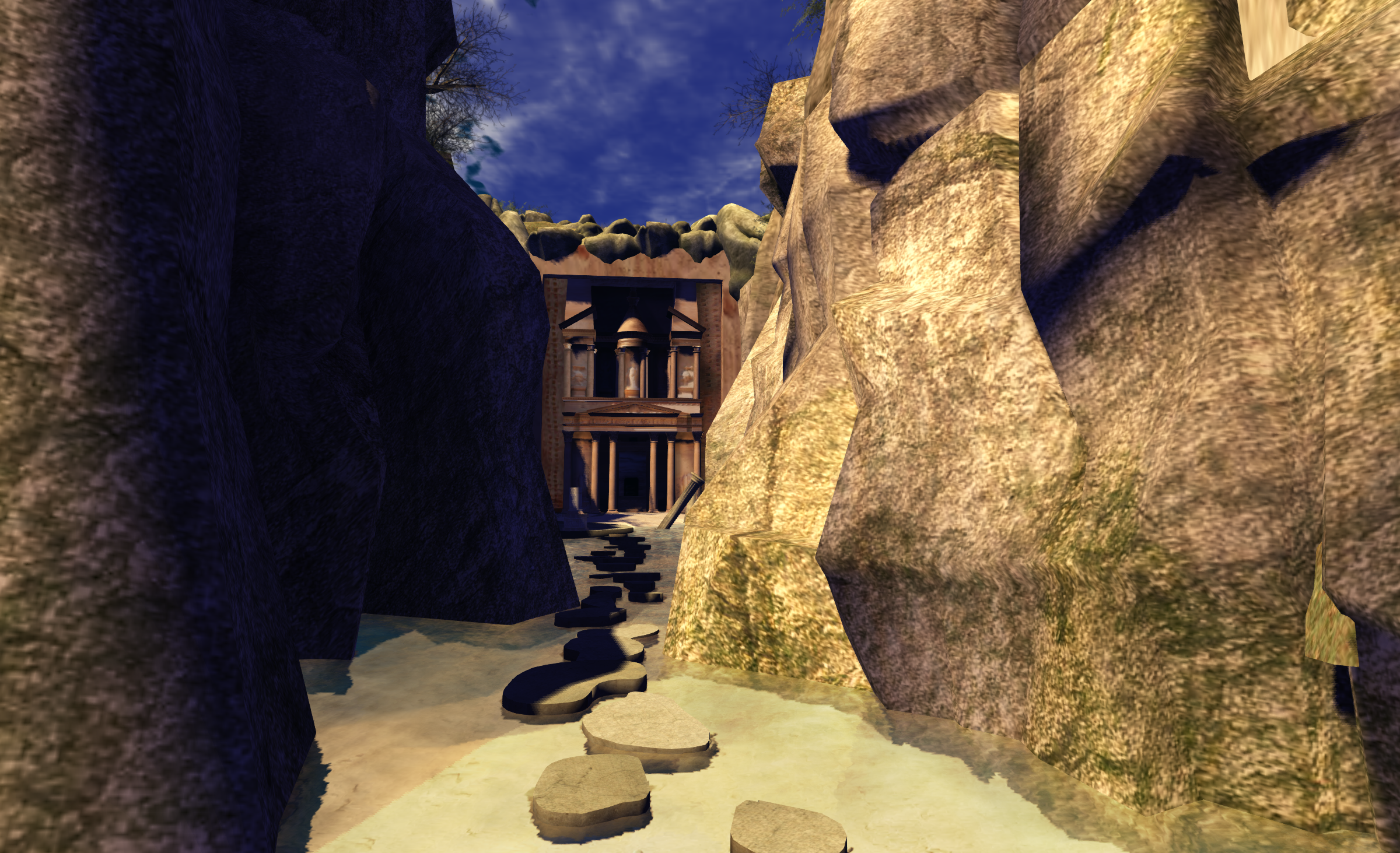
The inclusion of Al Khazneh in the build wonderfully straddles the RL / SL divide; bring a genuine piece of historical culture into Second Life and presenting it in a manner which is visually appealing in an environment which is a pleasure to visit and enjoy.

Recommended.

Related Links

(view slideshow full-screen)

Seeking a little calm in Second Life

An island of worn ancient cliffs sheltering a garden of wonders; Lost for countless ages in the midst of a vast ocean, home to Jinn, Elves and gentle spirits.

So reads the description for The Sands of Time / Majilis Al Jinn. This is a stunning region created by Calein Flux which is well suited to both the SL photographer and the intrepid explorer. Given that we’re in the midst of many celebrations to mark SL’s 10th anniversary which are going on across the grid, as well as about to see the start of a biggest gathering of exhibitions and entertainment to mark this momentous occasion, The Sands of Time might also be a worthy retreat from the hustle and bustle of partying and fun.

The Sands of Time
The Sands of Time

For my part, I wanted to explore The Sands of Time for two reasons: it immediately captured my sense of “OoO” on seeing it, plus my graphics card is becoming increasingly poorly and I wanted to see if issues which started to really make themselves felt while trying to snap exhibits at the SL10BCC regions would occur anywhere else.

Sadly, my GPu problems do. I’ve no idea if my woes are related to the nVidia 320.18 driver snafu (I was experiencing issues before the driver came out, although things got noticeably worse after updating the driver), but I do know that I’m now reduced once more to taking snapshots in JPG and at something just a little above my monitor resolution if I want to avoid either the snapshots failing to save to my hard drive or the viewer simply falling over with a graphics-related memory issue.

Sands of Time
Sands of Time

Nevertheless, exploring Sands of Time brought a smile to my lips; this is a beautifully composed region, which brings together a mix of eastern and western mythologies (the Djinn or Jinni (genies)) of the east, and the elves of the west) together in an incredibly scenic and restful sim which, Calein informs us through a visitor’s notecard, took a year to visualise.

The notecard itself, available from a vendor at the underground arrival point, is very much worth taking and reading. It not so much sets the scene for any forthcoming explorations, but rather allows us a glimpse inside the creative process and Calein’s thoughts and ideals in bringing the region into being. And it is a fascinating insight at that.

Sand of Time
Sands of Time

You have a choice of directions when leaving the arrival point – out through a cave to a beach area at the base of the cliffs, or a climb up through underground chambers to the cliff-top. Personally, I preferred going the beach route and working my way around things from there – it left the discovery of what Calein refers to as one of his most interesting creations until later in my visit, giving me a greater sense of anticipation.

This is also a place for romantics. Up on the clifftops are gardens and the palace, with fountains and lots of places where you can sit, watch, talk, and share with a friend or loved one. These very much bring one the sense of walking through the more romanticised tales of the middle east, although hidden in the gardens are also hints of the far east as well.

Sands of Times
Sands of Time

This is a wonderful, absorbing build, offering chances to explore, to wonder, to sit and share and even to meditate. Make sure you explore up as well as down – even if the “up” is only looking up inside the palace building. There is a lot to see here, and it is all very much worth the time taken to make sure you see it all.

Now, time for me to go source a new GPU card before I’m reduced to bashing the keyboard in frustration…

Related Links

(view slideshow full-screen)

A visit to a small corner of the grid

Rougham Town
Rougham Town

There’s a new entry in the Photogenic Spots category of the Destination Guide (which recently underwent a degree of culling to remove several entries which are, sadly, no more).

Rougham Town is billed as “a small Victorian port developed at the gates of Rougham Proper on the picturesque Britannia Isles.” And “small” really is the word here, the build occupies less than a quarter of the Britannia Isles region, the rest being almost completely water. I’ve no idea whether or not this means the region is still under development, or whether I simply missed a teleport to “Rougham Proper”, which leads to another region (and I admit, I was very pressed for time during my visit so may well have missed something). However, “small” doesn’t mean “not a lot to see”.

Rougham Town
Rougham Town

Rather the reverse is fact; there is actually a lot which has been packed into the scene, and any photographer looking for a range of backdrops for snapping may well to go take a look. There’s a beach, a dockside area, a couple of streets which present very different views to one another; one being a beachfront walk with a cafe, and the other a more industrial-like backstreet, while the tall facade of the Workhouse (this is a Victorian-era setting!), and the smoke stacks pouring forth black smoke offer opportunities of their own.

Wander around and you’ll find a marketplace, a small park area and places to sit and take-in the view.

Rougham Town
Rougham Town

For my part, I couldn’t resist snapping carious aspects of the build and then playing with them in GIMP afterwards, as you can no doubt tell from the images presented here :). There is something about Rougham which really encourages post-processing on snaps, the place has an atmosphere which  – for me at least – demands it be captured in ways other than just a simple snap.

This is not a place which will tax the SL explorer; as I said, the build is small and most of the buildings are facades – but this really doesn’t matter; and while a few of the textures used could perhaps do with a bit of an update, this is still a place SL photographers could have a lot of fun with. It’s also a place, I rather suspect, which could easily become a shining example of how the new materials capabilities could be showcased; the rough brick walls, the wooden window frames with peeled paint, the cobbled roads and iron gas lamps and the sand could look pretty amazing with the addition of normal maps.

Rougham Town
Rougham Town

Even so, I enjoyed my rapid-fire drop-in, maybe you will as well.

Related Links

The abbey on the hill

It’s been two years since I first blogged about Mont Saint Michel in Second Life. As I’ve been having a few issues with my GPU when logged-in the Second Life – particularly when taking snapshots with the various bells and whistles active – I stopped by the Mont in order to try things out after having fiddled with drivers and such-like, and grabbed a couple of snaps.

Mont Saint-Michel
Mont Saint Michel (windlight; no post-processing)

There have been a few changes over the years since my first review, with the “car park” region having long since vanished and a few more cars now on the island itself.

This is a great place to explore, with shops and parks to wander through en route up to the abbey itself and – for those willing to find it, a hidden secret which I actually missed during my original visit, but had to go back and find after several friend nudged me in the right direction.

If you’ve not paid a visit in the past, I cannot help but recommend you do.

Mont Saint-Michel (post-processed)
Mont Saint Michel (post-processed)

Related Links

A half hitch and a crow’s nest

As regulars here will know, I’m kind-of into SL sailing and flying, have written about both rather a lot since tumbling into both quite by chance, with my most recent acquisition for the former being the E-Tech Sparrow,  which is leaning me dangerously close to seeing if I can rent some water-front land somewhere (I have modest needs; nothing larger than 2048 sq metre & room enough for a cottage, a bit of landscaping and a dock…).

However, it occurred to me that while I have been out on (and over) the water rather a lot over the past few months, particularly on Blake Sea, I’ve never actually blogged about places there – and there is rather a lot to see and do, beside sailing / flying.

Blake Sea Half Hitch

Take Half Hitch, for example. This is one of the areas in Blake Sea where you can rez your own boat (or seaplane or submarine – whatever takes you), and set out to explore the ocean blue. It’s like that many people arriving there never get beyond the quayside landing point and rez zone, which is a shame, as there is a lot to poke about at on the island – just take a wander through the cave at the landward end of the quay.

Blake Sea Half Hitch

On the other side of the cave tunnel is a sheltered port, complete with breakwater, a lighthouse and warning buoys to guide boats in, and quays and buildings which form a part of a small fishing “community” – there’s even a trawler sitting dockside, either getting up steam to sail on the morning tide or which may have recently returned to port after a day’s fishing.

Blake Sea Half Hitch

Now, the build is admitted not state-of-the-art. Some of the rock formations on the north side of the island are decidedly spherical, some of the textures are a tad low-res – but remember, everything around Blake Sea is designed to be low-lag to aid the flying and sailing and – in particular – to assist with any racing which may be going on. And anyway, “dated” doesn’t necessarily mean “not worth exploring”.

Blake Sea Half Hitch

There are lots of little corners to poke and pry at here, and even more opportunities for the SL photographer. Those who want to try their hands with sailing can also find a demo boat rezzer which will help them take to the water and skim around a bit, and there are some nice little look-out points to watch the world go by or where you can watch any racing taking place.

Those who do take to the water and sail west may well encounter the Crow’s Nest Lighthouse, which has again featured in some pictures in this blog. This is actually a build based on a real life lighthouse (Fastnet Rock), and, if you have your draw distance down somewhat (something of a good idea when sailing / flying), appears as a reminded of what a lonely and isolated lives lighthouse keepers once had to lead.

Blake Sea Crows Nest

I managed to grab one shot in particular of the lighthouse while flying east out of Hollywood Airport a couple of months ago, which I think really demonstrates this last point, even if it’s not necessarily the most artistic of shots.

Blake Sea Crows Nest

Should you opt to land at the lighthouse, there’s not a lot to actually see inside the lighthouse – although if you look hard enough, you’ll find a picture of the real life original. – but that’s not the point, it’s a great little build in its own right which does much to enhance Blake Sea, as well as providing a useful way-point for sailors. Outside of the lighthouse tower, however – and as pointed out by Lance Corrimal in the comment below – there is a memorial for all members of the SL Sailing community who have passed away.

There’s a lot else to see out on the Sea  – so if you haven’t given it a try, why not have a mooch around the waters?

Related Links

B
Blake Sea Half Hitch

With thanks to Lance Corrimal for the update.

If maps are your thing, Rumsey’s the king!

The David Rumsey Map Collection is just about everything any cartographer with an interest in the history of the subject and a particular focus on the Americas could ever want. Over 39,000 maps are on file – although these also include various maps of Africa, Asia and Europe. The maps can be accessed through a number of online viewers and services – including Second Life!

David Rumsey Maps
David Rumsey Maps

The SL exhibit covers four adjoining regions and presents a number of displays, information boards and links to the main website which, taken together, form an interactive means of study and offers the opportunity to learn about cartography.

The arrival point comprises an information centre where you can learn about David Rumsey Maps, the SL exhibit and access teleports to the various displays. Directly outside of this is a push-pin map of the world, with the invitation for visitors to move one of several push-pin “givers” over their home location, add a pin and leave a message of up to 140 characters in length.

David
David Rumsey Maps

Below this, and covering all four regions is a gigantic topographical map of Yosemite Park and its surrounding areas, circa 1883, complete with a floating observation deck. Control options allow you to view the map with full bright on or off, and as a 3D relief display (using sculpts) or a conventional 2D map.

Above the 4-region map is a small orientation centre for those new to SL, and above that is a reproduction of J.H Colton’s 1836 map of New York. complete with models of some well-known landmarks (such as the Empire State Building, Brooklyn Bridge and City Hall) which help give the map context to modern eyes.

DR-5_001
David Rumsey Maps

Elsewhere in the build are touch-boards on the Map walk which surrounds all four regions and the gigantic Tower of Maps, which provide direct access to various maps and pages on the website. You can also hop inside two globe maps or admire a Japanese scroll map.

All-in-all this is an extensive and excellent use of Second Life, with the information centre also providing audio / video presentations as well as a range of collectibles (40 in all), which you can pick-up as you explore. There is also a skyborne auditorium, but I’m not sure if that is still running the advertised programme (I’ve managed to miss hopping over there at noon SLT to find out the last few times it has crossed my mind to check…).

DD
David Rumsey Maps

David Rumsey Maps makes for a worthwhile visit for anyone interested in cartography, and an engrossing use of Second Life. One word of advice should you visit – turn up your drawn distance to at least 512m to get the fullest benefit.

Related Links