A winter’s return to Aspen Fell in Second Life

Aspen Fell; Inara Pey, November 2017, on FlickrAspen Fell – click any image for full size

It’s been two years since my last visit to Aspen Fell, so when Shakespeare suggested Caitlyn and I head back and take a look and the region in its new home, I thought he had the right idea.

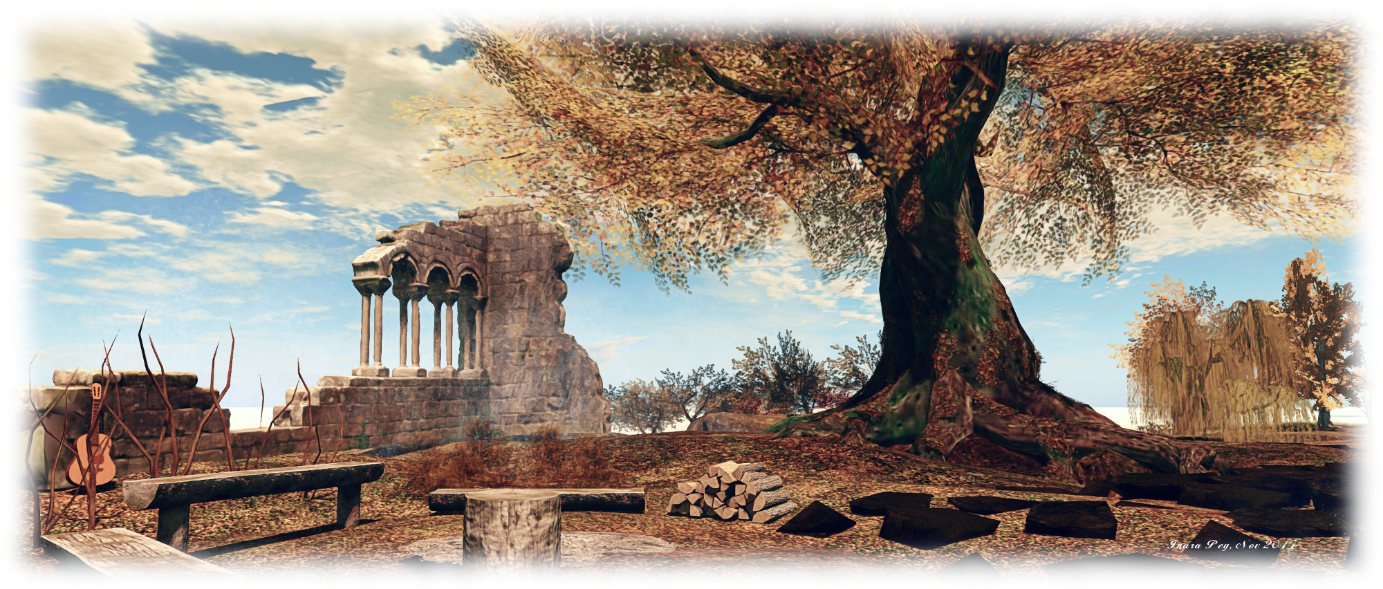
The region presents a setting caught between autumn’s last breath and the cold winds of winter. It is a rocky place, the majority of the region given over to a high-walled rocky U running north to south,  surrounded by cold looking waters and offshore peaks, the entire setting struck in muted browns, whites and greens by the lowering Sun (I’ll be honest, I pushed the Sun a little higher into the sky to gain a little more natural contrast).

Aspen Fell; Inara Pey, November 2017, on FlickrAspen Fell

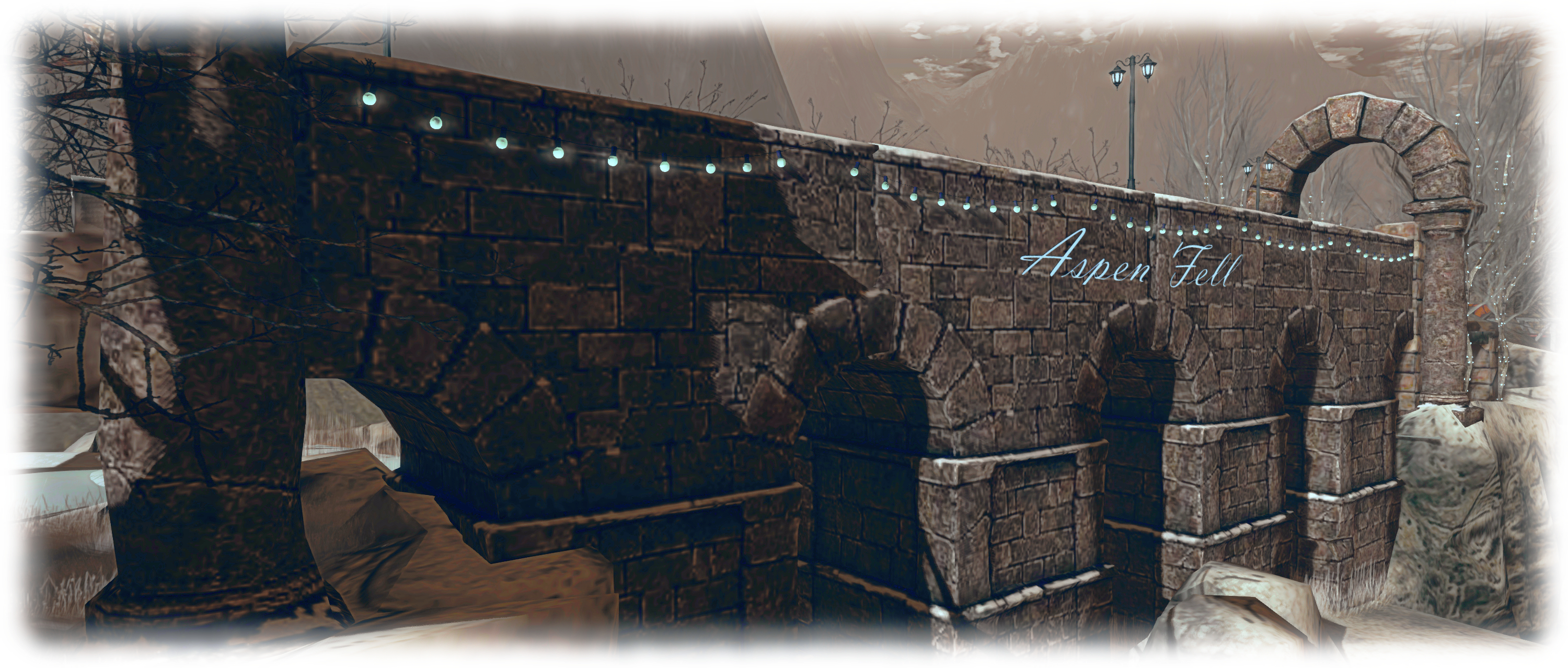
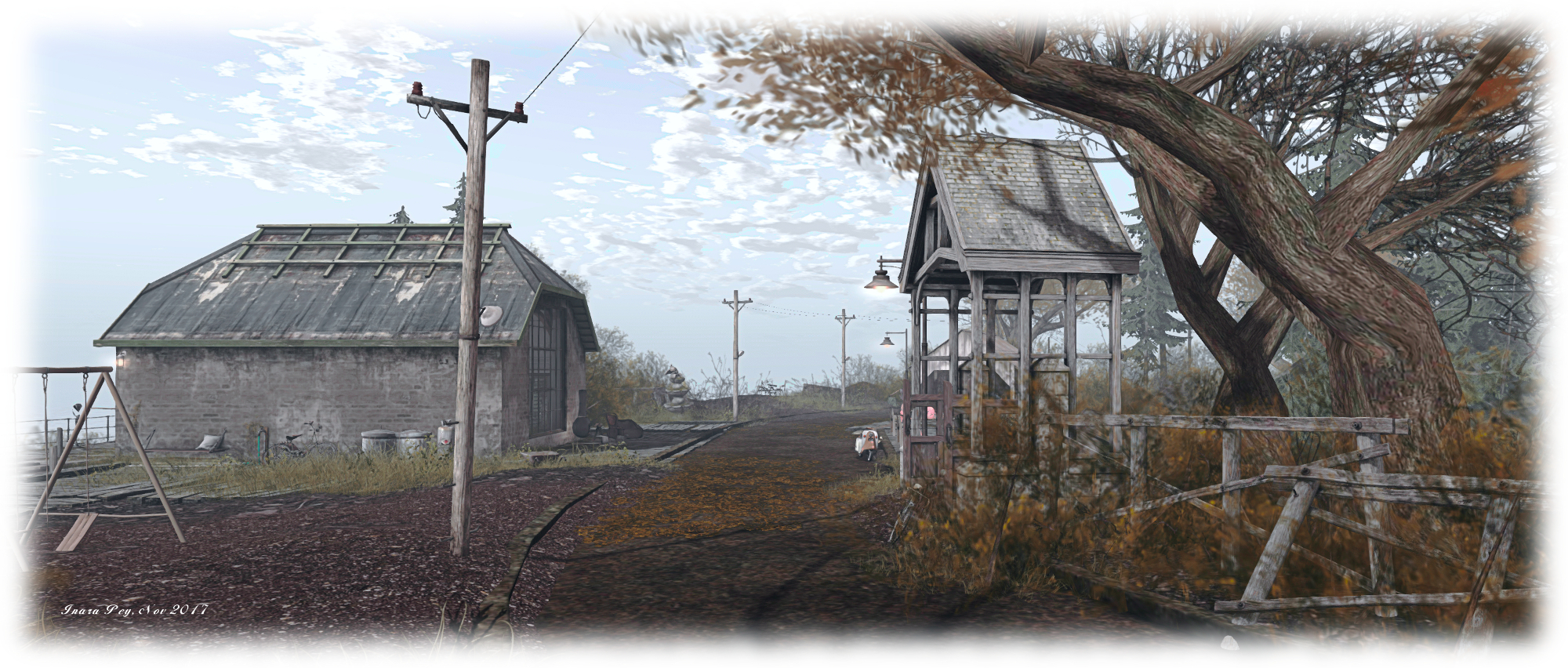
The landing point sits on the south side of the region, at the base of the U. Facing visitors on their arrival is the high face of the cliffs, split by a narrow crack, which seems to offer an invitation to see what lies on the other side of the rocks. However, we’d recommend you avoid the temptation, unless you want to get particularly wet. Instead, turn to the east or west, where sit old walls bearing wrought iron fences and heavy gates, pointing the way to where you might find paths snaking their way up to the plateaus above.

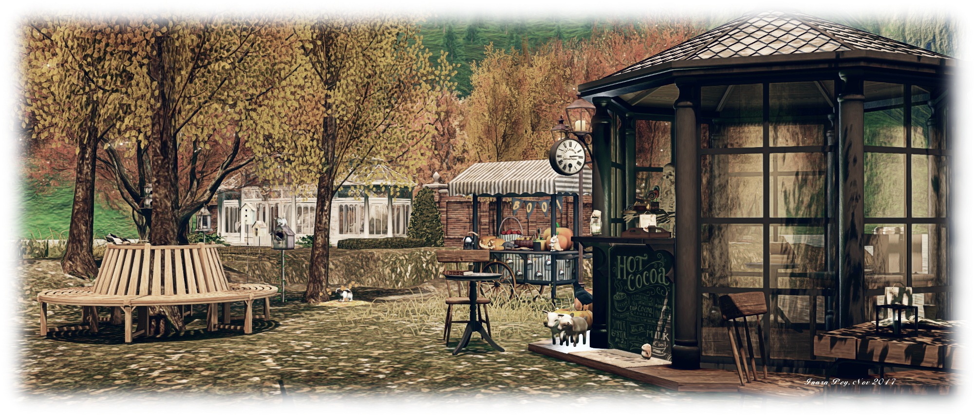
This is very much a place of two parts in several ways. To the west, it is distinctly autumnal; the grass is still green, the trees still have their leaves, the lowlands offer a long ribbon of sand that curls around the cliffs, a place to walk and even enjoy a sauna – but everything is cast under a chilly, heavy sky, the tide braking against that sandy ribbon particularly cold. To the east, the region is caught in the grip of winter; snow blankets lay over both the curl of the beach and the tops of the plateaus, and even forms drifting slopes between the two. The trees are denuded, the grass fighting to push itself through the white mantle of snow, and frost catches stone and wood.

Aspen Fell; Inara Pey, November 2017, on FlickrAspen Fell

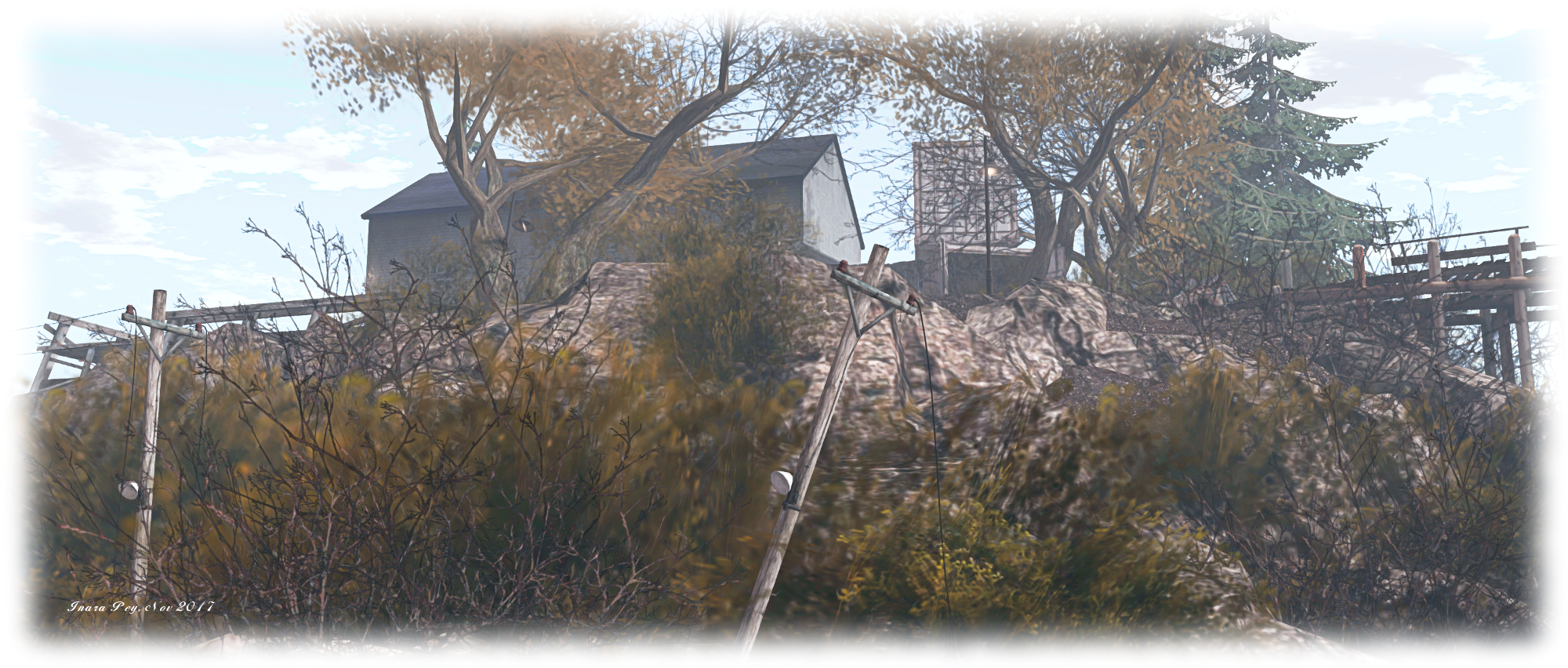
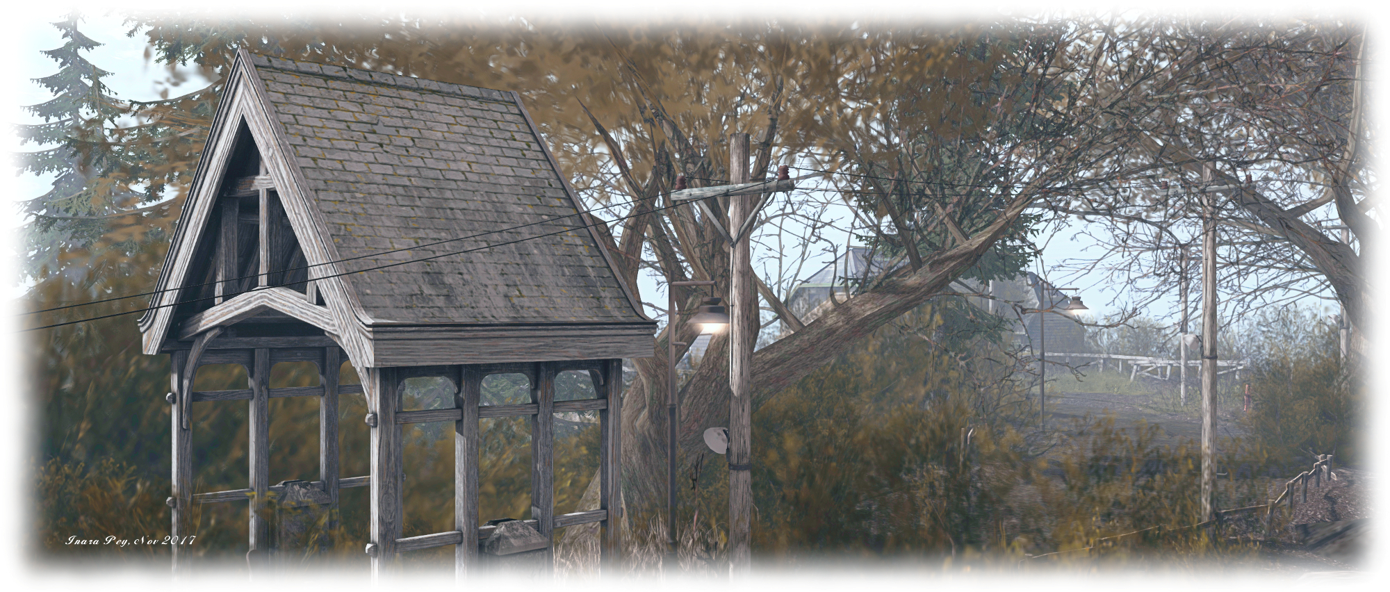
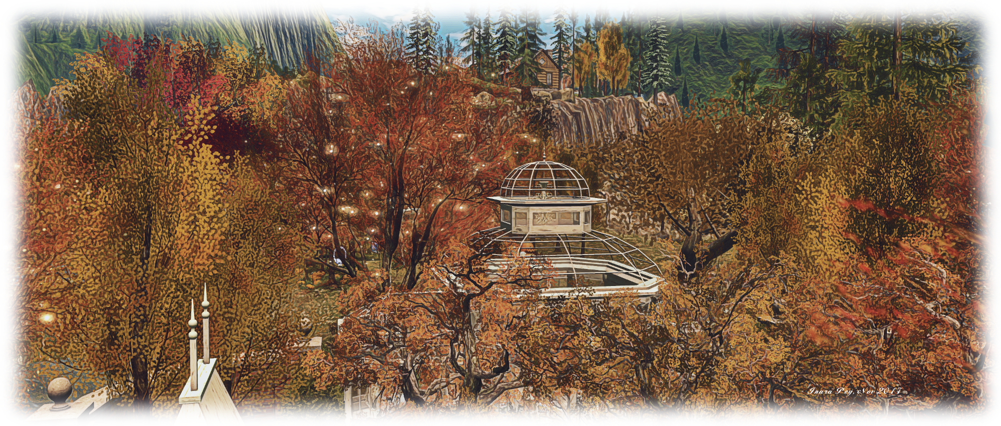
Similarly, to the west, the cliff tops, caught in their autumn cast, appear careworn and a little tired. Dilapidated barns and the ruins of a farm-house together with the wrecks of old vehicles lay scattered across the plateau. To the east, the cliff tops are given over to the remnants of much older structures: an ancient bridge or viaduct together with the walls, arches and paved floor of a former building or gate-house, their stonework giving them a sense of youthful permanence within the landscape, the snow on and around them presenting a feeling of pristine newness.

Down in the valley between the arms of this rocky U, these two halves meet, but do not merge. To one side, the cliffs descend with path and rocky face to the snow-covered banks of a watery finger poking its way south. The trees here are also without leaves, bent against the cold, while an icy shelf reaches outwards over the water without actually reaching the far bank. Across the water, the west side of this broad valley again holds on to autumn the grass is tall and the trees, though bent and twisted, retain their crowns of leaves.  Paths again wind up to the highlands above, and like those highlands the detritus of life can be found here: the ruin of a wooden house, the wreck of a car, a forlorn wooden deck caught under the downpour that holds the north-west of the region captive.

Aspen Fell; Inara Pey, November 2017, on FlickrAspen Fell

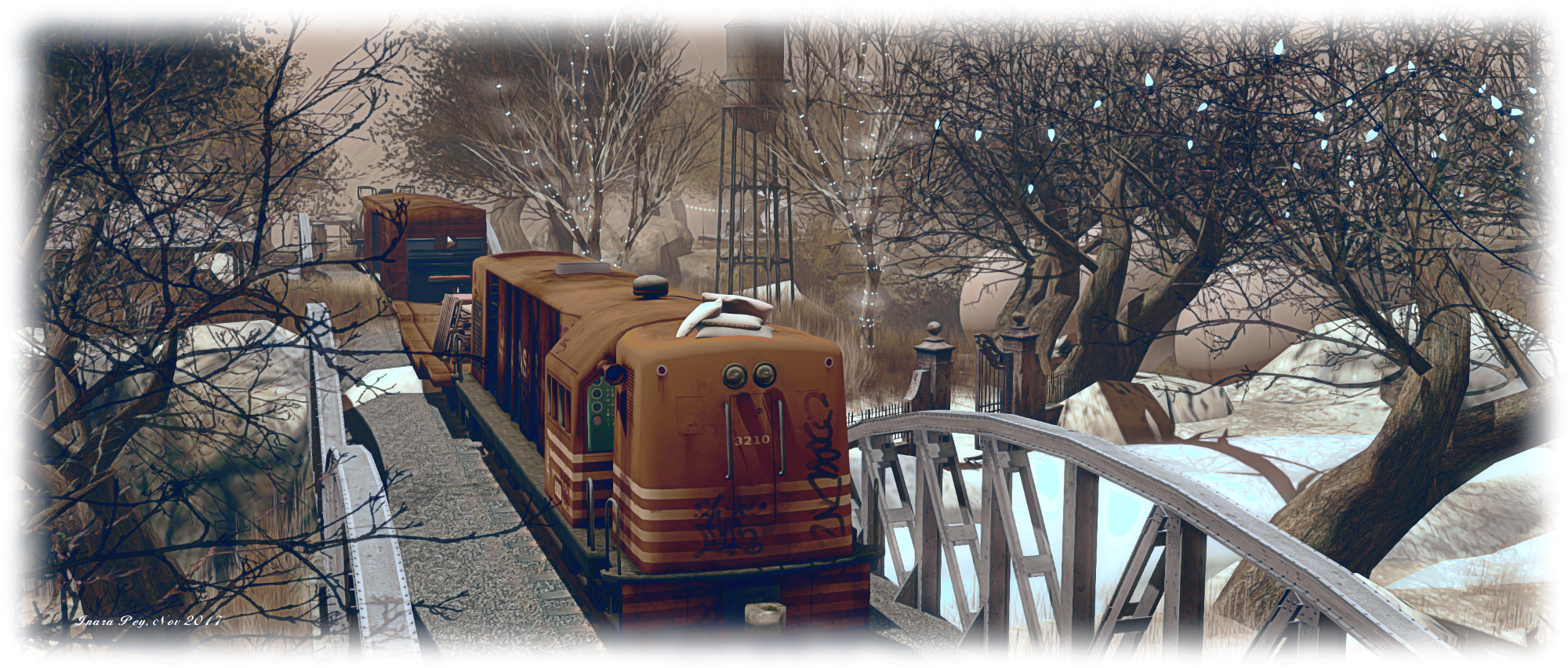
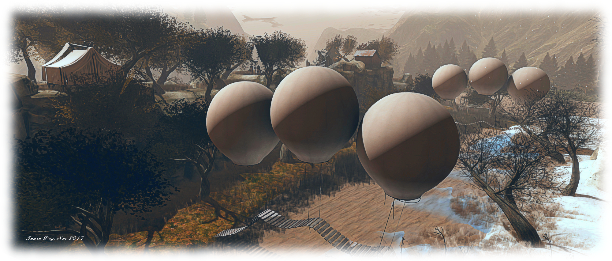
Bridges suspended by balloons link the two halves of the valley, undulating over ice and water to link snow and grass. To the south, the two halves of this landscape are also brought together by an old railroad line, a narrow bridge allowing it to hold the two sides together likes stitches holding together the thin slice of a cut.

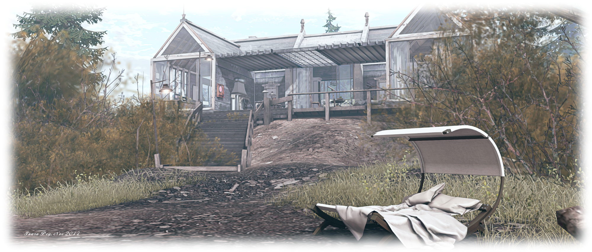
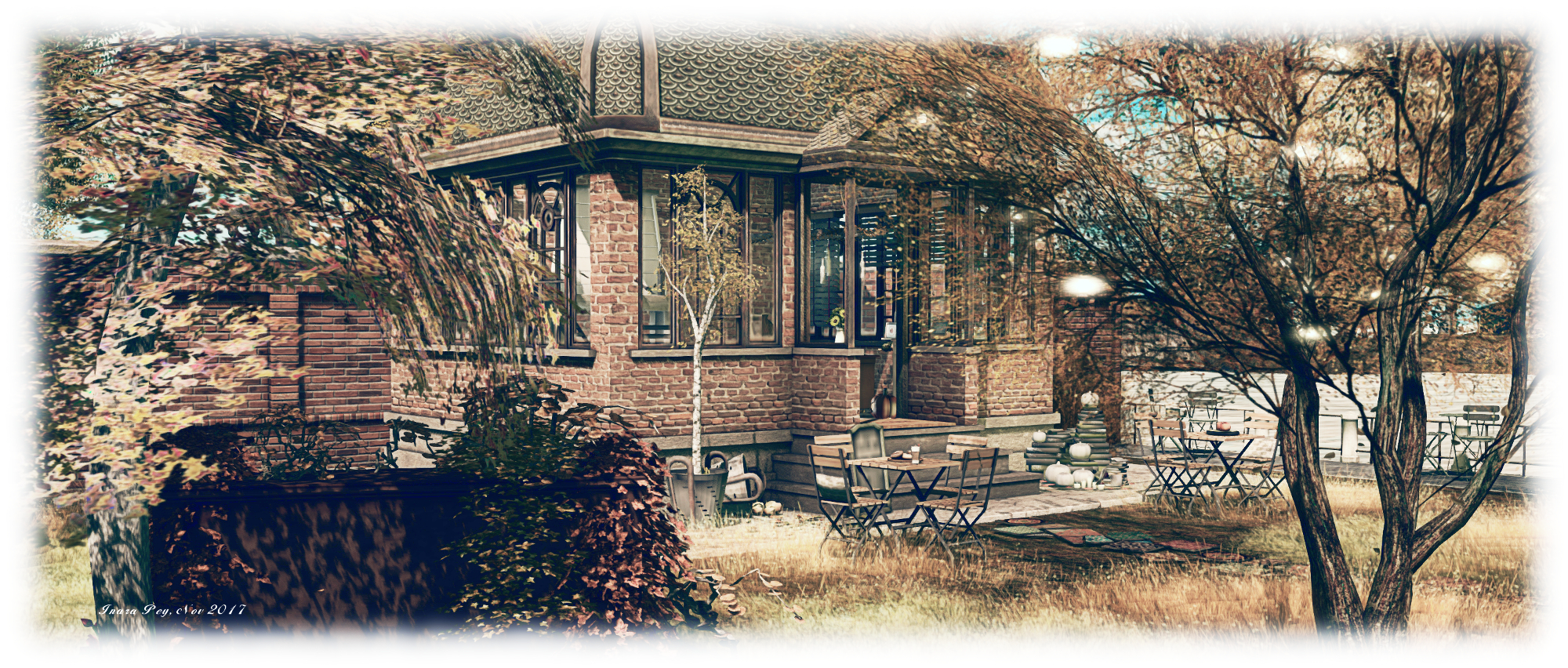
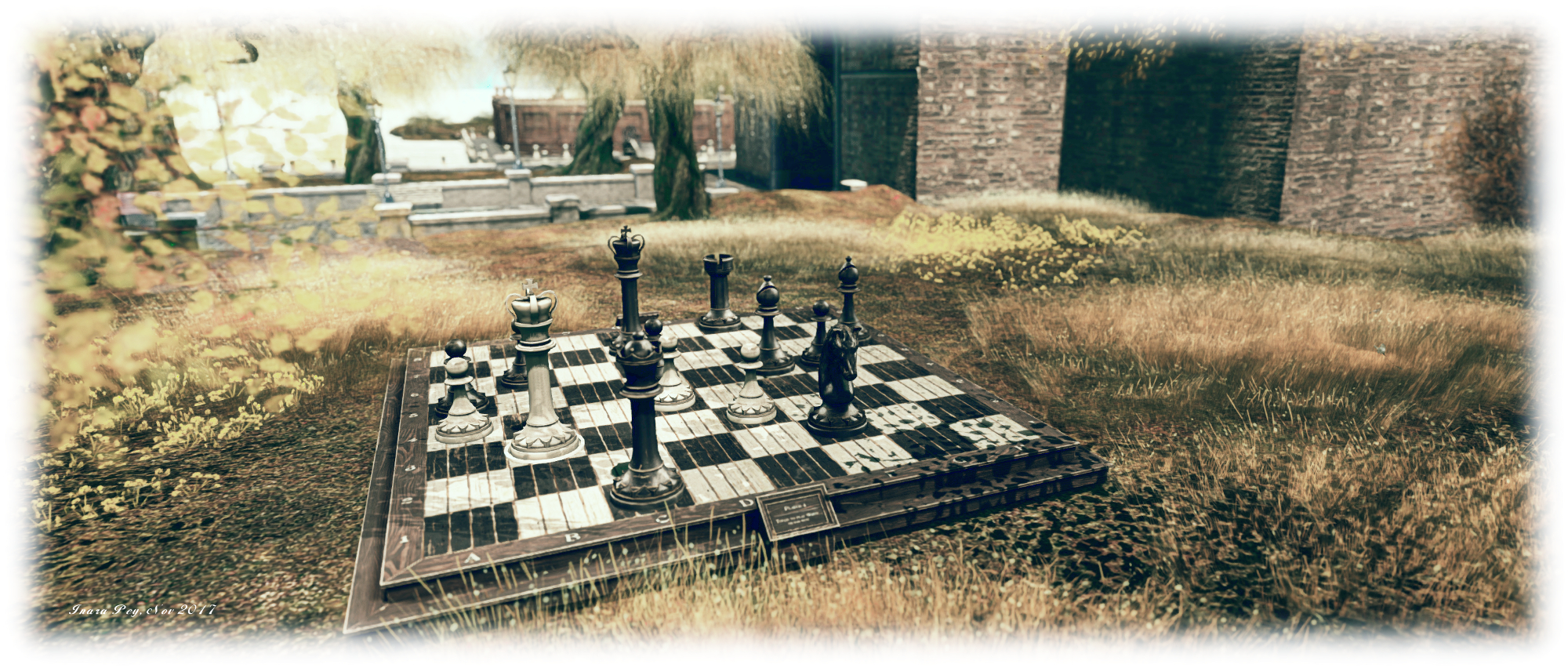
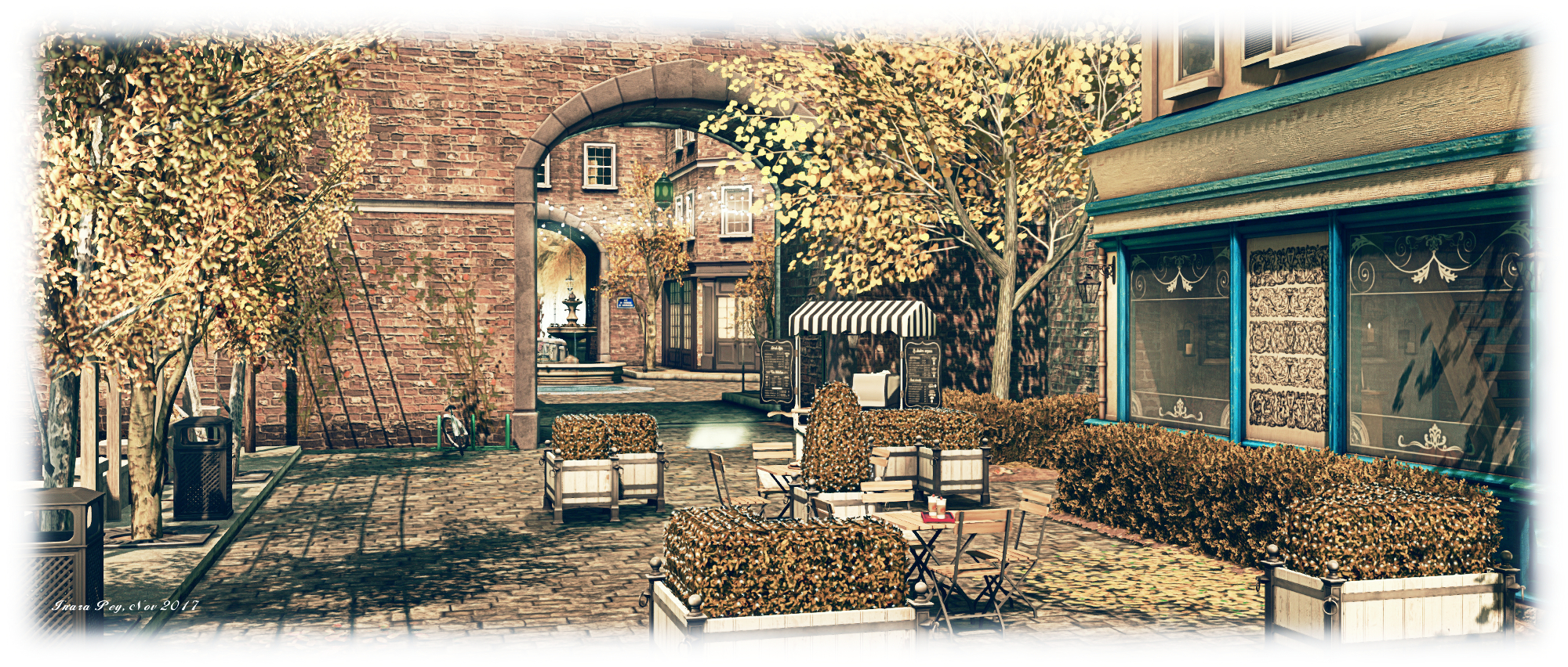
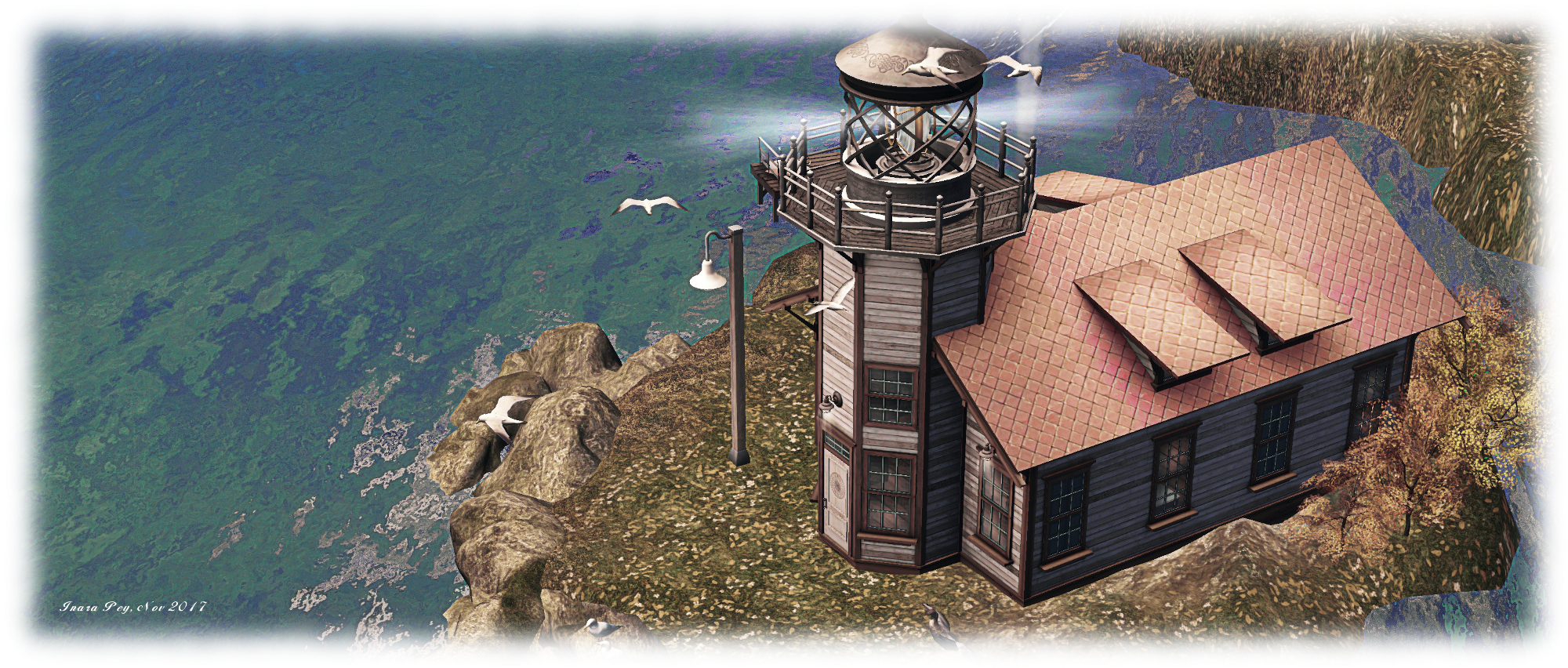
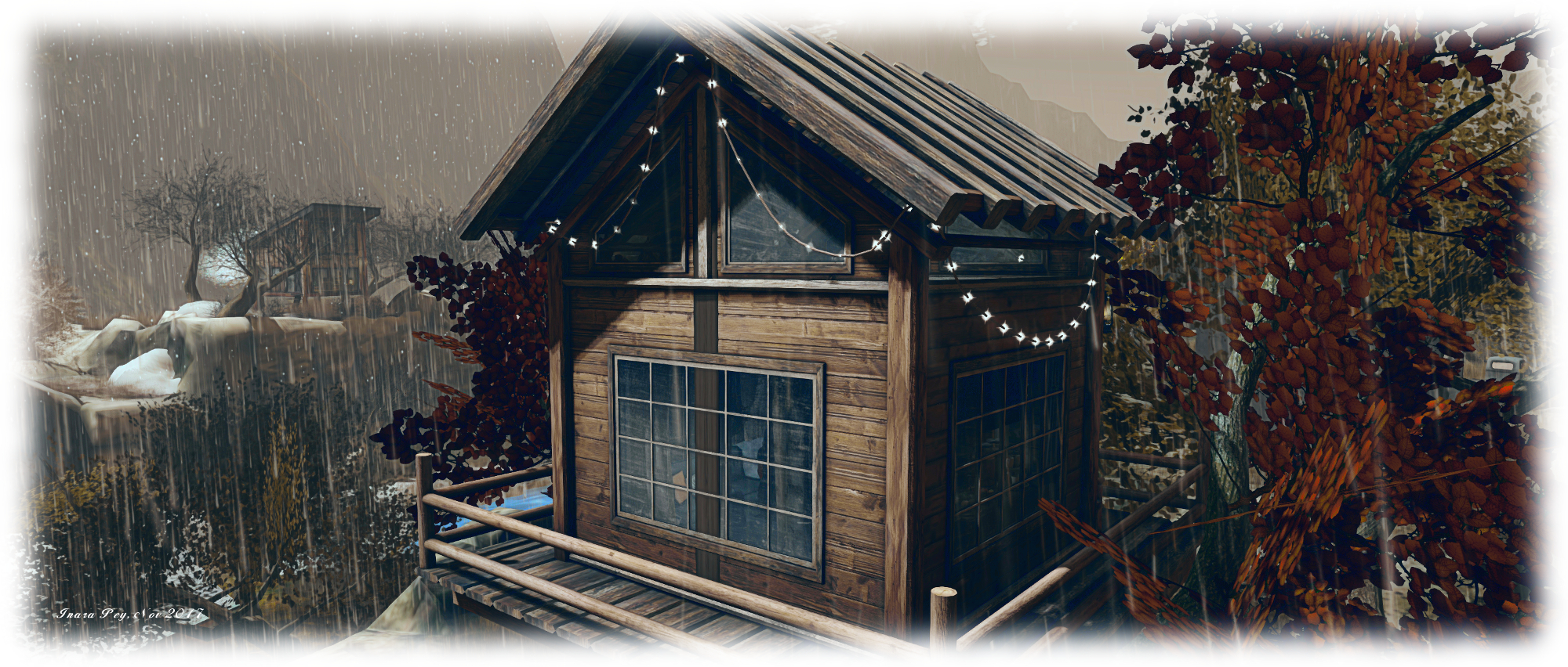
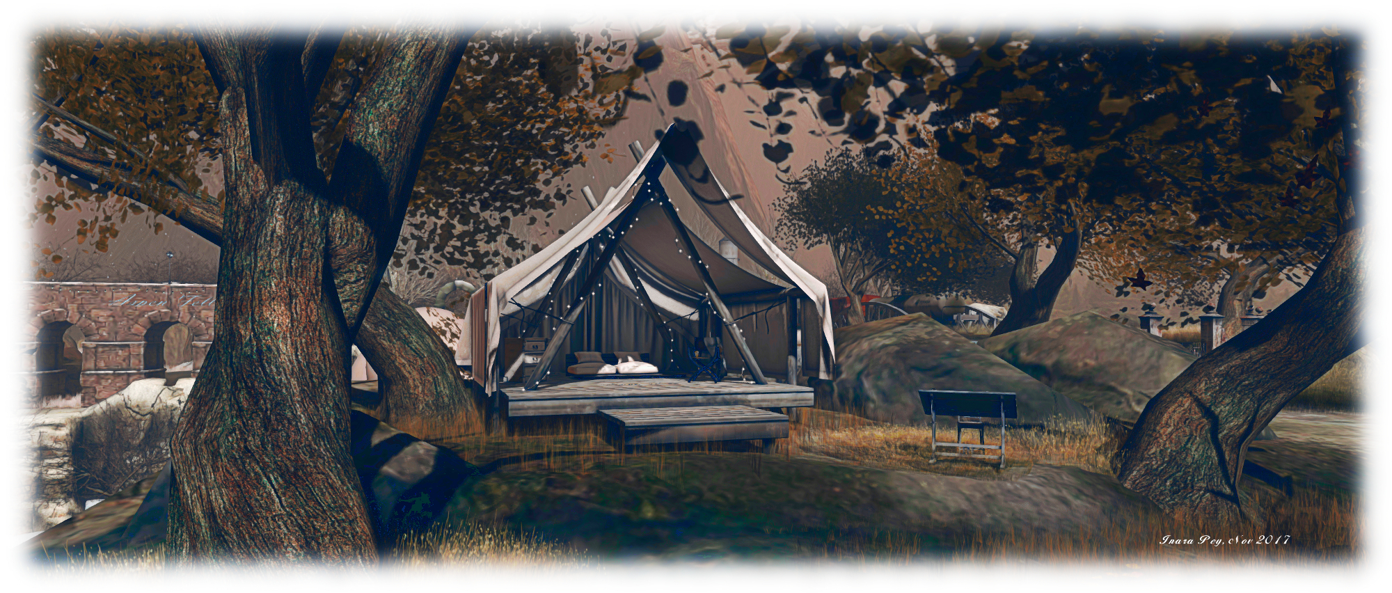
If all this sounds gloomy, don’t be fooled; Aspen Fell also hold plenty of warmth. Scattered across it are places to sit, indoors and out, be they in the warmth of cosy cabins or aboard the freight cars of a parked train or on blankets or cushions under open skies, or up in a watch tower or under the canvas awning of a tent.  Lamps and lanterns are also scattered throughout the setting, offering pools of warmth and illumination, while many of the trees on the snow-laden eastern side of the region are festooned with lights, bringing their own cheer and warmth to the setting.

Aspen Fell; Inara Pey, November 2017, on FlickrAspen Fell

I’ve always enjoyed Aspen Fell, and this iteration is no exception. Raw it may be on first looks, but there is an appeal to be found here, a desire to explore and discover. So, too, does it offer a place to be shared, and to perhaps reflect on the passing of another year (albeit with a typical northern hemisphere outlook).

SLurl Details

Hiking through Seagull Islands in Second Life

Seagull Islands

Seagull Islands is a full region designed by Balthasar Trebuchet and Angel Baxter which we happened across entirely by chance as a result of reading a group chat in-world. It offers an outdoor setting which might be seen as ideal for those wanting to capture the essence of summer vacations spent hiking through a national park – be it one in North America or the UK or Europe or elsewhere. It is also a place laid out in such a way as to feel far bigger than a single region.

As an outdoor location, there isn’t a set landing point, so for this article I’ve arbitrarily selected the little fishing wharf and warehouses located in the north-east corner of the region.  From here, the region opens out to offer several routes of exploration. To the north, for example, area couple of secluded little beaches. Behind these, across the flat grasslands separating them from the wharf and buildings, stone steps offer a way up into the hills.

Seagull Islands

Follow these, and the route will take you past an old chapel, and on upwards into the hills. A fenced track, overlooking a steep drop, points the way onwards and – if you take the right trail – further upwards to a mountaintop lodge. this overlooks the bay and fishing area. A second path, passing via wooden walkways and narrow clefts  offers a way back down to the red-painted buildings and warehouses.

The multiplicity of paths and trails are what make the region fun to explore – and gives that exploration the feeling that you’re on a hike. They lead to a range of locations from tented camp grounds to lodges, stone-built farms, and coastal walks, scattered across the lower-lying lands as well as within the inner hilly area.

Seagull Islands

Another way in which the feeling of being in an expansive parkland is through the use of region surrounds, from distant hills, to closer islands and a use of part of the region itself to form a protective bay around the quayside. Care has clearly been taken to blend these as far as possible with the region to given the impression of a continuous landscape.

Alongside of all this is the creation of a sense of history. Ruins can be found in the region and offshore: Kriss Lehmann’s Forest Ruins Tower sits on the north side of the island, while a TUFF medieval tower sits partially flooded in the region’s waters, as if caught by the slowly rising waters of a river. Elsewhere, the placement of stones give the suggestion of an ancient long ship, echoing the wreck of such a vessel lying across the bay.

Seagull Islands

This is a place which requires time to explore, as there is much hidden away under the foliage and along the paths and trails awaiting discovery, be they places to  sit or to dance or simply to watch the fires at a camp site or the birds flying overhead. It’s also a place well suited to photography, either under the default daylight settings, or via a range of windlight settings – I opted to use a summer lighting for my photos here.

All told, a pleasant visit – just be sure to wear your hiking boots!

Seagull Islands

SLurl Details

A trip to Borneo in Second Life

Borneo; Inara Pey, November 2017, on FlickrBorneo – click any image for full size

Borneo is a homestead region designed by Neva Crystall (NevaCrystall) on behalf of region holder Gac Akina, and which has just opened. Being a fan of Neva’s work, I was keen to hop over and take a look after hearing about it via Shakespeare and Max after they spent time there at the weekend.

“Neva is magical!” Gac told me as we chatted about the region. “It was supposed to be friends only location; we all needed a place to chill and hang together, but then I just couldn’t lock this up for only a few. I’m very happy we are getting visitors and can’t wait to start seeing some pictures pop up 🙂 .”

Borneo; Inara Pey, November 2017, on FlickrBorneo

The setting has the look and feel far removed from the one you might imagine from the region’s name. Instead of a tropical jungle-like environment, Borneo presents a location strongly suggestive of a northern temperate area, perhaps in the Pacific north-west of North America, or maybe coastal Sweden. It’s somewhat industrial in tone, and set beneath a hazy, cold-looking sky suggestive of the onset of winter.  The region is split into two islands, the larger of which forms a curve running from the north down to the east, while the smaller sits towards the south-west, as if protected by the larger’s curve.

Both are rugged in nature, rising from the surrounding waters on rocky shoulders. The landing point sits to the north side of the larger island, on hard-packed earth. An old warehouse sits to one side of the landing point, with a smaller barn-like storage area on the other. Both clearly haven’t been used for their intended use for some time; the smaller is overgrown and full of ageing bric-a-brac, the larger looks like it has in part been turned into a makeshift den, although one room has long since been claimed by nature.

Borneo; Inara Pey, November 2017, on FlickrBorneo

The flattened ground running between these two structures suggest an old road, or perhaps the remnants of a railway spur, arcing as it does along the spine of the island. Follow it around to the east and south of the island, and it will bring you by way of a gabled gate to a house  on the southern headland – but do note this is not open to the public, so don’t be surprised by the ban lines crossing the path before it.

Take the track around to the west, however, and no such barriers block the way. Instead, the path will lead you by way of an old wooden bridge spanning the narrow channel between the two islands, to a third warehouse, this one converted into a bar, the Borneo Pub. “I can’t wait to open the pub,” Gac told me. “We’re waiting on the logo. We’ll have music and parties there. Nothing really scheduled, just for fun and for people to enjoy. I’m hoping we’ll start in the next week or two.” The bar sits within its own parcel, complete with a dedicated in-world group for those wishing to be kept informed of events there.

Borneo; Inara Pey, November 2017, on FlickrBorneo

Sitting within the curve of the main island is a small, stark bay. This can be reached by a mix of wooden steps and board walks leading down from a another gabled gate, this one close to the landing point. It’s not the cosiest of spots in terms of looks when compared to the usual (and oft-expected) beach, but it does have a certain character and warmth – there is a little snug along one of the board walks, while down by the foot of the steps is a little ramshackle trailer serving hot drinks which the local cat clearly recommends!

Balancing the route down to the bay, and on the north side of the island, is a path that snakes its way down to an old quay. An old fishing boat is drawn up alongside, sitting close to its wrecked twin. Both vessels in the shadow of a brick-built lighthouse that raises a slender finger to the sky, tall enough to look down on the landing point and its buildings.

Borneo; Inara Pey, November 2017, on FlickrBorneo

There is a wonderful feeling of wild desolation about Borneo. cold it may look, but it is rich in character and marvellously presented to both explorer and photographer alike. The attention to detail is superb, the detritus of work and life, giving a real sense that this is a place long-established and with its own history, all of which makes for a rewarding visit.

SLurl Details

  • Borneo (Borneo Isle, rated: Moderate)

Malal’s Autumn cheer in Second Life

Malal's Autumn; Inara Pey, November 2017, on FlickrMalal’s Autumn – click any image for full size

Malal’s Autumn is a scenic Homestead region open to visitors and featured in the November 3rd 2017 Destination Guide Highlights. Designed by TeaRose and Dragon Rider (Dragon Walmer), it offers a perfect autumnal setting for those wishing to hold on to warmer times in the northern hemisphere, whilst also offering something of a promise of spring – golden hues notwithstanding – for those in the southern hemisphere looking forward to summer.

The heart of the region is a small built-up area with tea rooms, cafés and (non-commercial) premises. Bordered by water to the west and east, the centrepiece for this area is a cosy little tiled roof café, warm and homely looking among the flat-topped shops flanking it.

Malal's Autumn; Inara Pey, November 2017, on FlickrMalal’s Autumn

Travel north and west from the landing point, following the stone-paved paths, and you’ll come to open land, a little rugged in setting and overlooking a curved beach where surf boards are stacked and a little beach house sits on silts just beyond the surf. For those not into the beach experience, a game of chess is available on the grassland above, waiting for players to indulge themselves.

North of the little precinct of shops and reached via an archway spanning the footpath, is an open paved area with a cosy little lounge at its northern end, offering sofas for sitting and books for reading. The paved area offers further views out over the waters west, east and north, complete with views back over the region’s landscape.

Malal's Autumn; Inara Pey, November 2017, on FlickrMalal’s Autumn

To the east, the region breaks up into a pair of smaller islands, rugged in nature and the home of ancient ruins. A viaduct runs over the waters to  grassy headland to the south-east, where a barn and various table games can be found on a third island, offering the chance for those who feel in the mood to pass a little time in friendly competition. Across a covered bridge from here is a small house, linked back to the shops and cafés by a paved footpath, and again presenting a cosy spot in which to spend time.

All of this is very well done, although there are one or two little edges that need smoothing here and there – walls with gaps under them, or buildings floating a little above the uneven terrain. At the time of our visit both TeaRose and Dragon Rider were working on the region, so hopefully these will be dealt with, ant they didn’t intrude enough to  spoil the overall look and feel of the region.

Malal's Autumn; Inara Pey, November 2017, on FlickrMalal’s Autumn

All of this leads me to what is – for me at least – the most attractive part of the region: the walled garden sitting between shops and islands on the north side of the region, and linked to both by bridges. This is home to a Victorian style orangery outfitted as a coffee-house, with indoor and outdoor seating. The garden itself has been allowed to grow a little wild, the grass approaching knee-length, but with a mossy path running through it from the orangery to a folly, while the trees within the walls are strung with lights. It’s  an eye-catching and delightful retreat, and I especially liked the setting and the way the trees and shrubs have been used to break up what might otherwise be an overbearing presence of brick walls.

Music also plays a role through the region, with pianos and guitar offering a range of classic and popular pieces at various points as you explore. So it’s worthwhile exploring with local sound enabled to appreciate both this and the sound scape for the region.

Malal's Autumn; Inara Pey, November 2017, on FlickrMalal’s Autumn

A quiet, considered design with plenty of opportunities for photography, Malal’s Autumn makes for an enjoyable visit.

SLurl Details

Gallant Estates: a Second Life showcase

Gallant Estates; Inara Pey, November 2017, on FlickrGallant Estates – click any image for full size

Gallant Estates opened its doors to the public at the end of October 26th, 2017.  It is a venture by Gallant Magazine, a publication dedicated to Men’s Fashion and Home & Garden which launched in March, 2017. The region, a Homestead, is intended to be a companion location for the magazine, as is explained on the Gallant website:

Gallant wants to provide readers with the interactive opportunity to see many of the scenes showcased in the magazine as they appear in Second Life. Until November 5th, readers can visit this newly decorated sim for decor ideas or take pictures with the sim as a backdrop. Feel free to drop us a note with any feedback or ideas for future home & garden scenes.

Gallant Estates; Inara Pey, November 2017, on FlickrGallant Estates

Given the November 5th deadline, I’m leaving it very short time frame for people to visit, but having spend time exploring with Caitlyn, we can certainly recommend dropping in.

Primarily designed by the magazine’s Editor-in-Chief, Divos Titanium and Pahkah (Parker Droverson) with support of their partners, Apple Fall, the region had an autumnal look at the time of our visit with hints of Halloween, the region presents three furnished homes to be explored along the C-shaped main island, with a barn conversion towards the east end of the region, which is very imaginatively done and a genuine showcase of decor and design.

Gallant Estates; Inara Pey, November 2017, on FlickrGallant Estates

The western end of the island, by contrast, offered an upland setting, overlooking the bay, where a house sits on a rocky outcrop, perfectly decorated for Halloween. Between the two sits a small farm, the farmhouse facing the landing point and offering another setting for internal decor suggestions.

Enormous care has been taken to provide a natural landscape to explore and for photography, with tall hills and mountains surrounding the setting, all of which is sitting under an atmospheric windlight – particularly if you’re using something like Firestorm and can easily tweak your cloud maps.

Gallant Estates

I understand from Divos that the region will close for a time to the public after November 5th in order to be redressed ready for the next issue of Gallant Magazine. I hope to keep track of at least some of the region designs as they are made public, Gallant Estates offering a unique way to see design concepts for house and home.

In the meantime, I recommend that if you have the time before the end of November 5th, you drop into Gallant Estates and explore the current design.

Gallant Estates

SLurl and Web Details

The Garden of Absentia on Second Life

Garden of Absentia; Inara Pey, November 2017, on Flickr Garden of Absentia – click any image for full size

Established on November 7th, 2016, Garden of Absentia this month celebrates its anniversary, marking the time as an ideal opportunity for a visit to this Homestead region managed and designed by Filo Tani and Sage (Sage Allegiere) which serves a very special purpose in Second Life.

“We take pride in raising awareness for autism, bullying, domestic violence, depression and cancer,” Sage and Filo state in the information note card available from the landing point. “The cancer memorial offers candles to light for loved ones as a remembrance, for those fighting and survivors.”

Garden of Absentia; Inara Pey, November 2017, on Flickr Garden of Absentia

However, far from being preachy or specially designed as a memorial, Garden of Absentia presents visitors with a park-like environment, surrounded by tall green peaks, and seemingly caught at that time when summer is fading and autumn is on the rise. It is a place to be explored and shared, with trails and paths meandering through the shade of tall trees or climbing the slopes of  rugged hills to where cabins and camp fires and lookout points await. And for those who do wish to remember, the opportunity to enjoy quiet solitude at one of the many locations ideal for sitting and resting, or to visit the memorials and perhaps light a candle to a loved one or friend.

The landing point sits towards the north-east side of the island. Given this lie of the land, it is fairly centrally placed for reaching the major points of interest – and where you wander from it is entirely up to you. Just a short walk to the north-eat sits a beautiful green house sitting before a walled garden, lit by lanterns strung from the boughs of trees, the grassy open space below – when open to the public – suitable for dancing as birds chirp from the branches. Follow the walls around the outside of this garden, and you might happen across a picnic spot or pass under fairy lights among the trees, before spying a red-roofed lighthouse sitting on a small islet and offering a place for quite cuddles.

Garden of Absentia; Inara Pey, November 2017, on Flickr Garden of Absentia

Walk north and west from the landing point, and you’ll pass long the base of the broad ridge forming the island’s spine to where a camp site overlooks the water, a tree platform close by. Or, if you prefer, you can turn away before reaching the camp site, and follow the hiking trail offering a way up onto the ridge itself.

This path also offers a choice of routes for the willing explorer. There’s a log-stepped climb up to the top of the ridge, where a cabin and look-out point sit, and a stone arch spans the gorge separating the ridge from another upland region to the south-west. Or, for those who prefer, a narrow ledge-like paths curls around the north-west side of the ridge to run southwards, passing over a wooden bridge spanning the gorge to reach the same, more southerly upland area. Here sits another cabin overlooking the waters below, a path nearby leading back up to the rocky arch across the gorge to complete the circular hiking route.

Garden of Absentia; Inara Pey, November 2017, on Flickr Garden of Absentia

This second upland area forms a ring around a shallow canyon which hides a little secret. Simply cross the covered wooden bridge westward of the landing point just beyond where another rugged path leads up to the tops of the ridge, to find out what this might be.

Travelling directly south from the landing point will bring you, by way of a pleasant little open-air café, to a lovely tiered wall garden, complete with an old cup-and-saucer merry-go-round. Alongside of this garden sits a little headland where a table is set for a tea party and a little nod towards a certain children’s tale.

It is just beyond this tiered wall garden, snuggled into the south-east corner of the region that you can find the memorial area and take the opportunity to light a candle to a loved one or friend lost to cancer, heart disease or diabetes. There is no charge for doing so, and instructions on how to have a candle placed out on the water are provided on the signs at the bridge leading to and from the memorial island.

Garden of Absentia; Inara Pey, November 2017, on Flickr Garden of Absentia

With the opportunity to explore two more small islands on the south side of the region from the memorial island, the chance to commemorate those we’ve loved, the freedom to explore, dance, sit, take photos and simply enjoy the time spent visiting, Garden of Absentia makes for a fulfilling visit. Should you go, do consider sharing your photos via the region’s Facebook group if you can (an odd choice, given the overwhelming popularity of Flickr), and do please consider a donation towards the continuance of the region.

SLurl Details