A Fairelands Journey: the valley and the castle

Fantasy Faire 2020: Elemaria

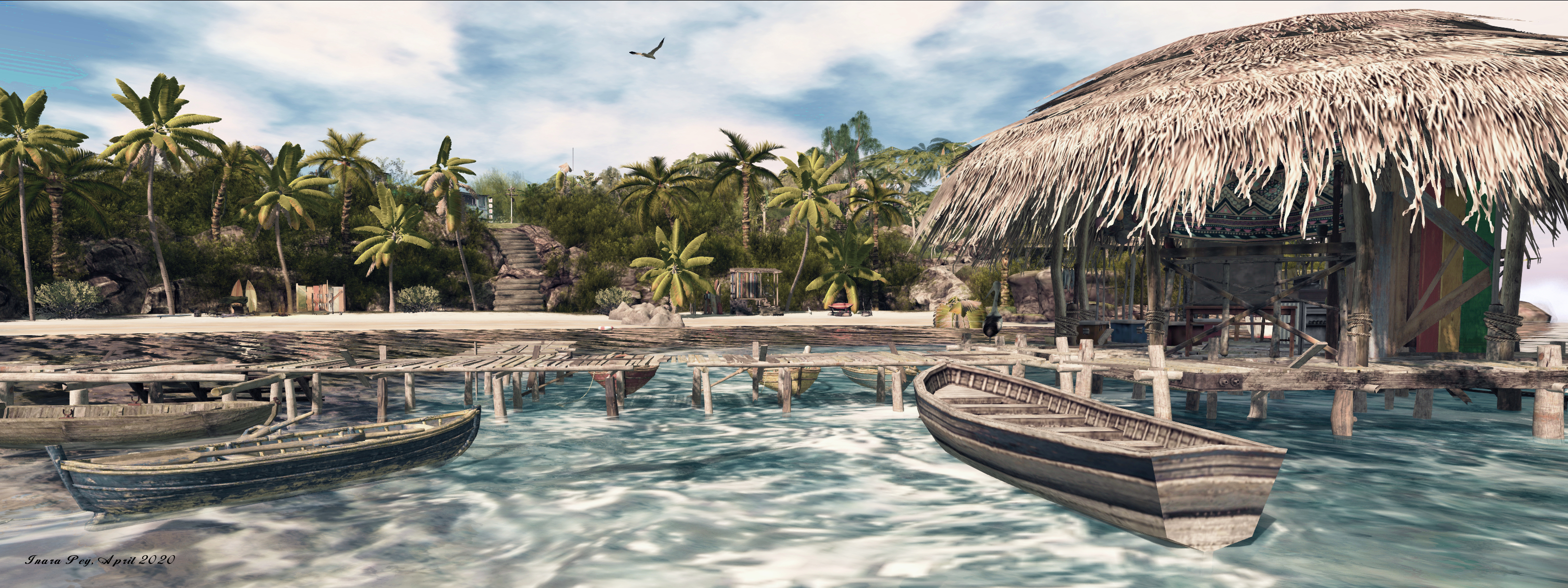
We broke our fast before the Sun had cast its first orange light across the broken walls and towers of Siren’s Lore, our guide having told us we must pass through the the Spirit Valley during the light of day, for our next place of rest lay on the valley’s far side, and at the end of a long journey. And so we passed beyond the wooden pathways of the city across the rugged lands beyond, our guide telling of the first place we would encounter, and how it came to have its mysterious name of Spirit Valley of Kuruk.

His tale sounded both wondrous and fantastical: bear warriors, ancient gods and and transformations. And yet we all knew that the Faireland realms held mysteries and wonders, so it was with excitement rising in my heart that we reached the pass that marked the start of the descent into the valley. At first I saw little worthy of the breathless tales our guide related, the path winding downwards, morning mists hiding the far side whilst fir trees at first screened or view of its deep floor.

Fantasy Faire 2020: The Spirit Valley of Kuruk

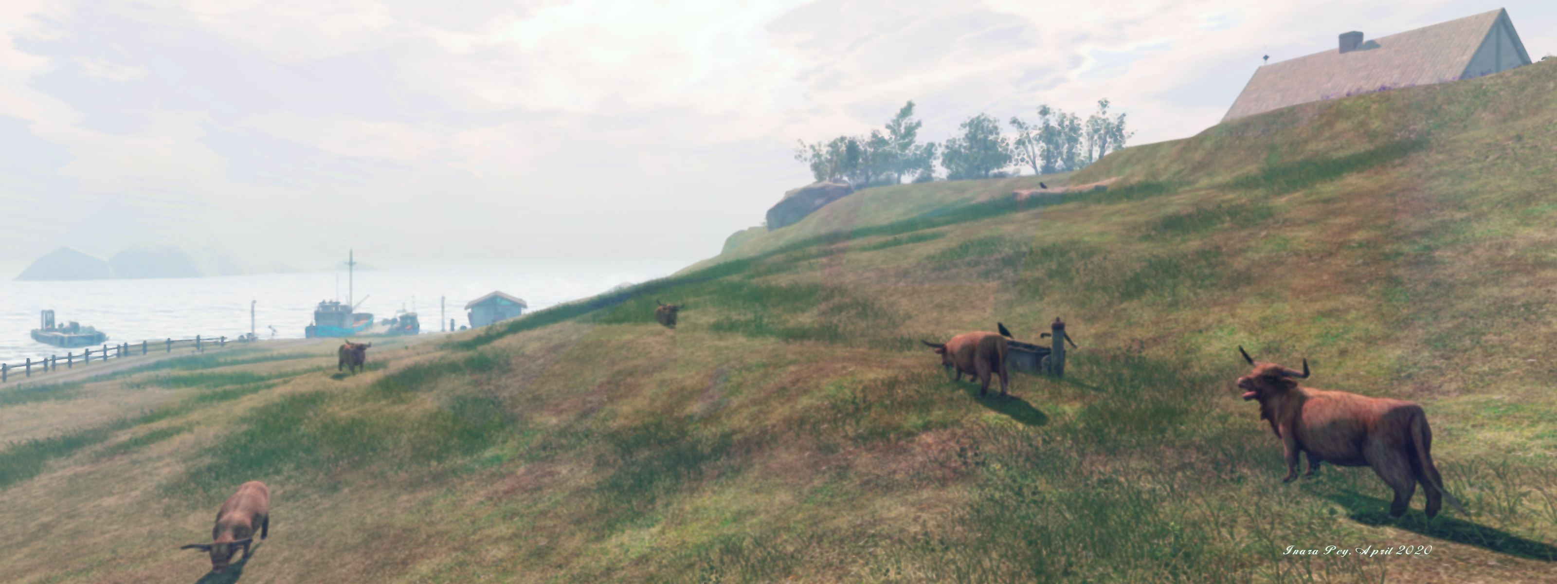
But then we rounded a rocky curve and caught sight of the valley’s broad bowl, the path now clinging to the side of its rocky face. But it was not this breath-taking view that held our eyes; for there seated at the side of the road was a great brown bear, it’s fur tufted and arranged around its neck like a collar of office. On seeing it, my kinsmen cried aloud and reached for their bows, but our guide stayed heir hands. Cool black eyes regarded us, and our guide instructed us to pass the bear in single file. As we did so, the great beast raised its forelegs slowly, paws outward as if in blessing as we passed, and I heard the rumble of its voice, chanting deeply.

I could scarce keep my eyes from this marvellous beast until it was carried from view by a bend in the trail; but as I regarded the valley once more, so I saw more of these strange bears, watching us from high perches, including one that stood upon a wooden trestle, banners draped behind it, its fur painted and arranged into a headdress. I found myself caught in the gaze of a great chieftain or perhaps a medicine leader, who watched our progress even to the valley floor.

Fantasy Faire 2020: The Spirit Valley of Kuruk

It was here that we paused to eat, a procession of children marching to us from a nearby village. They bore platters of fruit and jugs of water for us to partake, as our guide informed us these were the Grizzly Cubs, who follow the path of the Great Bear Tribe, and defend the spirits of the valley and its healing ways.

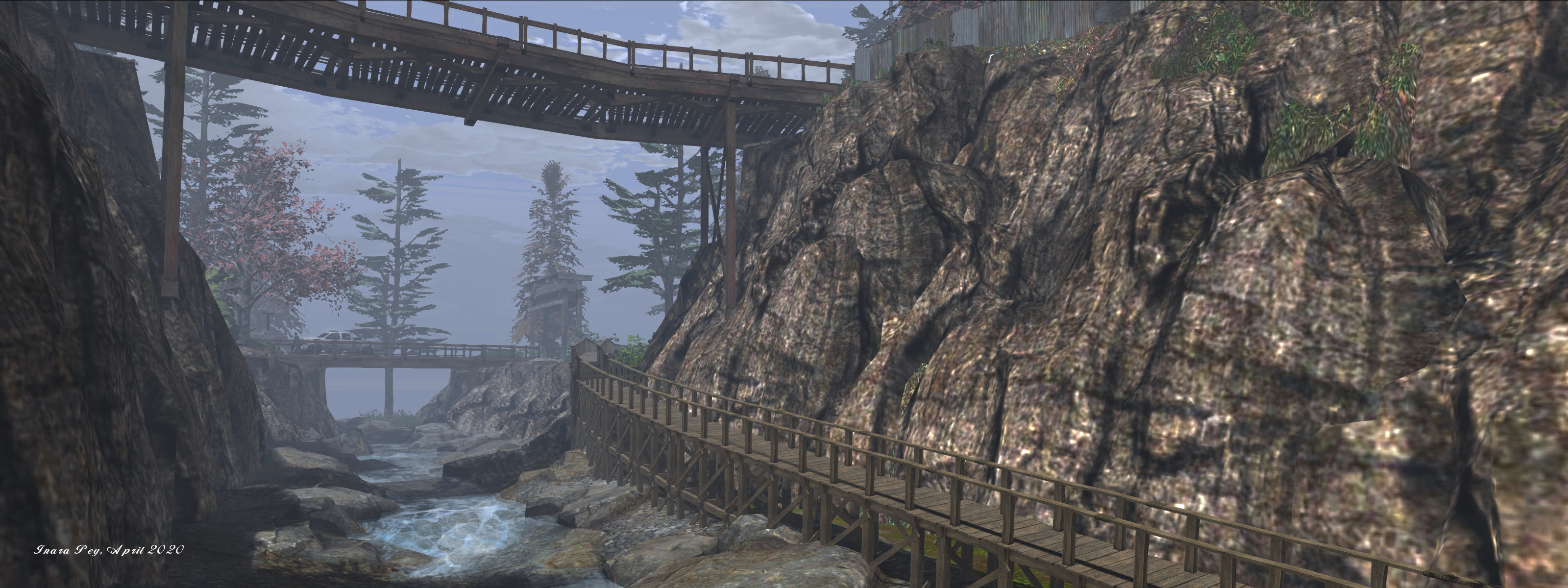
The children said nothing as we ate, but sat with us as we ate. Afterwards, they walked to either side of us as we climbed the long path, passing the painted mouths of caves our guides said we should not enter, least too much time pass and we fail to arrive at the night’s destination at our appointed hour. As we reached the pass that would carry us into the lands beyond the valley, a slender boy came to each of us and indicated we should bow in turn as he painted symbols on each of our foreheads, our guide telling us not to wash or otherwise remove them until after the Sun had set.

Fantasy Faire 2020: The Spirit Valley of Kuruk

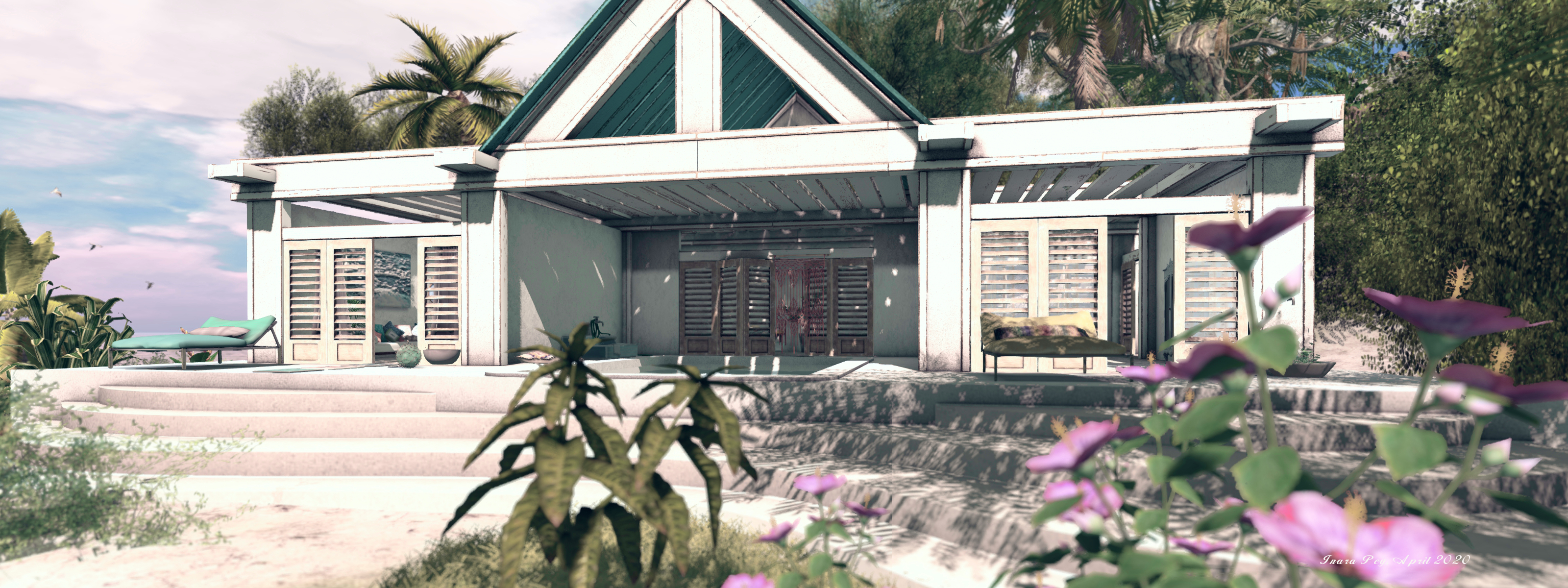
Beyond the valley the land changed quickly, rocks giving way to verdant grass and tall trees warmed by a rich afternoon Sun. At length we came to high curtain walls, their stones faced and well-fitted. Guardsmen hailed us from square towers draped with the Banner of Elemaria, and our guide went before us so that we might be allowed access to this walled realm of which I had heard so much.

Formed by the the elements – air, earth, water and fire all working in equal measure at the Edge of Time -, Elemaria lay as the Home of Nature, the elements present throughout its landscape, each having given of its best to create a place wherein harmony rules, and men, women and creatures live in peace, tending the land and creating a kingdom where all can find welcome and peace.

Fantasy Faire 2020: Elemaria

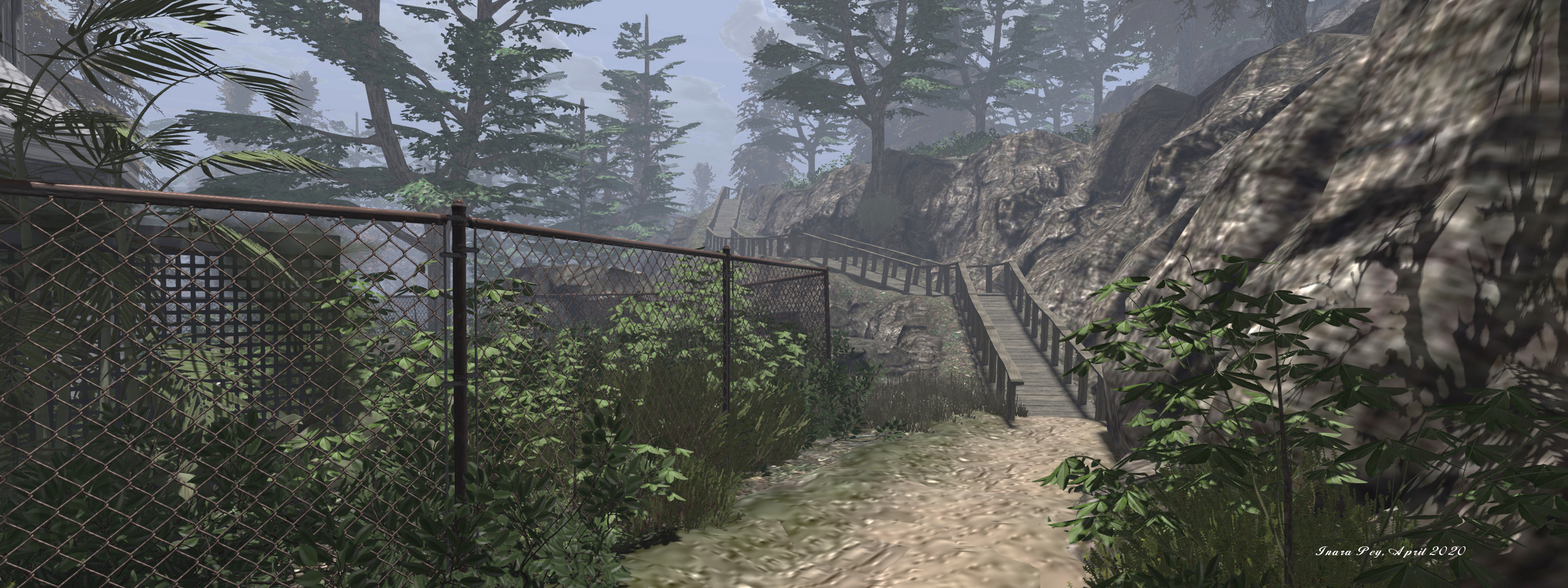
And so we passed along the grass-edged paths and between tiled-roofed homes and stores of Elemaria’s citizens, all of whom greeted us warmly or, on seeing the painted marks of the Grizzly Cubs upon our foreheads, with a degree of reverence.

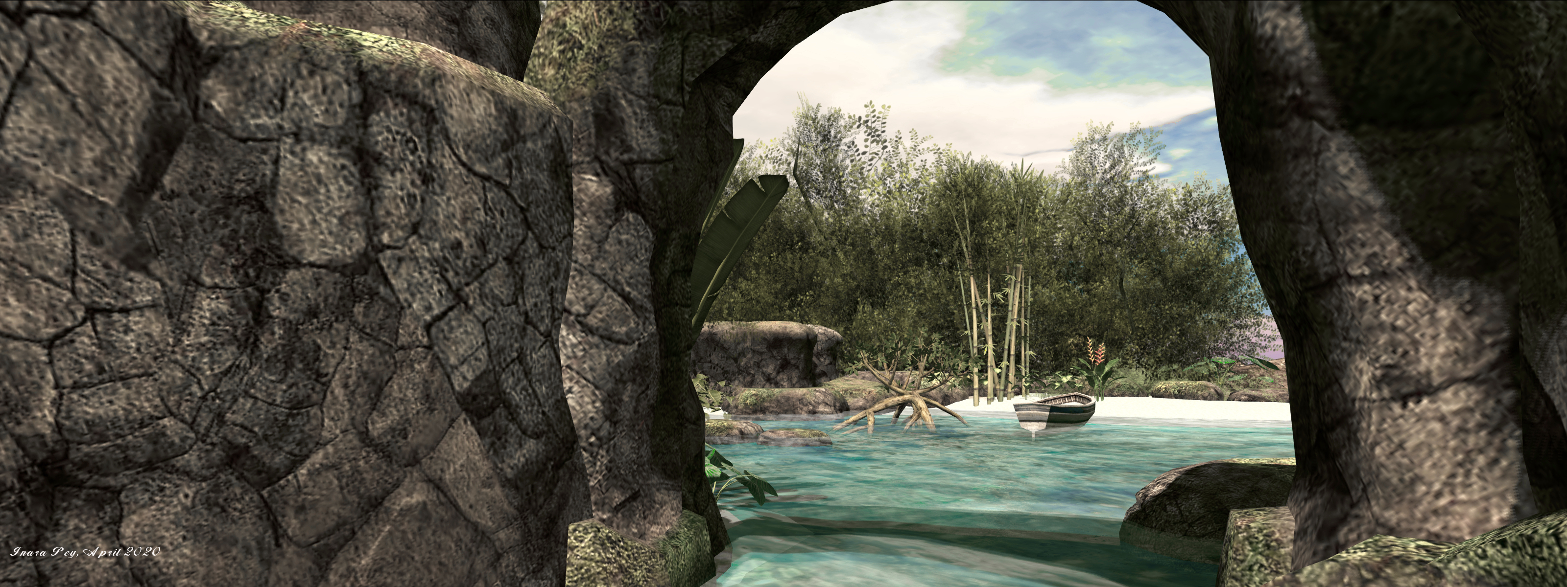
Around trees and over streams we passed, drawing ever closer to the great castle the rose over this pleasing land, until we at last came to a paved circle marked by three arches. Here we were met by the royals of Elemaria, tall and fair folk of great grace and beauty, descended from the first people to enter this lands and peacefully occupy it to live in harmony with nature. 

Fantasy Faire 2020: Elemaria

They greeted each one of us in turn, taking each of us by the forearms drawing us close as we each gripped theirs, until forehead lightly touched forehead. Then one each paired with us, and by twos in a line, we climbed the stone stairs up to where a garden of water and blue-hued trees lay before the towers of the castle, the roar of the falls that fell true and sheer from these gardens bringing an end to conversation until we passed over the gardens atop arched bridges to pass within the walls of the castle. Here the sound of the water passed behind us, to be replaced by music as light and warmth greeted us within those high, dressed walls.

And so we arrived in Elemaria, the length of our journey soothed by the music, and the grace and beauty of our hosts who guided us to our quarters high within the castle, treated as royalty even though they who served us and welcomed us to their banquet later, were themselves of high office. 

Fantasy Faire 2020: Elemaria

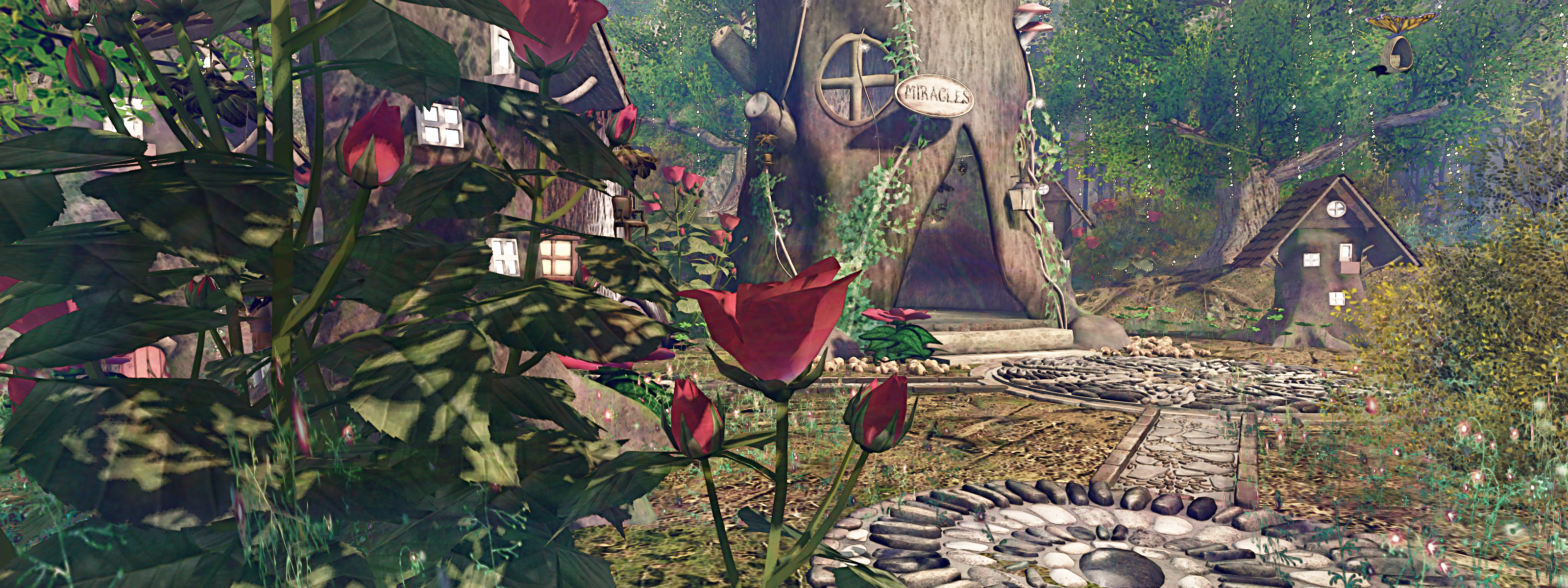
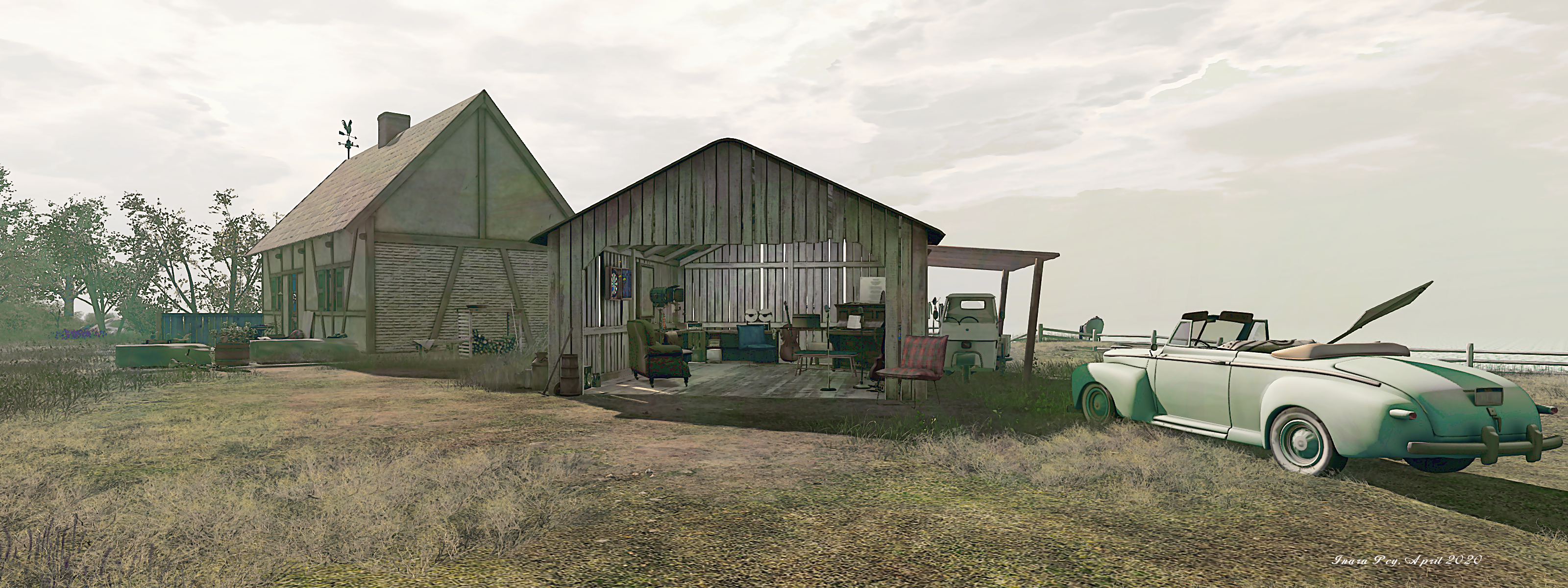
Spirit Valley of Kuruk designed by Loki Eliot and sponsored by Spyralle, Little, Big Designs, Team ACTS, Totally Tinies. Featuring stores by: Attitude is an Artform, Atomic Kitties, Cerridwen’s Cauldron, Cheval D’or|Elysian, CHIMAERA, Designs by Isaura, Dinkie Boutique, Fantavatar & Moonstruck & Lilith’s Den, Icaland ind, Peeps Dinkies, Prehistorica: The Dawn Kingdoms, Stytchwytch Designs, Tiny Inc., and Twisted Whiskers & Dinkie Duds.

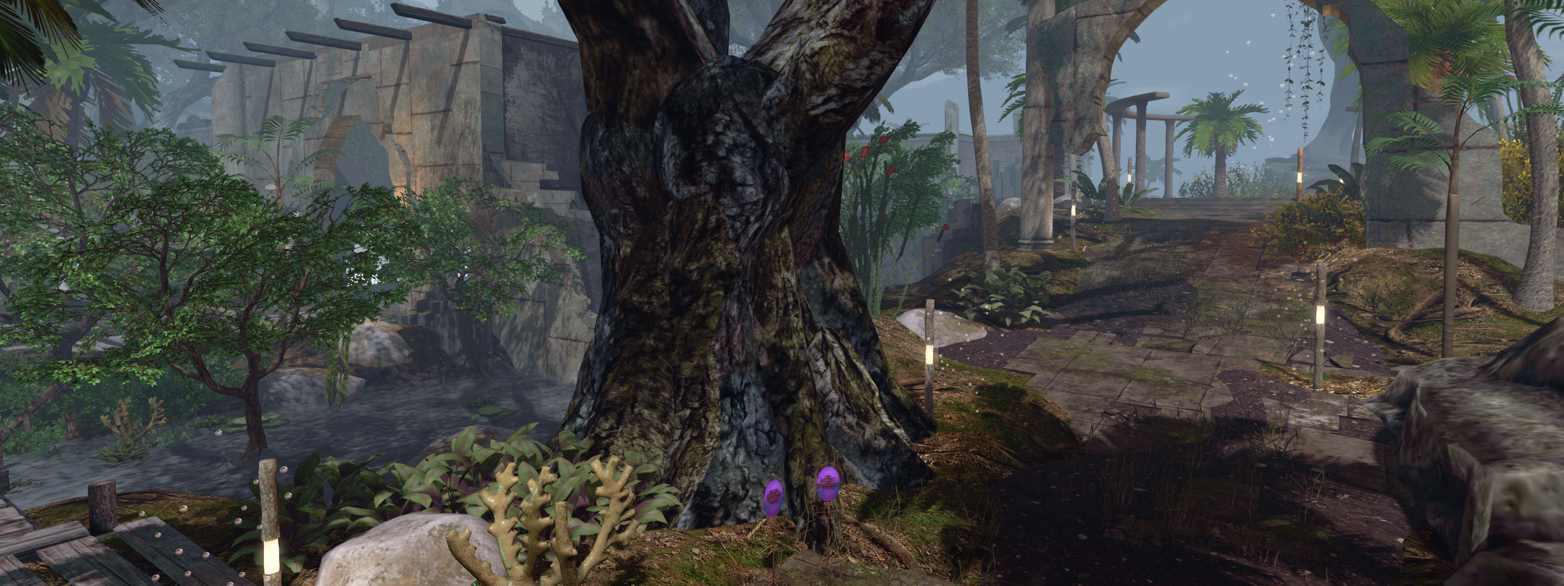
Elemaria by Bee Dumpling & Solas Enchantment and sponsored by Silvan Moon Designs, Secrets of Gaia. Featured stores: ABADDON ARTS, Ab.Fab skins and Fantasy, :: ANTAYA ::, =ED= Eagle Designs, FaceDesk Creative Creations, Flying Horse Head Studios, Gecko Creations & ~Soraida~, God Mod, Laminak, Last Ride, Stardust, Star Journey, The Elven Forest, The Wooly Pig, TRB – A Woman’s Touch, Unity Maxim, Valkyrie Designed, and .Viki.

Total raised by the end of the Faire’s third day: L$3,779,514 (US $15,118).

SLurls and Related Links

Regions are rated Moderate.

A Fairelands Journey: Siren’s Lore

Fantasy Faire 2020: Siren’s Lore

Our first view of the Fairelands – both our goal and the true start of our journey – came as our vessel approached the Isle of Shadows. It was perhaps not an auspicious start to our pilgrimage: the masts of sunken ships lay scattered amongst the rocky teeth that broke the surface of the waters leading to the inner bay; but our Captain assured us that the route to anchor was known to him, and as the clouds parted, our spirits lifted at the sight of the great vessel floating among them, held aloft by the form of a great dragon – Fairechylde!

Of course tales of this great flying ship had reached our homelands – where many considered it little more than a myth – but to see it now and after so long at sea, renewed our spirits, and we gathered on the deck as our ship slowly drifted into the bay, its anchors breaking the surface of the waters. Boats were lowered, and we were carried ashore aboard them, the entire crew eager to climb the ladders and steps that passed up through the raised hull that formed the moorings for Fairechylde, eager to avail themselves of the sky-ship’s welcome.

As much as we felt the same wish, and to seek the great caverns rumoured to be here, our path lay in a different direction. A guide awaited us on the the shores of the bay, ready to guide us onwards, across the high wooden bridge to where a stone path lay across the broken lands to where the high walls of our first destination lay, wreathed in afternoon mist.

Fantasy Faire 2020: Isle of Shadows

Passing over the bridge, we paused to look back at the bay and our ship, the Fairchylde floating above, before the road dipped into the vale beyond, carrying us past a tiny town formed from the trunks and stumps of trees. Whilst lights were starting to shine from little windows, we saw no sign of who lived within these strange small houses – the inhabitants perhaps driven indoors by the sound of our clumping feet and the hoof-falls of our mounts – and I was filled with a desire to wander down along the stone paths that ran from trunk to trunk, but with the lowering Sun approaching the horizon, our guide insisted we moved onwards.

And so at length we came to those high walls. Imposing from a distance, suggestive of great strength, I expected them to be watched over by armoured guards, our way forward challenged. But as we drew close, it was clear the walls had long since become broken, gates long ago gone, and so we passed unhindered into the realm of Siren’s Lore.

Fantasy Faire 2020: Siren’s Lore

Once a great and powerful city, Siren’s Lore stood through the ages as a beacon of beauty and power, a haven to all who came to her gates. A place close to the seas, the gods of which were revered by the city’s people. Then it had been a place of great commerce, where sea and land met harmony.

But that was before the Fall, its reason lost in time, but it left the city broken, towers and buildings crumbling, the  streets vanishing beneath the waves. And yet the citizens survived, and whilst the glory of the city’s former build was forever lost, so was a new Siren’s Lore born; a place where the Protectress still stands watch over the city’s remains and the the merchants, patrons and visitors who walk the wooden paths that have been lain to replaced the once sunlit streets that ran straight and true.  

Fantasy Faire 2020: Siren’s Lore

For Siren’s Lore, both lost and found, is once again a place of commerce, and we passed by many shops offering all manner of goods. It is also a place rich in mystery, and magical ruined beauty, all enhanced, I left as we passed along the wooden paths as the Sun reached the horizon and cast long shadows across the overgrown ruins of what might once of been a great palace or fortress.

And so it was that we came to the end of our first day within the lands of the Faire, strangers to these realms, yet welcomed, ushered to a place of refreshment and rest, where we could renew ourselves with a peaceful night’s sleep unbroken by the roll and creak of an ocean bound vessel. And as I settled upon my pallet in readiness for sleep, my mouth still tingling at the exotic taste of the foods we had been offered, I wondered what strange places we might find as we continued our journey on the morrow.

Fantasy Faire: Siren’s Lore

Isle of Shadows designed by Aelva & Emme Eales and sponsored by Seanchai Library.

Siren’s Lore designed by Syn Beresford and sponsored by Petrichor and Elysion. Featuring stores by: Ars Hokori, Belle Epoque, Celeste, Dragon Magick Wares, En Pointe, Harshlands, Living the FantaSea, LuluB!, Poet’s Heart & Mermaid Treasure Boutique, Poseidon, [QE] Designs, Romin Creations, RVi Design,[][]Trap[][], Valkyr RP, Voodoo, and Witchcraft.

Total raised on Day 1: L$1,829,351 (US $7,317).

SLurls and Related Links

Regions are rated Moderate.


A journey to Orkney in Second Life

Endless 58-58N, April 2020 – click any image for full size

Orkney is an archipelago in the Northern Isles of Scotland, about 16 km from the coast of Caithness, comprising some 70 islands, of which 20 are inhabited, the largest being simply called Mainland. It is now also the subject of the latest region design by  Sombre Nyx called Endless 58-58N – in recognition of both her Endless region builds and Orkney’s northerly latitude (58º 58′ north).

Presenting an archipelago within an area just 256m on a side is not easy, but Endless 58-58N does so quite magnificently. True, there are off-sim surrounds that can help give the sense of depth to a location, however, how well they work can be a matter of debate. Here, by combining them with a hazy Windlight environment, Sombre has created a setting that perfectly captures the sense of being within a group of islands caught within the hazy coolness of the North Atlantic.

Endless 58-58N, April 2020

Thus Endless 58-58N is an engaging representation of Orkney’s gentle rugged beauty, with the focus on the South Isles as then encompass the natural basin of Scapa Flow, once the home of Britain’s Grand Fleet, and the place where the German Imperial German Navy was scuttled in 1918, the vessels that could not be salvaged becoming  – along with a number of sunken British ship – a popular dive spot.

That the region appears to be a representation of Scapa Flow and the larger islands surrounding it comes not only from region’s introductory note card, by by the shape of the largest island in the region, which has the look of part of Mainland, Orkney’s largest island. Also, the tall finger of rock that rises from the south-west side of the second largest island carries with in a suggestion of The Old Man of Hoy, another of the islands that surround the bay.

Endless 58-58N, April 2020

Orkney has a long history of occupation dating back to Mesolithic and Neolithic times. Much evidence of this can still be found among the island, including the Standing Stones of Stenness and the Ring of Brodgar. To reflect this, Endless 58-58N includes its own standing stones, watching over the sheep that graze on the slopes below them.

There is no set route to exploring the region – from the landing point, visitors can wander where they will. As with Orkney and the wilds of Caithness, this is an open, rolling setting with few trees, but with coastal areas raised in hard, rugged cliffs. A small fishing wharf with piers and boats sits at the foot of one of these cliffs, just over a cottage-topped hill from the landing point. A single road runs back from this little port to where a deck sits out over the waters of the bay, offering a place to sit and appreciate the view.

Endless 58-58N, April 2020

Getting to the other two islands of the region is a case of flying, there being no obvious ferry or rowing boat to take. Do note, however, that there is a separate parcel to the south-west of the region sitting between the large island and its two small neighbours that has ban lines active, so care should be taken in that area.

Endless 58-58N is a region that deserves to be seen first-hand; minimal yet rich in detail, perfectly set within its windlight environment and with subtle celebrations of Orkney’s history, it is genuinely a delight to visit and photograph. Keep an eye out for the local seals as well!

Endless 58-58N, April 2020

With thanks to Shawn for the pointer!

SLurl Details

A Devil’s Bend in Second Life

Devil’s Bend National Park, April 2020 – click any image for full size

We came across Devil’s Bend National Park, a region design by Aiden Caudron and occupying a Full region using the full region land capacity bonus, after poking at the Recently Added category of the Destination Guide.

Intended to offer the look and feel of a rugged national park, the setting is an interesting mix of public and residential spaces (the former well scattered across the region so as not to interfere with exploration). Raised into a high plateau, the park is a series of dusty trails running under rich fir foliage and over deep ravines by means of wooden bridges, together with wooden board walks that wind through the ravines and cling to the sides of cliffs as they rise and fall through the park.

Devil’s Bend National Park, April 2020

The landing point sits at the visitor centre, a small lodge sitting at the side of one of the dusty roads. From here lie a choice of routes – one of which is reasonably short inasmuch as it crosses a bridge to reach two of the rental properties before coming to an end. Taking the road in the other direction is more constructive for explorers, as it winds much further through the park and offers a means to reach some of the wooden  walkways.

This is a place with a curious (in an interesting way) feel to it: open spaces, winding trails, and walks that are in keeping with the overall theme of a national park; but at the same time, the rental properties have something of a run-down feel to them; fenced gardens are overgrown, the houses faded by the sun and looking a little the worse for wear.

Devil’s Bend National Park, April 2020

Meanwhile, the north-east and northern side of the region are closed to public access – that is, the road is unexpectedly blocked by the wreck of a school bus. This appears to be less to do with matters of privacy and more with the fact that a major bridge has partially collapsed. Whether this is the result of an earthquake or rockfall – or both – is unclear; but the damage is such that it does bring the route to an abrupt end. Nevertheless, the use of the wrecked bus to block the road, together with the dilapidated state of the buildings beyond it suggest perhaps another narrative for this northern side of the region.

Follow the roads and the wooden board walks up to the summits of the park, and you may find yourself passing through at least one tunnel boring through the rock. It leads the way to a zip line that can be used for riding past a waterfall and back to the road below. Should you miss the tunnel, you can make your way to the radio mast on the highest peak – but be aware that the radio station close by is now a private home.

Devil’s Bend National Park, April 2020

I mention the tunnel, as tunnels are very much the secret to the park – threading through its rocky mass is a network of them, together with  chambers. Some are interconnected, others run on their own. Whilst most of the chambers do not hold a secret waiting to be found, they and the tunnels add a dimension to exploring the park that can keep visitors engaged for no small amount of time.

Rich in detail and offering numerous opportunities for exploration (and a café where visitors can rest should walking get a little too much), Devil’s Bend makes for an engaging visit. The texture load can have an impact if you’re running with all of the viewer’s bells and whistles engaged (particularly shadows), but this shouldn’t be a reason for not visiting, nor does it detract from the rugged charm of the region.

Devil’s Bend National Park, April 2020

SLurl Details

Dya’s Scent of the Caribbean in Second Life

Dya’s Scent of the Caribbean, April 2020 – click any image for full size

I arrived in-world on April 17th, 2020, to a message from Dya OHare inviting me to hop over to her latest region design, Dya’s Scent of the Caribbean, which now supersedes her Abandoned Vacation Spot design I blogged back in February (see: An abandoned vacation spot in Second Life).

The new setting, as might be gathered from the name, presents Dya’s take on a Caribbean setting, and is with her previous build, she packs a lot of detail into the region, offering a real taste of the tropics with nicely placed touches that add authenticity to the setting while the overall layout once again suggests a place much larger than a single region.

Dya’s Scent of the Caribbean, April 2020

This is one of the smaller, cosier Caribbean islands, surrounded by clear blue waters that gently shoal to a sandy apron that encloses the island on three side – and gives the impression it might completely surround it at low tide. The island raises its sapphire back from surrounding sea and sand, presenting a roughly diamond shape with an south-eat to north-west orientation. The landing point lies towards the former, located in a little commercial hamlet that sits on the top of the island, its single pedestrian street flanked on either side by a number of small businesses, including what might best be described as a boutique hotel, together with a bar and local small diner.

Looping around this tiny slice of urban life is is dusty track of a road that offers the primary means of exploring on foot as it curls and branches its way between uplands and beaches and rocks. Follow it south and behind the bulk of the taller commercial properties, and it’ll take you to a dead end and a tongue of sand that licks its way up over the grass with an invitation to walk across it. Doing so brings you to a stretch of golden sand that is watched over at one end by a whitewashed lighthouse, and at the other by beach house that offers shade from the Sun’s heat and glare and a cooling freshwater pool. Just offshore, the point at which the sandy shelf surrounding the island gives way to deeper waters is marked by a ring of anchored buoys (actually denoting the region’s edge).

Dya’s Scent of the Caribbean, April 2020

Take the road the other way from the landing point and it’ll offer a looping walk around the northern aspect of the island, rising and falling in response the land’s own undulations. A modest motel sits on the western side of this road, offering a view (partially obscured by trees) of the ocean, which here meets the unyielding rock of the isle, as the tide appears to be in.

Further along the road sits a little chapel facing steps that climb up to a little shanty village of corrugated tin huts straddling the island’s backbone,  the road again looping around it below. Just past the chapel and the step up to the shanty, the road offers a glimpse down into one of the island’s secrets: a landlocked cover of clear water that tumbles from a waterfall and sheltered by rocky walls and the verdant greenery of the island. Cut off from the open sea by a further beach, this cove is an attractive hideaway, perhaps now filled by freshwater given the sea apparently can no longer reach it.

Dya’s Scent of the Caribbean, April 2020

After curling around the north-western headland, the road loops back towards the landing point once more, passing as it does so a set of stone steps that offer the way down to what would appear to be – at low tide at least – the island’s largest expanse of sand. With the tide in, most of this is covered covered by water – if only moderately so – meaning a walk out to the tiki bar that marks where the depths significantly increase is actually going to be something of a wade / swim. For those not feeling so energetic, there is shade to be found under an awning set out over the ruin of an old boat further along the beach.

Like her previous build, Dya offers something of a story with this setting. Little clues are scattered about that suggest this island perhaps sits not in the present, but in the last of 20-30 years ago: the style of car parked here, the only Honda mopeds scattered around, and so on. Certainly, it would appear to be a place that is showing signs of age: paintwork on buildings, rowing boats and elsewhere is all well sun-bleached, while board walks out on the water are in a sorry state of repair – even the plumage on one of the island’s parrots is looking a little careworn!

Dya’s Scent of the Caribbean, April 2020

All of this suggests this isn’t one of the Caribbean’s more popular tourist stop-off points, but at the same time, all of the little touches waiting to be found – like a glimpse of a Bob Marley photo through an open door here, the roadside fish stall there, the fading beat of reggae music to be heard drifting through the air as one explores, clearly indicate the island is very much home to those who live on it.

Dya tells me this design will likely remain in place for at least six weeks, although she will continue to add to it / tweak it (a hurricane may apparently be on the way!), so there is plenty of time yet to visit. For now, and given the weather in my part of the physical world has gain turned cold and damp, I’m off back to Dya’s beach house with its shade, pool and – hopefully – a glass of chilled white wine as should be used to counter the Sun’s heat!

Dya’s Scent of the Caribbean, April 2020

SLurl Details

A desert ghost town in Second Life

Kolmannskuppe, April 2020 – click any image for full size

On April 10th, 2020, Serene Footman opened his latest limited-time region build to once again transport us to one of the most unusual places to be found on Earth.

I tend to wax lyrical over Serene’s designs, and for three good reasons: the first is they are invariably elegant in design and statement, packed with details that may be both obvious and subtle, whilst also incorporating Serene’s own recognisable individuality of touch that has marked all of his designs. The second is that they demonstrate that while Second Life sets the imagination free and can become the home of the strange, the out-of-the ordinary and the unique – so too can the physical world around us, which is every bit as richly diverse as anything to be found in-world; the difference is, Second Life offers the means for to visit such places where otherwise they might forever be out of out reach save for photographs and videos seen in publications and on-line.

The third reason is that his builds are always educational, both in terms of what can be achieved in Second Life with care and forethought in design and because as soon as I visit one of his designs, I’m reaching for the encyclopaedia and calling up my search engine to find out as much as I can about the locations he picks, so I might broaden my own knowledge.

Kolmannskuppe, April 2020

And so it is with Kolmannskuppe – The Ghost Town of Namib Desert, his build for April 2020, which brings to SL the long-deserted mining town of Kolmannskuppe or (to give its name in Afrikaans) Kolmanskop located on the inter-coastal erg of the southernmost reaches of the massive Namib desert in modern-day Namibia, but was at the time of the town’s founding, German South West Africa.

Named for a nearby kopje, or hillock, which had in turned been dubbed Kolmannskuppe “Kolman’s Head” after the wagon driver who had been forced to abandon his wagon there after a particularly violent sand storm in 1905, the town came to prominence as one of the first areas along the Namib coast to experience a diamond rush.

Three years later, a railway was being built between the territory’s major harbour town of Lüderitz on the coast and the inland town of Aus. The man in charge of the work was German-born August Stauch, who has moved to the territory in the hope of alleviating his asthma. An amateur mineralogist in his spare time, Stauch became fascinated the tales surrounding the territory’s founder, Franz Adolf Eduard Lüderitz (after whom the the harbour town was named) and his belief the region contained diamonds just waiting to be found.

Kolmannskuppe, April 2020

So firm was his belief Lüderitz had been correct, Stauch obtained a prospecting licence and told his railway workers to bring him any unusually shiny stones they might turn over whilst digging to lay the train line’s foundations, and in April 1908, one of his aides, Zacharias Lewala – who had previously worked at the Kimberley diamond mines in South Africa – did just that. Systematically searching the area Lewala had been scouting, Stauch found more of the stones and took them to Lüderitz, where his friend and mining engineer Sönke Nissen confirmed they were diamonds.

Using Stauch’s prospecting licence, the two men secured a 75-acre claim at Kolmannskuppe. At first they tried to keep the mine and their growing wealth secret, but news inevitably spread, sparking a diamond rush into the area, and Kolmannskuppe  grew to become an extremely wealthy settlement, boasting all the amenities of a modern town: a rail link to Lüderitz (itself massively enriched by the flow of diamonds from Kolmannskuppe  and further deposits found to the north), its own tram service, a host of civic facilities and utility services form a hospital (with the southern hemisphere’s first x-ray machine) through a theatre, ballroom and casino to its own power station and ice-making factory.

Kolmannskuppe, April 2020

The town reached its peak in the years immediately before and after the first world war. However, the discovery of a huge deposits of diamonds 270 km to the south around the mouth of the Orange River that did not require complex mining, resulted in many from Kolmannskuppe simply up and moving south, leaving their homes and possessions to the sands of the desert. These moves marked the start of 3-decade decline for Kolmannskuppe, the last inhabitants leaving the town to the shifting desert sands in 1956.

More recently, Kolmannskuppe has become a tourist attraction – if one that is corporately managed, De Beers and the Namibian government jointly funding it. This remaining buildings sit alongside a dusty road, dunes of tufted sand wrapping themselves around wooden, sun-bleached walls that are so leached of moisture they don’t so much fall down as crumble away. It’s a place that is beloved of photographers, artists and film-makers for its sense of desolation and nature’s reclamation of man’s fragile foot-hold in this harsh desert environment. As Serene notes in his own informative blog post on the setting, it is in some ways a contrived and artificial location, centred upon the hulking form of the former casino (and now the nexus for tourists) – but it is undeniably photogenic and captivating.

Kolmannskuppe as it is today. Via Wikipedia

It is in this form that Serene captures the town, and does so quite magnificently, from the high shoulders and roof of the former casino through to the crumbling skeletons of houses and the bare bones of former utilities. While some of the house styles may be more esoteric than those of the actual town, he has perfectly captured and embodies the spirit of Kolmannskuppe, right down to the touches of corporate artificiality, such as the misplaced baths.

As the same time, he has added his own touches, notably in the form of multiple places where visitors can sit and immerse themselves in the setting, watching the coming and going of others, the entire region surrounded by high dunes that mirror the Namib’s reputation for sand dunes that can reach heights of up to 300m. Rounded-out by the presence of oryx gazella, Kolmannskuppe – The Ghost Town of Namib Desert is yet another remarkable location presented by one of Second Life’s foremost region designers.

Kolmannskuppe, April 2020

SLurl and Links