I arrived in-world on April 17th, 2020, to a message from Dya OHare inviting me to hop over to her latest region design, Dya’s Scent of the Caribbean, which now supersedes her Abandoned Vacation Spot design I blogged back in February (see: An abandoned vacation spot in Second Life).
The new setting, as might be gathered from the name, presents Dya’s take on a Caribbean setting, and is with her previous build, she packs a lot of detail into the region, offering a real taste of the tropics with nicely placed touches that add authenticity to the setting while the overall layout once again suggests a place much larger than a single region.
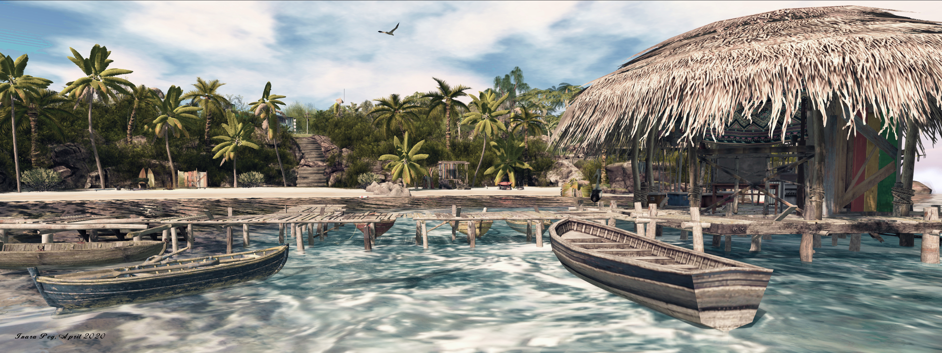
This is one of the smaller, cosier Caribbean islands, surrounded by clear blue waters that gently shoal to a sandy apron that encloses the island on three side – and gives the impression it might completely surround it at low tide. The island raises its sapphire back from surrounding sea and sand, presenting a roughly diamond shape with an south-eat to north-west orientation. The landing point lies towards the former, located in a little commercial hamlet that sits on the top of the island, its single pedestrian street flanked on either side by a number of small businesses, including what might best be described as a boutique hotel, together with a bar and local small diner.
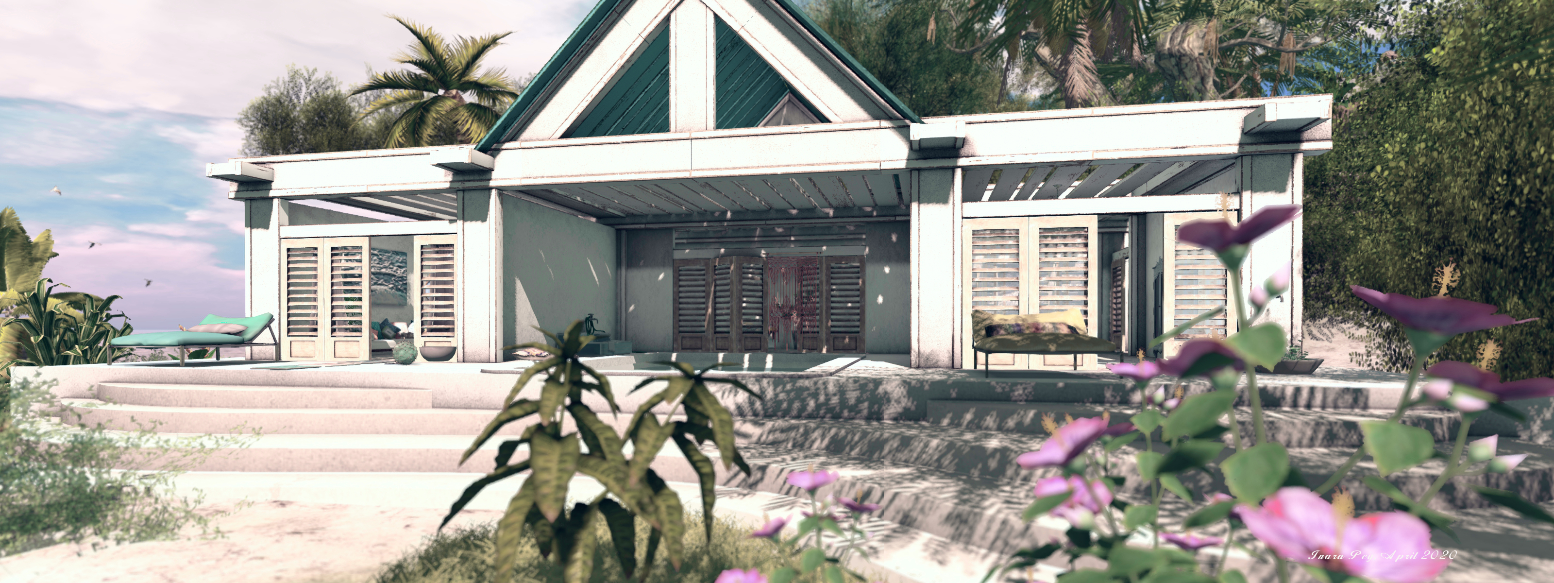
Looping around this tiny slice of urban life is is dusty track of a road that offers the primary means of exploring on foot as it curls and branches its way between uplands and beaches and rocks. Follow it south and behind the bulk of the taller commercial properties, and it’ll take you to a dead end and a tongue of sand that licks its way up over the grass with an invitation to walk across it. Doing so brings you to a stretch of golden sand that is watched over at one end by a whitewashed lighthouse, and at the other by beach house that offers shade from the Sun’s heat and glare and a cooling freshwater pool. Just offshore, the point at which the sandy shelf surrounding the island gives way to deeper waters is marked by a ring of anchored buoys (actually denoting the region’s edge).

Take the road the other way from the landing point and it’ll offer a looping walk around the northern aspect of the island, rising and falling in response the land’s own undulations. A modest motel sits on the western side of this road, offering a view (partially obscured by trees) of the ocean, which here meets the unyielding rock of the isle, as the tide appears to be in.
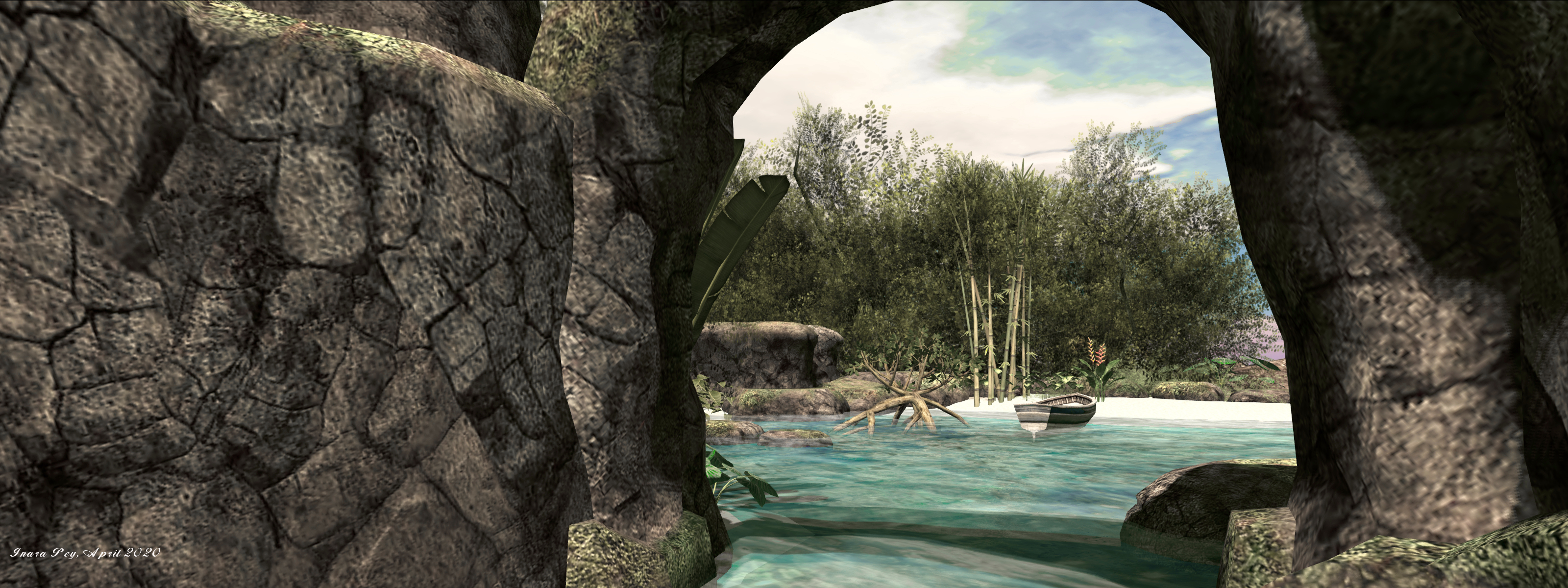
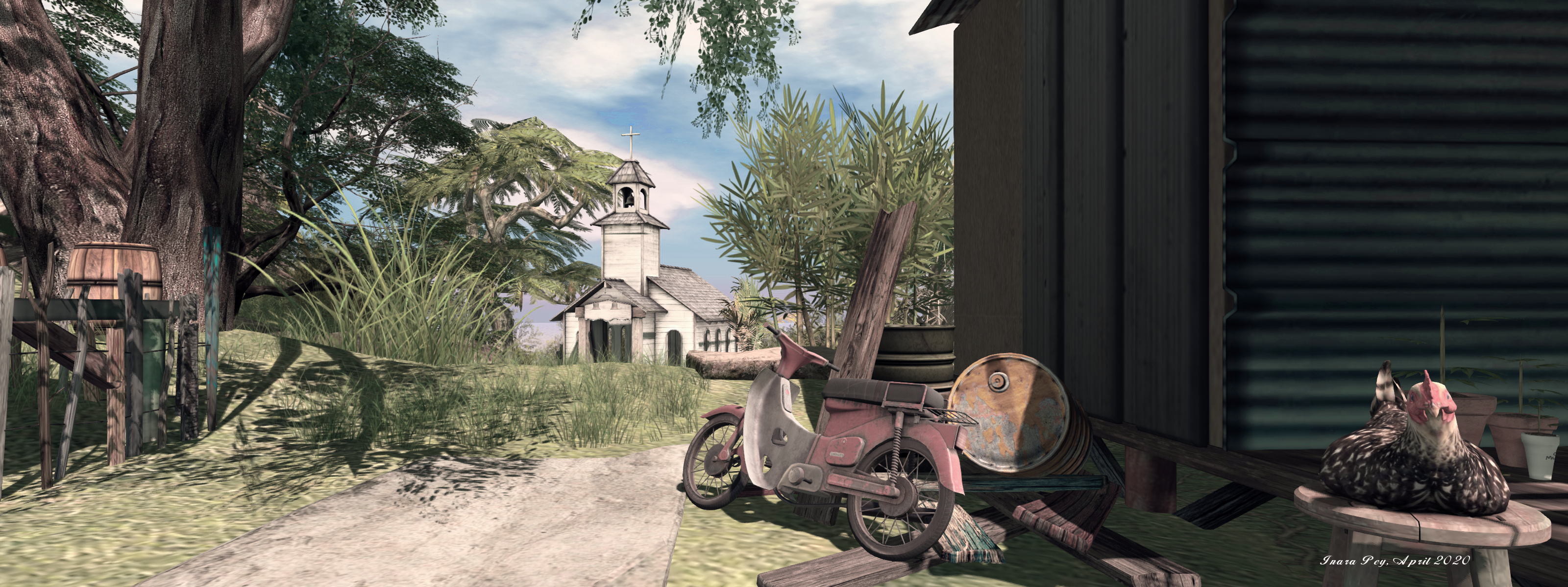
Further along the road sits a little chapel facing steps that climb up to a little shanty village of corrugated tin huts straddling the island’s backbone, the road again looping around it below. Just past the chapel and the step up to the shanty, the road offers a glimpse down into one of the island’s secrets: a landlocked cover of clear water that tumbles from a waterfall and sheltered by rocky walls and the verdant greenery of the island. Cut off from the open sea by a further beach, this cove is an attractive hideaway, perhaps now filled by freshwater given the sea apparently can no longer reach it.
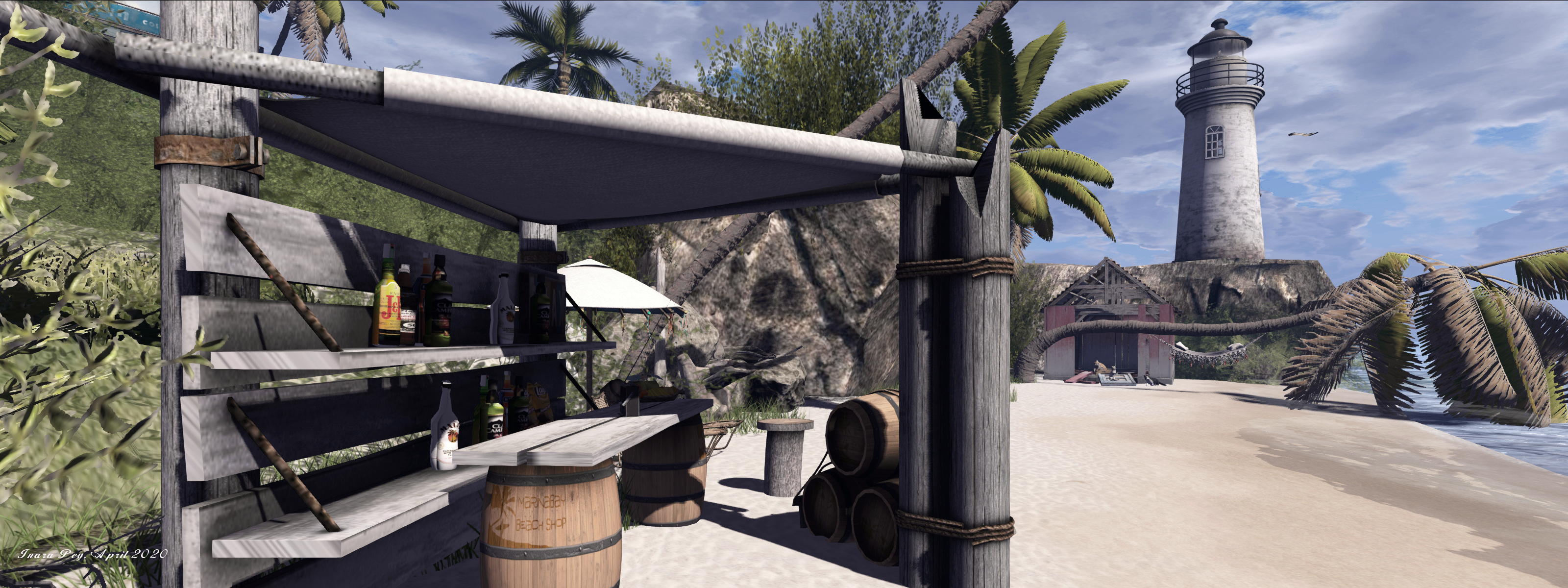
After curling around the north-western headland, the road loops back towards the landing point once more, passing as it does so a set of stone steps that offer the way down to what would appear to be – at low tide at least – the island’s largest expanse of sand. With the tide in, most of this is covered covered by water – if only moderately so – meaning a walk out to the tiki bar that marks where the depths significantly increase is actually going to be something of a wade / swim. For those not feeling so energetic, there is shade to be found under an awning set out over the ruin of an old boat further along the beach.
Like her previous build, Dya offers something of a story with this setting. Little clues are scattered about that suggest this island perhaps sits not in the present, but in the last of 20-30 years ago: the style of car parked here, the only Honda mopeds scattered around, and so on. Certainly, it would appear to be a place that is showing signs of age: paintwork on buildings, rowing boats and elsewhere is all well sun-bleached, while board walks out on the water are in a sorry state of repair – even the plumage on one of the island’s parrots is looking a little careworn!
All of this suggests this isn’t one of the Caribbean’s more popular tourist stop-off points, but at the same time, all of the little touches waiting to be found – like a glimpse of a Bob Marley photo through an open door here, the roadside fish stall there, the fading beat of reggae music to be heard drifting through the air as one explores, clearly indicate the island is very much home to those who live on it.
Dya tells me this design will likely remain in place for at least six weeks, although she will continue to add to it / tweak it (a hurricane may apparently be on the way!), so there is plenty of time yet to visit. For now, and given the weather in my part of the physical world has gain turned cold and damp, I’m off back to Dya’s beach house with its shade, pool and – hopefully – a glass of chilled white wine as should be used to counter the Sun’s heat!
SLurl Details
- Dya’s Scent of the Caribbean (Phantos, rated Moderate)