Coalition Island: looking at the US military’s use of Second Life

Coalition Island – June 2020

In late 2008, the US Army made the headlines in a number of on-line periodicals such as Wired, when it announced the Army Training and Doctrine Command (TRADOC) was opening a “recruitment island” in Second Life, hoping to tap into the “4 million” users of the platform (yes, this was the era of hype about SL) into signing-up through a mixture of promotion and tchotchkes.

While that announcement was met with sniggers by some of the press reporting on it, it actually masked the fact that the US military had been engaged in evaluating Second Life as a platform for modelling, simulation and training (MS&T) activities for more than a year.

This work was centred on a group of regions called MiLands – Military Lands – which at their height (2009-2010) were made up of around 30 regions, split between the four major branches of the US military: Air Force, Navy, Army and Marine Corps. Such was the US military presence, Linden Lab assigned Scott Linden to manage the regions and liaise with the US Department of Defense in its use of SL.

The MiLand Meeting Room, home of the MiLand Charter

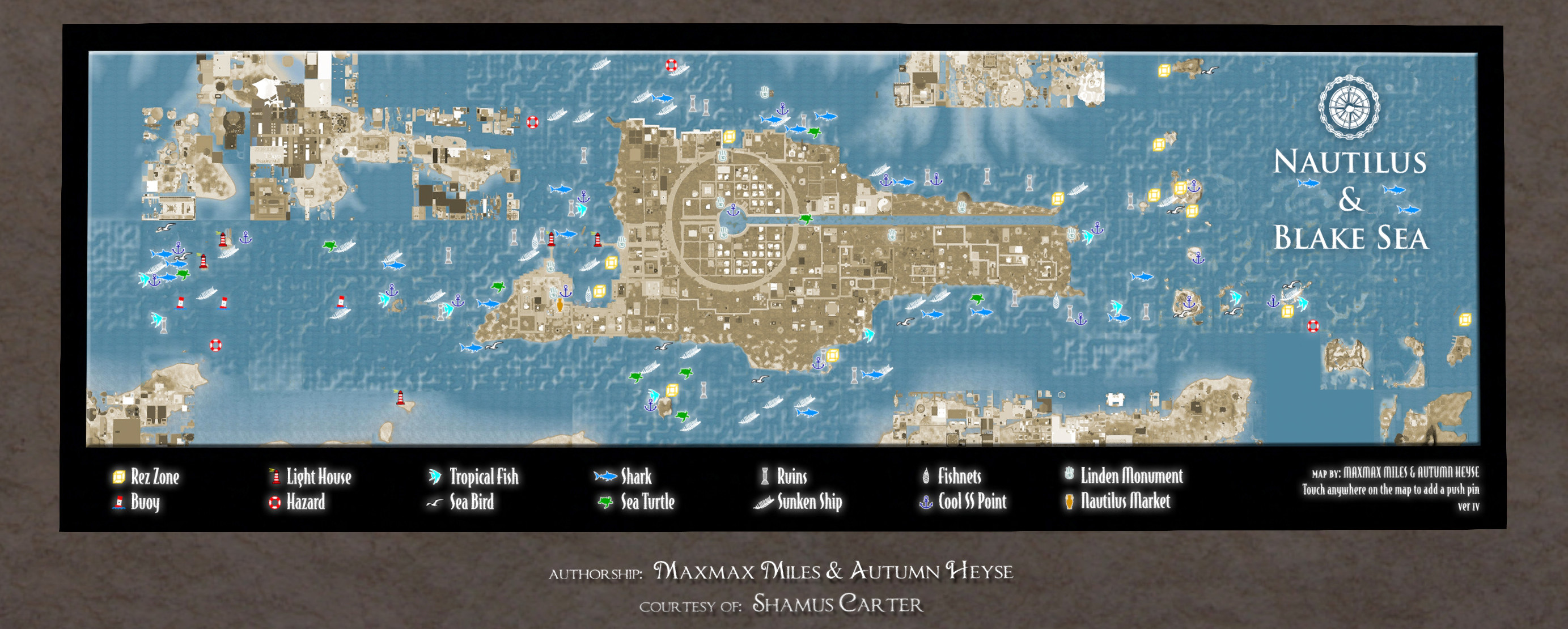
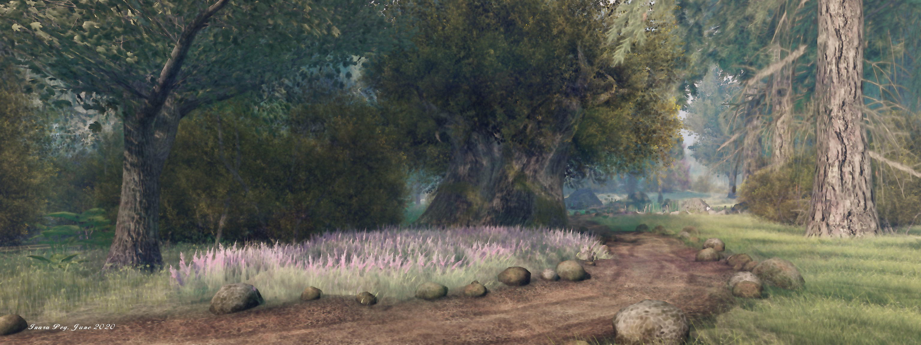
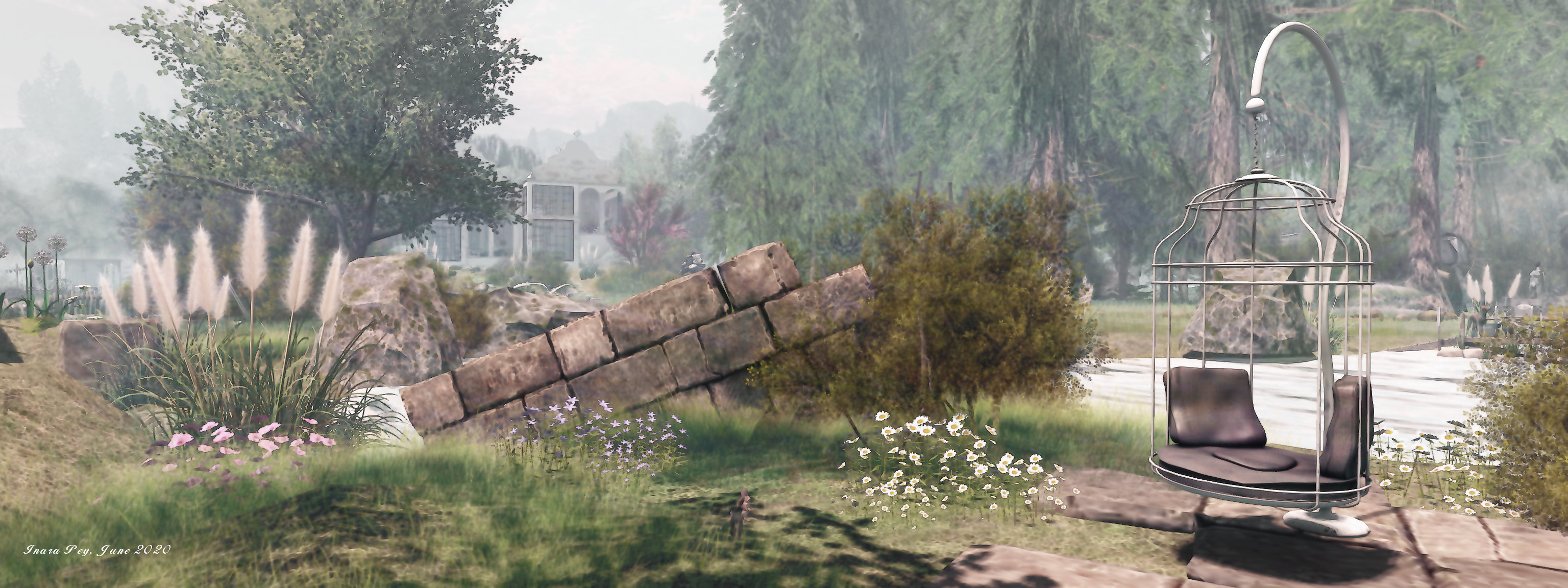
Within those regions, Coalition Island, established (2009), was created to offer a public point of access to the US Military’s use of second Life. Today, it remains as a piece of Second Life’s early history – although it could in all honestly do with a little TLC as parts of it have not weathered the passage of time too well.

At its heart is a large pentagonal area – the symbolism here fairly obvious! On four of its sides, this presents photographs of each of the four military branches mentioned above Brownstone paths radiate each to lead to informational displays on how each branches was using SL – although both the Army and Air Force displays look more recruitment oriented, and the US Marine Corps is now conspicuous in its absence. The US Coastguard also gets a passing nod, with a small inshore patrol RHIB moored to one side of the island.

The fifth side of the pentagon comprises a broad set of steps once used for presentations (and now somewhat disconcertingly inhabited by three disembodied heads). At the top of these is the island’s former greeting / conference / meeting centre, the upper floor of which contains the Second Life US Military Coalition Charter, covering the aims and use of the former MiLands regions.

Coalition Island: the Team Orlando information display

Close to main conference centre is a display by Team Orlando, a collaborative alliance of U.S. military organisations working in modelling, simulation and training using a number of platforms including – back in 2009-2010 – Second Life.

While I was unaware of Team Orlando’s use of Second Life, thanks to Dr. Douglas Maxwell (Maccus McCullough in SL, and also the founder of he in-world group RL United States Military in SL), I had originally become aware of attempts by the US military to use Second Life as an MS&T platform, back in 2011.

As a civilian contractor, Dr. Maxwell was employed at the Navy’s Virtual Reality laboratories in Washington DC, and in 2008 he was asked to head-up the work in establishing a 12-region campus in Second Life to be used by the Navy Undersea Warfare Centre (NUWC) for training and simulations.

It is a computationally steerable persistent simulation. The capabilities in here are tremendous: in-situ scripting, terrain deformation in real-time, every object is composable, not static. We got the idea that if we could increase the fidelity of the physics in here, it could actually be very useful.

Dr. Douglas Maxwell discussing NUWC’s use of SL in 2008

Coalition Island: US Navy NAVSEA display for the Virtual Navy Undersea Warfare Centre (vNUWC)

Maxwell’s involvement with the military use of Second Life expanded in 2009 when he became the Science and Technology Manager at the US Army’s Simulations Training and Technology Centre (STTC), also looking to make use of Second Life. This came at a time when Linden Lab was engaged in the (ultimately ill-fated for a variety of reasons) development of the “standalone” (or perhaps more accurately, the “behind your firewall”) Second life Enterprise (SLE) product, and Maxwell and his team were steered towards SLE as a potential solution to their needs.

In fact, Maxwell’s team found SLE to be highly conducive to their work thanks to a greater freedom of control over the simulator software and capabilities than could be achieved with the “public” SL product. This allowed them to develop a number of feature-rich training simulations to help train troops in advance of their deployment to Afghanistan.

Nor was the STTC alone in the use of SLE – the US Navy invested in it, at one point filing a US government FBO request for the purchase of up to 70 SLE support licences for the product, worth in the region of an initial US $3.5 million, had it been approved.

Coalition Island: the US Air Force information display

But before that came to pass, Linden Lab opted to discontinue the development of Second Life Enterprise, thus ending US military interest in the product. For Douglas Maxwell and the STTC, this meant taking the lessons they had learnt and applying them to building a simulation environment using OpenSimulator (see: MOSES: the US Army’s OpenSim exercise).

Whether or not the ending of SLE development was also the cause of other branches of the US military stepping back from experimenting with Second Life, I cannot in all honestly say. Today, as far as I’m aware, the US military has little or no official involvement in Second Life. However, Coalition Island today stands window on a time, as short-lived in the scheme of things though it might have been, when Second Life was being looked at seriously as a platform for training and simulation, and so it remains as an integral part of the platform’s history.

SLurl Details

A new Storybook in Second Life

“With a Smile and a Song”: Storybook, June 2020:  – click any image for full size

Caitlyn and I have long enjoyed visiting the Lost Unicorn regions held by Natalie Montagne and designed by Noralie78. The designs offered within them have been the most captivating of any within Second Life. Sadly, as I reported in The closing of a Storybook in Second Life in March 2020, one of the region designs – Storybook Forest  – went away, although in a kind-of compensation, Noralie78 went on to design Finian’s Dream, also held by Natalie (see A touch of Celtic magic in Second Life).

But, and as the saying goes, you just can’t put a good book down, so Storybook Forest is once again back; this time with a new name – a simple Storybook -, a slightly different approach and entirely the work of Natalie, who announced the new design in her blog on June 26th, 2020:

I have been working on and just recently completed my first attempt at building a region all on my own. I had a lot of fun and am pretty excited about it and am ready to share it with everyone 🙂 Remember Storybook Forest at Lost Unicorn? This is an all new version … now called Storybook. It is above the gallery region, Faerie Tale.

– Natalie Montagne, Lost Unicorn Gallery blog

Storybook, June 2020

As a sky build, Natalie has been able to combine the new design almost seamlessly with a mountainous region surround. This gives the real feeling that this is – to coin a phrase used in relation to fairy tales – a land far, far away, something which the ground-level Storybook Forest couldn’t achieve to the same degree. A further difference between this design and that past iteration is that this includes a number of rentals properties that present people with the chance to live within a fairytale setting, and of which more anon.

Visitors initially arrive at a landing point sitting on its own – a click of the storybook there will carry them onwards to the setting itself, delivering them to a small town setting that may at first look quite ordinary. But again, as a saying goes – looks can be deceptive. A mouse looking a little like Stuart Little awaiting a tour guide stands close to the landing point; down the street, another mouse is carrying a try of drinks and cakes in the café; the street, an antlered jackalope enjoys a cup of hot chocolate while another bunny is preparing to take a photograph – perhaps of the little robot trundling down the street or perhaps of Mary Poppins, who is dropping in via umbrella overhead (so much so that it’s hard not to hear the melody of A Spoonful of Sugar as she drifts in).

Storybook, June 2020

The little town marks the heart of the setting – and the detail that has been poured into it: as well as the characters on the streets, the little shops are all given furnishing and décor entirely within the contexts of a storybook setting; but it what lies beyond it that gives the land its soul. The T-shaped streets all end in tall wrought iron gates, neatly splitting the land into three area of exploration: south and east, north and west, and westwards, with the first two – south and east and north and west – having paths that loop through them to return to the little town fairly close to the landing point.

Which route you take is entirely a matter of choice: all three offer much to see, although the forest itself lies through the gates that sit to the west, within an archway of a great castle. Beyond them, steps descend into the forest, mist snaking among the trees, the paths between the tall trunks set out with paved slabs of stone, each with a name that reflects the theme to be found along them: Cinderella Way, Brave Boulevard and Snow White St.

Storybook, June 2020

Each of these gives a clue as to what lies along them by way of vignettes. Those familiar with the past iteration of Storybook Forest will be pleased to note that here – and elsewhere – familiar characters from that build can still be found, although some are now offered in a new aspect of their story, as is the case with Snow White. There are also some new characters to be found as well. Follow Brave Boulevard, for example to its twisting end you’ll discover the old woman who lived in a shoe sitting and reading, while her children are at play. Behind them, their shoe (or in this case boot) house rises – and a careful examination will reveal it is one of the units available for rent.

And therein lies the secret of seven rentals here: all of them are offered in a style entirely in keeping with the vignette they may be placed alongside, or the theme of the setting as a whole- shoe, forest cabin, pear house, watchtower and more, none of which interfere with people’s ability to explore.

Storybook, June 2020

Elsewhere are other reminders of the previous iterations of the design: Alice is still attending an unusual tea party; the little village of animal houses curves around one of the paths, while books and quotes on stories await discovery.

Within the castle – a new addition that forms a gallery space – the Wonderland theme continues on the lower floor with the Red Queen / Queen of Hearts waits. Through its halls, floors and towers can be found more of the Storybook Forest characters, offered in reflection of the art on display: interpretations of Peter Pan (while Captain Hook’s ship floats over the region), Cinderella, Snow White and Hansel and Gretel, making for a visit in its own right.

Storybook, June 2020

The new design offers a setting that captures much of the magic of the original whilst offering something new – a new chapter in Storybook’s tale.

SLurl Details

The maps (and more!) of Second Life

New Kadath Lighthouse Art Gallery: Second Life Maps

When listening to the SL17B Meet the Lindens Session with Patch Linden, I was given cause to recall Juliana Lethdetter’s outstanding Maps of Second Life, on display at her New Kadath Lighthouse Art Gallery.

It’s a place I last wrote about long ago in the dim and misty days of 2012 (see: Charting the growth of Second Life), and so has been long overdue for further coverage in these pages.

New Kadath Lighthouse Art Gallery: Second Life Maps

For those unfamiliar with this particular gallery, it is a labour of love that brings together just about every style of map of Second Life that has ever been produced – and provides a wealth of information besides.

The maps start from the earliest days of Second Life – 2002 – and run through to almost the present. It encompasses “official” maps, those produced by SL cartographers depicting the Second Life Mainland continents, and specialist maps charting air routes, airports, the SL railways, specific estates. Not only are they informative, some stand as works of art in their own right, as with the map of Nautilus, below.

New Kadath Lighthouse Art Gallery: Second Life Maps

Alongside of the maps is a veritable treasure trove of information that any Second Life historian is liable to fine mouth-watering, as well as a certain amount of practical information poking at the technical intricacies of the platform. You can, for example, look back to 2007 and see why Anshe Chung became the first “SLebrity”, appearing on the cover of CNN’s Business week as her Dreamland “empire” as it stood at the time shown in all its glory. Or you can take a peek at Second Life as it stood in March of that year – a time when it had in total roughly the same number of private and Mainland regions as Mainland has on its own today.

Elsewhere, you can look back on Second life Birthday celebrations of the past, the gallery featuring SL12B, one of the celebratory events organised entirely by residents and referred to as the Second life Birthday Community Events (2012 through  2018), when Linden Lab completely stepped back from direct involvement in the event’s annual planning and execution. Or you can catch up on the very latest acquisitions for the gallery, such as Rydia Lacombe’s map of SL railways I recently wrote about (see: Mapping Second Life’s mainland railways).

New Kadath Lighthouse Art Gallery: Second Life Maps

The latter underscores the point that this is a living museum / exhibition. Since my original article on the gallery, Juliana has continued to curate and grow the exhibits on display, growing to incorporate further items of interest new locations in Second Life, as well as retaining those special items of SL history like the guide to the legend of Magellan Linden.

Thus, as well as the railway map noted above some of the elements that have been added since my last piece include a display of other map resources in Second Life, which includes information on David Rumsey’s excellent collection to physical world maps (see: If maps are your thing, Rumsey’s the king!), while maps and images of Bellisseria ensure the gallery is right up-to-date with the growth of Second Life continents.

New Kadath Lighthouse Art Gallery: Second Life Maps

What makes this exhibition especially worthwhile is the sheer depth of information presented. Individual maps / displays are presented around the walls of the gallery with large information panels alongside or under them, complete with citations, while gear icons provide further access to information – note cards, landmarks, links to external web pages, and so on. All of which makes this a first-class practical resource.

If you’ve never visited the New Kadath Lighthouse Art Gallery, then regardless of your level of interest in Second Life history or maps in general, I really cannot recommend it enough. It is guaranteed to captivate, and is a genuinely educational visit. And while there, please do use the books on the landing point to visit other points of interest in the region.

New Kadath Lighthouse Art Gallery: Second Life Maps

SLurl Details

A corner of Cascadia in Second Life

Cascadia, June 2020 – click any image for full size

Zakk Lusch recently invited us to pay a visit to Cascadia, a Homestead region he has designed with the assistance of Lilly Noel and Jimmeh Obolensky. The name appears to be taken from the Cascadia bioregion, a theoretical region / country that, were it to come into existence, would extend down through British Columbia, Washington state and Oregon, and inland potentially as far as Utah, although more modest proposals limit it to the the Cascade Mountains.

In particular, this means the bioregion follows the line of the US / Canadian Pacific Northwest coastline, and it is in the spirit of this coastline that the region has been modelled. It offers the suggestion of a coastal headland backed by high mountains, a place where the local highway briefly winds between the two maws of tunnels to offer an expansive view of the northern Pacific.

Cascadia, June 2020

One of the first things to note in general about the region is that it is in part residential, with three private homes located on it. However – and I assume this is a genuine comment – the note card that is delivered to visitors at the landing point states, “While all of the homes on the sim are indeed occupied by Residents, we strongly encourage you to enter these homes and disturb the occupants!”

That said, given the three homes do not intrude into the public areas of of the region, it is possible to enjoy explorations without having to worry about trespassing into people’s homes.

Cascadia, June 2020

Like the coast on which it is modelled, this is a ruggedly beautiful setting, if the drop from high mountain peaks to foothills is perhaps a little abrupt. The landing point sits to the north-east on a deck build over a cove that cuts its way into the landscape. The deck is part of a cosy roadside area just across the highway from the local motel and gas station. The highway appears to be El Camino Real (The Royal Road) – otherwise known as Route 101, suggesting the setting is towards the northern end of the American stretch of the Cascades.

Running out from one of the two tunnels mentioned above, the road points south to pass between the landing point and the motel before making a hard turn to point westwards, passing over a bridge that spans the mouth of the landing point’s cove. In this, the highway offers the best route of initial exploration, although once across it, further paths of exploration open up.

Cascadia, June 2020

One of these routes is a gravel track that offers a way along the south-eastern headland to one of the private homes. The latter might easily be mistaken for a café given the OPEN sign hanging alongside the door, but the furnishing and washing hanging on the line outside confirm it is a residence, a small and rough beach bordering it on two sides. Just before the path along the headland reaches it, it passes steps that descend down to a ribbon of beach that points westward, under a line of low cliffs that also see the continuance of a branch of the gravel path above which in turn sits the second of the region’s homes.

This second house sits on a square of rock between gravel and highway, trailing a tail behind it that narrows to a point where stone steps connect path and highway, a wooden bridge alongside crossing the waters to where the third house sits on its own island, offering an impressive view back across the region.

Cascadia, June 2020

Cascadia is a photogenic, natural region that is given added life by the inclusion of static figures, each of which has been perfectly placed: the tourists pausing in their journey to take in the view, the cyclist taking a break from a ride along the coast, shoppers and storekeepers in the little roadside area, and so on.

There are also touches of humour to be found within the region – the advert for a shady lawyer, for example – together with numerous places to sit, some more obvious that others. For the latter, be sure to follow the signs for the woodland walks; one might lead you to a camp site being watched over by an unexpected visitor!

Cascadia, June 2020

An engaging and considered design well worth the time needed to explore and appreciate it. Our thanks to Zakk for the invitation, an apologies for taking a while to accept it.

SLurl Details

  • Cascadia (whisperwoods, rated Moderate)

A summer’s island in Second Life

Conall-Vika, June 2020 – click any image for full size

Conall-Vika is the name given to a Homestead region designed by Second Life partners Madflex and Trin Adasia we were directed towards by Shawn Shakespeare, who is always the expert locator of regions to explore.

The name, according to region’s creators, is derived from the Celtic for “strong wolf” – Conall, as in Conall Cernach, the hero of the Ulaid in the Ulster Cycle of Irish mythology – and “Vika”, which they give as “from the watercourse”.

Conall-Vika, June 2020

It’s certainly true that water plays an important  part in the formation of the region: it sits as a lowland island that at first looks might be taken for a broad inlet that cuts its way into coastal hills and eroded the island’s shores into their distinctive shape.

The landing point sits to the north-east of the island, atop its one highland area: a flat-topped mesa of sheer-sided rock crowned by fir trees, course grass and the remnants of an ancient villa. The latter is apparently long-deserted, lavender plants encroaching into the walls and across the fading wood of a terrace even as the branches of a tree within that terrace are starting to apply their own pressure on the surrounding walls. 

Conall-Vika, June 2020

A single path winds down to the lowlands to join with a lone track that snakes outwards across the island. It offers a route around the region that gently meanders from point of interest to point of interest, offering a perfect means to explore and discover. Many of these form places to sit or pose, most with options for individuals or couples and range from a simple blanket under a parasol through a tricycle built for two, to blanket-draped hideaways, cosy summer houses and beach-side loungers.

Towards the centre of the island the track arcs past a second house. This is a split-level affair with whitewashed walls suggestive of some age. Comfortably furnished, it has a western terrace that looks down over ground that rolls gently down to the island’s ribbon of beach and gives a view out over the waters as they reach into the inlet through a narrow neck formed by off-region hills and another island.

Conall-Vika, June 2020

The tall north side windows of the house present a further enticing look, this one over the bay that cuts it way to the heart of the region. True, aged willow trees drop their branches across the vista in a green curtain that partially obscures the view, but, what can be seen encourages investigation. Doing so reveals they bay is perhaps one of freshwater rather than salt: reeds grow around the bank, whilst swans and ducks swim on the water.

The presence of ducks, swans and reeds transform the setting from the suggestion of it lying on the coast somewhere to one sitting towards one end of a great freshwater lake surrounded by hills. Swans that can be found elsewhere on the water or nestling inland further add to this feeling, whilst the northern end of the island’s bay is occupied by a wooden pier and deck against which a sailing boat is moored. The presence of the latter encourages explorers to walk the grassy tongue that lick west and north around the bay to reach the deck and the loungers on its back.

Conall-Vika, June 2020

All of this only scratches the surface of the region, despite the apparent open nature of the island, there is a lot to appreciate. For example, sheep graze in a meadow with fencing that have seen better days – a fact attested to by the presence of more sheep further afield, enjoying the grass in the lee of the landing point plateau. Art elements are also awaiting discovery, as are some ancient ruins and a little coffee house.

With all that is going on in the physical world due to the SARS-CoV-2 pandemic,  Conall-Vika is another in-world settings that offers a sense of the the outdoors and a relief from being cooped-up inside the house all day. Plus, with all the excitement of SL17B going on through the rest of June, it may also give the opportunity for people to catch their virtual breath. Oh, and the wolves? They are on the island as well – but you will have to keep an eye out for them if you want to find them 🙂 .

Conall-Vika, June 2020

SLurl Details

A rugged retreat in Second Life

PhotoStudio Purple Cows, June 2020 – click any image for full size

Annie Brightstar, who curates Second Life destinations through Scoop It and various social media, poked me via IM to the fact the noted photographer Skip Staheli has opened his personal Homestead region, PhotoStudio Purple Cows, to public visits, and suggested I go have a look.

The region’s design is by Busta (BadboyHi), who is responsible for a number of region designs Caitlyn and I have enjoyed visiting (and in my case, writing about) in that past; a fact that further encouraged me to take a hop across and visit sooner rather than later. And I have to say, his work here is impressive.

PhotoStudio Purple Cows, June 2020

The region forms a rugged, temperate island marked by an impressive spine of an undulating, rocky hill that winds from the north-west to both the south-wast and south-east in and extended “Y”. Relatively narrow, the hill nevertheless appears to contain an high-level aquifer, as waterfalls tumble from its many flanks to both form pools at its base and outflow channels that extend to the surrounding sea, breaking-up the shingle and muddy lowlands.

It’s an entirely natural setting – perhaps the best Busta has produced to date. The central hill is beautifully constructed, rising from natural footings to highest peak, the paths running it it from the lowlands all looking to have been created by the processes of wind and water erosion rather than carrying an appearance of having been purposefully designed. Similarly, the blending of mesh land forms with region terrain is exquisitely done, further enhancing the depth of the setting.

PhotoStudio Purple Cows, June 2020

All of this serves to give the region a feeling of being almost literally transposed from the physical world to the virtual, offering visitors with the sense that they really are in a wilderness location – perhaps somewhere deep within the mountains of North America of just off part of it’s more remote coastline.

It’s a sense of wilderness that’s enhanced by the fact only two man-made structures are on the island. To the north lies a Japanese-style cabin sitting on one of the broad channels of water flowing outwards from the central hill and formed by a horseshoe of waterfalls. The cabin sits as the kind of retreat many of us would love to have; one with a outstanding morning-time view, with places close to hand – just across the water in fact – to sit and contemplate. Eastern influences are strong around the cabin, but in fact it is not a home; within it sits a small café and the suggestion of a studio space.

PhotoStudio Purple Cows, June 2020

The cabin sits in the lee of the hill’s north-west arm, a steep cliff rising just behind it. Follow the base of this shoulder of rock, and you’ll find a path that winds up it and along the rising edge of the cliffs to where stone steps point the way to the second wooden structure, this one home to a bakery and small gallery space. It sits at the summit of the island’s central hill and upon a substantial deck that can be reached by two additional paths up from the lowlands. The deck extends out of the one of the island’s waterfalls to present a stunning view down to the cabin below.

As well following the paths up to the island’s summit, it is possible to circumnavigate the setting, keeping entirely to the lowlands. Bridges connect the shingle beaches where water flows out from the falls, the route rising here and there to pass over rocky feet as they extend to the coast. Doing so will reveal the various routes to the more elevated parts of the island and also bring some of the hidden / smaller details of the region into focus.

PhotoStudio Purple Cows, June 2020

These details are many and varied – and sometimes easy to miss. A few of the more obvious are the the multiple locations where visitors can sit. These range from chairs and converted pallets  to tyre swings and blankets at the end of piers. There’s also wildlife to be found here, but some of it may not be easy to find (hint: keep an eye out for the local perambulating frogs).

A thoroughly captivating region, perfect in its design and execution, PhotoStudio Purple Cows is not one to miss while it remains open to the public.

PhotoStudio Purple Cows, June 2020

SLurl Details