Stepping into Luane’s World in Second Life

Luane's World; Inara Pey, April 2016, on Flickr Luane’s World – click any image for full size

I was drawn to Luane’s World by Owl Dragonash, who recently blogged about this charming Homestead region. The work of Luane (LuaneMeo), the region is the home of her store and is offered to visitors as, “a romantic sim where you can relax, cuddle or hang out with friends. Made with photography in mind”. It also offers a number of gallery spaces featuring the work of some of Luane’s favourite artists,

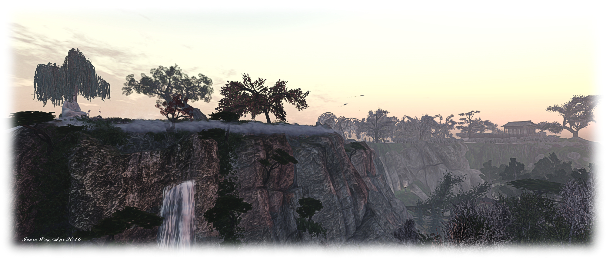
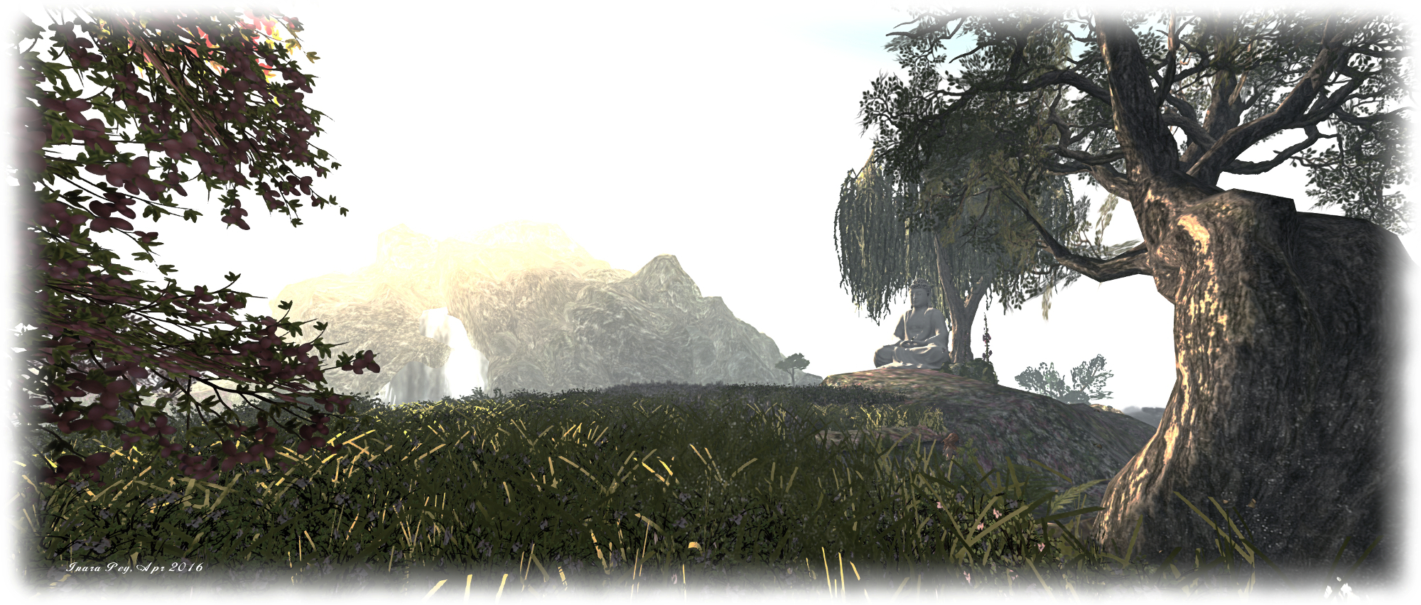
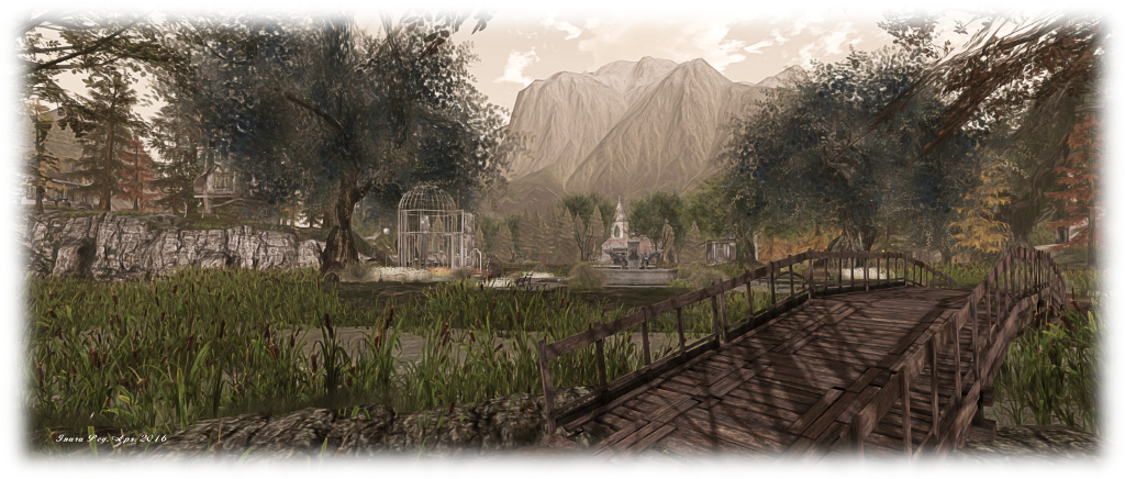
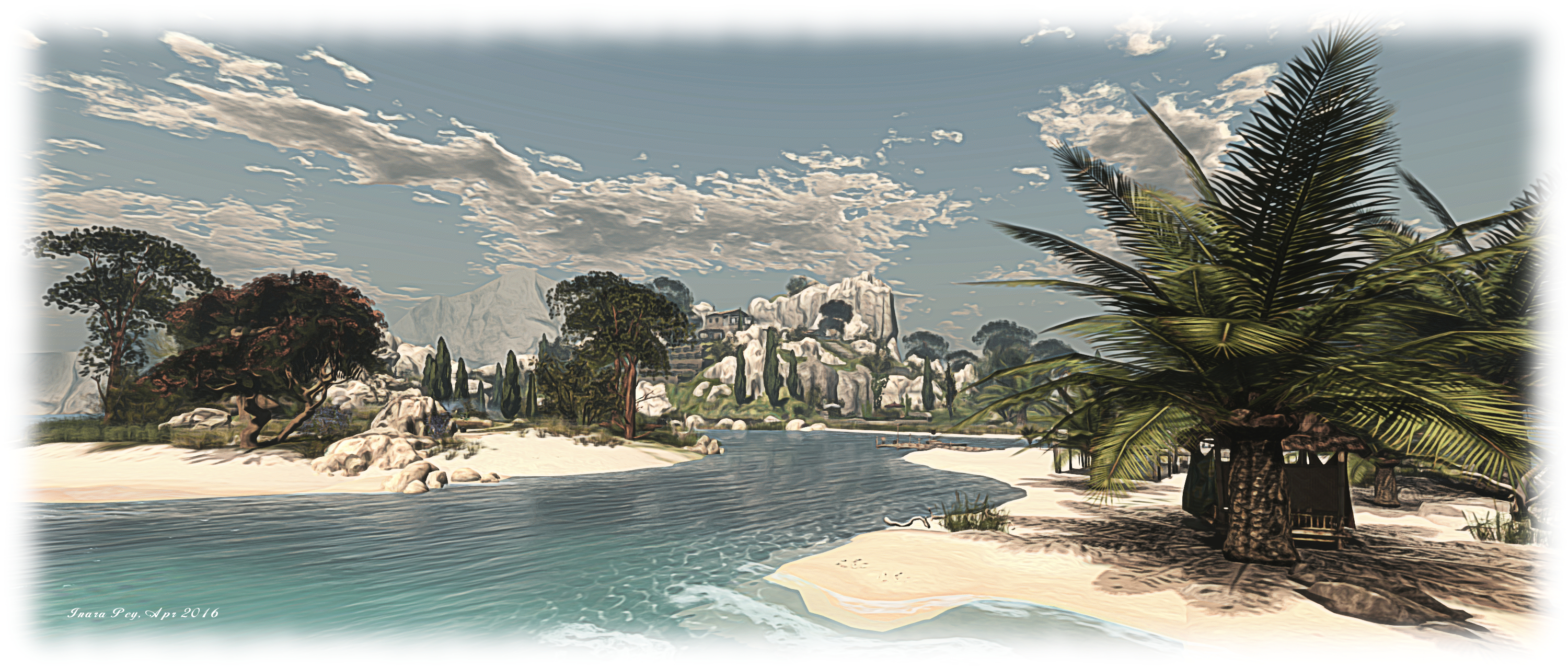
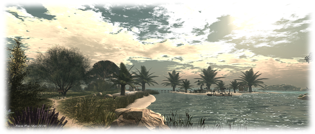
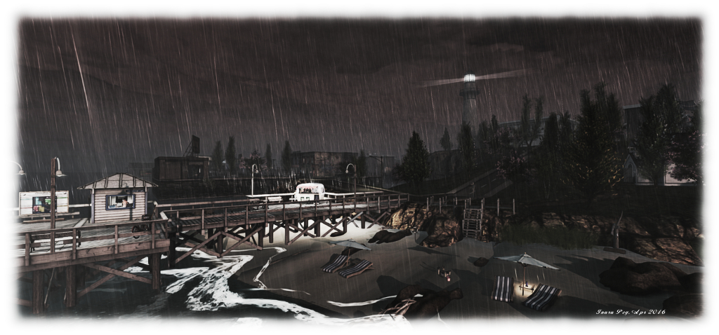
It is one of the gallery spaces which serves as the landing point, on the north side of the region. This sits alongside a watery  fantasy area where you’ll see a unicorn can indeed fly (or possibly take an amazing leap!) under golden boughs and leaves, as misty particles drift through the glade on a gentle breeze. Close by sits a beach overlooked by a long-fingered headland pointing out to sea, upon on which the ruins of an old castle rest, reached by a grassy stair.

Luane's World; Inara Pey, April 2016, on Flickr Luane’s World

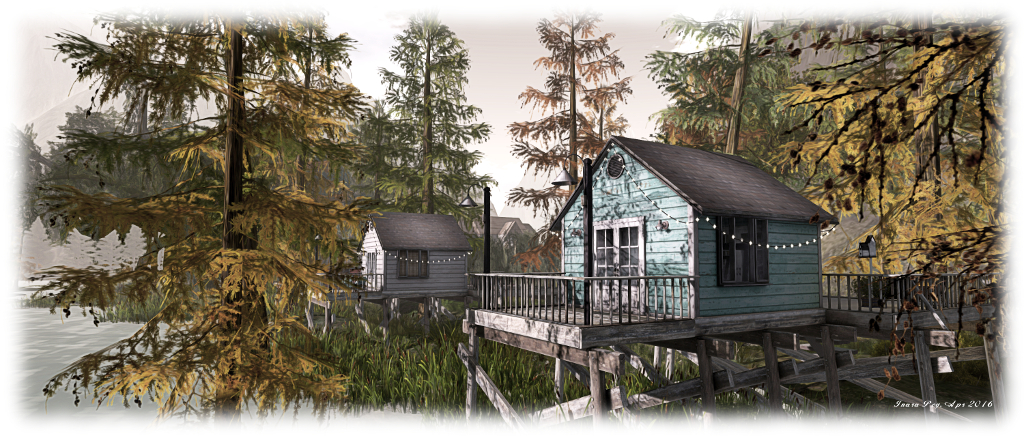
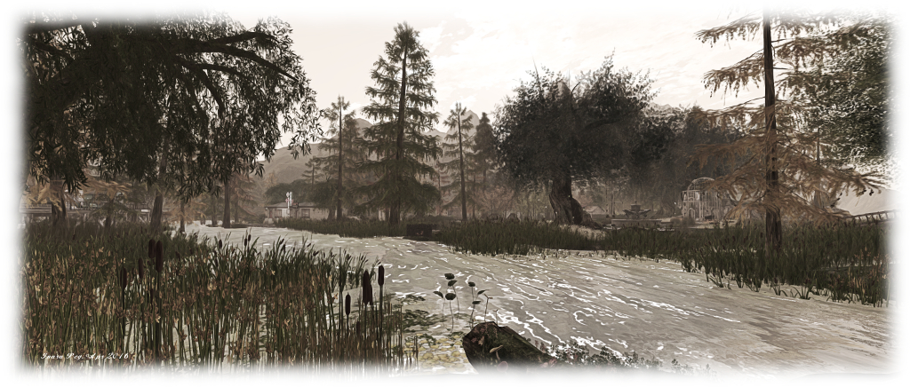
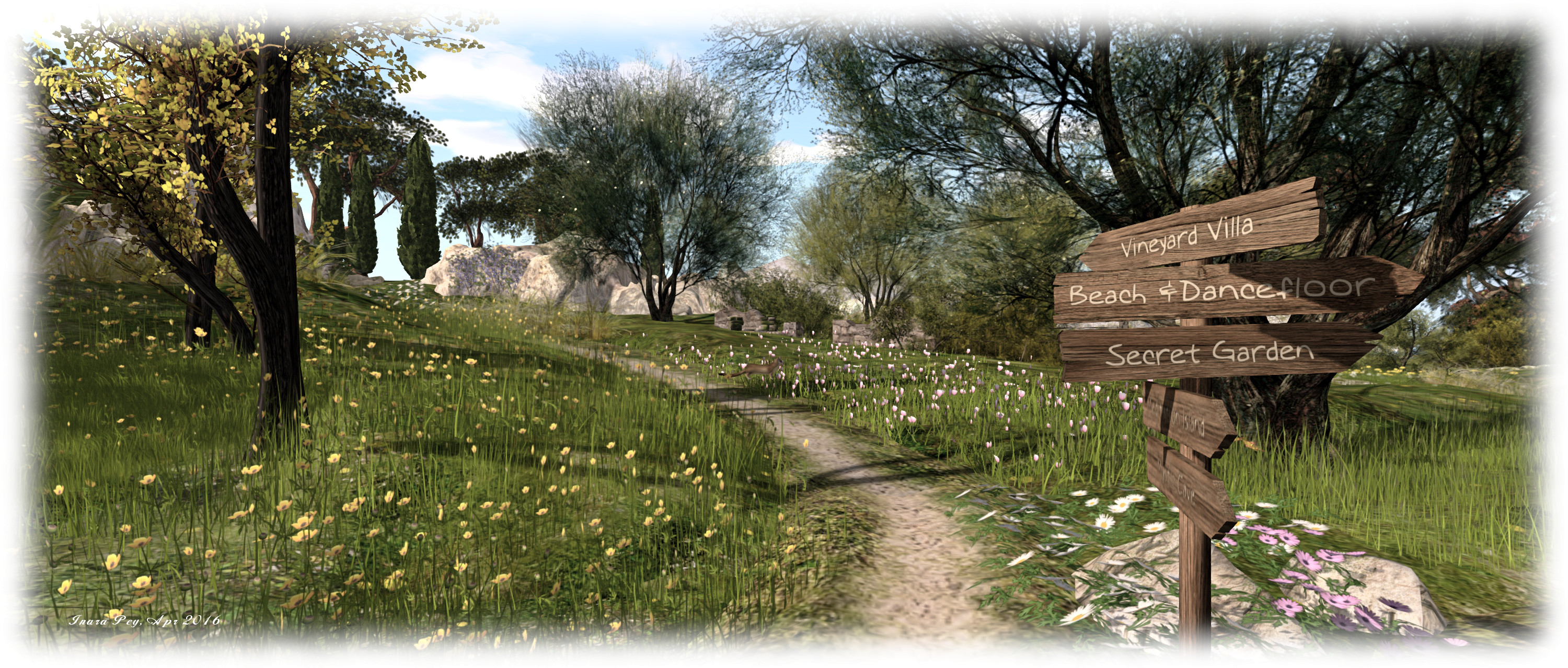
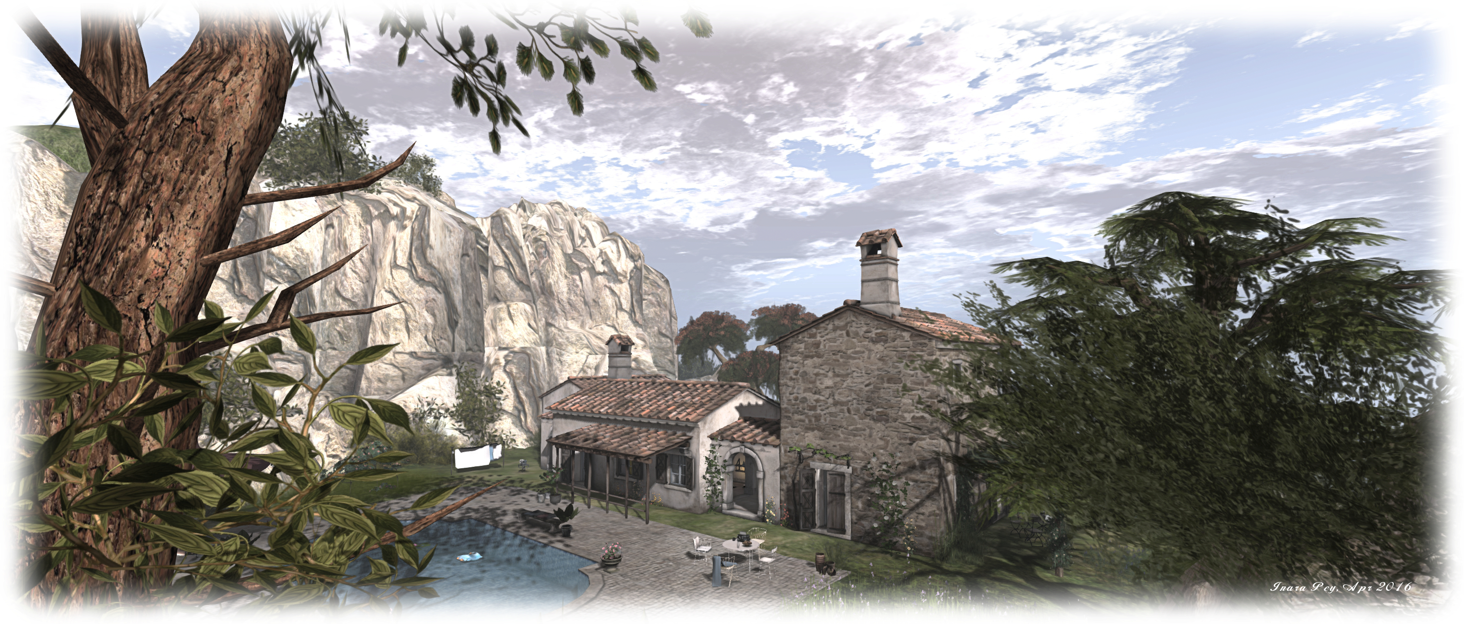
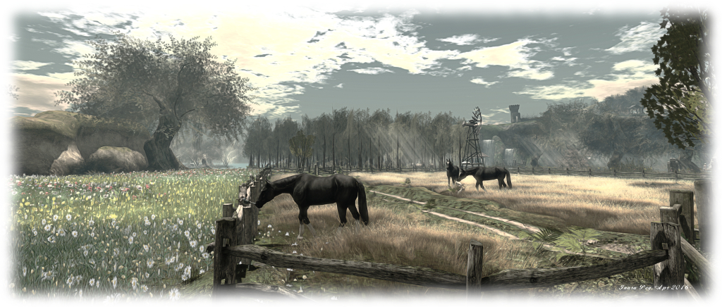
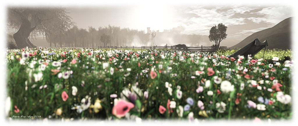
The ruins looks out over the sea, and inland across a woodland copse. Close by sits a small island reach by a little wooden bridge, while the woodland plays house to elk, the misty wafting through it offering plenty of scope for photographs. Travel west via the woodland track, and you’ll come to a gated field where horses graze, and beside it a broad sea of wild flowers separating you from a cottage and windmills – each the home of further gallery spaces – which rise from the tide of flowers on a ridge-sided island of grass.

A cart track running through the fenced field offers the way to another island, every bit as rugged as the headland, and the home of another castle ruin, this one reached by the arched trunk of a once  mighty tree. Once explored, you can rejoin the cart track and follow it around the coast to the cottage and windmill.

Luane's World; Inara Pey, April 2016, on Flickr Luane’s World – click any image for full size

With swings and seats and cuddle beds scattered across the land, Luane’s World offers touch of romance for couples seeking a place to rest and enjoy pleasant open spaces, while the free-spirited can run through the wide expanse of wild flowers as the lovers of SL art roam the gallery spaces.

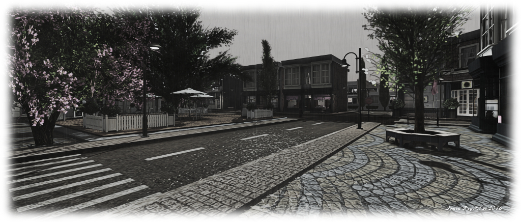
Luane’s World is a simple, open design with welcomes visitors to explore, with some excellent opportunities for photography. The default windlight is (or appears to be) Annan Adored Morning Dream, but the landscape naturally lends itself to visitors playing with viewer settings. If you do visit and take photos, Luane offers a Flickr group for sharing them; what’s more, there is a photography contest running through until April 30th with cash prizes on offer. Details can be obtained near the region’s landing point.

Luane's World; Inara Pey, April 2016, on Flickr Luane’s World – click any image for full size

SLurl Details


Oriental mornings in Second Life

Tatakai Tochi; Inara Pey, April 2016, on Flickr Tatakai Tochi – click any image for full size

I was drawn to Tatakai Tochi for two reasons. The first is that it features the work of Shen Molinaro. The second is that it offers an oriental theme, something guaranteed to attract my attention much like a moth to a flame 🙂 .

A homestead region held by Regina Mills, (heatherfury) Takakai Tochi literally means “land of flight”. In keeping with this name, it presents visitors with rugged highlands pushing their way into a misty sky, an early morning sun just edging over the highest peaks.  Sitting atop the shoulders of several of this craggy hills are flat-topped plateaus occupied by traditional Japanese houses and buildings which overlook the deep slices of the valleys and gorges dividing up the land.

Tatakai Tochi; Inara Pey, April 2016, on Flickr Tatakai Tochi

Water flows through these deep valleys, fed by high, tumbling falls and winding its way out towards the surrounding sea. Several of these channels are bordered by wooden board walks or stone footpaths, offering the traveller paths through and around the region and a chance to explore it in detail.

“When I set out to make this sim,” Regina says of Tatakai Tochi in the notes presented to visitors on arrival, “My intention was to create a peaceful and serene place where I could come and hang out with my friends without any distractions or bothers.” For a time she toyed with the idea of adding rol-play to the region, but in the end decided to offer it as a place others could visit, enjoy and photograph without the added distraction role-play might have brought with it, and Shen Molinaro, Regina’s friend, and who designed the equally atmospheric and stunning Suomi, a place I wrote about in early March.

Tatakai Tochi; Inara Pey, April 2016, on Flickr Tatakai Tochi

While described as a Japanese themed region, Shen has drawn on both Japanese and Chinese influences – as is fairly common in many oriental themed regions in SL – whilst building Tatakai Tochi. The former is by far the more dominant of the two, but the latter eases into the consciousness as one comes across the occasional giant panda or when encountering a Foo Dog (Chinese imperial lion) standing guard at a fork in a walkway.

This is a place for quiet contemplation as well as exploration. Walk through the meandering valleys and gorges and you’ll pass through bamboo groves or under the gently rocking arms of blossoming trees to small shrines and past figures of Buddha, very occidental wrought iron benches offering places to sit and listen and think.

Tatakai Tochi; Inara Pey, April 2016, on Flickr Tatakai Tochi

From the bay alongside the landing point, visitors can embark on a walk around the island, following one of the wooden walkways mentioned earlier, before these also turn inland. For the energetic, there are also various paths to be found up to the high regions – and climbing quickly reveals the more panoramic nature of the region.

Tatakai Tochi is a picturesque region, beautifully capturing the orient from which it draws inspiration, and offering some excellent photographic opportunities, making for an ideal visit. You may need a little time to explore all of it, but it is more than worth the effort.

SLurl Details

Travelling through Noire’leans in Second Life

Noire'leans; Inara Pey, April 2016, on Flickr Noire’leans – click any image for full size

There’s a certain bayou feel to Noire’leans, and the name itself tends to put you in mind of Mississippi, if not Louisiana. Reader Maddie (MadisonRaelynn) suggested I add it to my itinerary of places to visit, and as Maddie has suggested a number of places to me, all of which I’ve enjoyed visiting, I was only to happy to add Noire’leans to the list.

Truth be told, Caitlyn and I actually first dropped into the region back at the end of February. However, I was hesitant to blog about it right away, as it is not intended as a public region per se. Rather, it’s a residential island, one that has been lovingly put together by Kas Torkelsonn (Kasia Kenin) and MadZ Levane (Magdaleine Demonista); so I wanted to ensure they were comfortable with the region being written about.

Noire'leans; Inara Pey, April 2016, on Flickr Noire’leans

As it turned out, the way had been prepared for me. “Maddie did say she was going to mention us to you,” Kasia informed me when I approached her about blogging the region. “We have been  preparing for this day and are totally open to this being a place to  explore. MadZ and I are working on the last remaining  undeveloped area to make it more inviting to guests who want to stroll,  linger, and take photos.”

Given this is a residential region, it should come as no surprise that the landing point is alongside the rental shingle, sitting on a small dock where visitors can rez a pedalo and explore the region via its various waterways. For those who prefer dry land, there are tracks, paths and bridges to guide them around the island.

Noire'leans; Inara Pey, April 2016, on Flickr Noire’leans – click any image for full size

The bayou feel is immediately apparent: the winding waterways crossed by wooden bridges, tall trees growing from mushy, reedy banks, wooden houses sitting back from the water or over it on slits, all presided over by a sky which could be taken to be a late pre-dusk afternoon, filled with the croak of frogs chirp of cicadas and buzz of dragonflies. The only thing indicating you are not in the bayou perhaps being the high peaks of the surrounding mountains.

Properties here are of varying sizes and forms, but all are in keeping with the general theme of the region and stand within their own parcels. “We have installed security in the residences  and made the scan range minimal,” Kasia told me. “So if anyone wants to visit, they  literally have to be on the porch of the house before they get a  warning.” This means that straying onto a property whilst exploring won’t get you told off by a security system, but you will be given a reminder that the houses are private residences should you try to enter.

Noire'leans; Inara Pey, April 2016, on Flickr Noire’leans – click any image for full size

As well as the residential homes, Noire’leans presents a central park area, a small beach, a café where refreshments can be had after wandering (or padding) around the region. With a design that’s immersive and which ensures tenants have a good sense of privacy without feeling cut off from one another, the region is also photogenic and welcoming to visitors.

Thank you, again, Maddie, for dropping me the details of another gem!

SLurl Details

Mediterranean meditations in Second Life

NOELIA Island; Inara Pey, April 2016, on Flickr NOELIA Island – click any image for full size

NOELIA Island, designed by Ida Carlberg and her partner, Lyshco, is a beautiful Mediterranean themed homestead region, offering visitors the opportunity to “dance, date, romance or cuddle in the romantic spots, take a fun boat ride, relax on the beach, take photos or meditate near the Buddha”.

Divided into three islands, the largest of which hunches high rocky shoulders to the east and south, encompassing land which rolls down to a low-lying coast to face two smaller islands on the north side of the region. One of these thrusts a rugged head up from its covering of sand and grass, while the other offers a low-lying atoll-like beach reached via a board walk spanning the water.

NOELIA Island; Inara Pey, April 2016, on Flickr NOELIA Island

The largest island, which also encompasses the landing point, features a Tuscany style villa sitting up on a high plateau. Sheltered by sun beached rocks, and reached by a winding stair of stone steps, the villa oversees a terraced vineyard to one side, overlooking one of the two smaller islands and served by an aged stone stairway. The walls supporting the steps of the vineyard appear to be similarly aged, alike the steps, suggesting that perhaps they were once part of a much older structure hugging the slope.

Below the villa, snuggled back against the lowest level of rock, and sitting between it and the channel separating the island from its companions, is the terrace arrival point, offering a shaded place for visitors to sit. From here, dusty, sun-dried tracks lead the way around the island, a nearby sign pointing the way to various points of interest, such as the beaches across the water, a little walled garden close by, the main climb to the villa, and more.

NOELIA Island; Inara Pey, April 2016, on Flickr NOELIA Island

There is a lot to explore on the main island, including a footpath and wooden walkway which takes visitors around the south and east sides of the island, hugging the backs of the rocky peaks to a narrow beach in the south-east corner of the region. While for those that follow the path around below the vineyards from the landing point, there’s a cave system waiting to be explored and a high hanging bridge spanning the water to the more rocky of the smaller islands.

This second island is a place of meditation, on which can be found the figure of Buddha mentioned in the region’s description, just down from the cliff top retreat which sits alongside the bridge. Wisdom is on offer here as well, from a standing stone close to Buddha, as is a meditative music stream for those who wish to listen.

The remaining island with the low beach, is a place of entertainment, again with its own music stream. A stage here is set out for music and dancing, while and tiki hut is one of several places where people can sit and relax.

NOELIA Island; Inara Pey, April 2016, on Flickr NOELIA Island

With boats also available for getting across the water, a fabulous ambient sound scape and plenty of opportunities for sitting and cuddling,  NOELIA Island makes for a very relaxing visit, offering a charming environment which has been beautifully put together by Ida and Lyshco. It’s also highly photogenic and begging to be filmed – and I hope to return in the near future to record a short machinima, subject to permission being given.

Should you enjoy your visit as much as I did mine, please consider making a donation towards the upkeep of the region at the landing point.

SLurl Dand Website Links

Waiting for the hurricane in Second Life

Asphyxiation Point; Inara Pey, March 2016, on Flickr Asphyxiation Point – click any image for full size

I first wrote about Asphyxiation Point, the free-form role-play region, back in February of 2016, after being invited to explore the region by one of region’s Admins and a prime mover in the region’s development, Charles Newton Kuluk (kuluk). At the time I noted that the town is host to a range of activities,most of which are reported through the associated website, and Thursday, March 31st through to Sunday April 3rd inclusive will see the town engage in one of those activities, as it faces the ravages of a hurricane.

“Hurricane is one of the most visually striking events in Second Life,” Charles said in his invitation. “I would like to invite you to Asphyxiation Point to view the event in person and hopefully capture it through your lens.”

Asphyxiation Point; Inara Pey, March 2016, on Flickr Asphyxiation Point

The storm is intended to unfold – as storms in the physical world so often do – over a period of days, rising to a peak, then ebbing away. As such, the time frame for the event is currently as follows:

Thursday, March 31st 2016 – The Rain: It starts with rain, materials-enabled rain in this case, which allows local lighting to be reflected in the water on the ground and in the splashes of raindrops when you have the Advanced Lighting Model active. The rain is region-wide, but playing with different windlights and time settings in the viewer can create some interesting results, particularly at night.

Friday, April 1st 2016 – The Wind: As Friday arrives, so does the wind, driving the rain and pushing against the trees, whilst lightning flickers across the sky, followed by thunder’s inevitable booming, as the townsfolk batten down and prepare for the hurricane’s anger.

Asphyxiation Point; Inara Pey, March 2016, on Flickr Asphyxiation Point – materials bring the rain to life

Saturday April 2nd 2016 – Hurricane: the storm proper strikes,  the sea rages, flooding much of the town, breaching defences around noon SLT and rising steadily through until 18:00 SLT.

Sunday April 3rd 2016 – The waters recede:  the storm has passed, and with nature’s fury abated, the waters slowly recede through the early morning hours (SLT), leaving some debris left in its wake as the people of Asphyxiation Point clean-up and return to normal life.

As noted in Charles’ invitation, visitors are encouraged to drop into the region over the course of the storm and take photos as events unfold. All the folk at Asphyxiation Point ask is that those taking pictures consider sharing them on the Asphyxiation Point Flickr group, to help record the event for posterity.

Asphyxiation Point; Inara Pey, March 2016, on Flickr Asphyxiation Point

Should you visit to see the storm for yourself, do keep in mind that Asphyxiation Point is a free-form role-play environment in which most of the residents interact “in character” in open chat conversation. Visitors are welcome to give it a go as well; however, if you are approached in local chat by someone wanting to role-play, but would prefer not to, just IM them to let them know you are visiting and / or taking photos.

As we’re talking storms, I’ll wrap this piece with a little musical interlude from Chris de Burgh.

Additional Links

A visit to the 18th Century in Second Life

Rocca Sorrentina
Rocca Sorrentina

I was drawn to Rocca Sorrentina after seeing it featured in a recent Destination Guide highlights blog post from the Lab. Described as an immersive education experiment operated by Brown University, the region presents an 18th Century period setting, offering visitors the opportunity to interactively learn about the period through art, information note cards, exhibitions, events and even via casual role-play with the island’s residents (although it is emphasised the latter is not a primary function of the region).

The initial landing point is located at altitude. Here visitors can learn about Rocca Sorrentina (a fictional rocky island located in the Bay of Naples), both in terms of its own “history” and the broader terms of both the project and the period in which it is set. A note card giver alongside the landing point offers a wealth of information across multiple note cards, including useful visitor information, rules regarding period role-play and use of the region, and on the various displays to be found here.

Rocca Sorrentina
Rocca Sorrentina

Opening off of the landing area are three exhibition areas. These currently feature in turn, an exhibition of the art of Pietro Fabris, a history of tarot, and a history of the Kingdom of Naples during the late 18th century. All are informative, with the last in particular providing considerable insight into 18th Century life and culture.

Also to be found on the wall of the arrival hall (and in the note cards offered by the information giver) is a map of the island. This is worth noting / studying, as there is a lot to be found once you’ve teleported down to ground level.

RS-11-1_001
Rocca Sorrentina

On teleporting down, visitors find themselves at the island’s busy docks. Ships are alongside, anchored just offshore or heading out under full sail into the Bay of Naples (which connects Rocca Sorrentina with the estate of the Duché de Coeur – which I haven’t actually re-visited for well over four years!). Just off the main island are the smaller Harbour Master’s island and the fortified Lighthouse Island.

Once ashore, there are several routes of exploration: along the quayside to the lower town, or up the ramped path towards the villa, passing the vineyards on one side, and then turning to cross the Great Lawn to the upper town and its church, or by following the ramped path directly up to the villa itself.

Rocca Sorrentina
Rocca Sorrentina

The latter is modelled on the Villa Almerico Capra Valmarana (also known as La Rotonda, Villa Rotonda, Villa Capra or Villa Almerico), near Vicenza in northern Italy. Called the Villa Vesuviana, and designed by CapabilityTodd Elswitt, who was also responsible for building the original Rocca Sorrentina, this grand house perfectly captures the imposing form of La Rotonda and presenting similarly commanding views of its surroundings, whilst its interior decor also draws directly on that from its physical world inspiration.

Below the Villa sit the Cascade water feature and a small amphitheatre, and nestled between them, ruins which appear to date back to the time the island was used by the Byzantine Greeks. Just across from the Cascade, an area of excavation reveals more antiquities have been discovered.

Rocca Sorrentina
Rocca Sorrentina
Rocca Sorrentina
Rocca Sorrentina

When exploring the island, it is worth remembering a couple of points. The first is that while large parts of Rocca Sorrentina are open to the public, there are private apartments to be found here as well, which are available for rent by residents (the rental offices being up at the arrival point). These are indicated by signs outside (Residenza Privata), and visitors are asked to respect the privacy of those renting them.

The second is that while there is no formalised role-play on the island, residents can engage in free-form role-play, and visitors are invited to join in if they so wish. Those who do are asked to indicate as much by dressing in 18th century period costume (there are some free costumes available at the landing point).

Rocca Sorrentina
Rocca Sorrentina

With its public programmes and exhibits focused on the history and ideas of the Age of Enlightenment and the era of the Grand Tour, and presenting unique opportunities to experience the baroque, rococo and neo-classical styles of the period, Rocca Sorrentina makes for a fascinating and educational visit. My only regret is that it has taken me five years to discover it and engage upon my own Grand Tour!

SLurl Details