Waiting for the hurricane in Second Life

Asphyxiation Point; Inara Pey, March 2016, on Flickr 
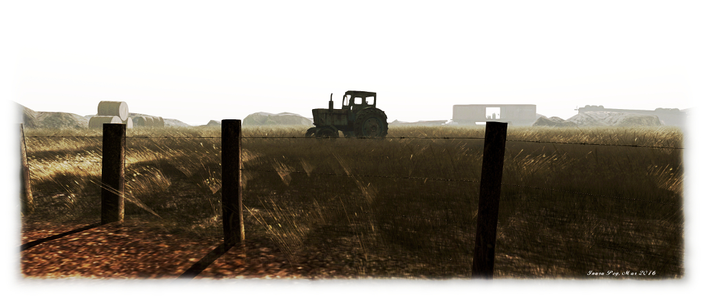
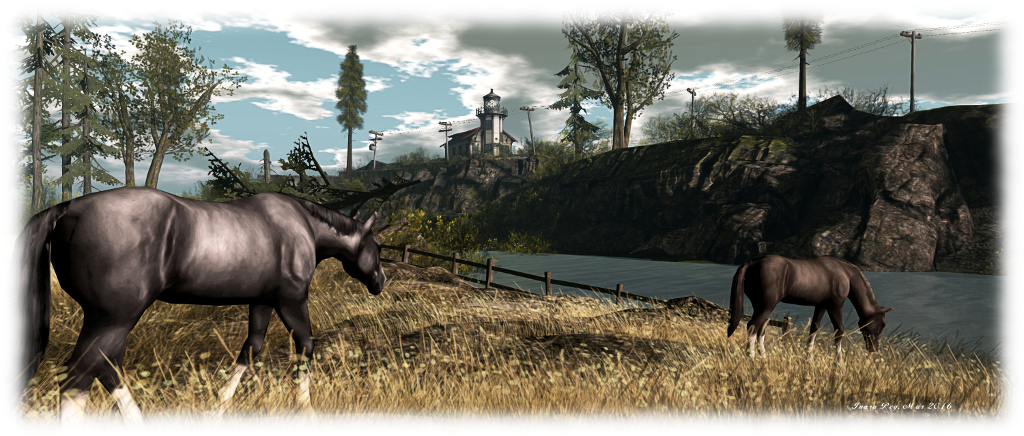
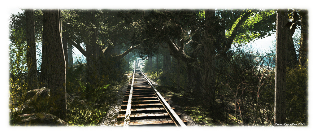
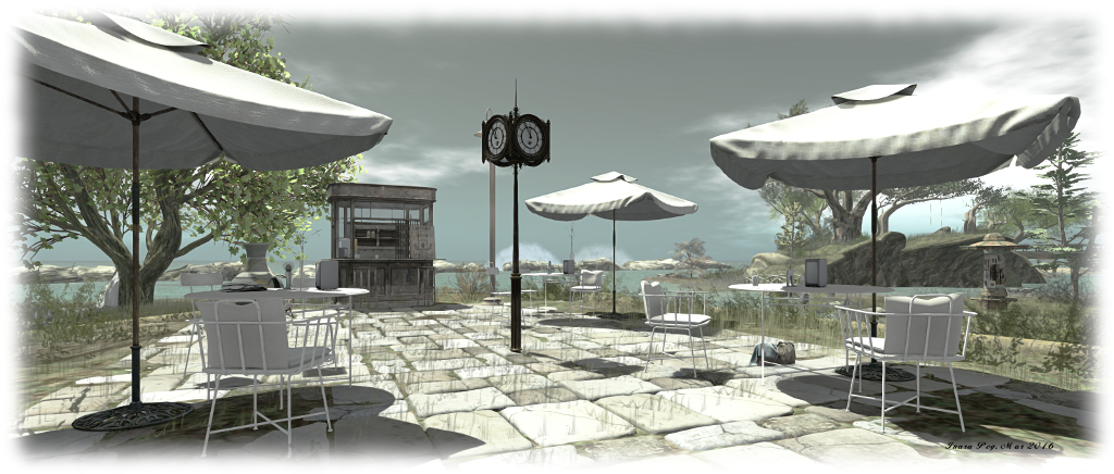
Asphyxiation Point – click any image for full size

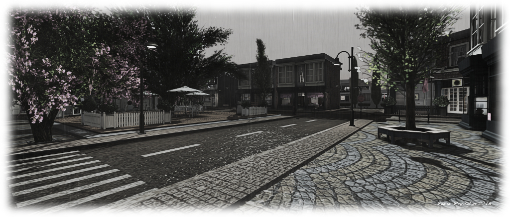
I first wrote about Asphyxiation Point, the free-form role-play region, back in February of 2016, after being invited to explore the region by one of region’s Admins and a prime mover in the region’s development, Charles Newton Kuluk (kuluk). At the time I noted that the town is host to a range of activities,most of which are reported through the associated website, and Thursday, March 31st through to Sunday April 3rd inclusive will see the town engage in one of those activities, as it faces the ravages of a hurricane.

“Hurricane is one of the most visually striking events in Second Life,” Charles said in his invitation. “I would like to invite you to Asphyxiation Point to view the event in person and hopefully capture it through your lens.”

Asphyxiation Point; Inara Pey, March 2016, on Flickr Asphyxiation Point

The storm is intended to unfold – as storms in the physical world so often do – over a period of days, rising to a peak, then ebbing away. As such, the time frame for the event is currently as follows:

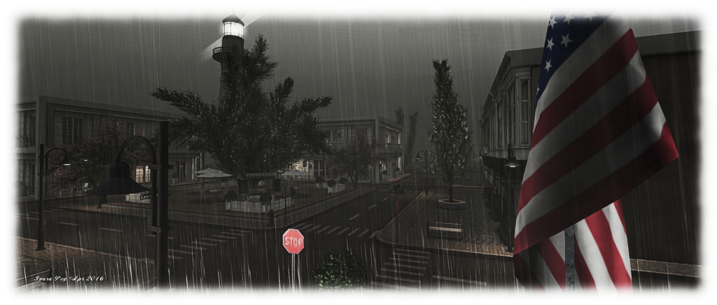
Thursday, March 31st 2016 – The Rain: It starts with rain, materials-enabled rain in this case, which allows local lighting to be reflected in the water on the ground and in the splashes of raindrops when you have the Advanced Lighting Model active. The rain is region-wide, but playing with different windlights and time settings in the viewer can create some interesting results, particularly at night.

Friday, April 1st 2016 – The Wind: As Friday arrives, so does the wind, driving the rain and pushing against the trees, whilst lightning flickers across the sky, followed by thunder’s inevitable booming, as the townsfolk batten down and prepare for the hurricane’s anger.

Asphyxiation Point; Inara Pey, March 2016, on Flickr 
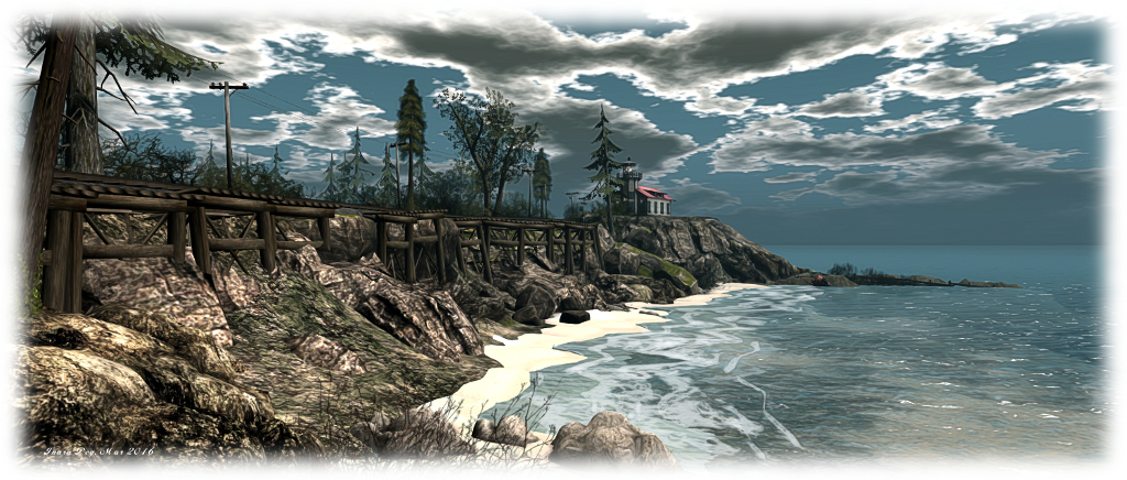
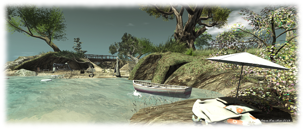
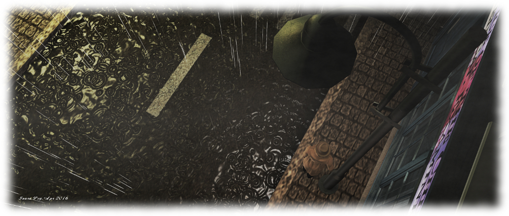
Asphyxiation Point – materials bring the rain to life

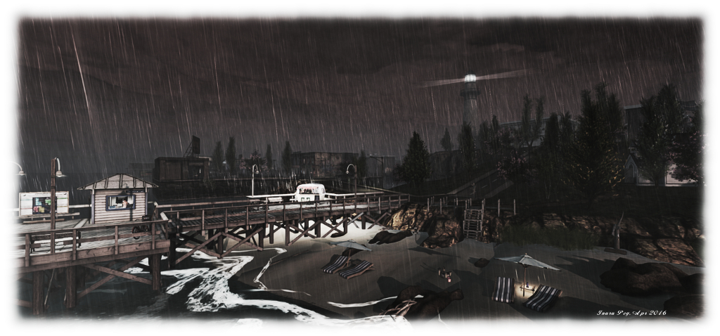
Saturday April 2nd 2016 – Hurricane: the storm proper strikes,  the sea rages, flooding much of the town, breaching defences around noon SLT and rising steadily through until 18:00 SLT.

Sunday April 3rd 2016 – The waters recede:  the storm has passed, and with nature’s fury abated, the waters slowly recede through the early morning hours (SLT), leaving some debris left in its wake as the people of Asphyxiation Point clean-up and return to normal life.

As noted in Charles’ invitation, visitors are encouraged to drop into the region over the course of the storm and take photos as events unfold. All the folk at Asphyxiation Point ask is that those taking pictures consider sharing them on the Asphyxiation Point Flickr group, to help record the event for posterity.

Asphyxiation Point; Inara Pey, March 2016, on Flickr Asphyxiation Point

Should you visit to see the storm for yourself, do keep in mind that Asphyxiation Point is a free-form role-play environment in which most of the residents interact “in character” in open chat conversation. Visitors are welcome to give it a go as well; however, if you are approached in local chat by someone wanting to role-play, but would prefer not to, just IM them to let them know you are visiting and / or taking photos.

As we’re talking storms, I’ll wrap this piece with a little musical interlude from Chris de Burgh.

Additional Links

A visit to the 18th Century in Second Life

Rocca Sorrentina
Rocca Sorrentina

I was drawn to Rocca Sorrentina after seeing it featured in a recent Destination Guide highlights blog post from the Lab. Described as an immersive education experiment operated by Brown University, the region presents an 18th Century period setting, offering visitors the opportunity to interactively learn about the period through art, information note cards, exhibitions, events and even via casual role-play with the island’s residents (although it is emphasised the latter is not a primary function of the region).

The initial landing point is located at altitude. Here visitors can learn about Rocca Sorrentina (a fictional rocky island located in the Bay of Naples), both in terms of its own “history” and the broader terms of both the project and the period in which it is set. A note card giver alongside the landing point offers a wealth of information across multiple note cards, including useful visitor information, rules regarding period role-play and use of the region, and on the various displays to be found here.

Rocca Sorrentina
Rocca Sorrentina

Opening off of the landing area are three exhibition areas. These currently feature in turn, an exhibition of the art of Pietro Fabris, a history of tarot, and a history of the Kingdom of Naples during the late 18th century. All are informative, with the last in particular providing considerable insight into 18th Century life and culture.

Also to be found on the wall of the arrival hall (and in the note cards offered by the information giver) is a map of the island. This is worth noting / studying, as there is a lot to be found once you’ve teleported down to ground level.

RS-11-1_001
Rocca Sorrentina

On teleporting down, visitors find themselves at the island’s busy docks. Ships are alongside, anchored just offshore or heading out under full sail into the Bay of Naples (which connects Rocca Sorrentina with the estate of the Duché de Coeur – which I haven’t actually re-visited for well over four years!). Just off the main island are the smaller Harbour Master’s island and the fortified Lighthouse Island.

Once ashore, there are several routes of exploration: along the quayside to the lower town, or up the ramped path towards the villa, passing the vineyards on one side, and then turning to cross the Great Lawn to the upper town and its church, or by following the ramped path directly up to the villa itself.

Rocca Sorrentina
Rocca Sorrentina

The latter is modelled on the Villa Almerico Capra Valmarana (also known as La Rotonda, Villa Rotonda, Villa Capra or Villa Almerico), near Vicenza in northern Italy. Called the Villa Vesuviana, and designed by CapabilityTodd Elswitt, who was also responsible for building the original Rocca Sorrentina, this grand house perfectly captures the imposing form of La Rotonda and presenting similarly commanding views of its surroundings, whilst its interior decor also draws directly on that from its physical world inspiration.

Below the Villa sit the Cascade water feature and a small amphitheatre, and nestled between them, ruins which appear to date back to the time the island was used by the Byzantine Greeks. Just across from the Cascade, an area of excavation reveals more antiquities have been discovered.

Rocca Sorrentina
Rocca Sorrentina
Rocca Sorrentina
Rocca Sorrentina

When exploring the island, it is worth remembering a couple of points. The first is that while large parts of Rocca Sorrentina are open to the public, there are private apartments to be found here as well, which are available for rent by residents (the rental offices being up at the arrival point). These are indicated by signs outside (Residenza Privata), and visitors are asked to respect the privacy of those renting them.

The second is that while there is no formalised role-play on the island, residents can engage in free-form role-play, and visitors are invited to join in if they so wish. Those who do are asked to indicate as much by dressing in 18th century period costume (there are some free costumes available at the landing point).

Rocca Sorrentina
Rocca Sorrentina

With its public programmes and exhibits focused on the history and ideas of the Age of Enlightenment and the era of the Grand Tour, and presenting unique opportunities to experience the baroque, rococo and neo-classical styles of the period, Rocca Sorrentina makes for a fascinating and educational visit. My only regret is that it has taken me five years to discover it and engage upon my own Grand Tour!

SLurl Details


A return to Baker Street in Second Life

221B Baker Street, Second Life

“Come at once, if convenient…” such was the start of a summons sent by Sherlock Holmes to Dr. John Watson in A Study in Scarlet, and much later in a Study in Pink from the outstanding BBC re-imagining of Arthur Conan Doyle’s famous coupling, Sherlock. It was also, as it happened, the quote I opted to use when writing about a simply outstanding Second Life recreation of 221B Baker Street from that TV series, back in April 2015.

As I noted at the time, the recreation of the flat, by Darius Godric who is very much a Sherlock aficionado, was nothing short of marvellous. The attention to detail was superb, with lots of wonderful touches directly from the various cases  – notably those of the first season – making it a veritable treasure-trove for fans of Sherlock and Holmes in general.  So when Darius dropped me a line over Easter to let me know he’d been working on the flat, and invited me to drop by to have a look at the results, I was only too happy to do so!

221B Baker Street, Second Life

From the outside, not a lot has change (but the it wouldn’t, would it? Baker Street is hardly likely to undergo radical change 🙂 ). Speedy’s is still there, offering patrons breakfast, lunch and pasta, and alongside it is the entrance to apartment 221B, with the hallway leading to Mrs. Hudson’s kitchen and the stairs going up to the flat itself.

It is here that the attention to detail really comes into play. In my original piece, I mentioned touches such as the  bullet-scared flock wallpaper from The Great Game (“I’m BORED!” *BANG*), the pink valise from A Study in Pink, references to St. Bart’s Hospital used in The Reichenbach Fall, as well as a direct reference to that case; the riding crop from either A Study in Pink or possibly A Scandal in Belgravia and more besides.

221B Baker Street, Second Life

Now to these has been added much more. Walk through the kitchen (which has some subtle changes, but retains the famous head-in-fridge and chemistry set), and you can visit Holmes’ bedroom, as seen in A Scandal in Belgravia, complete with Jack-and-Jill access to the bathroom, and a framed periodic table of elements on the wall.

Meanwhile, in the living room, the pink valise has been moved to one side, making room beside the dining table for John Watson’s laptop, complete with its significant 1895 visitor count. On the table itself, joining the page of ciphers alluding to the episode The Blind Banker, now sits a page on which has been scrawled U.M.Q.R.A (The Hounds of Baskerville), together with blueprints for the ultra-modern house belonging to Charles Augustus Magnussen (His Last Vow – and in fact Swinhay House in Gloucestershire).

221B Baker Street, Second Life

Nor does it end there. Also on the table are a couple of very clever references: a map of Europe and Russia with the submarine blueprints which were the focus of Doyle’s 1908 story, The Adventure of the Bruce-Partington Plans. Thus we have a neat reference to the Sherlock episode The Great Game (which involved the Bruce-Partington Project) by way of Doyle’s original tale. There are more such touches to be found – but I don’t want to spoil things by listing everything, as discovering them is far more fun.

Back in April 2015 I wrote “Anyone who has enjoyed Sherlock’s three (thus far) seasons via the BBC (and their world-wide partners) is going to love the version of 221B Baker Street Darius has created in Second Life; it really is a marvel to visit. The many touches within it will have fans of the show smiling happily (I know I was).” This still holds true now, and it’s a delight to see how Darius has both updated 221B Baker Street and offers links to the original adventures taken by Holmes and Watson, thus very much keeping the magic alive.

221B Baker Street, Second Life

If you are a Holmes / Sherlock fan and you haven’t visited already, I cannot urge you strongly enough to hail a cab and head over. The address, should you need it, is below 🙂 .

SLurl Details

221B Baker Street – Sherlock Holmes (Rated: Moderate)

A cheerful visit in Second Life

[G]aio; Inara Pey, March 2016, on Flickr [G]aio – click any image for full size

There are some extraordinary lovely regions popping up across Second Life right now, several of which I’ve been fortunate to visit recently, and I’m adding. [G]aio (Italian: cheerful, happy) to the list.

The work of cambiamento Radikal, [G]aio is a homestead region nestled between tall green mountains, presenting the feeling of being a small cluster of islands sitting on a lake and caught in a perennial summer’s morning, the sky yellowed by a slowly rising sun gradually hauling its way up over the eastern peaks.

[G]aio; Inara Pey, March 2016, on Flickr [G]aio

The largest of the islands offers  a Tuscan farmhouse sitting to the south-west, the outhouses of which present games rooms and the chance to enjoy a little wine. Those who prefer can dance out in the courtyard (touch the sign next to the house for poseballs), or they can sit and sip wine and watch the sheep drinking at the water trough alongside a small coral. The latter is home to a saddled horse awaiting anyone who might want to ride him.

Outside the farm buildings, a stone path leads the way along a tongue of land running east, past grapes growing on the vine and corn on the cob, to a children’s play area. Beyond this, the tongue of land continues east then north to arrive small headland crowned with a copse of tall fir trees through which sunlight slants.

[G]aio; Inara Pey, March 2016, on Flickr [G]aio

A rope bridge connects this headland with the second largest island as it sits cupped in the arms of the first. A rutted track undulated across this island, under the boughs of trees and between thick hedges. Two stone bridges, hopping to a much smaller island offer the way back to the farm, leading visitors past a magical faery ring in the process.

[G]aio may not appear to be as extensive as other region designs, but this doesn’t make it any less endearing. There is a beautifully rural feeling to it, perfectly underlined by a gentle ambient sound scape. It is also a place which naturally lends itself to photography under a range of windlight settings (there are also poses available, and rezzing is set with a 60-minutes return time).

[G]aio; Inara Pey, March 2016, on Flickr [G]aio

For those who simply want to spend time together, snuggling, exploring or dancing, [G]aio is equally the ideal destination, offering plenty of opportunity for all three, with cambiamento a convivial host (we spent a good part of my most recent visit in conversation). Should you enjoy your visit to {G]aio, do please consider making a donation towards the region’s upkeep (via the courtyard water trough).

SLurl Details

Visiting Nowhere in Second Life

Nusquam; Inara Pey, March 2016, on Flickr Nusquam – click any image for full size

Nusquam (latin: “nowhere”) is an atmospheric homestead region designed by Randi Lenroy, and which is currently featured in the Destination Guide Highlights for the week ending March 18th, 2016.

The name for the region becomes evident on arrival: the setting echoes the looks and feel of so many remote coastal regions to be found around the world – Canada, America, Europe, Australia, South America, New Zealand, it could well be anywhere. And so, because of all these echoes, it is in fact, nowhere other than where our imaginations decide to set it as we wander its rugged and open spaces.

Nusquam; Inara Pey, March 2016, on Flickr Nusquam

The Landing point is located in the north-easy corner of the region, within a barn spanning an old railway line. The tracks run from north-west to south-west, running along the eastern seaboard before rising to run back westwards along the south side of the region,  coming to an abrupt end at the ruins of a trestle bridge. This in turn suggests that the region was once connected to somewhere, further inviting our imaginations to extend or create a setting for the region.

Within the arms of this sweeping, undulating track – which frankly, has seen better days and was doubtless abandoned following the loss of the bridge to Wherever, is open farmland. This is neatly dissected into two fields by a dirt track pointing the way to an old workshop and barn, complete with a makeshift pier, the possible home for two fishing boats lying offshore.

Nusquam; Inara Pey, March 2016, on Flickr Nusquam

A lighthouse sits atop the highest point on the land, occupying a rocky shoulder in the south-east of the island. The spur of the railway line sweeps by outside, just the other side of a cement wall, to continue out along a  finger of rock, open sea on one side, narrow watery channel on the other, on its way to the bridge to (or is that from?) nowhere.

The lighthouse, barn and workshop are the only structures on the land, although it is clear this is still a place of work: hay bales are neatly rolled, a tractor has been working in one of the fields, whilst someone has been using another in an attempt to shift a fallen tree. Whether the latter came down by accident or design is hard to tell, but the way the telegraph poles are angled as they run beside the old train line suggests this place can suffer from high winds at times, so perhaps age and the weather took its toll on the tree.

Nusquam; Inara Pey, March 2016, on Flickr Nusquam

Horses roam one of the fields, their sleek coats suggesting they are well cared-for, adding a further sign of long-term habitation here, and giving the visitor more hints by which they can weave a tale of their own about the place. East of the railway tracks, the unsurfaced road continues, passing a small parking lot bearing a sign promising fried chicken and gasoline further inland.

An overgrown board walk winds its way from this to barn landing point, while the road quietly dips under the lapping waves on the east side of the island, again suggesting this is a place that was one somewhere – or at least linked to somewhere. now a young apple tree rises slowly from what’s left of the track, a silent sentinel warning the onward progress is perhaps not advisable.

Nusquam; Inara Pey, March 2016, on Flickr Nusquam

With it’s rugged, looks and open spaces, complemented by a subtle sound scape which is more noticeable along the coastline than further inland,  and presided over by a dusky windlight which plays beautifully with lighting as you cam around, Nusquam presents the perfect  destination for whenever you feel like you’d like to go Nowhere.

SLurl Details

Follow your Bliss in Second Life

Follow Your Bliss; Inara Pey, March 2016, on Flickr Follow Your Bliss – click any image for full size

For those seeking a little escape from the rush of life and a chance to recall memories of summer holidays long ago, a visit to Follow Your Bliss might be just the ticket. This homestead region is the vision of Elizabeth (ElizabethNantes) with assistance from Omkara (kazu Koray), and it is an absolute delight to visit, explore and photograph.

Resembling an archipelago, the region offers a chain islands surrounding a shallow, sandy-bottomed bay. Of varying sizes, the islands are protected on their northern flank by a natural rocky breakwater against which waves crash, the remaining compass points offering relatively unobstructed access to the sea.

Follow Your Bliss; Inara Pey, March 2016, on Flickr Follow Your Bliss

Directly behind the breakwater, and curving gently around the north and east sides of the region, is a chain of mostly low-lying islands linked one to another by a series of bridges. These present a sunny walk through knee-high grass, over warm beaches and across the bridges to reach either a final low-lying sand bar, or in an eastwards turn and across the sturdiest of the bridges, access to the largest and tallest of the islands.

Each of the islands offers something of its own to occupy visitors: places to cuddle, places to sit and while away the time watching the tide or in conversation, swings on which to have a little fun, shady sports and shacks and cabins in which to escape the light of the sun. Two of the latter sit upon the largest of the islands, a twisting climb of stone steps linking them. One is a two-storey cement structure at the foot of the island’s main hill, the other a wood framed atelier perched on the top of the hill, with commanding views all around.

Follow Your Bliss; Inara Pey, March 2016, on Flickr Follow Your Bliss

The atelier in particular attracted me, not only because it is a design I like, but also because of the beautiful map of Sir Lanka (then Ceylon), dating from the 1690s and the period of the Dutch Governorate. With north to the left and east at the top, the map makes for an interesting view of the island, the names the Dutch offered for places I’ve been fortunate enough to visits as exotic as their Sinhalese equivalents: Anurodgburro (Anuradhapura). Trinkinmaly (Trincomalee), Battacilow (Batticaloa), and so on.

In order to reach the remaining islands in the group, visitors have a choice: swim, take one of the rezzable paddle boats available from the dock near the landing point, or join the local group and avail themselves of one of the group motorboats. Flying is also an option – but to do so isn’t really in keeping with the spirit of exploration.

Follow Your Bliss; Inara Pey, March 2016, on Flickr Follow Your Bliss

These islands, to the west of the region, between them offer more places to relax, including a charming little café and a touch of the oriental. In all, Follow Your bliss is aptly named; exploring the islands, it is easy, even natural, to leave worries and cares behind and simply enjoy the carefree bliss offered by the region, and all under an almost tropical sky.

SLurl Details