Serenity & Tranquility in Second Life

Serenity & Tranquility; Inara Pey, April 2016, on Flickr Serenity & Tranquility – click any image for full size

Serenity & Tranquility is the name of the homestead region designed by Ron (Veronica Franchini), and which offers a peaceful heaven where those in need of a break from the pressures of the world, physical or digital, or who simply want to hang out with friends and  / or lovers, can freely do so.  Homestead region.

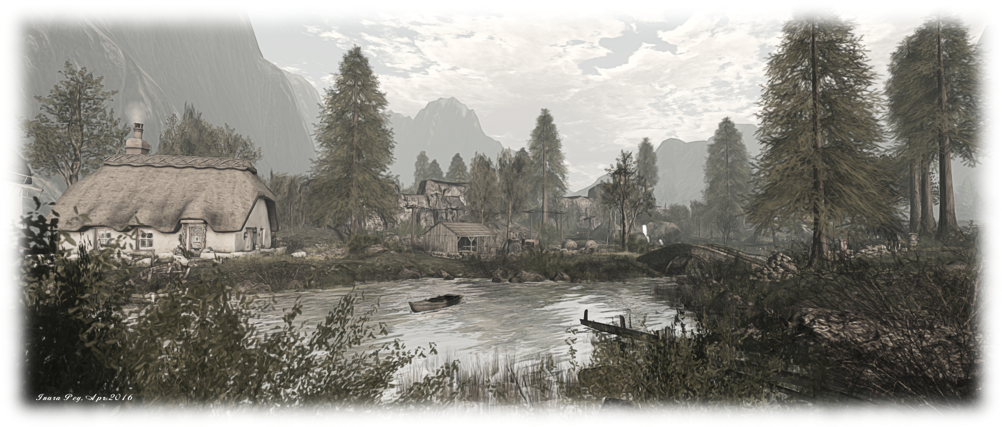
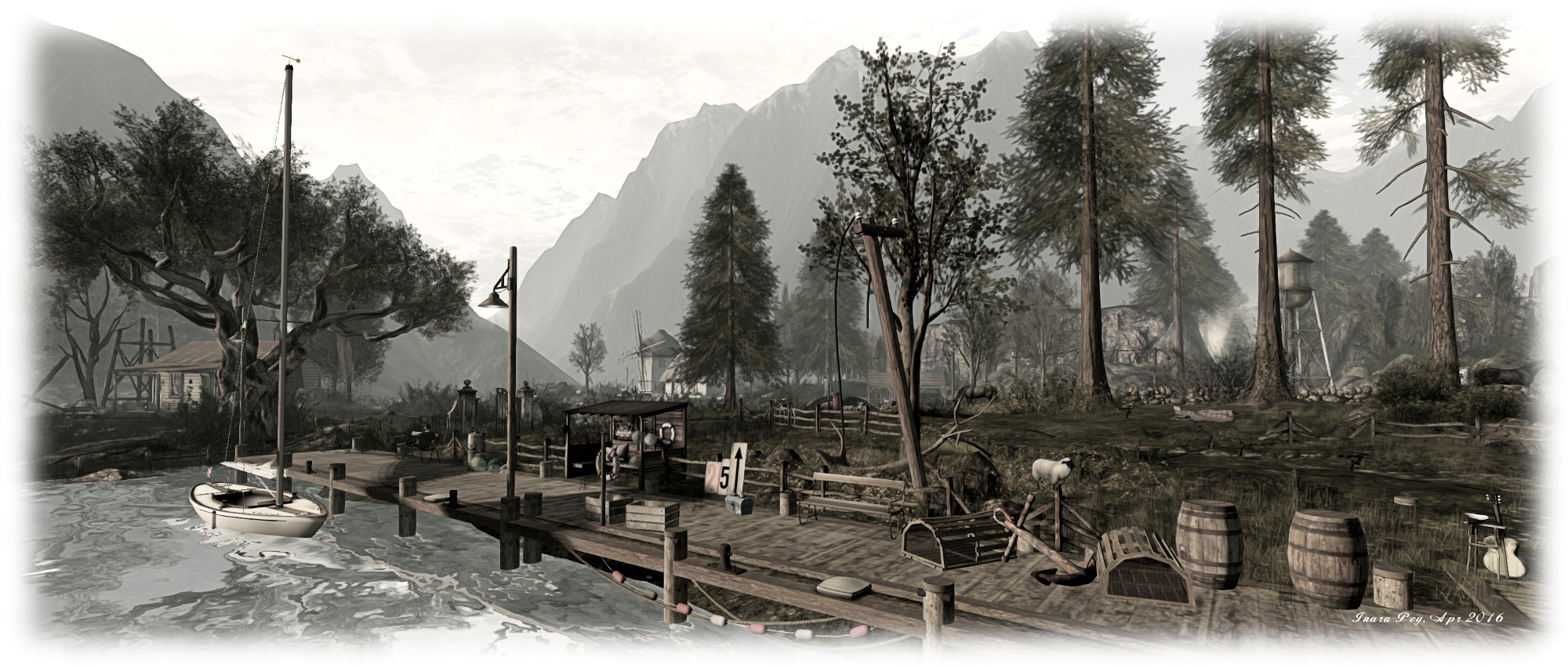
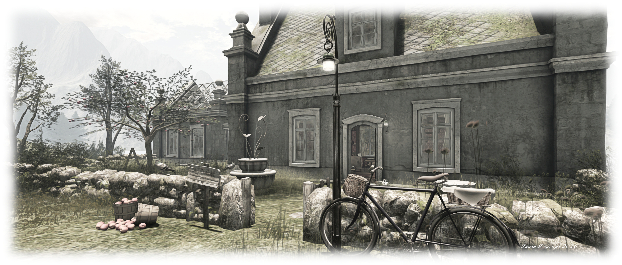
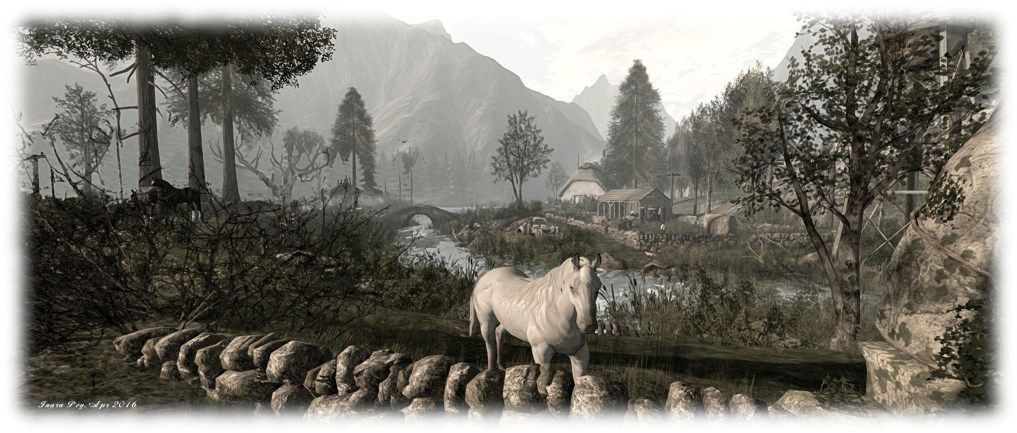
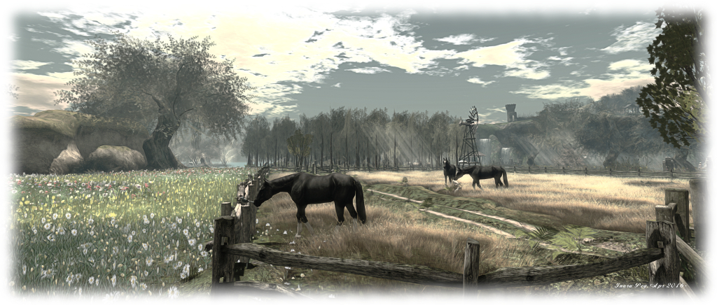
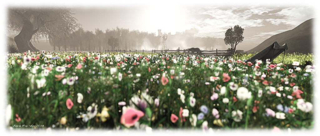
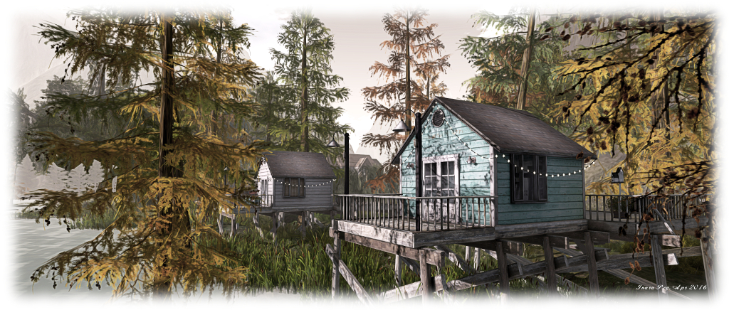
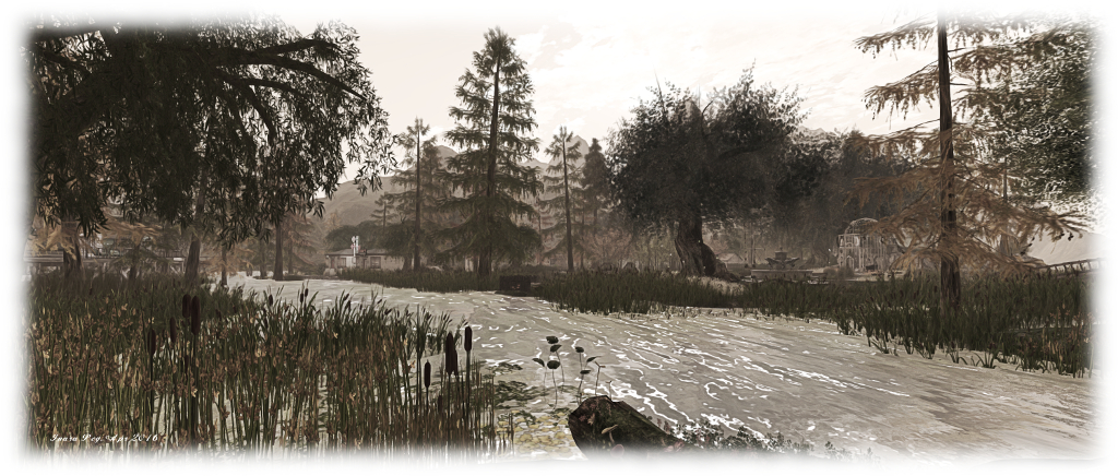
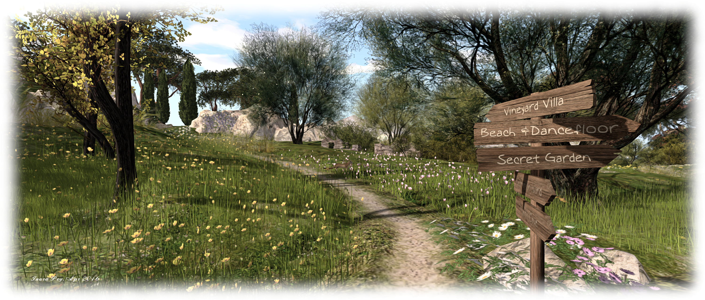
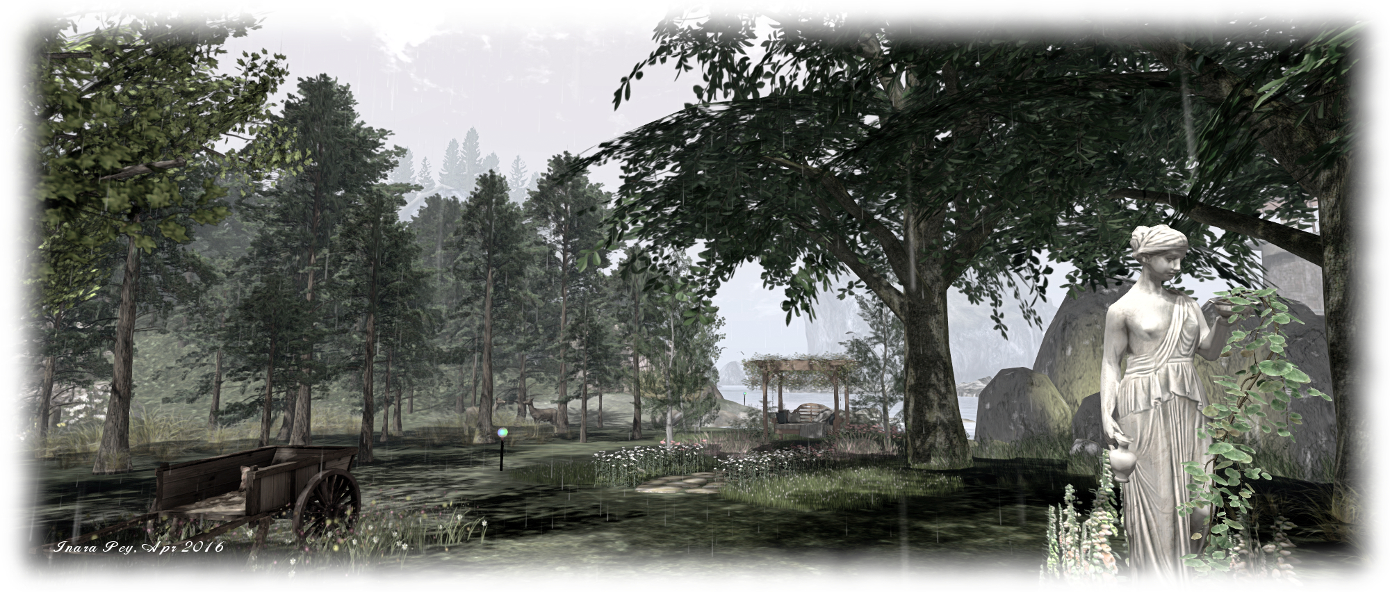
Surrounded by tall islands and hills, Serenity and Tranquillity offers a rich, low-lying landscape where the trees seem to hold up the sky whilst rivers of flowers meander beneath their outstretched boughs, and sandy tracks lead visitors from location to location, be it the cabin in the woods or the beach or the tiki on the lake or the art gallery, or any one of the romantic spots scattered across the island.

Serenity & Tranquility; Inara Pey, April 2016, on Flickr Serenity & Tranquility – click any image for full size

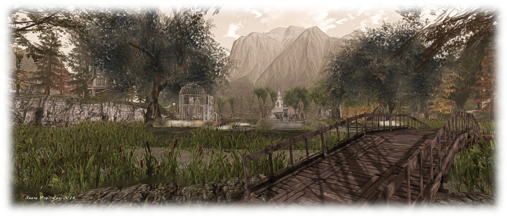
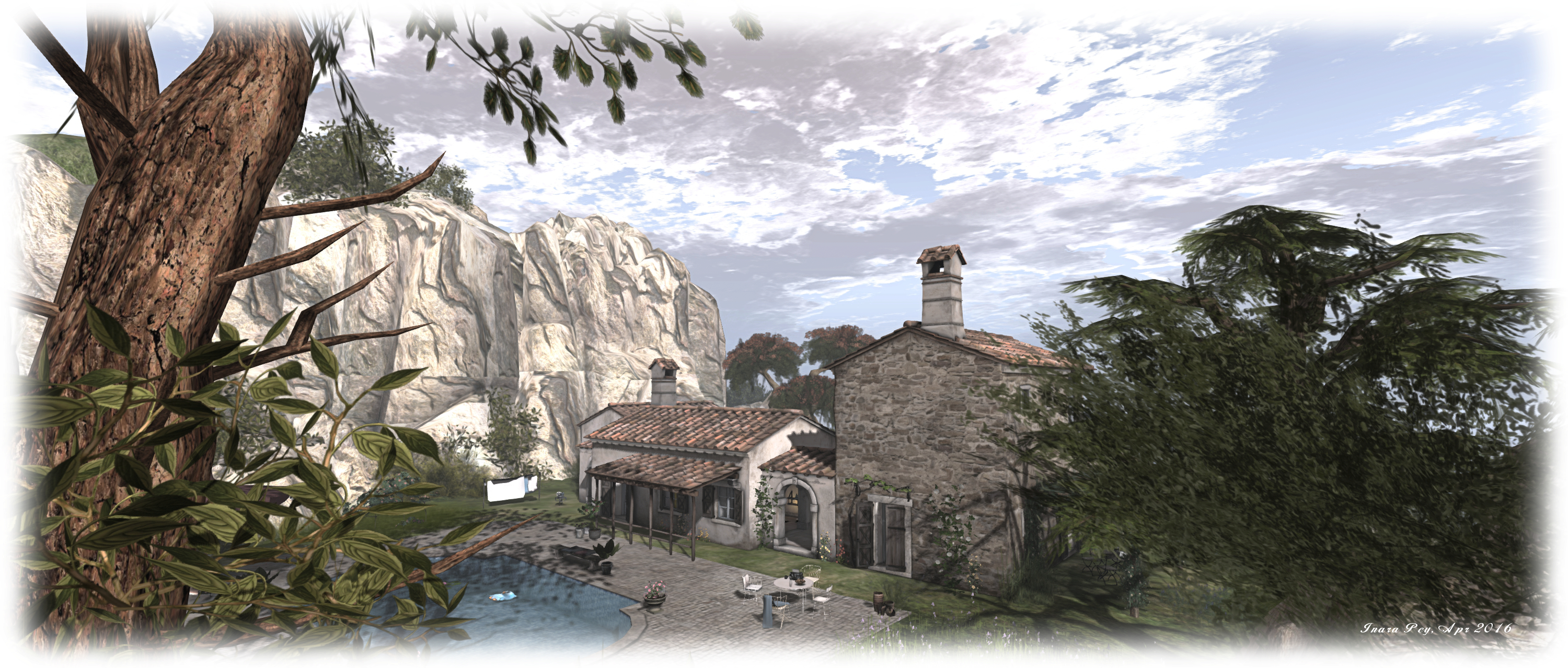
From the landing point, it’s just a short walk to the cabin, and from there to a pair of ancient stone circles, arched pillars still intact, which offer a place to celebrate weddings under the open sky, but sheltered from the sun by the surrounding trees. In the opposite direction to the cabin, you’ll likely find your way to the gallery building toward the north-east corner of the region.

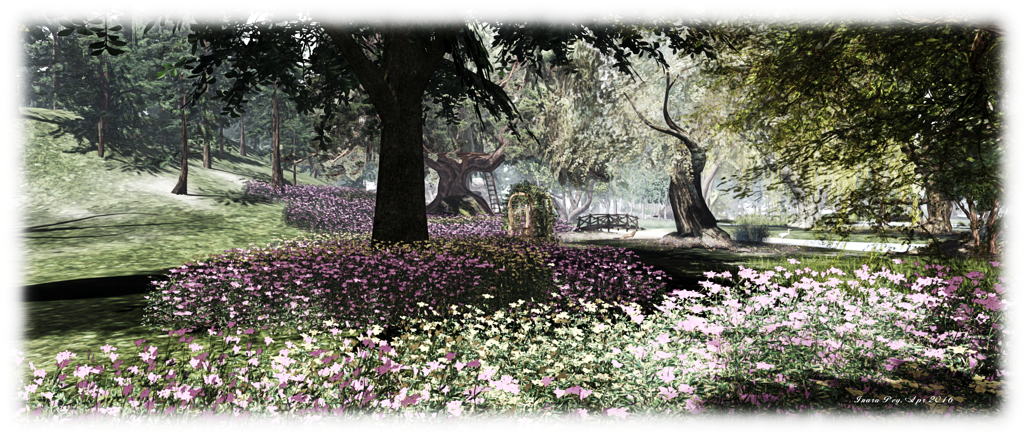
The gallery is the home to portraiture by Tex McDonald, and includes his studio space, together with some of his landscape work. I’ll be honest and admit I’d not previously come across Tex’s work, but it is something I’ll be keeping an eye out for in future. A short distance from the gallery is one of the little romantic spots scattered across the region – the aforementioned tiki hut, which sits out over a small lake served at one end by a little waterfall. Walk around the banks of the lake, and more sitting / cuddle spots will make themselves known.

Serenity & Tranquility; Inara Pey, April 2016, on Flickr Serenity & Tranquility – click any image for full size

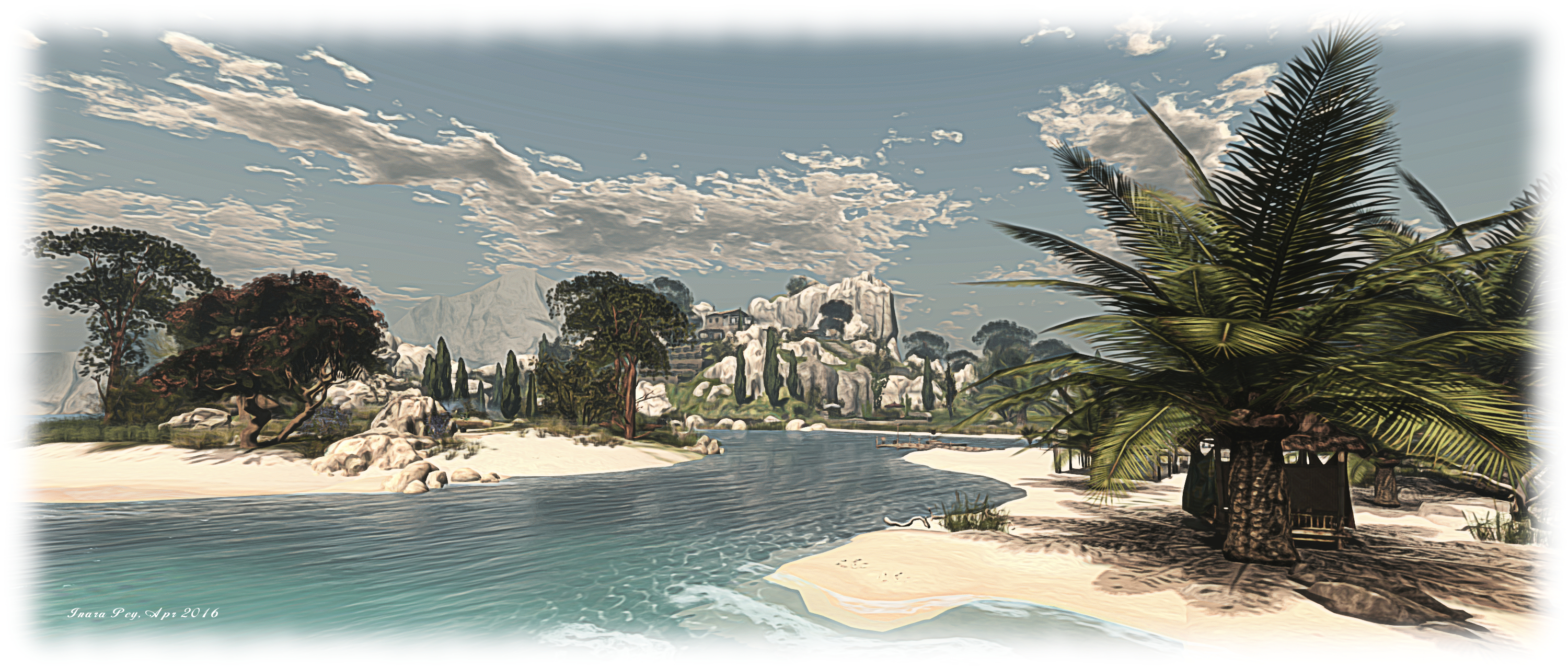
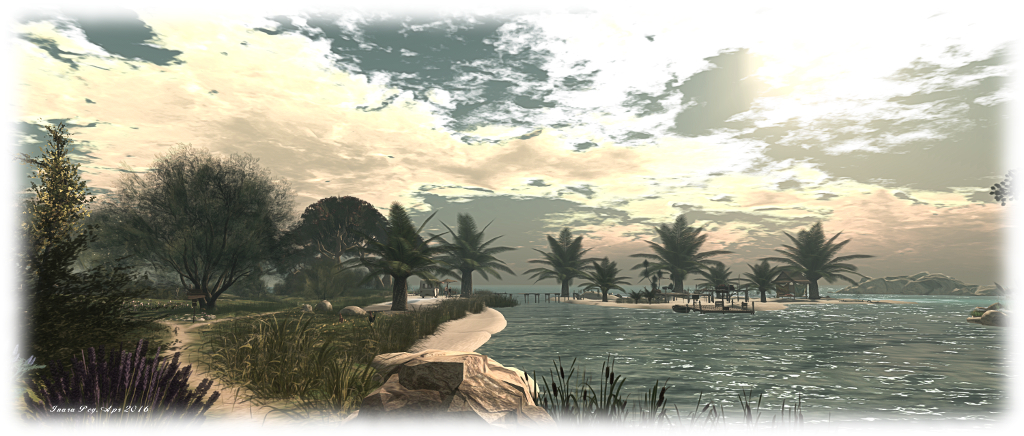
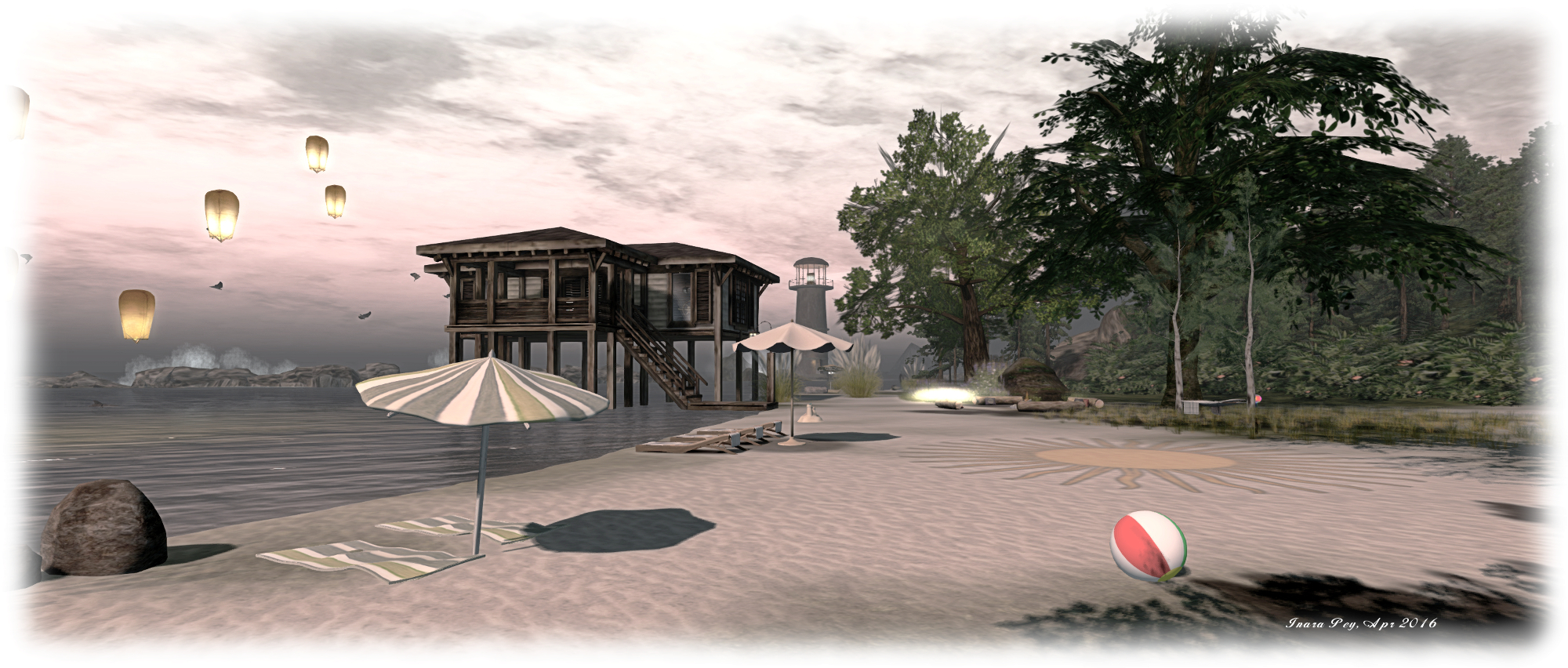
The south-west corner of Serenity and Tranquility is where the beach is to be found, ideally located for watching the sun set beyond one of the natural breakwaters which sit just off the west side of the region, a lighthouse warning of their presence. With a beach house and a sandy expanse, this corner of the island again offers several places to relax, both indoors and out, together with one of the InTan dance systems spread across the region. Or for those who prefer, a hot tub awaits a walk along a wooden pier.

With a subtle sound scape, and suited to a range of windlight options for photography, Serenity & Tranquility is an ideal setting for getting  away from cares and stresses. Recommended.

Serenity & Tranquility; Inara Pey, April 2016, on Flickr Serenity & Tranquility – click any image for full size

SLurl Details

Capturing the Lake District in Second Life

Netherwood; Inara Pey, April 2016, on Flickr Netherwood – click any image for full size

Netherwood while a fictional name, is inspired by the picturesque English Lake District where I have lived all of my life,” Lauren Bentham says of her latest creation in Second Life. “I decided it was time for me to do a build based on my local surroundings which I have enjoyed on a daily basis for many years & share with others the experience and views I see every day, which I feel very grateful to have 🙂 .”

The result is a beautifully landscaped Homestead region which, for those who have visited the Lake District, England’s largest national park, is instantly reminiscent of the rugged beauty to be found there. But there is also something more here as well; the tall, snow-capped peaks which rise steep around the region, their lower slopes clad in fir trees, carry a suggestion that Netherwood could easily be located in other parts of the world as well.

Netherwood; Inara Pey, April 2016, on Flickr Netherwood

At the landing point on the west side of the region, visitors are confronted with a railway line, apparently disused, running beneath the boughs of trees and pointing the way eastwards. Follow it, and it will take you through a landscape shadowed by trees, overgrown with grass and heavy with bird song, to a narrow passage between wall-like cliffs, and the end of the line.

Beyond this, the landscape opens out dramatically to the left and right, and a genuine feeling of England’s north country is presented to the visitor. Dry stone walls denote grazing areas for cows and horses, tress rise from beside a curling stream,  farm houses stand amidst rutted tracks, low-slung fences and wooden barns whilst sheep roam freely, grazing where they will. There’s even a familiar royal Mail letter box awaiting the arrival of the postman to collect the letters dropped into it!

Netherwood; Inara Pey, April 2016, on Flickr Netherwood

On the east side of the region is a wooden quay, against which the water gently laps. Here, those who have visited the Lake District might be inclined to think they are standing on a quiet stretch of shoreline of Coniston Water or Ullswater, or perhaps think of Netherwood as one of Windermere’s many islands. Yet the truth is, such is the natural beauty of the region, it would fit with any of the lakes to be found in the 2292 square kilometres which make up the park.

But as I mentioned above, there is more here as well; the surrounding peaks also suggest Netherwood might reside elsewhere in the world, such as the Great Outdoor of the United States or Canada. A tall wooden water tower and broken windmill in the south-east corner of the land add to this feeling, while a more traditional windmill with a left-hand drive truck parked outside perhaps give the region a slight European influence. Nor are such influences out-of-place; rather they add to the charm and welcoming feel to Netherwood.

Netherwood; Inara Pey, April 2016, on Flickr Netherwood

Needless to say, the region offers excellent photo opportunities throughout, and should you wish to rez props you can join the local group (L$150 joining fee to deter litterbugs). There are also places to cuddle or sit and admire the view, and the entire region is wrapped in a perfect ambient sound scape.

All told, Netherwood again demonstrates Lauren’s eye for creating atmospheric and evocative regions which can be enjoyed by everyone, and it has every right to become as poplar and as well-known as her other creations: Baja Norte (and its neighbouring regions), Storybrooke Gardens and Everwinter. Thoroughly recommended.

Netherwood; Inara Pey, April 2016, on Flickr Netherwood

SLurl Details

Stepping into Luane’s World in Second Life

Luane's World; Inara Pey, April 2016, on Flickr Luane’s World – click any image for full size

I was drawn to Luane’s World by Owl Dragonash, who recently blogged about this charming Homestead region. The work of Luane (LuaneMeo), the region is the home of her store and is offered to visitors as, “a romantic sim where you can relax, cuddle or hang out with friends. Made with photography in mind”. It also offers a number of gallery spaces featuring the work of some of Luane’s favourite artists,

It is one of the gallery spaces which serves as the landing point, on the north side of the region. This sits alongside a watery  fantasy area where you’ll see a unicorn can indeed fly (or possibly take an amazing leap!) under golden boughs and leaves, as misty particles drift through the glade on a gentle breeze. Close by sits a beach overlooked by a long-fingered headland pointing out to sea, upon on which the ruins of an old castle rest, reached by a grassy stair.

Luane's World; Inara Pey, April 2016, on Flickr Luane’s World

The ruins looks out over the sea, and inland across a woodland copse. Close by sits a small island reach by a little wooden bridge, while the woodland plays house to elk, the misty wafting through it offering plenty of scope for photographs. Travel west via the woodland track, and you’ll come to a gated field where horses graze, and beside it a broad sea of wild flowers separating you from a cottage and windmills – each the home of further gallery spaces – which rise from the tide of flowers on a ridge-sided island of grass.

A cart track running through the fenced field offers the way to another island, every bit as rugged as the headland, and the home of another castle ruin, this one reached by the arched trunk of a once  mighty tree. Once explored, you can rejoin the cart track and follow it around the coast to the cottage and windmill.

Luane's World; Inara Pey, April 2016, on Flickr Luane’s World – click any image for full size

With swings and seats and cuddle beds scattered across the land, Luane’s World offers touch of romance for couples seeking a place to rest and enjoy pleasant open spaces, while the free-spirited can run through the wide expanse of wild flowers as the lovers of SL art roam the gallery spaces.

Luane’s World is a simple, open design with welcomes visitors to explore, with some excellent opportunities for photography. The default windlight is (or appears to be) Annan Adored Morning Dream, but the landscape naturally lends itself to visitors playing with viewer settings. If you do visit and take photos, Luane offers a Flickr group for sharing them; what’s more, there is a photography contest running through until April 30th with cash prizes on offer. Details can be obtained near the region’s landing point.

Luane's World; Inara Pey, April 2016, on Flickr Luane’s World – click any image for full size

SLurl Details


Oriental mornings in Second Life

Tatakai Tochi; Inara Pey, April 2016, on Flickr Tatakai Tochi – click any image for full size

I was drawn to Tatakai Tochi for two reasons. The first is that it features the work of Shen Molinaro. The second is that it offers an oriental theme, something guaranteed to attract my attention much like a moth to a flame 🙂 .

A homestead region held by Regina Mills, (heatherfury) Takakai Tochi literally means “land of flight”. In keeping with this name, it presents visitors with rugged highlands pushing their way into a misty sky, an early morning sun just edging over the highest peaks.  Sitting atop the shoulders of several of this craggy hills are flat-topped plateaus occupied by traditional Japanese houses and buildings which overlook the deep slices of the valleys and gorges dividing up the land.

Tatakai Tochi; Inara Pey, April 2016, on Flickr Tatakai Tochi

Water flows through these deep valleys, fed by high, tumbling falls and winding its way out towards the surrounding sea. Several of these channels are bordered by wooden board walks or stone footpaths, offering the traveller paths through and around the region and a chance to explore it in detail.

“When I set out to make this sim,” Regina says of Tatakai Tochi in the notes presented to visitors on arrival, “My intention was to create a peaceful and serene place where I could come and hang out with my friends without any distractions or bothers.” For a time she toyed with the idea of adding rol-play to the region, but in the end decided to offer it as a place others could visit, enjoy and photograph without the added distraction role-play might have brought with it, and Shen Molinaro, Regina’s friend, and who designed the equally atmospheric and stunning Suomi, a place I wrote about in early March.

Tatakai Tochi; Inara Pey, April 2016, on Flickr Tatakai Tochi

While described as a Japanese themed region, Shen has drawn on both Japanese and Chinese influences – as is fairly common in many oriental themed regions in SL – whilst building Tatakai Tochi. The former is by far the more dominant of the two, but the latter eases into the consciousness as one comes across the occasional giant panda or when encountering a Foo Dog (Chinese imperial lion) standing guard at a fork in a walkway.

This is a place for quiet contemplation as well as exploration. Walk through the meandering valleys and gorges and you’ll pass through bamboo groves or under the gently rocking arms of blossoming trees to small shrines and past figures of Buddha, very occidental wrought iron benches offering places to sit and listen and think.

Tatakai Tochi; Inara Pey, April 2016, on Flickr Tatakai Tochi

From the bay alongside the landing point, visitors can embark on a walk around the island, following one of the wooden walkways mentioned earlier, before these also turn inland. For the energetic, there are also various paths to be found up to the high regions – and climbing quickly reveals the more panoramic nature of the region.

Tatakai Tochi is a picturesque region, beautifully capturing the orient from which it draws inspiration, and offering some excellent photographic opportunities, making for an ideal visit. You may need a little time to explore all of it, but it is more than worth the effort.

SLurl Details

Travelling through Noire’leans in Second Life

Noire'leans; Inara Pey, April 2016, on Flickr Noire’leans – click any image for full size

There’s a certain bayou feel to Noire’leans, and the name itself tends to put you in mind of Mississippi, if not Louisiana. Reader Maddie (MadisonRaelynn) suggested I add it to my itinerary of places to visit, and as Maddie has suggested a number of places to me, all of which I’ve enjoyed visiting, I was only to happy to add Noire’leans to the list.

Truth be told, Caitlyn and I actually first dropped into the region back at the end of February. However, I was hesitant to blog about it right away, as it is not intended as a public region per se. Rather, it’s a residential island, one that has been lovingly put together by Kas Torkelsonn (Kasia Kenin) and MadZ Levane (Magdaleine Demonista); so I wanted to ensure they were comfortable with the region being written about.

Noire'leans; Inara Pey, April 2016, on Flickr Noire’leans

As it turned out, the way had been prepared for me. “Maddie did say she was going to mention us to you,” Kasia informed me when I approached her about blogging the region. “We have been  preparing for this day and are totally open to this being a place to  explore. MadZ and I are working on the last remaining  undeveloped area to make it more inviting to guests who want to stroll,  linger, and take photos.”

Given this is a residential region, it should come as no surprise that the landing point is alongside the rental shingle, sitting on a small dock where visitors can rez a pedalo and explore the region via its various waterways. For those who prefer dry land, there are tracks, paths and bridges to guide them around the island.

Noire'leans; Inara Pey, April 2016, on Flickr Noire’leans – click any image for full size

The bayou feel is immediately apparent: the winding waterways crossed by wooden bridges, tall trees growing from mushy, reedy banks, wooden houses sitting back from the water or over it on slits, all presided over by a sky which could be taken to be a late pre-dusk afternoon, filled with the croak of frogs chirp of cicadas and buzz of dragonflies. The only thing indicating you are not in the bayou perhaps being the high peaks of the surrounding mountains.

Properties here are of varying sizes and forms, but all are in keeping with the general theme of the region and stand within their own parcels. “We have installed security in the residences  and made the scan range minimal,” Kasia told me. “So if anyone wants to visit, they  literally have to be on the porch of the house before they get a  warning.” This means that straying onto a property whilst exploring won’t get you told off by a security system, but you will be given a reminder that the houses are private residences should you try to enter.

Noire'leans; Inara Pey, April 2016, on Flickr Noire’leans – click any image for full size

As well as the residential homes, Noire’leans presents a central park area, a small beach, a café where refreshments can be had after wandering (or padding) around the region. With a design that’s immersive and which ensures tenants have a good sense of privacy without feeling cut off from one another, the region is also photogenic and welcoming to visitors.

Thank you, again, Maddie, for dropping me the details of another gem!

SLurl Details

Mediterranean meditations in Second Life

NOELIA Island; Inara Pey, April 2016, on Flickr NOELIA Island – click any image for full size

NOELIA Island, designed by Ida Carlberg and her partner, Lyshco, is a beautiful Mediterranean themed homestead region, offering visitors the opportunity to “dance, date, romance or cuddle in the romantic spots, take a fun boat ride, relax on the beach, take photos or meditate near the Buddha”.

Divided into three islands, the largest of which hunches high rocky shoulders to the east and south, encompassing land which rolls down to a low-lying coast to face two smaller islands on the north side of the region. One of these thrusts a rugged head up from its covering of sand and grass, while the other offers a low-lying atoll-like beach reached via a board walk spanning the water.

NOELIA Island; Inara Pey, April 2016, on Flickr NOELIA Island

The largest island, which also encompasses the landing point, features a Tuscany style villa sitting up on a high plateau. Sheltered by sun beached rocks, and reached by a winding stair of stone steps, the villa oversees a terraced vineyard to one side, overlooking one of the two smaller islands and served by an aged stone stairway. The walls supporting the steps of the vineyard appear to be similarly aged, alike the steps, suggesting that perhaps they were once part of a much older structure hugging the slope.

Below the villa, snuggled back against the lowest level of rock, and sitting between it and the channel separating the island from its companions, is the terrace arrival point, offering a shaded place for visitors to sit. From here, dusty, sun-dried tracks lead the way around the island, a nearby sign pointing the way to various points of interest, such as the beaches across the water, a little walled garden close by, the main climb to the villa, and more.

NOELIA Island; Inara Pey, April 2016, on Flickr NOELIA Island

There is a lot to explore on the main island, including a footpath and wooden walkway which takes visitors around the south and east sides of the island, hugging the backs of the rocky peaks to a narrow beach in the south-east corner of the region. While for those that follow the path around below the vineyards from the landing point, there’s a cave system waiting to be explored and a high hanging bridge spanning the water to the more rocky of the smaller islands.

This second island is a place of meditation, on which can be found the figure of Buddha mentioned in the region’s description, just down from the cliff top retreat which sits alongside the bridge. Wisdom is on offer here as well, from a standing stone close to Buddha, as is a meditative music stream for those who wish to listen.

The remaining island with the low beach, is a place of entertainment, again with its own music stream. A stage here is set out for music and dancing, while and tiki hut is one of several places where people can sit and relax.

NOELIA Island; Inara Pey, April 2016, on Flickr NOELIA Island

With boats also available for getting across the water, a fabulous ambient sound scape and plenty of opportunities for sitting and cuddling,  NOELIA Island makes for a very relaxing visit, offering a charming environment which has been beautifully put together by Ida and Lyshco. It’s also highly photogenic and begging to be filmed – and I hope to return in the near future to record a short machinima, subject to permission being given.

Should you enjoy your visit as much as I did mine, please consider making a donation towards the upkeep of the region at the landing point.

SLurl Dand Website Links