Spring 2018 at La Vie in Second Life

La Vie; Inara Pey, March 2018, on FlickrLa Vie – click any image for full size

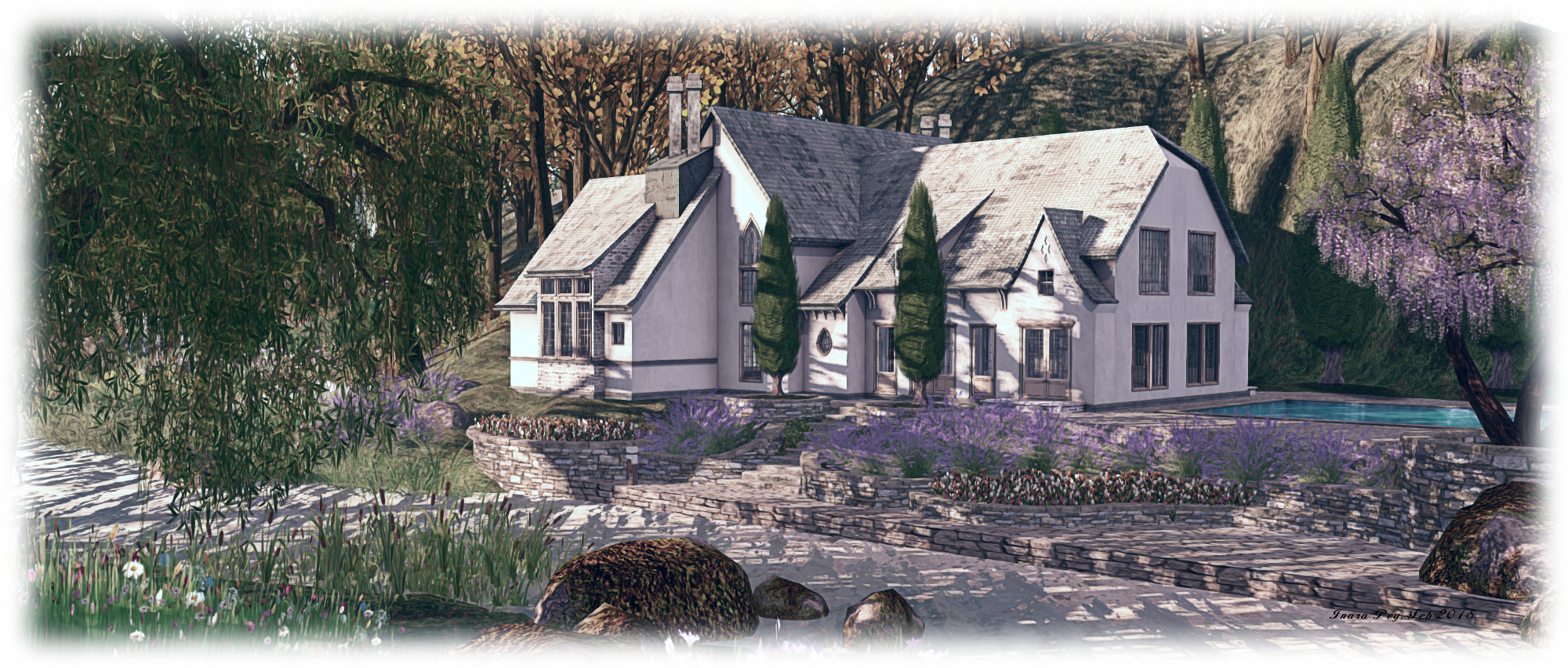
It’s just two months since our last visit to La Vie, the homestead region designed by Krys Vita and Arol Lightfoot (see here for our winter visit write-up). Normally, I prefer not to re-visit regions after so short a space of time, but La Vie has always been somewhere special, so when I received word from Krys that the region had received a spring 2018 make-over, I knew we had to hop over a take a look.

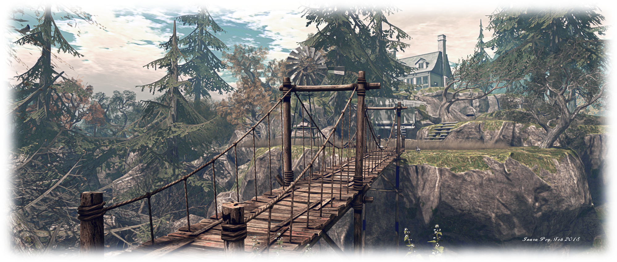
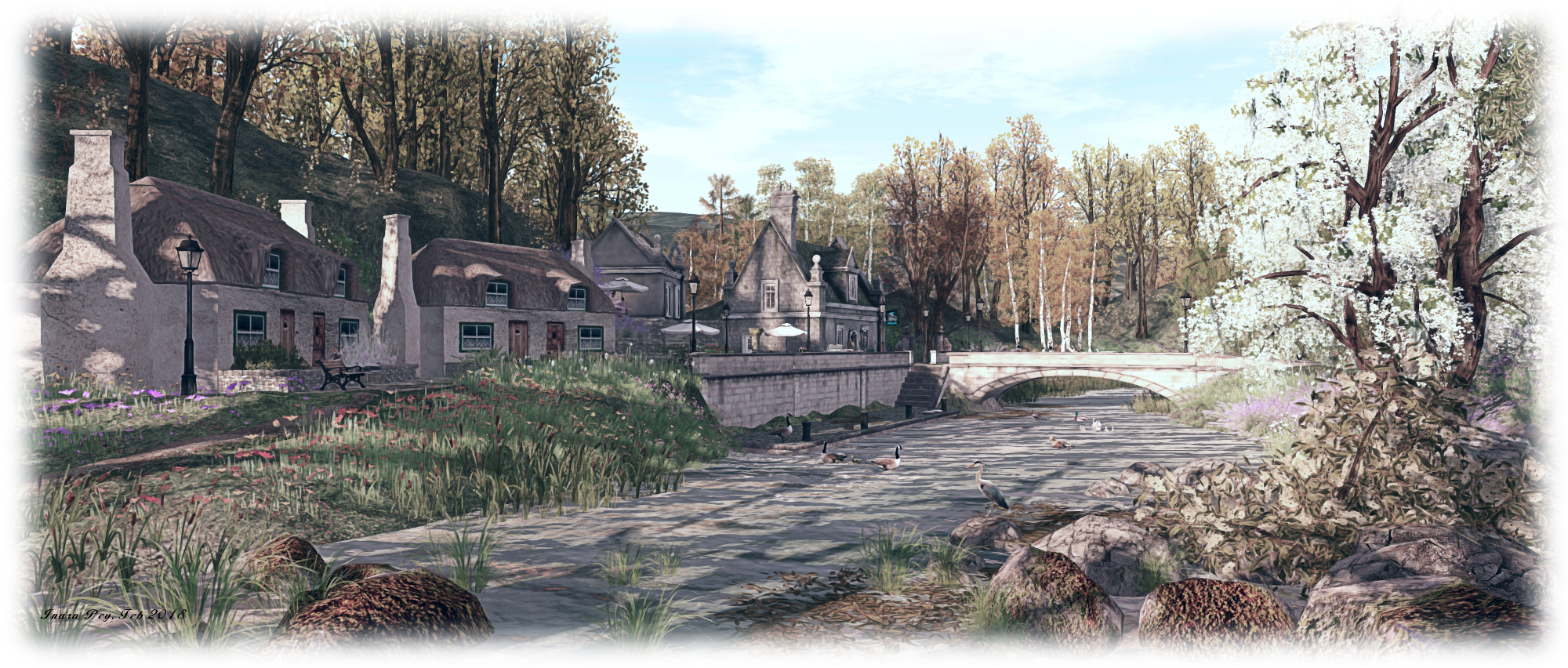
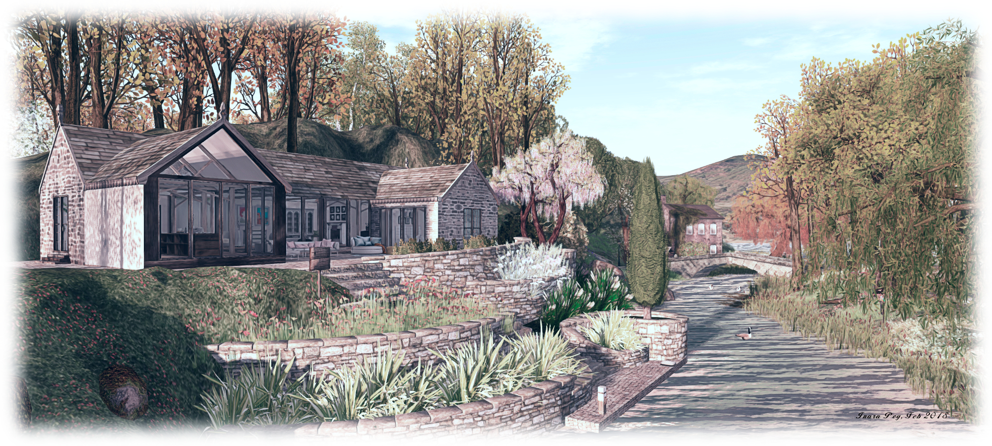
The new design brings with it some motifs and elements those familiar with earlier iterations of the region will recognise – a broad sandy beach, rural paths and fields, a little gathering of buildings – while the region as a whole presents something wholly new in terms of look and feel.

La Vie

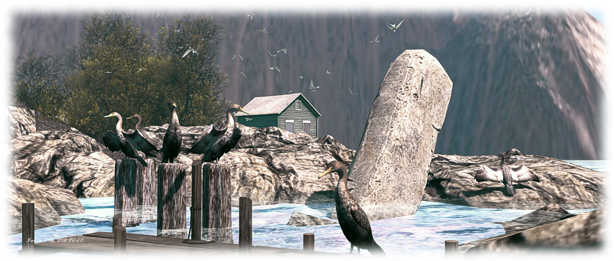
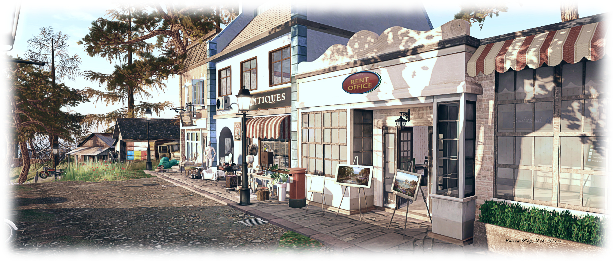
A visit begins on the west side, where sits a little cobble square with a round-cornered road to nowhere set within it. Two sides of this square – north and east – are bounded by tall shops and town houses. To the west, the square overlooks the open sea, a wooden board walk extending out over the rocky shoreline.

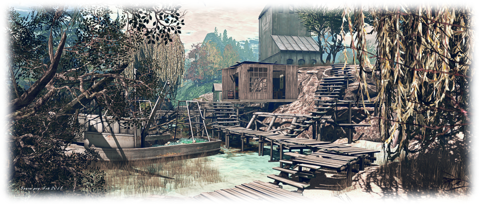
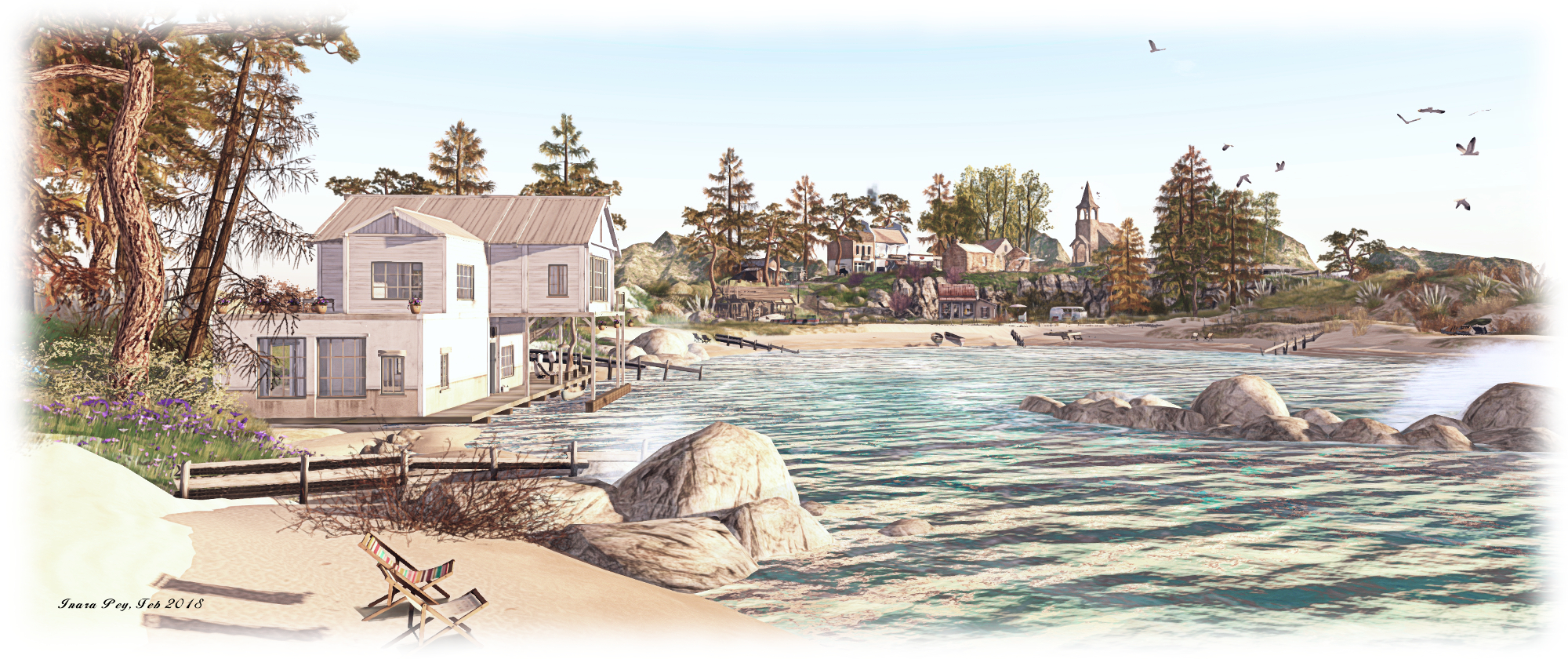
On the east side sits a gym ready for those wishing to keep themselves in shape (try the boxing bag). Close to the gym, a set of wooden boards and steps provide passage over more rocks and cross a sliver of water to where a small warehouse store and wharf sit at the water’s edge. This finger of the region is almost – but not quite – cut off from the rest by the water’s narrow passage, allowing it to offer a little corner of solitude, its southern edge marked by a cinder beach, and a cosy gazebo sitting in the middle of its grassy top.

La Vie

Finding other routes out of the little village square is somewhat harder. It sits on a flat table of rock, the rugged making passage to the beach to the north or the open lands to the east a matter of scrambling over rugged  shoulders of rock; it would perhaps be nice to have another wooden walkway and steps to help guide visitors. However, once the rocks have been negotiated, visitors will likely find themselves in a broad dip in the land that forms something of a track to be followed, easing further exploration.

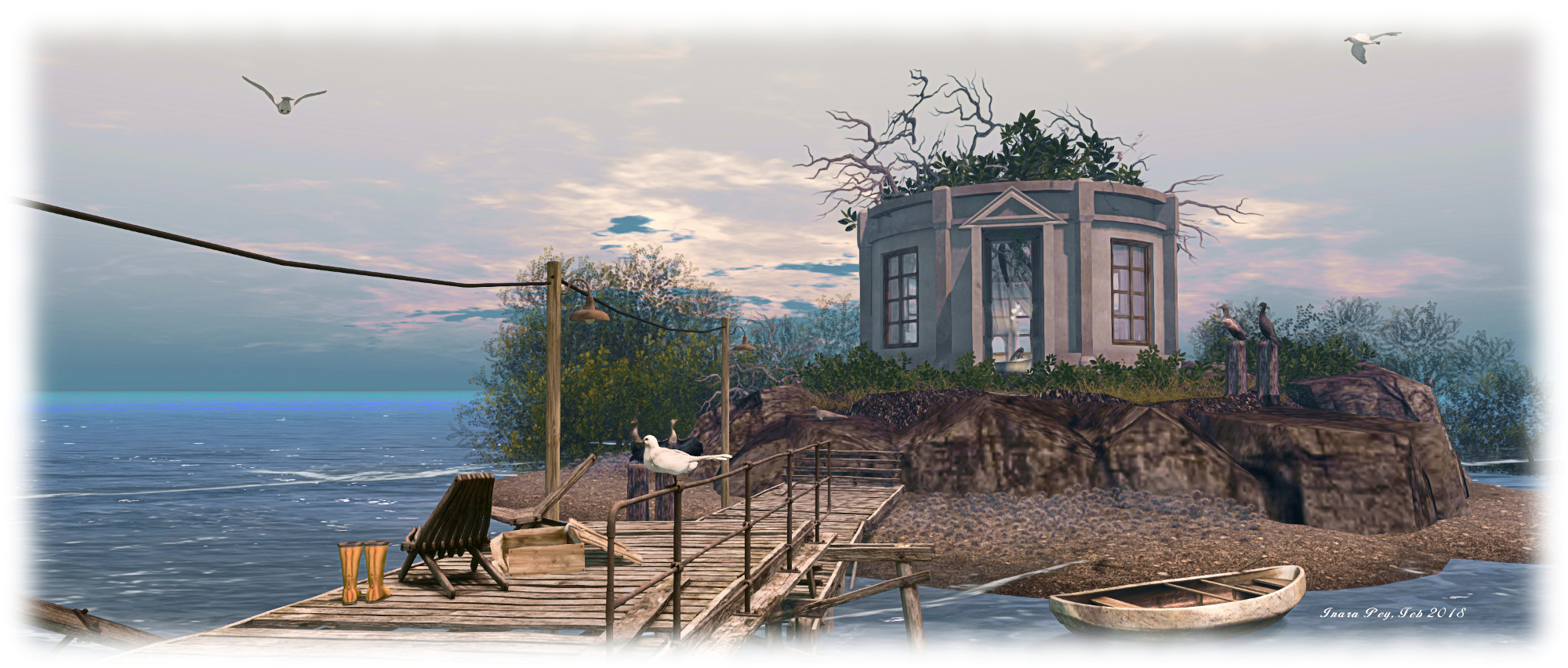
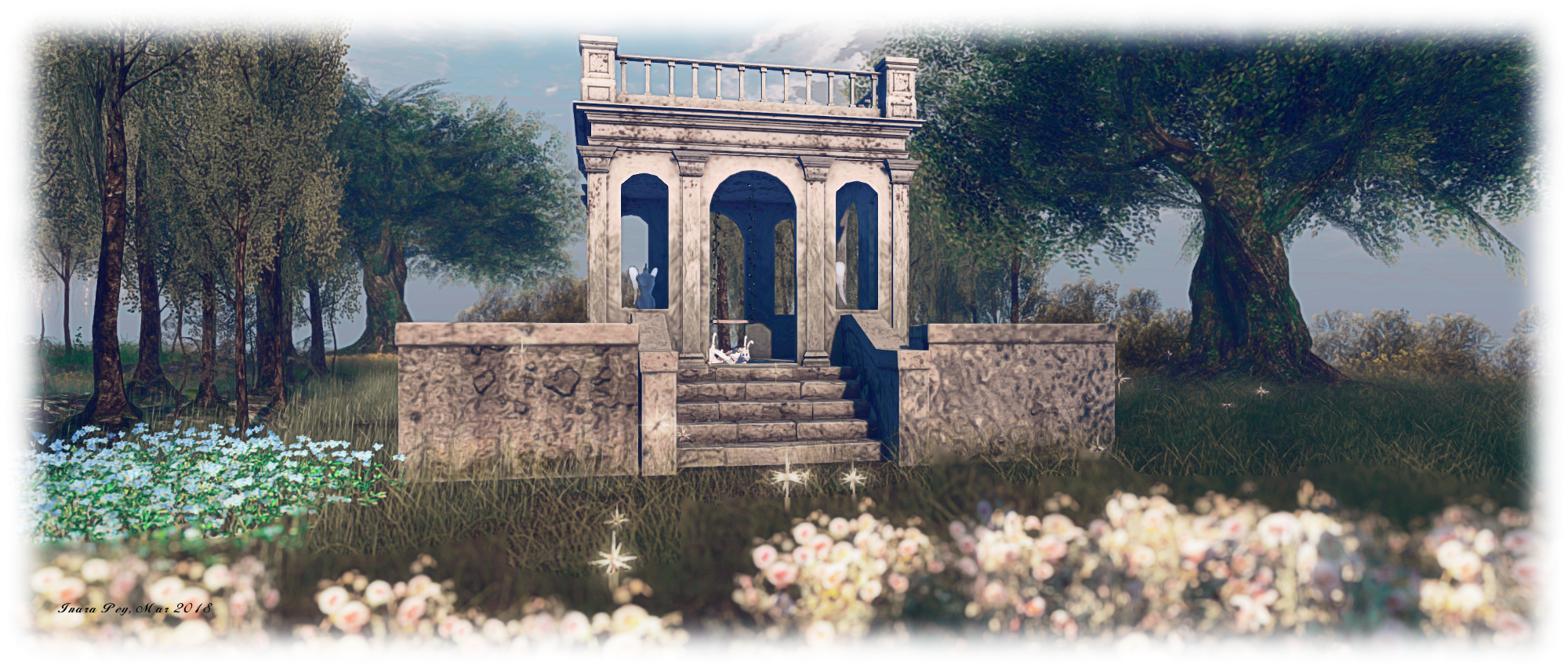
Take this path northwards, and it becomes increasingly sandy until it delivers you to the broad northern beach. Take it eastwards, and it will lead you through grass and by tree and bush, curling gently around the large plateau that forms the backbone of the land, steadily rising towards the top as it does so. A set of stone steps passing between old iron gates mark the top of the plateau, and give the impression you’re entering a wild garden. Crowned by trees, the plateau is home to an old folly where beribboned  geese and winged mannequins gather around a wooden swing, all watched over by a passing unicorn. A second set of gates and steps present a way to a track running sharply  down the slope of the plateau to meet with the beach below.

La Vie

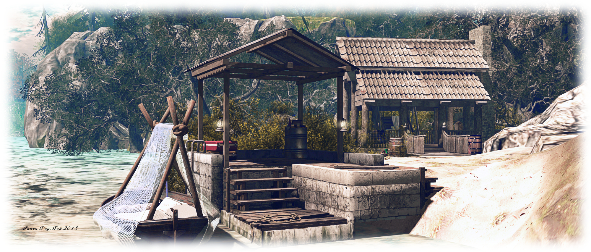
Throughout this setting are a number of places visitors can sit and enjoy the scenery, from the gazebo mentioned above, to bench seating and parasolled tables in the village square, to places like the folly and its swing and shady spots on the beach. There’s even an off-shore vantage point offering a bird’s-eye view of the region, although whether it is supposed to be used or not is questionable; it’s positioned so close to the region edge, anyone finding it and sitting on it is in for a dunking when they stand!

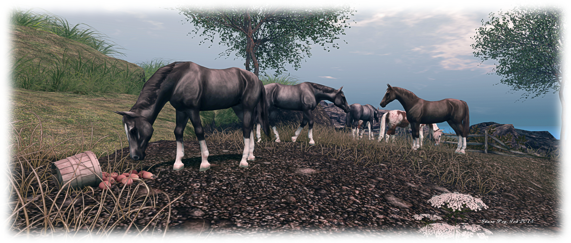
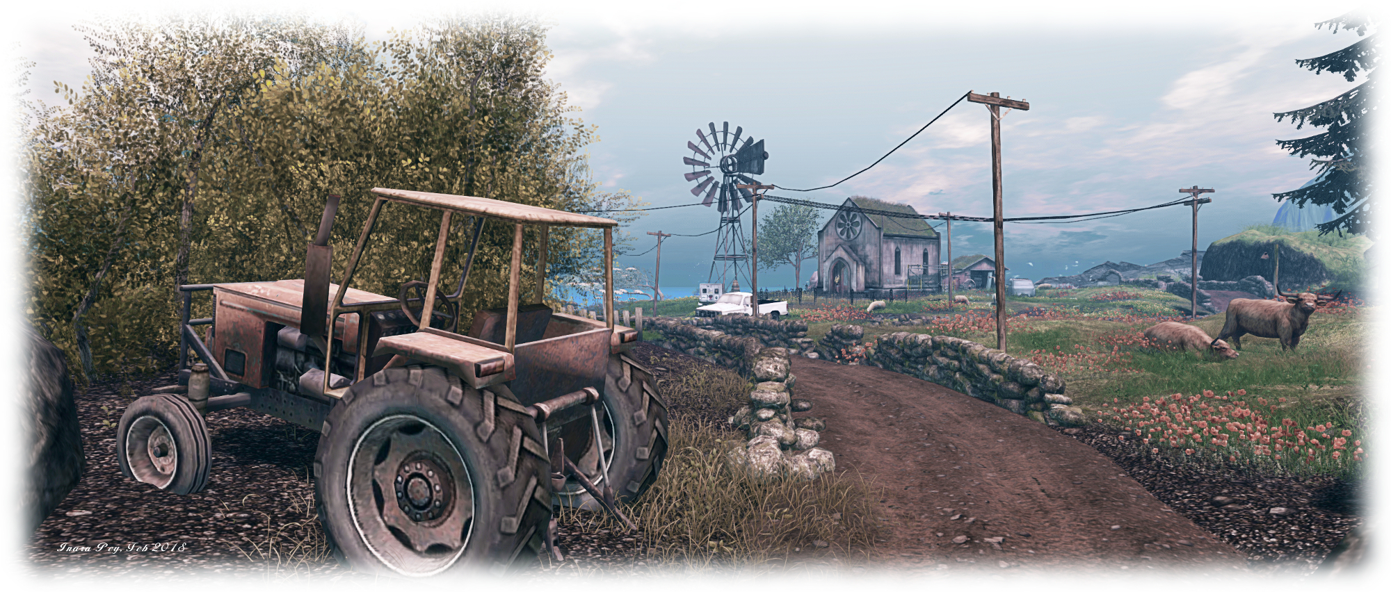
With March having arrived, and the promise of spring sitting on the horizon for those of us in the northern hemisphere – or the danker days of winter for those in southern climes – La Vie’s current make-over reminds us of the promise and delight of warmer, sunnier days and the opportunities for countryside walks or lazy afternoons on the beach.

La Vie

Another beautiful setting by Krys and Arol, and a perfect destination for those seeking somewhere to go.

SLurl Details

  • La Vie (La Vie, rated: Moderate)

A little more tee in Second Life

Angel Manor: always an amazing visit and for those trying SL golf for the first time, an excellent introduction to the game?

Caitlyn and I have been dabbling on-and-off with golfing in Second Life. Our preferred base of operations has been the AERO golf club, simply because it is so relatively quiet (see Teeing off in Second Life for more). However, there are many places in SL where a round or two can be enjoyed. So many, in fact, that there are doubtless favourites for many who enjoy the sport  – just as those coming into it for the first time might feel a little overwhelmed. Not just by the breadth of choice, but also by the prospect of trying to get around an entire 18 holes.

Of course, you can always break your round down over a couple of sessions: find a course and do the first nine, say, then come back and complete the back nine another day. Or, if that doesn’t appeal, you can always try a smaller course – such as the one at Angel Manor. Here, on the south side of Kaya Angel’s magnificent 12-region estate centred on his stunning manor house, can be found a delightful 6- hole course which can serve as an excellent introduction to SL golf.

Set within Angel Manor Park, the course covers just over half a region, and can be played using most golf systems. Two systems are provided at the tee for the first hole: Fa Nyak’s basic system of club and HUD (provided free and works for about a day), and the CrowleyCorp Elite golf system. The latter can be purchased outright from the vendor boards, or “rented” for L$10 per 16 hours (real-time).

One of the six fairways at Angel Manor Park

Fa Nayak’s system is more than adequate for more casual golf play in SL: everything is HUD-driven, with three basic clubs provided: driver, wedge and putter. The CrowleyCorp system is more sophisticated: HUD-driven again, it provides a set of 12 clubs: driver, 3 woods (1, 3, 5), five irons (5-9), a pitching wedge, a sand wedge, and a putter. In addition, the HUD provides options for adjusting the club size for a better fit with different height avatars, a range of camera options, a built-in power meter, a spinner for adjusting backspin on the ball,  and an animation suite (tee-up, walk to ball, drop ball, holster / unholster club from bag, if used).

Which of the two systems you play with is a matter of choice: Fa’s is the simpler of the two, and avoids the need to have to worry about fiddle-farting with options and settings – useful if you are just starting out. The CrowleyCorp system offers a more “realistic” approach to play, although with respect to the Angel Manor course, it probably really doesn’t come into its own, the holes all being relatively short par 2 or par 3 affairs with few obstacles which have to be worked around.

Both systems also offer the same basic play: select your club – such as the driver (which will also tee you up) –  then checking the particle wind indicator and noting the ball’s direction of flight as indicated by the arrow marker overlaying your ball. The LEFT / RIGHT cursor keys can be used to adjust the latter, and to compensate for winds cutting across the ball’s line-of-flight (headwinds and tail winds are handled through the power of your stroke).

The Fa Nayak HUD (l) offers the essentials for good game play without overwhelming the novice. The CC Elite HUD (C) offers a broader range of clubs (on the right) and additional gameplay and animation options. Selection of wood, iron or wedge opens a further sub-menu of options (r), requiring a greater degree of familiarity with the function of the various clubs

When your shot is aligned, it is then a case of pressing and holding the LEFT mouse button and monitoring the power behind your swing. This is indicated by the power meter on the CrowleyCorp HUD, or in-world with the Fa Nayak system, which uses a hovertext indicator. Judge the amount of power to put into a swing takes practice – and be wary of holding the mouse button down too long as the power meter reaches full strength (when needed), as this can over-drive your swing and lead to unexpected results. Then, note where your ball falls, may way for your companion players, before continuing down the fairway and to the green, selecting your clubs as required by each stroke.

Given their relatively short par lengths, the six holes at Angel Manor can be completely pretty easily, avoiding a round from becoming too drawn-out. As noted the obstacles are pretty limited, but it is still possible to get into the odd spot of bother which can make things fun. But, as a gentle introduction to golf in SL, the compact size of this course makes it pretty ideal – while the choice of systems available for play gives newcomers a good feel of what to expect on other courses.

Both systems use essentially the same approach to play, including swing direction indicators. note my camera is deliberately slewed to take this picture, and is not representative of gameplay camera positioning

Nor is this the only fun to be had in Angel Manor Park. Sitting in the middle of this little 6-hole course is a clay pigeon shooting system. Free-to-play, this is a qualification-based game: each round comprises 40 clays, with a minimum number which must be hit each round (e.g. 10 in the first), to progress to the next round. At the same time, the frequency and number of clays released each time increases, and the angles of release can become more and more divergent.

I’ve played this type of game in SL before (in fact, a really old, and no longer functional system is buried in my boxed inventory). Some require the payment of a basic fee to play, others are free – the Angel Manor system, created by Abramelin Wolfe – is free to play. Just get a shotgun from the board and touch the trap to start a round and go to Mouselook to shoot (left-click). My one minor niggle with this system is the gun has unlimited ammo: hitting the clays is a matter of blasting away as fast as possible, rather than making shots count in the knowledge you have to “reload” every 2 shots. But – it’s still fun to play.

So, if you’re looking for a gentle introduction to SL golf located within a eye-catching environment (and one of the grid’s most famous and stunning destinations) – and which offers something “extra” in the way of fun (blasting clays out of the sky), Angel Manor park could be just the ticket. And don’t forget – there is the manor and its public grounds awaiting exploration as well!

SLurl Details

Bay of Dreams in Second Life

Bay of Dreams; Inara Pey, February 2018, on FlickrBay of Dreams – click any image for full size

Bay of Dreams is the Full region home of Valor Poses Mainstore and Photo Sim, operated by Keegan Kavenagh (AlexCassidy1), and designed on his behalf by inertia (Caridee Sparta) of Neverfar fame. This latter point alone should have anyone seasoned SL travellers adding Bay of Dreams to their list of places to visit, whether or not they are on the look-out for poses; as with Neverfar (about which you can read more here), the region is an eye-catching and involved design.

No landing point is set within the region, but a good place to start explorations is in the courtyard before the main store, tucked into the south-east corner. A large church style gate stands guard over the store area, separating it from the rest of the region, large gates ready to be opened or closed as required. A teleport board sits just beyond this, offering a choice of 10 destinations for those keen to start seeing the sights. These destinations include both the ground-level store and its skyborne Adult annex – a minor niggle here being there wasn’t (at the time of our visit at least) a TP point to easily get back to ground level from the latter. Also, as the board only delivers you to a location, we’d suggest it is actully better just to use shanks’ pony from the get-go, and explore on foot.

Bay of Dreams; Inara Pey, February 2018, on FlickrBay of Dreams

Veer left from the teleport board, and the route takes you through the ruins of a stone-built structure shouldered on either side by blocks of unhewn rock. Two arches stand at the end of the ruins, one offering a path down to a beach watched over by great trees with trunks bent with age to where a board walk cross shallow water to a smaller island. The other arch offers a path to where two old houses stand  above the beach, each reached by its own steps cut into the living rock. Both appear abandoned, and a rough, grassy path arcs between them, passing round a little copse of trees standing between them.

The larger of these two houses sits with its back to a deep gorge cutting south-to-north through the land, a sandbar at its southern extreme preventing the sea from completely splitting the region. A wreck of an old plane lies on the sandbar, and a path from the smaller of the two abandoned houses offers a route over the rocks above the edge of the gorge to where a set of steps drop down to the beach and ‘plane wreck. Alternatively, a wooden bridge spans the gorge from behind the larger of the two houses, linking it with the broad, stepped plateau on the far side. Here, past the windmill and tree house, up the wooden steps and with a little scrambling over rocks, you might find yourself at the front door of the largest house on the island, looking imperiously down at the rest of the scene.

Bay of Dreams; Inara Pey, February 2018, on FlickrBay of Dreams

A second bridge, wide and gated two-thirds of the way along its length, spans another watery charm splitting the land. It offers the way to a grassy shoulder of rock where visitors can either opt to go by way of log bridges down to a secluded beach and beach house, or use a switch back path cut into the rock to descend to where the wrecked aeroplane awaits.

The smaller island to the north-west and mentioned earlier, appears to have once been a centre of commerce. A lighthouse and a huge warehouse rise from the rocky base of the island, vying with one another to be the tallest. Old wharves extend out into the waters from their feet, and two old trawlers are moored in the shallows. But whatever went on here has long since ceased: the buildings are decaying slowly, the wharves falling apart, the waters beneath them fast becoming choked and overgrown with grass and weeds, while falling trunks of great fir trees now pin the old boats under their weight.

Bay of Dreams; Inara Pey, February 2018, on FlickrBay of Dreams

Whether the trees fell due to age, or were cut down might be a matter for debate. However, there is plenty of evidence for them having been brought low by storm and wind to be found elsewhere, while the heavily bent trunks of other trees suggests this is a place subject to extremes in wind, further suggesting it is the elements which are responsible for the damage.

With its rugged outlook, scattering of houses, store and old fishing centre, Bay of Dreams is a visual treat. For those who would like to tarry a while, there are numerous places to sit – indoors and out – to be found, and for photographers, rezzing rights can be enjoyed on joining the local group, although you might want to twiddle with Windlights.  Our thanks to Shakespeare and Max for pointing it out to us!

SLurl Details

The rugged beauty of Cuivieenen in Second Life

Cuivieenen; Inara Pey, February 2018, on FlickrCuivieenen – click any image for full size

Cuivieenen is the name given to a fabulously rural Homestead region designed and presented to Second Life users by Personal Jesus (Alexynophus). We were pointed towards it by Shakespeare and Max (TY, again!), and recently spent a pleasant evening wandering along its roads and paths, discovering its little nooks and crannies and spending time sitting and enjoying the scenery.

The landing point sits just off the region’s centre, just outside an old stone chapel. Where you go from here is – at first glance – a matter of following the unsurfaced roads running through the region, north-to-south, and winding westwards. By just keeping to these roads offers visitors a lot to see: the chapel surrounded by a small farm: cattle, chickens and sheep roam immediately outside of its walls, the wrought iron fence that might once have set it apart from their wanderings having long since have fallen or been removed over the years. And old barn sits behind it, while the role of pastor appears to been given over to a scarecrow, watching over his flock.

Cuivieenen; Inara Pey, February 2018, on FlickrCuivieenen

Turf-roofed cottages sit facing the chapel on two sides from across the roads, dry-stone walls guard the roads, while to the west what might be an old quarry awaits discovery. With each of the cottages being furnished, the exceptional care taken with the landscaping elements, this alone means Cuivieenen offers a lot to see – but keeping to the roads and just hopping into the cottages will reveal everything. For example, walk eastwards past two of the cottages to where the land drops rocky shoulders to the waters below, and you’ll find a path descending to a wooden board walk, which in turn offers a way to a small island  topped by a folly with a special welcome waiting inside.

Make your way around the coastline, and you’ll find other places to explore – the cinder beach to the north, the shallow and deep inlets to the south-east and the south, each of which offers a further eclectic feel to the region, be it through the Norse long-boat, or the Gothic alcove and ancient standing stones (with their retinue of cormorants).

Cuivieenen; Inara Pey, February 2018, on FlickrCuivieenen

Between these, up among the rocks are little places for couples to enjoy: a blanket and pillows spread under a tree, and old cart also with blankets spread in its bed; the ruin of an old boat converted into a shaded rest point on a cinder beach, the canoe floating on the waters of the quarry, or the motorboat moored at the foot of a set of iron stairs descending the northern cliffs. More cosy spots for sitting / cuddling can be found inside the region’s old barn, the ruins of a lighthouse and in the cottages – all of which adds a certain intimacy to any shared visit.

A nice touch with Cuivieenen is the way in which it has been blended with part of a sim surround. This very much gives the impression the region is something like a headland, that beyond the mountain behind it lies more land awaiting discovery. When you bring all of this together – the use of the sim surround, the overall care shown in the region’s design and the attention to detail evident in everything, large and small – Cuivieenen emerges as a place with a huge amount of depth. Although – and I say this cheekily and not as a critique – I had to agree with Caitlyn when she noted the landscape naturally leant itself to a cave or two for explorers to find.

Cuivieenen; Inara Pey, February 2018, on FlickrCuivieenen

One of the things I do when visiting a region is try to imagine where in the physical world it might be. In the case of Cuivieenen, I could not help but be put in mind of Iceland: the rugged landscape, cinder / lava like soil, sparse tree coverage – even the turf-roofed cottages – all put me in mind of various parts of Iceland I’ve been fortunate enough to visit, most notably the Myvatn region.

But howsoever you regard Cuivieenen in relation to physical world locations, its own beauty and design mean it not a place to be missed when region hopping across Second Life.

Cuivieenen; Inara Pey, February 2018, on FlickrCuivieenen

SLurl Details

A return to Chamonix City in Second Life

Chamonix City

With the 2018 Winter Olympics, officially known as the XXIII Olympic Winter Games running from February 8th through until February 25th, 2018 at Pyeongchang County, South Korea, a tweet from fellow SL traveller and writer, Erik Mondrian reminded me that Second Life also has its own winter sports venue in the form of six regions centred on Chamonix City on the Full region of Cross Check. It’s a place I last visited back in 2014, so the current games  and Erik’s tweet put me in the mind to hop back and have another look, and see what may have changed.

Chamonix City  – a reference to the location of the first Winter Olympics Games, held in 1924 – encompasses two of the six regions of this winter sports venue – Cross Check and Neutral Zone. They are bracketed by Breakaway to the west and Off Sides to the east, with Empty Net and Blueliner to the north and south respectively. Within these regions, the facilities on offer are extensive, and can be found both on the ground and up in the air. The city itself is dominated by two huge ice hockey arenas – the Brooks Arena on Blueliner, and the impressive Cleary arena, which straddles the northern part of Cross Check and most of Empty Net. Home to the Chamonix Pandas, Cleary arena also offers 10-pin bowling on the lobby area and one of a number of teleport stations which can be used to hop around the facilities scattered across the six regions.  This includes a direct TP to Brooks Area – although the walk across town is pleasant enough, or there is a subway option, with stations just outside of both arenas.

Chamonix City – Caitlyn tries her hand at curling

Directly behind Brooks Arena is the main curling hall, with four ends available for players. To be honest, some instructions would not go amiss – for example: is actually possible to sweep, and if so, how? However, game play is pretty much as per the physical world game – trying to slide your team’s stones as close as possible to the centre of the house, whilst also seeking to block / eliminate your opposition’s stones. When playing, make sure you wear at least one of the coloured brooms from the free pack available at the top house of each end – order of play is based on who is wearing the broom matching the colour (red or yellow) of the first stone to appear before the hacks (chocks). Clicking on the hacks will position the player and place them in Mouselook, then it is a case of taking aim (use the crosshairs HUD if required), then press and hold the left mouse button to deliver the stone – the longer you hold the button, the more momentum is delivered to the stone, and players should be wary of delivering too much momentum and carrying their stones out-of-bounds.

A faster pace of event can be found in the sky over Breakaway, where the speed skating arena resides.   Slip into a suitably aerodynamic suit, don your skates and then click on one of the speed skating rezzers located around the rink to get started. For those who prefer, there’s an indoor speed skating rink right next door to the outdoor arena. This is smaller and tighter, and requires a certain amount of skill to get around.

Chamonix City Park

Breakaway is also the home of the ski jump and alpine ski run for those who love sports skiing. Comprehensive instructions are given for the ski jump, and skis are available from the rezzer at the back of the jump’ s start. Sadly, the alpine ski rezzer appeared to be out of commission during our visit, so reacquainting myself with that run wasn’t possible.

Offsides, meanwhile, is the home of the snowboarding and bob-sleigh runs. However, at the time of our visit, while the rezzers (boots and board) worked OK for the former, the rezzer for the bob-sleigh also appeared to be out-of-action.

Chamonix City ski jump

At the time of my 2014 visit, there was a practice area in the sky over Neutral Zone, which included a figure skating rink. Since then, things have changed and this sky area is now the home of a go karting track, speedway circle and a Warbugs flying area, offering a set of alternatives to the winter fun across the rest of the regions. I’m not sure if this means the practice area and figure skating rink have been relocated – but I did have (an admittedly fast) hop around and attempt to find them, with no joy – and none of the teleport boards I found and tired led me to them.

A collaborative build, led I believe, by Kacey Rossini, Chamonix City provides a venue rich in winter scenery containing a lot of sports activities which can be enjoyed as a pert of a shared visit, with options as well for exploring the little town centre, having fun flying Warbugs or simply riding the cable cars.

SLurl Details

  • Chamonix City (Cross Check, rated: General, as are all six regions)

A double helping of Soul to Soul in Second Life

Soul2Soul River; Inara Pey, February 2018, on FlickrSoul2Soul River – click any image for full size

In January, MiaRiche Resident dropped me a line inviting Caitlyn and I to visit Soul2Soul River, a public / private homestead region designed and operated by Minnie Blanco (Minnie Atlass). It’s actually one of two Homestead regions Minnie has landscaped and offers for both public visits and private rentals, the other being Soul2Soul Bay.  Both are inspired by part of Minnie’s native England – and as such, have a particular attraction for Caitlyn and I.

Minnie describes Soul2Soul River as a reflection of the Thames River – although those unfamiliar with the full length of Old Father Thames may not recognise this at first glance, the Thames being popularly associated with London more than anywhere else. However, as the longest river rising and flowing entirely through England, it has many faces, its youngest being in Cotswolds district of Gloucestershire where the Thames rises – and it is this which forms the inspiration for Soul2Soul River.

Soul2Soul River; Inara Pey, February 2018, on FlickrSoul2Soul River

Given that Second Life regions are relatively small, representing a decent stretch of a river running through them isn’t easy without introducing a lot of twists and turns – and potentially reducing the width of the river itself, making it less of a focus. Minnie has sought to avoid this by dividing the region into four parts split by water. This way, when exploring, one can get the feeling of looking and walking along three stretches of a single river.

A visit starts at a small village landing point which might be referred to as “classically Cotswold”. Thatched cottages sit alongside a countryside pub, overlooking a stretch of river guarded by willows and bordered by reeds and flowers. A bridge spans the water to where a footpath runs around the south side of the land, offering a riverbank walk which loops back to a path cutting over the hill to the far side, and another bridge linking to the western side of the region – which is home to one of the rental properties, so please keep privacy in mind if you cross the bridge.

Soul2Soul River; Inara Pey, February 2018, on FlickrSoul2Soul River

A second path runs along the riverbank on the far side of the river to the village, offering views back towards the bridge and pub. It’s open to the public, but be aware that again it does run around to rental properties. Further retails are scattered along river banks, all positioned so that they can enjoy a degree of privacy from one another, and with enough room between them to offer space to explore.

Soul2Soul Bay takes its inspiration from the Cornish coastline, offering a little beach bay and a village – which again forms the landing point, complete with old chapel on the hill. A track runs down the hill from the village to the beach front and the sweeping curve of the bay’s C. The sand here offers a route around the region, passing the scattered rental properties.

Soul2Soul River; Inara Pey, February 2018, on FlickrSoul2Soul Bay

Getting around on foot is easy, but for those who prefer, there is a bicycle rezzer opposite the post office (rentals office) allowing visitors to take a ride around the region’s public areas. There are also several places to sit and rest from walking or riding, including on a number of rowing boats moored in the bay and deck chairs in the sand.

Visiting both Soul2Soul regions, I admit to being a little more attracted to Soul2Soul River – but this is primarily because I have an affinity for the Cotswolds, and really enjoyed the views along the river.  The truth is both Soul2SoulRiver and Soul2Soul Bay are picturesque and make for a relaxing visit. Those looking for a home within themed regions might also find them well worth a visit, while photographers will find both regions attractive to their cameras.

Soul2Soul River; Inara Pey, February 2018, on FlickrSoul2Soul Bay

SLurl Details