The Missing Whale in Second Life

The Missing Whale; Inara Pey, February 2019, on FlickrThe Missing Whale – click any image for full size

Note: Missing Whale is now closed. SLurls have been removed from this article.

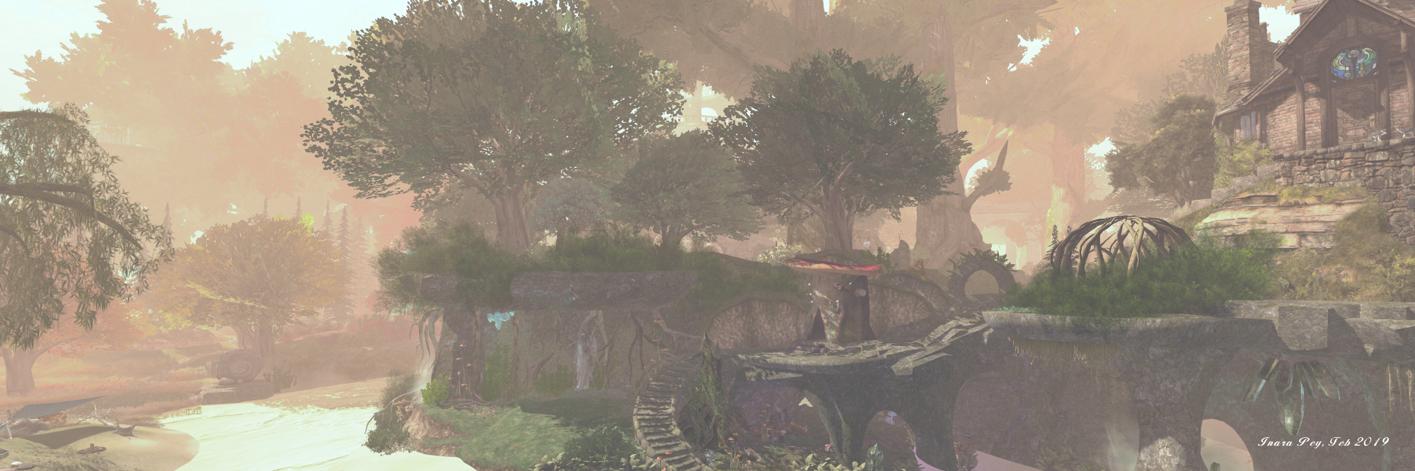
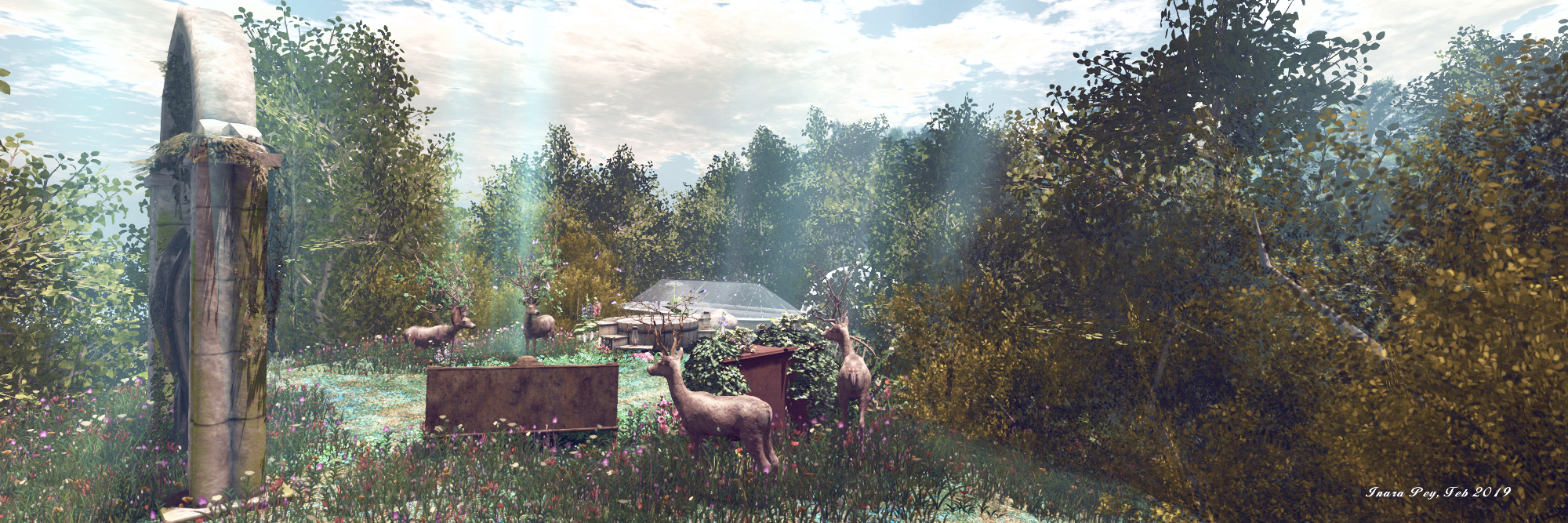
We were recently passed the landmark to The Missing Whale by Shakespeare, and decided to pay it a visit. Designed by Lotus Mastroianni and Fred Hamilton (frecoi), it’s a homestead region with a touch of the wild side about it, complete with an eclectic mix that adds to its depth.

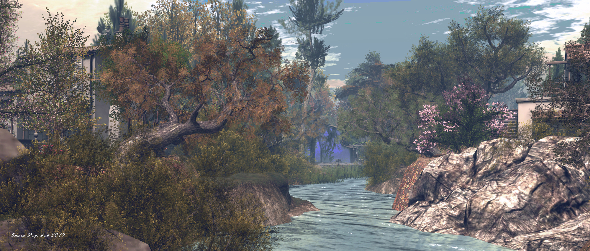
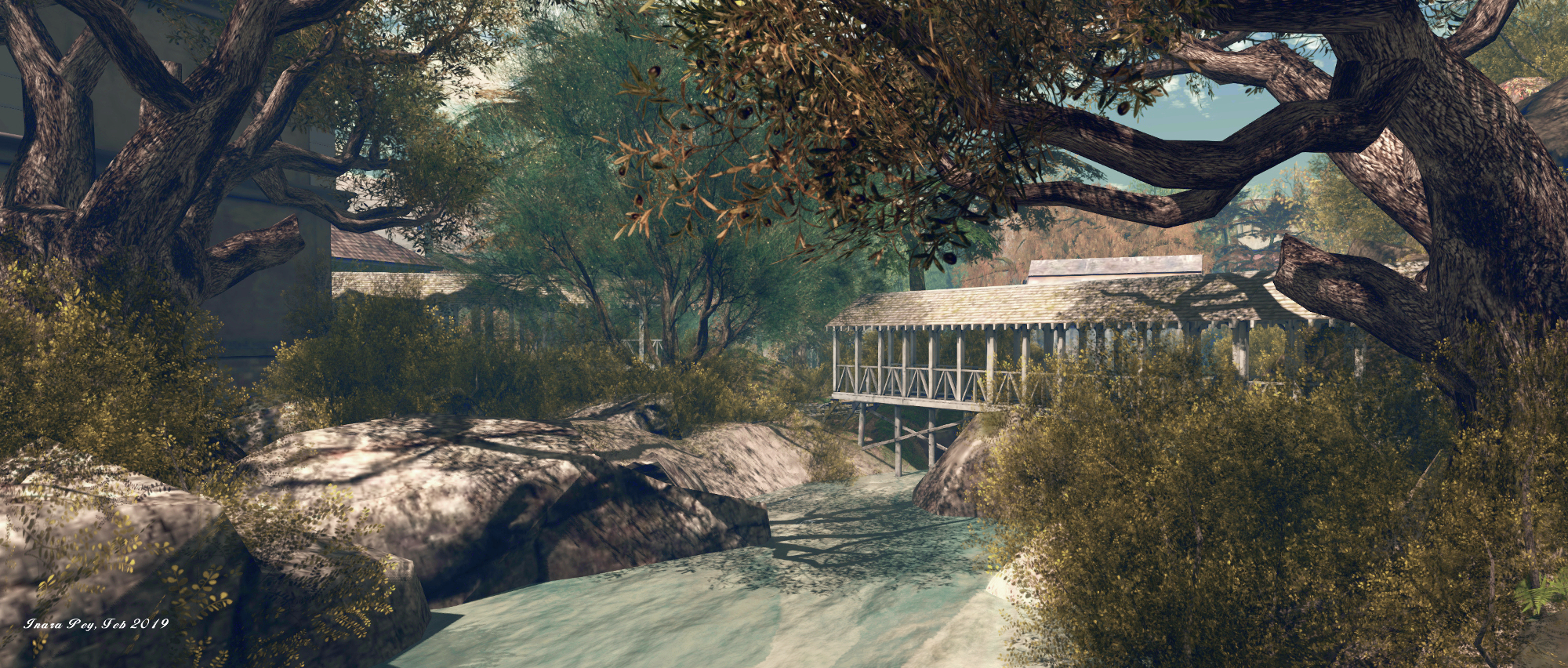
Backing directly onto a lush green sim surround, the region presents a feeling of being somewhere in a rain forest; a place built on the edge of a modest lake that feeds into a river that meanders away westward into the hills, and which is in turn fed by the broad falls that tumble from the hills to the east.

The Missing Whale; Inara Pey, February 2019, on FlickrThe Missing Whale

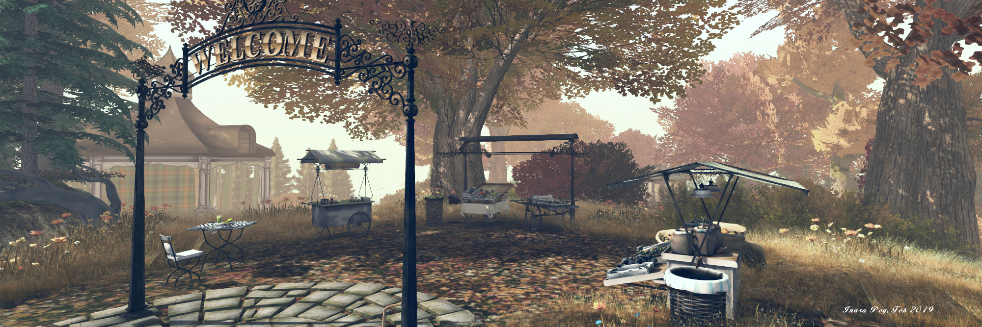
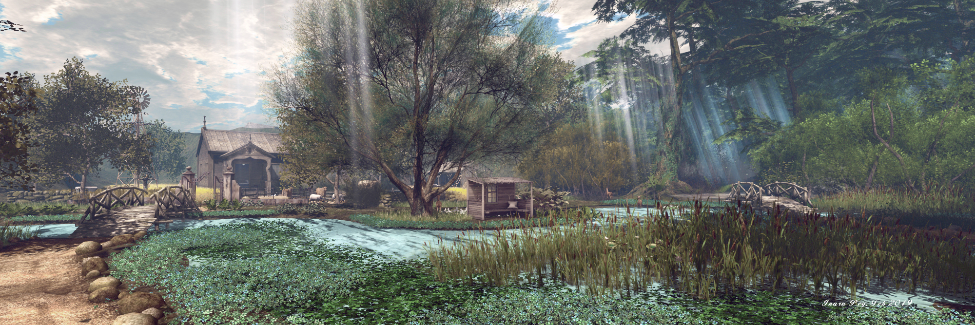
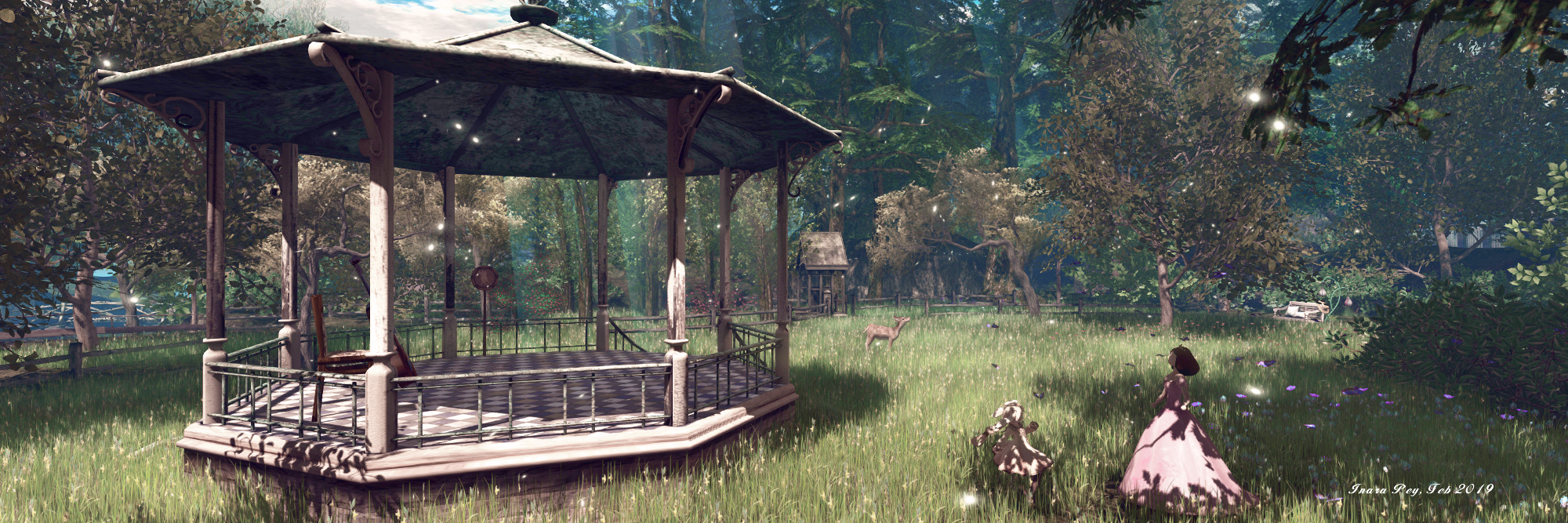
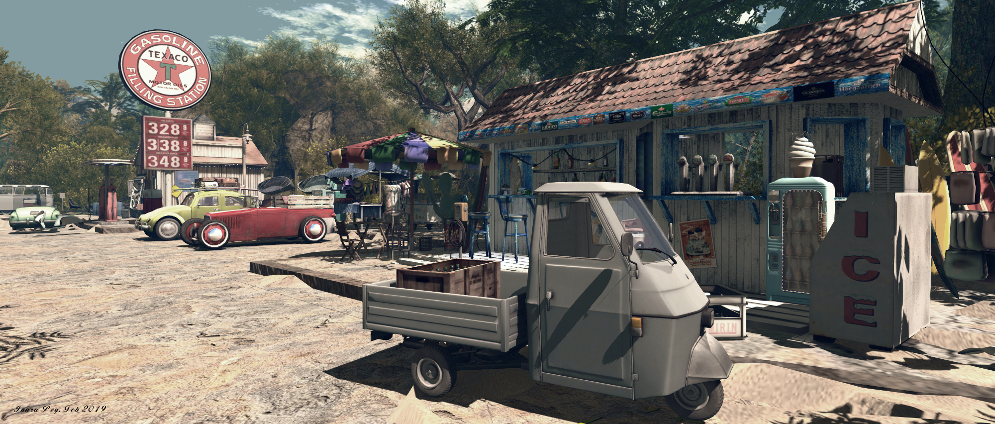
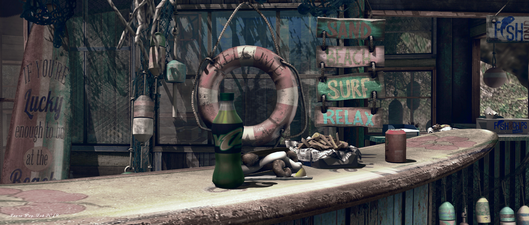
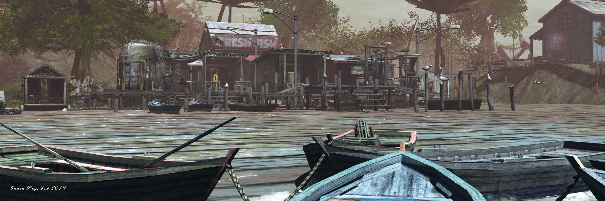
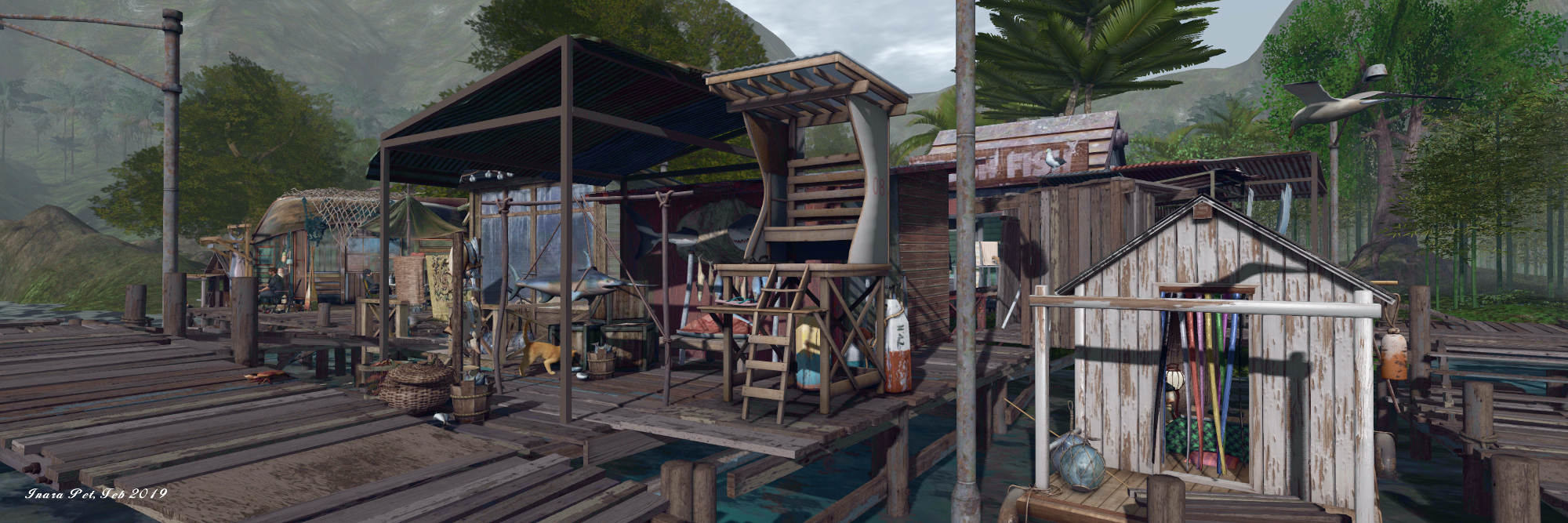
The landing point is in a small fishing shanty built out over the water. Music drifts through the air, the tunes and quality of which might suggest we’re caught in the 1930s; however, the televisions inside the huts of the shanty suggest a much later period. Perhaps the music is from a record player and innocent enough; but the contrast between the music and the presence of the televisions (and surfboards!) is the first in a series of mixes that make the Missing Whale such an interesting curio awaiting exploration.

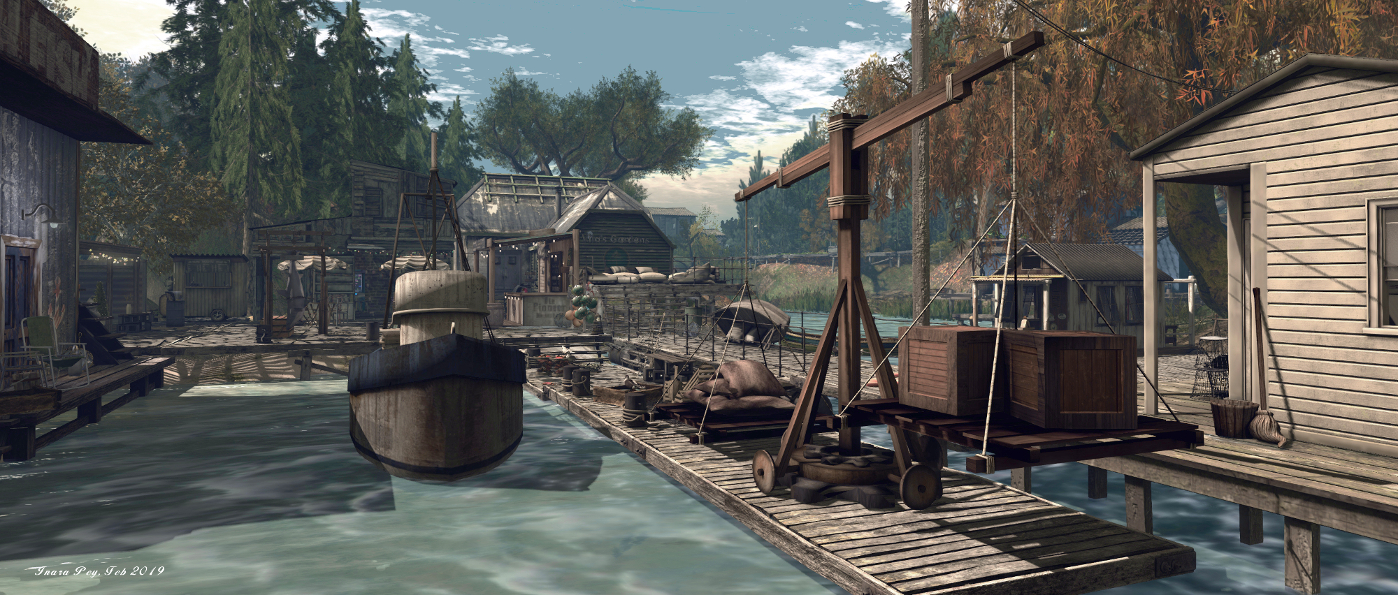
Raised board walks links the various huts and buildings of the village, and provide a route up onto dry land in one direction and, by way of a river crossing to the local store in another. The store is stacked with a range of produce, western meats and cheeses, oriental beer – and the opportunity for a game of pool. It appears to sit as the Last Friendly Store where explorers can gather supplies before delving into the interior.

The Missing Whale; Inara Pey, February 2019, on FlickrThe Missing Whale

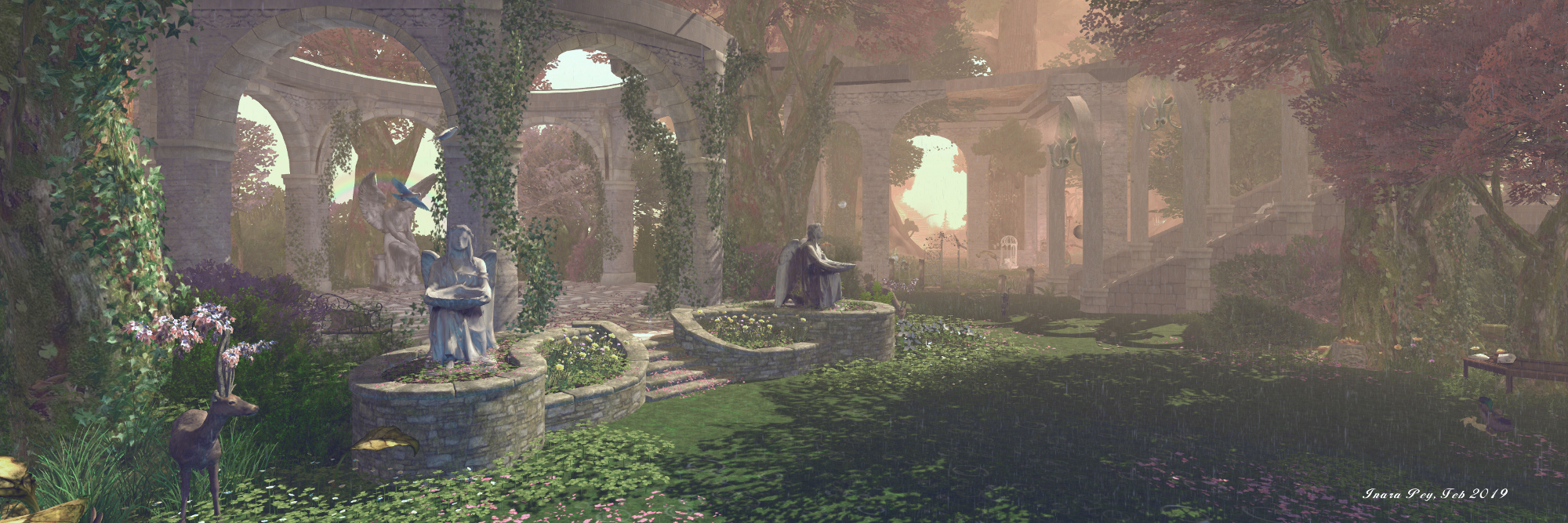
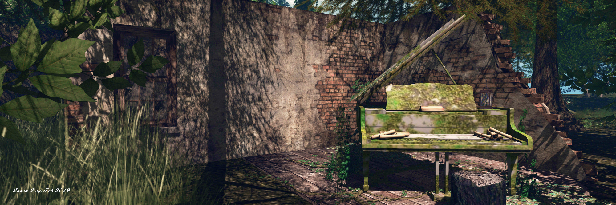
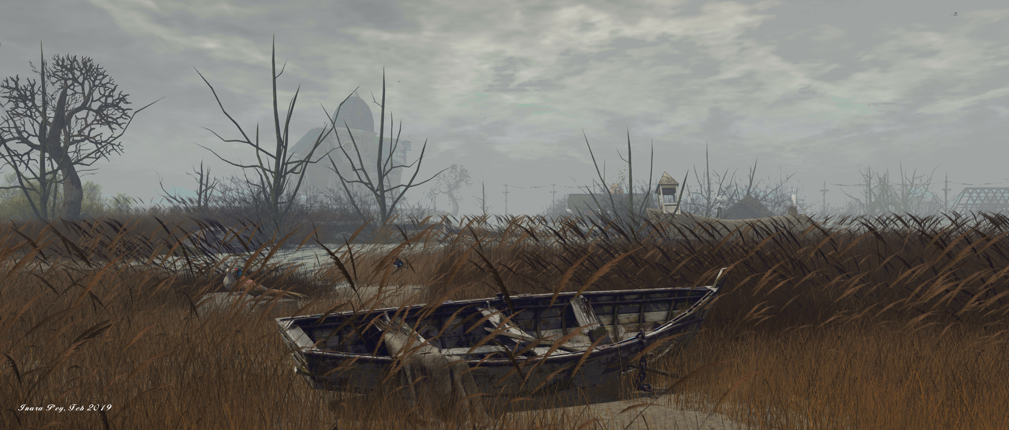
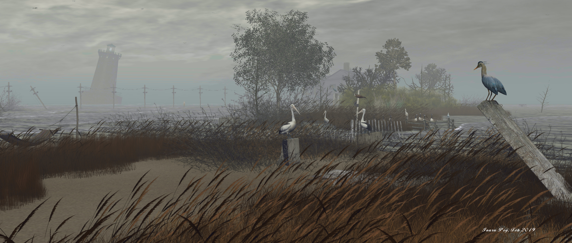
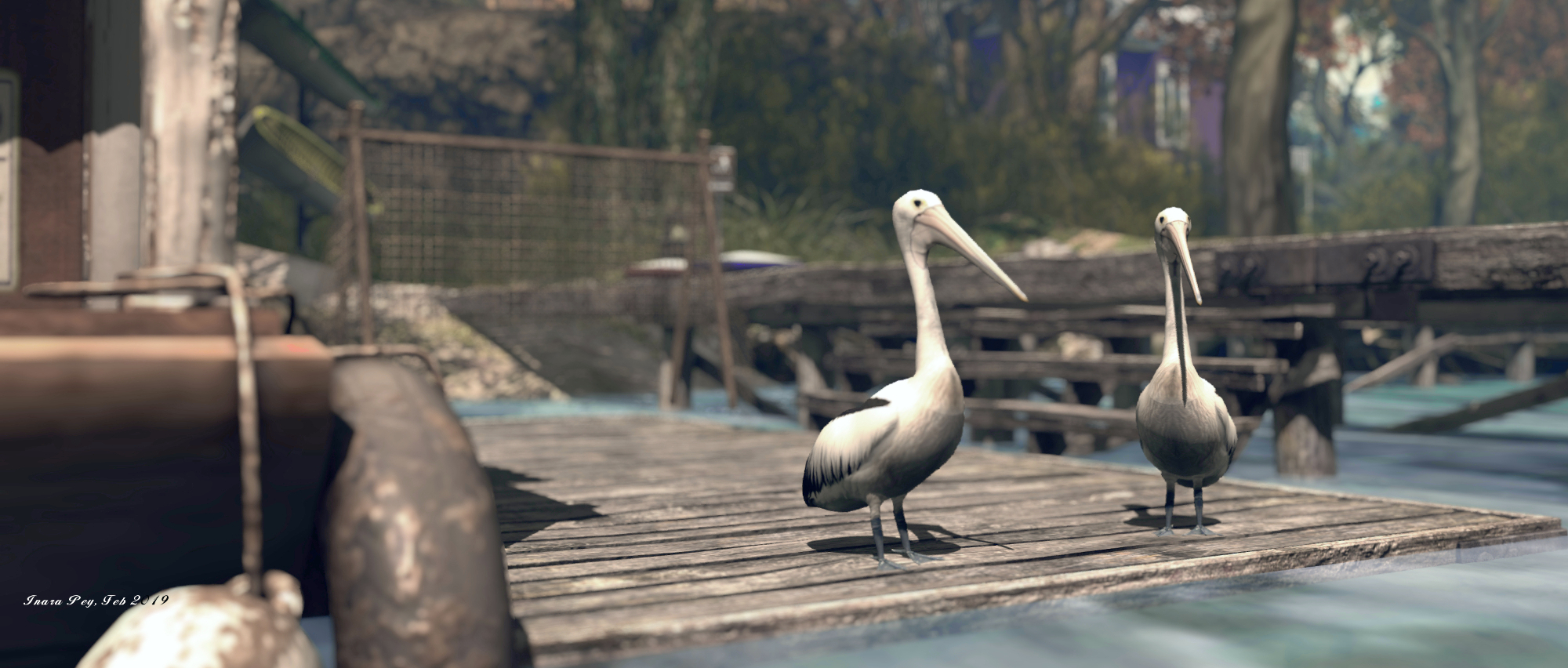
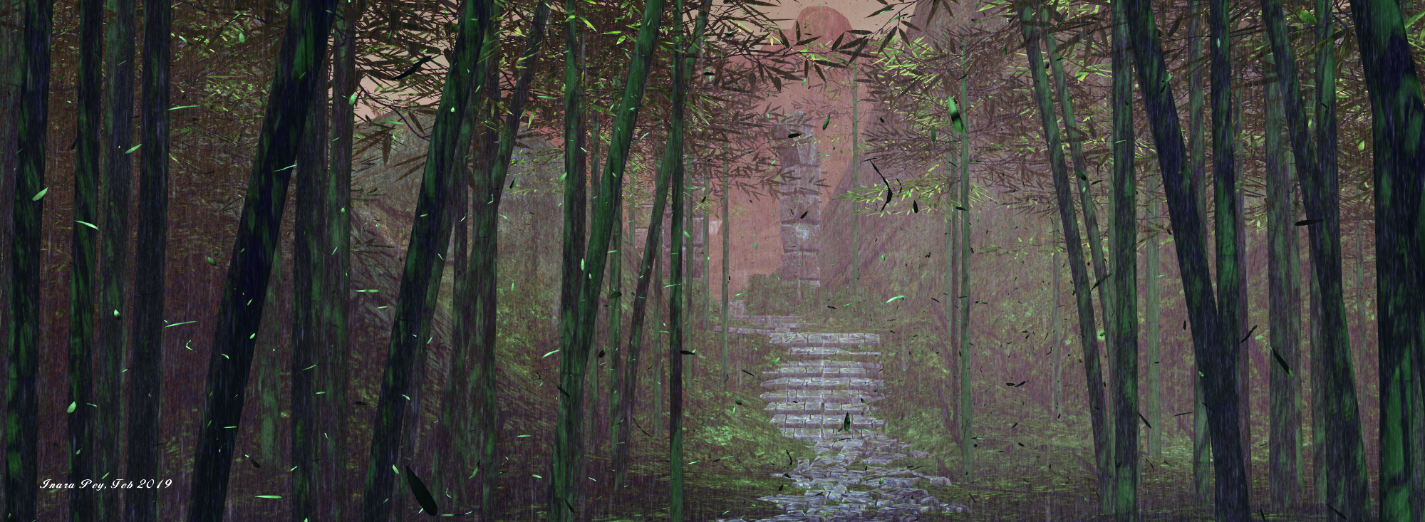
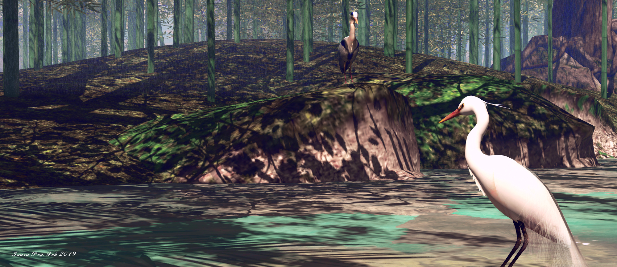
Beyond the little village, the landscape becomes more rugged  – and wet. Rain falls over a bamboo forest, water flows down over rocks and through pools to a broad channel cutting the land. Ruins lie close to this river, watched over by a tiger, offering a suggestion that perhaps we’re in the rain forests between India and Myanmar. But then, up on the rocky foothills beyond, African elephants bathe in the waters of the large, waterfall-fed pool. Thus we have another anachronism (although admittedly, it might simply be the result of Indian elephants being a little less popular with creators than their African cousins).

Even so, whether deliberate or forced by circumstance, the clash between tiger and elephant adds further mystery to the region. The Asian influences can be found elsewhere as well; there is more than one tiger in the region awaiting discovery, while stone and copper Buddha heads can be found as well. Similarly, the region has a number of oriental / Japanese style structures waiting to be discovered, both down among the trees and up on rocky plateaus, mixing things further.

The Missing Whale; Inara Pey, February 2019, on FlickrThe Missing Whale

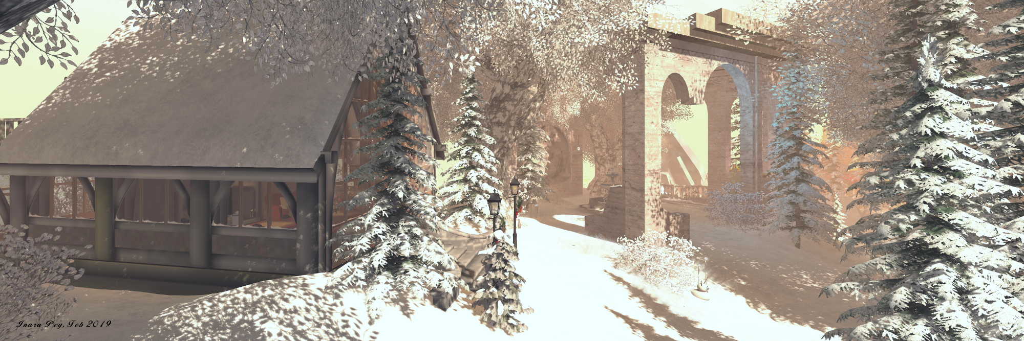
There is also an edge of danger to the region – as evidenced by the wreckage of two downed aeroplanes in the hills and a boat driven against the rocks in one of the river channels. This channel holds within it a little beach; although the path to it is not entirely obvious, even if it is signposted when you find it 🙂 . As an alternative, the daring could scramble down from the high rocks holding the beach in their curve.

If I’m totally honest, I’m not sure the selected region windlight shows the setting to its best advantage, and I would suggest playing with options for photography. Also, there are one or two areas where the is a lot going on which can impact viewer performance (depending on your system & settings, obviously). I found the walk through the bamboo forest in the rain pretty heavy going thanks to the rain, the motion of all the bamboo in the breeze and the atmospherics; hence again why playing with windlights can help.

The Missing Whale; Inara Pey, February 2019, on FlickrThe Missing Whale

But, this shouldn’t deflect you from a visit; the Missing Whale makes for an attractive visit.

The peace and seasons of Angelhaven in Second Life

Angelhaven; Inara Pey, February 2019, on FlickrAngelhaven – click any image for full size

Angelhaven is an artists’ concept of the natural wheel of change, beautifully expressing the seasons around us and within us. A haven for angels, winged and unwinged, and those searching for romance, peaceful prayer, and the things that comfort and remind us we are only human. Happy or sad, lonely or in good company, love and loss, life and death, there is a time and a season for all things.

– Angelhaven description

Angelhaven; Inara Pey, February 2019, on FlickrAngelhaven

So reads the description for the Full region of Angelhaven,designed and held by Vangel (VanderGalaeth). As the description suggests, this is a place for reflection, a natural setting that encompasses the beauty of nature and the realm of fantasy. It is also a place that exists on multiple levels, starting with the landing point  1,000 metres above ground level.

Here, visitors will find the rules for visiting the region – all of which are straightforward and understandable. Also available by touching the rules board, is a note card outlining all the major destinations within the region, each with its own land mark enclosed. However, these can also be reached via the teleport disk located at the end of the short hall leading off the main arrivals hall.

Angelhaven; Inara Pey, February 2019, on FlickrAngelhaven

Several of the locations can be found on the ground – including the Ballroom, the Café, the four seasons and the Swamp. Others are located on their own islands in the sky, such as the Lunar House, the Angel House, and the Solar House. Given the fantasy nature of the region, the windlight offers an ethereal look and theme: a pervasive orange glow surrounding the land and sky islands.

Those locations on the ground are linked one to another by paths making exploration possible without necessarily resorting to teleporting. Walking also reveals all the little spots to be found for sitting, cuddling and simply resting.

Angelhaven; Inara Pey, February 2019, on FlickrAngelhaven

The sky locations offer a nice feeling of further privacy and separation, while the similar nature of their appearance also helps give a sense of commonality between them, and thus a feeling of continuity as you travel one to the next, or between them and locations on the ground.

Finished with a fitting ambient sound scape, Angelhaven makes for a restful visit; a place where myth and fantasy mix gently with one anther to offer an environment open to being enjoyed and where tension can slip away. As noted, there are plenty of places to be found for couples to enjoy, as well as places to be appreciated in solitude.

Angelhaven; Inara Pey, February 2019, on FlickrAngelhaven

SLurl Details


In the Forest of Astray in Second Life

Forest of Astray; Inara Pey, February 2019, on FlickrForest of Astray – click any image for full size

The Forest of Astray is a Full region that offers a curio of a setting to explore, parts of which might be currently be under renovation.

Designed by 絵理子 (Eriko), this is a setting that, though a clever use of horizontal space and design, has the feeling of being far bigger than 256 metres on a side, and within which it is quite easy to become disoriented whilst exploring – just as you might in an actual forest.

Forest of Astray; Inara Pey, February 2019, on FlickrForest of Astray

Within the forest, the region is divided by streams and hills into a number of different settings, which are brought together by the paths and trails the meander under bough and leaf and over bridge and water, neatly sewing everything into a cohesive whole. Included within these settings are a farm, two houses, a beach and cabin, a fishing wharf with boats, gardens, old ruins of towers and houses, and walled Japanese house, glades where flowers grow and deer play, a reed-sided estuary fed by two streams, ponds and waterfalls, greenhouses-as-pavilions and more.

It is at the farm where visitors begin their journey, up in the north-east corner of the region. From here, a track hops over a bridge and winds outward and over a narrow channel of water to where a second bridge (which can also be reached by a grassy path running along the water’s edge)  leads the way into the forest proper.

Forest of Astray; Inara Pey, February 2019, on FlickrForest of Astray

Here the path winds between the trunks of giant oaks, the air alive with birdsong, the ground gradually becoming obscured by mist that becomes even thicker once another bridge has been crossed, and the sounds of piano might be heard. Follow the music and you’ll find an aged piano, its wood mildewed and mossy, sitting within the ruins of a building set on the far side of a path cutting across the one your on, presenting two routes of further exploration.

Take one, and you’ll be led by twist and turn lit by wolves carrying lanterns in their jaws, to the ruins of an old stone tower overlooking the junction of several streams. Take the other route from the piano and it will lift you up out of the mists before bringing you to a wall marking the boundary of a large property, the ground dropping sharply away on the other side into a fog bound bowl, reached via a pair of gates.

Forest of Astray; Inara Pey, February 2019, on FlickrForest of Astray

Here, under its own windlight and with rain falling steady, is a setting well suited to Halloween. Crows circle just above head height, strange figures loom out of the mists while the house stands as a shadow, old and decrepit, a strange (and decidedly sexual) tableau framed within its rotting walls, the upper floor given over to BDSM equipment.

If such a scene is not to your taste, simply pass the gates by and continue along the path outside of the wall and turn left at the point where it ends in a stone circle. A short distance across the grass you’ll find  a track lit by a scattering of luminescent confetti running down a short slope. The confetti points the way to where another grassy path runs by a glade of tall grass lapping around the feet of a pavilion; a place where a dance can be enjoyed. Stay on the path, and it will take you past – or to – the tower ruins, where it becomes the riverside route leading back to the wooden bridge crossed earlier.

Forest of Astray; Inara Pey, February 2019, on FlickrForest of Astray

A cobbled path runs along another side of the glade with its pavilion,  directing people through gabled gates to yet anther bridge, and thus to the southern aspects of the region. This offers even more to explore along winding paths: glades where angels might lie sleeping; gardens with hot tubs and dancing; hidden pools of clear water; the white frames and columns of the previously mentioned greenhouse and its companion pavilion – and more.

Choose the right paths here, and the rest of the setting will open to you, be it the bridge reaching back to where the Japanese house and onsen lie snug between wooded rocks and the sea, or the board walk reaching around a headland to the beach. A further path can be found, passing over stepping-stones and through a narrow gorge to where stone steps lead up to the south-east corner of the region, in which sits the largest house on the island, raised above the fishing wharf.

Forest of Astray; Inara Pey, February 2019, on FlickrForest of Astray

It is here – and on the beach – where indications that parts of the region might be under some remodelling were visible during our visit; furniture was floating over the beach cabin, while things around the house were in slight disarray (I’m actually not entirely sure whether the large house is supposed to be open the public; a request to Eriko for clarification passed unanswered; so take care with invading privacy while exploring, just in case).

Even with these little glitches, Forest of Astray makes for an engaging visit, with plenty of opportunities for photography and romance for those wishing to enjoy a dance.  The adult undertones aren’t restricted to the house in the north-west corner, some of which might not be wise for a Moderate region – but these also aren’t particularly overt enough to question a visit. Overall, this is a unique location and well worth a visit, one that is well worth setting aside to explore simply because there is to much to find and see.

Forest of Astray; Inara Pey, February 2019, on FlickrForest of Astray

SLurl Details

The lost islands of Chesapeake Bay in Second Life

Chesapeake Bay; Inara Pey, February 2019, on FlickrChesapeake Bay – click any image for full size

Update: in keeping with Serene and Jade’s approach to having their region designs open for approximately a month, Chesapeake Bay has now closed and the host region is under private holding. SLurls have therefore been removed from this article.

Serene Footman and Jade Koltai have opened their February region design – called Chesapeake Bay – and, given it is by two people who always produce the must stunning vistas in Second Life, it is utterly captivating.

Our latest sim is located in the Chesapeake Bay, an estuary in the US states of Maryland and Virginia.  The Chesapeake Islands are famous for the simple reason that they disappeared. Built on clay and silt, over the course of a century the islands were gradually submerged as a result of erosion exacerbated by sea level rise. They were the islands that sank.

– Serene Footman, introducing Chesapeake Bay

Chesapeake Bay; Inara Pey, February 2019, on FlickrChesapeake Bay – click any image for full size

For the build, Jade and Serene have focused on two islands in particular:  Holland Island and Sharps Island, with a particular focus on the former while blending features of both into a unique setting and memorial to both with all of the attention to detail and care in design that make their work among the best to be found in Second Life. As with all of their regions, this design carries within it a story – or rather stories. The first – and primary – story is that of the attempts of a husband and wife team to save Holland Island and the last remaining house standing upon it, all that remained of a place once home to over 400 watermen and farmers, and their families.

Stephen White, a waterman and Methodist Minister, first visited Holland Island when he was a boy. Years later, he was visiting one of the island’s three cemeteries when he saw an inscription on one of them.
The discovery inspired Stephen White to embark on a campaign to stop Holland Island from disappearing into the sea. He purchased the island for $70,000, and set up the Holland Island Preservation Foundation. For fifteen years, Stephen and his wife waged their own battle against the sea. Spending $150,000, they built wooden breakwaters, laid sandbags and carried 23 tons of rocks to the island and dropped them at the shoreline.

– Serene Footman, describing Stephen White’s attempt to save Holland Island

Chesapeake Bay; Inara Pey, February 2019, on FlickrChesapeake Bay – click any image for full size

The waters of the Chesapeake were not to be held back, however, and in 2010 that last house, originally built in 1888, collapsed, forcing the Whites to admit defeat and sell the island. The remnants of  that last house was completely lost to the waters of the bay in 2012.

Hoewever, for this incarnation and in recognition of the Whites’ attempts, the house remains, much as it appeared in 2010 after the initial collapse. It sits on the west side of the island, the carcasses of the vehicles used to try to shore up the land around it slowly drowning under the rising waters, watched over by sea birds and waterfowl.

Chesapeake Bay; Inara Pey, February 2019, on FlickrChesapeake Bay – click any image for full size

North of the Last House is an automated lighthouse sitting on a platform, marking the second story commemorated by the region: that of lighthouse keeper Ulman Owens. The light sits atop a platform once home to the Holland Island Bar Lighthouse, also built in 1888, and manned through until 1960, when the automated tower replaced it on the platform. In 1931, keeper Owens was found dead in the lighthouse kitchen amidst a scene of apparent violence, including a bloodied butcher’s knife close to the body and bloody stains within the room, although the body itself showed no significant wounds.

Initially, his death was ruled the result of a fit, rather than foul play. But subsequent investigations and an autopsy suggested Owens may have been murdered by local rum runners or that, given he had at least two affairs that caused the women involved to leave their husbands, he might have been set upon by an angry husband. However, as the autopsy revealed Owens had heart disease, the ruling of accidental death was held, and the case closed.

Chesapeake Bay; Inara Pey, February 2019, on FlickrChesapeake Bay – click any image for full size

Sharps Island, although some distance from Holland Island in the physical world, is represented in the region by a reproduction of the “leaning tower” of the (deactivated) Sharps Island Light, and the ruins of a second large house. The latter represents the popular (if short-lived, due to the island’s continuing erosion) hotel built by Miller R. Creighton in the late nineteenth century. Sharps Island itself finally vanished under the waves in 1960.

Today, Holland Island is marshlands and sandbars, home to a great many varieties of birds and waterfowl, and Serene and Jade have captured this within their design, which is finished with an atmospheric windlight and superb sound scape.

As with all of Jade and Serene’s builds, Chesapeake Bay won’t be around forever, so do make a point of visiting; you won’t be disappointed. Be sure, as well, to read the excellent piece on the region and its inspiration on the Furillen blog.


A return to a cyberpunk Cocoon in Second Life

Cocoon; Inara Pey, February 2019, on FlickrCocoon – click any image for full size

In August 2017, Caitlyn and I visited Cocoon, a futuristic, cyberpunk-ish role-play environment established in 2016 – see A cyberpunk Cocoon in Second Life for more. Since then, the entire setting has relocated and has undergone an extensive update. While I didn’t document the previous simulator type on which Cocoon was placed, the new one is a Full region, utilising the added full region land capacity bonus.

Alongside the move, the backstory for the environment has also been updated, moving the clock forward some two years from the August 2017 setting:

It is the year 2489. What’s left of Earth is a by-product of the things that went wrong there. The weapons unleashed in the Transcendence War transformed the surface into a blighted wasteland and forced the refugee remnants skywards, first to floating cities and arcologies in Earth’s upper atmosphere, then further out, to orbital colonies and settlements throughout the solar system. 

– Cocoon introduction

Cocoon; Inara Pey, February 2019, on FlickrCocoon

Cocoon is one of those orbital facilities, an artificial asteroid owned, operated and governed by the Cocoon Corporation. Its primary function is that of a commerce hub, and – if I might borrow from Babylon 5 (one of my favourite Sci-Fi shows) and re-phrase it a little:

It’s a port of call; a home away from home for business men and women, hustlers, entrepreneurs, freighter crews, smugglers, gangs, and wanderers, all alone in the night…

The station itself appears to have been greatly expanded on as well, although many of the locations present from the last iteration we visited remain – such as the walks visitors are delivered to from the main landing point / information area (be sure to collect and wear your OOC visitor tag if just visiting), the Pulse Bar, the Luxxon Hotel, and the extensive road network which Cocoon group members can be ride via bike. However, the overall sprawl of the asteroid city appears to have been extended.

Cocoon; Inara Pey, February 2019, on FlickrCocoon

This makes, as I noted when previously writing about the setting, Coccon feel much more of a place – walking the streets with their automated vehicles and interactive non-player character (NPCs) – just touch them to engage with them via a mix of local chat and dialogue menu options – it is easy to become disoriented.  Thus, just like any newcomer to a strange environment, you have to spend time gaining familiarity with the city and its various sectors.

It might be a case of mis-remembering, but the city also seem to have far more depth in a literal sense, levels being more stacked one atop the other. This again adds to the feeling this is an entirely artificial construct. In particular, the main terminal building seemed to be much larger and more multi-level; finding your way down to the shuttle teleporter to reach Earth can be a little bewildering, for example, and I don’t recall that from our last visit.

Teleporters are also provided in the form of The Fifth Element style flying taxis. These are either parked on various platforms or parking bays, or can be summoned via yellow taxi call boards. Just select your desired sector and destination in that sector. Within various buildings are elevators. These may operate as actual elevators, as per the one at Pulse, or as teleporters.

Cocoon; Inara Pey, February 2019, on FlickrCocoon

One of the aspects of Cocoon I’ve always liked is this blending of influences. There’s the echo of The Fifth Element in the taxis, sense of Blade Runner within Sector 2’s residential strip and within the advertising boards and signs, and there are the Anime reflections throughout. There’s even a slight whiff of the Yorktown star base from Star Trek Beyond with the freighters moving directly below the building and walkways of Level 1.

Again, as I noted last time. this doesn’t make Cocoon in any way derivative, but rather a unique blending of styles and approaches that simply work. And while the city was not quite as active during our more recent visits as it was in August 2017, it still offers an attractive – a pull if you will.

Nor is this all. As Ellie (Mii1a), the prime mover behind Cocoon informed me on our first return visit, a new Lunar setting is being added to the region as a further destination alongside of Cocoon and the remnants of Earth below.

Cocoon; Inara Pey, February 2019, on FlickrCocoon

With full information on role-play and the setting available on the Cocoon website as well as at the landing point, Cocoon remains an intriguing place to visit.

SLurl Details

  • Cocoon (Esperia, rated: Moderate)

The Four Villages in Second Life

The Four Villages; Inara Pey, February 2019, on FlickrThe Four Villages – click any image for full size

We visited The Four Villages, a full region utilising the full 30K land capacity, early in January 2019, but its taken me a while to document it. Held and designed by Vita (Vita Camino), the region is region is a mix of public and residential parcels within a themed environment that makes for a pleasant visit.

The residential parcels are grouped into four  themed groups, including a beach side area and Mediterranean area, of which more anon. Public areas link these together, offering the means to explore all of then, and with two of them – the beach theme and the Mediterranean  – provide something of a community heart.

The Four Villages; Inara Pey, February 2019, on FlickrThe Four Villages

The beach area, referred to as the Beach Club, is located to the east side of the region, includes a sandy road that runs from nowhere to nowhere, offering a landing point. While the road may be short and without real start or destination, it has plenty of character waiting to be explored along its short length. It also overlooks the larger of the two waterways to the north, which is home to a small inland  fishing harbour, again rich in character.

The Four Villages; Inara Pey, February 2019, on FlickrThe Four Villages

The harbour forms a further focal point that includes a small hang-out area atop a raised wooden deck and the Vitas Gardens office. The piers of the harbour effectively block navigation along the length of the river, but they do provide access to the north side of the land. This is home to the two remaining residential areas, respectively New England and Countryside, and both are landscaped in reflection of their names. A hiking trail extends into this area, raising up from the piers to a chapel, before running east and west – but do keep in mind it both runs by and ends at private homes.

Covered bridges run from the beach area’s road over the second river splitting the region and a small pool. They carry visitors to the Mediterranean residential area – called Little Italy. Bordered by private residences, this offers more places to sit and relax, the opportunity to take a swim. Roman bath style.

The Four Villages; Inara Pey, February 2019, on FlickrThe Four Villages

To ease getting around the region, the Vitas Gardens offices sitting above the mooring piers offers a teleport board to all four of the residential areas, as well as to the principal public area on the region. If you’re looking for a place to rent, check the mailboxes outside of the residential parcels.

Providing care is taken when exploring, The Four Villages offers plenty to see., and provides numerous opportunities for photography, making for a pleasant visit.

The Four Villages; Inara Pey, February 2019, on FlickrThe Four Villages

The Four Villages; Inara Pey, February 2019, on FlickrThe Four Villages

SLurl Details