Visiting Royaume de Versailles in Second Life

{Ville Par La Mer} / Royaume de Versailles; Inara Pey, May 2016, on Flickr {Ville Par La Mer} / Royaume de Versailles – click any image for full size

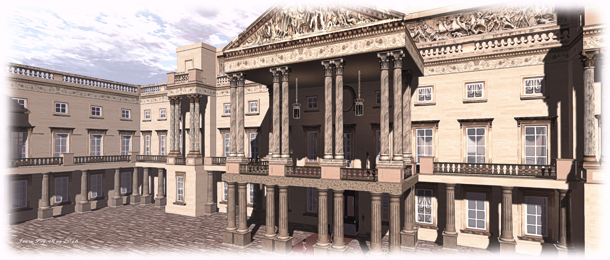
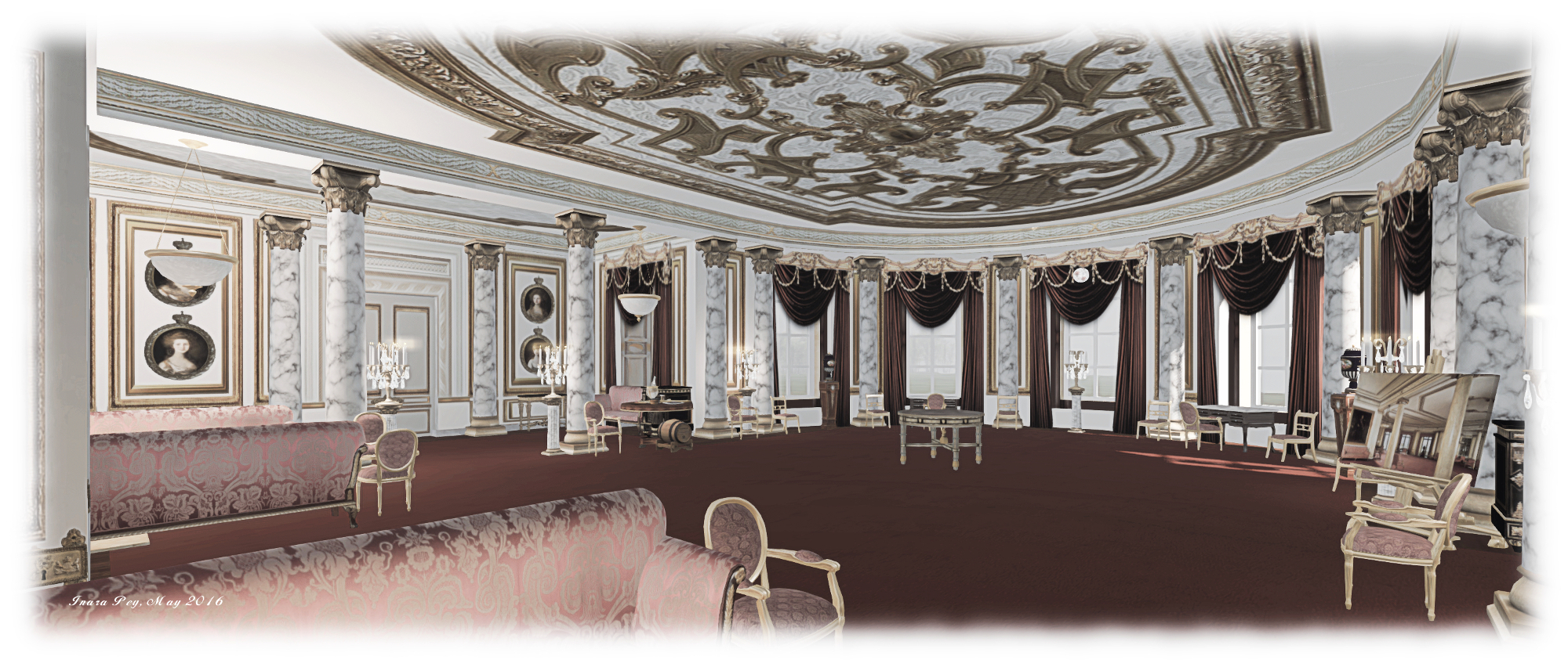
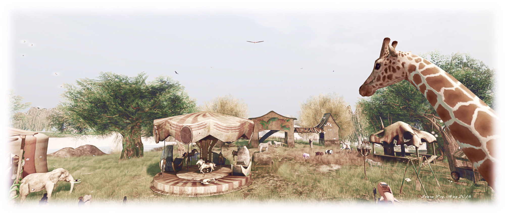
{Ville Par La Mer} / Royaume de Versailles (literally “city by the sea” and ” Kingdom of Versailles”) caught my attention whilst browsing the Destination Guide. Both a private home (this being located in the north-east corner of the region), and a public destination,the region is the work of Dolly Everleigh Versailles (Dolly Morrisey), on behalf of the Versailles Family. And it is another picturesque region that is a genuine pleasure to visit.

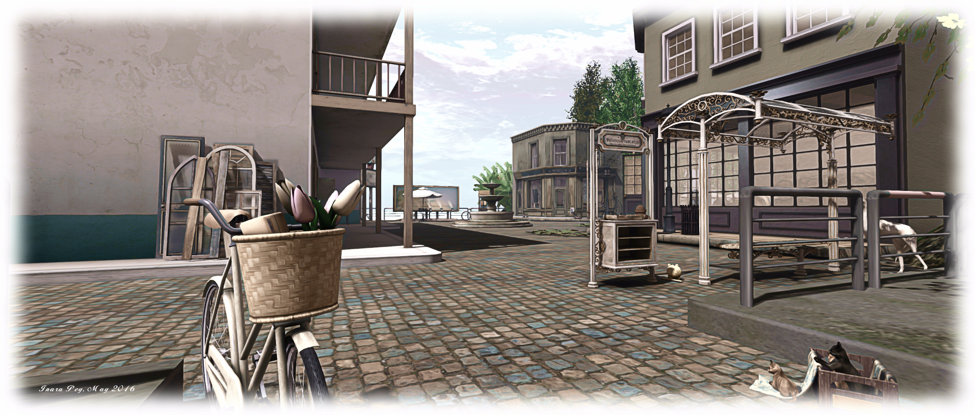
The landing point is a little terrace area in the south-west of the region, where sit little boutique shops – a hairdresser, an ice-cream parlour and a delightful café bar. A pier runs along the south side of the island from here, crossing an inlet to reach the local beach, presenting one of two ways a visitor can start their explorations of the island.

{Ville Par La Mer} / Royaume de Versailles; Inara Pey, May 2016, on Flickr {Ville Par La Mer} / Royaume de Versailles

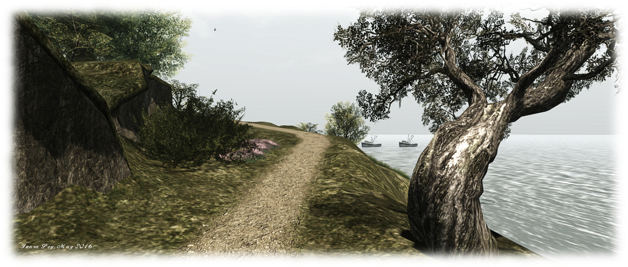
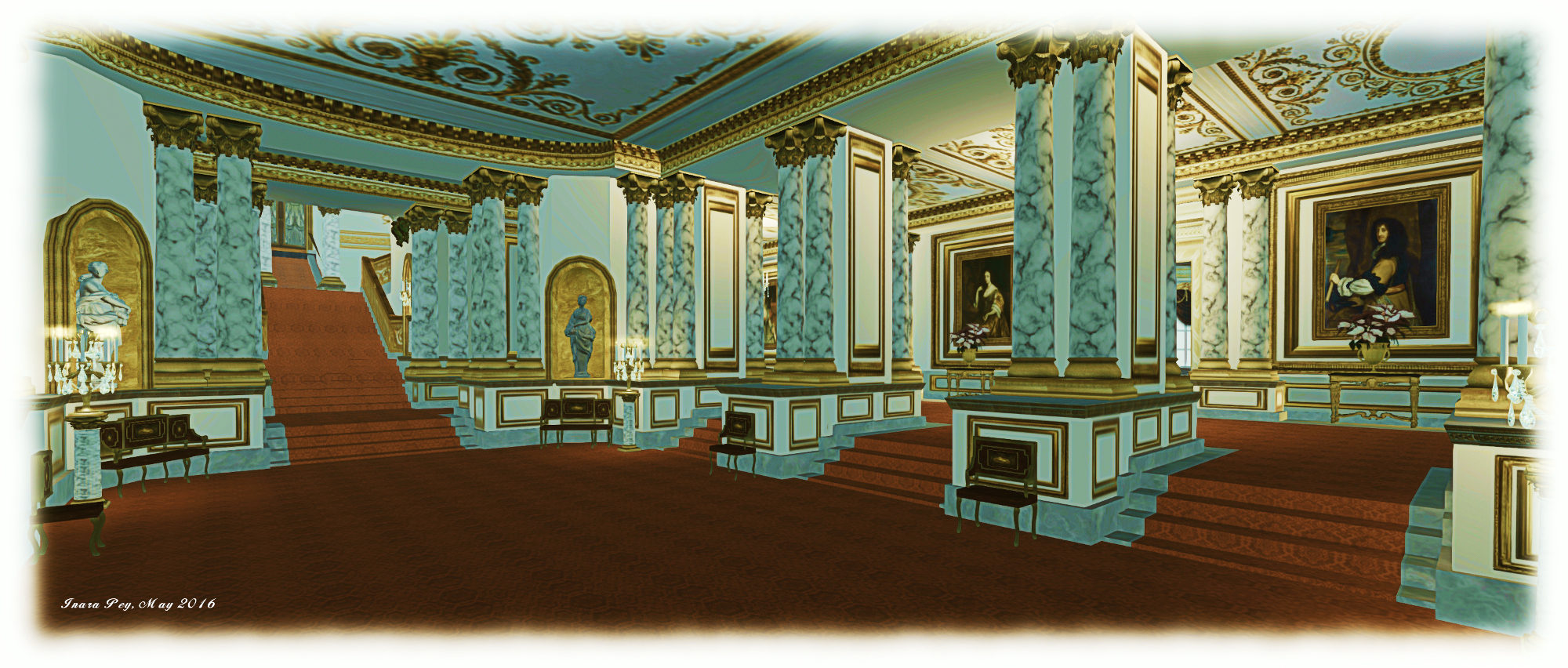
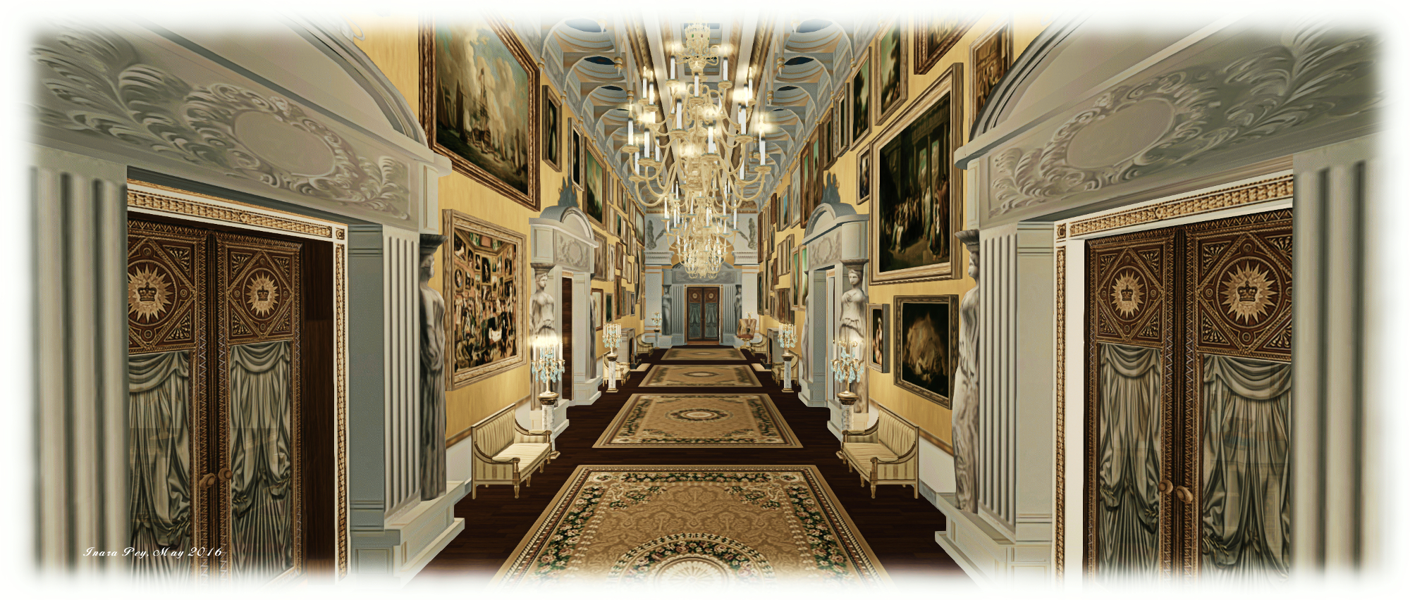
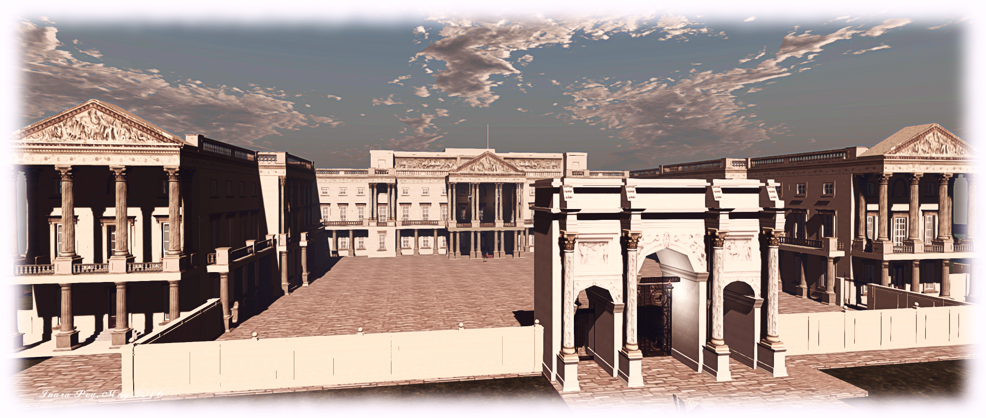
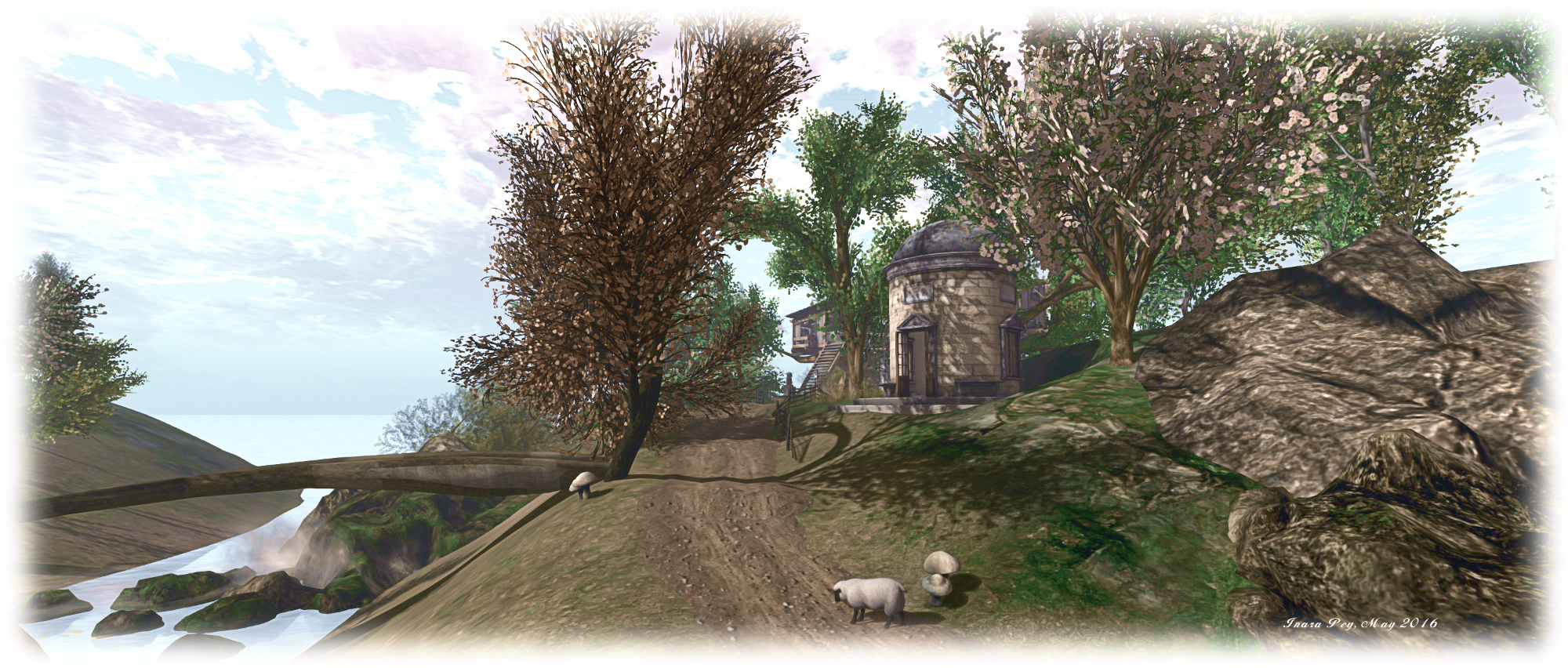
The other is to climb the steps to one side of the terrace and follow a road as it winds around the island heading west, then north and then back east. This will eventually bring you to the house in the north-east corner, which as noted, is a private residence. However, it is possible to walk around the extended grounds below the house proper, where there are several vantage points and places to sit and / or snuggle.

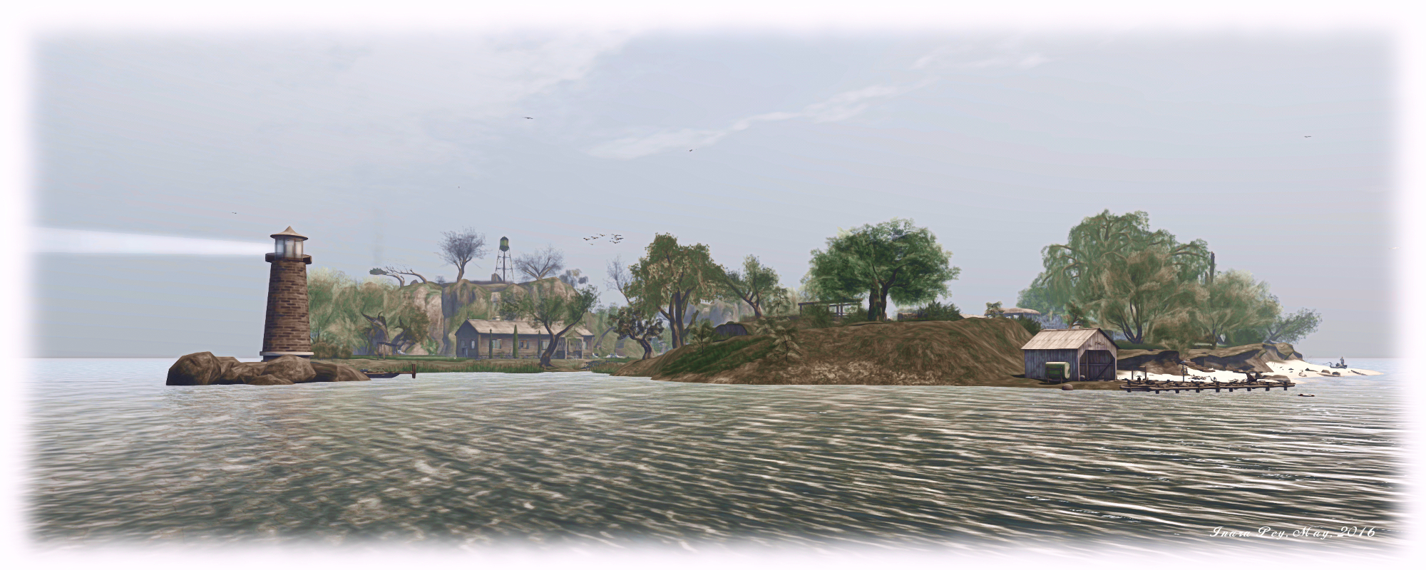
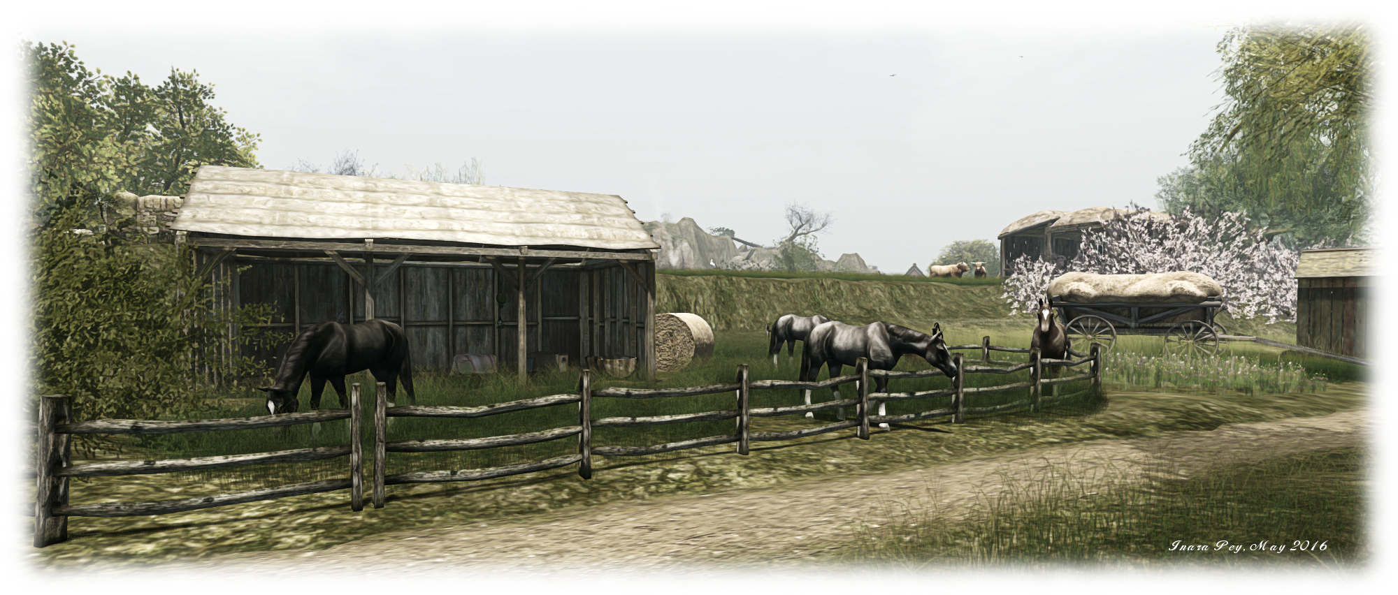
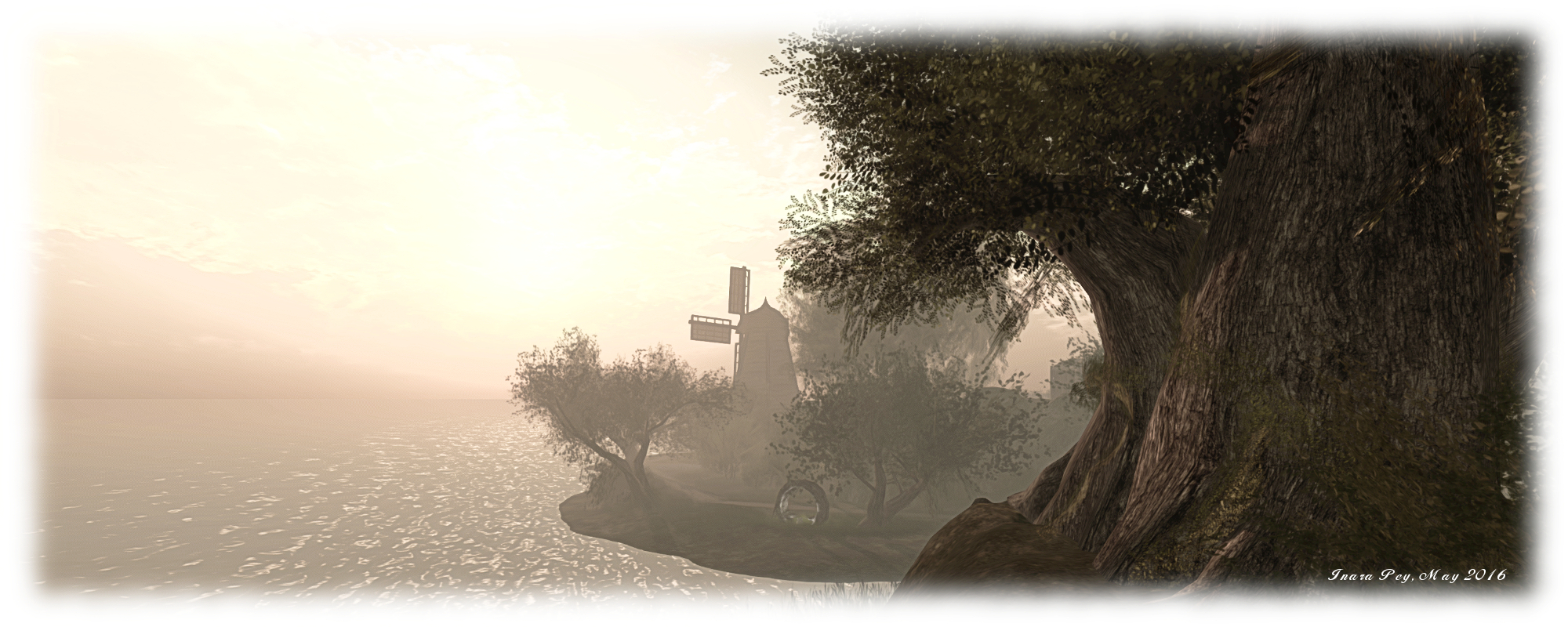
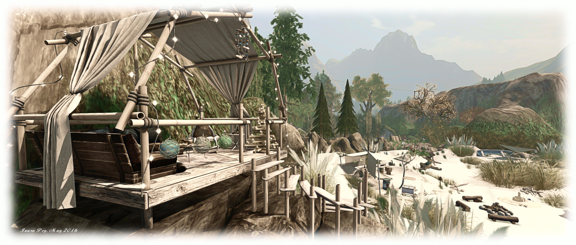
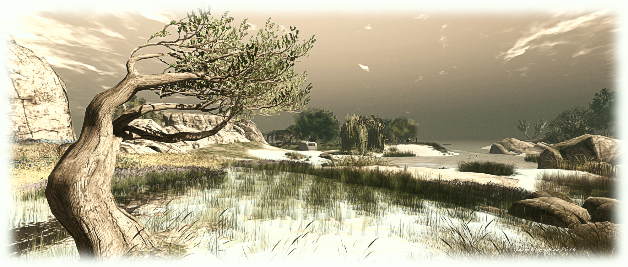
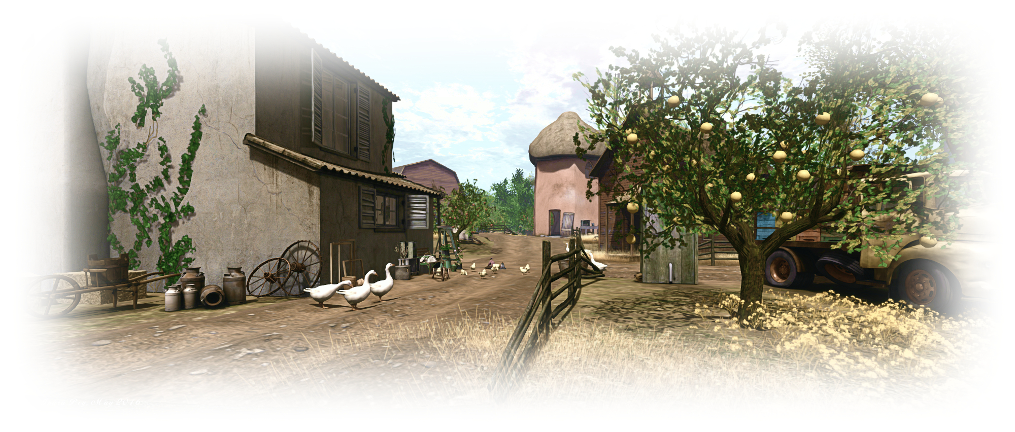
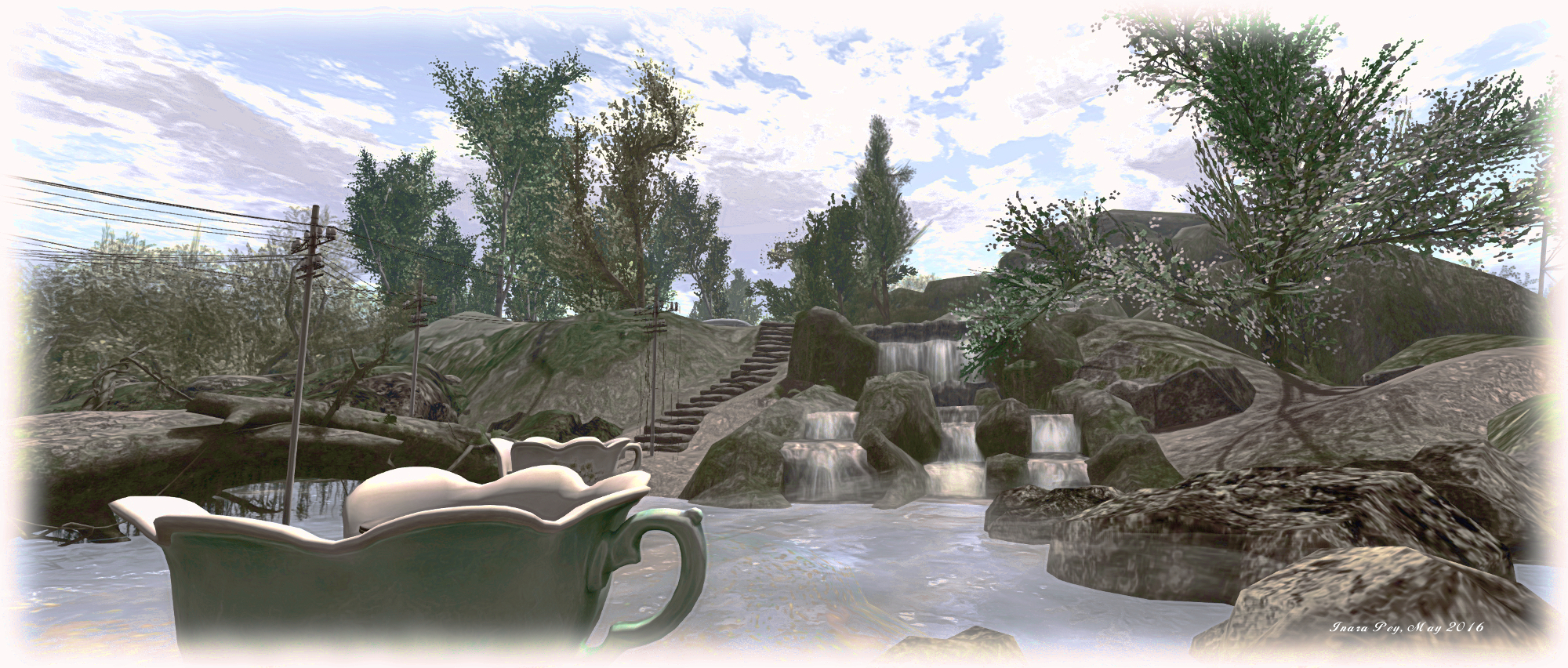
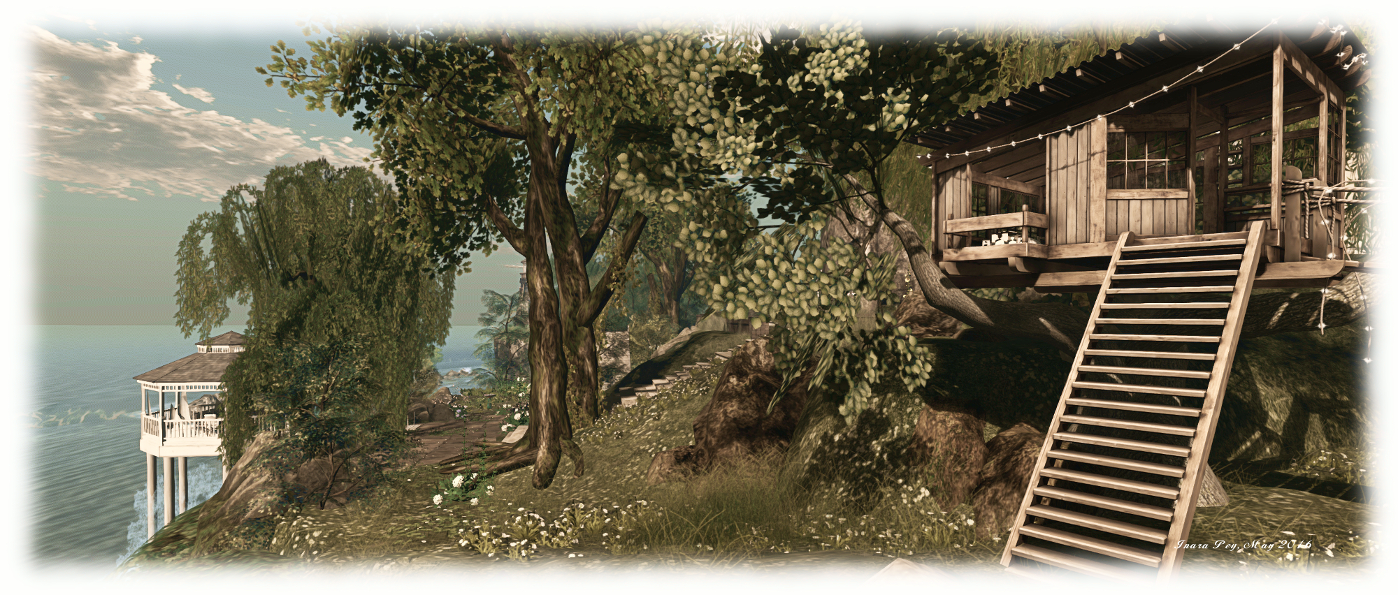
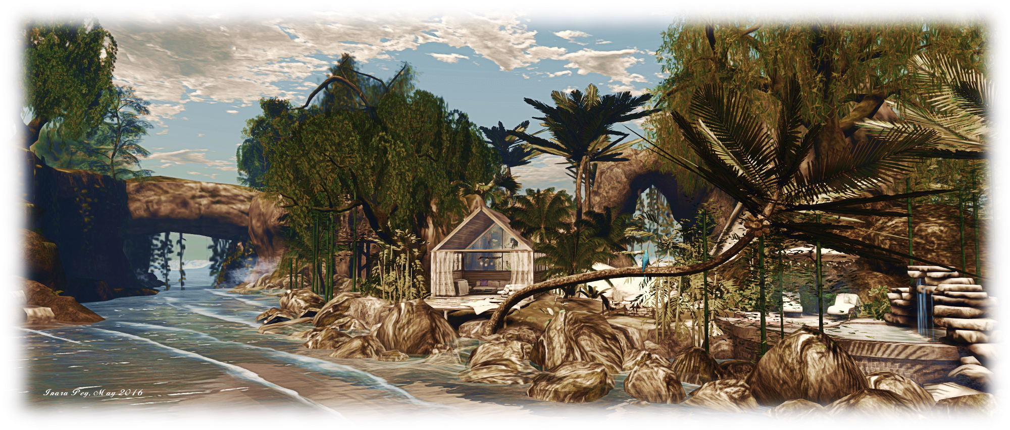
A vineyard and barn occupy the low-lying centre of the island to the north-west, a dirt track offering a path past them from the foot of the steps leading down from the big house. meandering by both vineyard and barn, the track leads to another series of stone steps which climb up to the broad top of a gorge which cuts from north to south through the region, revealing a hidden treasure below and across the narrow channel of water: a tropical-like hideaway, reached from the main beach by a rocky arch.

{Ville Par La Mer} / Royaume de Versailles; Inara Pey, May 2016, on Flickr {Ville Par La Mer} / Royaume de Versailles – click any image for full size

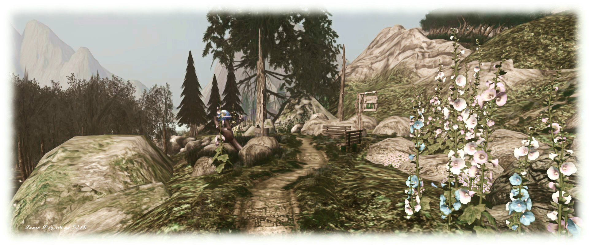
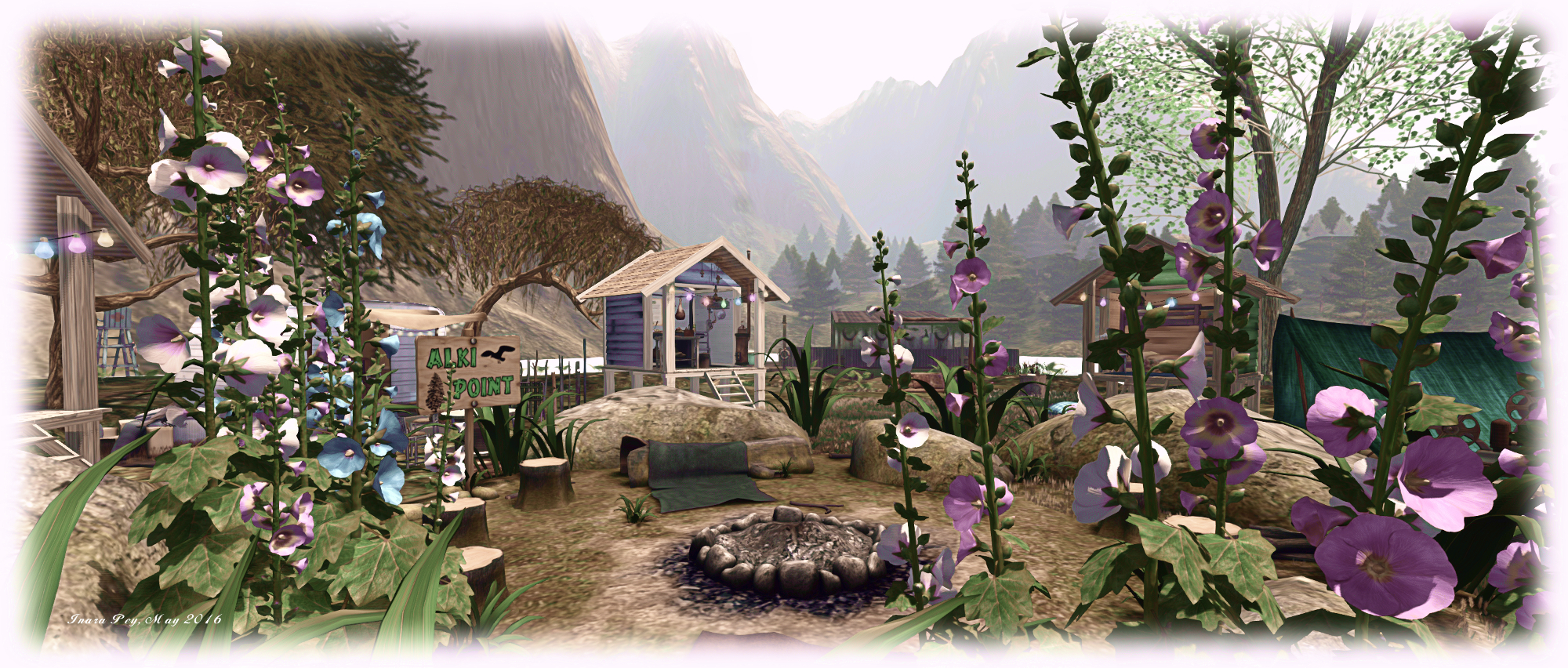
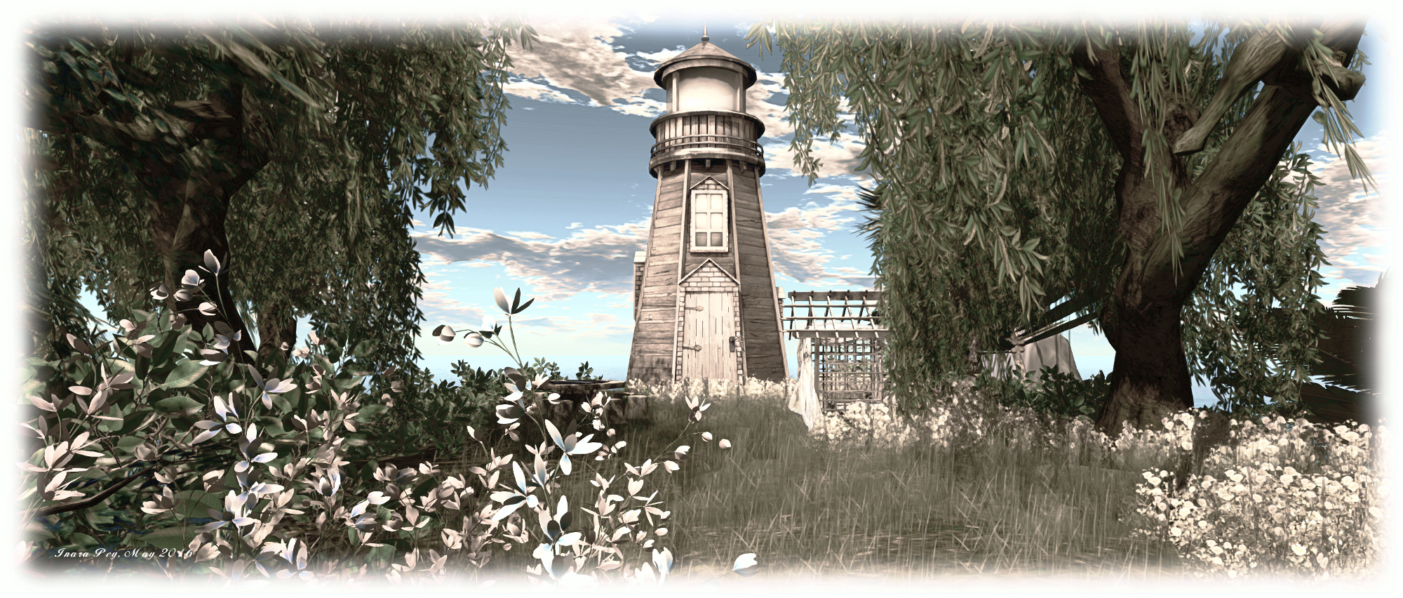
Follow the grassy walk along the lip of the gorge eastwards, and a natural stone bridge offers access to a picturesque plateau where there are places to set and play Greedy, Greedy, all watched over by the tall sentinel of a wooden lighthouse. A switch back path from here offers a way back down the the beach below.

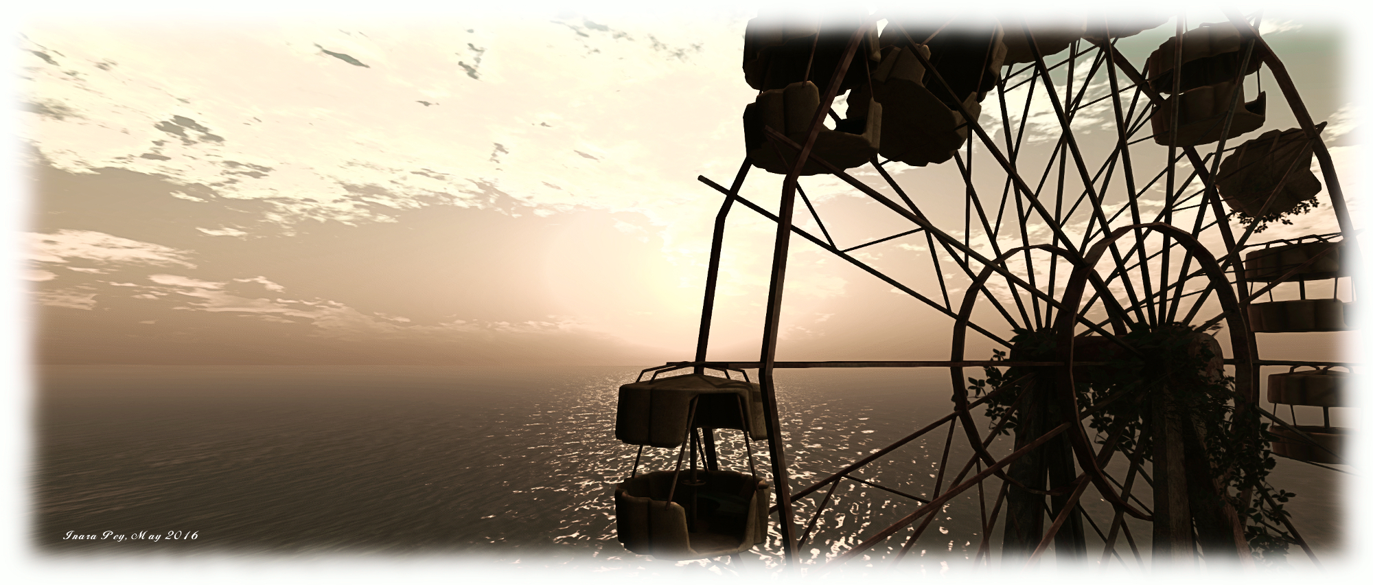
This is a charming region, with plenty of opportunities for photography and a fair few places to sit and relax, have a cuddle and enjoy the ambient sound scape. If you do take photos of your visit, you are invited to add them to the Royaume De Versailles Flickr group.

{Ville Par La Mer} / Royaume de Versailles; Inara Pey, May 2016, on Flickr {Ville Par La Mer} / Royaume de Versailles – click any image for full size

All told, a lovely design that’s well worth a visit.

SLurl Details

{Ville Par La Mer} / Royaume de Versailles (Rated: Moderate)


A summer’s farewell to Frisland

Frisland; Inara Pey, May 2016, on FlickrFrisland – click any image for full size

The time has finally come to bid farewell Frisland’s golden reign…

We have shared two amazing years since opening Frisland back in March 2014, and have been blessed with so many precious moments shared with all of you, which we shall carry with us as treasured and priceless memories in our hearts and minds.

So reads, in part, a note from Charlie Namiboo, Anna (Annabell Barzane) and Frislanda Ferraris announcing the forthcoming closure of their photogenic and popular region, Frisland.

Frisland; Inara Pey, May 2016, on FlickrFrisland

I first visited the island on March 23rd, 2014, shortly before its public opening. An invitation had been extended to me to do so by Charlie, something I was more than happy to accept. And like many who have visited the region, I instantly fell in love with it – and with the fact the over the intervening two years, other than marking the passing of the seasons in the northern hemisphere, it has changed little over time, presenting itself as a familiar and welcoming place with each visit.

The region came into being as a result of happenstance. . “A few weeks ago,” Charlie explained back when the region was about to open for the first time, “Frislanda did a search on Google about the origin of his name and found an article about a phantom island called “Frisland” in the North Atlantic. He just asked us what we would think of creating a region in Second Life based upon the idea of that phantom island.  We were all for it! And so we started the project with the working title Frisland’s rebirth …”

Frisland; Inara Pey, May 2016, on FlickrFrisland

As I noted at the time, the “original” Frisland first started to appear on maps of the North Atlantic from about the 1550s, and continued to do so for at least the next 100 years, although its position was prone to movement, travelling as it did from south of Iceland to close to the British Isles then back across the Atlantic, where it was imagined as a southern spur of Greenland, separated from the rest by an ocean strait.

How it came to be on maps in the first place is a mystery – although one romantic notion had it as a last remnant of Atlantis. However, for Fris, Charlie and Ana, it offered the opportunity to present a part of the island as it might look today, sitting in the Atlantic and quietly settled.

Frisland; Inara Pey, May 2016, on FlickrFrisland

The result – as noted – has been a beautifully imagined and much photographed and loved region, one that will be missed when it finally follows its namesake and vanishes from maps. However, there is still time to visit, either for the first time, or to say a fond farewell. The region will remain open until Saturday, June 4th. And then? Well, as Ana, Fris and Charlie remind us, “when one door closes, another one opens … who knows what fabulous adventure will be coming next!”

I hope to get back to Frisland before it closes and film there. However, just in case time conspires against me, here’s a video I made back in December 2014. It’s a little long in the tooth, but I hope it serves as a reminder of a winter’s Frisland.

SLurl Details

Recreating Buckingham Palace in Second Life

Regency Buckingham; Inara Pey, May 2016, on FlickrRegency Buckingham – click any image for full size

Jacon Cortes recently invited me to visit a project on which he has been working on for the last several years, and which finally opened its doors to the public in late 2015: an exquisite reproduction of Buckingham Palace. Intrigued, I hopped over to take a look, and Jacon and KarenKate Sands were kind enough to join me.

“We call it Regency Buckingham,  Jacon, a period role-player known in-world as  Jacon Cortes de Béxar (the historians might note his surname being indicative of another of his interests) told me. “Altogether, it’s been three-and-a-half years in development. and we’re still  building project, and it is still a work in progress; we still have some rooms we are working on. But we have reproduced twelve of the staterooms, which people can tour.”

Regency Buckingham; Inara Pey, May 2016, on FlickrRegency Buckingham – The Grand Entry

Those more familiar with the modern-day Buckingham Palace might be a little surprised on their arrival. The familiar East Wing of the Palace, which stands before the Mall and is home to the famous Royal Balcony, is entirely absent; its place taken by Marble Arch. This isn’t an error in the design or imaginative thinking; rather it is the first indication that this is not Buckingham Palace as it is, but rather Buckingham Palace as it was, during its construction; hence the name Regency Buckingham.

The Palace was essentially built on the orders of King George IV, after his father had initially purchased the older Buckingham House for conversion into a private retreat for Queen Charlotte. Inheriting the house on his ascension to the throne in 1820, George IV originally envisioned expanding it into a comfortable home, only to have it grow into a design for a Palace, which John Nash designed along classical cour d’honneur lines, with Marble Arch serving as the triumphal entrance to courtyard.

Regency Buckingham; Inara Pey, May 2016, on FlickrRegency Buckingham – The King’s Gallery

This has been a labour of love for Jacon and co-builders Crotian and Twelfthnight Cortes de Béxar, and is also something of a visualisation of what the Palace might have been like, had George IV had lived to see it finished  (in fact, neither George IV nor is younger brother and successor, William IV lived to see the Palace completed).  “We’ve tried to stay true to the building,” Jacon informed me.

The result is a build which exhibits an incredible level of detail and attention to detail, Jacon, Twelfthnight and Crotian drawing on numerous sources, including the National Trust, the Royal Collection Trust and the Buckingham Palace pages of the Royal website, in order to ensure the build is as historically representative and accurate as possible. For example, in keeping with the Palace’s period of construction through the reigns of George IV and William IV, none of the works of art reproduced within it date from later than the end of the 1830s. In fact, many of the reproduced pieces are drawn from the collections of George III and George IV.

Regency Buckingham; Inara Pey, May 2016, on FlickrRegency Buckingham

On offer at the landing point at the Marble Arch, is an information note card written by Tiamat Windstorm which is a must read. Not only does it present the Palace in is historical context as shown by the build, it provides detailed notes on the 12 available staterooms which can be explored, and provides a tour map for finding your way around them.

In addition, many of the staterooms offer images of their physical world counterparts, while hovering your mouse over portraits and paintings will often provide a short description of their subjects. All of this adds immeasurably to the experience of exploring the Palace.

Regency Buckingham; Inara Pey, May 2016, on FlickrRegency Buckingham – The Bow Room

Whether viewed as a historical reproduction, potential educational destination, role-play environment or labour of love, Regency Buckingham makes for an excellent visit, and is genuinely a must see.

My thanks once again to Jacon and Karenkate for taking the time to chat with me during my visit, and for providing me with some insight into Antiquity Estate – a subject and place to which I will be returning in future Exploring articles!

SLurl Details

Returning to Alki in Second Life

Alki - click any image for full size
Alki – click any image for full size

I first visited Alki, the music and scenic region designed by Zoidyn (Zoidyn Kytori) and Alana Onyett, far back in 2013, which is Second Life terms, is almost a lifetime ago. Back then, it was described as an “evolving project inspired by the Pacific Northwest”, so I was curious to know what might have changed in the intervening years.

The overall answer might at first appear to be “not a lot”: the landscape is still the same, there’s the same mix of venues, the paths are familiar, and so on. However, the region has changed in subtle ways – but that’s the point of evolution; things don’t happen overnight, they happen over time.

Alki
Alki

The high plateau dominating the north side of the island is still there, but the Z&A coffee-house, one of several music venues in the region, and the neighbouring art studio both occupy different buildings when compared to my original visit. These now sit to one side of a slightly redesigned plateau, complete with sidewalk, street lamps and a large paved area on which sits a model of the original coffee-house and art studio.

Getting up to the plateau is a case of either following the tree-lined path which curls its way between cliffs and trees up to the heights, or via a steeper climb up the wooden stairs clinging determinedly to the east side of the plateau’s cliff. Getting down, however, is an easier affair: just grab the zip line that will take you across the landscape below to the rugged hills to the south of the region.

Alki
Alki

Well, easier to a point – it’s still a bit of a scramble to get down to ground level again, but when you do, the rest of the region is yours to explore – and there is a lot of it, whether it’s the west-facing beach, looking out over the bay with plenty of snuggle spots and under the watchful gaze of the Dragonfly Inn, or around the lake eastwards, through the woodlands to the camp-site and an activity area offering sailing, Greedy, Greedy, a children’s playground and a water slide; or northwards around the lake, under the lee of the platea, and along the path to the open-air music venues.

To the east sits a small island, reached by pedalo, with a contemplative oriental garden for Tai Chi followed by tea, and with caves to be explored below. Northwards of this, rising on sturdy wooden legs from the water, is the Z&A Fun Factory, where an assortment of table games, arcade games and other distractions can be found, including an annoyingly addictive game of rock, paper, scissors!

Alki
Alki

When regions seem to come and go, sometimes with barely a blink between arrival and departure, it’s good to see places like Alki continuing over the years, offering a place both familiar and new to visit and re-visit and enjoy. Should you decide to hop over and take a look, do please consider a donation at the landing point to help ensure it remains a place to be shared in the coming months and years.

SLurl Details

  • Alki (Rated: Moderate)

Enjoying Rosemoor in Second Life

Rosemoor; Inara Pey, May 2016, on FlickrRosemoor – click any image for full size

Rosemoor is the name of a collaborative region design by Arol Lightfoot and Krys Vita (who designed the popular Kaleidoscope I wrote about here). “This one was meant to be fun!” Krys told me as Caitlyn and I paid a visit a few hours after the region had opened its doors slightly ahead of schedule, “welcome to our zoo 😛 .”

Rosemoor presents visitors with a low-lying island of grass and sands, just a couple of craggy plateaus offering genuine elevation in the south-west corner. The “zoo” Krys mentioned as we chatted, sits to the north-west, close to the landing point. It takes the form of Everlag Park – a place which has clearly seen better days at some point. Now the paint is fading, dirty and chipped on the entrance, the sign having partially fallen from its place above the archway, while the buildings either side showing similar distress.

Rosemoor; Inara Pey, May 2016, on FlickrRosemoor

Within the park, the carousel and big wheel stand broken and dejected, while the bumper cars look to have been the victims of a fire, while rides sit overgrown and forgotten in the grounds. Only the circus tent appears to be in reasonable condition, but even this fails to hold the attention for long, thanks to the animals standing and roaming the park – or as I put it to Krys, “tigers and zebras and giraffes, oh my!”

“Ha ha!” Krys replied, “the craziest thing is in the other corner 😉 Our little addiction found itself a home!”

Rosemoor; Inara Pey, May 2016, on FlickrRosemoor

To the south and east, around and across the bay cutting into the island, the land is sandier and offers a couple of homes between which horses contentedly wander, grazing on the stubble of grass poking above the gently undulating dunes and hills of sand. Those which are roaming freely and saddled can be ridden by visitors.

And it was southwards and eastward that I was drawn, wondering what the addiction Krys mentioned might be.  It can actually be found on a little island just off the coast. I’m saying nothing else on this, as to write about it would spoil a visit for others 🙂 . All I will do is repeat Krys’ explanation for things: “D-Lab… the gacha got us! 😉 ”

Rosemoor; Inara Pey, May 2016, on FlickrRosemoor – click any image for full size

With places to sit and to snuggle scattered around, particularly along the coastline, Rosemoor has a wonderfully coastal feel to it; somewhere perhaps not too far from civilisation, but far enough to offer a sense of isolation and being off the beaten track (hence why the Everlag Park may not have succeeded, despite the picturesque surroundings).

The default windlight suggests an early morning, but the region is ideal for photography under many different environment settings, as I hope the images here demonstrate. Very thoroughly recommended as a place to visit!

SLurl Details

A Playa of a different kind in Second Life

Playa Flamingo; Inara Pey, May 2016, on Flickr Playa Flamingo – click any image for full size

Playa Flamingo is a beautifully landscaped Homestead region designed by Marcus (Marcus68), which Caitlyn and I have dropped into a couple of times and been fascinated by its mix of picturesque landscaping and touches of whimsy.

Those familiar with the term “playa” might be expecting a desert-like environment, perhaps with a little water covering it; or maybe a beach-type location in keeping with the region’s physical world namesake in Costa Rica. Instead, what visitors find is a perfect island environment which packs an incredible about into it without ever once feeling crowded or overdone.

Playa Flamingo; Inara Pey, May 2016, on Flickr Playa Flamingo

Visitors arrive in a small business area on the westward side of the island, a comfortable gathering of business premises gathered along a cobbled road and around a fountain.  Bounded to the south by one of the broad bays cutting into the land, and to the west by the local beach, this offers two routes by which the rest of the island can be explored: north and east.

North takes you, by way of a large walled square, to the local railway line pointing the way eastwards. The first touch of whimsy is to be found here: a trio of Iakua Arriga’s little animals whiling away the time sitting at the side of the track. Follow the latter eastwards and it’ll take you past some old bungalows before turning inland and coming to an abrupt end above the shoreline of the island’s major inlet.

Playa Flamingo; Inara Pey, May 2016, on Flickr Playa Flamingo

A bridge spans the neck of the inlet to reach the east side, the headland there occupied by private property. However, the track beyond the bridge turns south, offering visitors the opportunity to wander down to a farm sitting on the south-eastern headland. This is overlooked by the Cyclopean eye of a lighthouse sitting on a rugged island  to the south, and reach by taking the eastward exit from the arrival point.

This route will take you, by way of a trailer park with just one occupant, down past the steps of  waterfalls tumbling from the rocky heart of the region, to the bank of the channel separating the islands, spanned by a bridge made from the trunks of two ancient trees, locked together as if shaking hands across the water.

Playa Flamingo; Inara Pey, May 2016, on Flickr Playa Flamingo

Here lies another touch of whimsy: large teacups sit on their saucers, floating on the misty water, offering visitors a place to sit and relax. Across the bridge, the steps up to the lighthouse take visitors past three tall turbines looking for all the world like giant children’s windmills, their sticks plunged into the ground. Just a little further around the curve of the channel, in the bay behind the landing point, sits a little gathering of rowing boats, some of which offer further places to sit and rest, huddled around an old fishing pier.

Playa Flamingo is another delight to explore and photograph, completed by a delicate ambient sound scape which further presents the region as a haven of tranquillity. Caught in a forever sunset, the region lends itself to almost any windlight setting you might happen to like, and it’s hard to find a camera angle which doesn’t lend itself to a snap or two. Should you enjoy your visit, please considered showing your appreciation by leaving a donation at the piggy bank by the landing point..

Playa Flamingo; Inara Pey, May 2016, on Flickr Playa Flamingo

SLurl Details