Of pirates and airships in Second Life

Airship Pirates Town; Inara Pey, May 2016, on Flickr Airship Pirates Town – click any image for full size

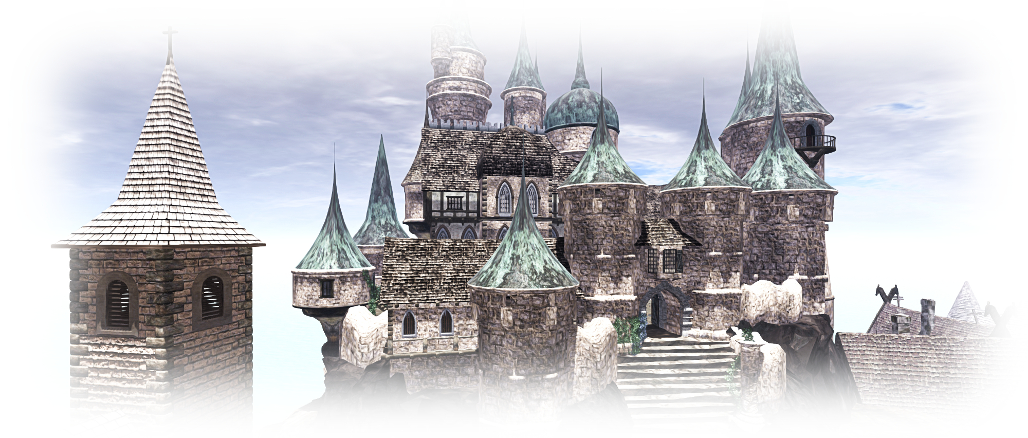
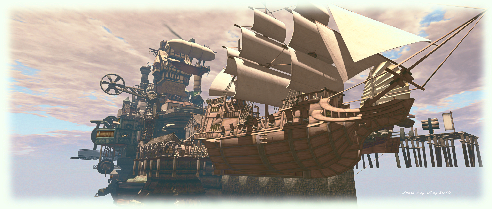
Jamisson Burnstein recently drew my attention to a store called Airships Pirates Town, located high over the island of Hakone, and the work of へき (hekirekika Jinn). “Airship Pirates” is actually enough to get a quizzical eyebrow rising, but the build itself really has to be seen to be believed.

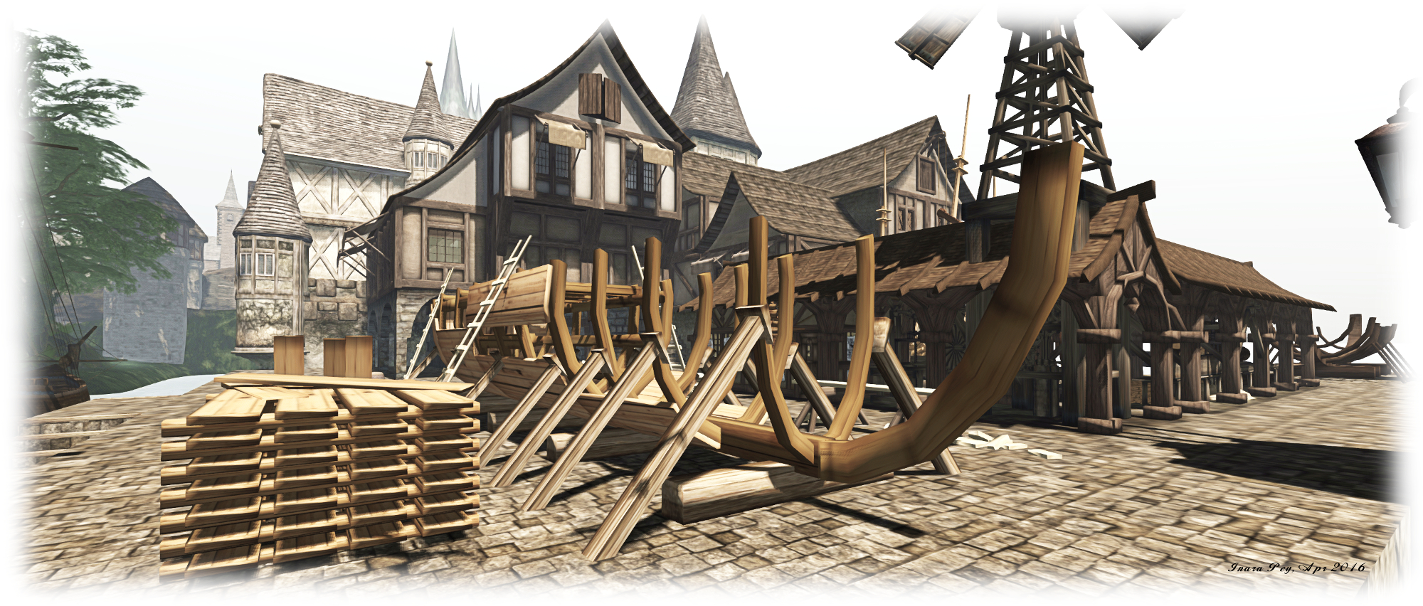
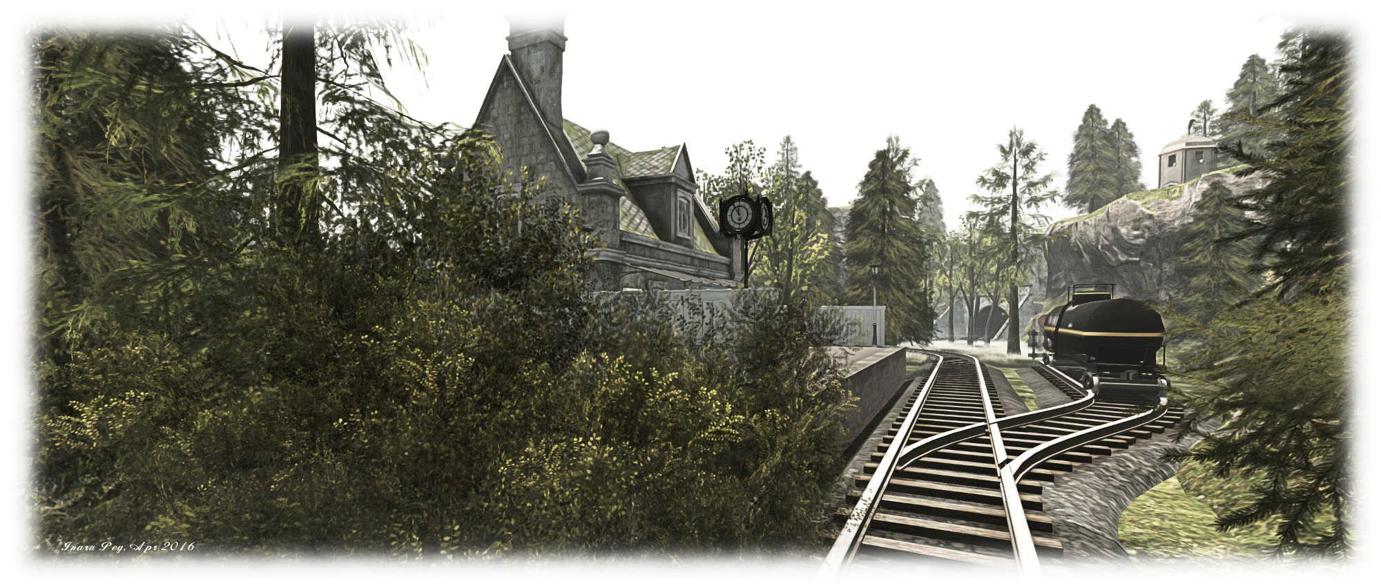
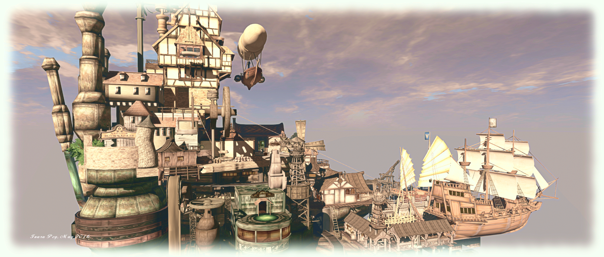
The “airships” in this case are not what you might think: they are neither dirigibles, nor are they (well, for the most part!) great galleons sung beneath gigantic gasbags or held aloft by whirling propellers. Rather, they are regular sailing vessels  – a man of war and an armed Chinese junk – berthed against a stone quay, all of which just happen to be 3,500 metres in the air, with the quay attached to the most fantastical and delightful to the eye steampunk town which also extends outwards blow the great stone piers of the quay.

Airship Pirates Town; Inara Pey, May 2016, on Flickr Airship Pirates Town

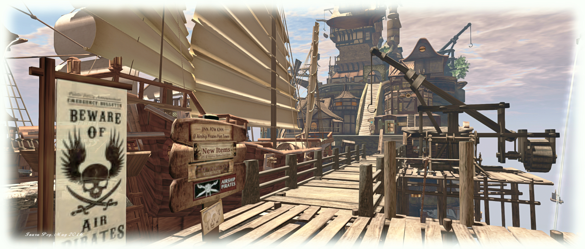
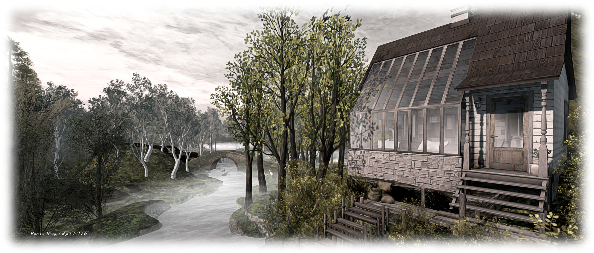
The landing point for this eye-catching build is a wooden dock, somewhat in need of repair, running out alongside the berthed Chinese junk. Wooden cranes sit idle alongside the dock while a zip line offers a rapid transfer down to the lower levels. However, it is likely to be the strange, piled-up charm of the town, reached by solid wooden stairs, will initially attract visitors on their arrival.

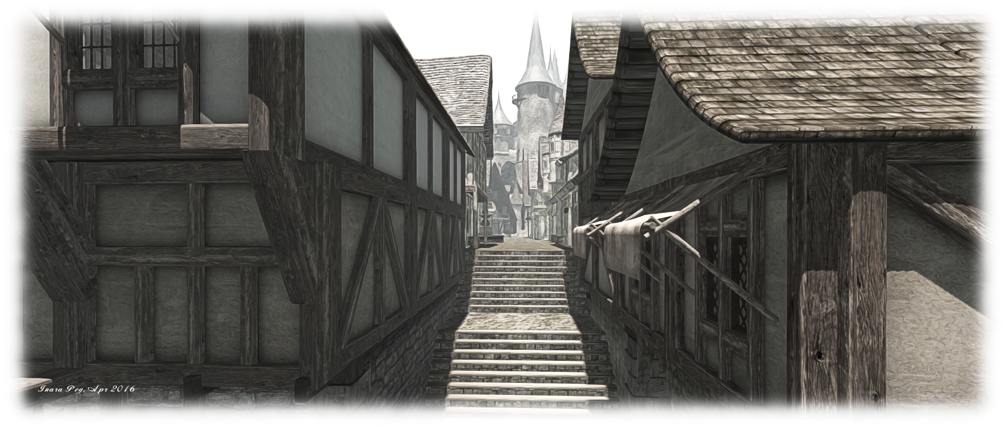
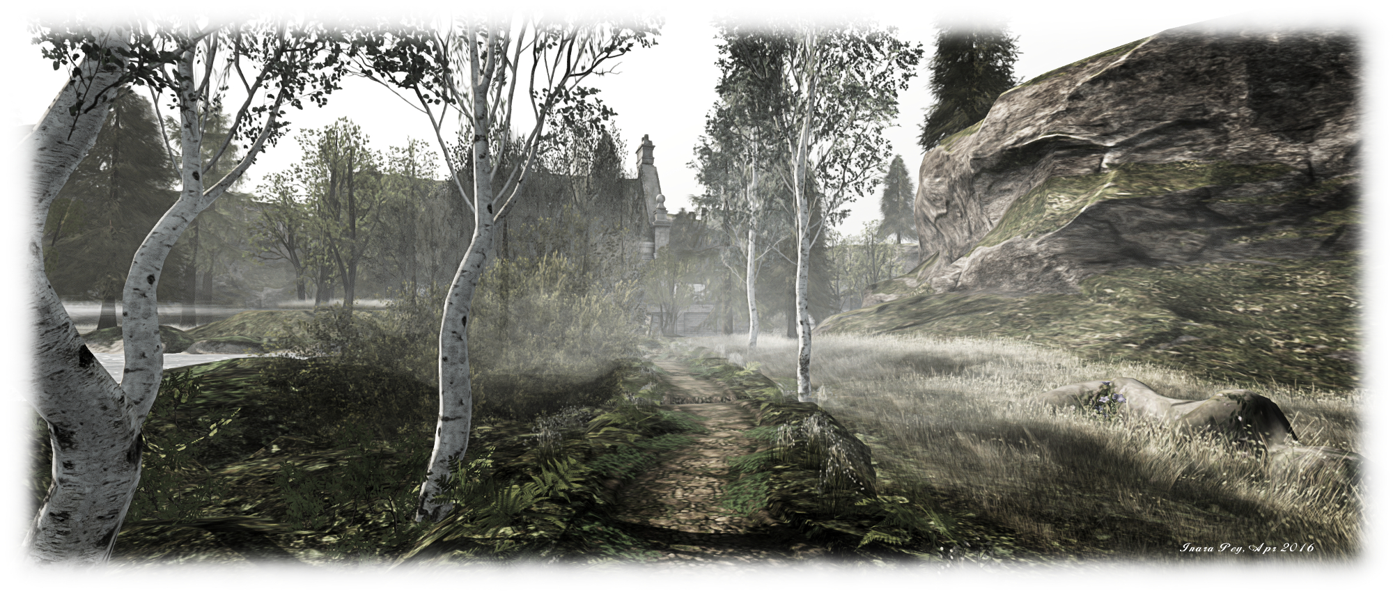
The town is an eclectic mix of buildings, some made of wood, others of brick, still others of wood-framed stone, all of random shapes and sometimes piled one on top of the other without regard – brick upon wood, for example. They are all clustered around one face of an enormous iron, steel and glass island from which huge chimneys and stacks rise and great pipes descend and around which little flying ships circle and even a great black locomotive chugs an endless circular journey from tunnel to wall.

Airship Pirates Town; Inara Pey, May 2016, on Flickr Airship Pirates Town

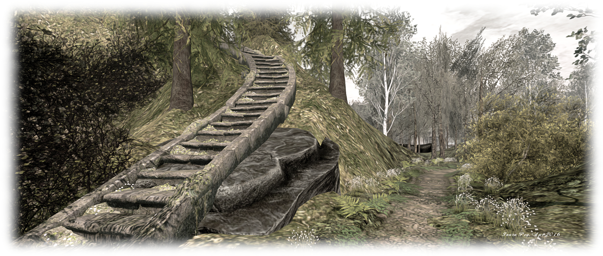
Clinging to the sides of this strange place on platforms of wood or steel or brick stand huge, slowly turning wheels or creaking wooden windmills. Stairways and steps and ladders provide routes upwards, while individual buildings invite visitors inside. Most are shops, but some offer living and working space. Getting around can be confusing, so look out for the teleport hub at the top of the stone steps or for the TP signs scattered around and within the buildings. Climb high enough, and you’ll find another zip line waiting to carry you back down to the quay.

Nor are explorations restricted to the shops and various levels of the floating island: find the right teleport or the right entrance, and you can enter the heart of the iron island, where sit both  the great generator which presumably keeps the place hovering in the sky, and also an Indiana Jones style course involving switching, swinging bridges, and dodging cogwheels – although the end of this journey is a little abrupt.

Airship Pirates Town; Inara Pey, May 2016, on Flickr Airship Pirates Town

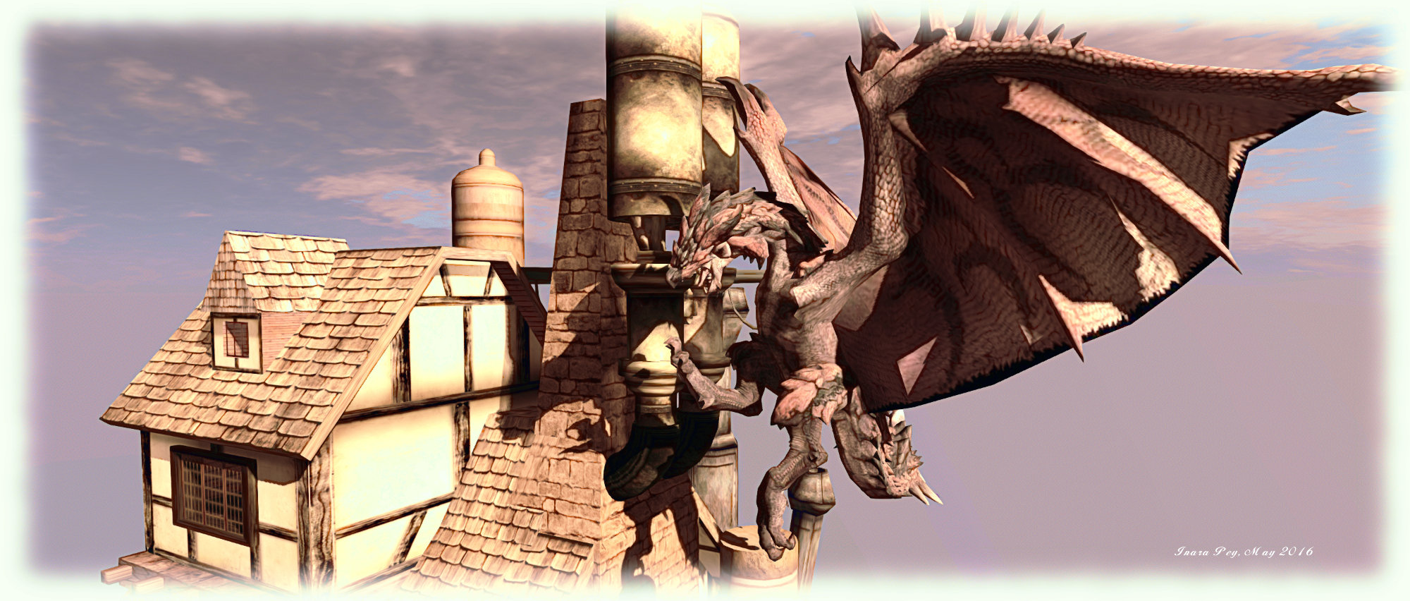
With a dragon keeping an eye on things, and the odd genuine flying boat (emphasis on boat!) either moored higher up or circling the sky and a lot packed into what is a very small area, not to mention the phenomenal steampunk look, Airship Pirates Town is well worth a visit and explore, standing as a wonderful demonstration of the creative whimsy possible in this digital world.

SLurl Details

The hidden paths of Osprey Ridge in Second Life

Osprey Ridge; Inara Pey, April 2016, on Flickr Osprey Ridge – click any image for full size

Osprey Ridge has passed into the annals of SL history. SLurls have therefor been removed.

Osprey Ridge is a homestead region within the United Sailing Sims located eastward of Blake Sea and a place we’ve often passed when our sailing or boating. Open to the public, the region has been landscaped by Markarius Viper and is cared for by Flo (SweetFloXO) and presents a pleasing environment in which to spend time.

The best place to start a visit is at the moorings on the north side of the island, sheltered from the passage linking Blake Sea with Second Norway by a natural grassy breakwater. From here, visitors can walk eastwards along the moorings and the beach to come to a cosy summer gazebo sitting alongside a reedy pond, or head inland along a wooded track which winds its way to a sturdy and comfortable log cabin.

Osprey Ridge; Inara Pey, April 2016, on Flickr Osprey Ridge

The cabin sits nestled between tall columns and plateaus rising to the south and west of it, topped by tables of grass from which tress grow. Of these more anon; for now however, take the path onwards around the front of the cabin, and it will turn southwards and lead you between more trees and under the shadow of a another mesa on the east side of the region bore your arrive at the southern shore, a deck overlooking the open waters, with another ribbon of beach pointing westwards.

If you prefer, there is a track on the west side of the cabin, just within the tree line, which leads the way to the waters at the foot of the rocky cliffs, which are in turn spanned by a bridge made from the trunk of an old, fallen tree. From here it is possible to pass between the tall mesas on either side to reach the south-western corner of the island, or scramble over the rocks and into the cavern beneath the west side plateau.

Osprey Ridge; Inara Pey, April 2016, on Flickr Osprey Ridge

The cavern is a place of peace, watched over by a fae waystone which, for those running with ALM enabled, casts patterns of light across the surrounding rock faces and over the pool of water in which it sits. A narrow opening on the north side of the carven provides a short-cut back to the moorings, which eagle-eyed visitors may have spotted as they followed the rack down towards the cabin from the north side of the island.

The broad, grassy tops of the plateaus are home to a tree house, a camp site, Greedy, Greedy and a romantic cuddle swing. A wooden bridge connects the two plateaus, but how to get up to them without flying or double-click teleporting actually defeated Caitlyn and I (we eventually went the double-click TP route).

Osprey Ridge; Inara Pey, April 2016, on Flickr Osprey Ridge

The region could perhaps benefit from having the moorings on the north side parcelled-off so that auto-return could be set to say, 60 minutes, to allow those arriving by boat to come ashore and explore without fear of their vessel poofing to Lost and Found as soon as they do so, but this is a minor point. Osprey Ridge offers a pleasing visit to those passing or who are looking for photogenic spots within Second Life, with plenty of places up high and at ground level for simply sitting and enjoying the environment or having an intimate cuddle (including a bed suspended from the trees in the woods!).

Landing at New Caelestium in Second Life

New Caelestium; Inara Pey, April 2016, on Flickr New Caelestium – click any image for full size

Reader Evelyn Held recently sent me a note card about New Caelestium, “a realistic medieval lifestyle sim with a touch of fantasy”, which celebrated its re-opening on Saturday, April 23rd. I’d actually written about the original Caelstivm (Caelestium) back in March 2014, but had lost rack of it in the intervening years;  so intrigued by Evelyn’s note, I hopped over to take a look.

The location of the original Caelestium was, so far as I can remember, unspecified; not so with the new build, which is described as, “a Celtic Isle with Scottish roots, a realistic medieval lifestyle sim with a touch of fantasy”, and I have to say that, as with the original, it is something of an eclectic mix of elements.

New Caelestium; Inara Pey, April 2016, on Flickr New Caelestium

Those arriving at the region receive a back story note card, together with the rules of the region and some additional notes on this being a “lifestyle” role-play environment – meaning that visitors are encouraged to wear appropriate clothing and adopt a fitting behaviour and language for a medieval period setting, although as the region encompasses fantasy elements, “dragons, elves, faes, gnomes and other fantasy fellows” are also welcome.

New Caelestium can be broadly divided into four areas: the medieval town and docks, which takes up the largest portion of the region, the jousting area, transported here from the original Caelestium, a coastal area with period manor house, and the fantasy area, dominated by a gigantic tree of life, and over which hovers a set of floating islands.

New Caelestium; Inara Pey, April 2016, on Flickr New Caelestium

The town and docks are mindful of the original Caelestium, although the quays are a lot busier, several of Lia Woodget’s unmistakable ships being tied-up alongside. The town forms an L-shape, and is dominated by a great castle sitting atop a rocky crag in its corner. Beneath this, a long street points the way to the docks in one direction, whilst the other arm of the L holds the market square and shops, beyond which lies the jousting lists.

The fantasy / fae area of the region lies separated from the town by narrow ribbons of water crossed here and there by bridges and rutted cart tracks. Here can be found paths to wander, and fae homes to rent (human houses can be rented in the town), while waterfalls tumble from narrow shoulders of rock, and the aforementioned enormous tree of life rises into the sky. It is on the south side of the region, and under lee of these rocky shoulders and the shadow of the great tree, that the coastal area can be found, trees surrounding a ribbon of beach and hiding the manor house from prying eyes.

New Caelestium; Inara Pey, April 2016, on Flickr New Caelestium

Photogenically, the region has a lot to offer, as I hope at least some of the images here demonstrate. There is also a lot to see when exploring, however, I’m not entirely sure how well it all works.

As I noted in my review of the original Caelestium, that region was also very much a place of two halves – medieval and fantasy – but the overall landscaping was such that the two elements naturally blended together as a single, contiguous landscape through which visitors and players could ebb and flow. That sense of continuity feels a little lost within New Caelestium; rather than existing as parts of a whole, the medieval and fantasy aspects of the region came across to me as vying with one another for space and attention.

New Caelestium; Inara Pey, April 2016, on Flickr New Caelestium

Nevertheless, if you are interested in fantasy or medieval role-play, or are looking for a medieval environment ripe for photographs, Caelestium is certainly more than worth a visit.

SLurl Details

The serenity of Peacehaven in Second Life

Peacehaven; Inara Pey, April 2016, on Flickr Peacehaven – click any image for full size

Update, September 9th: Purr has moved Peacehaven to a new quarter region location.

Update, June 23rd: as Purr indicates in her comment, Peacehaven remains open, so the region is there still for you to enjoy, and again, if you have not paid a visit, I encourage you to do so!

I was drawn to Peacehaven after seeing it highlighted in the Destination Guide – only to find that its future is far from certain: a noticeboard close to the landing point carries the news that the region will be closing on May 2nd. This is something of a shame, as the region is another slice of rugged beauty in second Life, which lends itself to photography whilst offering a place to enjoy with a friend.

The landing point, located on the west side of the region presents two tracks for visitors to follow, one to the north, the other to the south. Both paths lead directly to little stone bridges – Alex Bader’s popular design – which arch over gently flowing streams – before offering the visitor a choice of ways forward.

Peacehaven; Inara Pey, April 2016, on Flickr Peacehaven

The northward track branches left and right once over its bridge, a tall mesa – one of two here –  blocking the way forward. Whichever branch of the path is chosen, both eventually lead the way around the mesa to a little farm huddled behind it on the north side of the region. However, the left branch of the path offers perhaps the shorter route, whilst the  right branch offers the way through copses and past a glade set for dancing.

The southward path offers a slightly different choice once over its bridge, as it turns eastwards along the bank of one of the meandering streams, while also providing access to a wooden stairway which climbs the flank of another mesa by way of a smaller butte, taking visitors to a high vantage point overlooking the rest of the landscape and again offering a place to dance.

Peacehaven; Inara Pey, April 2016, on Flickr Peacehaven

Follow the path, meanwhile, and it will take you to a wooded area and what seems like the end of the road. Wander between the trees, however, and you’ll likely come across a little glade with seats and a camp fire. beyond this, a woodland path offer a way through the trees and around the north side of a small lake, or you can continue southwards and across a greensward between the lake and a small quay, and make your way eastwards.

To the east of the region, and separated from the rest by water spanned by bridges both natural and built by human hands, lay a little country church and, just off the coast, an ancient ruin sitting atop a craggy island. Should you visit the church (and no doubt you will!), the path taking you to it will also lead you onwards to the farm, reached by passing under a heavy arch of rock linking the two mesas.

Peacehaven; Inara Pey, April 2016, on Flickr Peacehaven

Whichever route you opt to take in exploring Peacehaven, you will find plenty of opportunities for photographs, or to sit and relax or enjoy a dance if you’re so minded. While I’ve no idea how absolute the closure of the region is, considerations at the donation points across the region might give encouragement for it to remain a little longer.

SLurl Details


A rugged corner of the British Isles in Second Life

Devil's Point; Inara Pey, April 2016, on Flickr Devil’s Point – click any image for full size

Devil’s Point is a Homestead region designed by Zakk Lusch and They Ellisson under their Ellisson brand. It was recommended as a place I should visit by friend and colleague, Mr Stavaros Gracemount (Stavaros). Given Stavaros is no slouch himself when it comes to region design (see this article for more), I knew the recommendation would be more than worth following-up.

Oriented along an east-west alignment, Devil’s Point presents two rocky headlands split by the deep cut of a river. This emerges from underground close to the east side of the region before looping westward, gradually broadening between the craggy fingers of the headlands and forming a sandy cove as the ground on one side finally drops down to provide room for a house sitting on a paved terrace, a shop which is more than it seems and, behind them, a grassy knoll topped by an ancient henge.

Devil's Point; Inara Pey, April 2016, on Flickr Devil’s Point

The house and shop aren’t the only buildings to be found here; several more at scattered along the valley and atop the craggy plateaus of the headlands. One of these, on the east side of the region and nestled between rocky shoulders, is a country railway station, the track snaking past it north-to-south, vanishing into tunnels on either side. Just across the river from the station sits a little cottage – although reaching it requires a walk along an old cobbled path to a little stone bridge. This will actually take you  past a set of stone step leading the way up to another cottage, perched up on the rocks and which faces a windmill and two follies across the valley.

Designed to evoke a feeling of “the Old British Isles”, Devil’s Point certainly suggests it is a place perhaps sitting along the more rugged part of the Northumberland or Scottish coast. or maybe it faces out over the Atlantic from the Irish coast.

Devil's Point; Inara Pey, April 2016, on Flickr Devil’s Point

It’s also a place with a certain air of old mystery about it, perhaps mixed with a supernatural edge; an air somewhat heightened by the mist hugging the river valley. There’s the ancient henge, for example, which is mirrored by a circle of standing stone at the other end of the region, watched over by a small group of nearby deer. Down in the river valley, the tombstones in the little graveyard are carved with ancient runes, while on the other side of the river an ancient statue lies in repose amidst the grass and mist.

Which is not to suggest there is anything sinister here; Devil’s Point is mysterious, not sinister. It’s a place that invites the imagination to wander as much as the feet as you explore. Why was the old boat house down on the cove abandoned? Does the old-style thatched broom mounted above the door of the cottage near the station signify anything supernatural? And what about the robed and hood figure standing in the copse nearby, her face hidden behind a goats head mask? And what are we to make of the brewing going on a the “Apothecary’s” shop?

Devil's Point; Inara Pey, April 2016, on Flickr Devil’s Point

I’ve always enjoyed regions which offer the suggestion of stories to be discovered or created, and Devil’s Point is a place which does precisely this. It’s also a place that is very photogenic, lending itself perfectly to assorted Windlight options, this exercising both the eye and the imagination.

“This is the first sim I’ve opened,” Zakk told me as we chatted during my explorations. “and it’s great seeing playing coming and enjoying it.” Given the rugged beauty of the region, I sincerely hope it’s not the last design we see from him, and I have no hesitation in recommending at a place reads of these pages might like to visit.

Slurl Details

Serenity & Tranquility in Second Life

Serenity & Tranquility; Inara Pey, April 2016, on Flickr Serenity & Tranquility – click any image for full size

Serenity & Tranquility is the name of the homestead region designed by Ron (Veronica Franchini), and which offers a peaceful heaven where those in need of a break from the pressures of the world, physical or digital, or who simply want to hang out with friends and  / or lovers, can freely do so.  Homestead region.

Surrounded by tall islands and hills, Serenity and Tranquillity offers a rich, low-lying landscape where the trees seem to hold up the sky whilst rivers of flowers meander beneath their outstretched boughs, and sandy tracks lead visitors from location to location, be it the cabin in the woods or the beach or the tiki on the lake or the art gallery, or any one of the romantic spots scattered across the island.

Serenity & Tranquility; Inara Pey, April 2016, on Flickr Serenity & Tranquility – click any image for full size

From the landing point, it’s just a short walk to the cabin, and from there to a pair of ancient stone circles, arched pillars still intact, which offer a place to celebrate weddings under the open sky, but sheltered from the sun by the surrounding trees. In the opposite direction to the cabin, you’ll likely find your way to the gallery building toward the north-east corner of the region.

The gallery is the home to portraiture by Tex McDonald, and includes his studio space, together with some of his landscape work. I’ll be honest and admit I’d not previously come across Tex’s work, but it is something I’ll be keeping an eye out for in future. A short distance from the gallery is one of the little romantic spots scattered across the region – the aforementioned tiki hut, which sits out over a small lake served at one end by a little waterfall. Walk around the banks of the lake, and more sitting / cuddle spots will make themselves known.

Serenity & Tranquility; Inara Pey, April 2016, on Flickr Serenity & Tranquility – click any image for full size

The south-west corner of Serenity and Tranquility is where the beach is to be found, ideally located for watching the sun set beyond one of the natural breakwaters which sit just off the west side of the region, a lighthouse warning of their presence. With a beach house and a sandy expanse, this corner of the island again offers several places to relax, both indoors and out, together with one of the InTan dance systems spread across the region. Or for those who prefer, a hot tub awaits a walk along a wooden pier.

With a subtle sound scape, and suited to a range of windlight options for photography, Serenity & Tranquility is an ideal setting for getting  away from cares and stresses. Recommended.

Serenity & Tranquility; Inara Pey, April 2016, on Flickr Serenity & Tranquility – click any image for full size

SLurl Details